We started our family Lake Powell Vacation in Page, Arizona.
On Sunday we went to church, the Glen Canyon Dam and Horseshoe Bend at sunset.
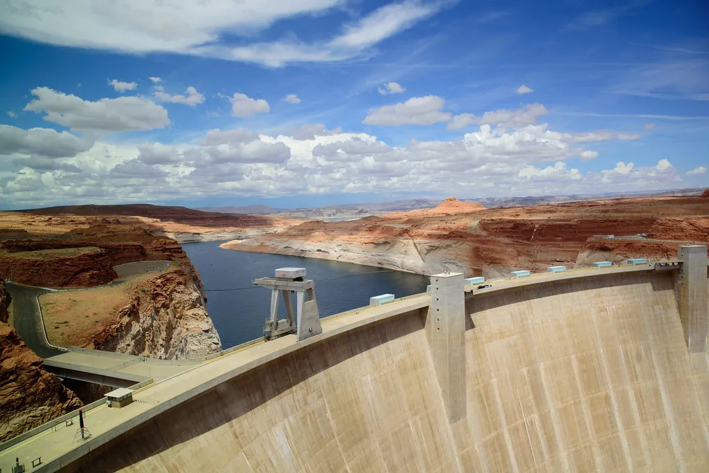
Here is a view of the Dam and Lake Powell from the Carl Hayden Visitor Center. The white line on the canyon wall is sometimes referred to as the 'bathtub ring' and is caused by the calcium carbonate and other hard minerals in the water that attach themselves to the sandstone leaving behind a white mark. The top of the white mark is the high water mark. 1
You can really see how low the lake is right now.
There is a very nice visitor center with a lot of information about the dam, Lake Powell and the surrounding area. There is also huge windows in the visitors center overlooking the dam.

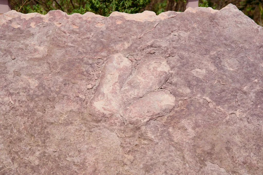
Of special interest was the dinosaur tracks right outside the visitor center.
According to the National Park Service
Until the construction of the Glen Canyon Dam in the 1960s and subsequent creation of Lake Powell, the central portion of the Colorado Plateau and Glen Canyon was mostly inaccessible.
Dinosaurs evolved as the climate changed and were common by the Jurassic Period. Sandstone created by the ancient sand dunes of Jurassic deserts preserves dinosaur tracks. Tracks of theropods, large carnivorous dinosaurs, are found in the Wingate Sandstone, Kayenta Formation, and Navajo Sandstone. Several known track sites have been covered by the water of Lake Powell. 2

Another dam view looking towards the lake.
Lake Powell was created by the flooding of Glen Canyon when the Glen Canyon Dam was completed in 1963. It is a major tourist destination for millions of people each year. 3
The Southwest United States is in a serious draught and the levels of Lake Powell are seriously low.

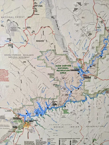
This is a picture of the area from inside the visitor center.
Interesting facts
Lake Powell is the 2nd largest artificial reservoir in the United States.
It is 186 miles (299 km) long
It has 1960 miles (3161 km) of shoreline
It has over 96 major side canyons
It has capacity of 27 million acre-feet (32 million cubic meters).
The average depth is 132 feet (40m)
The max depth is 583 feet (178m)
The rivers flowing in are Colorado, Escalante, Sau Juan and Green River
The river flowing out is the Colorado River
This dam supplies electrify to Colorado, Wyoming, and most of New Mexico and Utah and California, Nevada and most of Arizona.
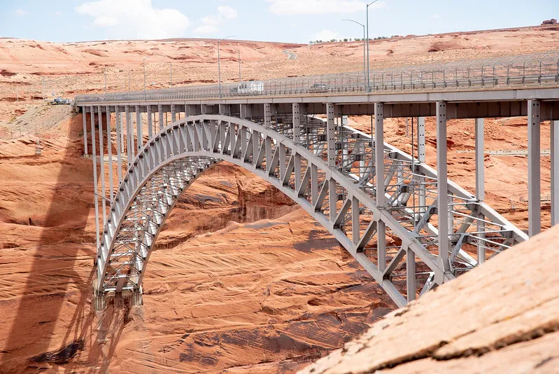
Here is the steel bridge you drive to cross the Colorado River. It is 700 feet (210 m) above the river making it one of the highest bridges in the US.
The family outside the visitor center.

Funny video of me and @jarvie telling dam jokes


Sources:
National Park Service- Glen Canyon
National Park Service- Glen Canyon FAQ
Lake Powell- Wikepedia
Share Our World Series
2022
Share Our World: Highlights of Lake Powell Vacation
Share Our World: DC Temple
Share Our World- Butterfly Wonderland
Share Our World: Hillwood Gardens
Share Our World: Hillwood Estate
Share Our World: National Arboretum
Share Our World: A gorgeous walk!
Share Our World: United States Botanic Garden
Share Our World: Washington Youth Garden
Share Our World: Washington National Cathedral
Share Our World: The George Washington University
Share Our World: Washington Monument
Share Our World: The Sonoran Desert
Share Our World: Spring 2022 Round Garden
Share Our World: Winter Wonderland
Share Our World: Washington Monument
Share Our World: The Sonoran Desert
Share Our World: Spring 2022 Round Garden
Share Our World: Winter Wonderland
2021 posts are here 4 Year Hive Birthday (2021)
All the 2020 posts are here 3 year anniversary on HIVE
All the 2019 posts are here My 2019 Steem Journey
All the 2018 posts are here My Year Journey on Steem