Finally I got another Ride With Me post! In Berlin having a bicycle is of course a given, as there are so many bike trails running through the city, and virtually every major street has a well marked and separated bike lane. But there is more: As you may be aware, there used to be a famous Wall dividing Berlin (and pretty much the whole world) during the cold war. And once it came down, the space it left behind was converted into parks and other recreational areas. Eventually these strips were connected by a bike trail, running all around former West Berlin, totaling about 160 km or roughly a hundred miles.
Planning the First Two Thirds
I came across the trail by chance, when I was exploring the area around the neighborhood of Französisch Buchholz where I live. The Wall used to run not far from here... in fact, less than 5 km (3 miles). So I already knew I had to explore this trail further one day. It look only a couple of weeks till I also got the perfect opportunity: My sister arrived back in Germany, precisely in Potsdam, right next to Berlin, and also not far from where the Wall used to stand. Since the weather was supposed to be perfect, I set out last Friday to ride along the wall, pay her a visit, and then complete the circle the next day.
Tracking, Documenting, and Navigating
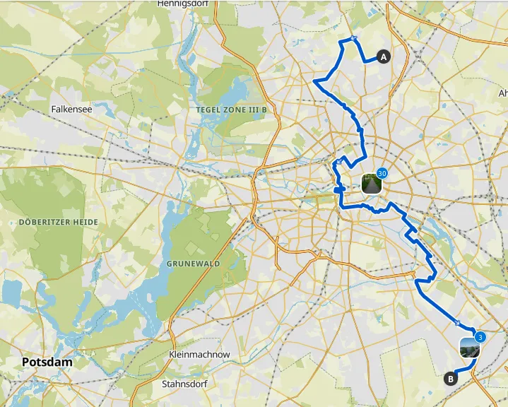
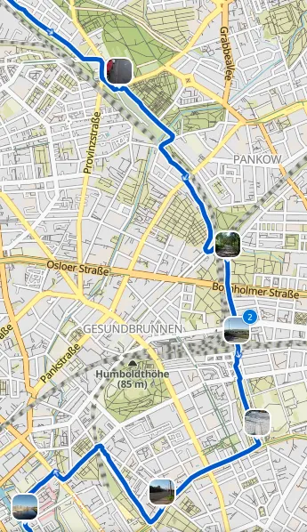
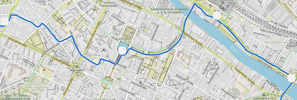
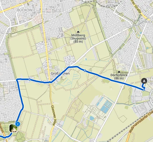
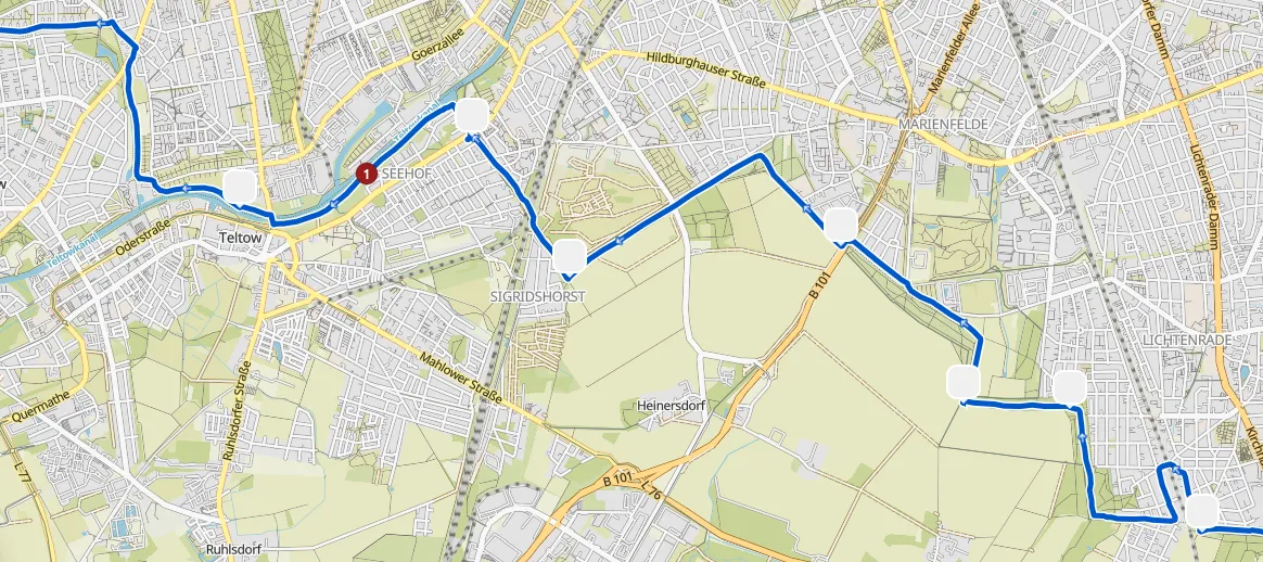
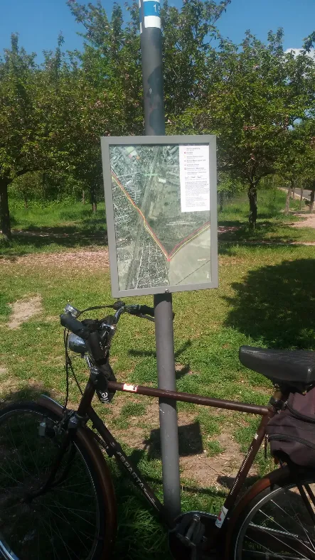
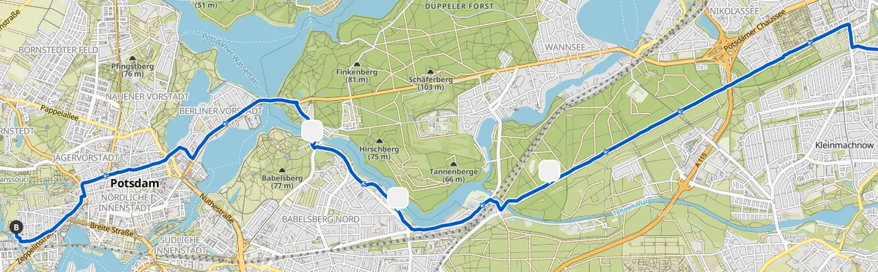
A friend of mine recommended a tracking software, so I decided to give it a shot. it's the not the one I used to use, nor its it blockchain based (unfortunately ActiFit is not compatible with my phone). It lets me take photos and post them immediately, plus the map navigation seems to be very well made. I hope sharing it here will be visible for those who are not registered on it. If so, you can see the first part and the second part of this nerly 100 km (62 mile) ride, zoom in, look at the elevation changes, and all the pics I took along the way.
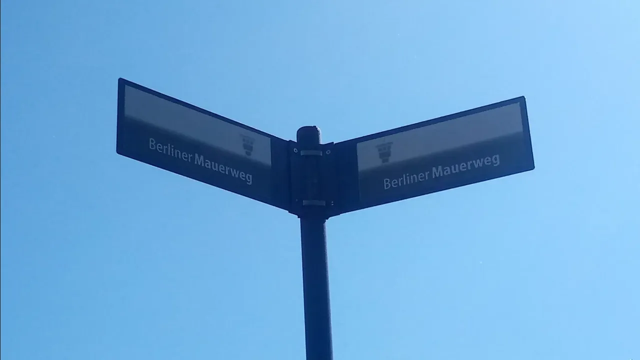
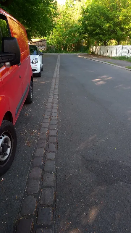
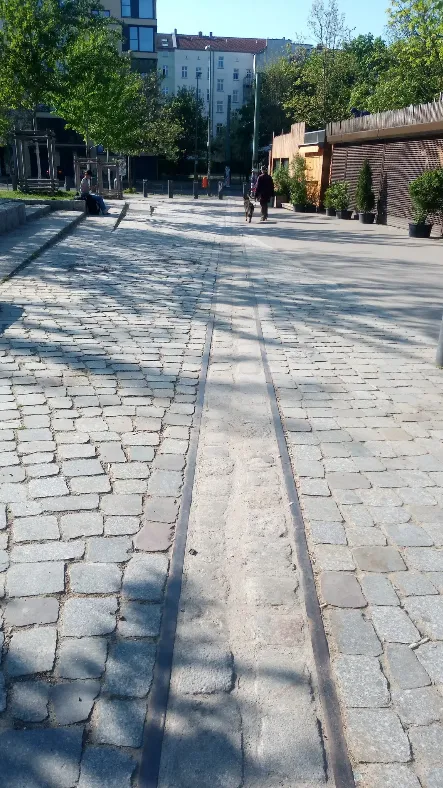
Along with the app, which I could consult whenever I was not certain about the way, there are many signs pointing into the direction of the Berlin Wall Trail. And to clear up the last trace of a doubt, on many occasions you will find two lines of cobblestones running through an otherwise asphalted street, without any reasonable purpose. That is also an indication to where the Wall used to be, and is easy to follow.
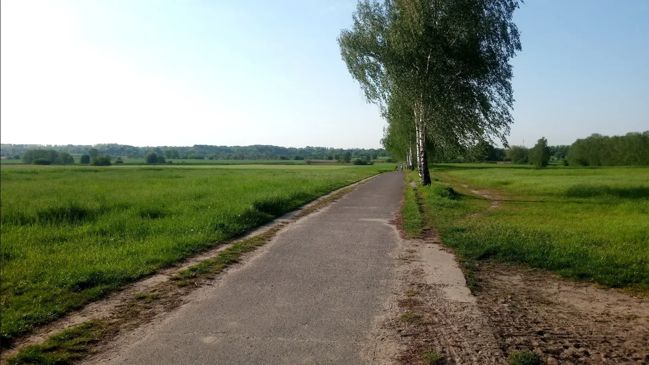
Open Fields on the Edge of the City
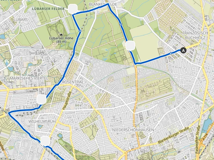
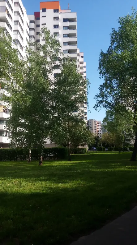
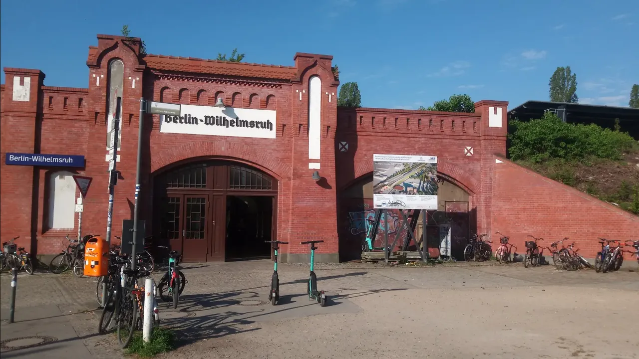
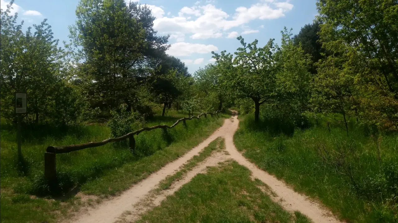
I left the house at 7:30 in the warm sunshine, riding first to Blankenfelde, from where the Wall was only a stone's throw away. Here Berlin does not look like a city at all, and I rode past green fields toward Märkisches Viertel. There I passed by a neighborhood of tall residential blocks, known in German as Plattenbauten. Usually they are associated with the socialist East, except for this was West Berlin. Interesting...! Following that, I rode past industrial areas along the train lines, before I reached Wilhelmsruh. Here the city started to feel more urban.
Cherry Trees and Memorial Parks
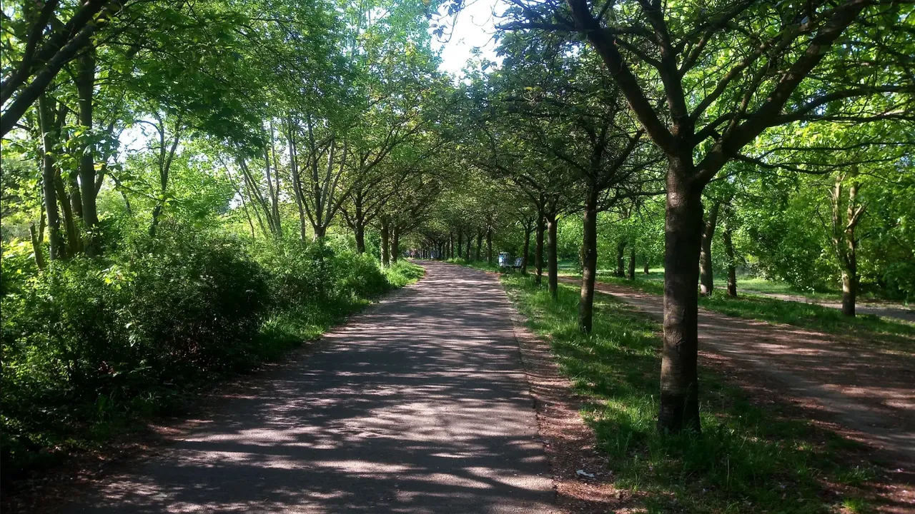
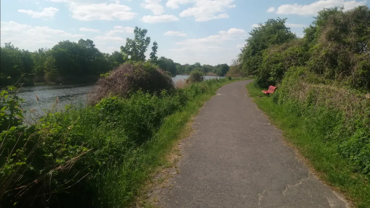
In spite of cycling through urban zones, the trail continued to follow the railroad through vegetated areas - as the Wall used to. Much of the area had been converted from the death-zone of the inner-German border line into a lush park. At some point I was riding under a lovely canopy of cherry trees. Apparently they had been donated by Japan to celebrate Germany's reunification. This is not too far from where I took my Hanami pictures when they were in bloom.
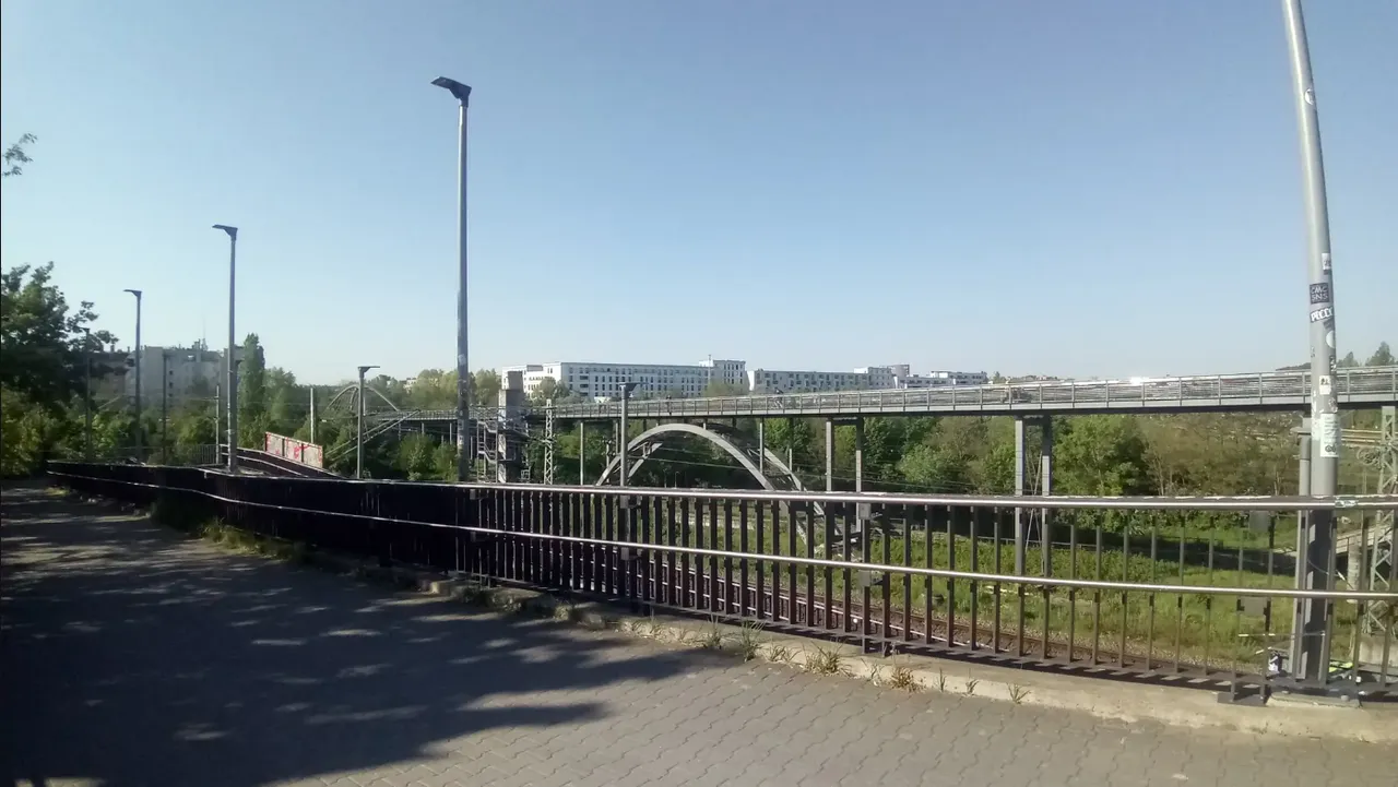
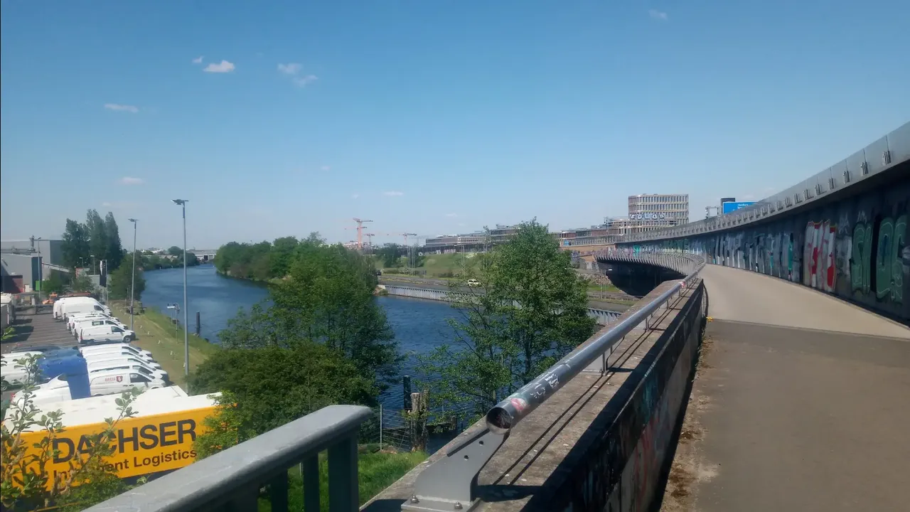
To cross the numerous train lines of the Ringbahn I had to ride over an impressive bridge, from where I was almost in the Mauerpark, the place where we had our BIRLIN Hive Meet - and will have the next one on June 10th.
Past the Mauerpark the Wall took a sharp turn right towards the Nordbahnhof, from where it ran back up north again for a number of blocks. Essentially this locked off the so called Brunnenviertel from three sides, which thus became a famously neglected part of West Berlin. The next turn took me down to the Spree river.
Through the Government and Business Centers
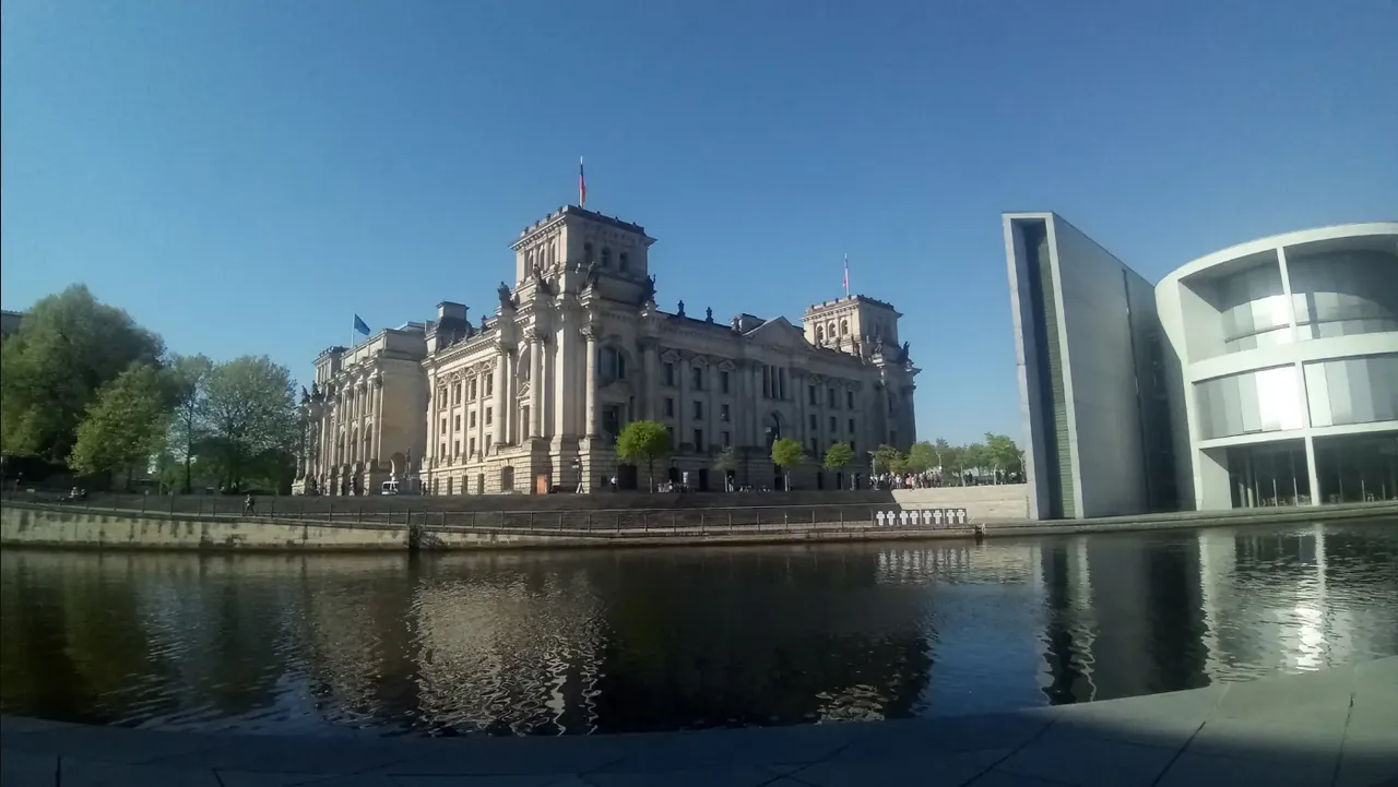
Following the river, the trail took me first through a cemetery of famous historical characters, then along the Hauptbahnhof, Berlin's main train station, behind the Reichstag, the parliament building, from where the Wall actually turned southwards towards the Brandenburg Gate... except for I could not! For some reason the entire area was cordoned off... So I had to go around.
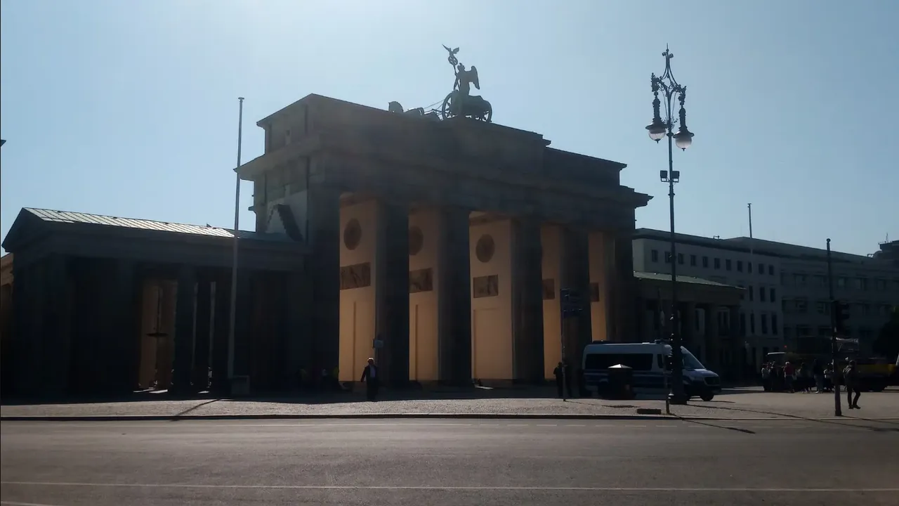
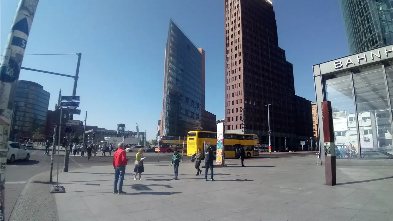
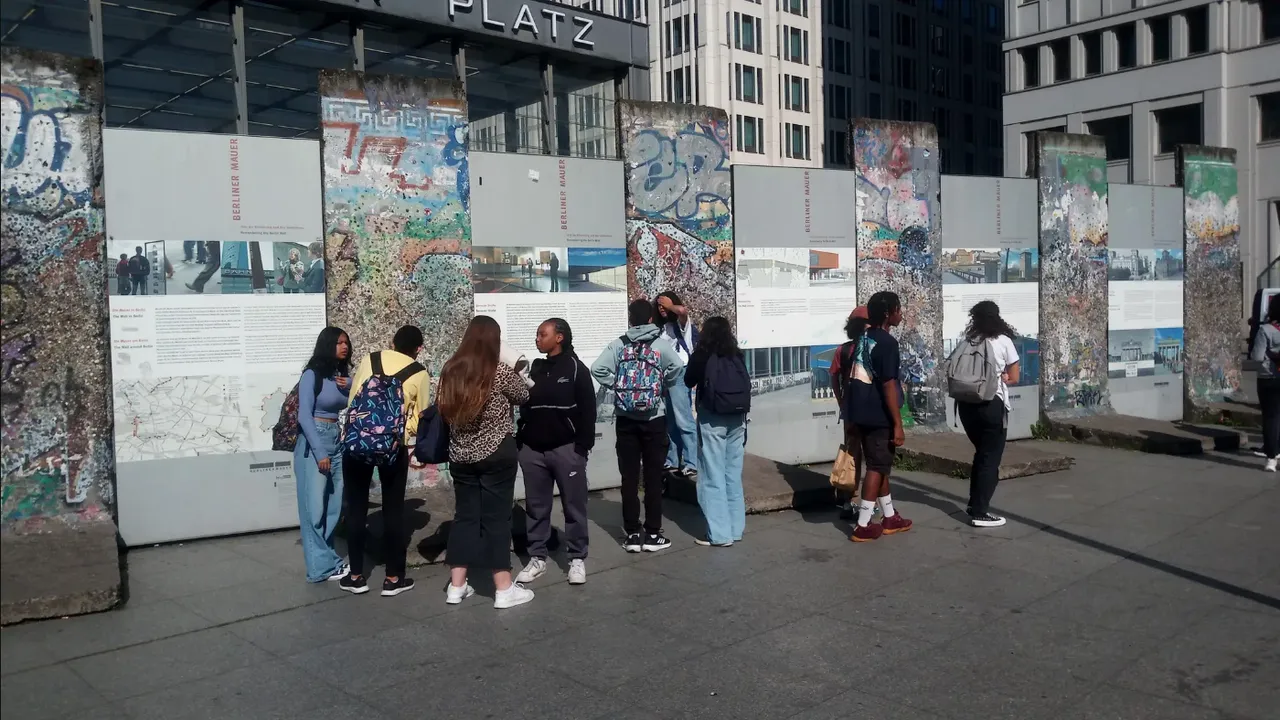
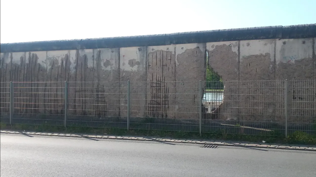
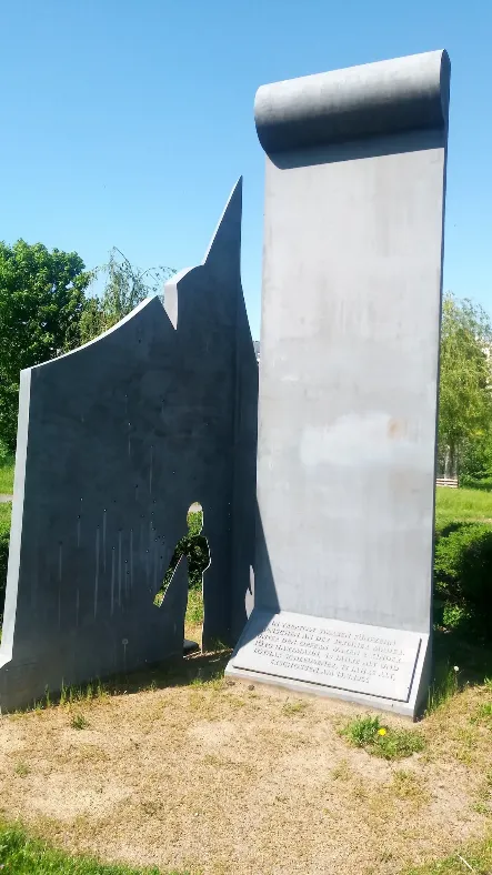
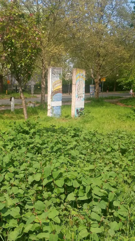
Past Brandenburg Gate the trail took me to Potsdam Square, which had been an eternal construction site - after being an empty piece of real estate in the middle of a city with a border running through it. Today the constructions have left behind massive ultra-modern glass structures... and a few pieces of Wall for tourists to take pictures of.
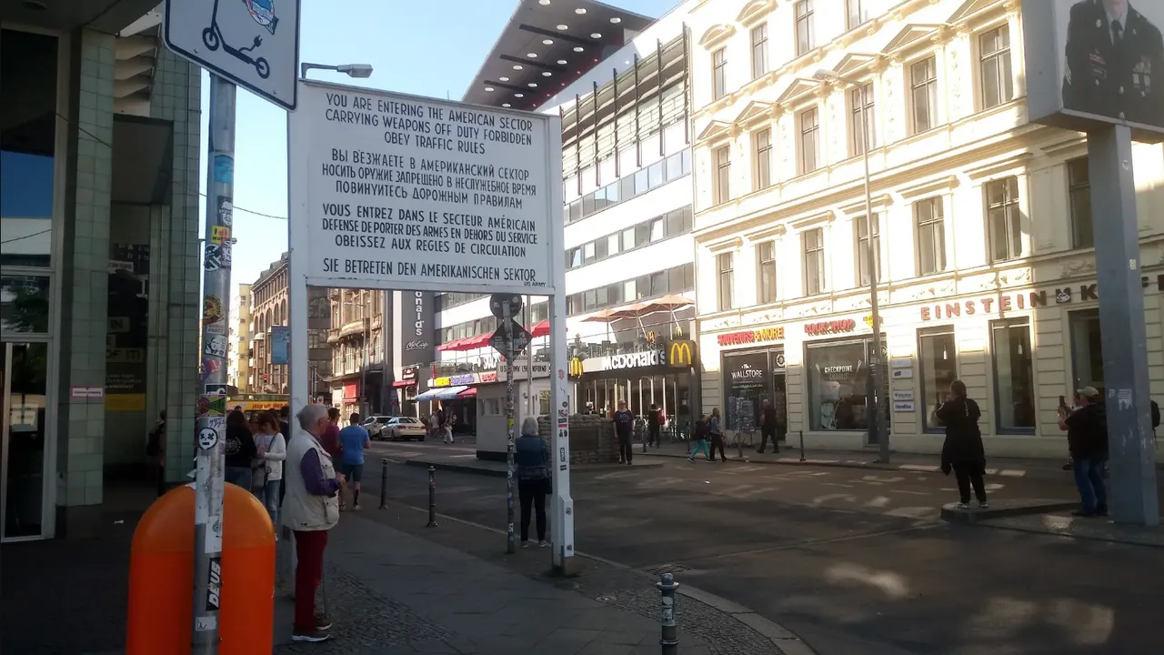
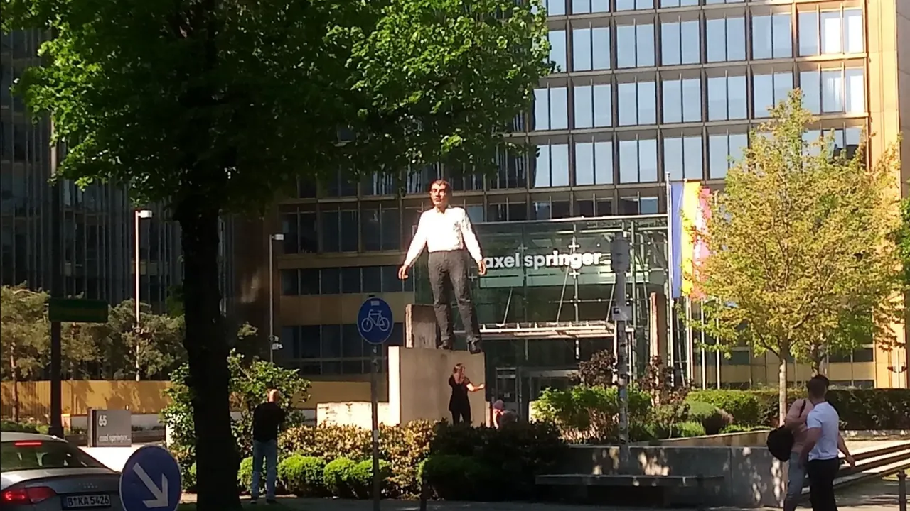
More remnants of the Wall - as well as tourists - can be seen along the Zimmerstraße, just before the Checkpoint Charlie (with a perfectly placed McD). Next, on the corner of the Lindenstraße are the media headquarters of Axel Springer. Normally I wouldn't consider it worth a mention, but what's that right in front of its building? Is that Axel himself dancing on a tipped over piece of the Berlin Wall? WTF??? Is he seriously pulling a David Hasselhoff? Not that it would surprise me the least bit...
Kreuzberg and East Side Gallery
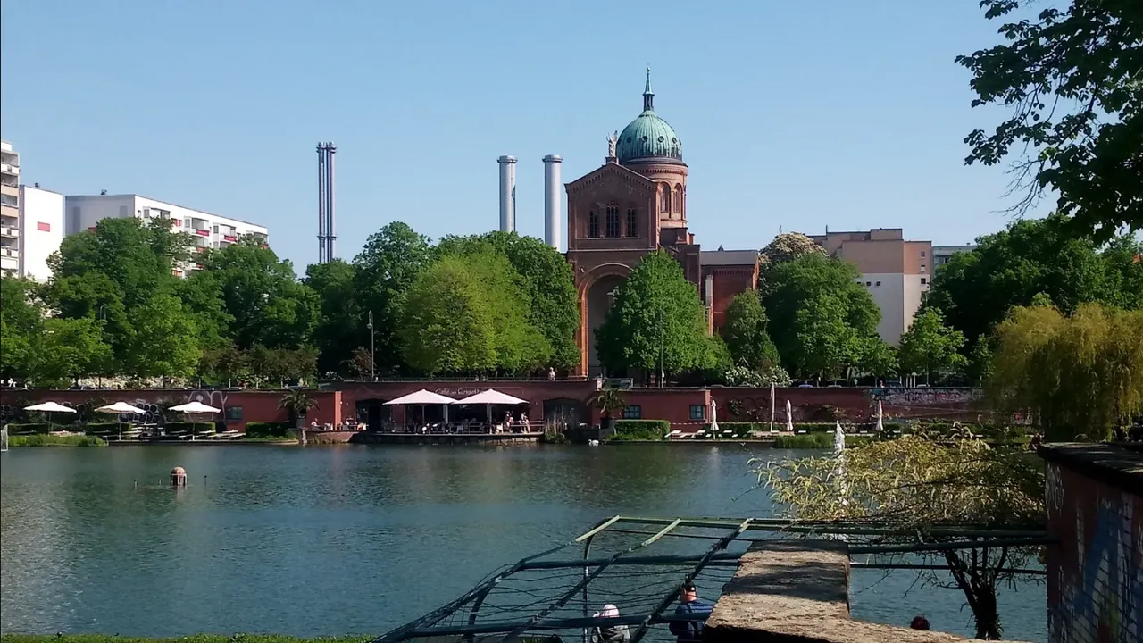
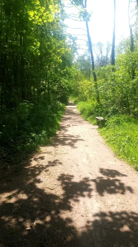
After a bit of a zig-zag tour through smaller streets (always reminding me what it must have been like having a border Wall going past this dense urban area), the trail took me to Kreuzberg, more exactly to Luisenstadt, where this district shows its prettiest side. Unfortunately I didn't get to enjoy its beauty, riding over the bone-shaking cobblestone streets. This is also the reason why I didn't go through the trouble of following the Wall between the Angel Pool and the St. Michael's Church, but took a pic of both from the other side.
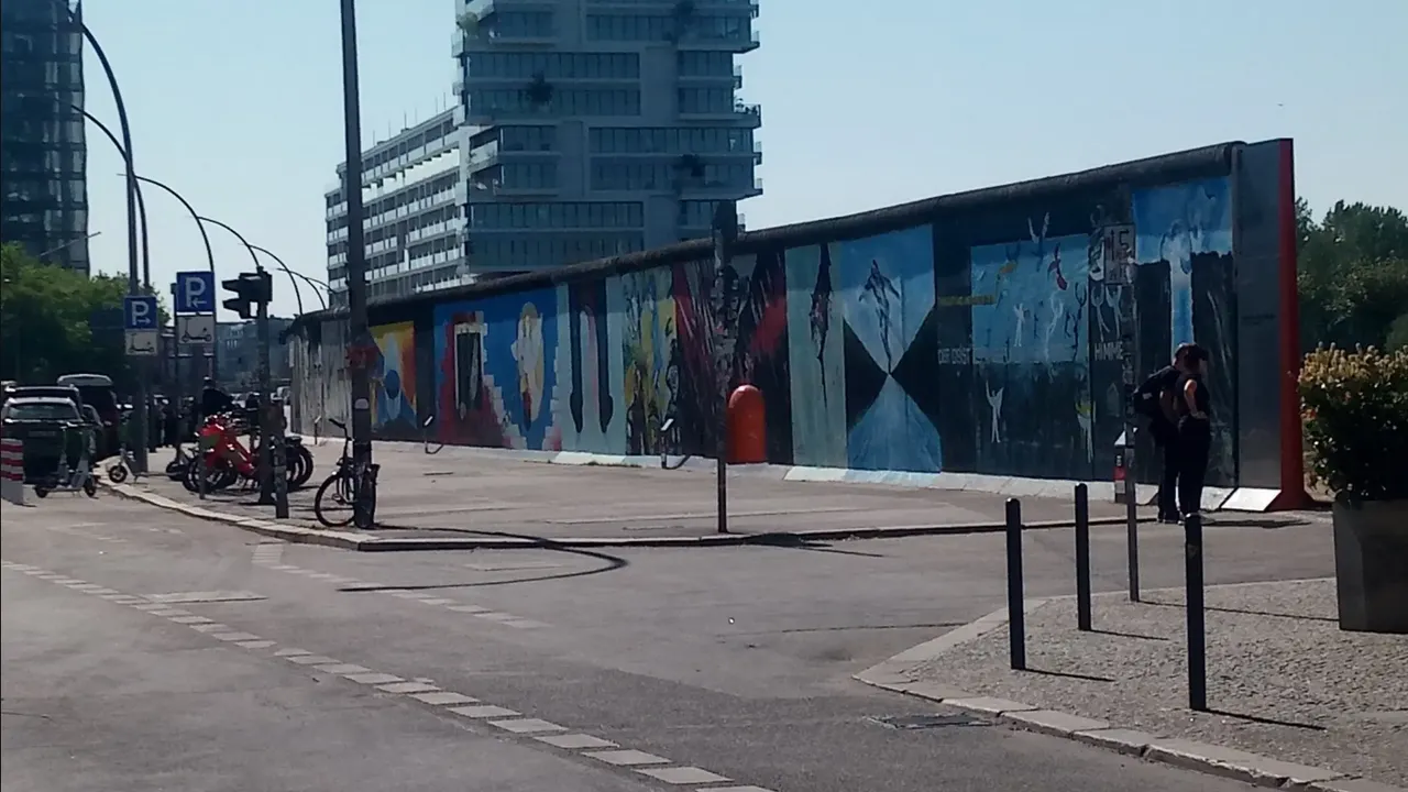
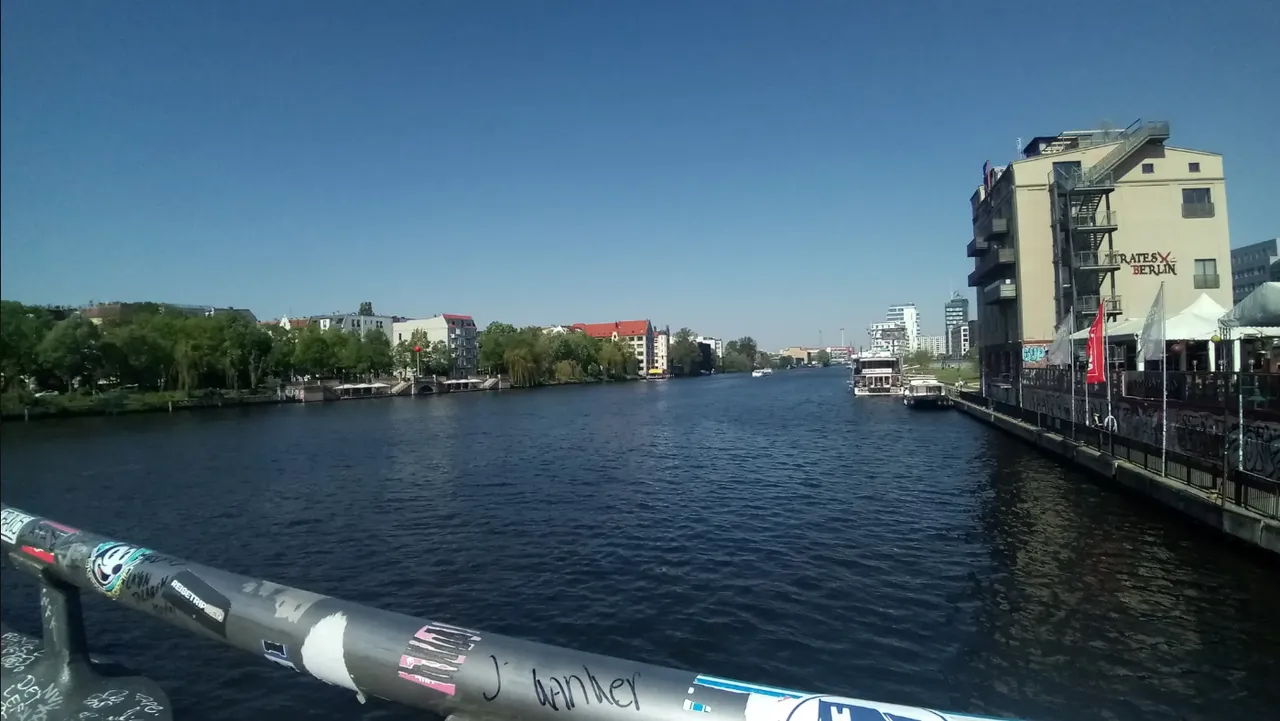
Continuing on the other side of the Spree, I rode past the East Side Gallery, a collection of awesome art on the Berlin Wall, which deserves its own post, in all honesty. Following that, at the Warschauer Straße the Wall ran back across the river to Kreuzberg, offering another nice view.
Leaving the City Towards Treptow
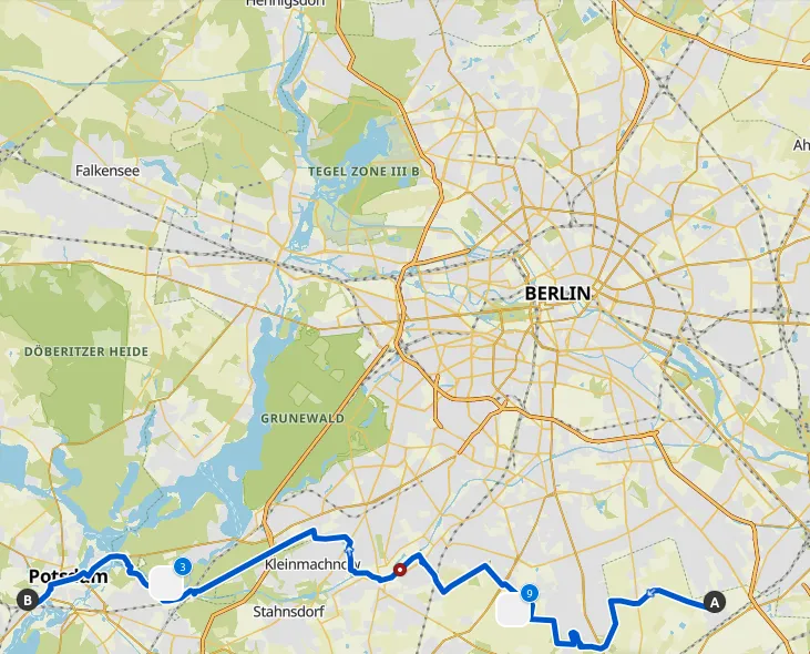
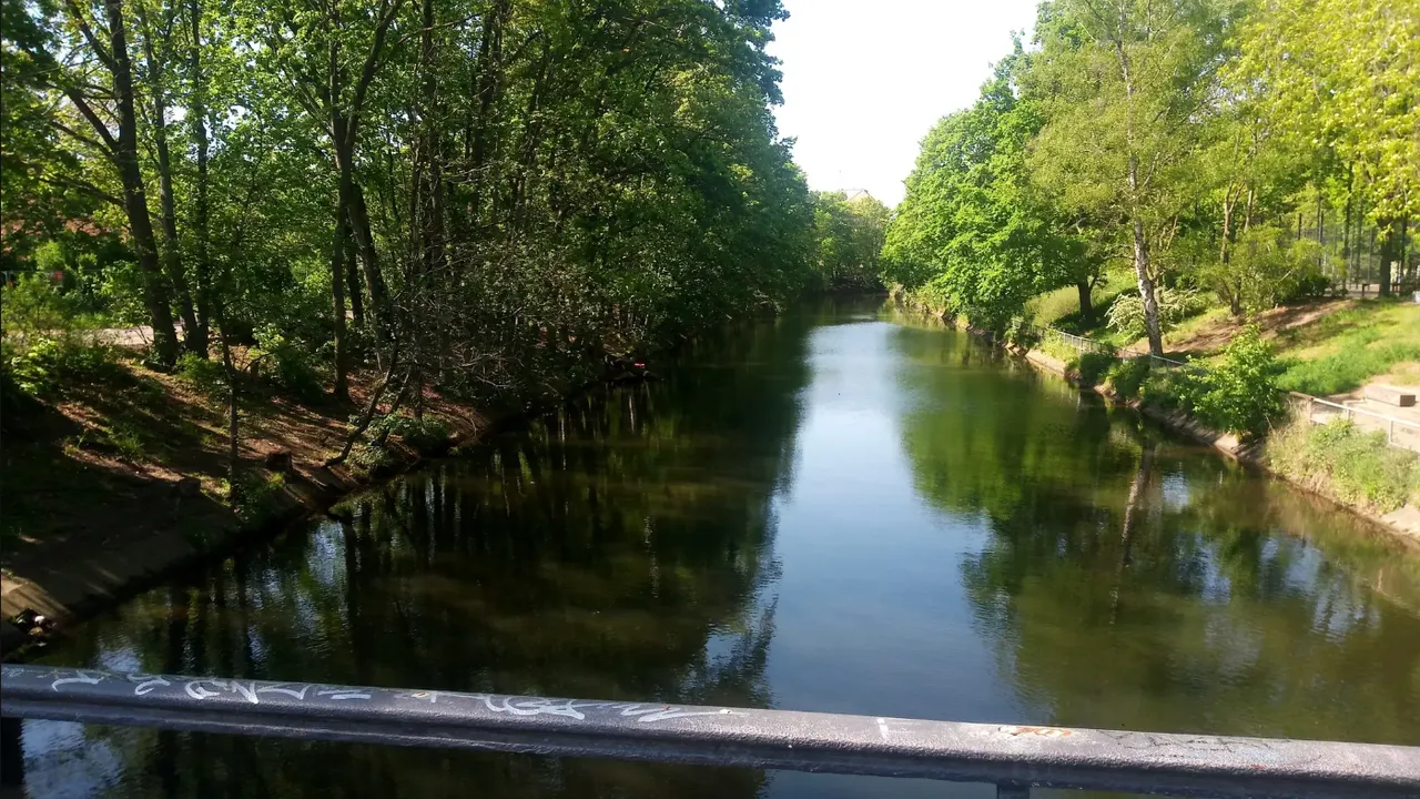
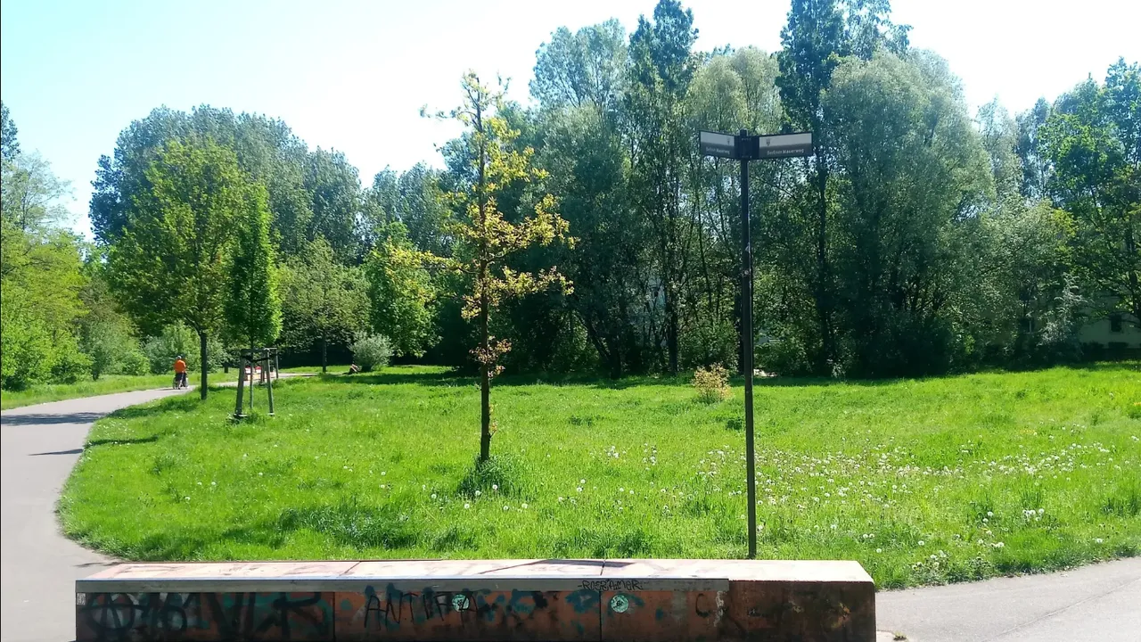
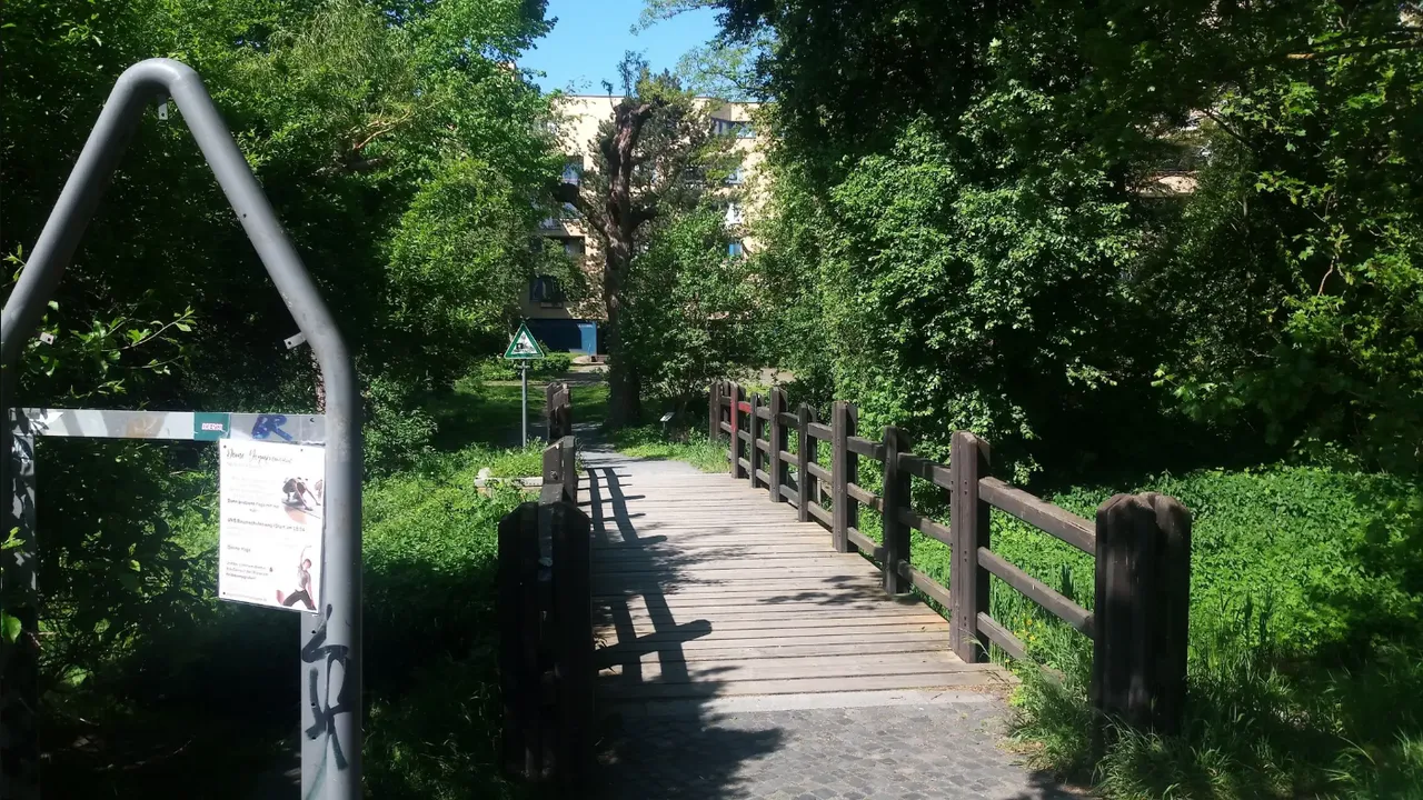
At this point I left the urban center of Späti convenience stores and Döner Kebab shops, heading to Treptow where the Wall used to divide everything. Along the way I made two mistakes, shooting past my turn-off point, and deciding to head back to follow the trail. Over here Berlin starts to feel very relaxing again. Picturesque canals and green parks in the loveliest season of all. Some trees, such as the chestnuts are still in bloom, while all of them are covered in green foliage. The sun is warm without being oppressive, and a soft breeze was caressing my face.
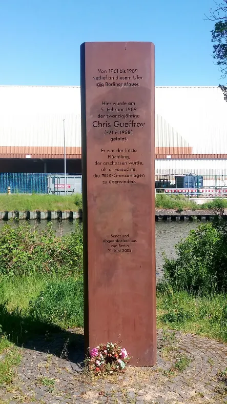
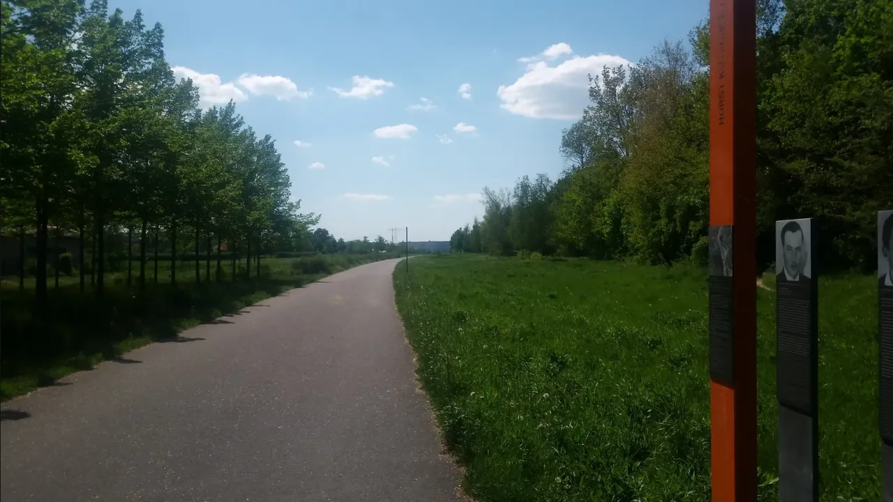
Occasionally, I came past signs indicating certain noteworthy aspects of that particular part of the Berlin Wall, such as children being shot to death, or the location of the last victim of the Wall attempted to cross on February 5th 1989, assuming that thy would't shoot any more. By the way, every single person who was directly murdered at the Berlin Wall has their own memory plaque, closest to the place of their death, with detailed information about the story of each one. Still, it is also mentioned, that countless other people had their lives destroyed as they suffered indirectly from the inner-German border.
Out Into the Vast Emptiness of Schönefeld
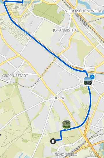
Once the trail makes the curve around the Teltowkanal, it's a straight shot down to Rudow... not that the name of the district makes one bit of difference, because all I saw was nature. The trees and bushes along the canal, the straight bike path, and on the other side of a wall to the left (there HAD to be a wall after all!) a noisy Autobahn. It would have been a pleasant ride, if not for the face-caressing breeze that had turned into a strong headwind. But eventually I made it to Schönefeld.
Schönefeld, is that not where the airport is? The former East Berlin Airport has become the brand new "Willy Brandt" BER Berlin-Brandenburg International Airport. So I kinda assumed I could find a Döner shop there, or maybe at least a Currywurst stand to buy me some lunch. But in fact, I have to say, that Schönefeld has nothing to offer! The endpoint of the first section of the trail took me to a residential neighborhood of recently constructed homes, but even the historic center of "Alt Schönefeld" doesn't have much more than a bakery. I had to go to a gas station to buy me a "Bulettenbaguette" (I love the Germanicized French - words as much as food). Then I continued on the second part of the Berlin Wall Trail.
The Mistake of Großziethen
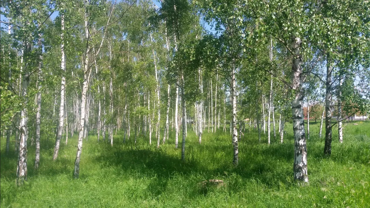
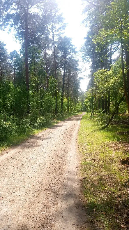
Along fields and woods I continued the trail, by now in Brandenburg, close to Berlin. The birch forests, apple orchards, and horse paddocks looked very pastoral, and the trail itself was well paved, so I could move along rapidly. So much so, in fact, that at one point I realized I was riding into the town of Großziethen. I kinda remembered that this was not exactly where I was supposed to be, the Wall at least took a rectangular turn around this town, which any map will make obvious, particularly since that is still the state line between Berlin and Brandenburg. At this point, however, I just kept going straight, not wanting to turn around again. Oh well, I left out a bit of the Wall, because I was enjoying the scenery so much. So the scenery is what I kept focusing on a bit more.
Detour and Urban Edges
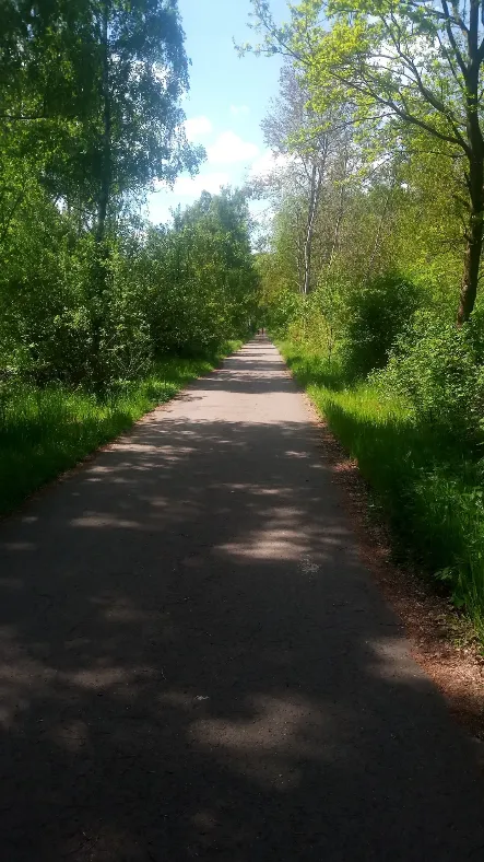
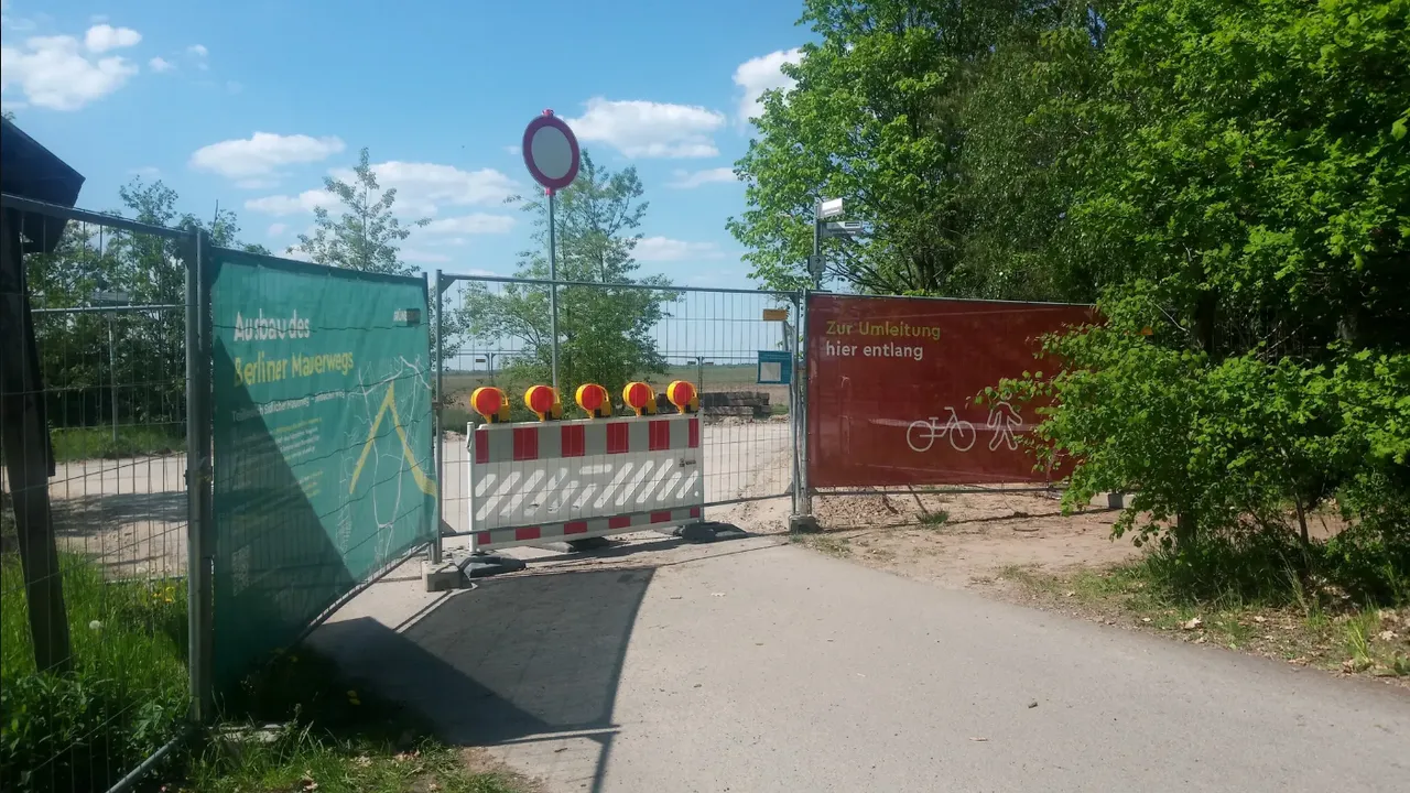
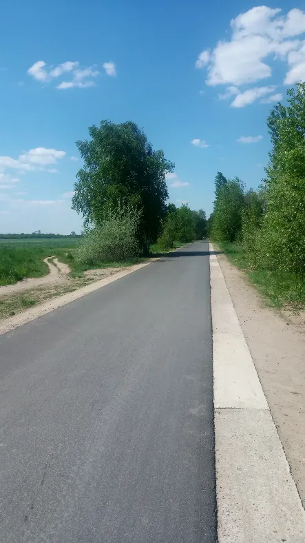
Cycling past Lichtenrade I came across a couple of detours. It seems like they are busy working on improving this biking experience along the former Wall. Not that I felt it was substandard at all, but apparently the conditions can be improved further. We're in Germany, after all. And indeed, once I got past the loops taking me through modern suburbs, and picturesque old-school German small towns (with more cobblestones - GRRRR!!!), I found myself on a paved bicyclist highway. I'm not kidding: This "trail" looked wide enough to be a two-lane road for cars, yet it was intended to be used exclusively by cyclists.
Another memorable experience struck me on the outskirts of the town of Teltow, where I stopped at a supermarket to buy myself a Radler, that is a beer-lemonade mix, very popular in Germany, especially among cyclists. When I rolled up to the bike stand, a lady dropped her bike off, without locking it!!! Sure, her bike was not any more fancy than my old Dutch bicycle, but while I was locking mine (frame and front wheel), another guy dropped off his bike: a race bike from the 80's, also without bothering to lock it (!!!) I could not believe my eyes. Up to now, that supermarket is the only part of Teltow I have seen, but that experience has engraved the town ś name in my mind forever.
Through the Forest into Potsdam
What followed, was more of the same: idyllic canals, picturesque orchards, lush fields of green, with the occasional remnants of the Berlin Wall in between. Eventually it was a straight ride through the forest of Düppel. Once I crossed the canal again, I found myself in Babelsberg on the outskirts of Potsdam.
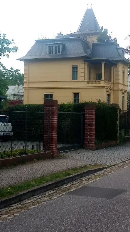
This used to be (and I suppose still is) the Hollywood of Germany. From the earliest days of silent cinema, this town has been known as the center of German film industry. Not that I saw any of the studios, but the mansions I rode past suggested a bit of the past century's opulence. I even started taking photos, but soon realized that in this place a villa follows the next one, before you even get started with the castles.
Potsdam and My Ride Home
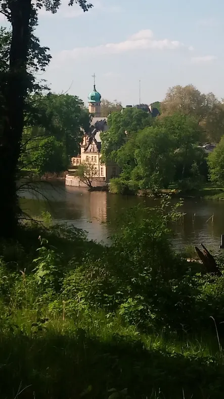
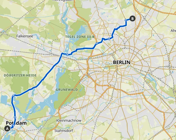
Potsdam itself is so impressive that it easily deserves a couple of posts on its own. For that reason I don't want to get into the details here. Suffice to say, that it is spectacular. And I'll certainly be back for more! As for going home, I had intended to continue on the rest of the Berlin Wall Trail, but this ingenious app wouldn't track me starting out in some Brandenburg town. Coming from Berlin was no problem (even Schönefeld was okay). So I will leave that section for the next time I visit my sister.
Instead, I took the straight route back home, via Groß Glienicke, Spandau, Haselhorst, Wedding, Reinickendorf, and Schönholz. It was not particularly pretty, but at least it was just 44 km (27 miles). Stay tuned for my next trip, completing the northwest section of the Berlin Wall Trail!