If there's one thing Japan has in abundance, it's water. Whether rain or snow, the annual rainfall is significantly higher than what I was used to in Central European regions, which means that it can be quite humid all year round. And due to the topography of the country, with its fairly high mountains in the interior, over a thousand rivers have formed over the course of time, which flow off in different directions towards the sea. And as the sea is usually not far away, many rivers are rather short and have a steep gradient. In this context, the Dutch river engineer Johannis de Rijke is said to have made the following comment in 1891 when he saw the Jōganji River: "That's not a river, it's a waterfall!".
In addition to the many rivers, large swamplands and freshwater lagoons have formed in some regions of the country, some of which have been drained over time to create land for growing rice and other crops. However, there were always problems with flooding, such as in Niigata, where there is hardly any gradient near the coast and the excess water was therefore often unable to drain away.
During the Edo period, the Echigo region then attempted to drain some of these inland lagoons, with the plan to dig an artificial river to transport the water into the Sea of Japan. However, this posed the problem of having to cross the Nishigawa River, which ran parallel to the coast and was important for supplying water to the nearby city of Niigata.
Finally, the shogunate administration approved a construction plan in which the Nishigawa was forced into a wooden corset, which was then undermined to form the riverbed of the Shingawa. After the opening of the new river in 1820, many of the surrounding lagoons dried up making space for new rice paddy villages.
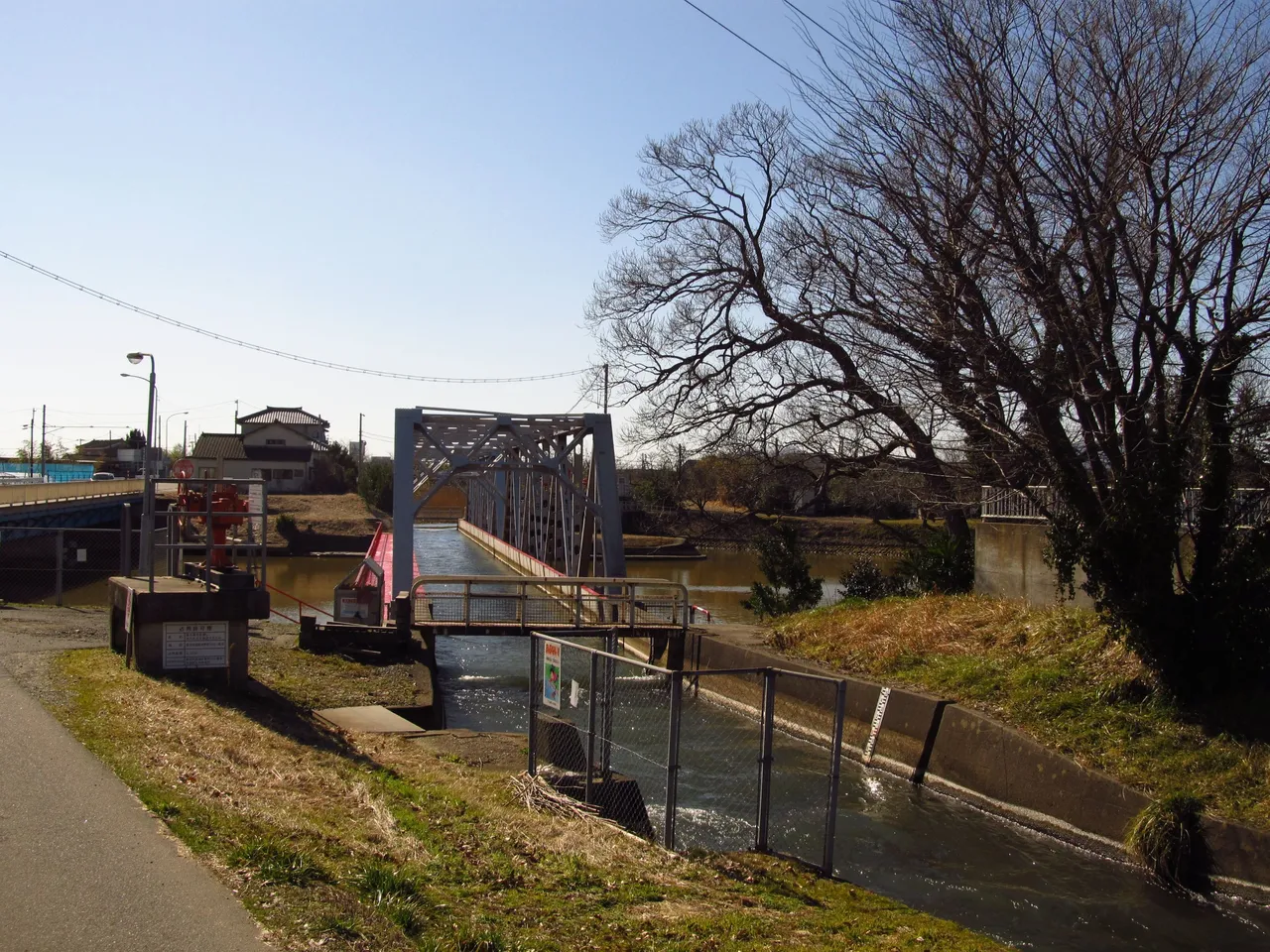
This construction was changed and improved several times over the years. Among other things, the locks in the new Shingawa, which were probably located directly under the Nishigawa, were removed, which significantly widened the riverbed of the new river. The current Nishigawa aqueduct was completed in 1955 and carries the water of the Nishigawa over the course of the Shingawa, just as it did 200 years ago.
I had driven along the main road nearby several times and had always been surprised when I saw this construction from the car window. At some point, my curiosity won over and I stopped to take a closer look. During previous visits to some local museums and exhibitions, I had already learned a little about the history of this region and its struggle with the water masses and also how people changed the river landscapes here.
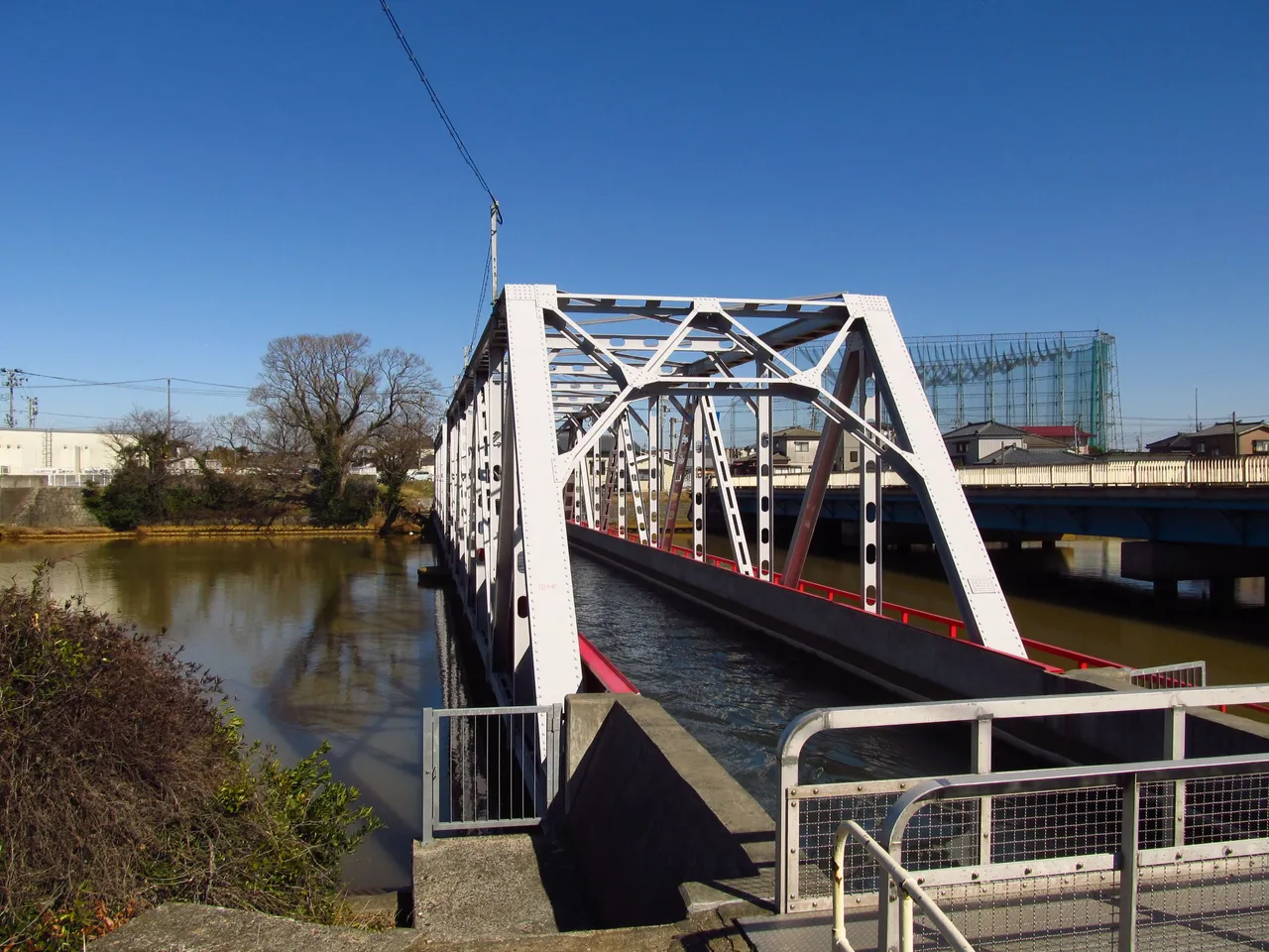
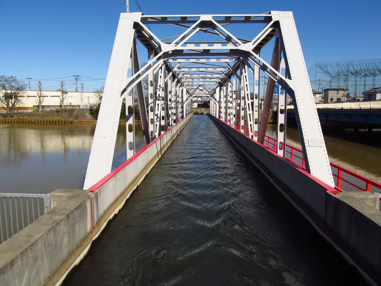
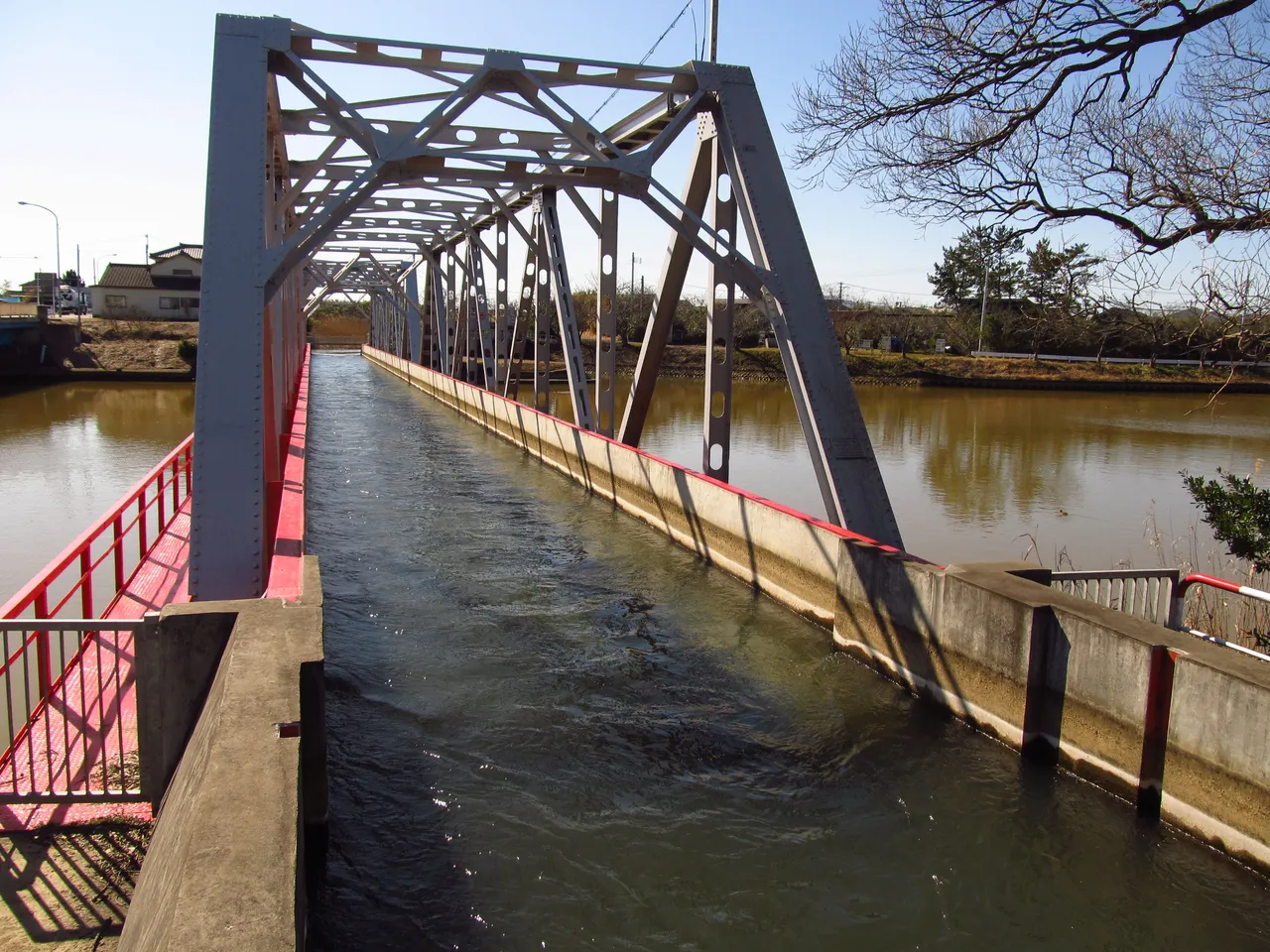
It was interesting to see the result up close with my own eyes, here at this place where over 200 years ago a huge project was realized by human hands. There were other bridges on either side of the waterway bridge over the Shingawa, so I was able to see the whole structure from all sides.
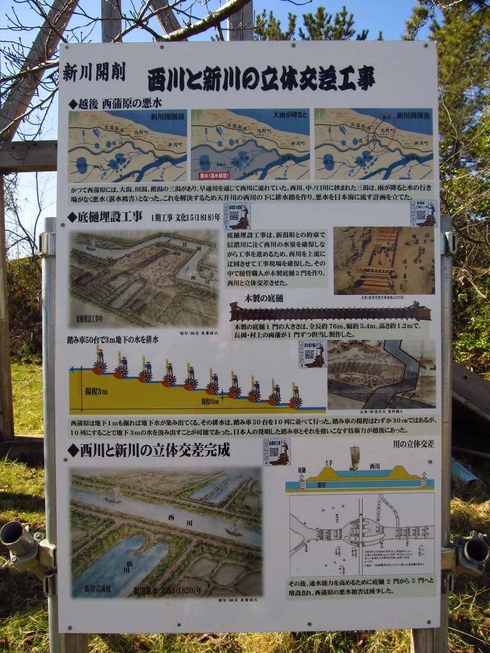
In the end, I despaired of my knowledge of Japanese, as I still find it particularly difficult to read Kanji, so I am always at a loss when it comes to information boards like this one. In the end, I was somehow able to understand the meaning and the content, so I can at least give a rudimentary account of it.
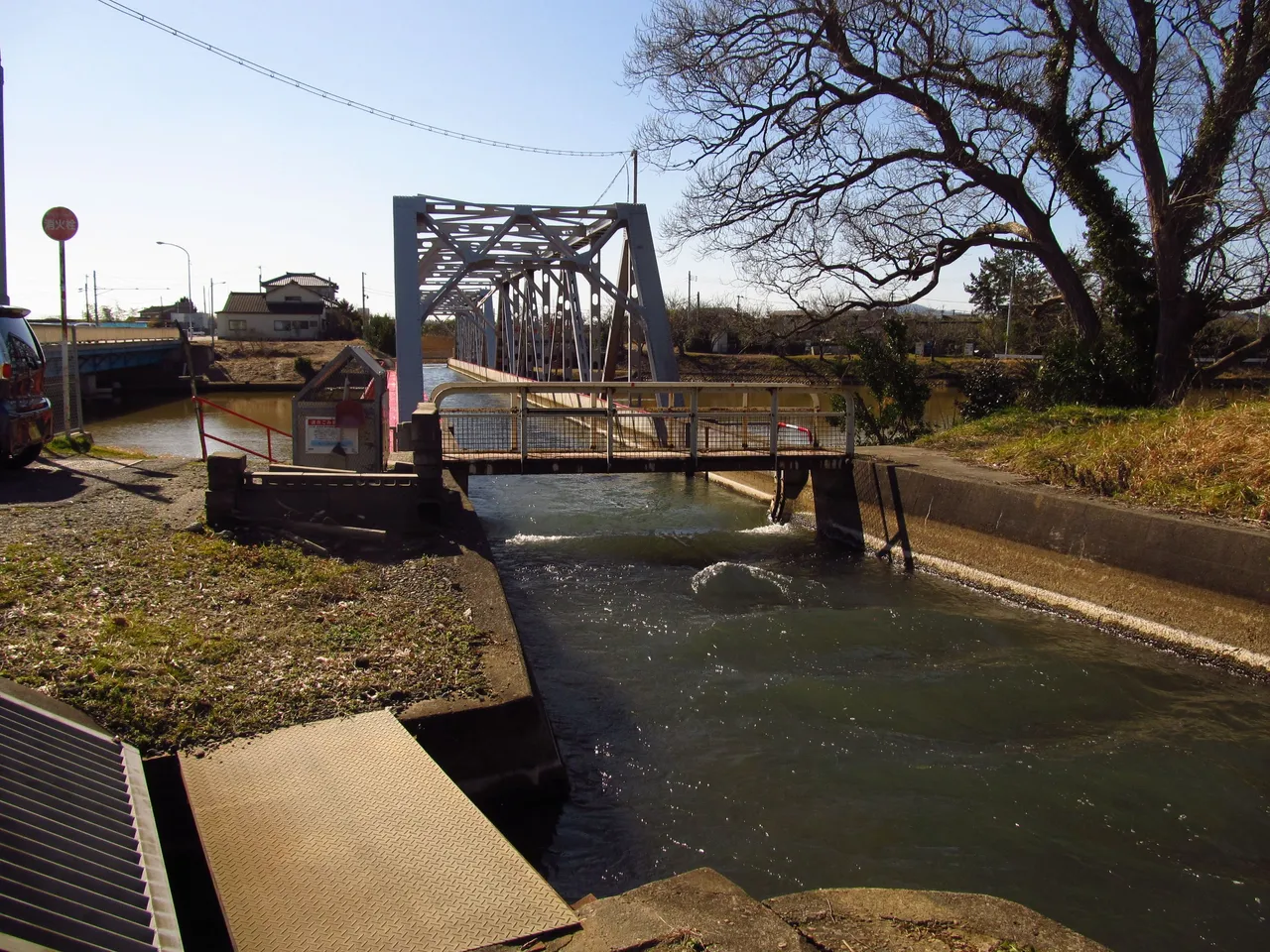
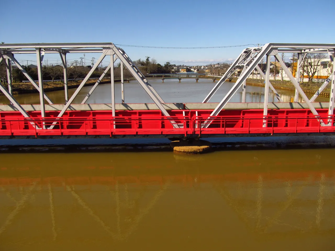
The previous and the following pictures give a small impression of what it looks like here, where also today the Nishigawa crosses the Shingawa, without allowing the waters of the two rivers to mix. Based on the old pictures, I assume that the upper river used to be wider and was navigated back then, whereas the lower river was much narrower in the first years after its formation and probably consisted of several tubes.
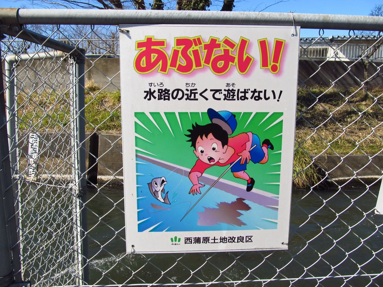
Some signs explain themselves without much knowledge of the language and we do better to pay attention to them. Water has no bars, and that also applies to our two rivers here.
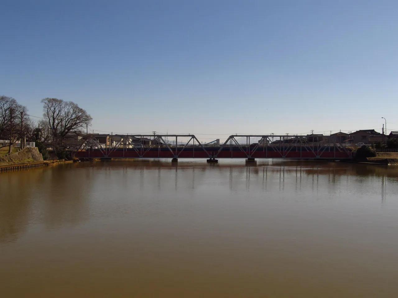
Seen from a distance, at first glance there is not much to suggest that we are looking at a waterway bridge with historical origins. The Edo period is long gone, but some of the achievements of that era still have an impact today.
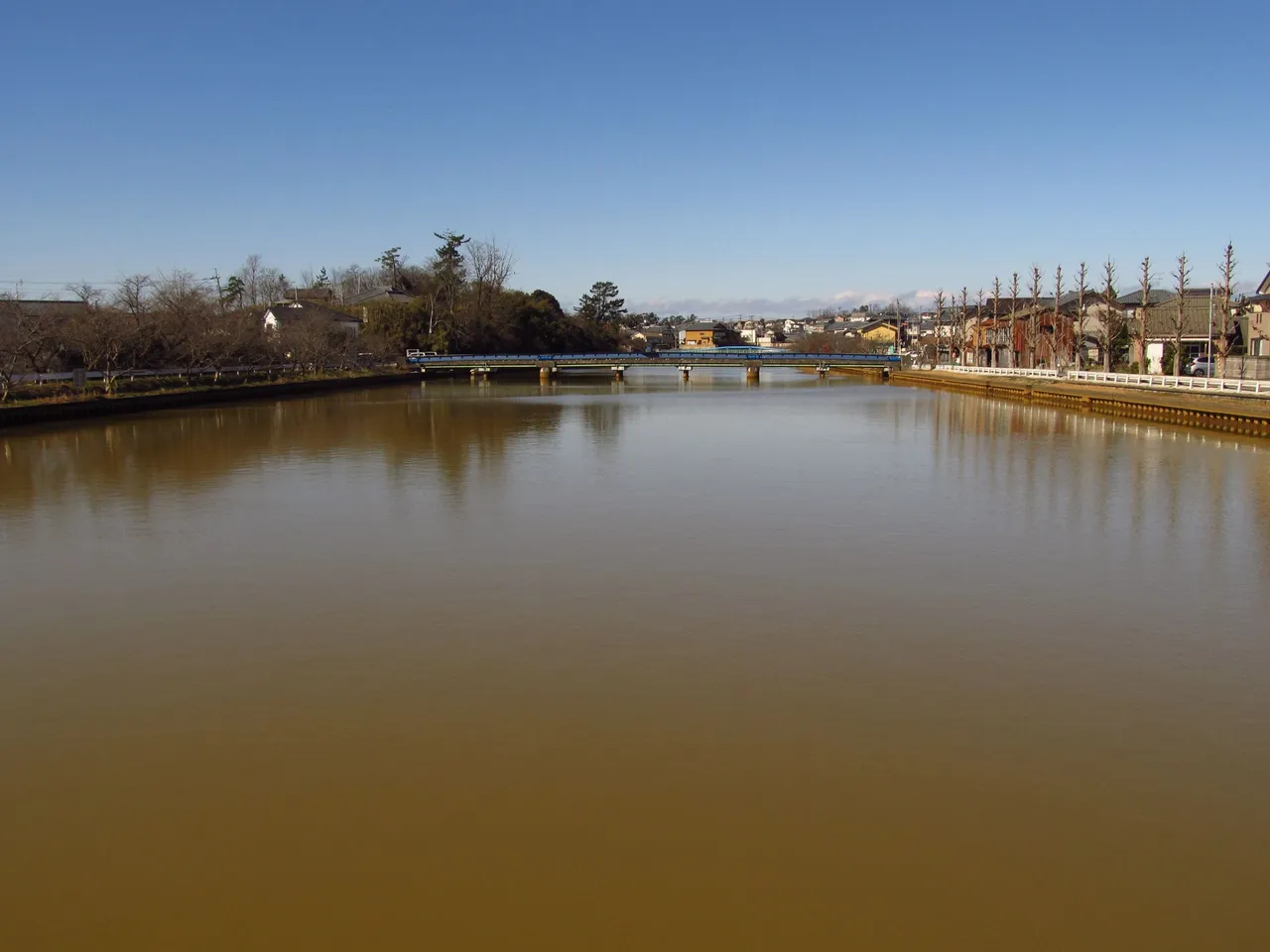
The view in the other direction shows a calmly flowing Shingawa, the new river, which only needs a few kilometers from here to reach the Sea of Japan, where it will be able to discharge its waters.
There is now a large weir at the mouth of the river and a harbor has been built right next to it, where fishermen moor their boats. If you didn't know any better, you'd think it had always been like this.
During my visit, I discovered a row of cherry trees on the left bank, which on that winter's day showed no sign of the beauty with which they enchant people here in spring. Let's see if I can make it back here for cherry bloom, hopefully with a little more time to spare. I would be very delighted...

[//]:# (!pinmapple 37.85239 lat 138.94017 long When two rivers cross 👹🍣🎎 Wonderful Japan d3scr)