Iceland's longest continuous marked trail, some say. Where the night is not, the wind wails, the rain rages, and geysers gurgle.
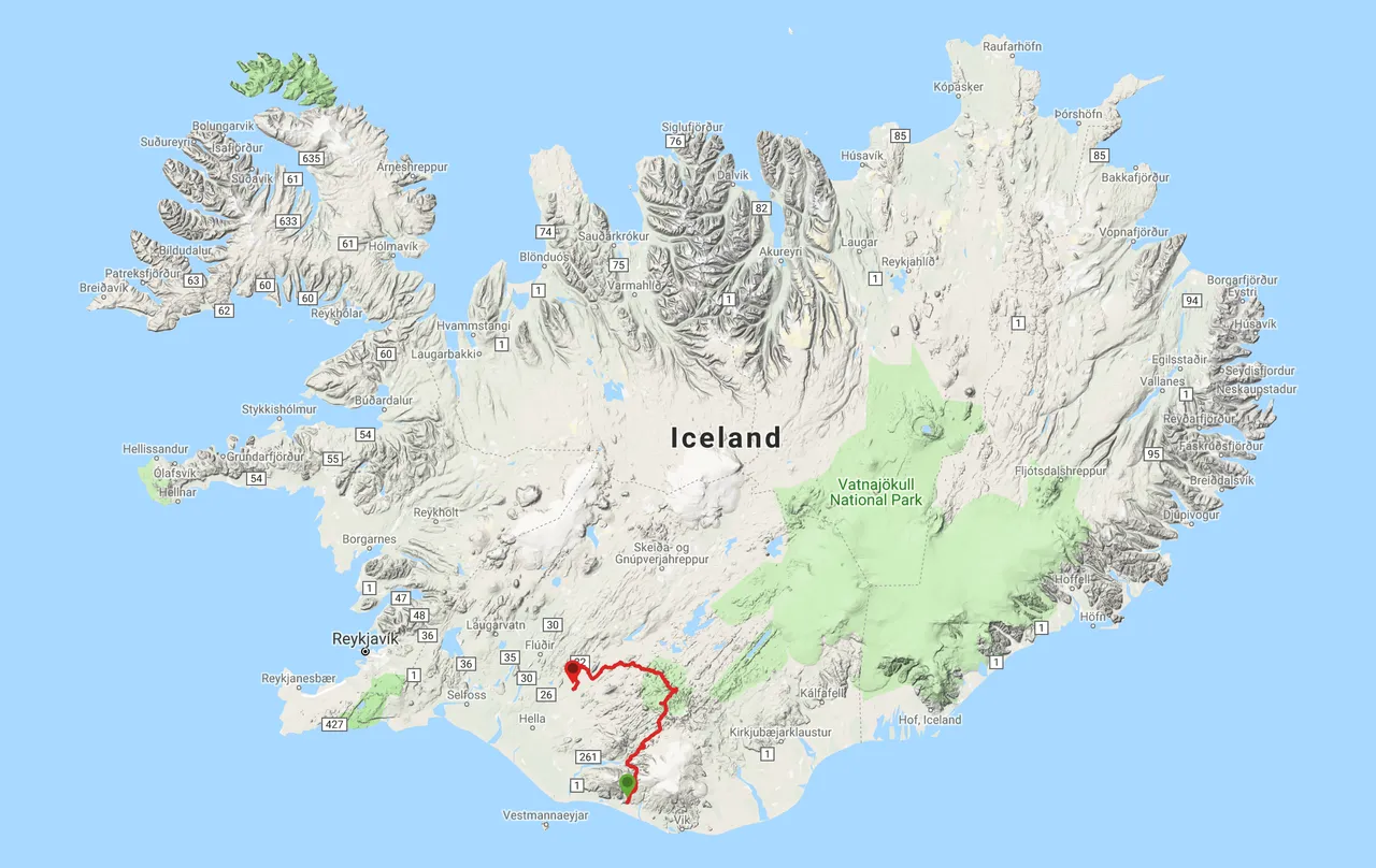
Starting June 15, 2019, I hiked from Skógar to Leirubakki in Iceland. My five day trek covered the following connected trails:
- Fimmvörðuháls Trail (Skógar and Þórsmörk, 24 km)
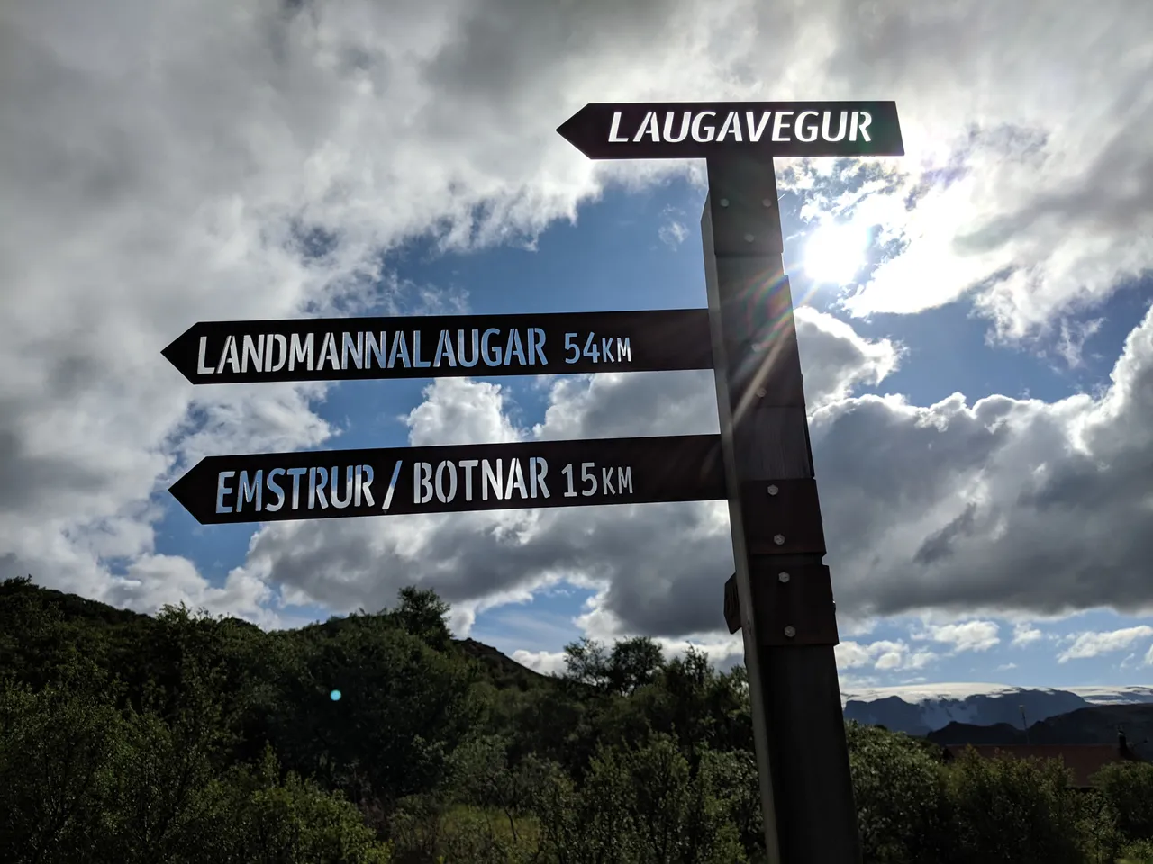
- Laugavegur Trail (Þórsmörk to Landmannalaugar, 63 km)
- Hellismannaleið Trail (Landmannalaugar to Rjúpnavellir, 55 km)
- Hellismannaleið Trail Extension (Rjúpnavellir to Leirubakki, 25 km)
Overview
The hike totaled 167 kilometers (104 miles, GPS track) across many highlights of the Southern Icelandic wilderness:
While Iceland is home to many multi-day hikes, I chose this Southern excursion due to its accessible logistics and the recommendations of my trusted counsel: Hayden the nomadic giant; Tómas the native, Andersen the nice; and Jake the ultralight introvert.
As I would learn along the way, my path traversed Iceland's longest continuous marked hiking trail system. Please comment if this assertion is incorrect or if it is possible to extend this trek further.
I hiked northbound for additional flexibility, since it provided more potential exit points while ensuring I covered the two most popular segments: the Fimmvörðuháls and Laugavegur trails. While these trails were magnificent, they were also crowded. So if you seek solitude in nature and more opportunities for wild camping, consider the Hellismannaleið trail and its extension.
Icelandic names take a bit of repetition and practice to get used to. This picture of bus routes may be somewhat helpful in seeing how the destinations I mention are oriented:
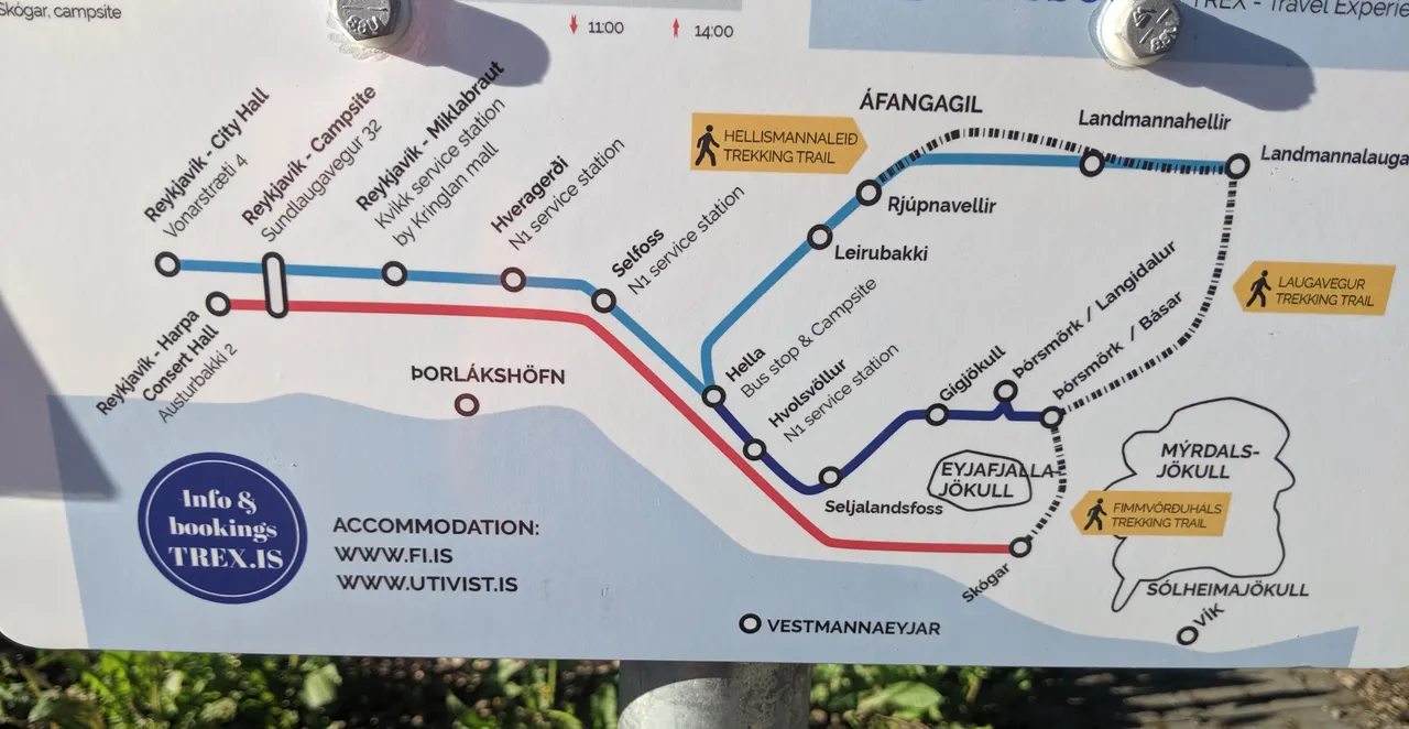
I began in Skógar near the Southern coast. Going into the hike, I expected the named villages along the route to be towns. However, in general they were a couple buildings, usually belonging to a single seasonal establishment. Since mid June is early in the season, with substantial snowpack in many areas, several of the villages were still dormant. Hence, it's best to carry everything you need and expect little infrastructure along the way.
Fimmvörðuháls Trail
I met several other hikers on the bus from Reykjavík to Skógar. We posed for a quick picture before setting off:
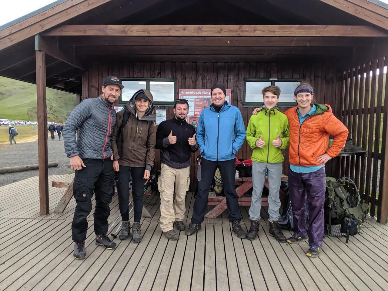
On the first day, I hiked with a French medic (black fleece above). At one point, he asked whether we should take a break to eat, to which I replied, "I already ate." The wonders of multitasking while walking!
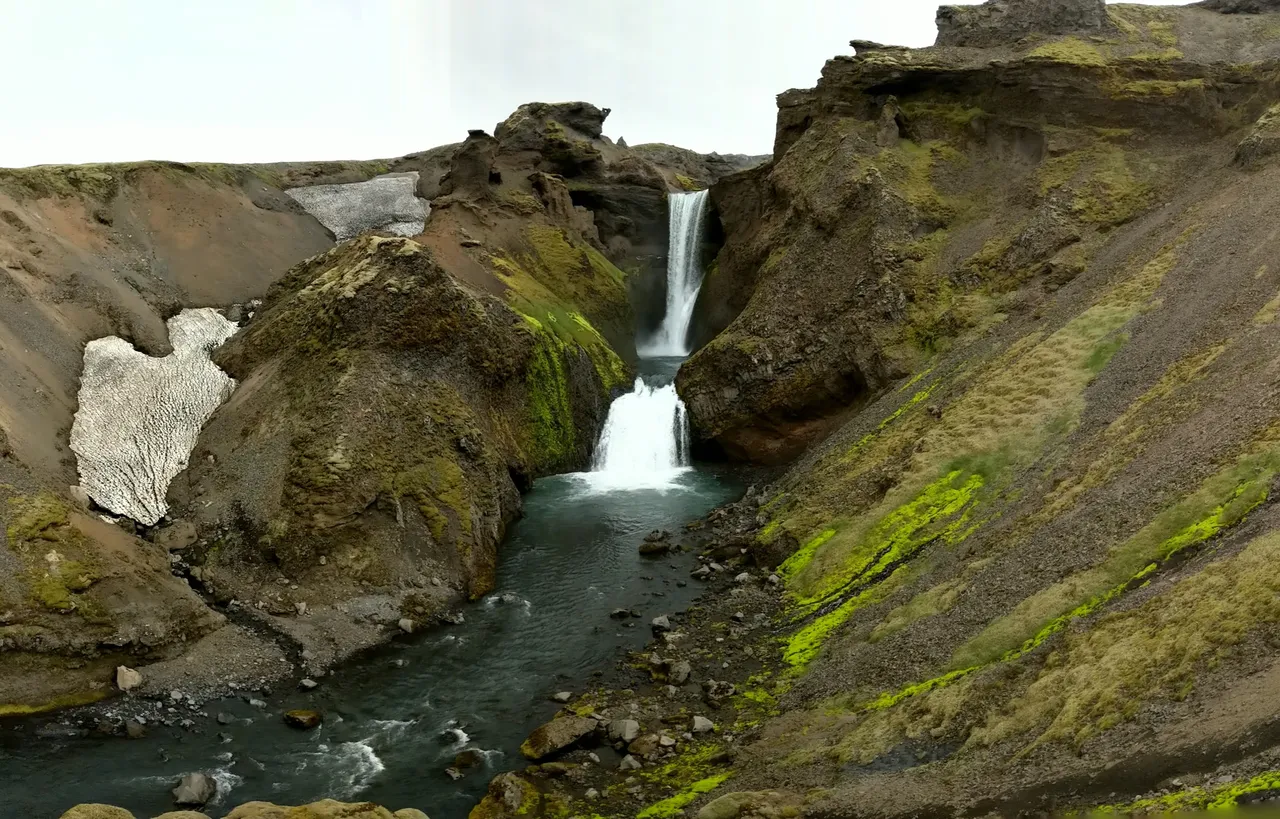
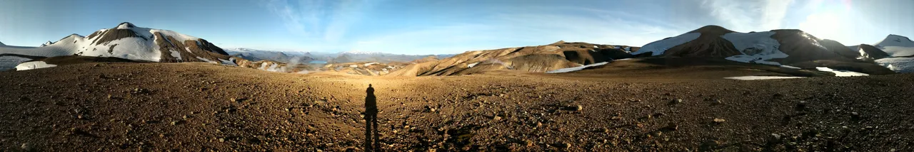
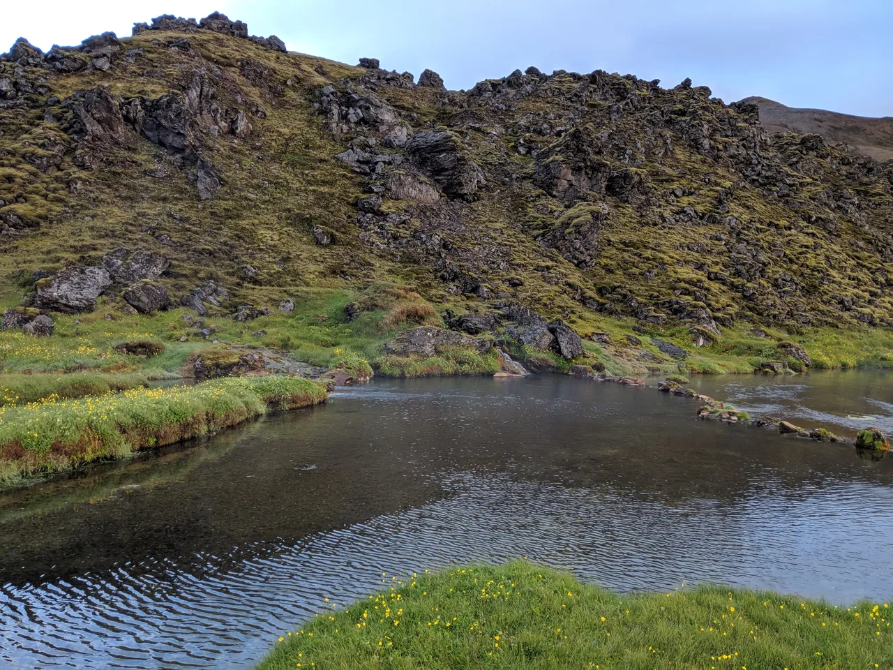
The landscapes were expansive.

The water, rocks, snow, vegetation, and clouds formed compositions of earthen colors:
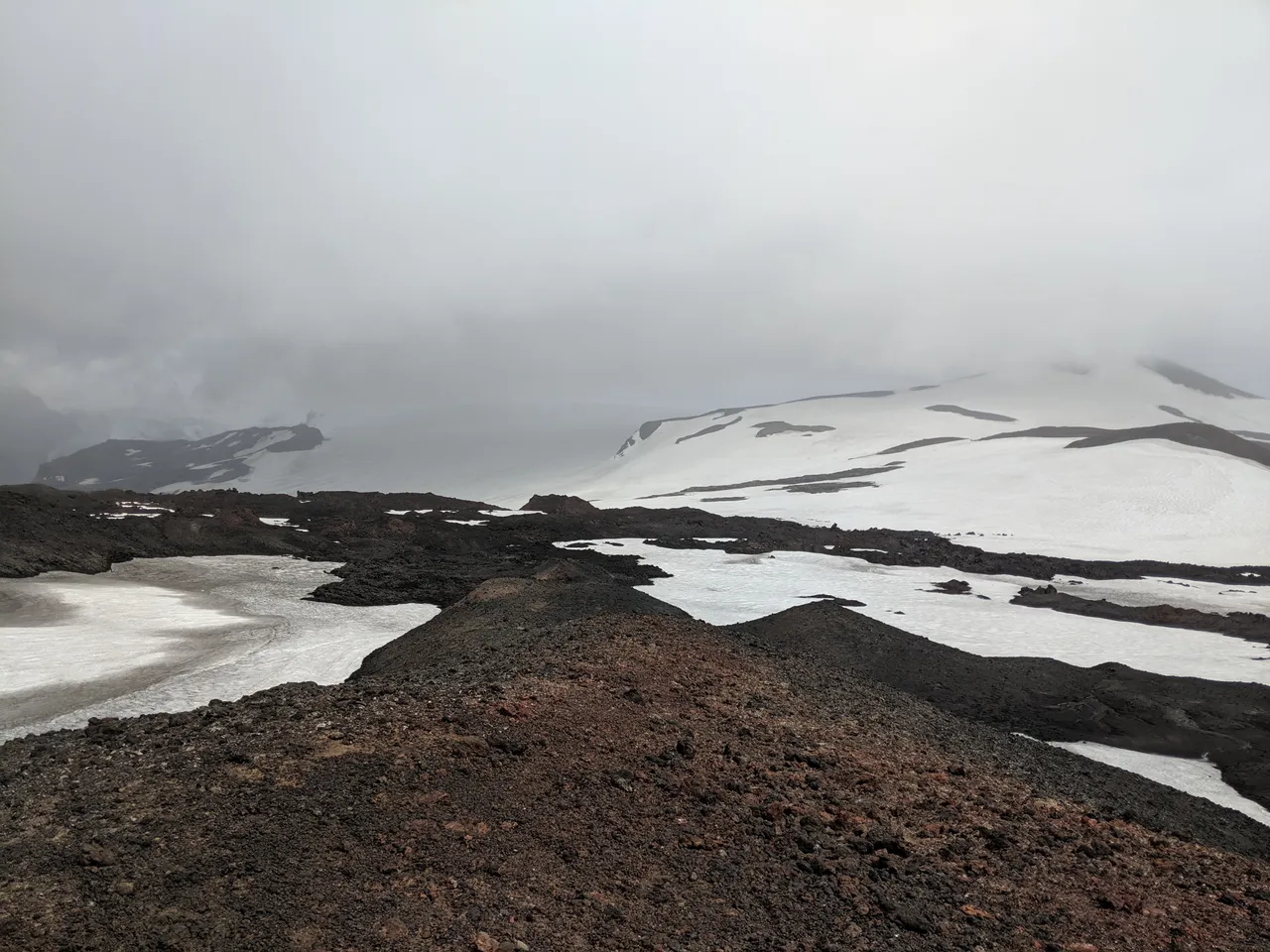
At altitude, the mist and snow merged into a ghostly gray:
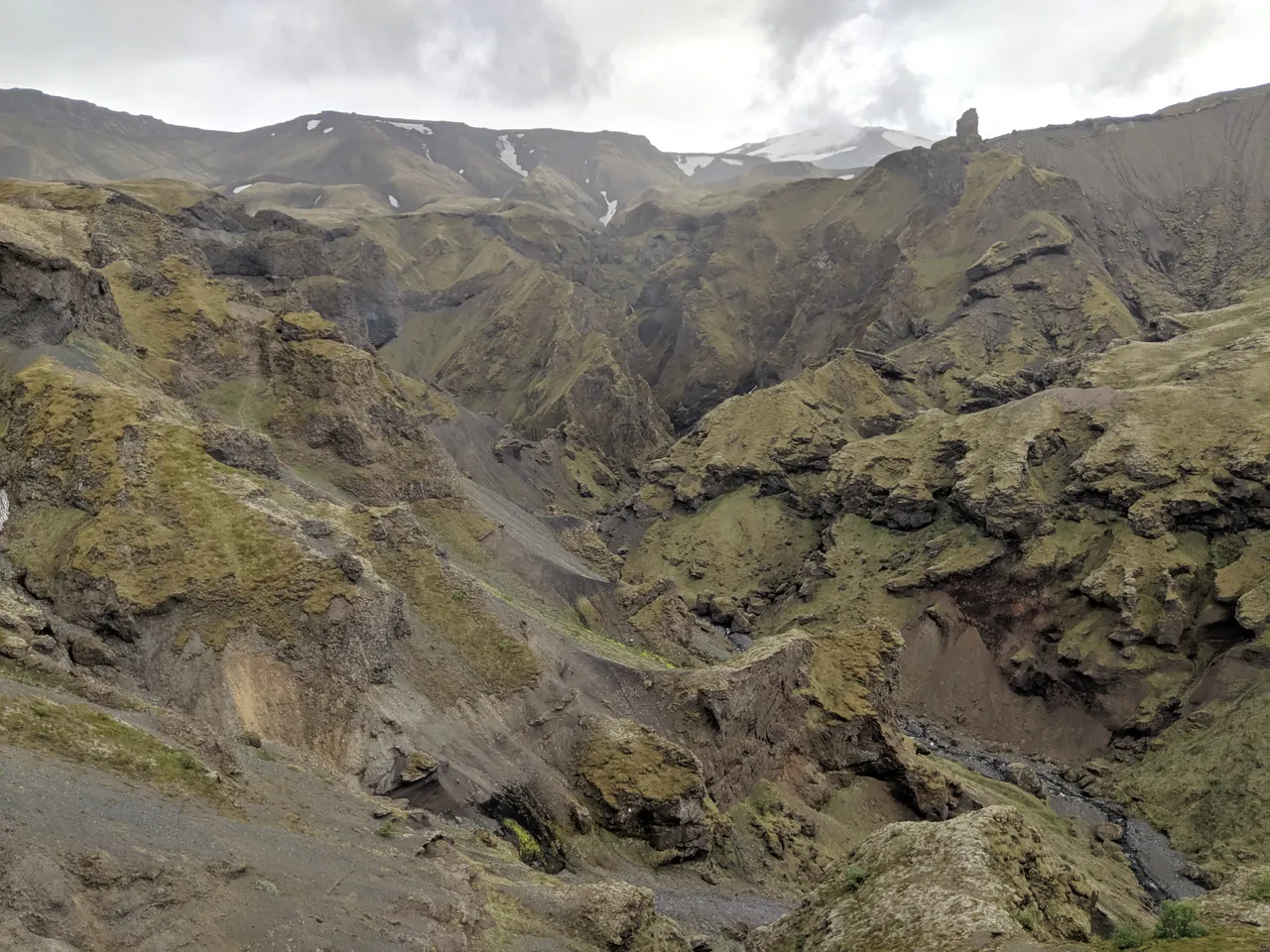
On the way down, the tectonic textures did not disappoint:
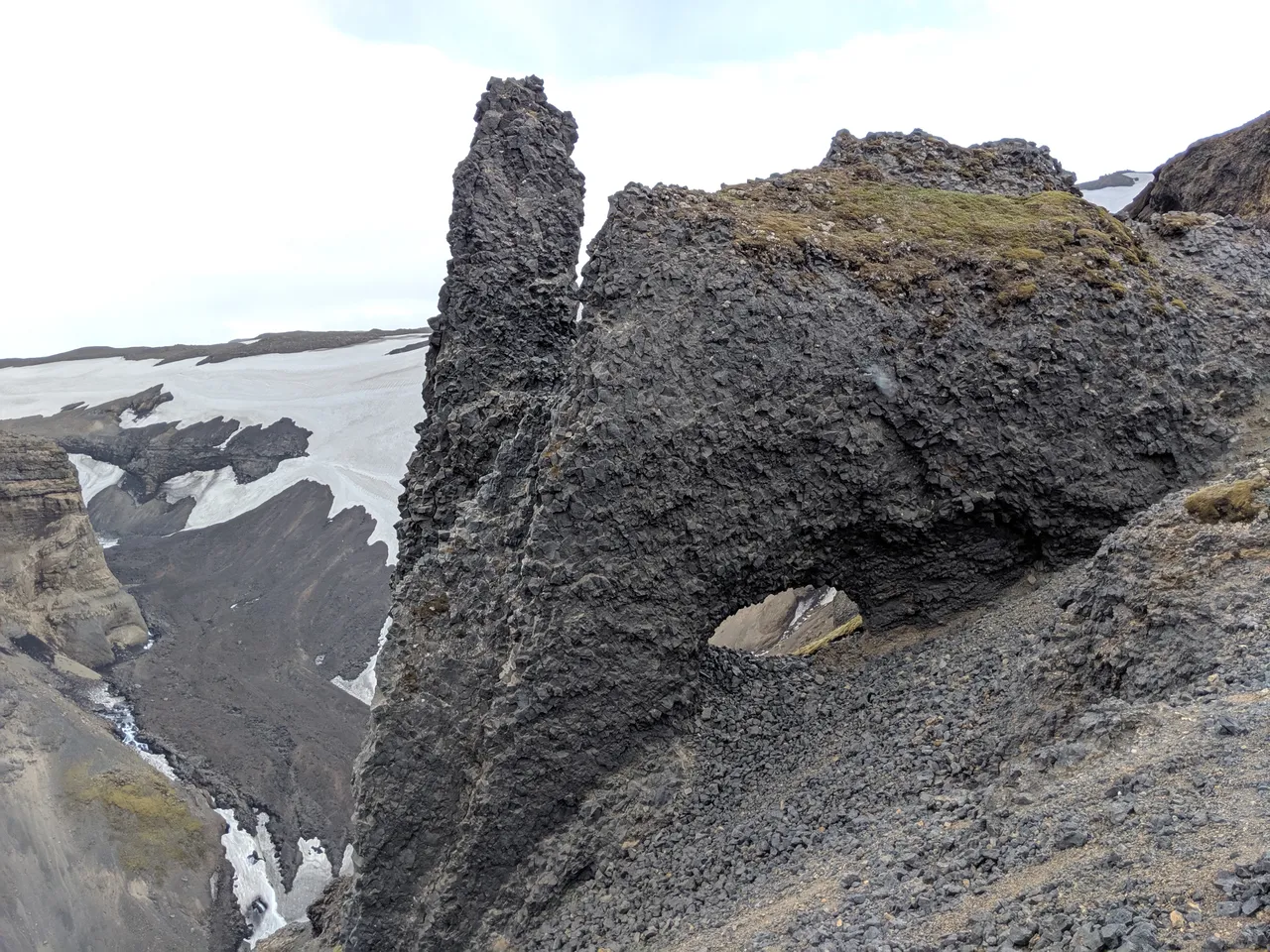
This rock formation appeared deceivingly anthropomorphic:
That night, the Frenchman and I camped at the Básar campground in Þórsmörk. With a nice forest canopy and valley basin to shelter us from the ever-present elements of light and wind, I entered a deep and sustained slumber.
This was the only night where sleep was pleasant. Perhaps the greatest battle going forward was the dreaded night where no amount of exhaustion, melatonin, or earplugs could overcome the forces of restlessness in these everlit arctic borderlands.
Laugavegur Trail
The next morning I set out alone, as I would be for the remainder of the hike.
Early in the day, I crossed a stream with my shoes on, for convenience not necessity. Wet sneakers pushed me close to my blister threshold, and for the remainder of the hike I applied maximum blister prevention, consisting of taping hotspots with Leukotape P, crossing streams barefoot or circumnavigating them, and wearing Injinji toe socks as a liner.
Later in the day, I crossed the behemoth Bláfjallakvísl river barefoot:
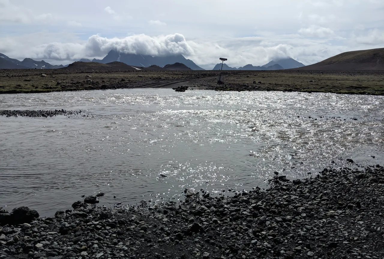
A warden I met afterwards said this is the one water crossing where he recommends footwear. It is also a road crossing and is wide. The frigidity rushed me forward against the competing objective of carefully selecting my footing.
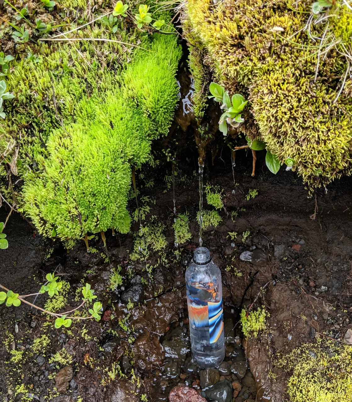
Some unfiltered water was more delicious than others:
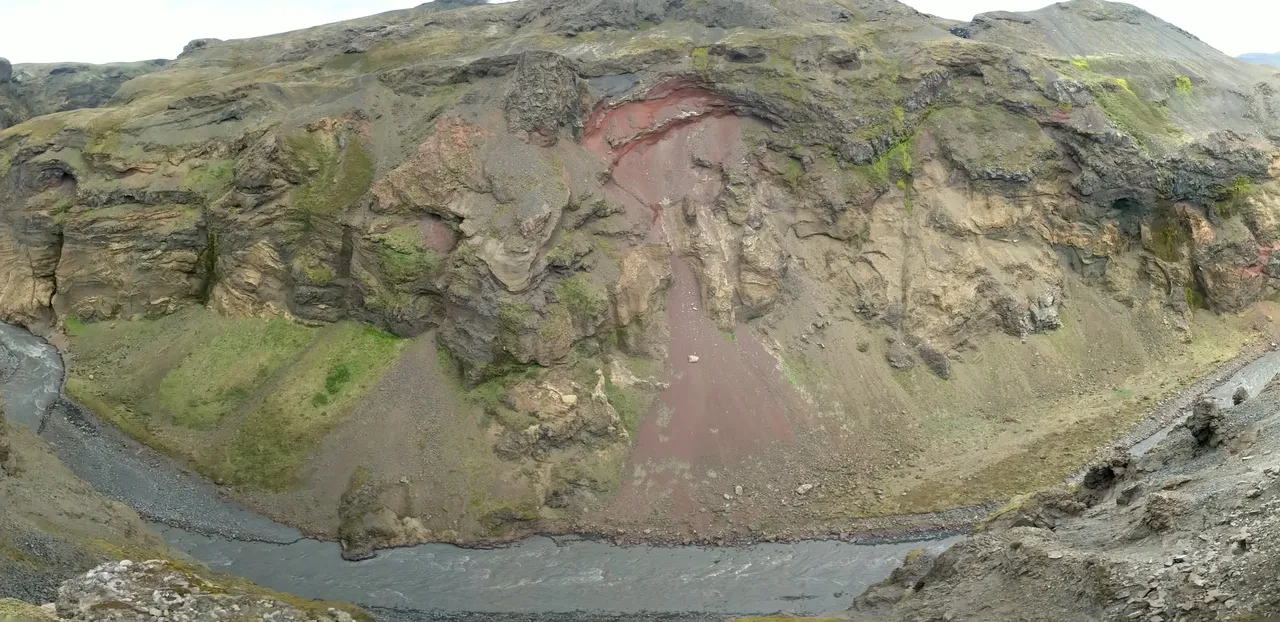
A great valley carved by rushing water revealed a red underbelly to the green surface:
The snow had horns:
It was rumored that camping outside of established campgrounds, which charge fees if in operation, is prohibited on the Laugavegur trail. However, after 20 plus miles on the day, I arrived to the Álftavatn huts next to an alpine lake of the same name. I was shocked by the location of the campsites, which seemed to be directly in the line of fire of the fierce winds accelerating from over the lake.
So I continued on and slept (or attempted to) aside a large boulder a bit off the trail:
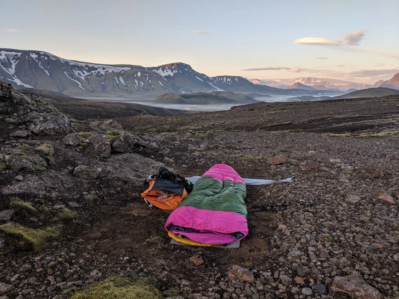
Nature would punish me for my possibly prohibited cowboy camping. By time I gave up on sleeping around 4 AM, my quilt was dripping with condensation. Apparently, my intuition that clear skies would mean little dew was incorrect.
To add insult to injury, not more than 20 minutes into hiking, I encountered a rugged stream crossing. Have I mentioned that Iceland is cold, especially when the sun makes its brief dip below the horizon?
But at the top of the pass, I was rewarded with a steam shadow:
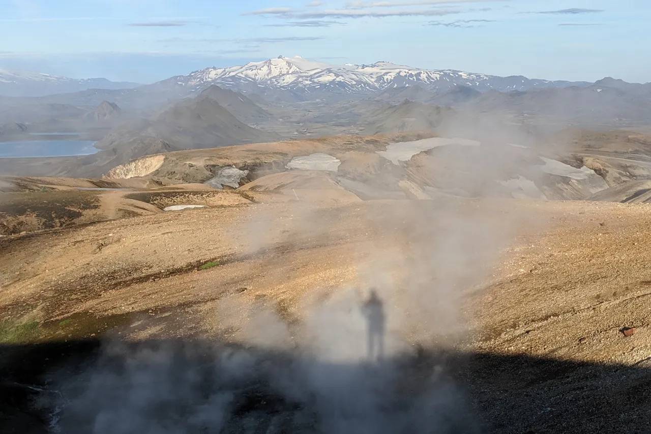
As well as a more traditional shadow:
Long stretches of snowpack allowed for optimized routing and smooth sailing:
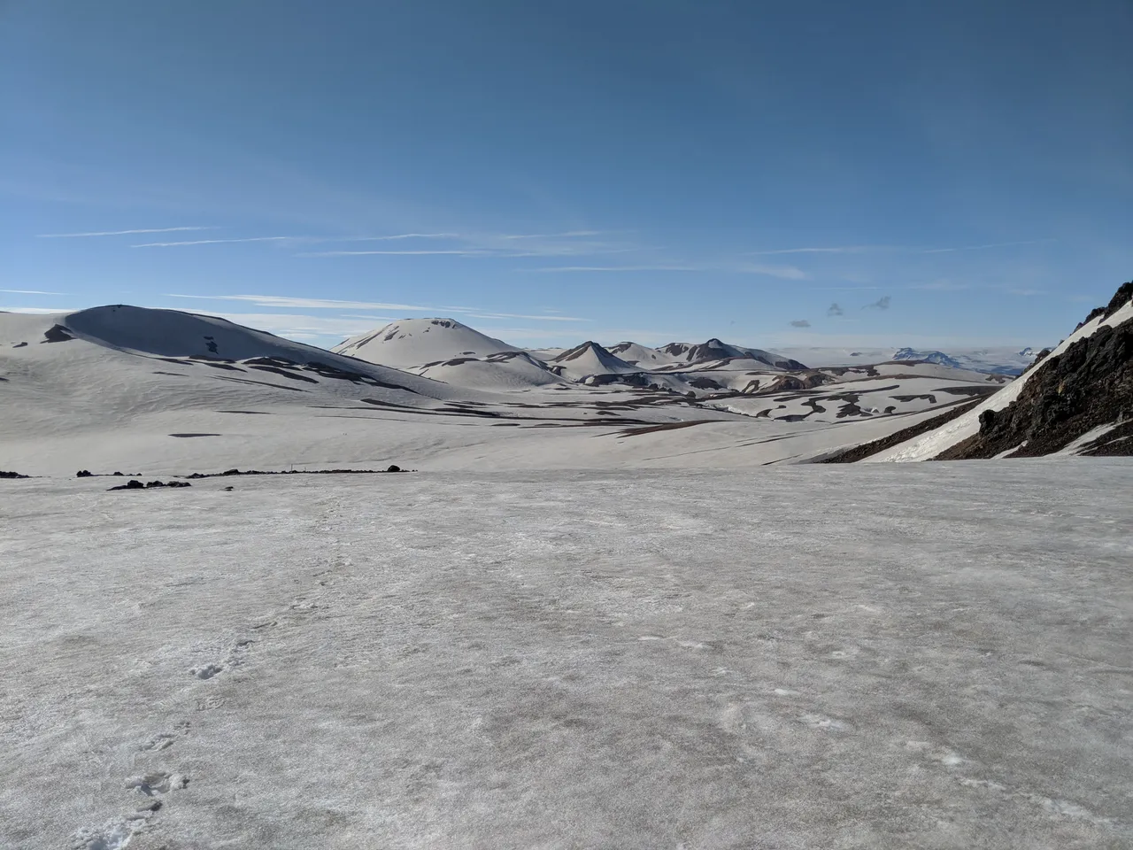
I found the snow was most compact and responsive when off the beaten path. Post-holing — a term some hikers use for when their feet sink into the snow — was non-existent.
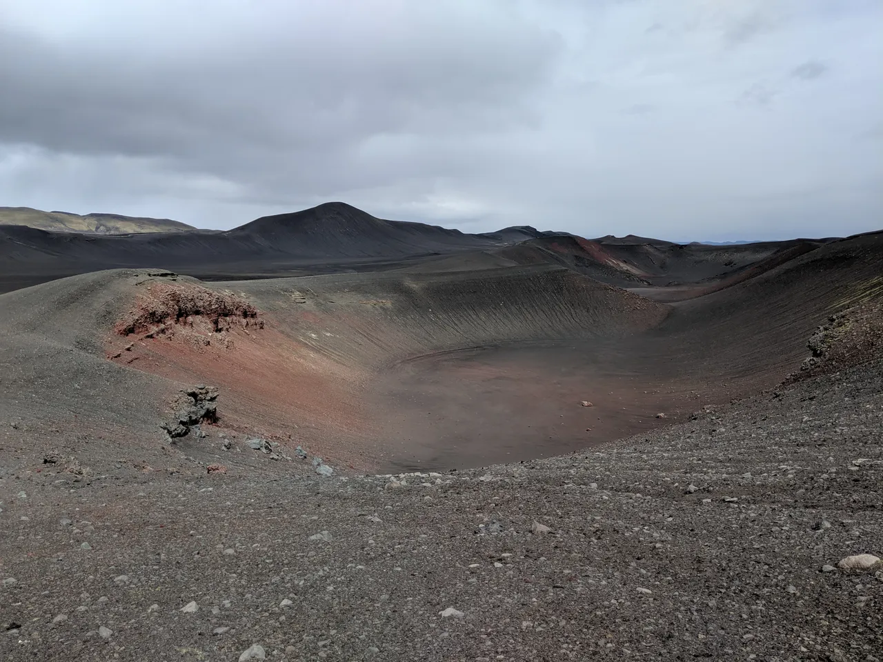
Based on the recommendation of a warden at the Hrafntinnusker hut, I ventured off the Laugavegur to a nearby ice cave that had collapsed, taking with it a German explorer — a tragic reminder of the drastic ephemerality of Iceland's volcanic landscapes.
The trek from the hut to the ice cave was a nice opportunity to escape the crowds, practice my skiing (without skis), and catch some views:
The only problem was that I didn't see the ice cave ahead … until I turned around and witnessed:
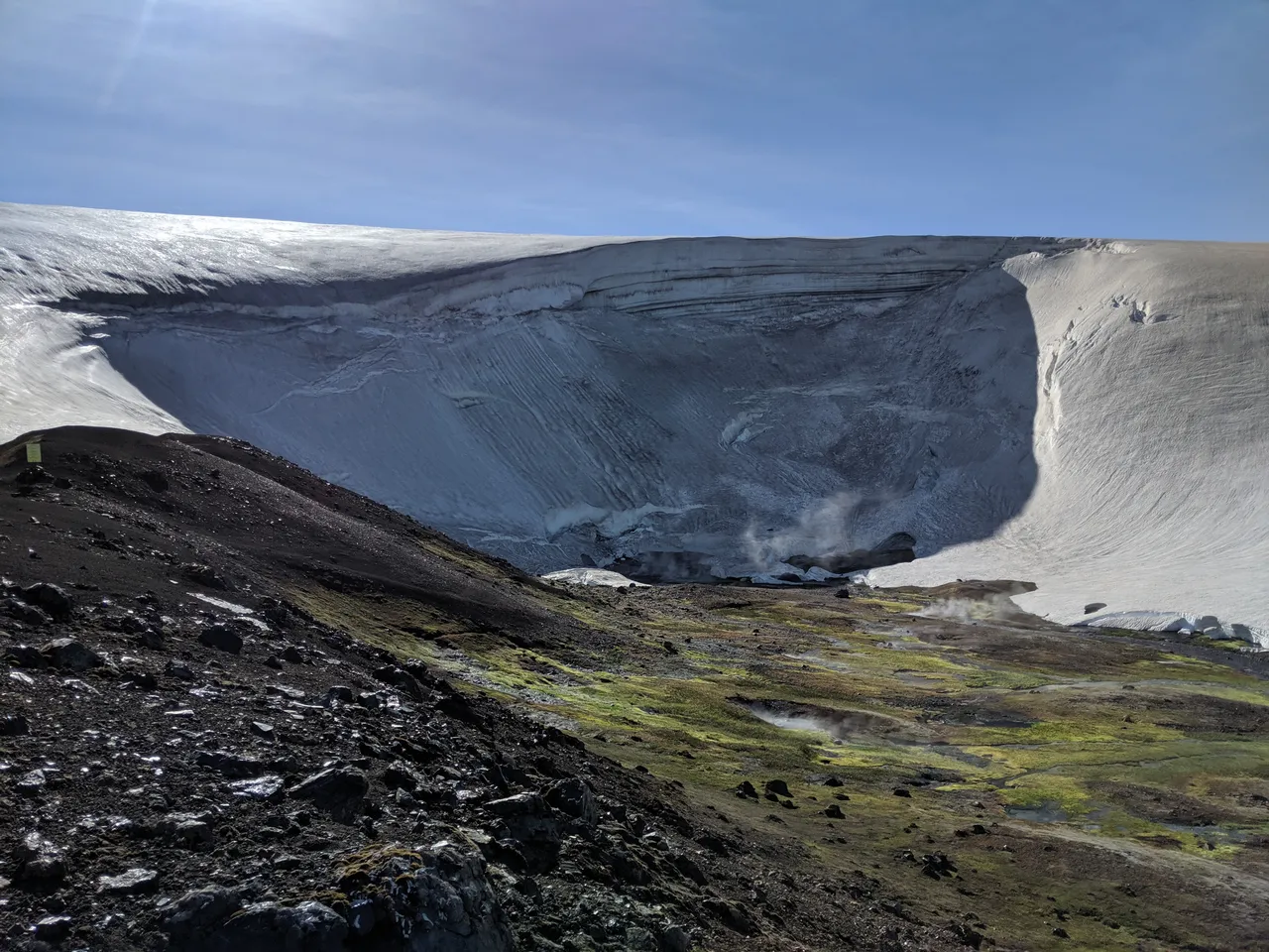
Take a guess on what topographical features give rise to such a sight.
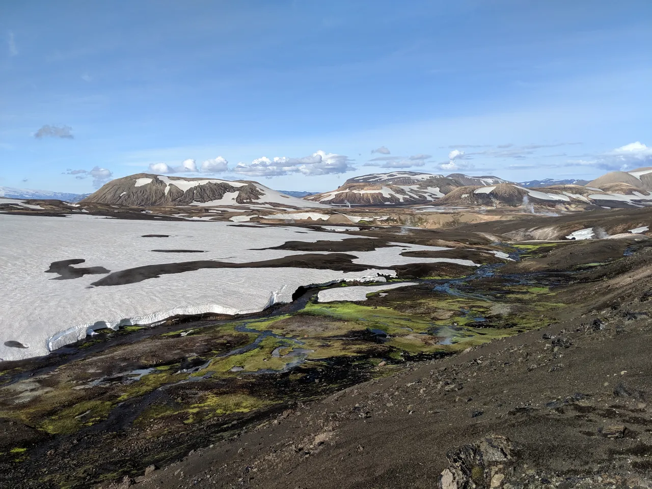
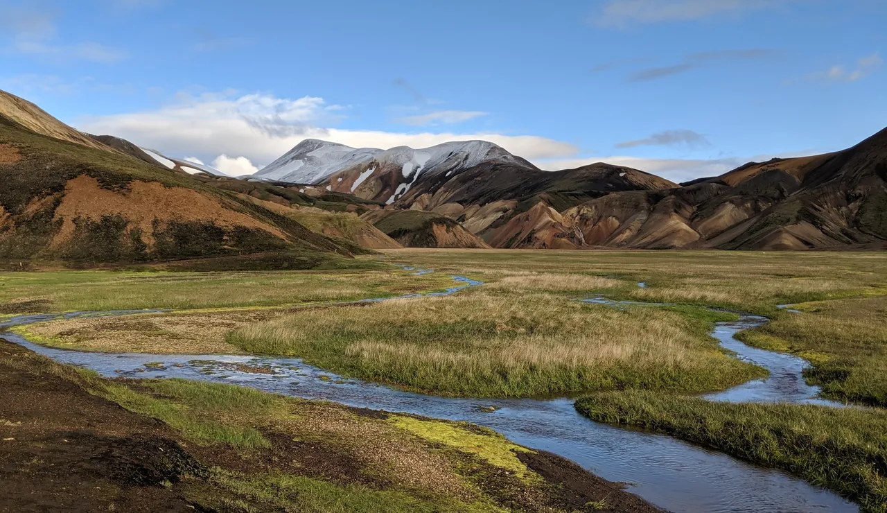
I continued on to Landmannalaugar. The early start that morning paid off as a prolonged rain began as I neared camp. If you are looking to combine the Laugavegur and Hellismannaleið trails, check out the route I took through the Laugahraun lava field to avoid duplicating trail. This section never ceased to amaze:
At Landmannalaugar, I setup up my tent at the most protected site I could find, which the many other campers seemed to have overlooked:
I recuperated in the hot springs, enjoying the juxtaposition of cold rain and geothermal bath:
While not a problem for the day-tourists that arrive by the bus load, those who pass through Landmannalaugar on foot may want to avoid unnecessarily wetting their limited wardrobe. When I asked the women at the information office whether it was acceptable to enter the hot springs nude, she replied, "Of course, this is Iceland."
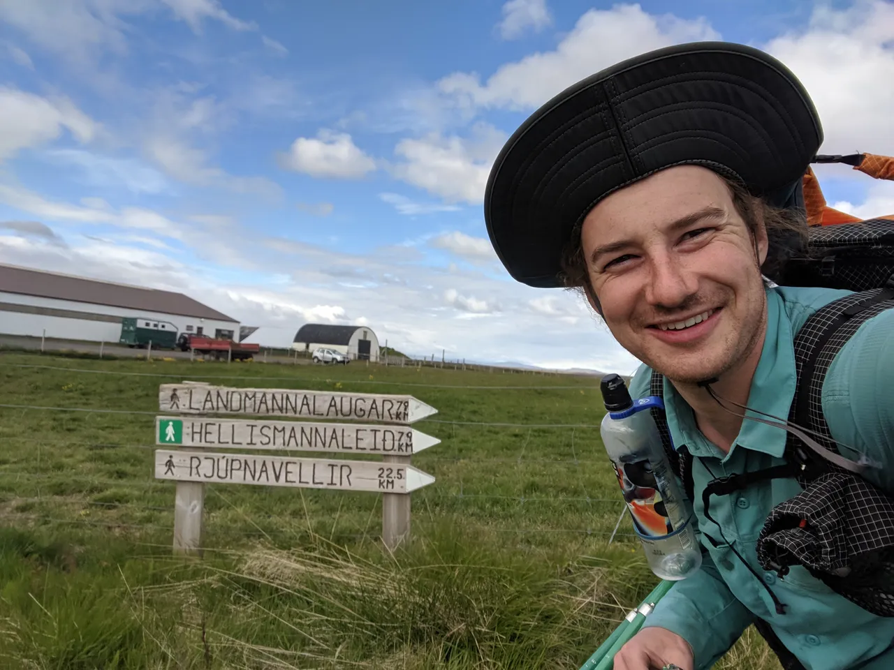
Hellismannaleið Trail
Feeling refreshed, sporting two pairs of surprisingly dry socks, I embarked on the Hellismannaleið trail to Rjúpnavellir. The morning started by crossing a stream-ridden valley before hiking out over the mountains in the distance:
I successfully hopped over most of the streams … until I failed, soaking my shoes. At least I could just walk right through the remaining valley streams with my shoes on. Later I would discover a new trick for hopping streams: temporarily extending my trekking poles to max height and swinging over the crossing.
A bit later, nature gifted me with a bridge of sorts:
Unlike the previous trails where hikers were plentiful, I would only see a single couple for the entirety of my time on the Hellismannaleið. Judge for yourself, but the beauty of this trail is distinct and unsurpassed by the Fimmvörðuháls and Laugavegur trails. Meanwhile, there were none of the sights that make Jake mad, like foam sleeping pads still in their plastic shrinkwrap and backpacks with rain covers on a sunny day.
A took a liking to a lost beanie that I picked up earlier in the hike:
Also notice the water bottle clip on my shoulder strap, which I was sporting for the first time. I became a big fan … once I performed substantial aftermarket modifications (i.e. superglue) to the velcro attachment system.
No complaining about a stream crossing when it's this tranquil:

The landscapes transitioned to desert:
The wind was at my back, and I was covering more miles in a day than I ever had before. If the wind direction is consistent, this is a big benefit to the Landmannalaugar to Rjúpnavellir orientation.
Behold, Hekla, one of Iceland's most active volcanoes, having last erupted in 2000.
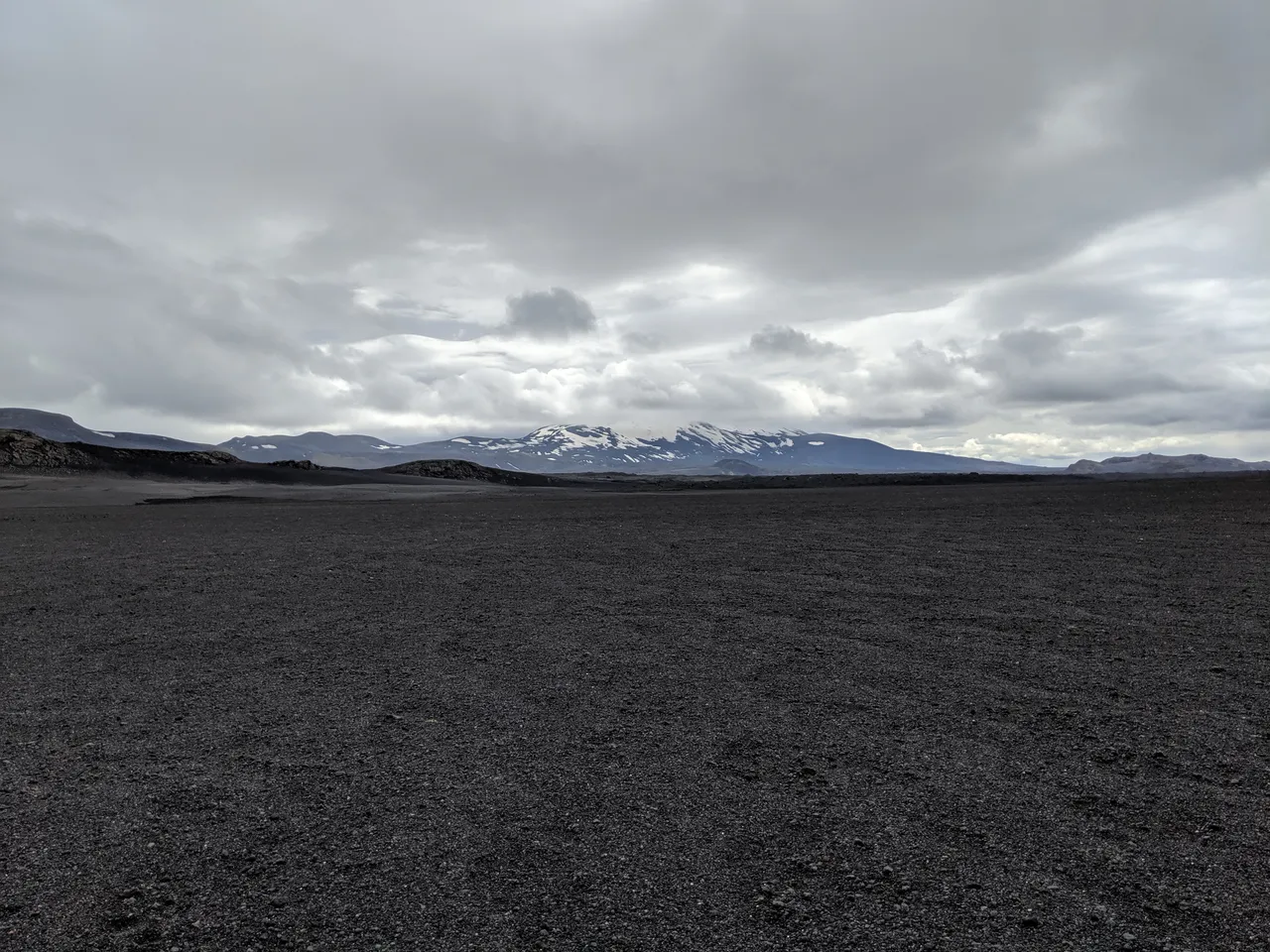
For the remainder of the hike, Hekla would remain as a frequent site. In many ways, Hellismannaleið and its extended versions are a homage to Hekla.
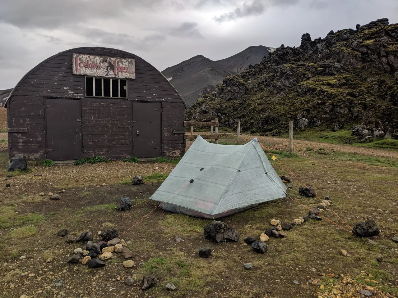
I arrived to Áfangagil, which had not yet opened for the season, but did have running water and an unlocked outhouse:
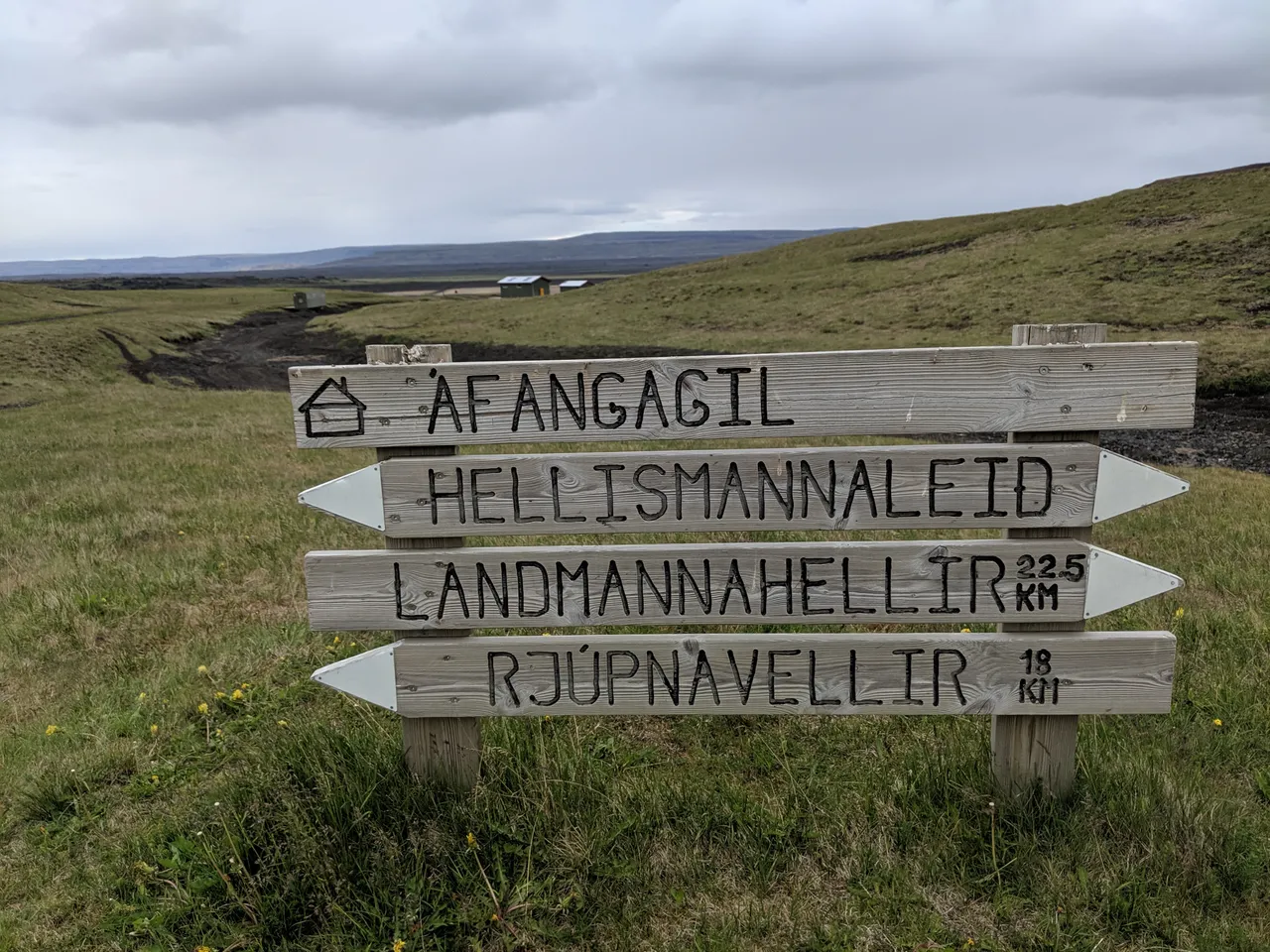
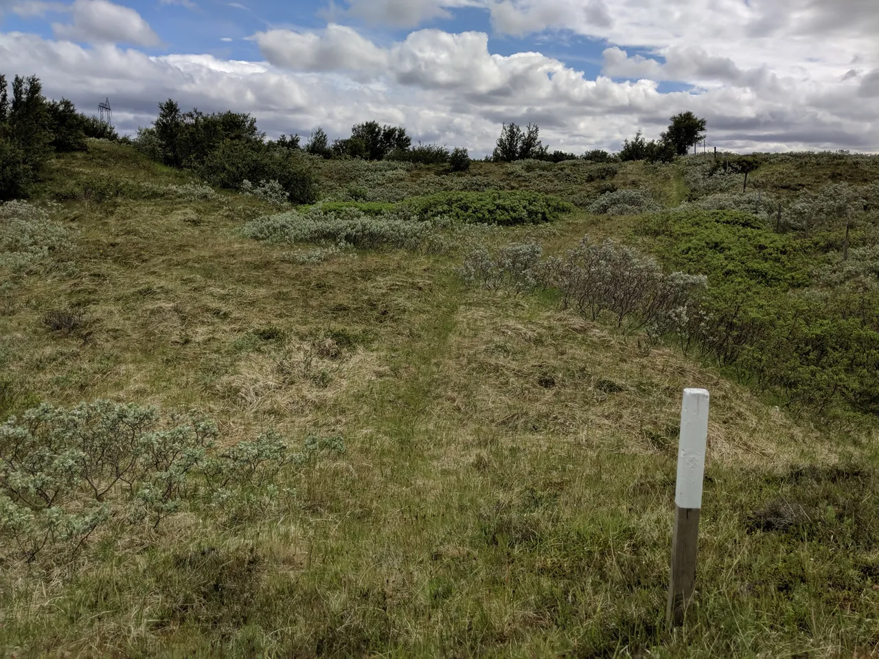
The trail signs matched the style of trail markers on the Hellismannaleið: white-tipped posts in the ground.
The ground at Áfangagil was uneven, and only one tight spot seemed to offer wind protection:
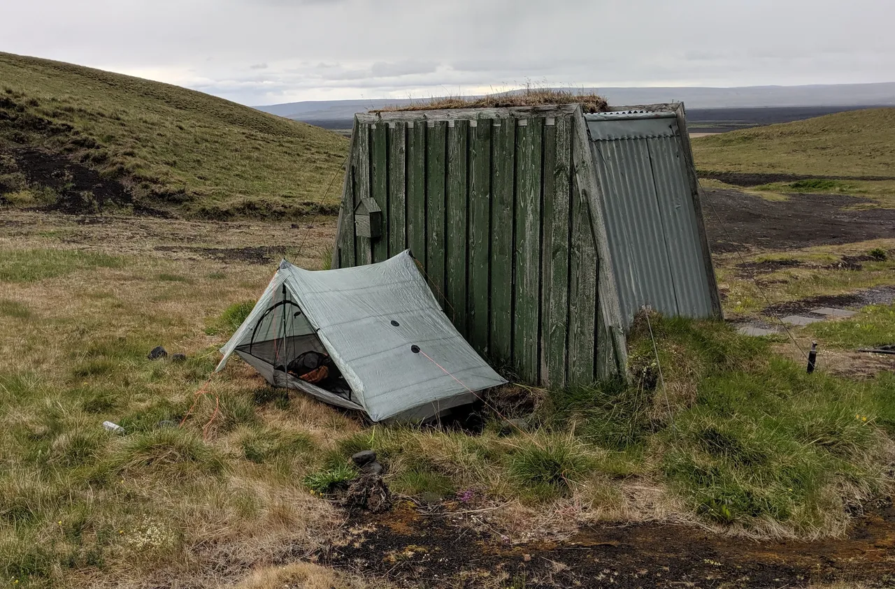
Sharp volcanic rock below made me wish I had brought my polycro groundsheet to protect my Dyneema Composite Fabric bathtub floor. In retrospect, I should have left the thinlight pad at home and brought the polycro instead.
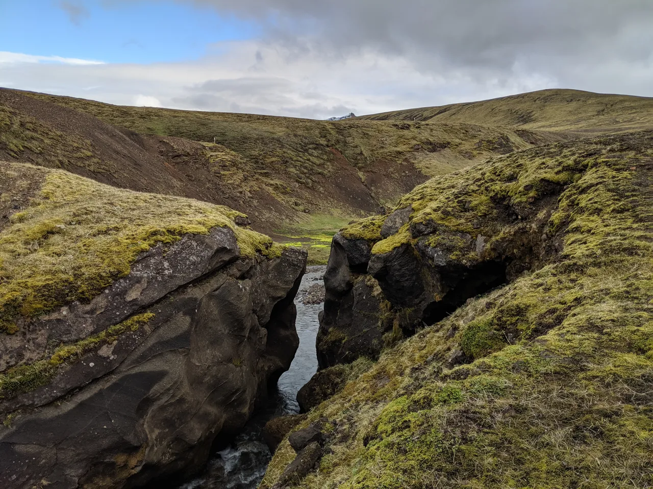
The arid scenes of endless gravel changed abrutly, as a stream emerged from nowhere:

There were some electronic instruments, perhaps to measure siesmic activity? The stream provided a prolonged oasis, replete with plant life, fish, and waterfalls:
When I saw the endless fields of lupine (Lupinus nootkatensis), my world turned upside down:
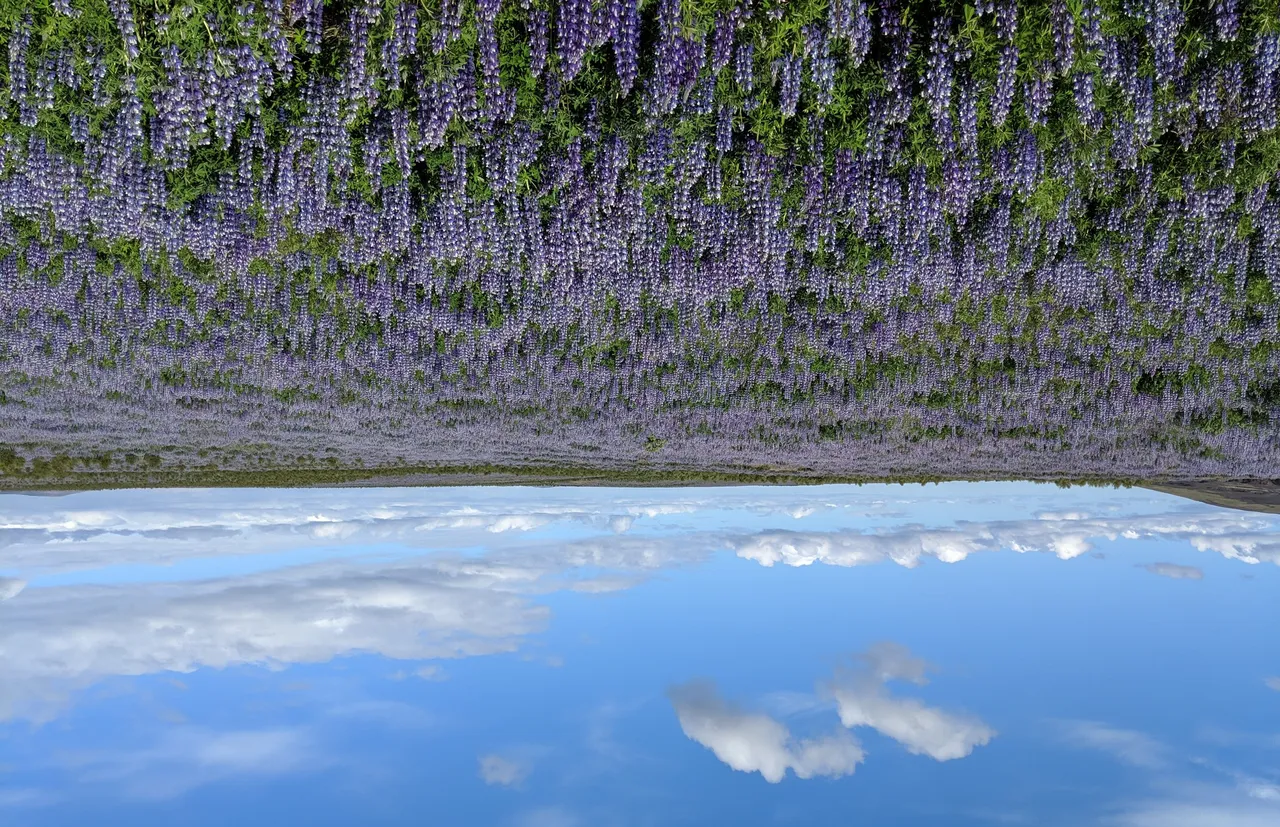
Purple as far as the eye could see. I would later learn lupine is non-native species to Iceland, with locals having mixed opinions about this foreign invader.
Hellismannaleið Trail Extension
I arrived to Rjúpnavellir around 10:30 AM. The online GPS route I was using for the Hellismannaleið Trail ended here. My bus was scheduled to stop at Leirubakki, a bit down the road, at 7:30 PM. I was planning on either road walking or hitch-hiking.
But to my surprise, the trail signs indicated that I had not yet completed the Hellismannaleið Trail:
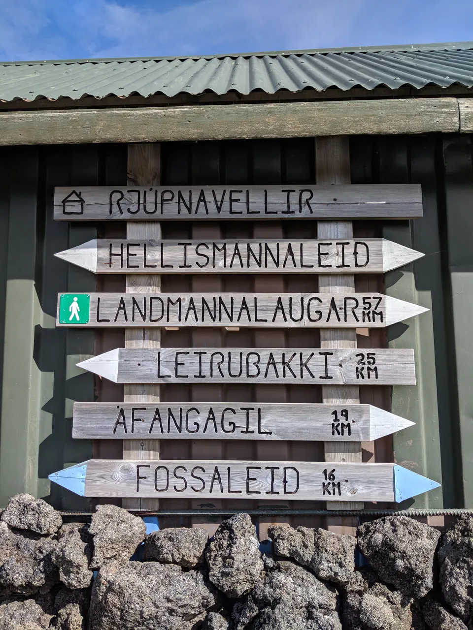
The trail goes on! Another 25 kilometers to Leirubakki! So not only did I have some extra time on my hands, but the Hellismannaleið trail seemed to continue in a circuitous route to my pickup spot. I had to continue.
First, I grabbed a beer at Rjúpnavellir for under $2 USD. While Iceland is generally quite expensive, Rjúpnavellir was the exception. Another customer came to recharge his RV while napping… they charged him 500 ISK, which is the same price Básar charged me to briefly charge my external phone battery three days earlier. Wifi was free, and I began preloading the maps for the extension.
The staff was helpful. While the boss was aware of the trail to Leirubakki, he had only done the first section to a waterfall. However, he claimed that I was on the longest marked trail in Iceland, and I certainly did not want to stop short.
So I set off. It quickly became apparent that the footpath for the trail had become quite overgrown (if it ever existed at all). However, hundreds of white-tipped posts were dutifully spaced and placed to mark the trail. Nonetheless, I wouldn't suggest embarking on this trail without GPS assistance.
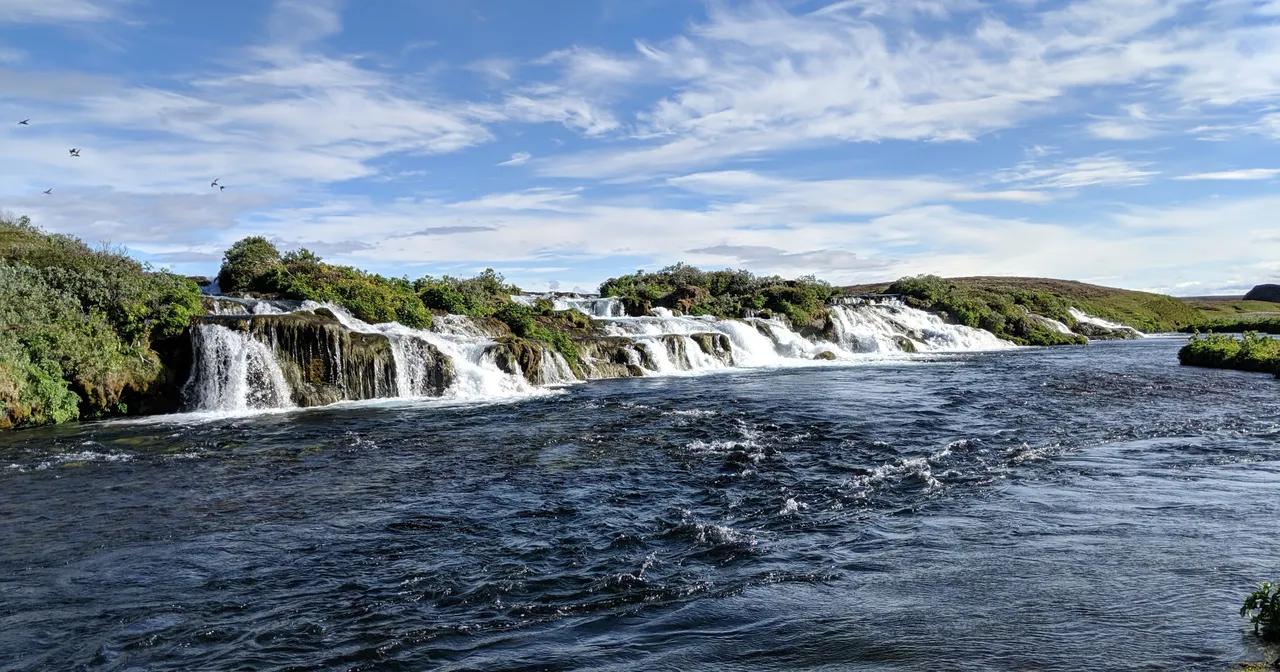
Hiking at a hurried pace as to not miss the bus, I reached the waterfall:
There was a long stretch of bushwacking through waist-high brush. Having learned of the lupine invasion, I trampled as many as possible (to little effect).
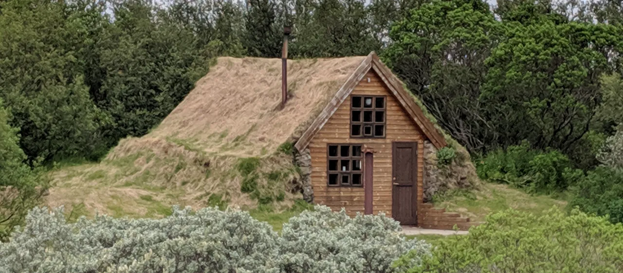
The trail eventually joined with a dirt road, which seemed to be frequented by horseback. The road passed by a quaint turf house.
Later the trail diverged from the dirt road. Here's what the trail markers looked like:
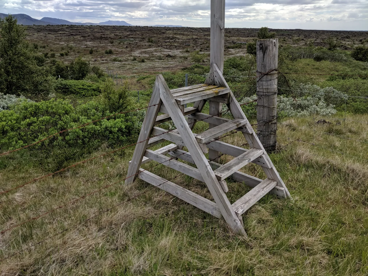
The heavy infrastructure was generally in good shape, including a bridge and several ladders over fences:
Much of the land, especially near the end, seemed to have been used for grazing somewhat recently. I left many footprints:
But by time you arrive, my footprints will have blown away. Finally, I reached Leirubakki, the end:
Note the sign clearly indicates that the Hellismannaleið trail starts here. But since other resources show Rjúpnavellir as the terminus, I've decided to refer to this portion as the "extension".
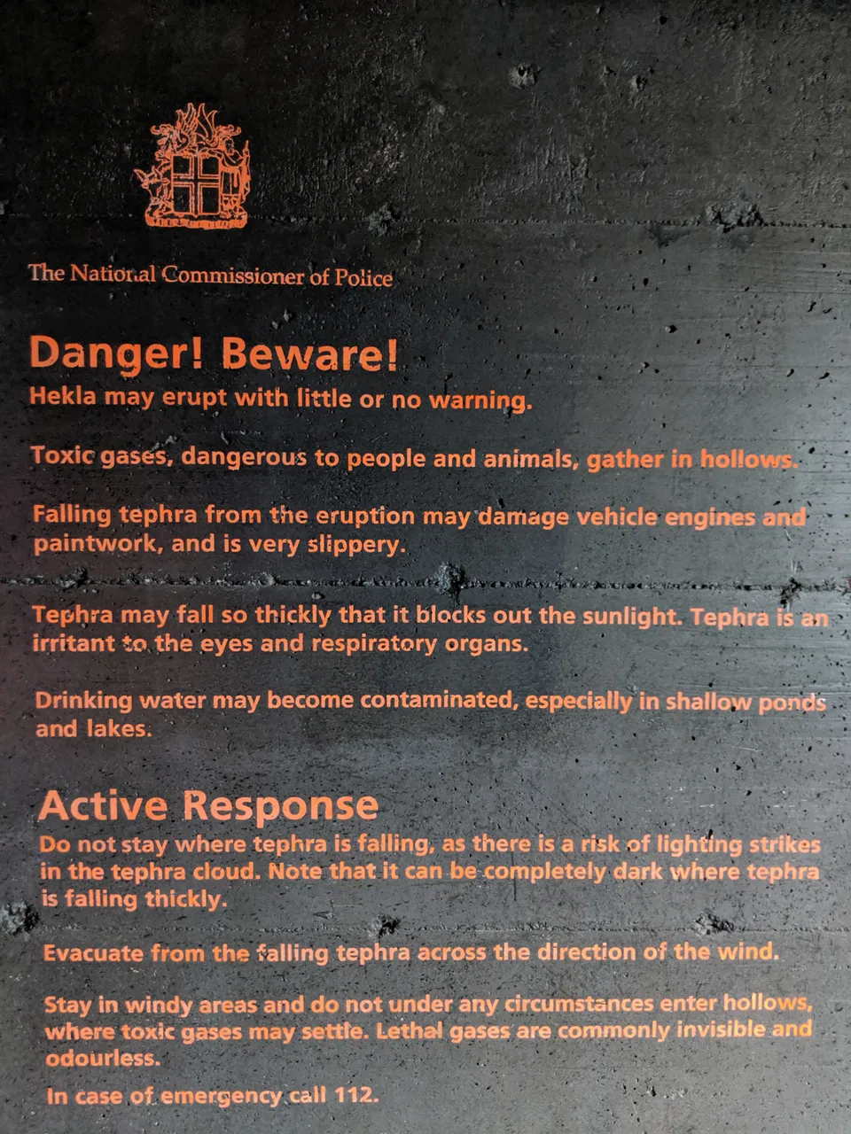
With still a bit more time until the bus arrived, I visited the Hekla Center located in Leirubakki. In case you were wondering what to do if Hekla erupts, I took a picture of one of the exhibits:
Gear
Putting together my gear list for this trip was a fun challenge. Before the hike, I gave a professional presentation in London. Therefore, my gear list contains a section of travel/business-related gear that I left at the Reykjavík Campsite.
I'd advise hikers to be well prepared against the cold, wind, and rain. I hiked several days in shorts, but having lightweight leg and arm covering can help protect against flies (big buzzing flies, not mosquitos) and the sun. I always hike with GPS and maps on my phone, but this was especially improtant for the Hellismannaleið trail (& extension).
My father often makes gear recommendations that deviate from the ultralight philosophy, such as wearing heavy hiking boots and bringing extra pairs of clothing. I disregarded this advice. He did however recommend one item I am glad I brought: the snow baskets for my trekking poles.
Since I was flying, with no checked bags, I made sure not to take anything that would be problematic for the airport scanners. The carbon fiber tent stakes and decomposable trekking poles passed through security four times. I used my Trail Designs titanium wind screen with Esbit fuel.
Since I was flying through the UK, I couldn't bring any food containing meat, dairy, or potatoes. I sure was sick of nuts by the end. Many of the huts did have hiker boxes, where I picked up some basic dehydrated meals.
I didn't bring a headlight or water filter, based on Tómas' advice. However, a few water treatment tablets (repackaged into a plastic pen casing, of course) would have been nice for some water sources located downstream of grazing grounds or other fecal matter of unknown origin.
Summary
What an amazing trek. If you're seeking a longer hike than the usual Fimmvörðuháls and Laugavegur trails, consider adding on the Hellismannaleið. If you're feeling adventurous and are of a completionary temperament go all the way to/from Leirubakki as opposed to Rjúpnavellir.
Iceland is an amazing natural resource. Help maintain it on the trail by picking up any litter. Hiking is a great way to enjoy Iceland while avoiding many of the more costly and thus environmentally destructive forms of tourism.
Iceland's beauty comes with risk, so please make sure to prepare sufficiently. Plan for rugged conditions. I got lucky with the weather, so make sure you have backup plans should your pace be slower than expected. Note that most common itineraries for these trails take approximately double the days (i.e. 9 days as opposed to 5).
License
This post is released under a Creative Commons Attribution 4.0 International License. When reusing this post, please attribute by linking to one of its locations on a Steem Blockchain browser, such as steempeak.com, steemit.com, busy.org, or partiko.app.