Saturday, May the 7th, 2022, Vipava, Slovenia. Time to finish an unfinished business. At 7:30 we are on a start line of a 50 K trail run. A lot of hills and forest trails await us, including the climb to Mount Nanos. Another walk in the park.
Yet, this walk has a prelude. On the weekend of 29th and 30th of October, I was here already, at the 100 K trail run. I DNFed at kilometre 54. Read the whole story about Ultra Trail Vipava. After that, I immediately submitted my entry to the second half of the loop, and devised a running training plan, and followed it, more or less successfully.
The real test came yesterday. It was a cloudy and moist day, actually warm enough for a pleasant all day long run and hike. It seems we would be lucky enough to avoid the rain. All was set for a great day.
During the trail run, I took several photos and I'll let them tell most of the story. It was divided into two parts. The first, the southern part was run on the rolling hills in lush greenery on great forest paths and between wine yards.
The second part was all about climbing up to the top of Nanos mountain range. More rugged terrain, strong gusts of bora wind, fog at the top. Then long stretches of downhill running on slippery rocks and tarmac roads.
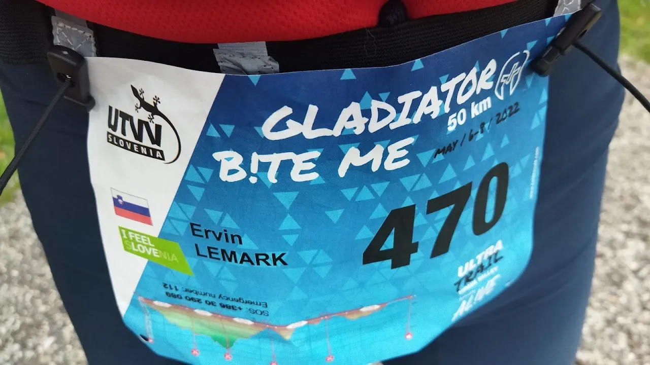
The run was nicknamed Gladiator and my bib was 470.
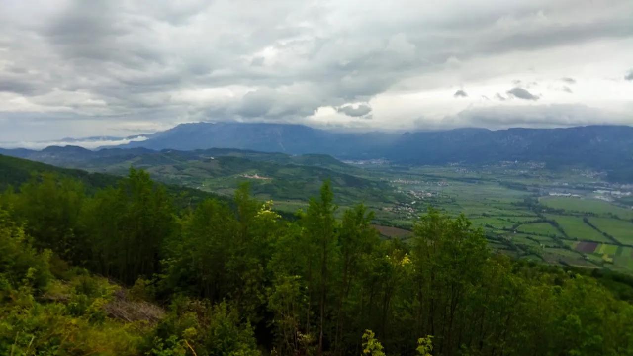
We started in the village Vipavski križ and ran up and down the hills on the south part of the valley and through the wine yards.

The morning fog was starting to disperse as we progresses on our trek.


The overall feeling was great.

What a beautiful planet.

Wine yards and meadows, bush trails, all so alive and green.

Beautiful scenery of still dormant villages down below and more hills in the distance.

Even with these rolling hills the total climb in the first half was 1100 meters. Quite a lot.

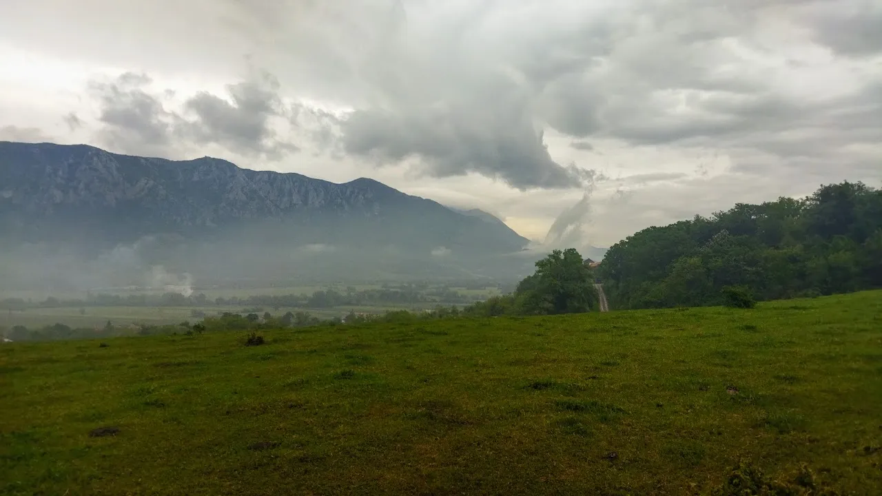
Nanos mountain range in the distance across the valley. The highest point of the course was some 13 kilometres of trail away.
A view from Socerb, the highest point from this part of the trail.

The refreshment station in Podnanos was lively and crowded. The volunteers were friendly and helpful as always. Thank you very much for all your goodwill and positive energy, friends.

From Podnanos it was mostly uphill, a long climb on an open rigde to Nanos. I didn't take many photos here since it was very windy. Despite the saturated air it felt dry and quite cold. I pushed through it with short sleeves. Somehow, I was too lazy or unwilling to change the shirt.
A fellow runner has said here: "It's like cryotherapy!" She was right.

This area is beaten by the bora wind all the time. It's unhospitable yet strangely beautiful.

There, behind these hills was the top, hidden in the clouds.

No photos of the top either. There's a mountain hut and an antenna station yet I didn't feel like taking photos. There were more pressing needs like food and drinks and getting away from the wind.
From now on it was mostly downhill on technical and slippery paths or on forest roads. 19 more kilometres to go on beautiful yet demanding trails protected from the wind.

Believe it is hard to run down in a presentable manner after 40 kilometres of claims and descents,
So, no photos from this section neither. The next on will be ...
... in the finish. Yes!

Eight hours and a quarter, 2400 meters of total climb, excellent trail. Satisfied!
Even more, tapped beer in the finish.

Now it was time to celebrate, mingle with friends, and runners, talk about the adventure of the day, have some more beer, and cheer for all who were crossing the finish line, ... The usual stuff one does at these events :)
It was a great day.
Map with basic data of the run

Altitude profile

The official split times.

Tagging those who showed interest and support the last time I was talking about Vipava Trail: @manuvert, @browery, @thebigsweed, @rthelly, @merthin. I did finish this loop :)
Better and better
:ervin :lemark