The Fish River Canyon
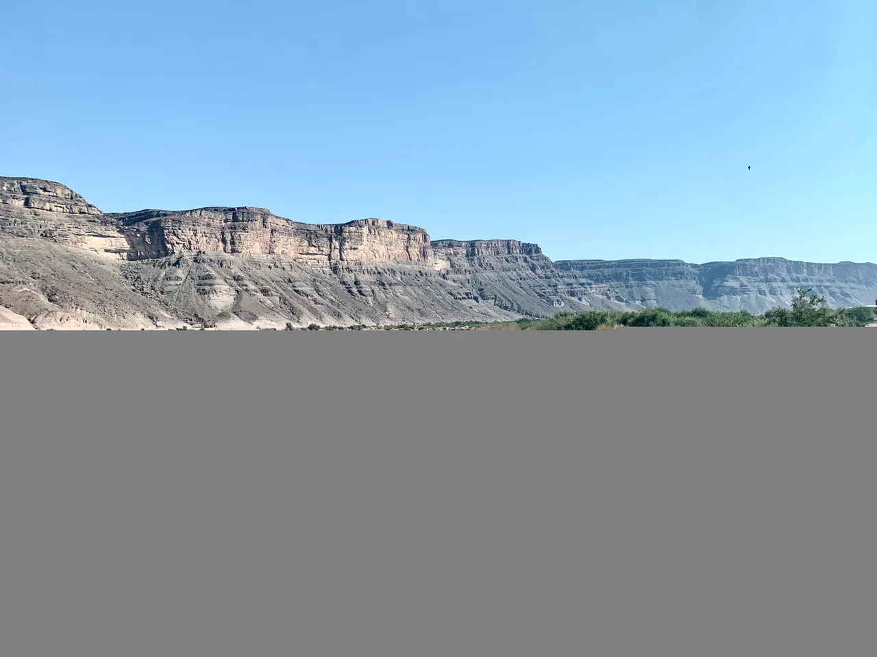
The Fish River Canyon is the second largest canyon in the world after the Grand Canyon. It’s found in the desert in Namibia about and hour and a half’s drive from the South African border.
The hiking section of the Canyon winds through arid harsh terrain for a distance of 97 kilometres with vast oxbows and steep rocky walls on either side. The hike cuts out some of the distance by taking shortcuts over some of the necks of the oxbows making the hiking distance around 70 kilometres. Hikers get the option to decide on the amount of days they would like to take to accomplish this distance. It varies from 4-6 days and we decided to take 5 days and 4 nights to finish the hike.
Hiking season is only open from 1 May to end of October annually as the summers are just too hot and the area experiences Summer rainfall which can flood the canyon as it did in Feb and March this year.
Travelling to Namibia and the Fish River Canyon from Cape Town, South Africa
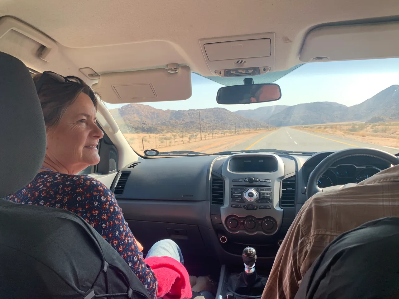
Our group of 15 people set off from Cape Town on Wednesday 3rd August this year in various cars and headed up the N7 highway. This is the main route from the Cape, leading from our beautiful country of South Africa to the dry desert of Namibia.
On the way we stopped for fuel and food on the 10 hour drive and eventually passed through the small town of Springbok shortly before reaching the border post. Springbok is the only town for hundreds of kilometres in every direction and the only place to get any last minute supplies. We stocked up and got back in the car headed for the border.
The land border wasn’t too complicated. On the South African side of the Orange River (which is the major demarcation between the two countries) we had to go to doors 1, 2 and 3. Simple enough. There were no covid requirements and being South African we simply needed our passports and a reason for travelling through to Namibia. The boarder staff had a quick look through our gear in the back and allowed us through.
The drive over the Orange River was a lush reminder of the power of water and its resource and strength. Both sides of the river were propagated with food crops and were thriving.
Arriving at the Namibian border was slightly slower. We first had to report to a covid office where we showed our passports and covid certificates. Once they had been documented we were allowed to continue on to “arriving” office followed by the “Road tax” office and lastly the “anything to declare” office - my names for each building. The instructions on this side weren’t particularly clear, but we filled in the forms and waited our turn in cues that didn’t seem to
Move even though they were short. Staffing seemed low for the middle of the week and we had to just hurry up and wait.
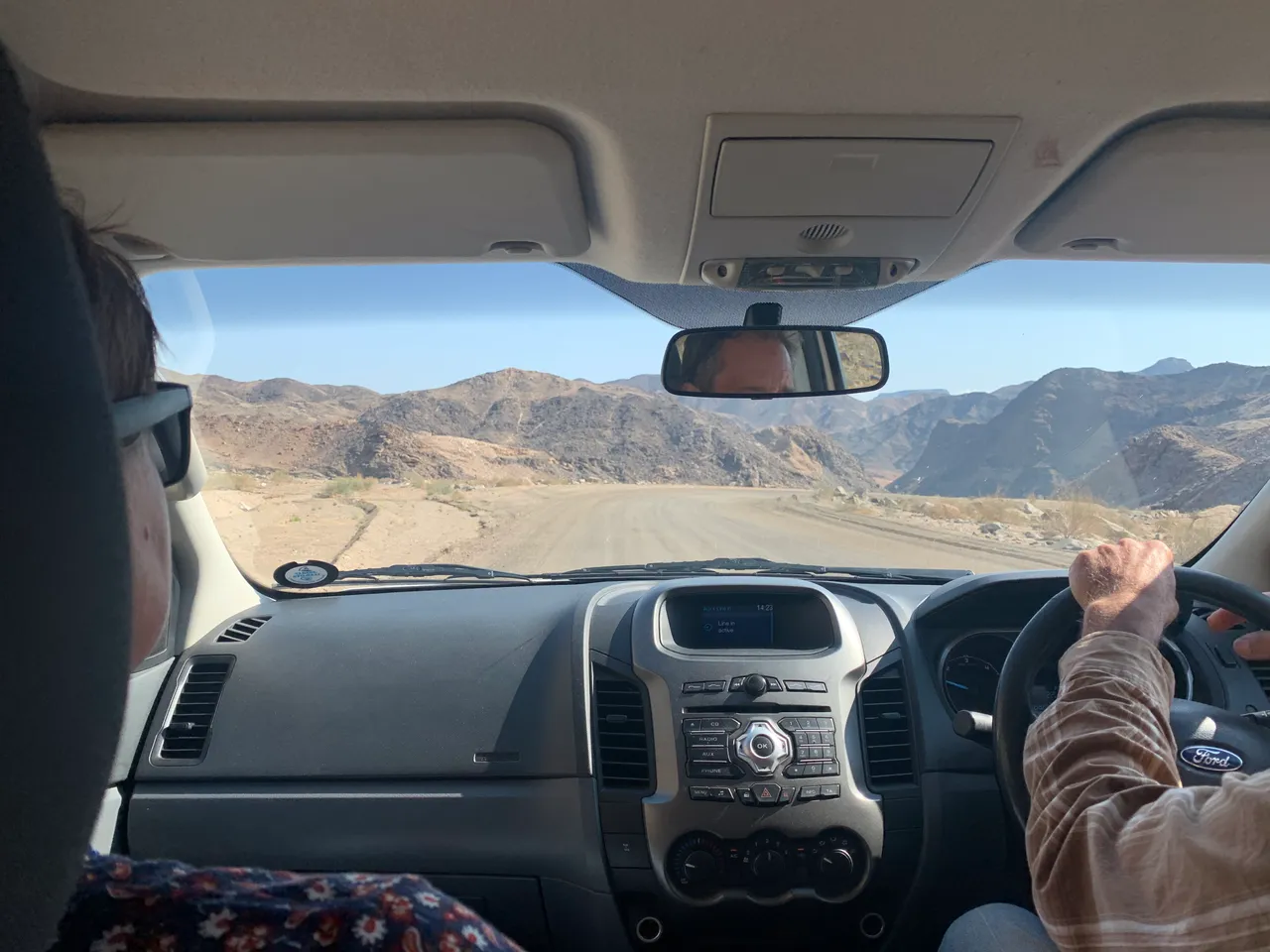
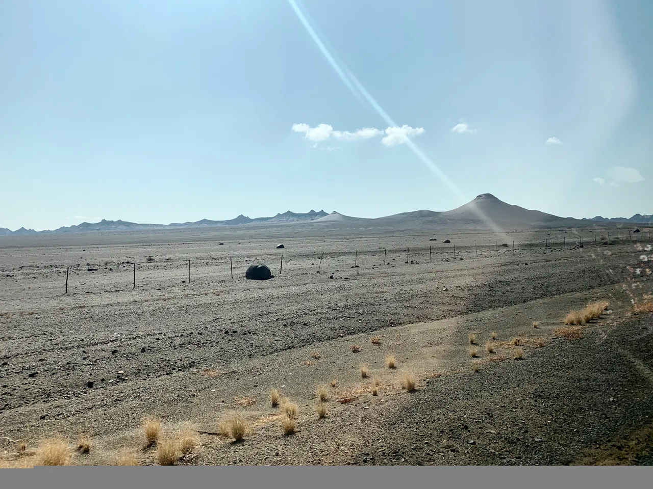
Eventually we got all the stamps and papers sorted and passed over into Namibia where the road stretched out into vast flatness with rocky mounds that looked like mine dumps, but apparently are naturally occurring rocky hills. The road soon turned from tar to dirt and we continued for another hour and a half towards Ai-Ais.
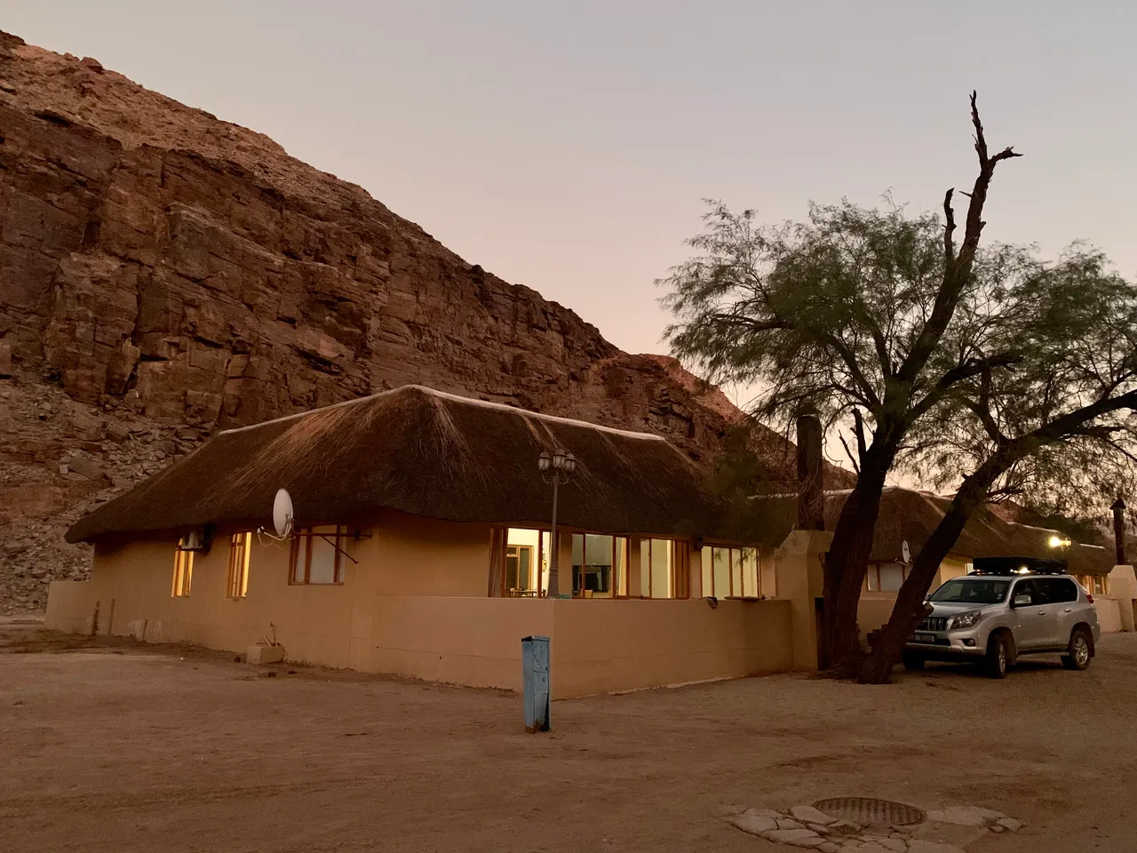
This was where we would spend the night before the hike started the next morning. Ai-Ais is like a paradise in the desert and also the finish of our hike over the following 5 days. We were welcomed and booked into our chalets that each slept 4 people and quickly dropped our stuff and headed for the warm pools.
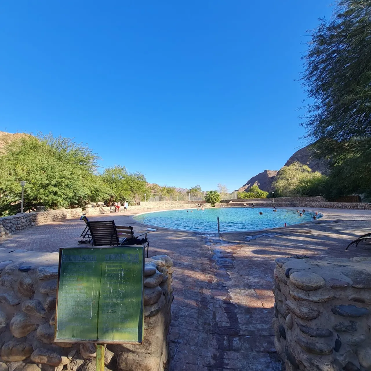
The next two hours floated by in the warm water as we waited for the rest of our group to arrive. By dinner time all 15 of us were at Ai-Ais and we enjoyed dinner together at the restaurant and got to know a few of the folk that I hadn’t met before.
Final bag checking and repacking and then to bed early. We were excited for the next mornings early start and the adventure ahead.

Transfer to Hobas & drop off at the lip of the canyon
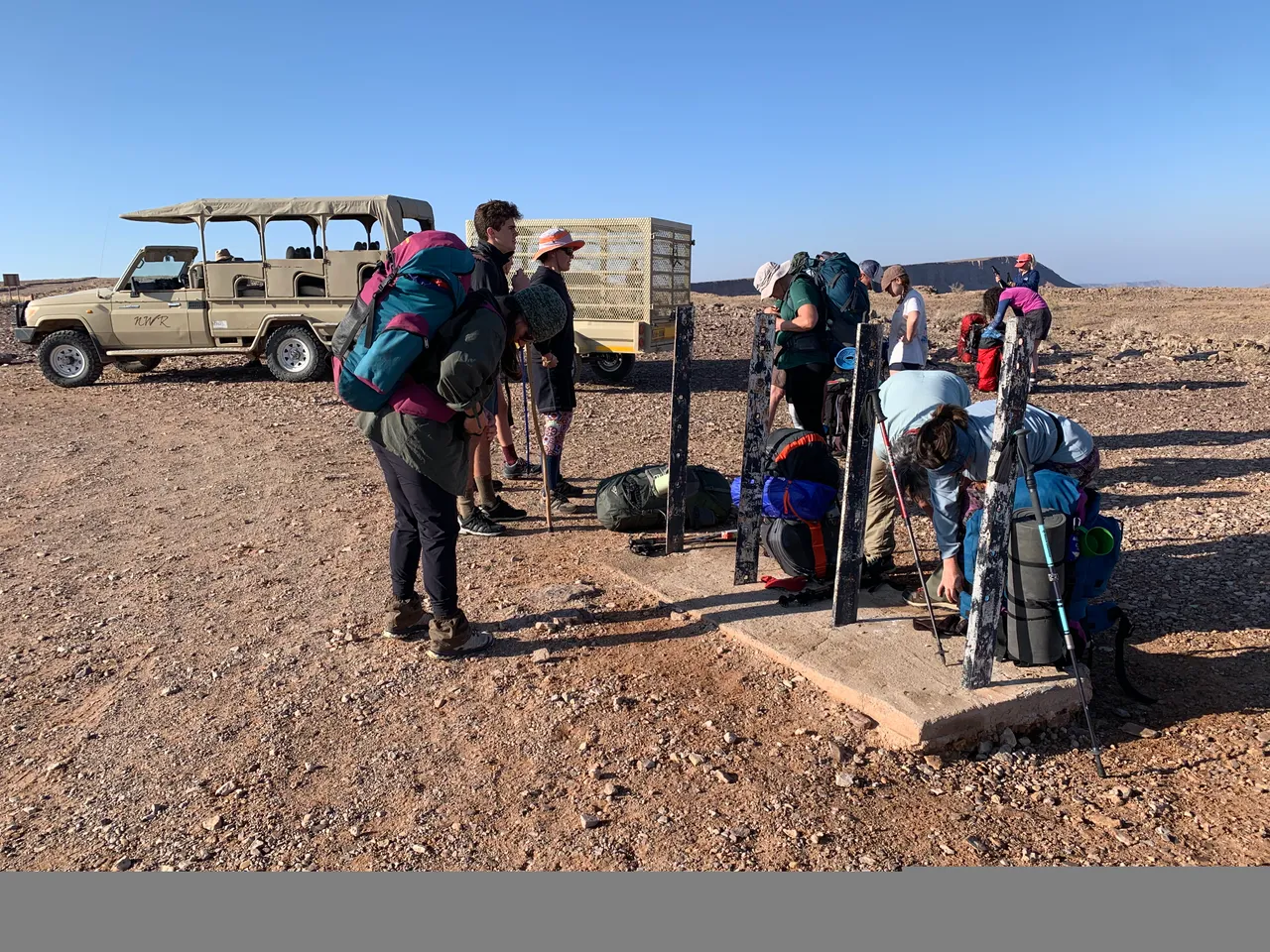
We were up at 6am, at our transfer transport by 7am and eventually got on the dirt road by 7.20am. We were required to complete medical forms to prove our fitness to complete the hike and had our R100 ready to pay the conservation fees at Hobas where we would sign the indemnity forms - basically saying that if anything happened to us they took no responsibility.
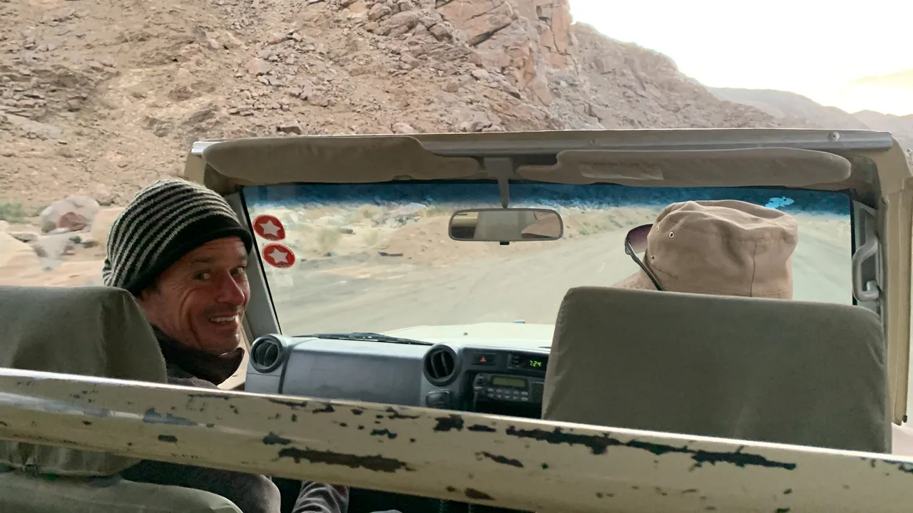
We jumped into one of the two options of transport available to us. One was a closed bus for 12 people and the other was an open safari type vehicle which sat 11 people and looked like far more fun. What we didn’t know was that we would be out in the freezing cold desert morning air travelling at 100 kilometres per hour for AN HOUR! Luckily my row had a blanket that we had nicked from the chalet to cover our legs and I had remembered my beanie and gloves.
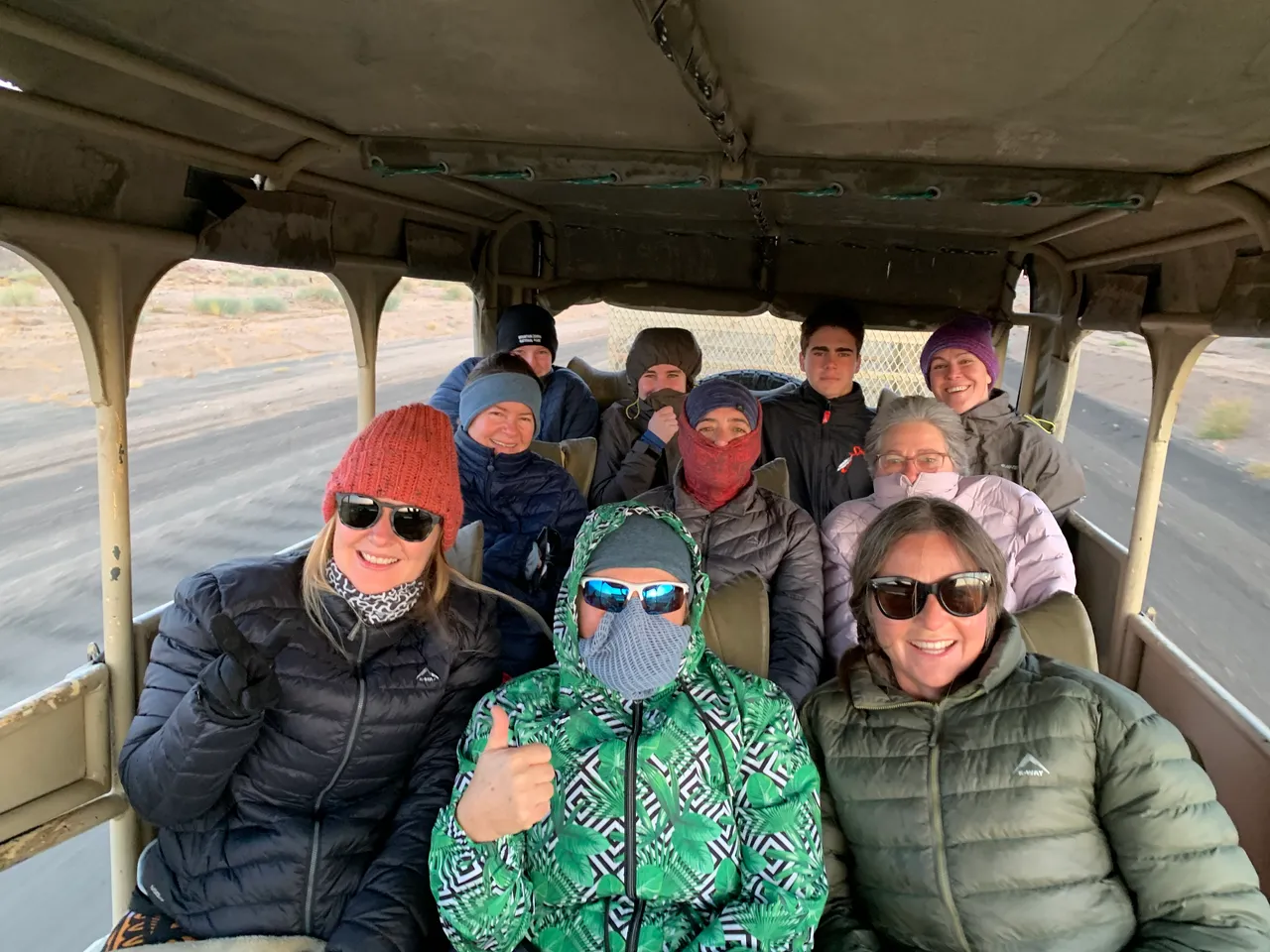
Although absolutely freezing, the morning sunrise was glorious and we were so happy to have gotten the first transfer of the day. 3 other groups would be starting that day and one group was already in the bus travelling with us.
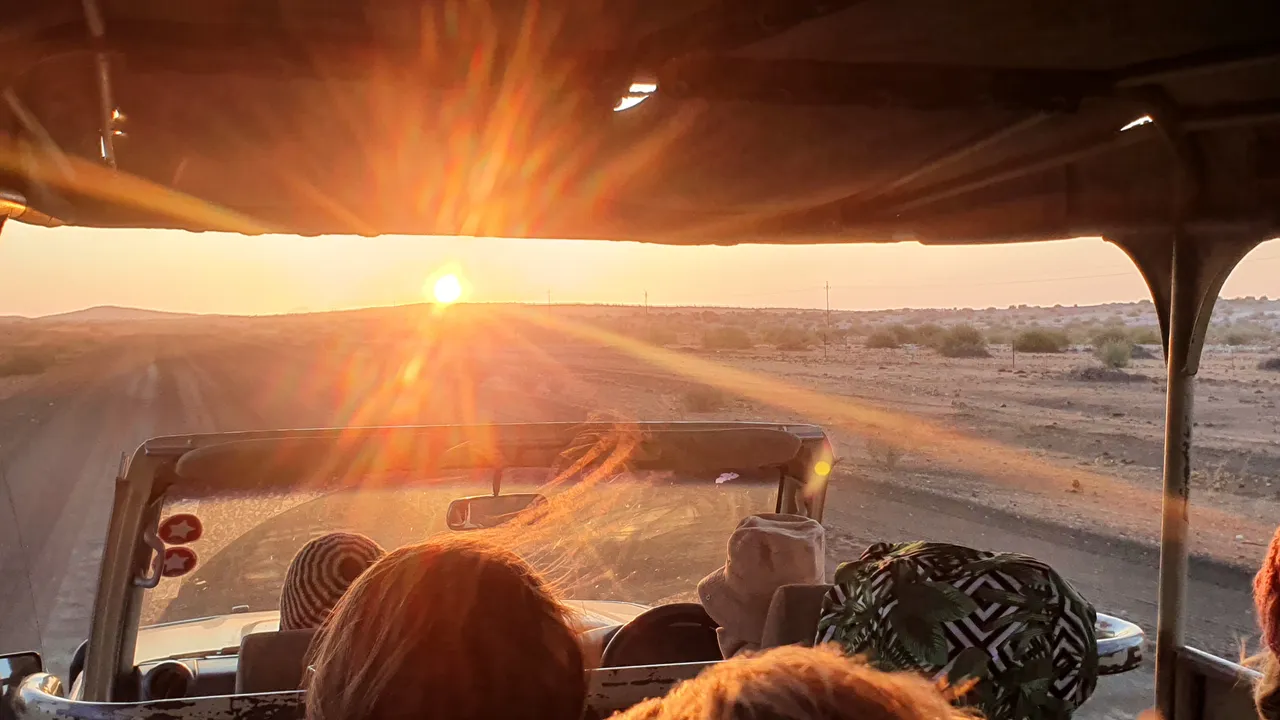
We took in the sunrise, tried to keep our teeth from chatting and some folk ate the breakfast that had been packed in for us. It consisted of 2 hard boiled eggs, a cheese and ham sandwich and a jungle energy bar. I thought I’d hurl if I saw a hard boiled egg, but I tucked into the sandwich and kept the bar for later.
We got to Hobas around 8.30am and figured out which office to head to. First it was the medical forms in one building and our R100 fee, followed by the actual hiking indemnity forms at another building which we all had to sign and witness and get them handed in by our group leader, Maggie.
A final cup of tea from the little tea room and then we were back in our transport and drove the final 15 minutes to the drop off spot.
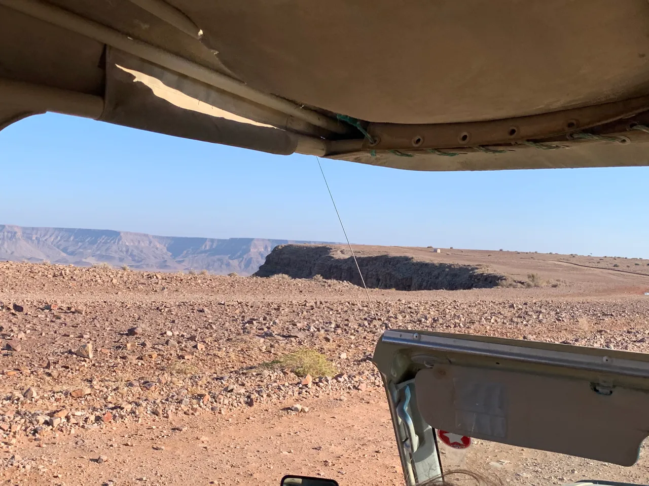
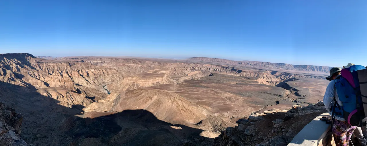
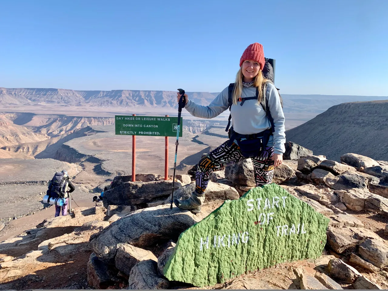
As we approached the edge of the canyon the lip and drop off of the ledge came into view. It was a sobering moment realising that we would soon be headed down the edge of threat lip towards the bottom far far below.
The safari vehicle and the bus stopped in an open area and started taking our hiking bags out of the back of the trailer. They simply pointed to a thatched gazebo in the distance and that was it. It felt like we had been dropped in the middle of nowhere - which we had - and now it was like Survivor and we had to get to the other side on our own.
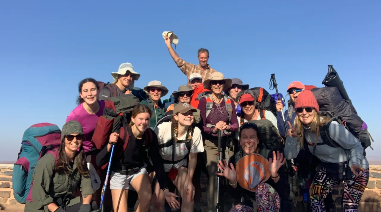

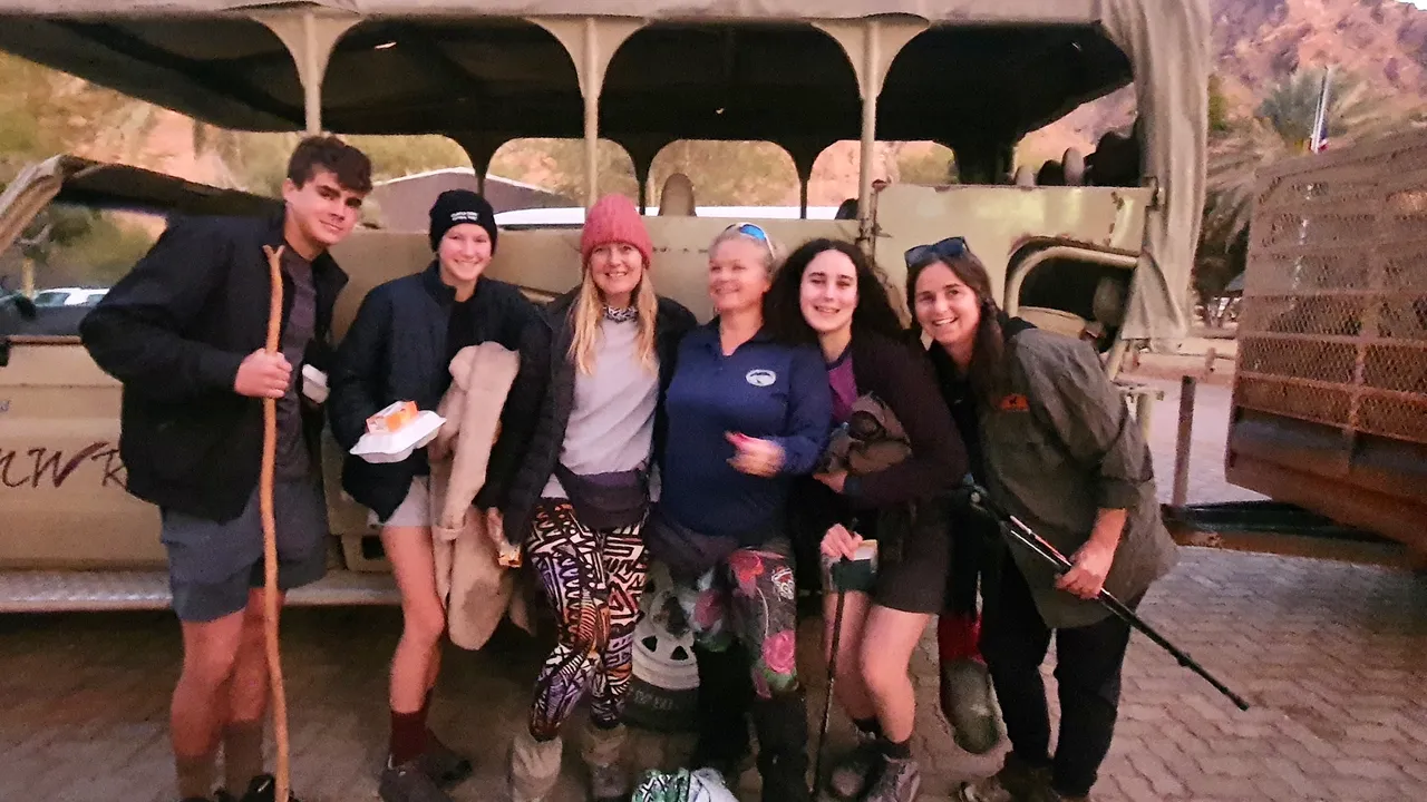
We took our group photos, took in the incredible views that we would not get to see from this perspective again and enjoyed the anticipation of what was ahead.
The other group got started just a couple
minutes ahead of us (bad idea) and we were quick on their heals.
Day 1 of the Fish River Canyon Hike - Start to Pulpit Rock
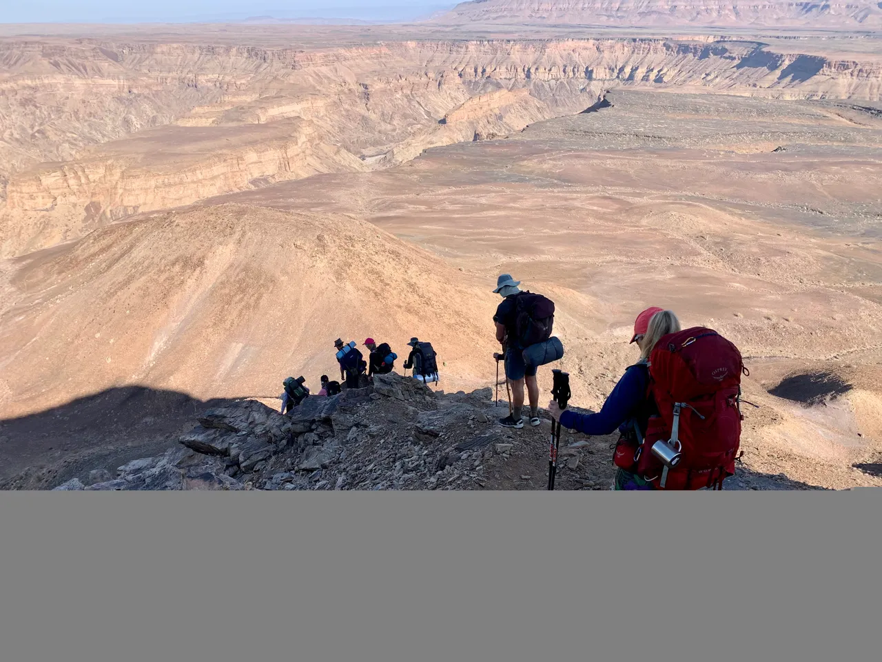
The first section of the descent was incredibly steep with chains that hold onto at certain points and nothing to hold at others. The stone that we were climbing down was loose and anyone with vertigo or who is afraid of heights would have a very tough time for the first 500 meters.
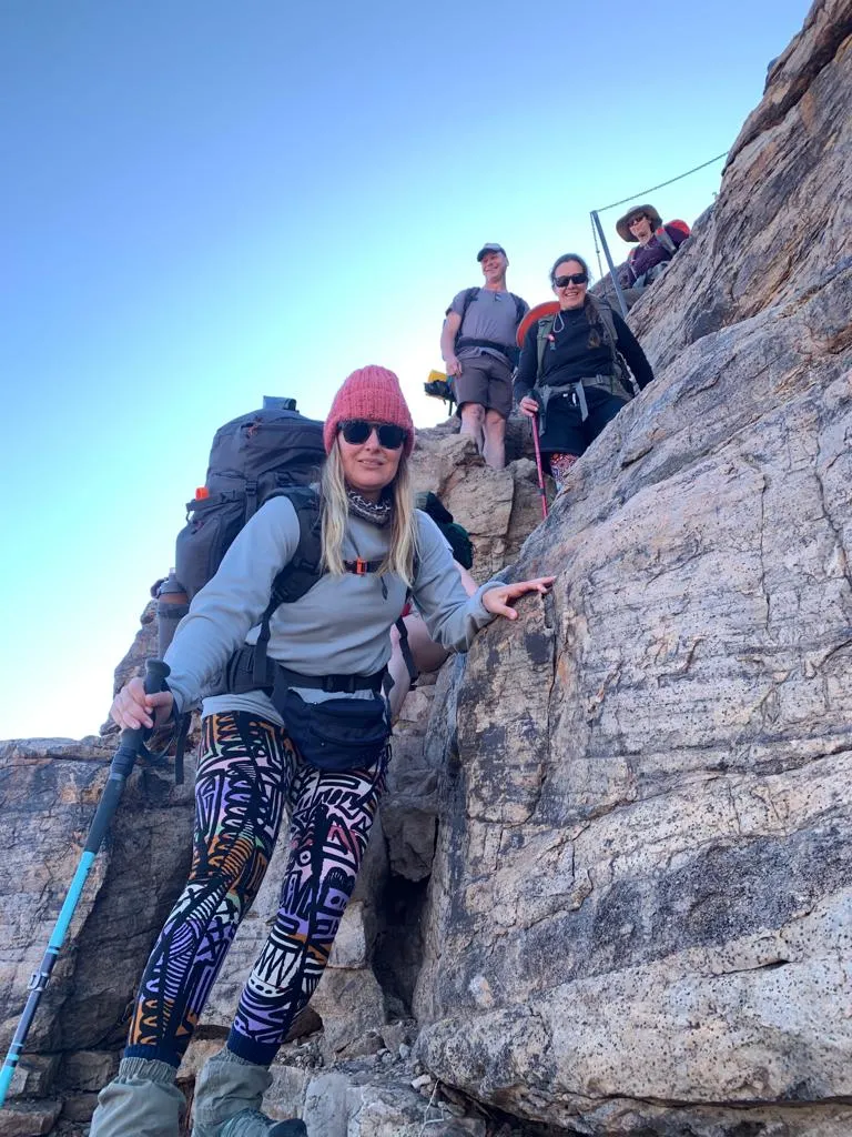
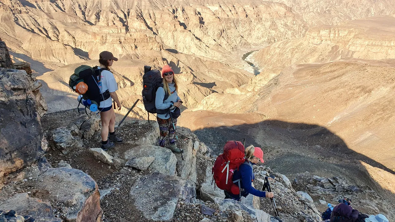
We quickly got slowed down by the smaller group ahead of us (who we soon dubbed MOSSELBAY - because they were mostly from a coastal town called Mossel Bay in South Africa) they eventually found a spot wide enough to let us pass when we were about half we down the side of the canyon.
The descent slowly became less steep and more like stoney steps and we began to feel like we were in the canyon rather than hanging off a cliff.
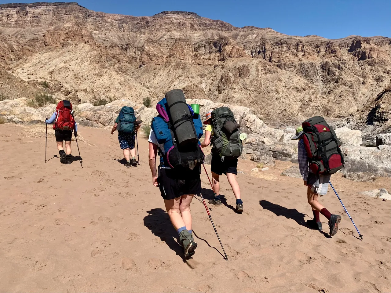
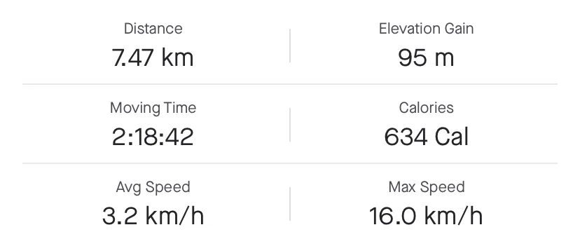
The entire descent was 1.7 kilometres of downhill and bracing our legs against the hard rock, loose stone and negotiating our very heavy backpacks. The extra weight was harsh on the legs and we would know all about it the next day.
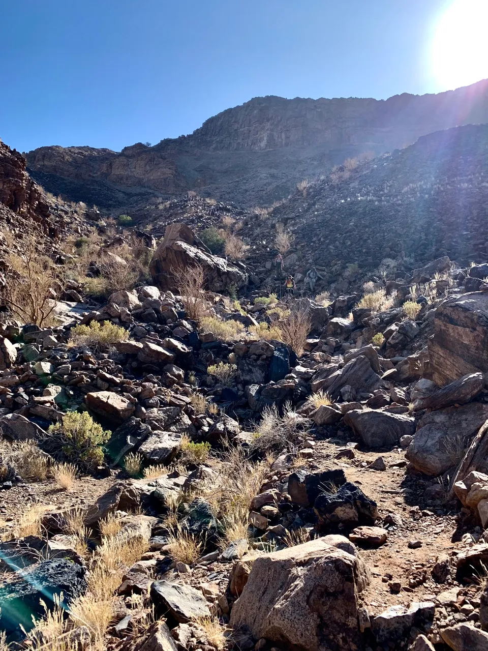
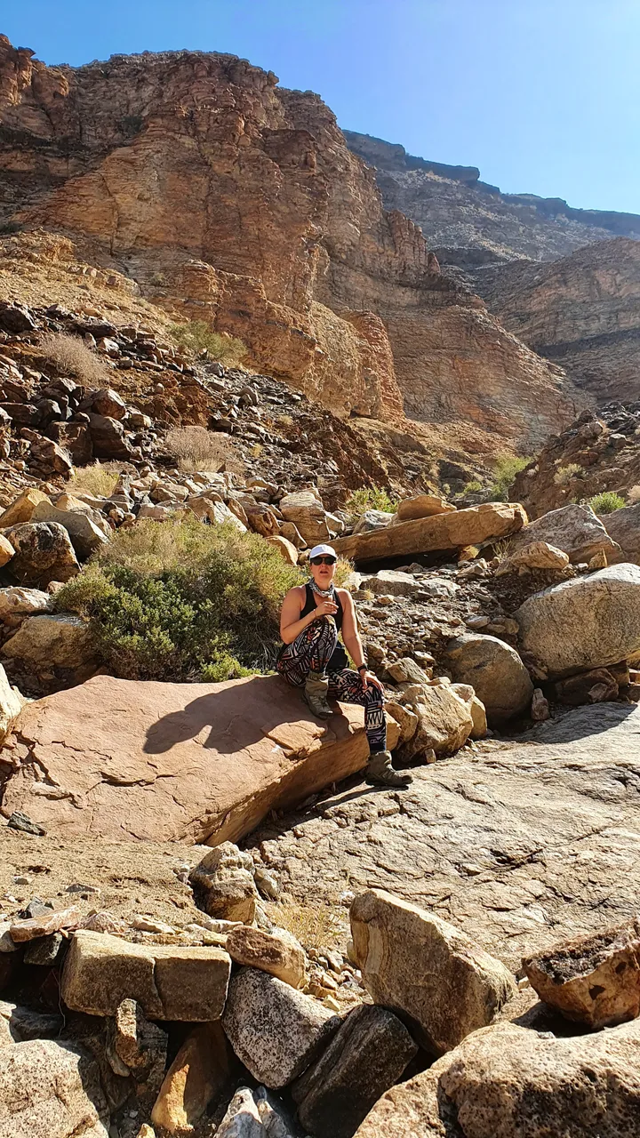
We saw an interesting tap on the way down which is apparently one of the things to look out for and started to see some greenery and one loan cactus.
We stopped in the shade of a large boulder to
Allow our group to gather and then walk into the bottom of the canyon together.
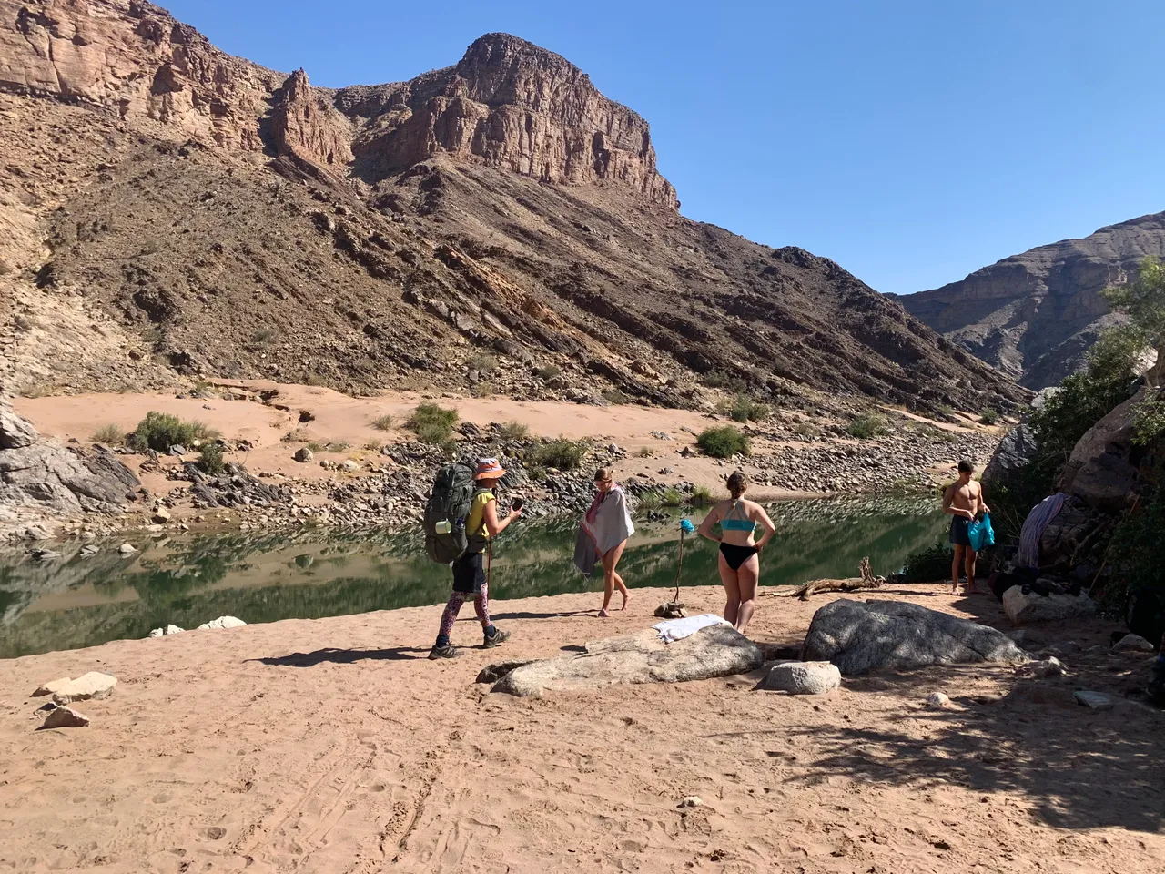
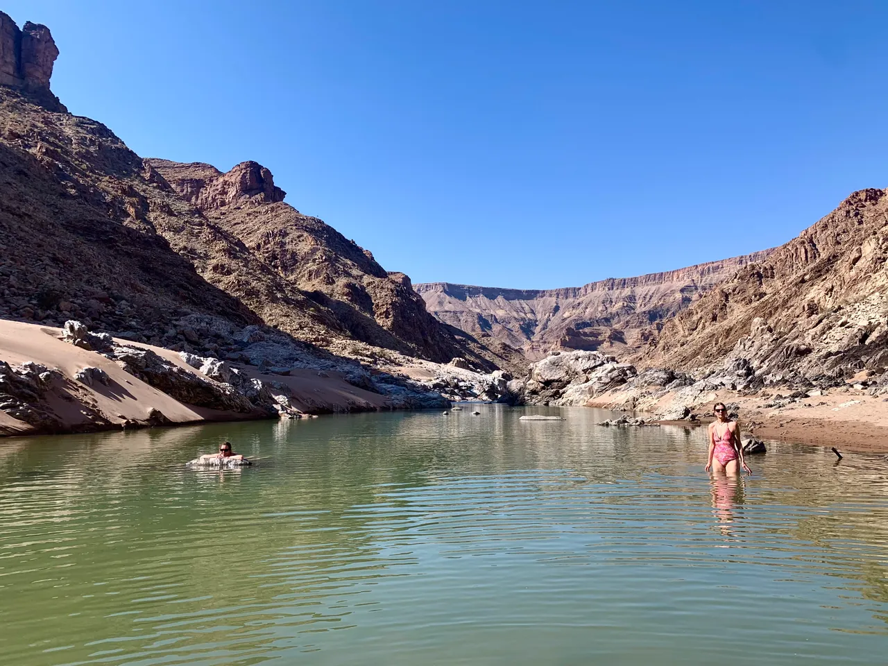
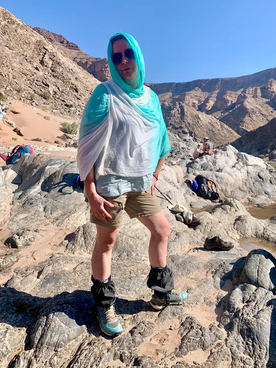
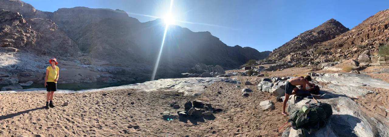
We celebrated LOUDLY when we saw that the river was FULL and quickly stripped to our swimsuits for a dip. The desert temperature had changed from 0 degrees Celsius to around 26 degrees Celsius from the start of the morning to this point. It had taken us an hour and a half to descent and it was midday.
The water was cold and refreshing and we ticked into our lunch snacks to refuel after the gruelling descent.

Soon we were dressed with hiking clothes over wet cozzies and headed down the river on the rocky riversides headed for Pulpit Rock. We had decided that this looked like a good place to stop for the night and that it was a decent distance down the canyon to make a dent in the 70 kilometres that we had to cover.
I had a graceful slip on a slanted smooth boulder that had a slight layer of sand that felt like a slip and slide. My padded bottom took the brunt of it and luckily I didn’t seriously hurt myself.

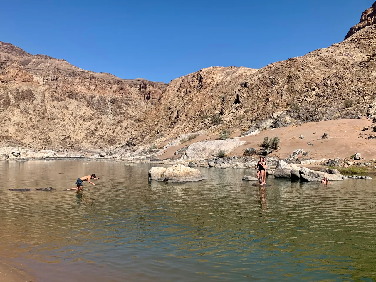
We stopped for another swim about an hour along the river and replenished our fluids. We had all brought some form of water treatment which ranged from water purification drops or tablets to filters and life straws. I had considered the life straw but in the end I’m glad that I had opted to leave it at home. The drops and tablets were adequate if you were ok with having a few tiny floaters in your bottle. The tablets worked in 10 minutes and the drops in 30 minutes.
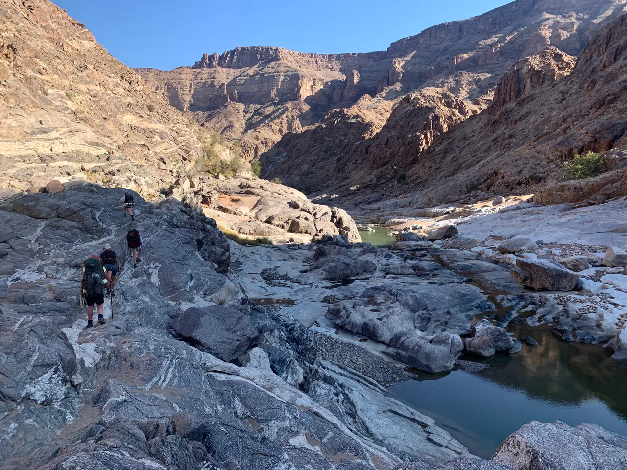
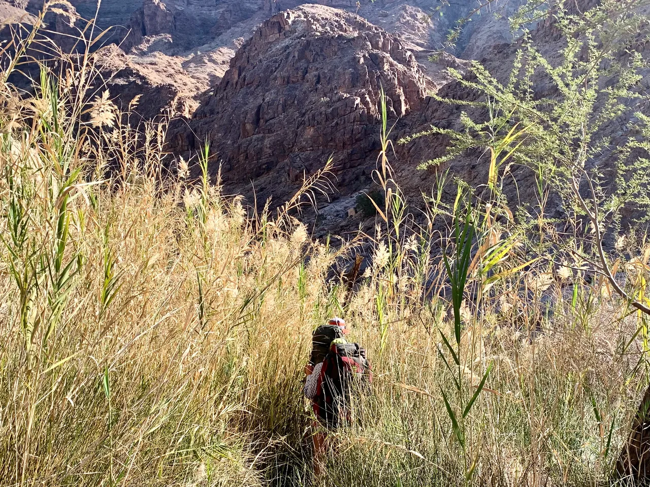
On we walked through one section of muddy reeds and then back onto even more rocky territory. Some took a high route which others took a low route along the water. We had to dig deep as the light was dropping and the shadows growing longer. The next couple beaches weren’t suitable for such a large group and didn’t have much flat space for sleeping.

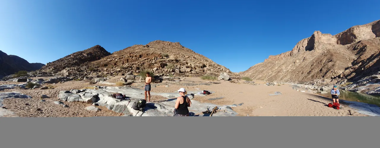
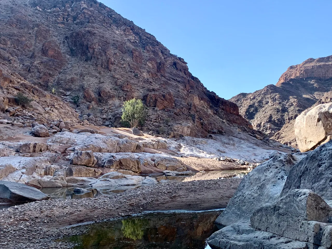
As the last light was dipping on the river we arrived at what we hoped was Pulpit Rock camp. With no signage it was a bit of a hope and guess but the terrain seemed to be that of pulpit rock up on the side of the cliff.
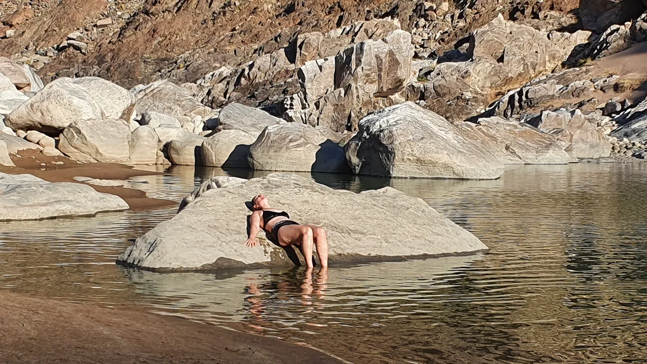
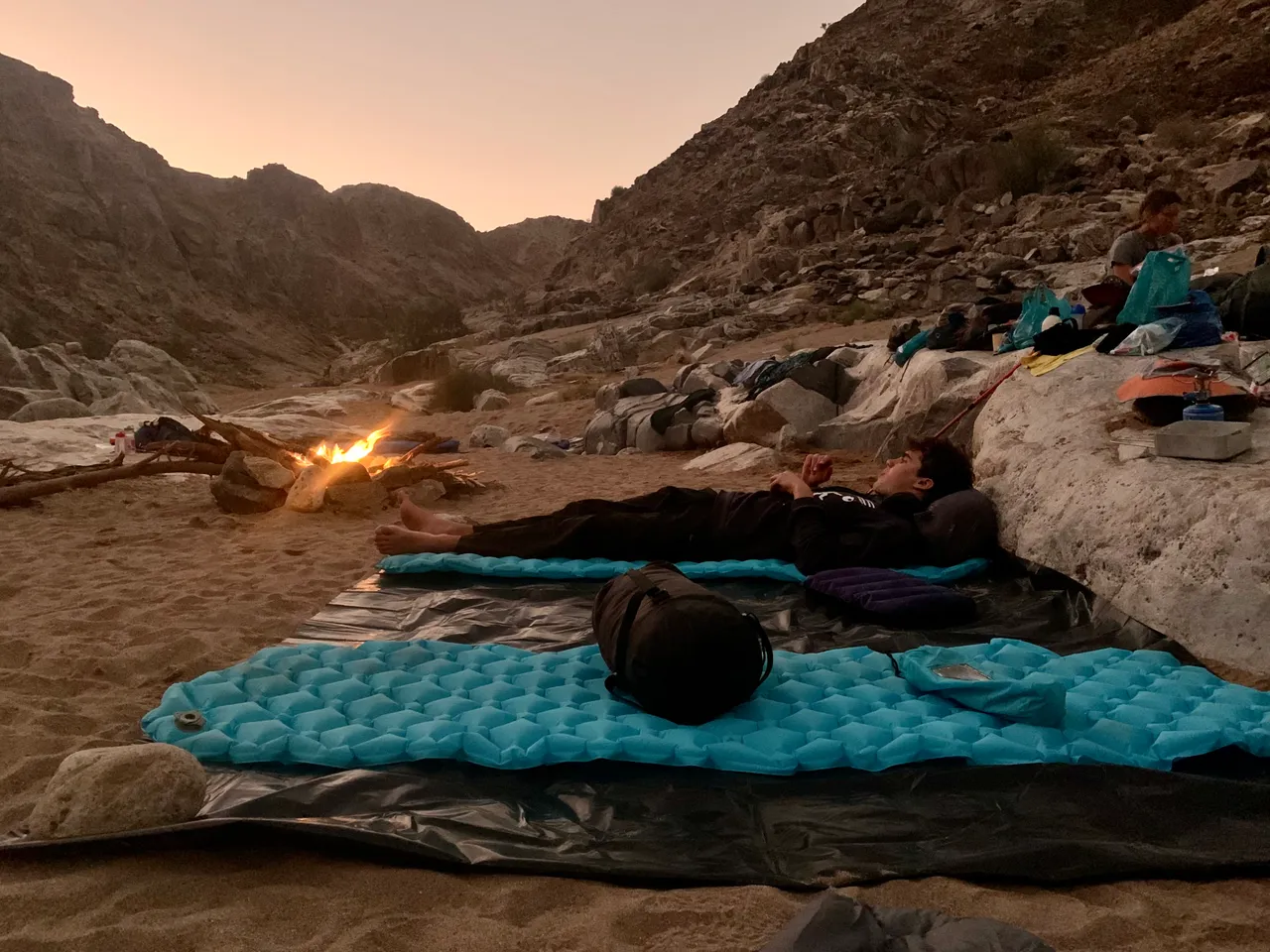
We set up our very basic camp of plastic ground sheets, sleeping bags and a campfire for light. We swam in the river one last time, gathered water and cooked our first dinner in the wild with friends. We were lucky that the weather predictions had been perfect with light cloud cover and no rain for the next week.
I slept badly on my thin inflatable matress and often gazed up at the multitudes of stars and the brilliant Milky Way galaxy above us as I rubbed my feet together to keep them warm. The nights were cold but not unbearable and the days ahead were warm.
STATS
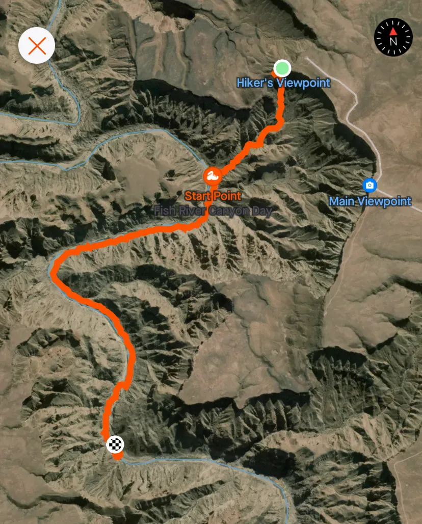
Our elapsed time for hiking was 6h30mins and we had covered 7.47kms of rocky terrain including 1.7kms of the initial descent which took 1 ½ hours.
Stay tuned for the last 4 days of the Fish River Canyon hike ahead and more adventures with our 15 adventurers.
Photos are my own and may have been used on Facebook or other social media prior to posting this blog. And were shared amongst our group for social media use.