It was time to give AllTrails app another try. This time I had my eyes set on a much longer trail. This one however I would not fully complete as it was a point-to-point 6.5 miles. So I would need to do double that to get there and back. There ended up being a more reasonable trail for someone of my fitness level once we got on site.
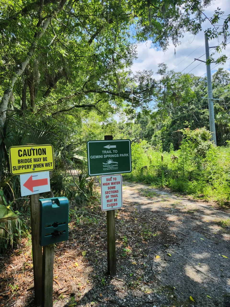
I found it a little strange that AllTrails has this trail listed as Spring-To-Sprint-Trail. It also did not show any of the other trails listed on the signs there. At least from what I could tell. It did however show there were many other trails around the area just not these.
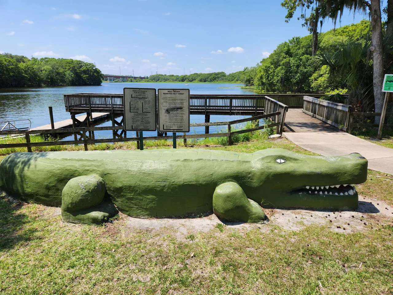
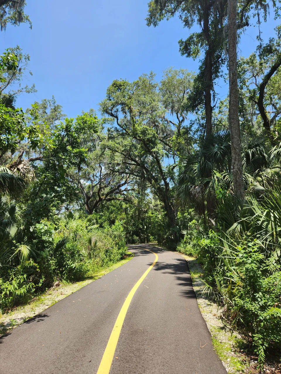
The trail starts just off Lake Monroe. When we got there I just had to investigate this giant gator they had out in front of the boating ramp. I also took a closer look at the lake itself. Sadly the part of the trail I would be going on was not as close to the lake as I was hoping it would be. That however did not stop it from still being amazing.
Also, that gator sign that got cut off on the right-hand side of the photo might be saying what you think it is. Not only do they not want you to feed them. They also don’t want you to do other things with them. I don’t want to know what transpired to have that sign made.
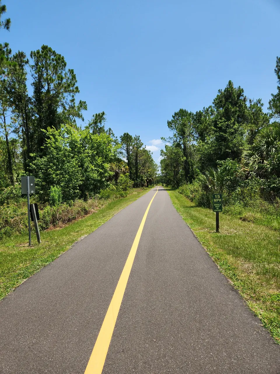
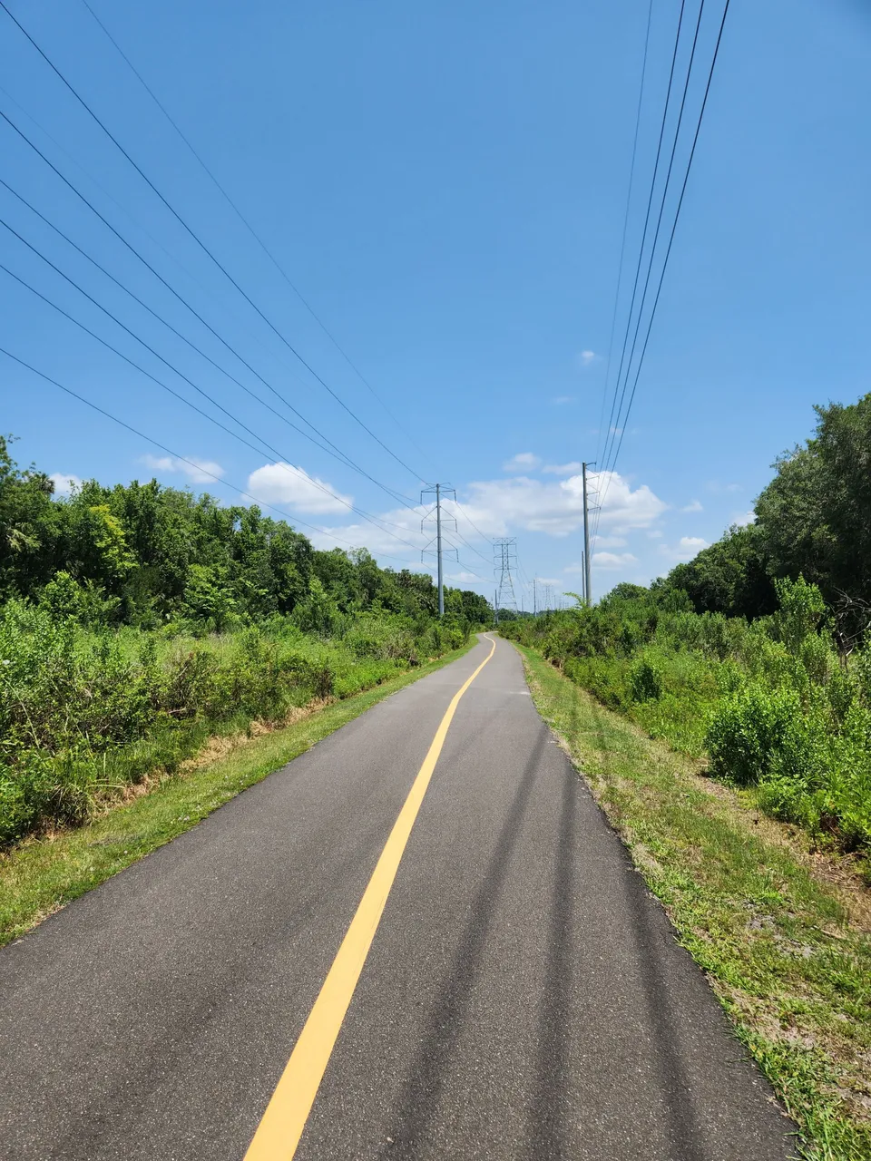
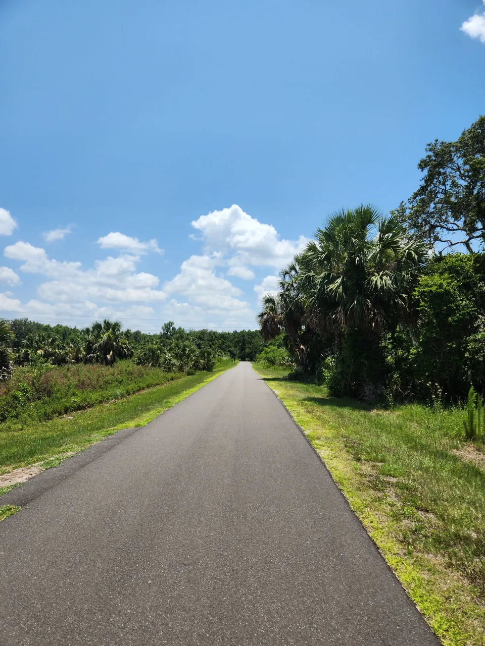
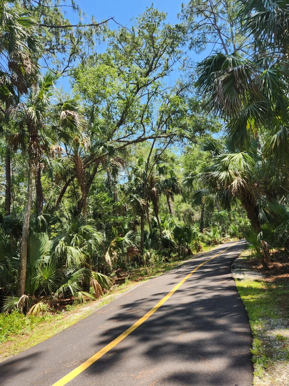
We then walked up a little way to get onto the trail itself. That is when we found out they had further parking right next to the trail start. Unlike the other place I had been this one was quite busy. A lot of people don’t come here to walk, run, or hike. They come here to bike. There were quite a lot of electric bikes as well since it was a nice paved trail.
From the looks of it, there are quite a lot of trails and areas that connect. The park however closes at night. While there appeared to be some places one might try and camp they had signs along them saying “no trespassing. . . park closes at night.” I’m not quite sure how someone could take on this massive network of trails without somewhere to stop for the night at some point.
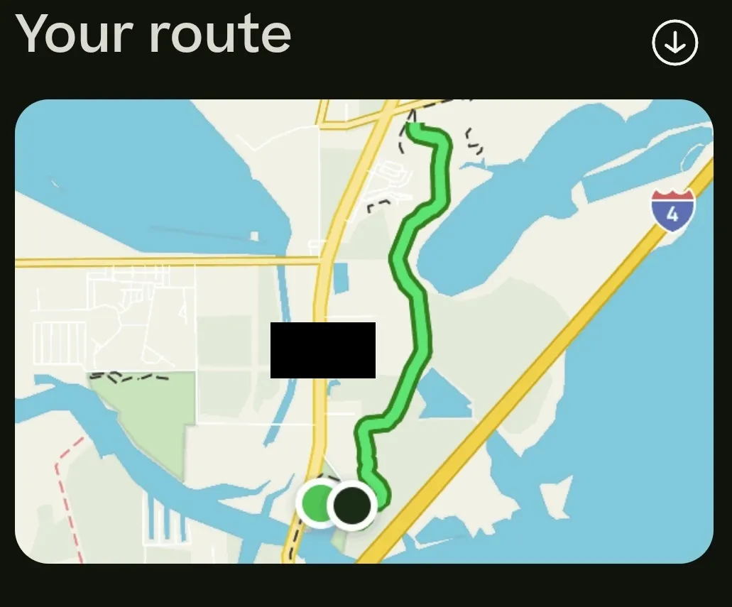
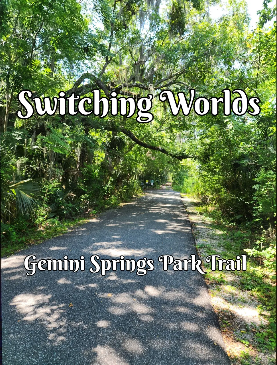
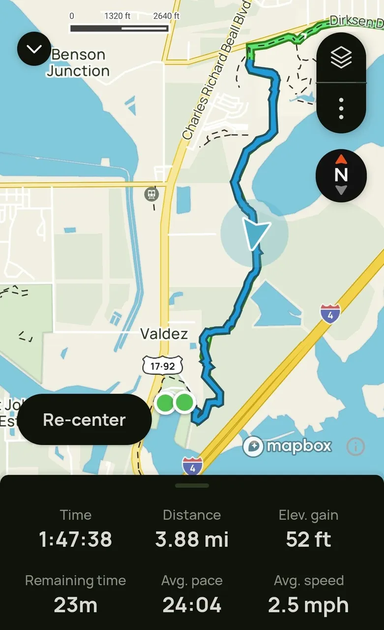
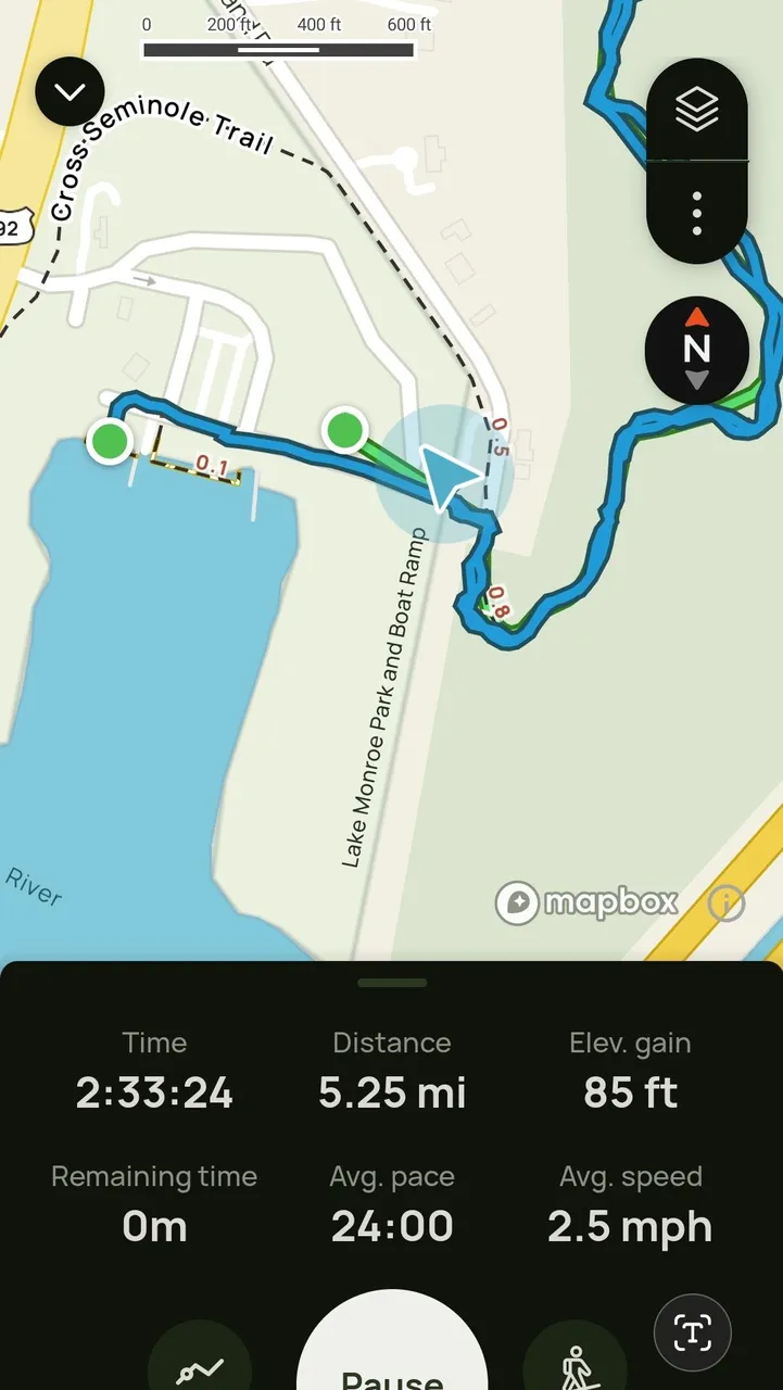
While I thought I would end up just doing part of a trail called Spring-To-Sprint-Trail. It ended up being called Gemini Springs Park Trail. With local temps hitting over 90 degrees and humidity being over 60% that would end up being quite a grueling 5.25 miles round trip.
While I had many days during my Atlantic City trip that would easily top this trail. Once you toss in the humidity down here and crank up the temp a bit. It starts to get a bit rough. Even more so since I’m doing this all at once and not just spread out over an entire day.
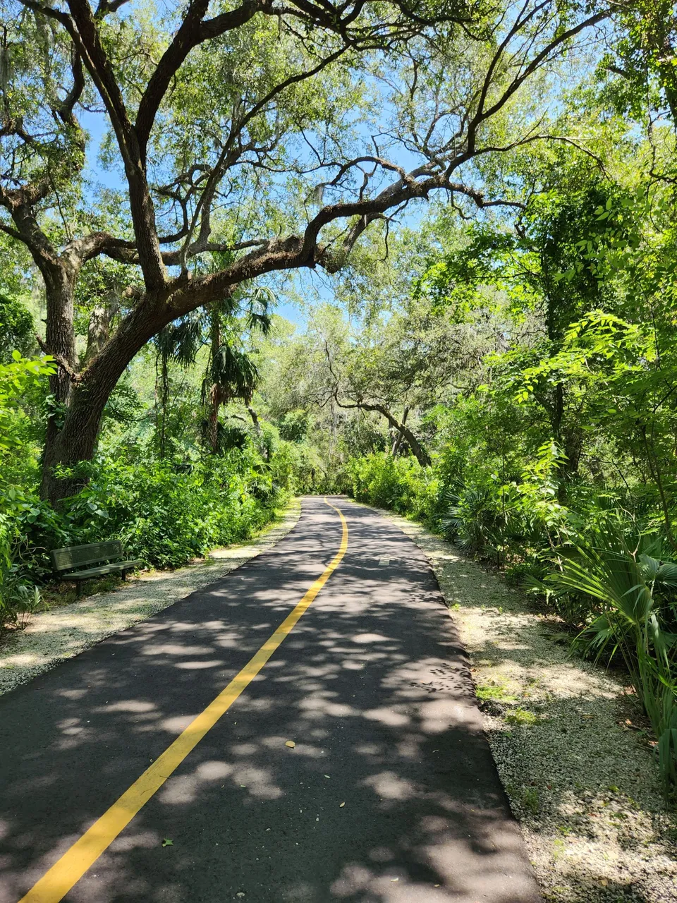
One nice thing they did since so many people ride bikes on this trail is they are working on installing a yellow line down it with arrows. Most of the trail had this yellow line down it. There were parts you could see they had markings on the ground to further expand on this.
Many people riding their bikes would say “Passing on your left.” Those people were usually going along at quite a quick pace. The less experienced ones not only did not do that you had to be an eye out for them in case you needed to get out of the way. That thankfully was quite a low occurrence.
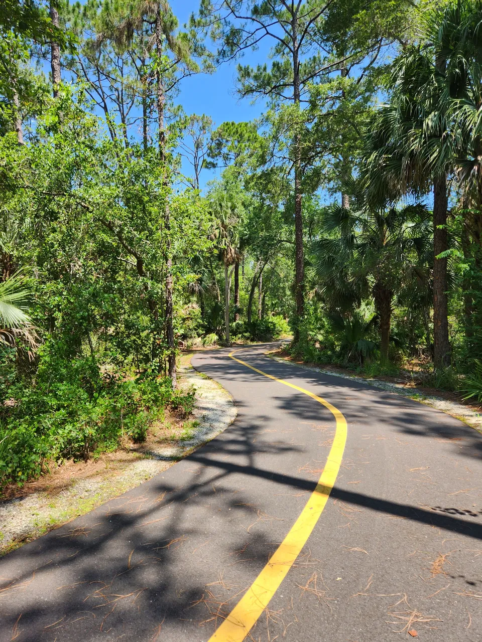
I wish I could say this trail had this amazing cover of shade for the entire thing. It did not and in some areas, you felt quite exposed. I was a bit shocked later after the trip I noticed I was sunburned. I guess this is an important lesson for me to start wearing sunscreen on these trips.
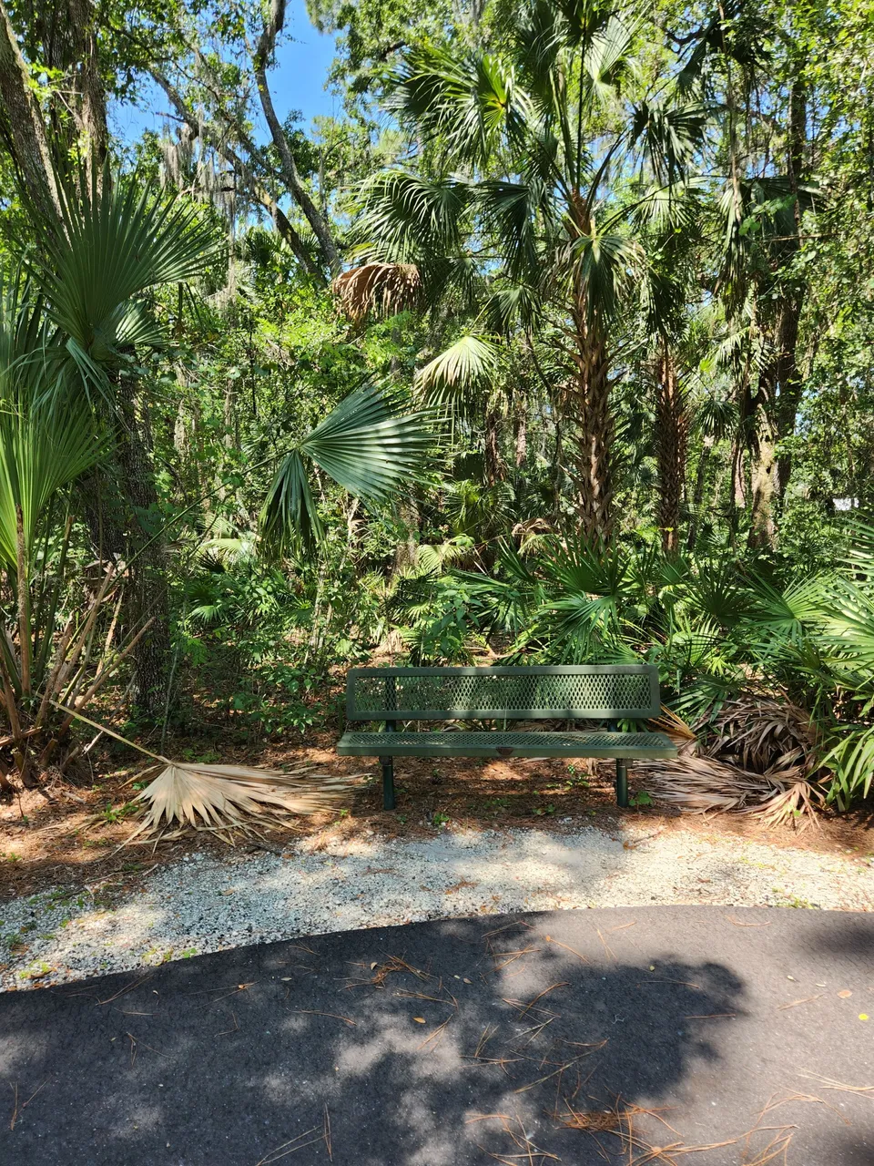
Every so often they even had benches or even picnic tables so you had a place to rest. For the first two or so miles I did not need to use these at all. In the end, however, they became quite useful for me.
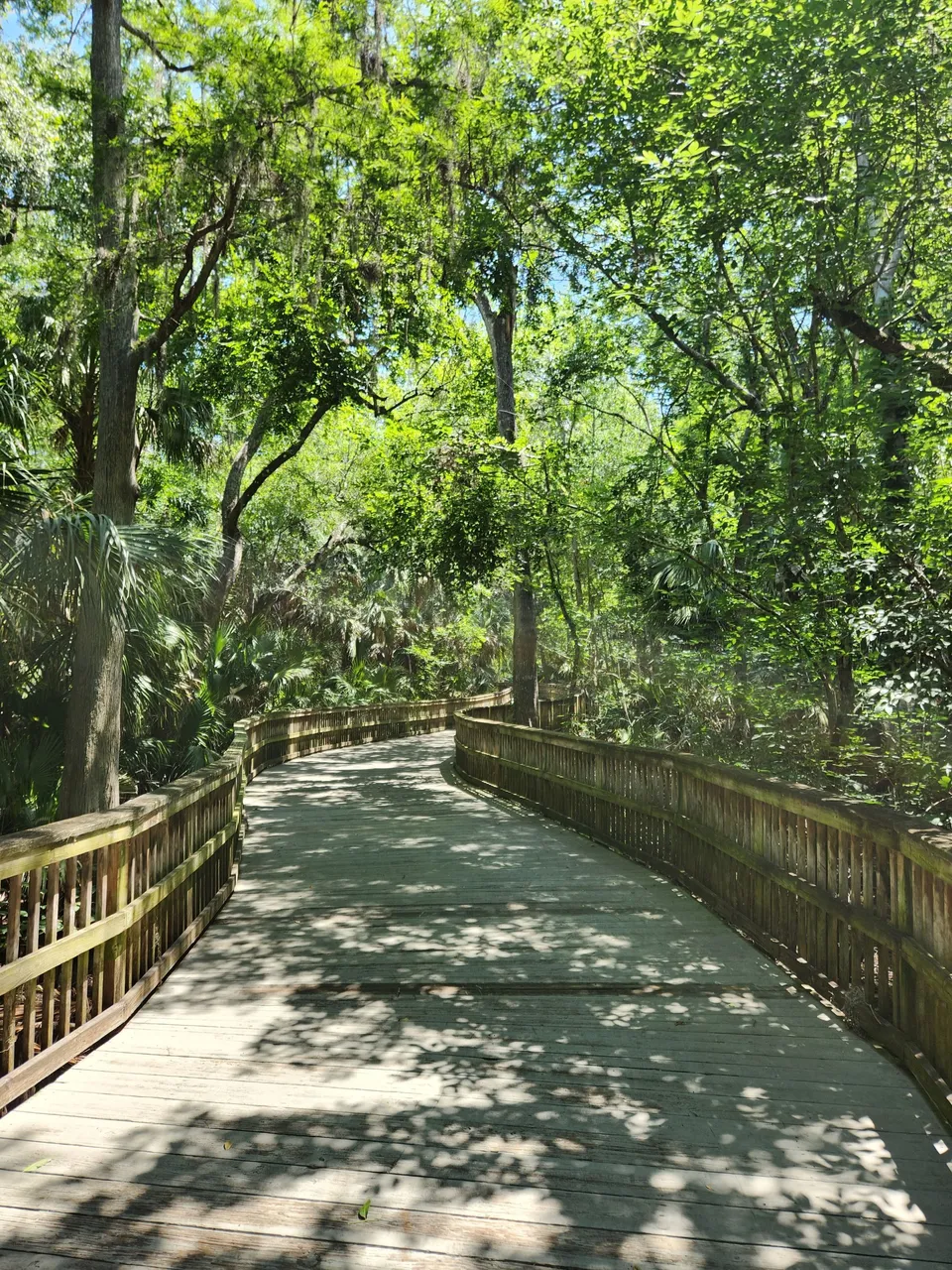
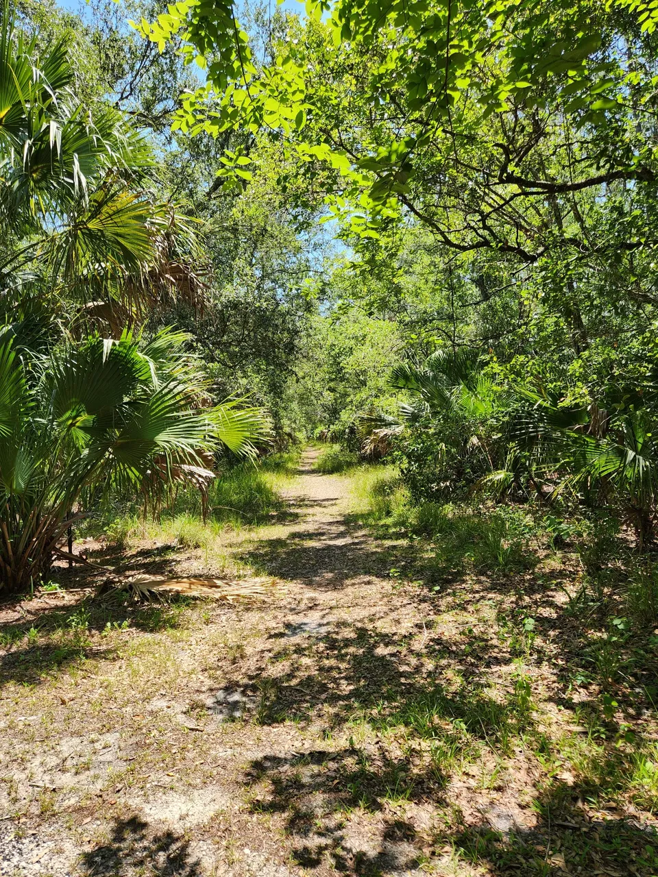
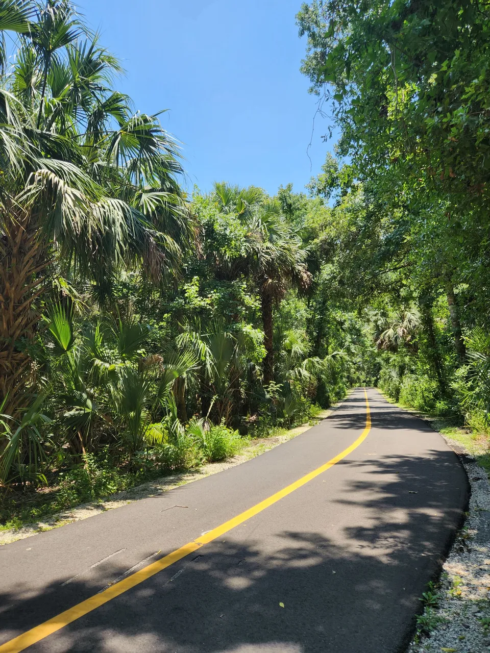
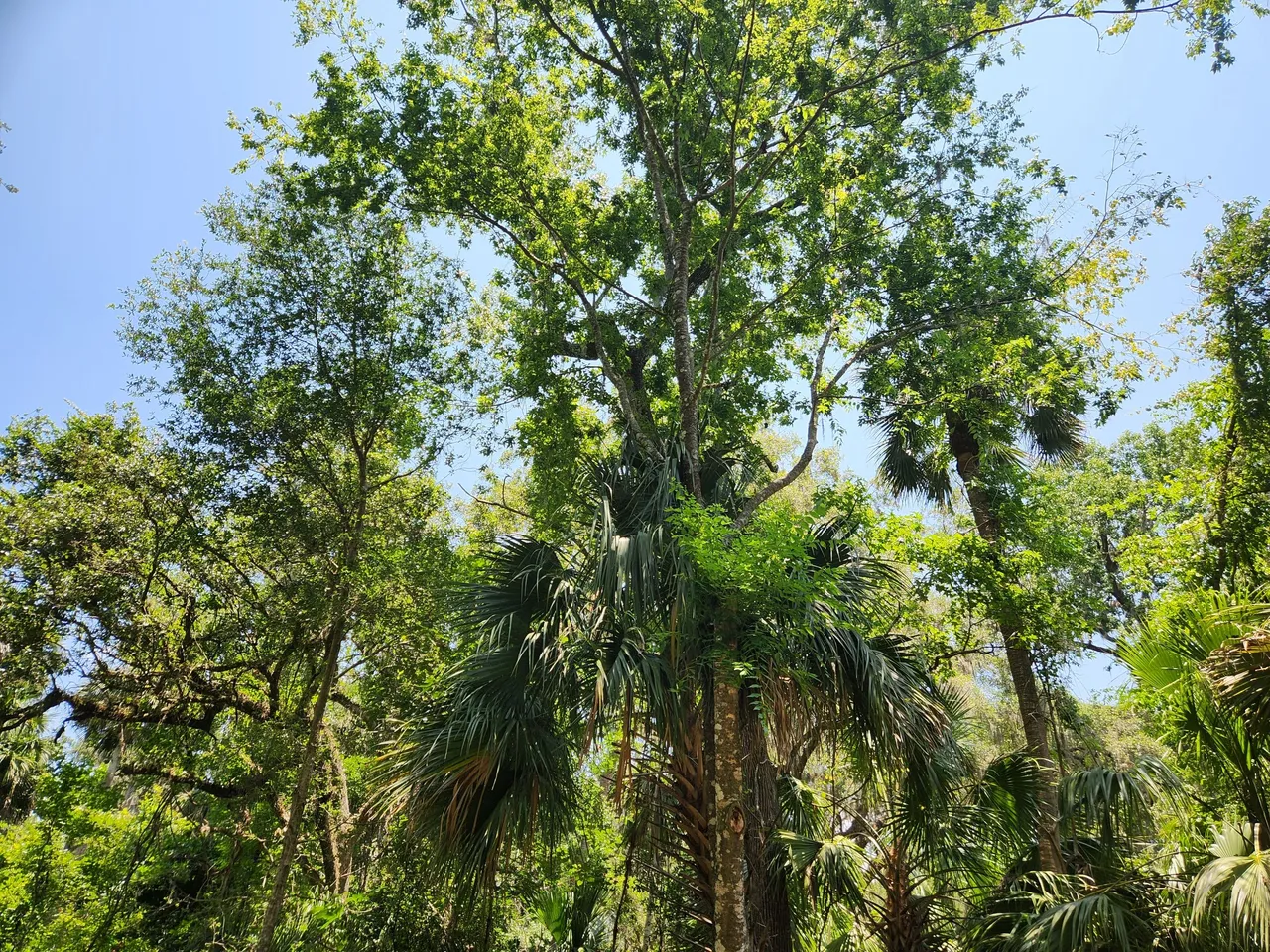
The trail also weaved around quite a lot. I can only assume there were larger trees they wanted to save by going around them. I at the very least made you feel like you were in the middle of the woods and you had little idea what was ahead of you. This I found to be rather fun.
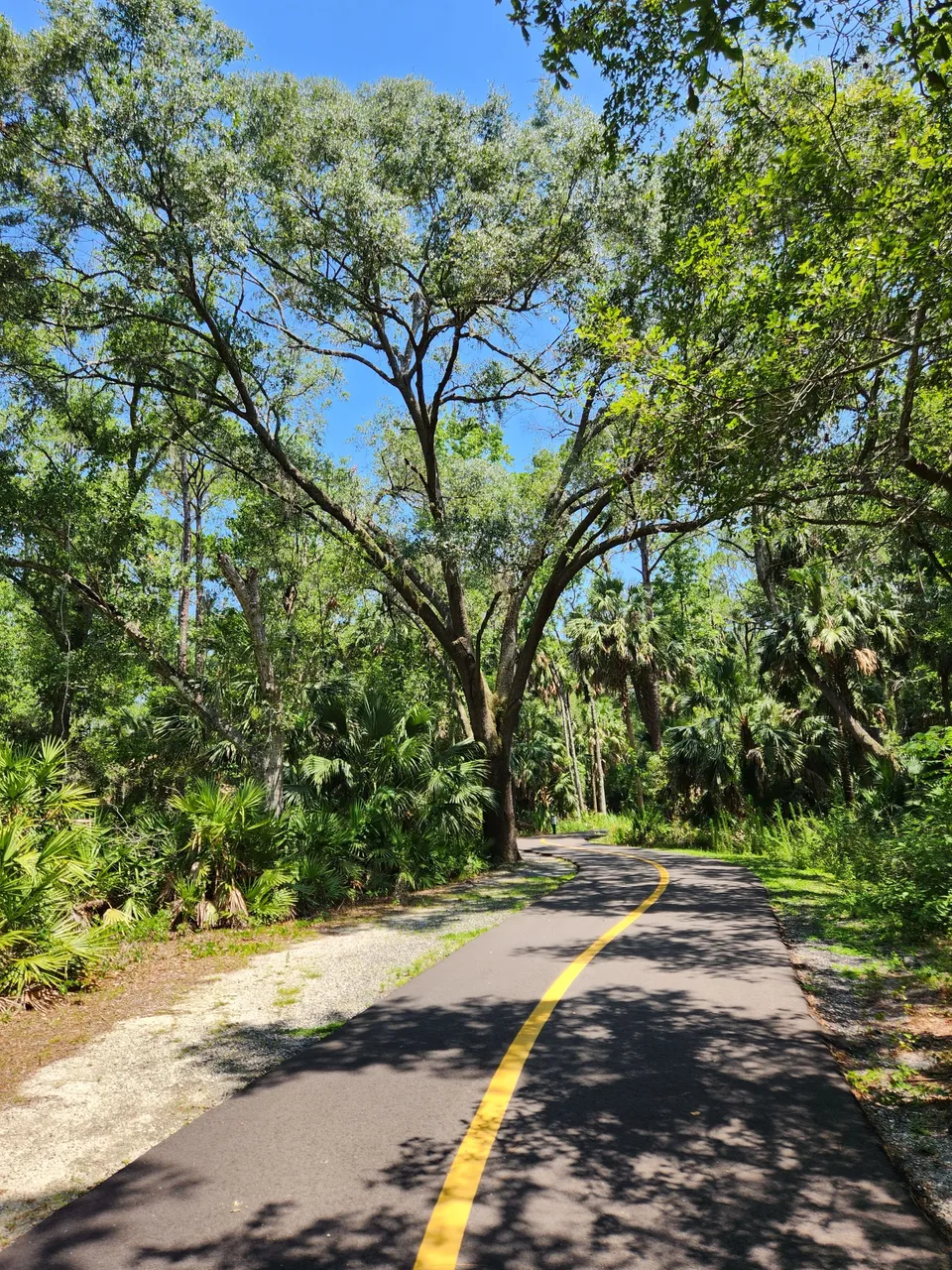
I am rather glad they choose to go around some of the bigger trees. This one was quite massive and so beautiful. It made this trip worthwhile. I could not wait to see it again on our way back.
Unlike the other trail where I did not even take water since I had forgotten to take a couple of bottles with me before going. This trail since I knew it would be longer I took my backpack. I had four bottles of water in it and some other rather basic stuff.
Since I’m a rather heavy person and quite out of shape. All I can say is I was not only glad I brought along that much water for two people. I kind of wish I had brought at least one more bottle along. My backpack has some side pockets that are great for storing bottles of water in.
Thankfully I did not need to break out my hiking backpack for this trip. Since it is quite an older pack I think its base weight empty is like 5 lbs. It would have been way too much space for just needing to carry a couple of water bottles. In the future, I do hope to test it out.
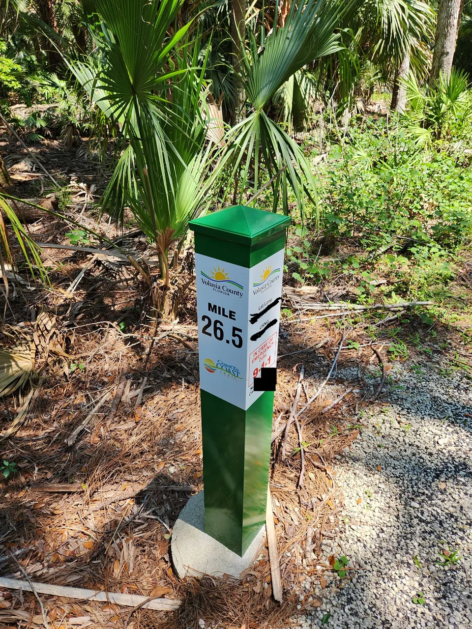
The trail also had mile markets every half a mile or so along it. They included the exact lat/long and reminded you to call 911 if an emergency was happing. I was not expecting this place to have this level of features.
As I joke I sent that photo off to a couple of people. They were not taking the bait that I had just gone that many miles. It was great we had internet access to the entire trail for checking the AllTrails app from time to time and texting.
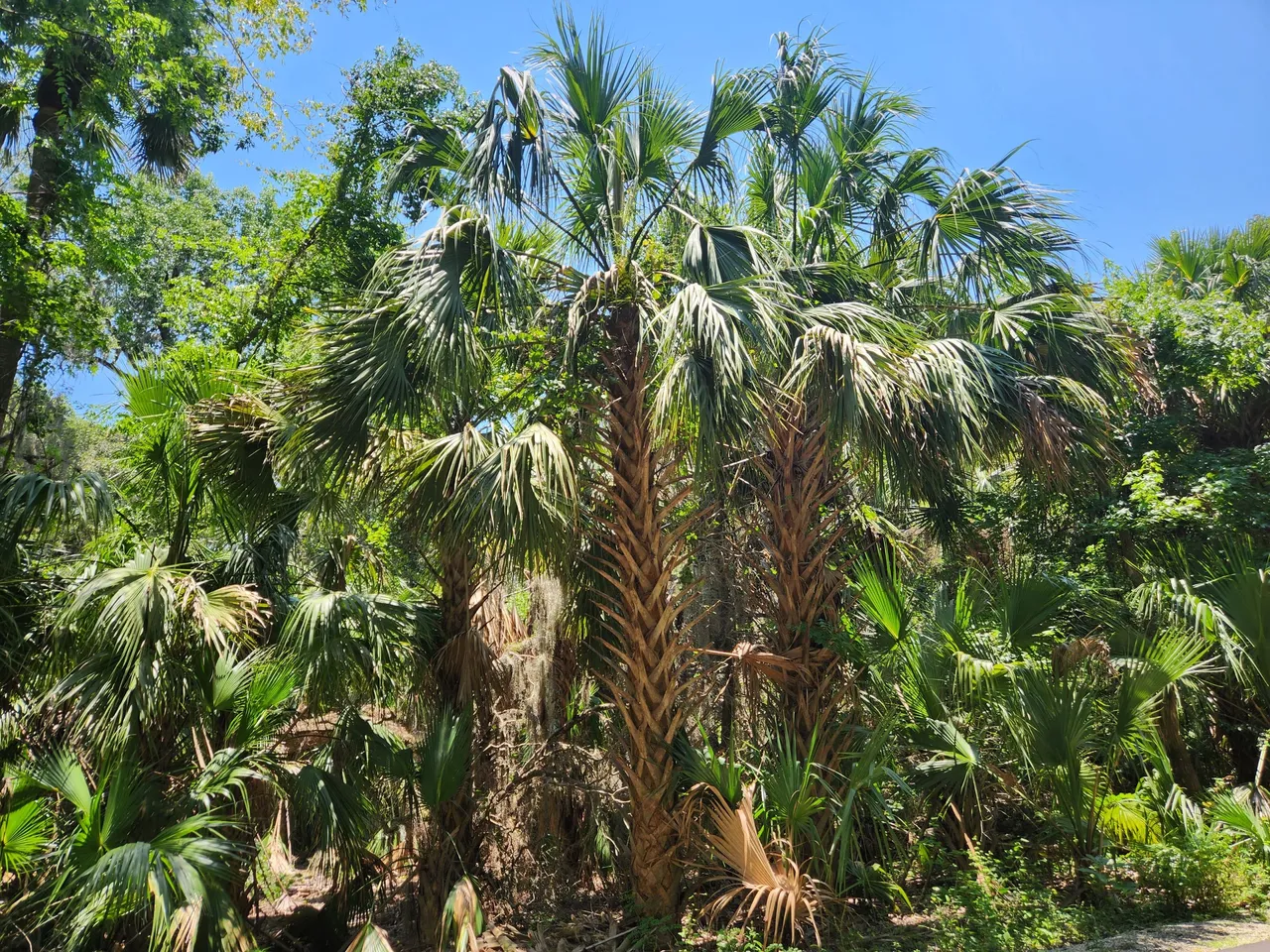
You really could just spend hours admiring the trees. One thing we were expecting to run into a lot more where birds. This was supposed to be a “decent” trail for bird-watching. We did end up running into a couple of birds. It was not as frequent as I was expecting. It was perhaps due to the time of the day.
Once in a while, we would find these trails that lead off to who knows where. They were not shown on AllTrails. Most of them also lacked any signs. On occasion, they would say “No trespassing.” Since we had quite a few more miles ahead of us this was not a trip we felt like going off the marked trail to see what the none trespassing areas lead to.
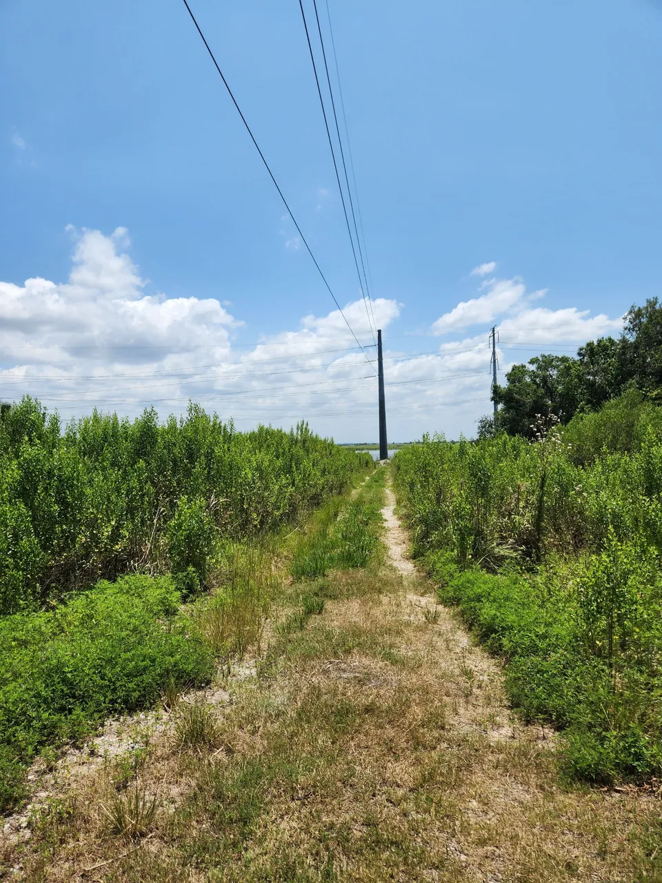
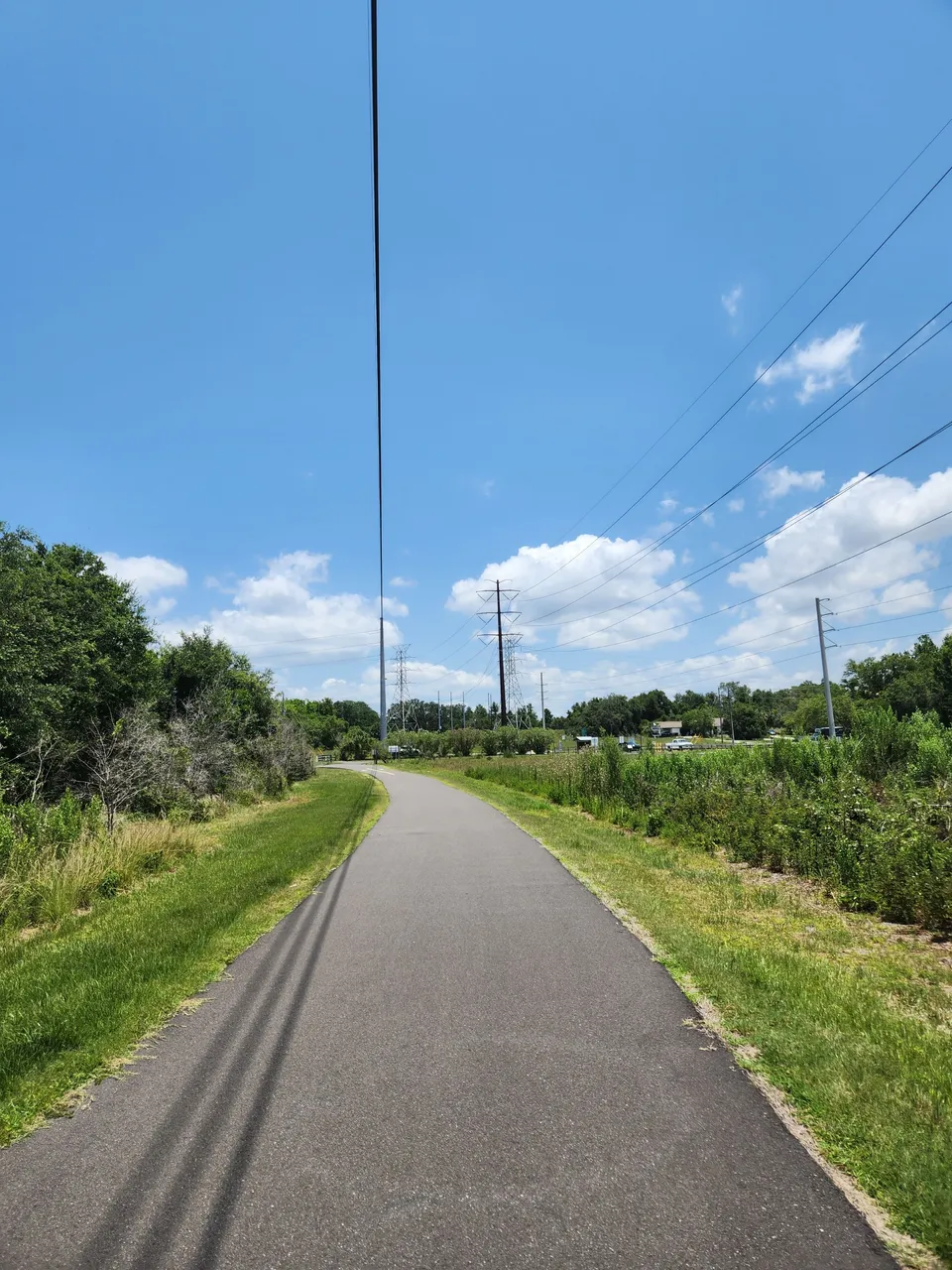
I find it a bit funny some of these areas had posted speed limits like you were on a highway or something. There were also quite a few parts of this trail you were left quite exposed to the sun. This spot was not as bad as many others.
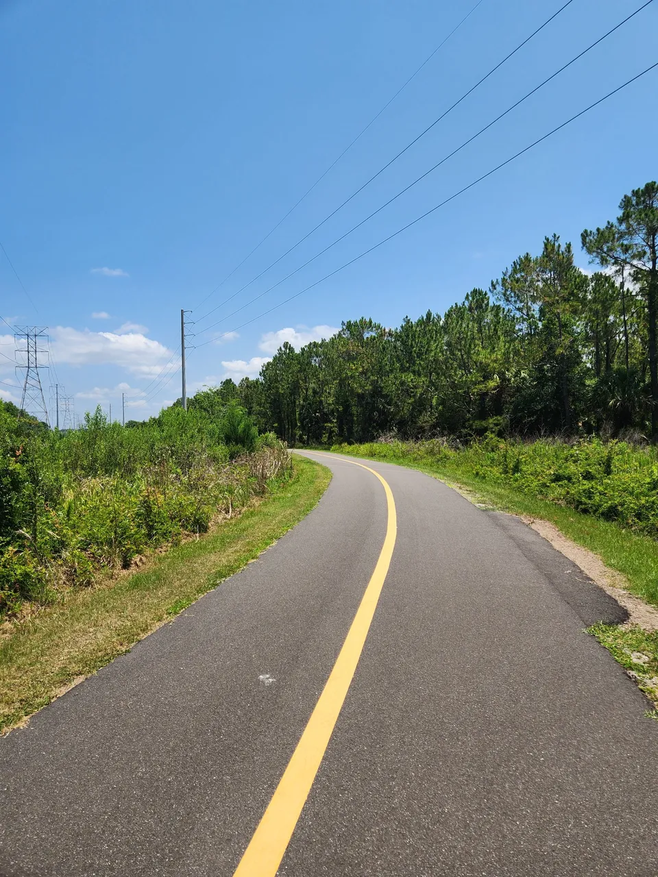
This area was quite brutal. On top of how exposed we were. You could hear the powerlines in some sections of this trail as well. It’s at least a cool idea that they used the area they had to clear for power lines to put in a trail. They were however viewed for quite a while.
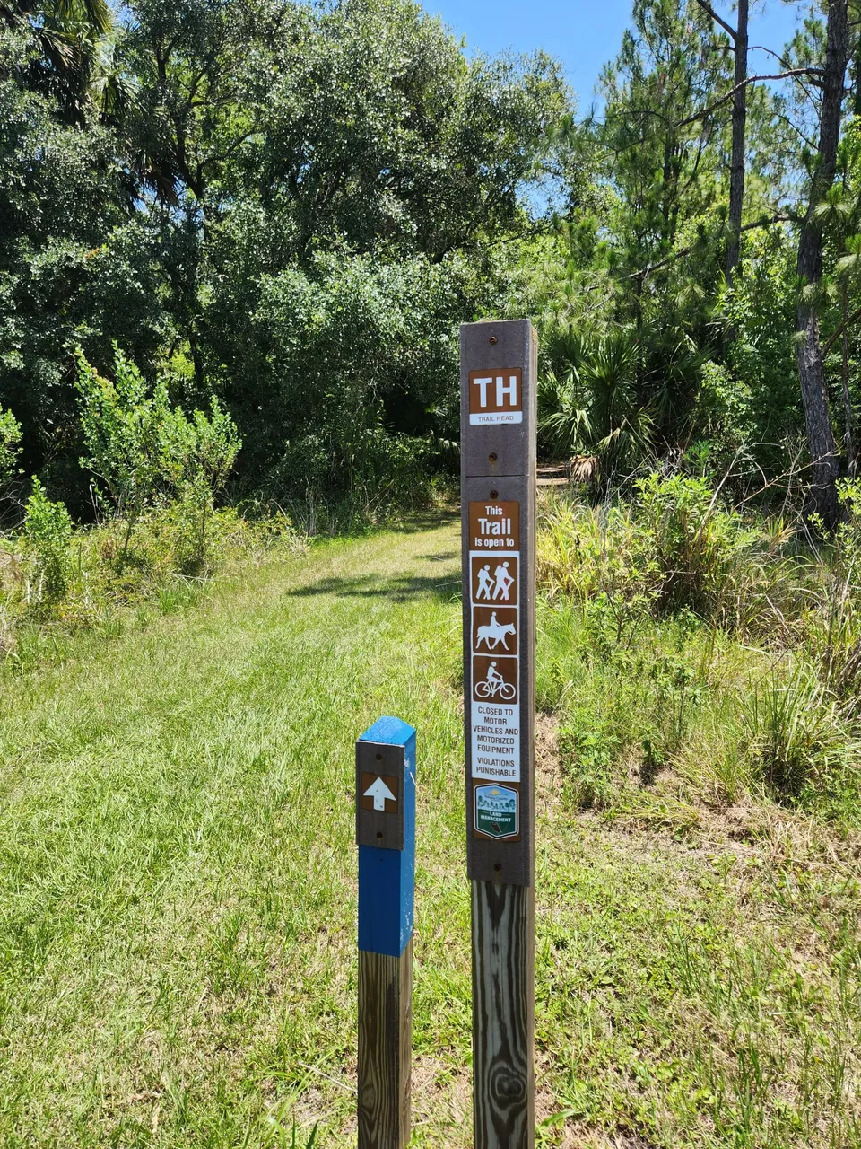
There did appear to be an approved off-the-main-route “trailhead.” It was not shown on AllTrails and since they just called it TH I had no idea about where it went. I suspect if I had gone further along the main trail we might have seen further of these. It’s great to know there would be some branching of the trails going on.
There was also a part of this adventure I was starting to wonder how far should I push myself to keep going. Since this was quite a long point-to-point trail and nothing like the short loop trails I’ve done in the past. I was a little concerned about finding out about my maximum distance in this kind of weather and not being anywhere near back at the start.
What I did know is I at least wanted to get past this well-open section. Once in a while, a little bit of a gust of wind would come along. I could not wait to get that wind once we were back under some cover.
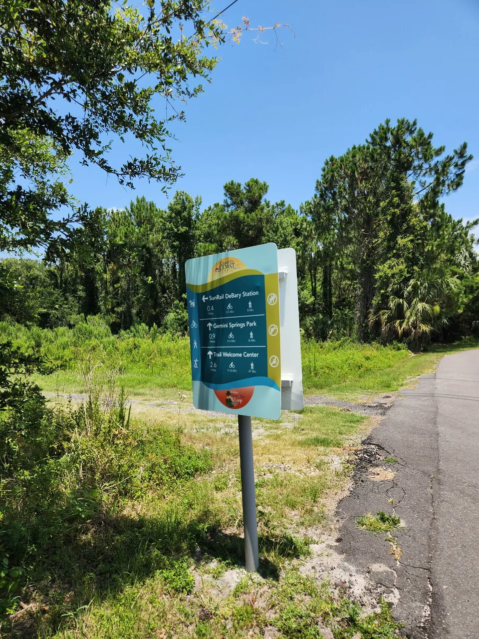
After a decent amount of walking, we came across the first actual sign that gave you some idea of how much further you had to go. There ended up being a path to take a train which is great to know in the future. As many that be a fun starting point.
It was at this point of the trip that I thought to myself “Just 0.9 miles to the goal.” I was not thinking about having them walk the entire thing to get back. I set my sights on pushing myself to keep going.
A little later there was this rather suspect trail going right into the water. I looked on the map and it looked like a riverway that went into the lake. I can’t tell you how badly I just wanted to go and jump into it. Expect that is a really stupid idea.
While this area I don’t believe has been reported to have the most gators. This is not a place you want to be testing your luck at. I was just glad we did not run into any along the trail. That body of water also looked more like a swamp than anything else.
After a while, I was thankful to have some shade again. It was not as dense as some of the other spots. The day however ended up being a lot hotter than we were expecting it to be. I had already down one of the bottles of water I had with me and was starting on my second.
A couple of turns later and we think this is where Gemini Springs Park was. It was right around where it should have been in terms of distance. You might be wondering “We think.” Well, we could tell it was next to a highway and it did not look that impressive.
While it would have been nice to stop for a half an hour's break. I was not in good shape at this point with how hot and humid the day ended up being. It was decided that extra distance might just be those last extra steps we would end up regretting.
I already felt like I had pushed myself a little too far. We still had the long walk back to the start. The good news is since this is a point-to-point trail we could always on another trip drive up to this point and start here to go to the next spot.
So making it only this far did not feel like a failure or a letdown. I could see what I needed to see and felt it was best to just turn around right here. I’m rather glad we decided to turn around as the journey back got quite hard.
On the way back to the start I welcomed the sight of every single bench or picnic table that was along the trail. While I did not sit down at every single one of them at least for four or five of them I did.
The first bench we came across on our way back that had some shade it was time for a bit of a break. I downed my second bottle of water. Thankfully the person I was with was doing great with water so I got their second water as my third. It would not last me the entire trip back but I’m thankful I had it.
One of the nice things about taking more breaks as the day got hotter and hotter was getting to enjoy the views better.
These more covered areas with some wind blowing by them were not too bad. In a total of two hours and thirty-three minutes, we were on this trail. Twenty-six minutes of it was recorded as being at rest. While it was great I did not need a long thirty-minute rest anywhere. It would have been better if I could have cut that rest time down by half. We could have gotten out of the sun sooner.
The hardest part had to be going back over the open areas. One of these areas I knew went on for so long that when I noticed we were coming up to a beach I knew I was going to have to rest at it. I think this is where I got a big part of my sunburn at.
I was also starting to check the AllTrails app a lot more. I was starting to count down the distance. Since there was only going to be one sign we would run into that would let us know how close we were getting.
I felt this was the best way to try and gauge if at any point I needed to just rest for quite some time and not try to push further down the trail back to the lake.
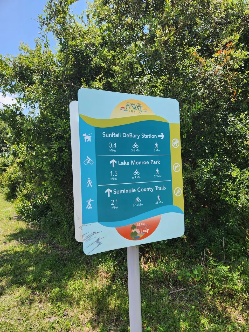
We then hit the only sign that would be on this part of the trail. We were just 1.5 miles from being back at Lake Monroe Park. This ended up being around what I was estimating we had left. I’m just glad when we got to this sign it was not a lot more.
The good news is if things were going much worse for me. I could have gone towards the SunRail station. There I would have had at least an AC area to sit in and I’m sure they have some water I could have bought out of a vending machine. This would also be a place I could have been picked up at.
I decided however I was not going cheap out now. It was just 1.5 miles to get back. I felt I still had it in me to do so.
At one point I even had to trade off the backpack I had been carrying this entire trip. Granted it was a lot lighter now without having four bottles of water. I however was starting to feel a bit concerned for my back. I had thrown out my lower back a couple of days before this.
I was hopeful this walk was going to do my lower back wonders. For what must be the first four miles of the trail I think it did. After that, however, it was clear I had pushed myself a little too hard.
Around the last half mile of the trail, I was asked if I needed another break. I admitted if I sat down one more time I’m not quite sure I was going to be able to get back up with how my lower back was doing. I also did not want to be out anymore in this heat. Taking another break did not seem worth it.
Final Thoughts
Thankfully we made it back to the starting area. I ended up stopping in an area I did not get any photos of. It was the parking lot next to the trail. It had a restroom area which after three bottles of water I needed. It also had a water foundation which I was quite thankful to have.
The person I was with walked down to the second parking area to get the car. By the time they got back up which was not that long. I had already sat down and struggled to get off the covered bench to get into the car. It’s a good thing I did not take that final break while on the trail.
The most important thing from this trail and trip is I learned where my current limit is and in what weather conditions it was reached. Till my health gets a lot better or it is much cooler weather with a lot less humidity. I’ll be looking to keep further adventures like these to under 4 miles.
I still feel for now that is still a point where I feel like I’m pushing myself. I’m however not pushing myself to a point where I feel I’m putting myself in a situation I don’t want to be in. I also now have a better understanding of just how much water I’ll need to bring per mile I go.
Other Content
Information
Photos were taken and content was written by @Enjar about my personal experiences in the real world away from the computer at home.