As someone who is not very physically active, I thought I’d test out some walking/hiking by finding a shorter trail and see how it went. This would also allow me to test out using an app called AllTrails. I’d be using that app to find locations to hike at and navigate through them.
The first location itself was quite maintained. Along with having a trail, there were a few dug-out and parking lots. It seems this place could hold a couple of baseball and soccer games all going on at the same time.
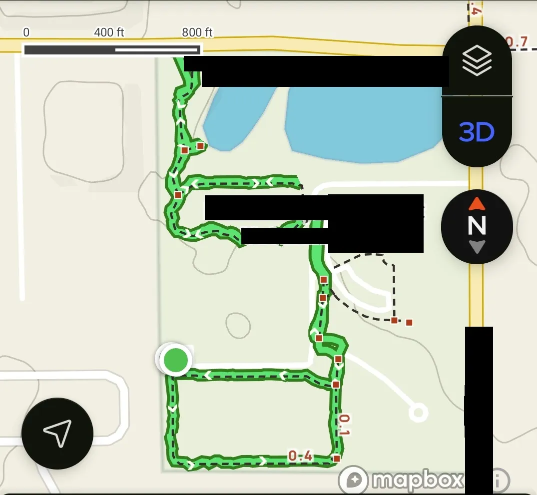
This ended up being the map we followed for the trails. I started somewhere down where the circle green dot is down in the bottom left. That section went around the fields. Then you followed some sidewalks up to the actual trail that went into the woods.
During this particular day, there was even a maintenance crew there. They were cutting the grass, making minor repairs to things, and maintaining the place quite well. It seemed like some decent effort is put into keeping this place clean and safe.
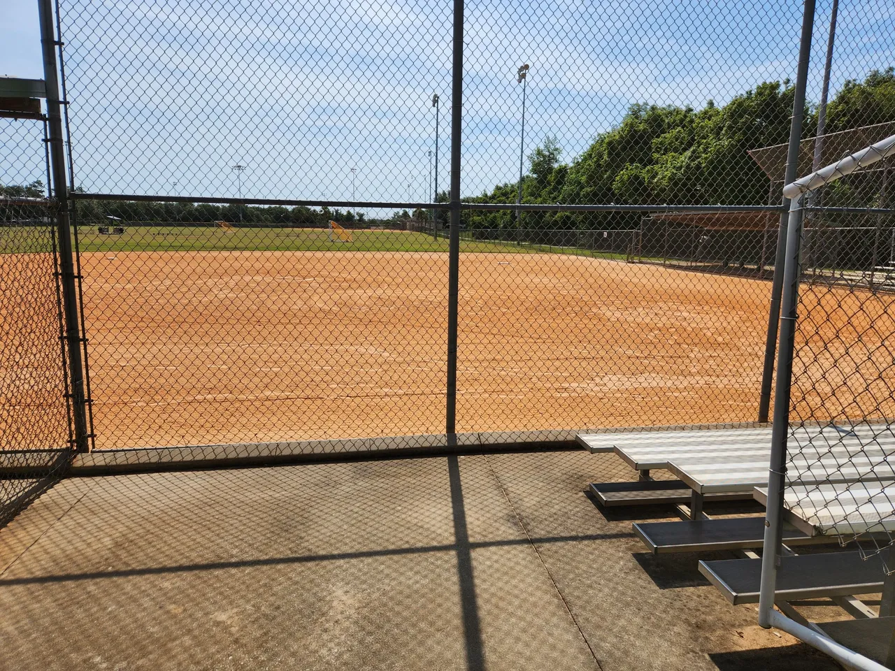
A couple of fields this place had were closed offed off. It seemed they did not want anyone using them at least when they were cutting the grass and sweeping things. I have no idea if they opened them up for free use after or if they can only be used during games or required booking.
I had no idea there were even fields here. I was just here to walk around and get the lay of the land. It was at least great to find out about these fields so I can avoid coming here late during the evening when there is a chance this place could be packed for a game.
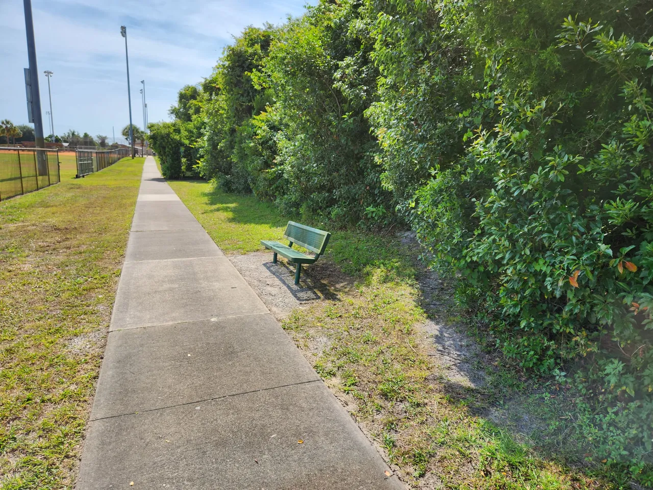
When AllTrails had this place listed as easy they were not joking. Most of the path was paved. There were trash bins every so often. They even had dog bags since it was a pet-friendly place so you could pick up after them. There were even benches and bathrooms as well.
I first took the path around the fields. This was the place I ran into other people that were walking around in this area. Some people even had their dogs with them further impressing that this was quite a pet-friendly location.
It was then time to try and figure out how to get to the actual trail here. Everything was mapped out on Alltrails. I did however start to notice the line on the map and my current location shown were always slightly off.
I don’t know if there is a setting to have more accurate GPS locations or if the path on the AllTrails app was quite thin. It would take a little trial and error to work out my actual location and how it was being represented on the map. It was my first time doing this so I was expecting some issues since I’m the kind of person who could get lost in a shoe box.
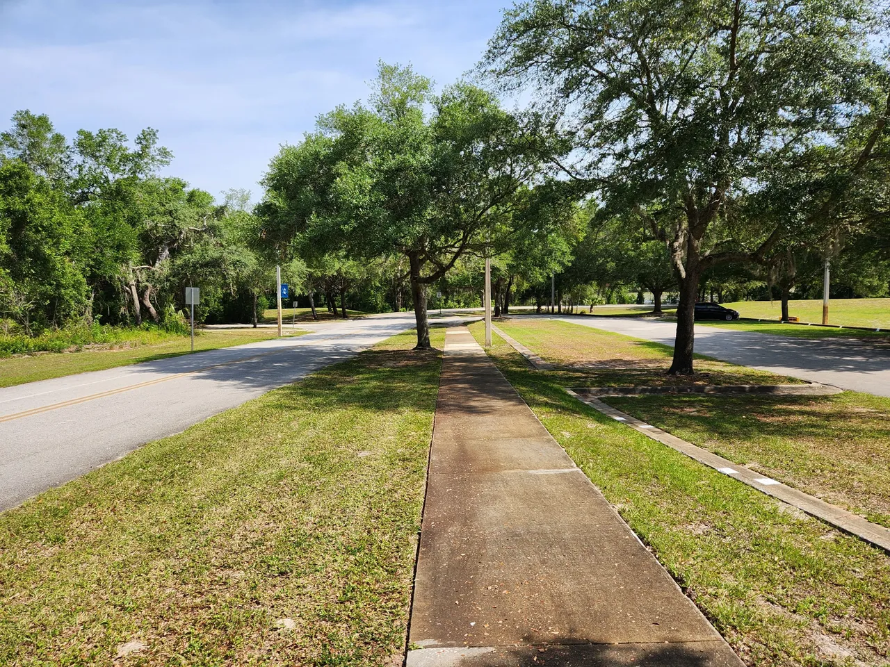
I ended up having to go down some sidewalks that went along the road. I also crossed over two different parking lots this place had. I was not expecting just how massive this place was. I more or less just thought I’d end up at a rough trail and off into the woods I would go.
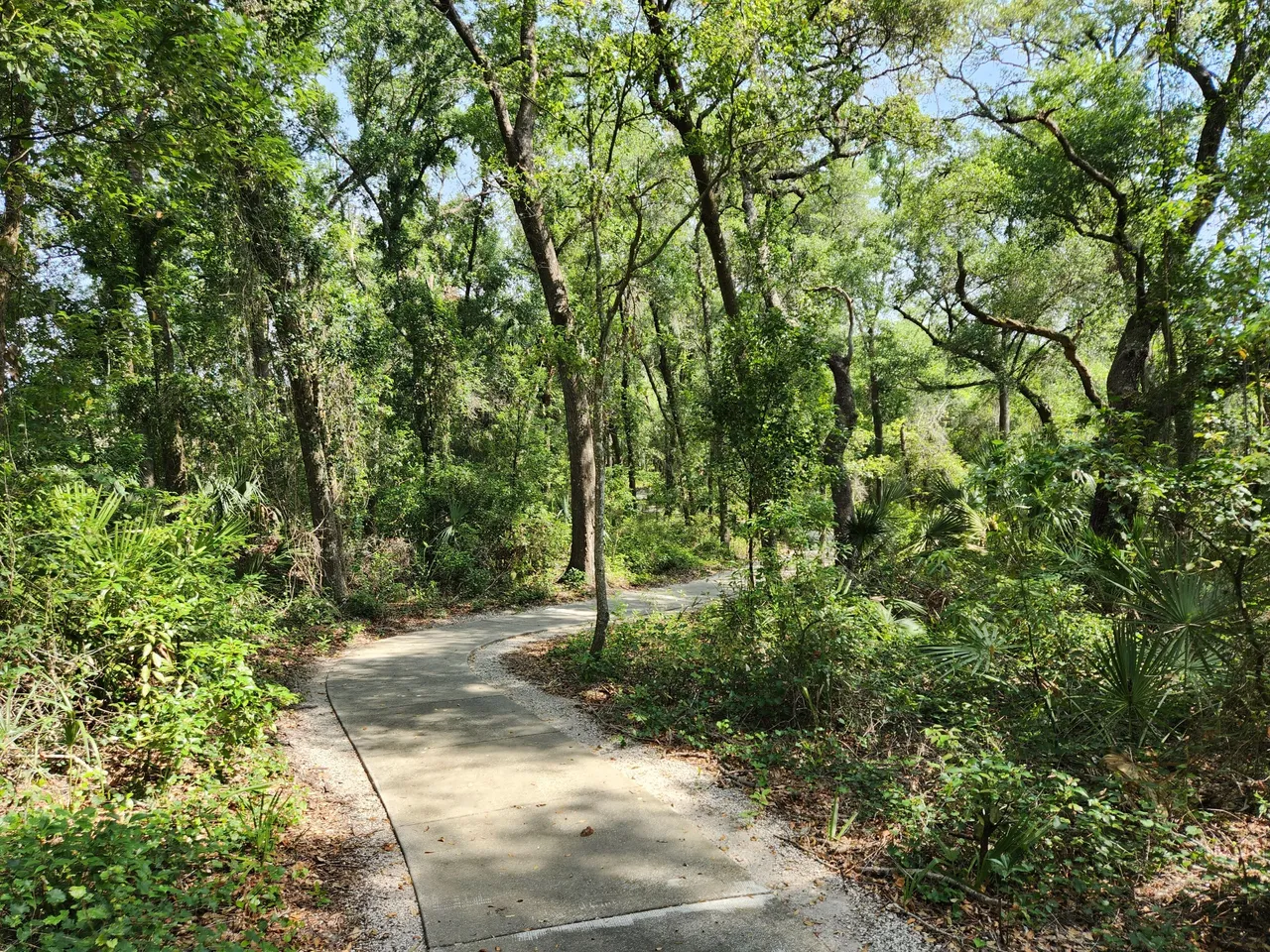
After some further walking it looked like on the map I had to cross over the road onto a different set of sidewalks. That is when I noticed the trail heading into the woods. Also quite ahead of me seemed to be someone exiting that trail on what I assumed at the time was the paved path looped I thought took you back out.
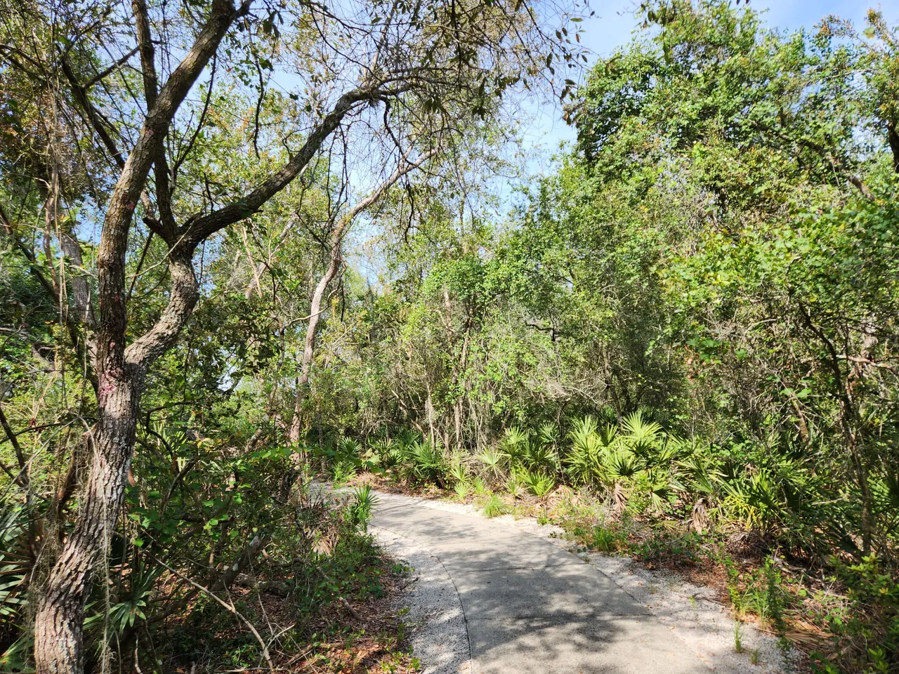
Once I got onto the path into the woods it was just the person I was with and myself. We did not run into anyone else while we were walking around in there. Despite people saying there was a lack of shade for this path it was quite shady.
This was perhaps the part of the path that was supposed to be 1.3-1.69 miles in length depending on where you went. One thing I need to work out regarding the AllTrails app is distance. I would soon discover that was not the only thing I needed to work out better either.
This path was quite well maintained. Every once in a while you would even see a marker for any trees they had plans to remove to keep the path rather clear. There were even benches at a couple of stops along this trail as well. It was all rather easy going.
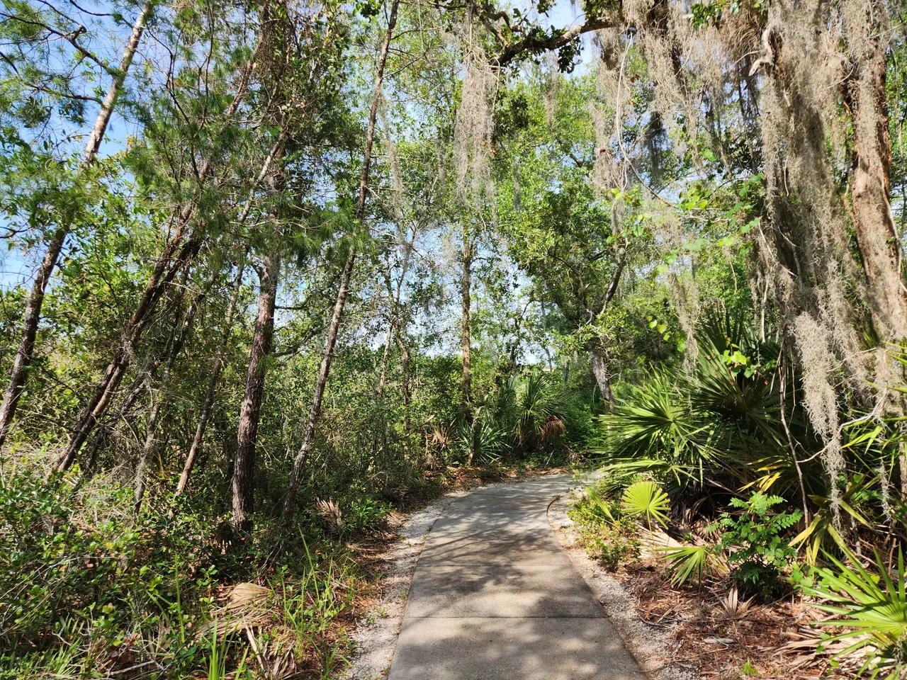
The path did weave back and forth a bit. Every so often I would look down at the AllTrails app and notice the location it was showing me was always just a bit off the path they had mapped out. Sometimes even the path I was on would have me walk slightly to the right while AllTrails showed the path going slightly to the right.
Since AllTrails was recording my trip I can only assume the data it was collecting of my trip would somehow get added to the assortment of the couple of other people that went on this path as well. Perhaps in the future, it would be a little more accurate.
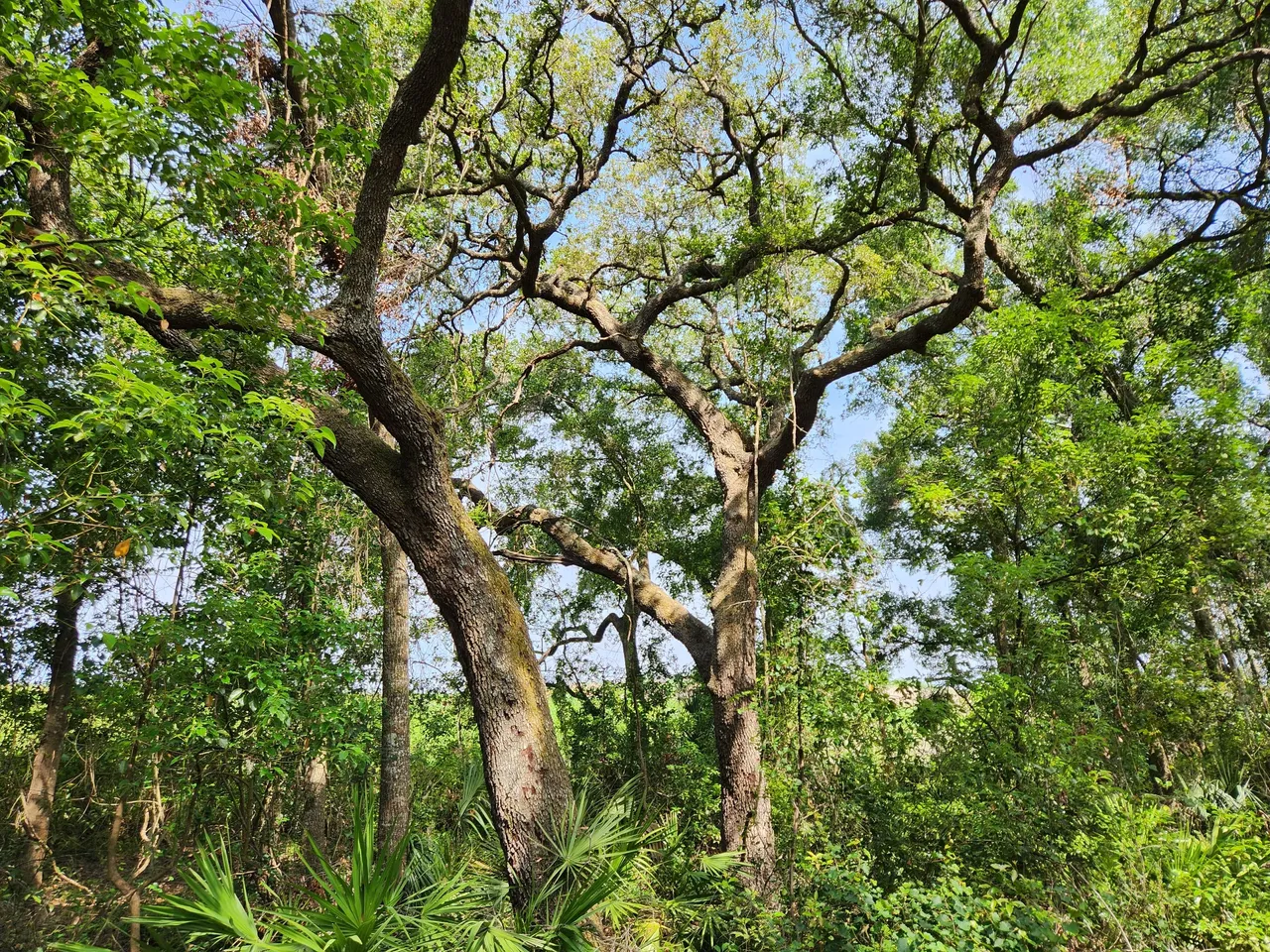
The fun part about being the only ones on this trail is getting to stop and just take in the views. While a lot of the trees were quite young here and there was some development not that far away but you could hardly if at all see those homes. There was enough of a tree cover to still feel in the woods.
There were also quite a lot of butterflies and even birds at this location. They went on with their business like we were not even here. Thankfully we did not run into any larger wildlife here like bears which some future trails I’d like to take have warning about such things occurring.
There was then quite a sharp turn. A few steps after that the trail forked. One path looked like it looped you back near the start where we had already seen someone exiting the trail. The other one led to a dead end.
Since my location on the AllTrails map was not quite lining up I just assumed that the paved path would take us on the loop back. While the cleared-out spot without a paved path would take us to a dead end.
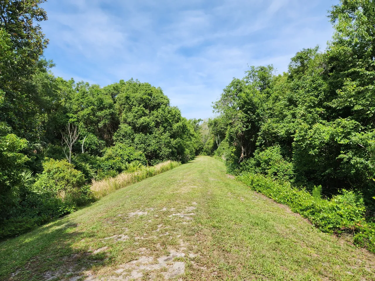
Turns out I was quite wrong. It appears at least as far as paved paths goes this trail is not a true “loop.” The loop part was an unpaved clearing. Why this clearing was even there? I can only guess.
I realized this after taking about 10 steps and checking the AllTrails map that I was not where I thought I was. You could say I was now lost in the woods! We decided to fully go down this path just to make sure it would loop back towards the start.
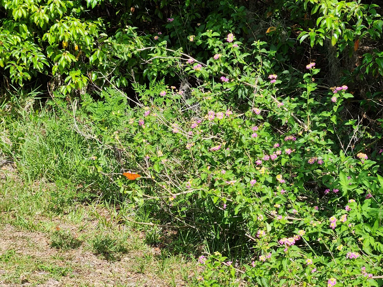
Along the way, we stopped to check out quite a few different flowers and bushes. The butterflies seemed to love this spot.
Over time we walked far enough to see the sidewalk and road that would take us back to the car. That is when we turned around and walked back through this clearing to get back to the paved path we left from.
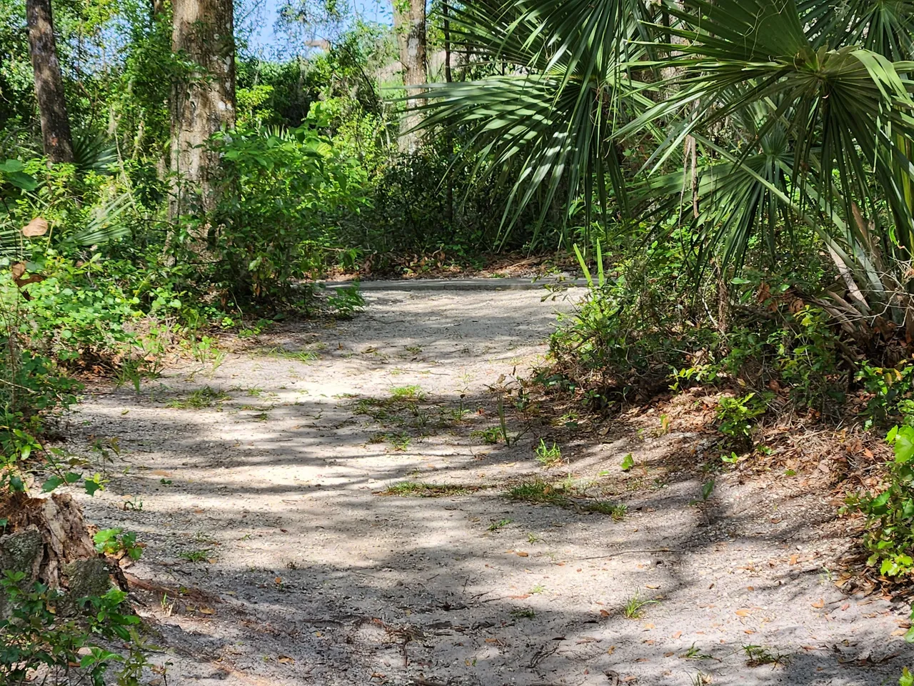
After a little further walking beyond that point I noticed there was a dirt path that went off the main path. AllTrails also had this spot marked as well. Since this time I knew where we were on the map we headed down the dirt path to see what kind of views that would lead to.
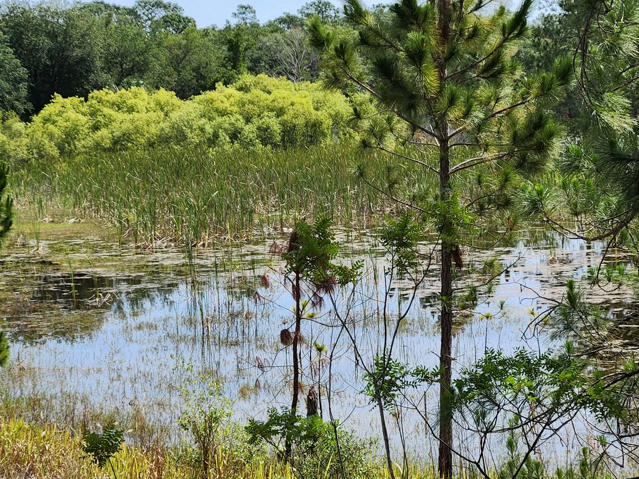
A few steps later we got this view of this marsh swap. There was also a single bench up on the hill we were on. Seeing what was carved and written into the bench I can only assume this was some kind of teen hanging out spot. Thankfully this spot was empty at the time.
This was also the only spot that had any trash in it. The rest of the trail was quite clean and people seemed to have enough respect for the place to hold onto their trash till they reached one of the many trash cans. Not this spot.
A short break here was had. I wanted to scan the waters to see if I could spot any gators. There appeared to be nothing whatsoever in the waters down below. Which I at least thought was great. As we did not want to run into anything unexpected in the wooded parts anyways if anything were to crawl away from this watering hole.
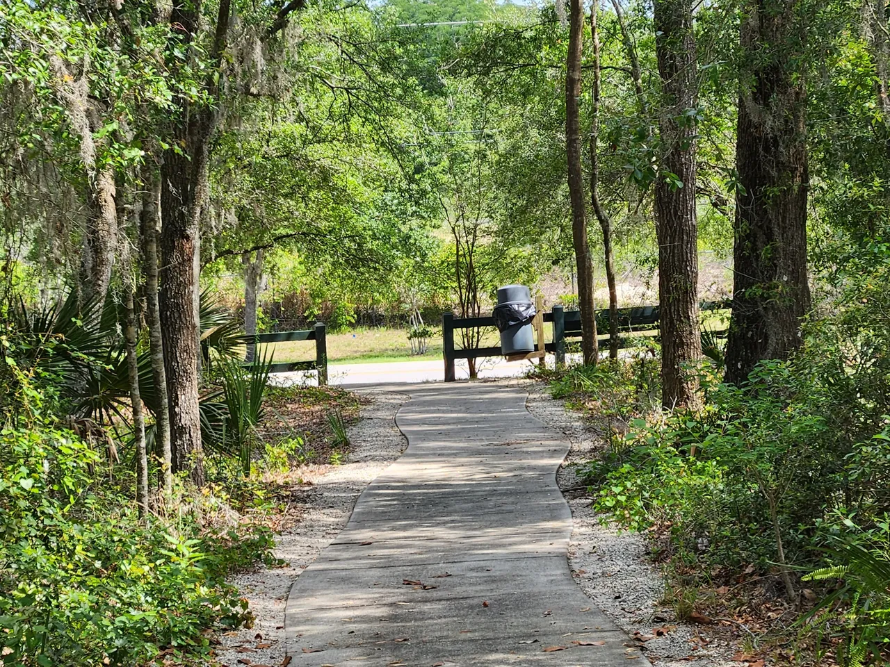
It was then time to get back on the paved trail. A bit of a walk later we hit the dead-end that connected to a sidewalk that went along a major road. We where now at the north spot on the map. It was great to know at least that if you wanted to just walk here you could take this path to get in from the road.
The only issue was there was only a sidewalk in one direction on this side of the road. The other direction did not have a sidewalk and you would have to walk across a decently busy road if you were coming from that direction.
Final Thought
We then walked back the entire paved path we came from that took us back out onto the sidewalks that ran along the parking lots. Before I knew it we were back in the car and it was time to leave.
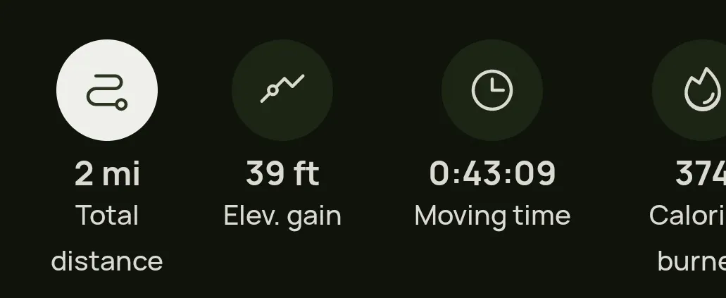
The AllTrails app showed that I ended up hiking 2 miles and had an elevation gain of 39 feet. This took a total of 43 minutes since we stopped quite a few times to take in the surrounding and to work out when I got lost.
It was nice to get out into nature even if it was not that deep into the woods. It was also nice knowing that even though I was lost I was not lost. This trip ended up teaching me quite a few things and some stuff I need to keep in mind when using the AllTrails app.
I’m hoping to use the app again at some point and try out a different trail. I still feel I need some further experience using it before I’d trust going on a much longer trail. Even more so since this entire trail, we had internet access. I know full well that will not always be the case.
Other Content
- Switching Worlds | Blueberry Fest
- Switching Worlds | Visiting The Manatees
- Switching Worlds | The Start Of My IRL Adventures
Information
Photos were taken and content was written by @Enjar about my personal experiences in the real world away from the computer at home.