Nature is still nature: Gullfoss, Geysir, Þingvellir
As this was my Mom and Dad’s first time visiting Iceland and it was only a one week trip, they decided to visit only the famous highlights of this country.
They started with The Golden circle route which was in the south of Iceland, The Blue Lagoon was also included in this route.
They headed to Gullfoss waterfall after they checked out from Reykjavik. On the way to the waterfall, the landscape was amazing, the wrinkled lava, naked hills and mountains (treeless environment).
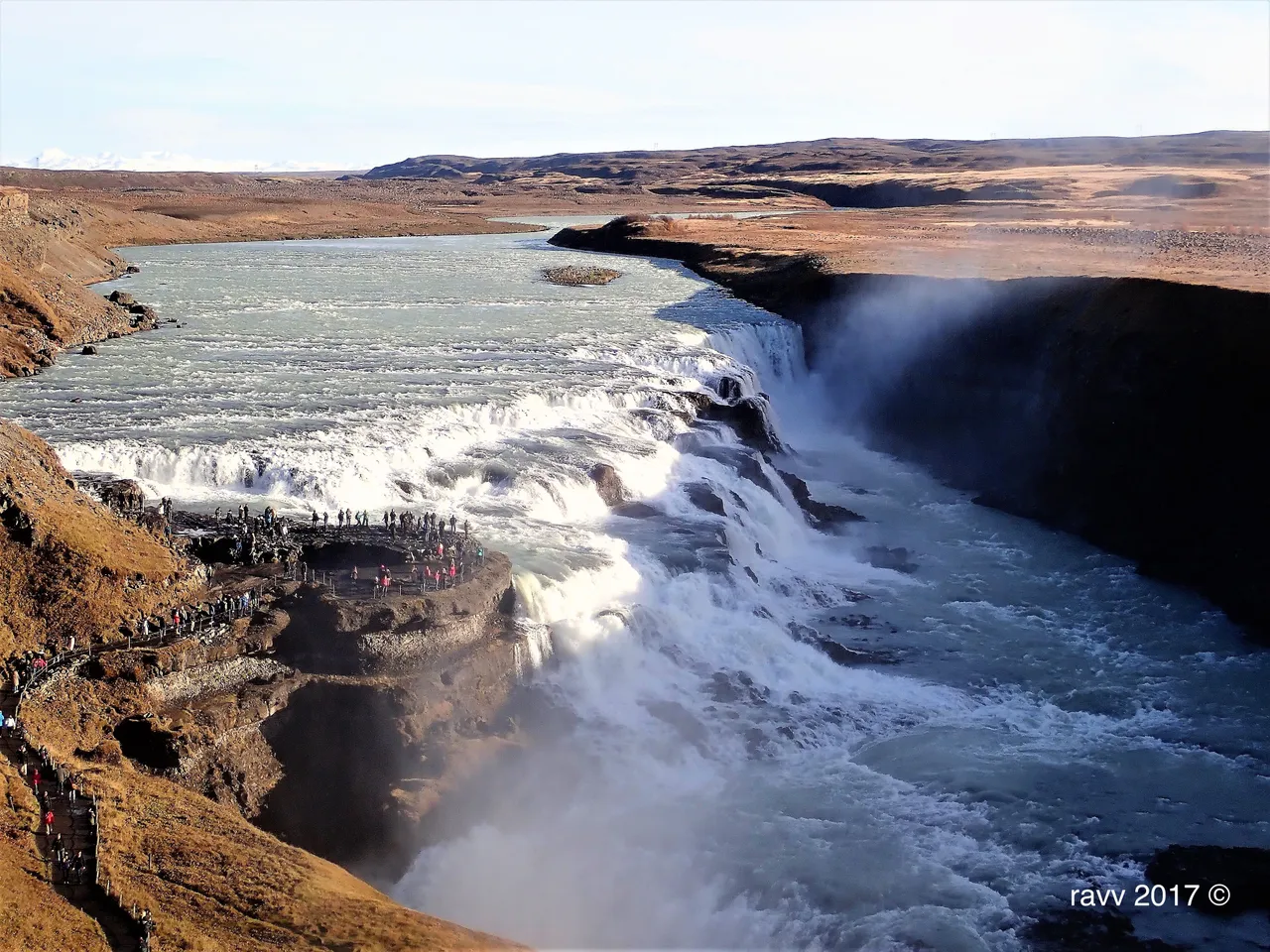
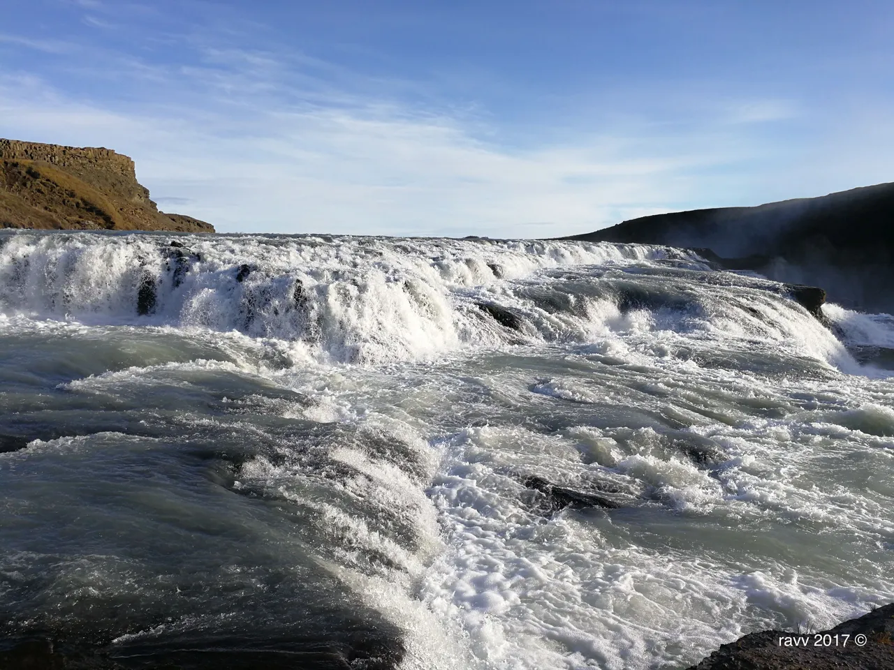
Gullfoss (Golden) is an iconic waterfall located in the canyon of Olfusa river in southwest of Iceland. It is a double cascade flowing across two tiers, at right angles to each other, the mass of the water is from the river Hvitá. The height of the upper waterfall is 11 meters and that of the lower one is 20 meters. The total height is 31 meters.
The Gullfoss gorge is approximately 2.5 km in length and up to 70 meters in depth. It is likely that Gullfoss was given its name because of the golden evening hue which often colours its glacial water.
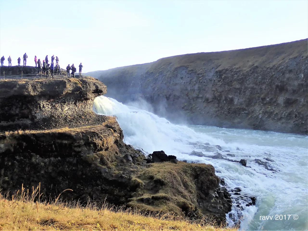
Gullfoss’ story is very interesting. In the early 20th century, foreign investors wanted to harness the power of Gullfoss to produce electricity, but the owner’s daughter at that time defended very aggressively against this project, even threatened to throw herself into the waterfall if the construction were to begin.
Her name was Sigriõur Tómasdóttir. Her attempts failed in court but before any damage was done to the waterfall the contract was disposed due to the lack of payments of the rent fee. Sigriõur’s hard effort to preserve the waterfall brought to people’s attention the importance of preserving nature and therefore she is often called Iceland’s first environmentalist.
Currently, Gullfoss belongs to the Icelandic government and it was designated as nature reserve in 1979 to permanently protect the waterfall and allow the public to enjoy this unique area.
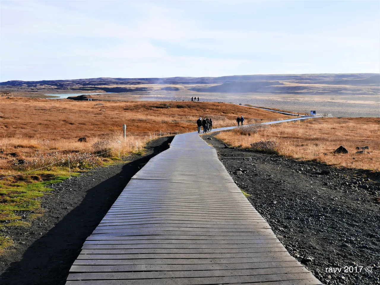
Then they proceeded to the most famous highly active hot spring, Geysir in Haukadalur which was not far from Gullfoss.
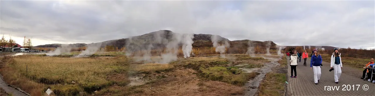
The name Geysir derived from the old west Norse word for “gush”. The geothermal field is believed to have a surface area of approximately 3 km².
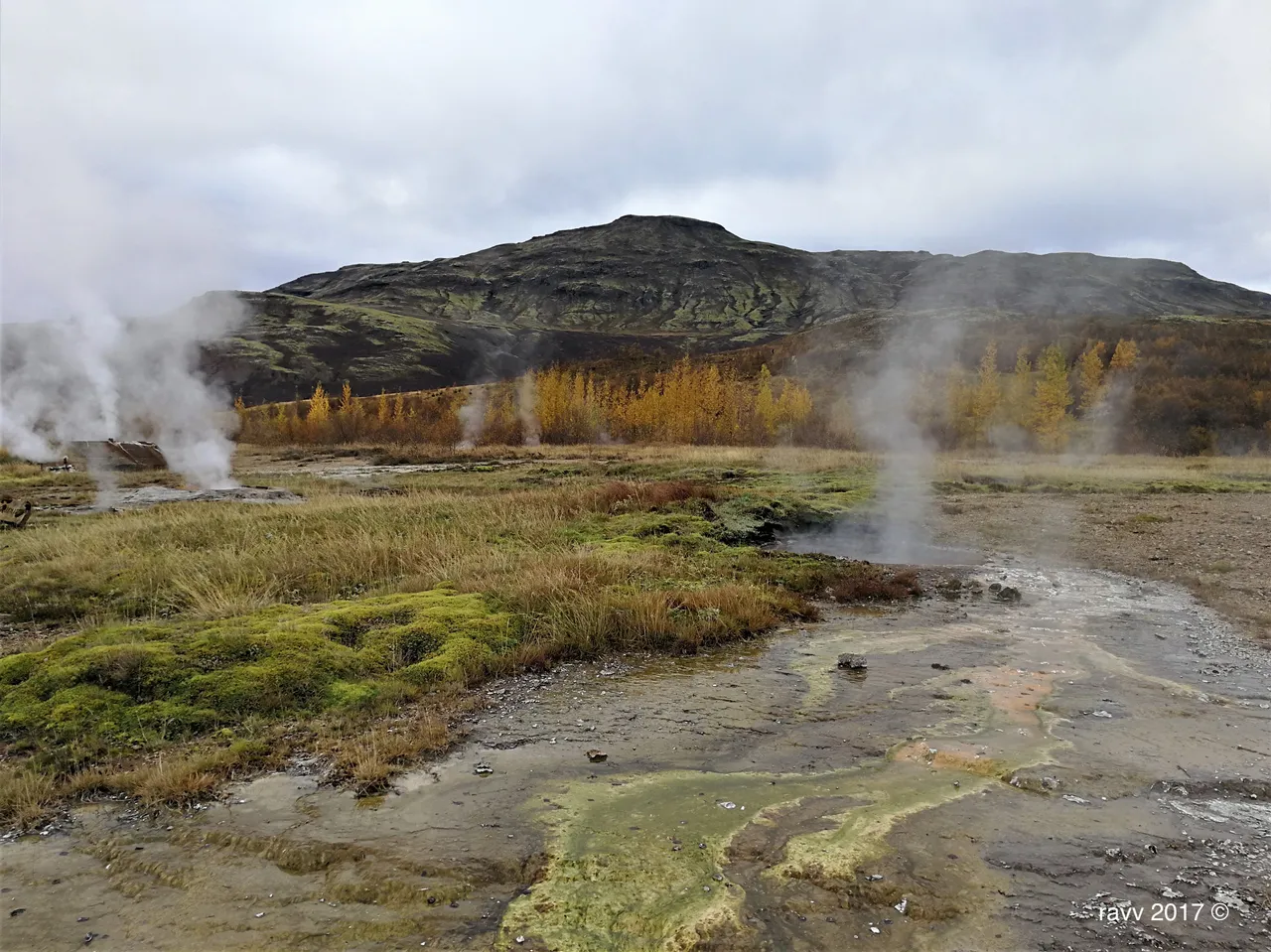
Most of the springs are aligned along a 100 meters wide strip of land running in the same direction as the tectonic lines in the area.
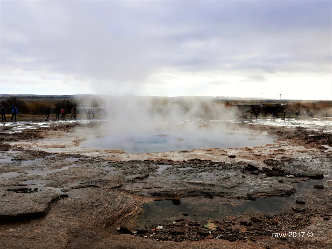
The great Geysir (Strokkur) spouts water 30 meters (100 ft) into the air every few minutes. The area became active more than 1000 years ago and comprises more than a dozen hot water blow holes.
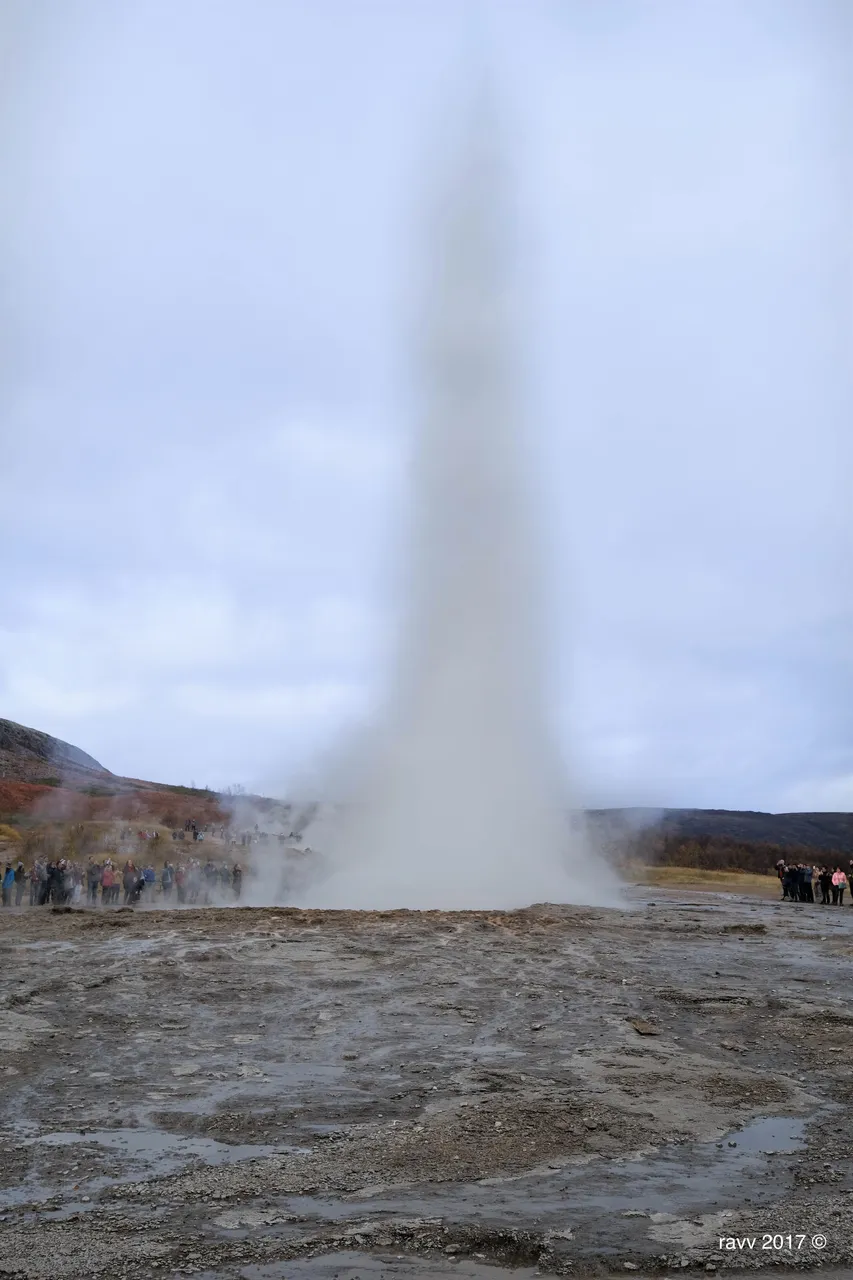
The underground water comes into contact with hot bedrock and heats up, building pressure and when the water has reached peak temperature and pressure it sprouts out from the geyser into the air. The water is extremely hot; therefore, people are not allowed to be closed to the hot spring.
My parent had a good buffet lunch at large cafeteria at Geysir. The next place was one of my mom favourite places in Iceland, Þingvellir.
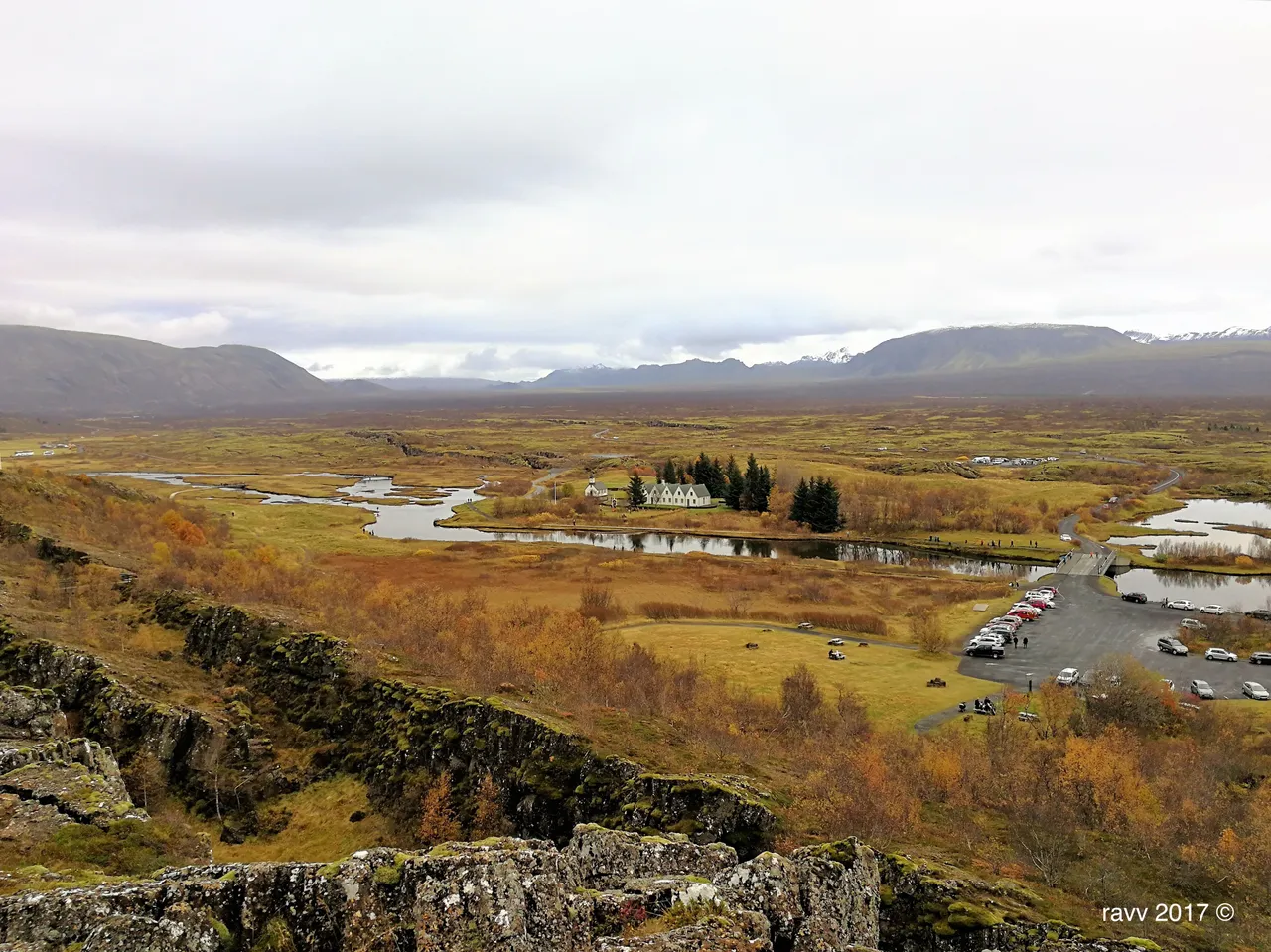
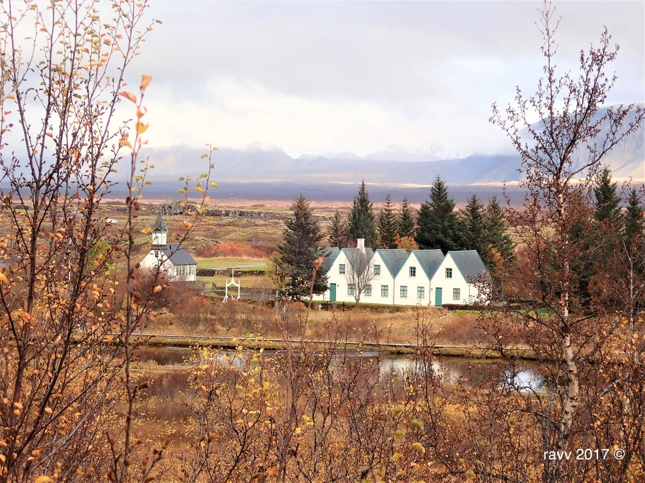
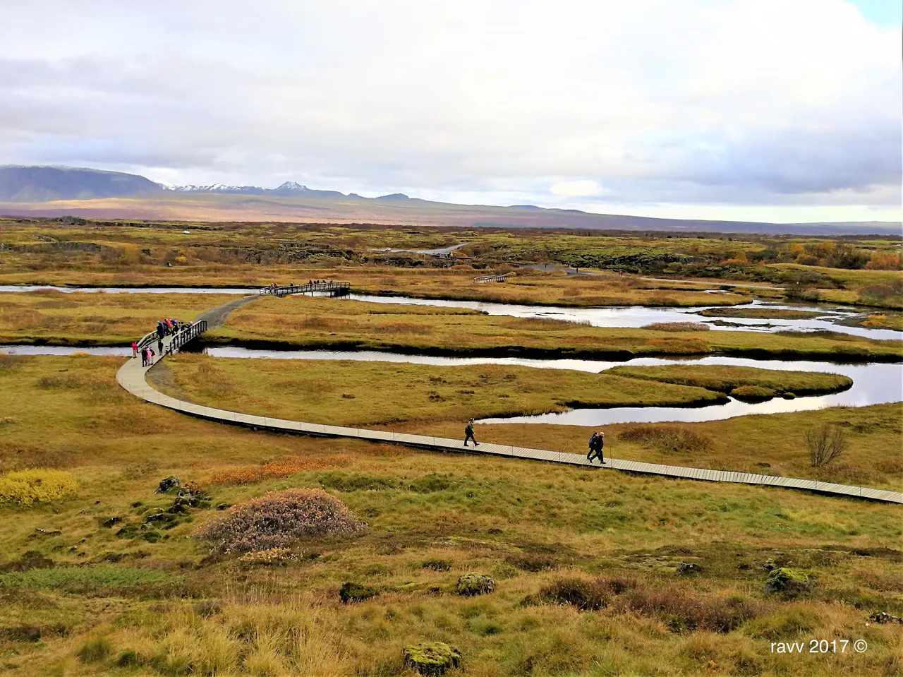
Þingvellir National Park is a historical, cultural, and geological site.
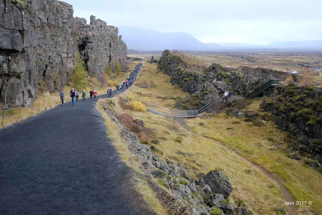
It is the valley between the continents. The core of the national park lies in a rift valley that marks the crest of the Mid Atlantic Ridge and the boundary between the North American tectonic plate and the Eurasian plate.
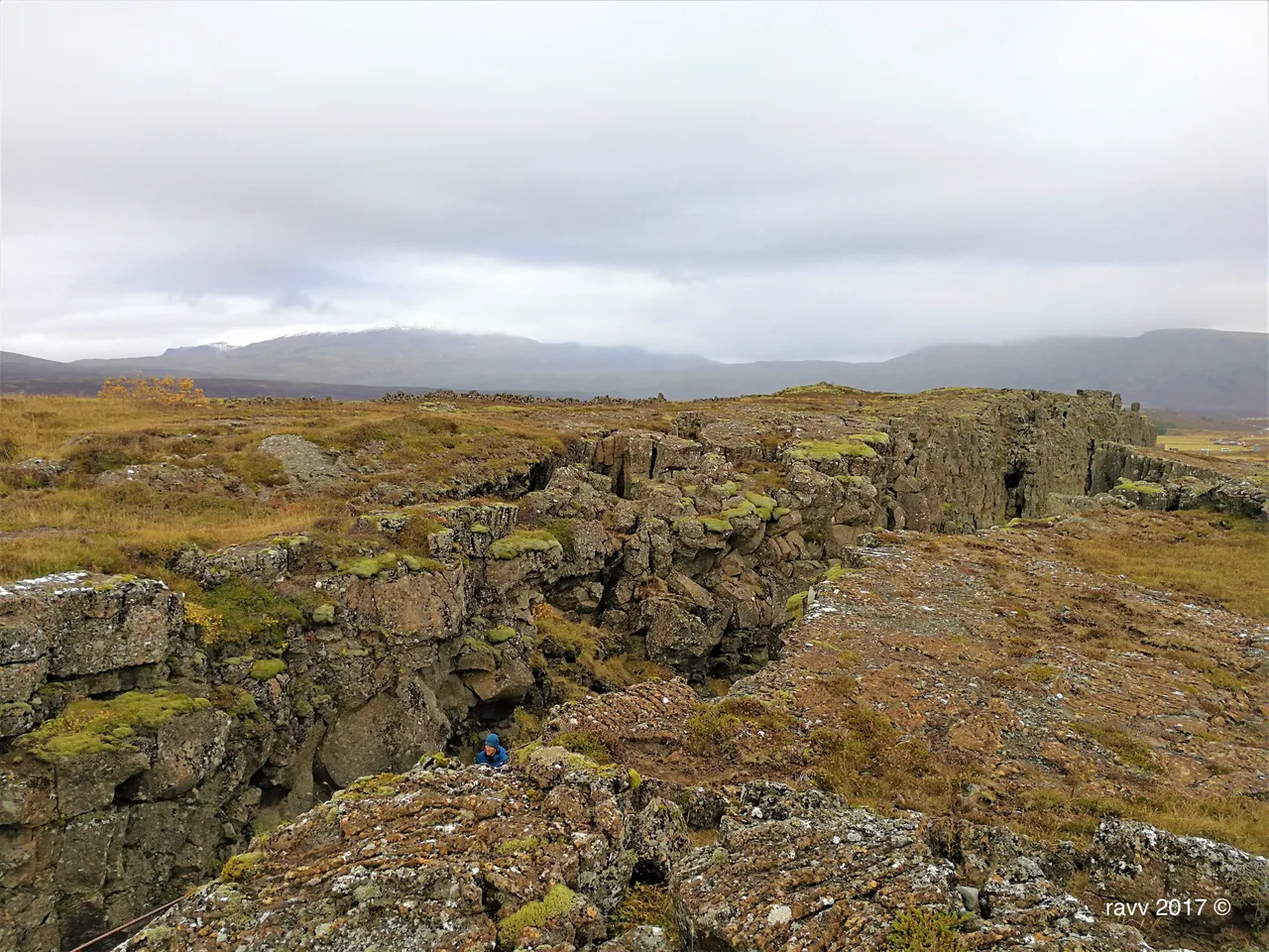
Nowhere else in the world is the drifting apart of two continental plates as evident as here.
Þingvellir National Park is located in an active volcanic area, just 49 km east of Reykjavík, and covers 24,000 hectares, of which 9,270 hectares constitute the World Heritage property.
Its best-defined feature is a major rift, which has produced dramatic fissures and cliffs demonstrating inter-continental drifting in a spectacular way. The National Park is enclosed by mountains on three sides, featuring grass-covered lava fields, and Lake Þingvallavatn (the largest natural lake in Iceland) lies at its southern end.
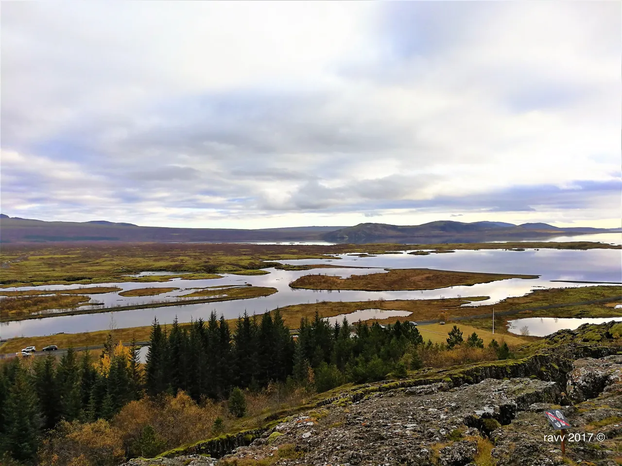
This outstanding scenery gives the area its unparalleled value. Þingvellir is associated with the Althing, the national parliament of Iceland, which was established at the site in 930 AD. Sessions were held at the location until 1798.
Althing is one of the oldest parliament in the world.
Unfortunately, my parents arrived Þingvellir in the late afternoon, so they didn’t have time to explore this beautiful and very interesting place. Just look around for two hours, they missed a lot of things here. So my mom has a good reason to come back to visit Iceland again :)
Facts and Information from:
Iceland Marco Polo Travel Handbook