Due to the release of the 2018 New Tibet Line (National Highway 219) yesterday, the most complete self-driving strategy for Lhasa and Ali sections! Many netizens hope to update the second half of the Raiders after they finish reading. That is, Ali travels to Xinjiang. I spent a night finishing photos and writing them overnight. Because many photos have been taken, the photos in the text are not One shot, the above photos and text are my original, for reprint, subject to my consent!
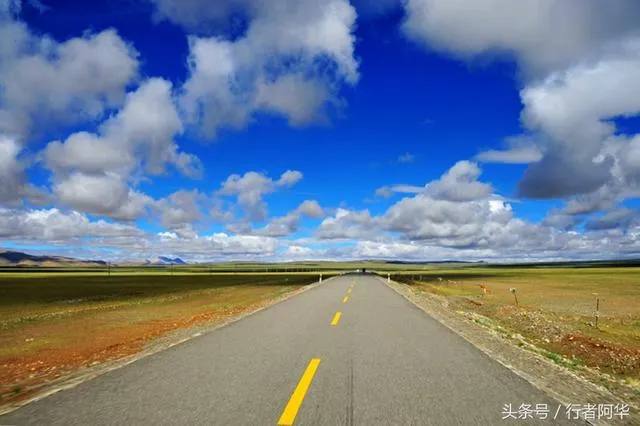
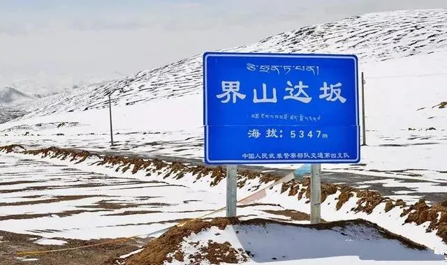
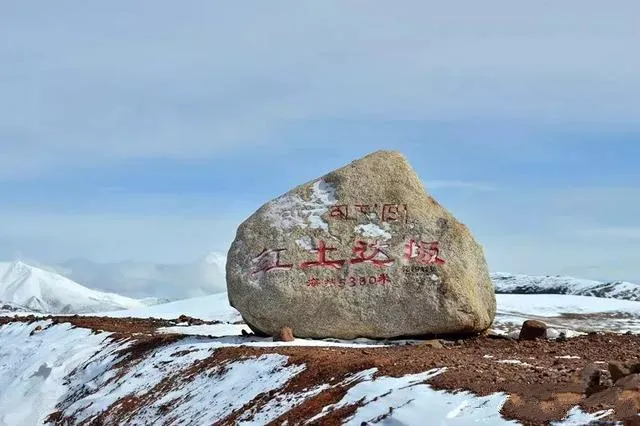
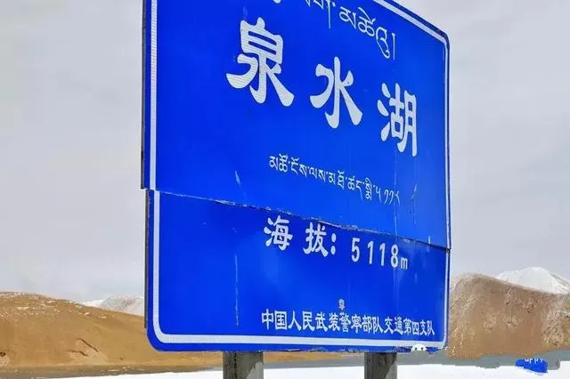
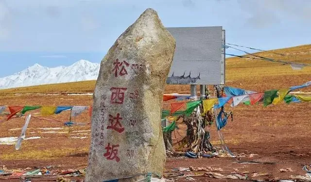
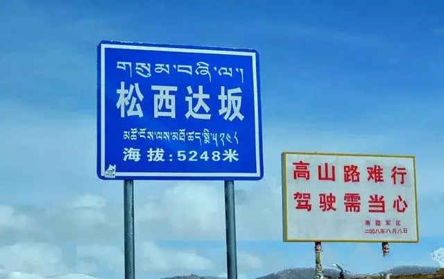
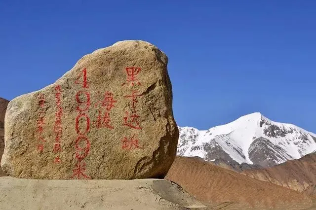
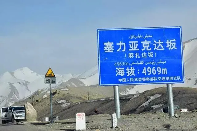
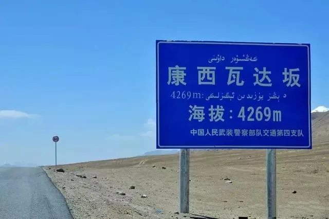
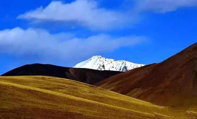
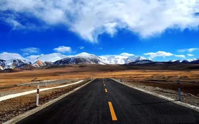
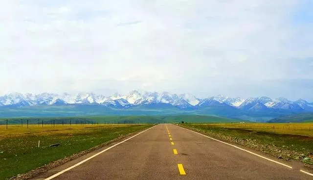
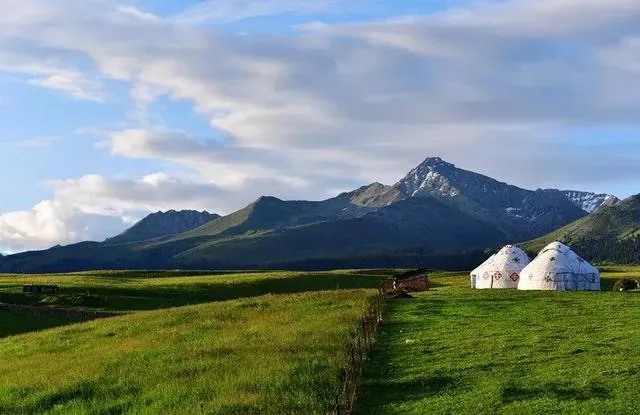
After crossing Alishan from Tibet, it reached the Dahongliutan area in Xinjiang and reached a distance of more than three hundred kilometers from the Dashan Mountain to the 30-mile camp in Xinjiang. It is also the highest section of the entire Xincang line. After passing through eight escorts over 4,000 meters, five of them are over 5,000 meters above sea level. This is truly the third level in the world and the true meaning of heaven!
Day 9-10: Ali-Ban Gong Cuo Lake-Xinjiang Dahong Liu Beach-Thirty Miles Barracks-Yecheng
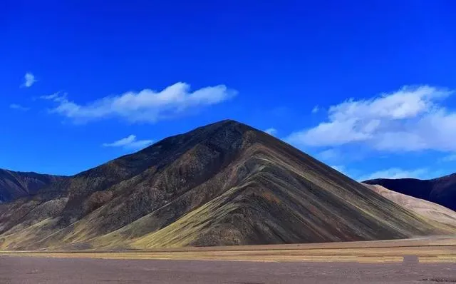
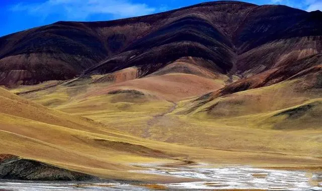
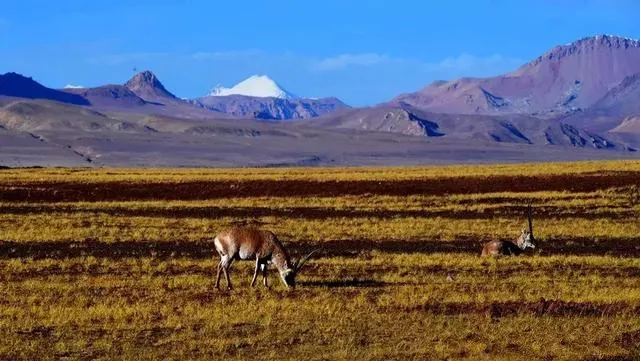
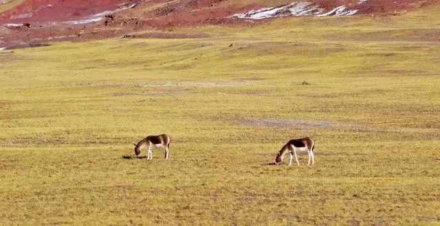
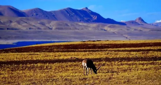
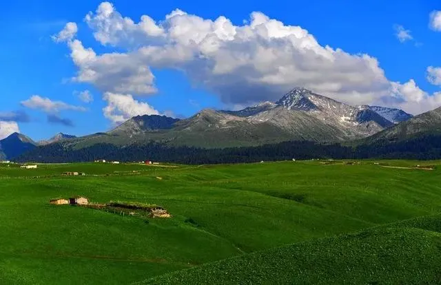
After entering the territory of Xinjiang, the holy mountain of Shenshan Mountain disappeared, and it turned into a deserted Gobi and grassy beach. The sky is still blue. However, all along the rolling brown mountains of Yanjin, as if entering another space.
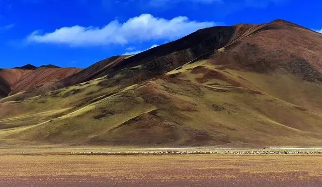
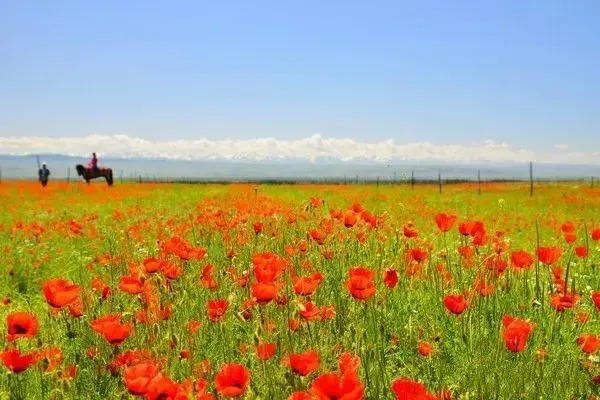
On the deserted grassy beach, Tibetan wild asses and Tibetan antelopes are often seen eating grass, adding some vitality to the desolate scenery.
Day 11: Yecheng-Kashgar-Gol ancient city
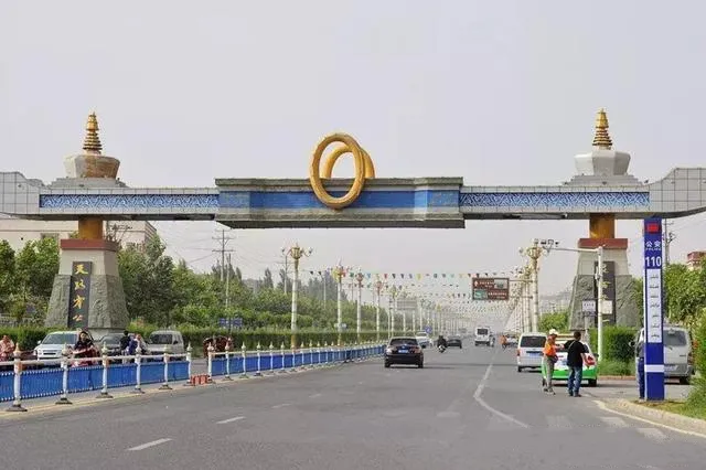
From Ali, along the 219 National Road, the starting point of the new line is Yecheng, which is about 1,100 kilometers. It is the highest in the entire Tibetan-Tibet line and has the worst weather. It is also the most difficult part of the time, except for the 30-mile barracks on the way. Outside of the accommodation, there are only military stations and checkpoints in other places. Therefore, the normal journey of this section is completed in two days. After reaching Yecheng, it seems as if it has returned from the primitive society to the feeling of a modern civilized society.
This is the starting point of the new Tibet Line, Yecheng. This large zero (0) is the starting point.
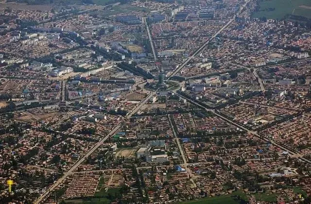
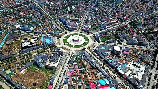
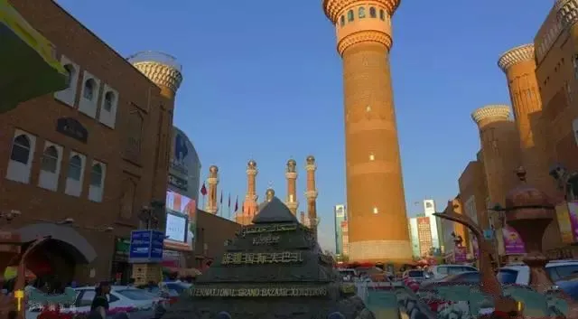
Yecheng is the southern Xinjiang region of Xinjiang. It is very close to Kashgar, the center of southern Xinjiang. So it usually goes to Kashgar. Kashgar is an abbreviation for Uighur “Kashgar” transliteration. Its source language is a combination of Turkic, ancient Islamic, and Persian. It has the meaning of “a brick house” and “a place where jade is concentrated”.
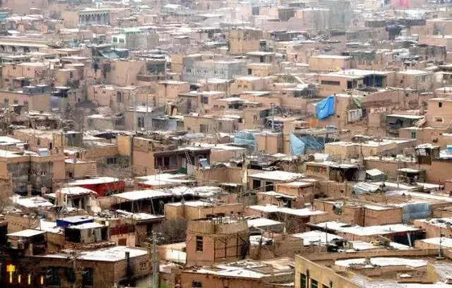
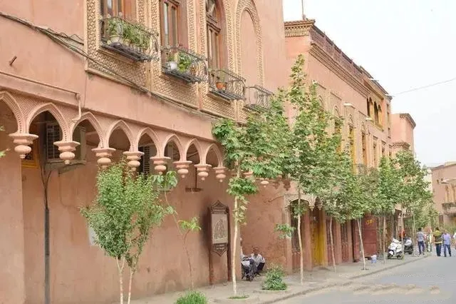
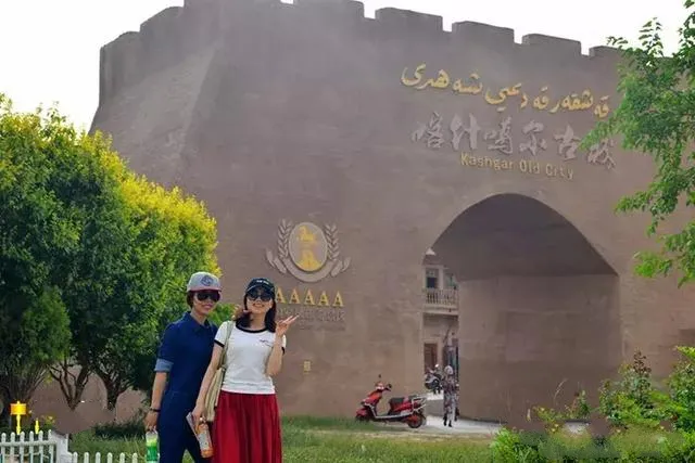
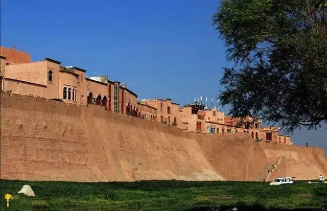
Kashgar is known as Shule. It is a famous historical and cultural city in Xinjiang. Kashgar is divided into the Old City and the New City. The Old City, we mainly refer to the ancient city of Seoul. Gur ancient city has about 20 square kilometers. In ancient times it was called "Panyu City" and its predecessor was Shule City in the Western Han Dynasty. It is said that Zhang Jian had the earliest written record of the ancient city of Kashgar more than 2,000 years ago.
Kashgar was known as Kashgar in ancient times and was the largest city in southern Xinjiang for hundreds of years. It is the general meeting point of the north, middle, and south line of the ancient Silk Road. It has always been a transportation hub and a commodity distribution center for trade between China and the West. It is well-developed and has the geographical advantage of “five to eight countries and all the way to Europe and Asia”.
"Not less than Kashgar to Xinjiang, not to the ancient city of Seoul is not to Kashgar," so the ancient city of Seoul is the most representative historical and cultural landscape in southern Xinjiang.
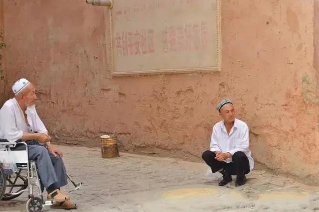
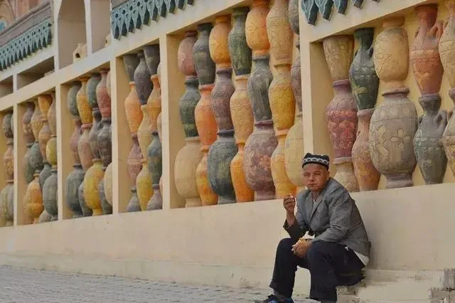
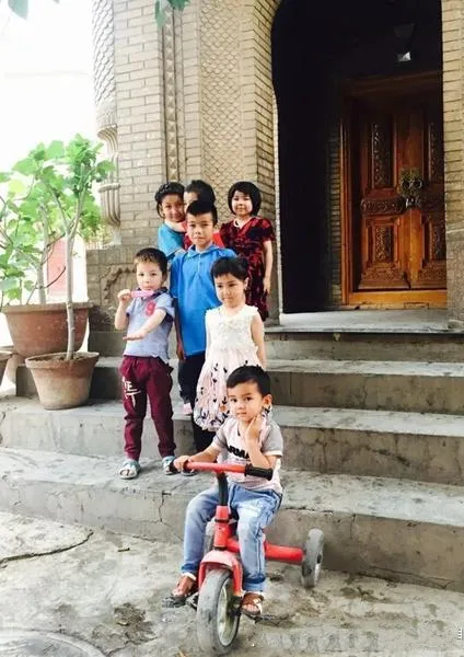
Gaotai Dwellings is a Uighur nationality settlement built on a high cliff more than 40 meters high and more than 800 meters high in the northeastern part of the old city of Kashgar. It has 600 years of history. It is a display of ancient Uighur dwellings and folk customs in Kashgar. Big landscape.
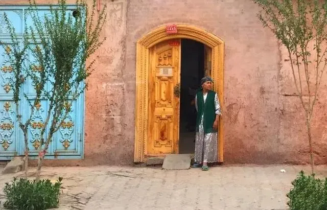
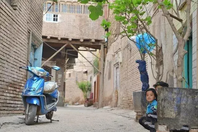
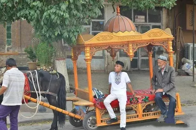
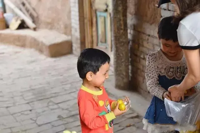
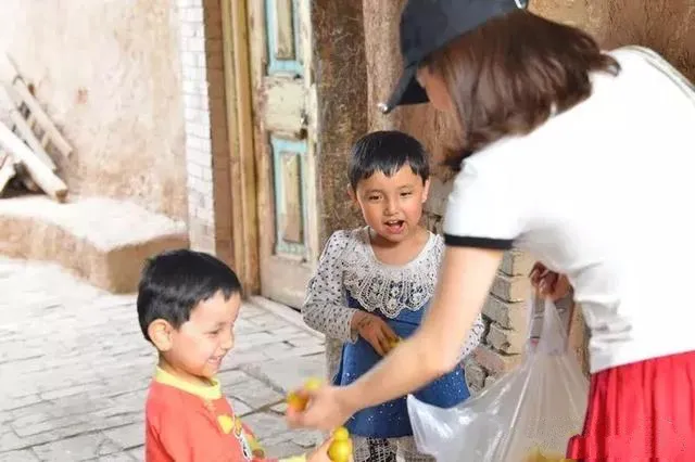
Carrying a bag of apricots to visit high-rise residences, where some local residents are still living. Many children in the alleys are playing. When we meet, we are very shy. We take the apricots to give them food. We almost feel embarrassed to pick them up. Usually we are Take it on their own initiative. Even if they take it themselves, they only take one or two and they won't take much. Judging from the circumstances we encountered, children in Xinjiang are much more primitive than those in Tibet.
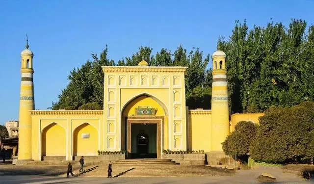
This is the Etigu Mosque in Kashgar and the most representative mosque in southern Xinjiang. It was built in 1442 and covers an area of 25.22 mu. It is one of the largest mosques in Central Asia and a place where local Muslims pray.
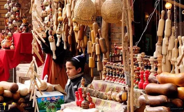
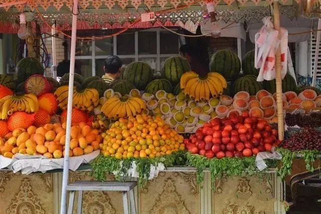
Various fruits sold in the ancient city of Kashgar
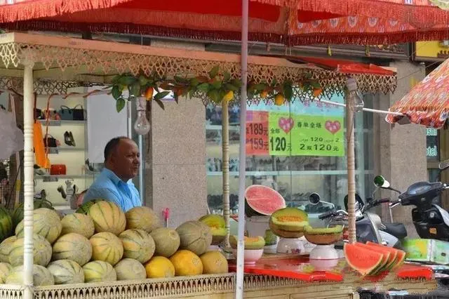
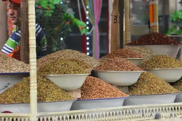
Various dried fruits
Xinjiang's favorite grilled oysters.
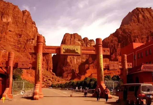
Day 12: Kashi - Aksu - Kuqa - Kuche Grand Canyon
Starting from Kashgar in the morning and passing through Akesu City south of Seiwai, it arrives at Kuche County. The “Kuche” is the ancient Kucha language, which means “the city of Kuchai”.
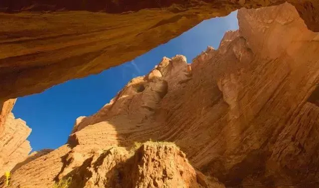
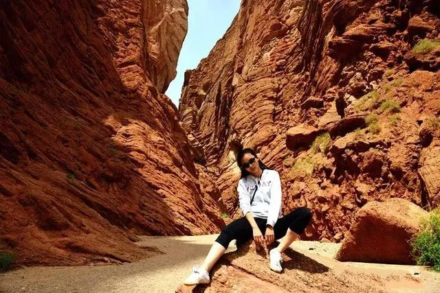
The focus is on the Kuche Tianshan Grand Canyon, a gorge in the Kiziliya Mountains, a branch of the Tianshan Mountains. It is formed by red-brown rocks that have been subjected to hundreds of thousands of years of wind erosion in nature. The reddish-brown mountains crowded into the sky, and in the sunlight it was like a cluster of burning flames. The canyons have winding streets, and do not have caves. The mountains are in various poses. The peaks and ridges are inserted into the sky. There is a ditch in the ditch and a valley in the valley, giving people a feeling of tranquility and mystery.
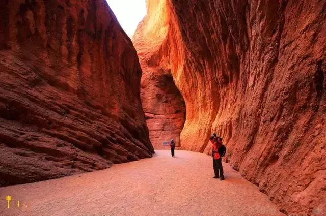
The Tianshan Mysterious Grand Canyon is also called the Kezilia Grand Canyon, which is located in the northern part of Kuche County in the Aksu Prefecture of Xinjiang. Kylia Uyghur means “red cliffs” because the Grand Canyon consists of red-brown giant mountain groups. The red-brown mountains of the Tianshan Mysterious Grand Canyon line up in the sky. Under the sunlight, it is like a cluster of burning flames.
Into the valley, walk in the red-brown mountains, as if into a quiet and cool world. Taniguchi is very open, but deep into the valley, the peaks and turns, sometimes broad, sometimes narrow, winding streets.
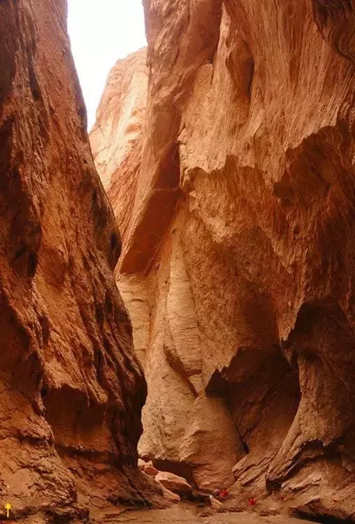
Under the reflection of the blue sky in the valley, there are many different peaks and strange shapes. There are countless sights such as Shengu Shougu, Xuantian Castle, Xianling Cave, Yuquan Spring, and Humming Peak.
The Grand Canyon is a Danxia landform as a whole. A dozen colors, such as red, yellow, orange, and yellow ash, add radiance to each other, giving people a striking beauty in the sunlight. The canyons are mostly flat hiking trails. Because of the streams, the air is moist and relatively cool. Therefore, it is relatively easy to walk on the trails. It is a leisure spot worth visiting.
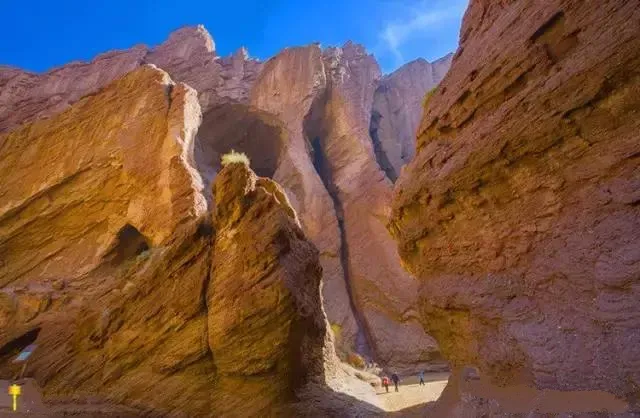
Taking pictures inside the Grand Canyon is great!
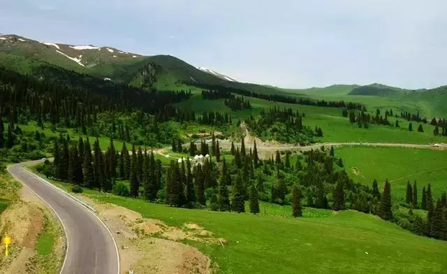
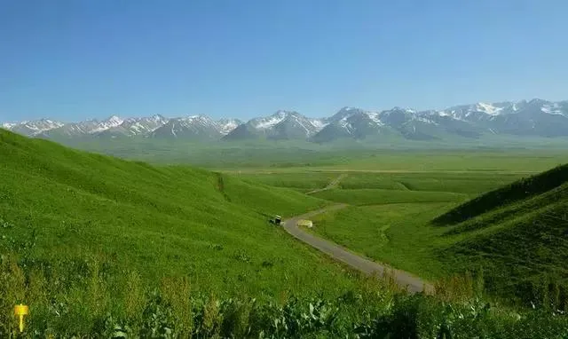
Day 13: Kuche Grand Canyon - Independence Highway - Bayinbrook - Nalati
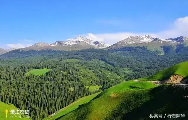
In the morning, proceed from Kuche along the magnificent and exclusive Kuchi Highway to Bayinbuluke, the exclusive Kuchi Highway, and the road from Dushanzi to Kuche. A total length of 561 kilometers, connecting the highways of northern and southern Xinjiang. The mountains pass through mountains and valleys, go through deep mountain valleys, and connect with many ethnic minority communities, making them the most beautiful roads in Xinjiang.

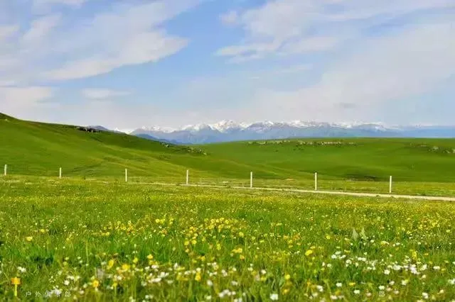
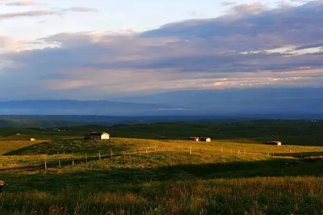
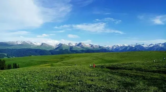
In the intermountain basin in the middle of the Tianshan Mountains, there is a beautiful grassland, Bayinbuluke, which means “rich spring water” and is the second largest in China after Erdos in Inner Mongolia. grassland.
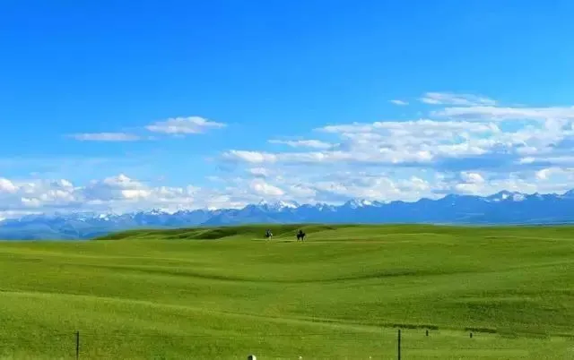
The vast grassland of Bayinbulak is like a huge velvet rug. It is dotted with numerous streams and lakes dotted with lights, and even under the sunlight it emits a diamond-like luster.
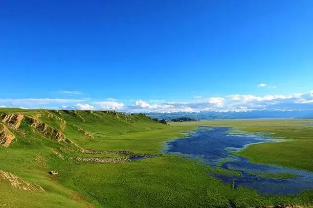
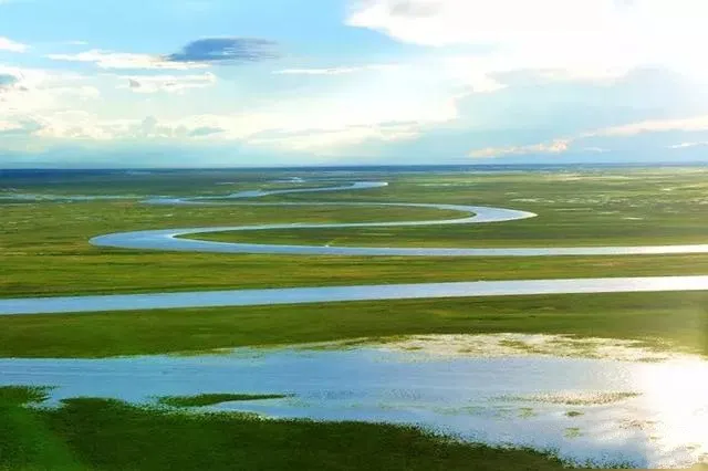
In addition to the beautiful scenery of the high mountain savannah and the Swan Lake, Bayinbulak is also famous for its nineteen bends. The river is meandering and twisting.
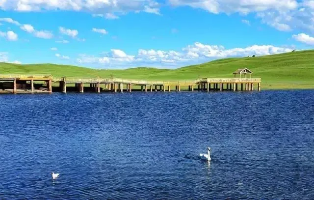
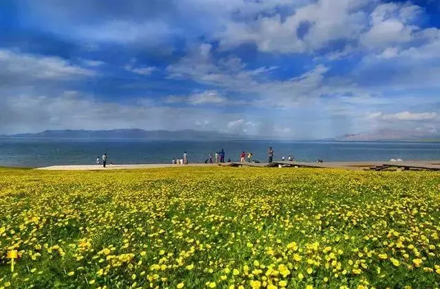
Bayinbrook Swan Lake
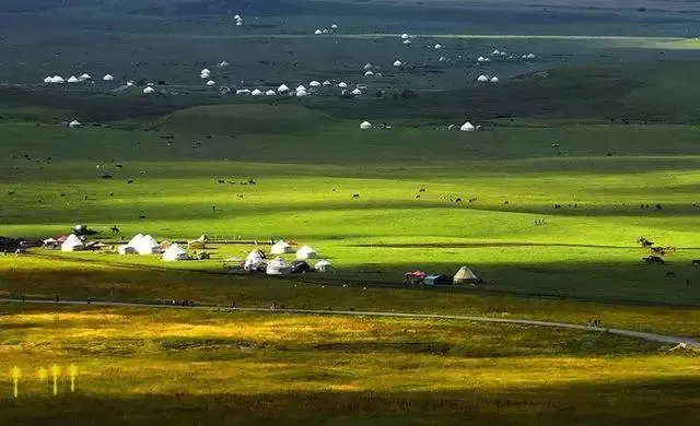
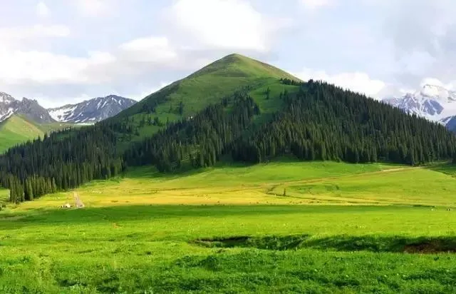
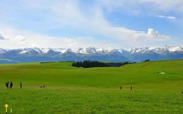
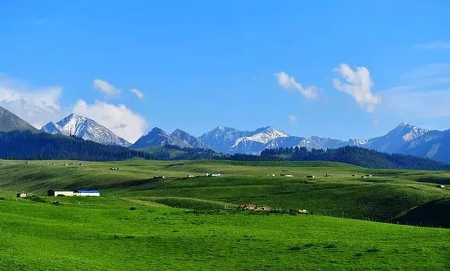
Leaving Bayinbulk soon reached Nalati’s aerial prairie. Nalati grassland is located in the eastern part of Nalati Town, Xinyuan County, Xinjiang. It has been a famous pasture since ancient times. Nalati Grassland is also known as Gong Naisi Grassland. Turkic means “White Mountain”. "Slope", the beautiful grassland scenery combined with local Kazakh folk customs, attracts many tourists.
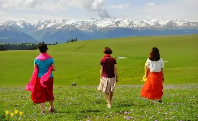
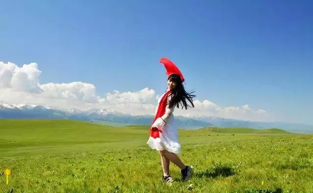
In Narathi’s vast expanse of grassland, there is a pearl-like snow-covered yurt. On the south side of the grassland, there are snow-capped peaks all year round. The green grass and snow peaks gleam together to form an impressive picture. Here you can Experience the beautiful scenery of the high-altitude prairie grasslands where winds blow grass and cows and sheep, and experience the local customs of Kazak!
According to legend, when Genghis Khan expeditioned, there was a Mongolian army marching from the depths of the Tianshan Mountains to Yili. When it was spring, the mountains were full of snow and snow. Hunger and cold made this army fatigued and did not want to turn over the mountains. It was a brocade. The prairie grasslands, dense springs, and flowing waters are like entering another world. At this time, the sky is open and the sunset is like blood. People can't help but scream “Nalati (there is the sun), Nalati” and stay behind. This place name.
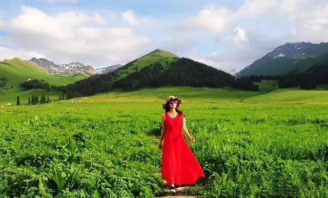
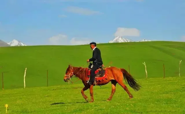
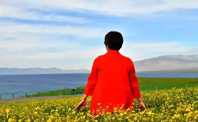
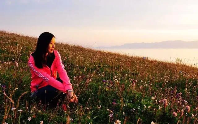
Of course, beauty can not be missed in the beauty, because someone in the beautiful scenery, the landscape will be more vivid!
Day 14: Nalati - Xinyuan County - Tianshan Safflower Base - Turks (Bagua City)
In the morning, a proposal was made from Nala. When you travel to Xinyuan County, you can admire a large area of Tianshan Safflower near the town of Zakeketai. The vast expanses of flowers stretch from the sky to the sky. It is spectacular!
The Tianshan Safflower Planting Base is not an attraction, but the local flower farmers will receive a symbolic fee of 10-20 yuan, but it is also worthwhile to capture such a beautiful sea of flowers.
In the afternoon, we arrived in Turks County, the famous Bagua City, which is said to be the Southern Song Dynasty. Qiu Jiji, one of the Taoist Quanzhen Seven, was invited by Genghis Khan. According to the city built by the gossip theory, Bagua City was a radiant circular street. The layout is like a magical labyrinth, connected by roads, streets and streets, and at night in a hotel in Bagua City.
In fact, the panoramic view of Bagua City is invisible. There is not a height on the road to see the whole picture. Only the hot air balloon of the local travel agency is chosen. However, the cost is very high. Of course, if there is a drone, you can also shoot Bagua Panorama!
Fifteenth: Bagua City - Kala Jun - Qiongku Shitai
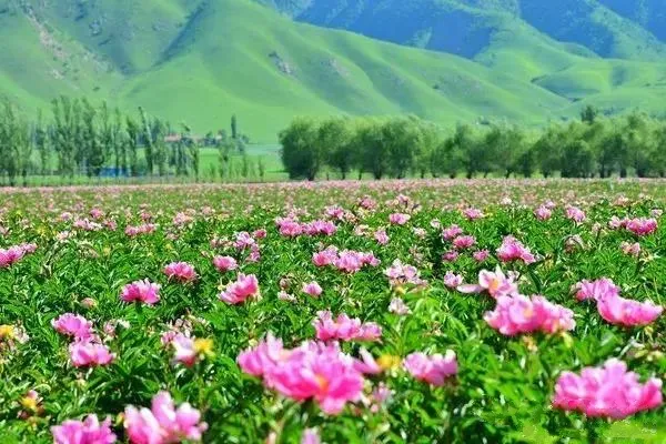
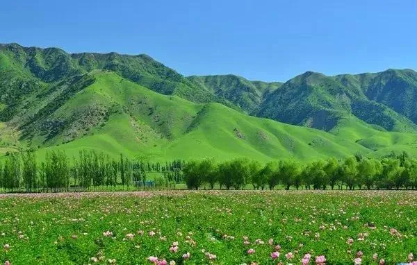
In Turks, besides the magical Hachiman Castle, another famous scenic spot, Kala Jun, must not be missed. “Kara Jun” is a Kazakh language. “Kala” has a dark, rich and vast meaning. “Jun” describes it. In a lush manner, literally, the “Kala Jungle” can be translated into a vast grassland.
The most beautiful season in Karachon is from May to June of each year. At this time, the flowers in the fields are in full bloom, and the snow-capped mountains stand in the distance and the green grass is near!
Kalah Jun is rich in precipitation, cool in climate, and hypertrophic in soil. It is a transitional zone between the West Tianshan Mountains and the Yili River Valley. It is a typical alpine five-flower meadow natural prairie. There are hundreds of high-quality forage grasses growing in the world. The best natural pasture.
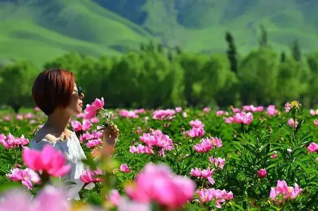
In the summer Khalil is bound to wear bright clothes or skirts. The beautiful grassland and sea of flowers set off with gorgeous clothes, and they become part of the landscape.
The distance is the scenery, the near is the shadow

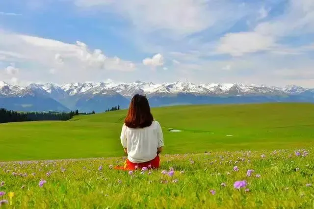
Sitting on the grass overlooking the snow-capped mountains, he has become a painter himself.

Facing picturesque scenery, I just want to sit quietly and do nothing at the moment.
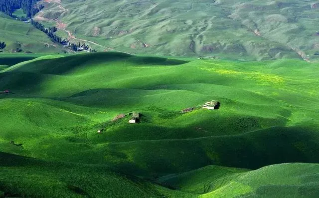
In addition to the beautiful Kharjon, the Qiongku Shi Terrace is also worth a visit. It is a well-kept historical and cultural village in the Ili River Valley. The ecological environment in the village is intact. Snow-capped glaciers, flower-sea grasslands, and valley-forests constitute a paradise-like beauty.
The prairie here is beautiful, delicate, delicate, and at the same time, it has a velvet-like texture. The snow-capped mountains and the prairie complement each other and the scenery is beautiful.
Horseback riding can be enjoyed on the grasslands, and in the evening you can enjoy the stunning grassland sunset. Evening in the Qiongku Shi Taiwan Herdsmen's Inn, friends who like to shoot can also take photos of the starry sky on the prairie.
Many people will ask why they have to come to Qiongkushutai since they have already gone to Karachi because Kalajan is already a very mature scenic spot and there are many tourists who can only visit the designated route. The Qiongkusi station is very primitive, with only a few clubs and self-driving vehicles. The local herdsmen are also very friendly and can truly feel the customs of Ili in northern Xinjiang. Therefore, this is a time when the time is recommended and you can consider coming here!
Day 16: Qiongku Shidai - Bagua City - Yining
It must be early to rise today. The sunrise on the Qiongkushitai grassland is not to be missed. The rising sun awakens the green grassland. The dew on the green grass sparkles with sparkling light. The white yurt is burning and the patchwork is beautiful. On the other hand, the herds of cattle and sheep stretched their shadows in the morning light and formed a paradise-like animation volume.
The scenery along the Qiongkuishi station is also very beautiful, you can shoot a lot of big movies!
After enjoying the sunrise, we headed to Yining, the capital of Yili. Yining is a garden city in the western border of the motherland. Together with Chengdu, it was named "China's Top Ten New Tianfu" and surrounded by beautiful western land. Prairie and mysterious forest. All the way to enjoy the green mountains and waters, stay in Yining City Hotel.
Day 17: Yining - Lavender Base - Horgos - Manzigou Canyon - Salim Lake
Starting from Yining in the morning, first arrived in China's largest lavender base, large swathes of purple lavender flowers, as if taking you into a dream fairy tale world.
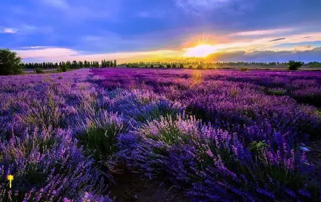
A large area of purple flowers here will surely make everyone excited and can take photos in various poses in the sea of flowers.
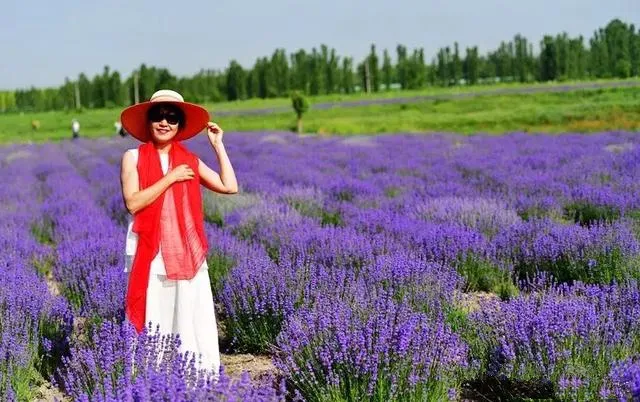

Photo shoot in purple lavender flowers is also very felt
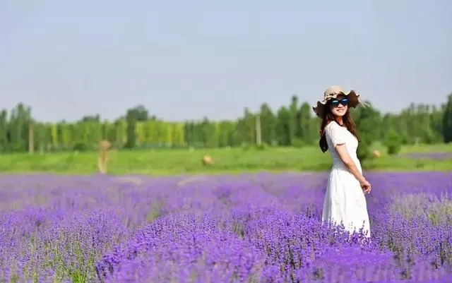
Every shot is like a large block of art


At noon arrived in China's Kazakhstan border state port Horgos. The Khorgos Port is the first class land highway port in China's western history that has the longest history, the largest integrated transport volume, the best natural environment, and the most complete functions. Strictly speaking, if this port is not a special one, besides patting the country, if the time goes by, it does not have to come here.

In the afternoon, after passing through the Guogou Gorge to reach the beautiful bank of the Salim Lake, the Salim Lake is like a sapphire “sapphire” suspended in a fault-depressed basin between the West Tianshan Mountains. The lake is surrounded by mountains and mountains. It was the last place in the warm, moist air of the Atlantic, so it was called the last tear in the Atlantic Ocean.
In the summertime, on the vast grassland near the lake, pastures and grass are everywhere, with cattle and sheep as clouds, pastoral songs, and yurts, forming a poetic picture of ancient silk roads.
Of course, taking pictures in the beautiful sea of flowers by the lake is absolutely a visual enjoyment.
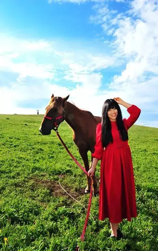
Photographed with a horse on the lakeside, it feels good
Close up of Zhang and BMW

D18: Sailimu Lake - Urumqi
Today must be early to get up and enjoy the sunrise at Salim Lake. The sun rises out of the clouds. It glitters with the dazzling golden clouds and pastures. The water is sparkling. It reflects the golden light and is very fantastic.

At the moment of sunrise, it is also a good time to make a big movie. It must not be missed.

It is also very beautiful to take close-up shots in the sea of flowers.

After enjoying the beautiful scenery of the lake and the mountains, Jinghe, Kuitun and Changji return to Urumqi, the capital of Tibet. After an authentic Xinjiang meal in the evening, it will end 18 days of pleasant and unforgettable itinerary. If there is still time second Days can go to Grand Bazaar and Museum to see!
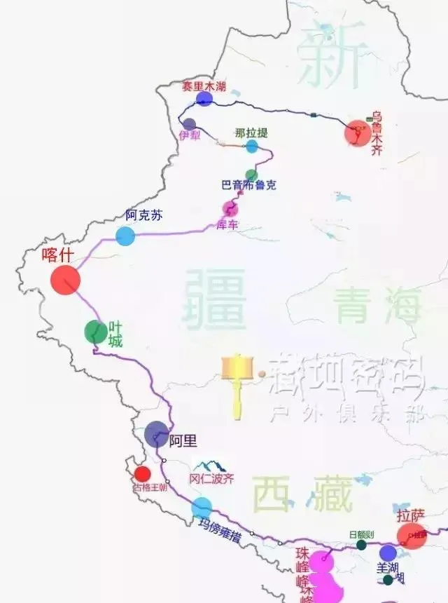
The Xinzang Line runs through the entire 18-day journey. The following is a brief introduction of the trip:
D1: Lhasa-Yangzhuo Yuchao-Karaola Glacier-Shigatse
D2: Shigatse - Lahu - Tingri - Everest Base Camp
D3: Base Camp - Pechocso Lake - Xixia Bangma Peak - Geelong
D4: Jilonggou-Nai Village-Gilungou
D5: Geelong Ditch - Sabang - Zhongba County
D6: Zhongba County - Payang - Maranga - Raongcu - Pulan
D7: Prang - Rinpoche Gods - Guge Dynasty - Zada
D8: Zada - Guge Dynasty - It's not as good as Shiquanhe Town
D9: Shiquanhe Town - Banggongcu Lake - Dahongliu Beach - Shiliuli Camp
D10: Thirty Miles Camp - Yecheng - Kashgar
D11: Kashgar - Ancient City - Athil Mosque
D12: Kashi - Aksu - Kuqa
D13: Kuche Grand Canyon - Independence Highway - Bayinbulak - Nalati
D14: Nalati - Aerial Grassland - Tianshan Saffron - Bagua City
D15: Bagua City - Kalajun - Qiongkushitai
D16: Qiongku Shidai - Bagua City - Yining
D17: Yining - Lavender Base - Manzigou Canyon - Salim Lake
D18: Salim Lake - Urumqi (end of itinerary)