typhoon #10 and naming
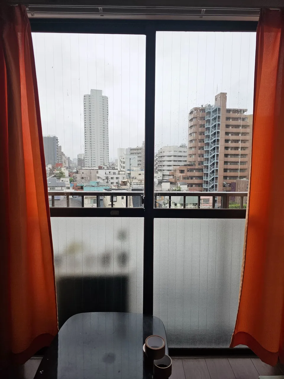
this was the view from our apartment this friday, the sky so gloomy with no signs of life.
rain fails, then stops, then falls again.
the typhoon is not here in tokyo though, it is still having a rendezvous with all the other southern prefectures of japan.
this typhoon has brought lots of damages in southern japan already, and is still heading for tokyo.
internationally called shanshan, this typhoon is locally called simply as typhoon #10.
japan just numbers the typhoons per year in order, pretty simple and quite nonchalant.
in the philippines, our weather agency has a predetermined name from a to z (and some more extras in case of more typhoons) per year and assigns those names to typhoons which enters the philippine area alphabetically.
typhoons which created great havoc where crashed out from this grand list of names to prevent bad luck.
when i was younger, only filipino women names were used not until the late 1990s (i think) when filipino male names where also used: x was excluded for the reason that there were few natural filipino sounding names which starts with x.
at around 7pm, the rains stopped, that meant that this nightwalker could go out and enjoy the outside world.
i was already feeling sick cooped in this apartment the whole day, i needed fresh air.
brought an umbrella just in case, i went out and started tracking this other train line close to home.
joban train line (常磐線)
the joban line is of course a train line which technically starts from nippori (yes, it is the same nippori i have been mentioning in the past entries) until iwanuma in miyagi.
but services has been extended which now starts from shinagawa to sendai, miyagi, a whopping 368 km (228.7 mi).
sections of this long train line was operational from 1889, and the complete nippori - iwanuma was done from 1905.
the line starts from tokyo, passes through chiba, ibaraki, and fukushima, finally ending in miyagi; the trail parallels the pacific ocean in the tohoku region of japan.
all these information above were taken from wikipedia (the greatest source of quick basic data).
now, do not expect this nightwalker to walk that whole stretch: very impossible.
so here is my mini walk version.
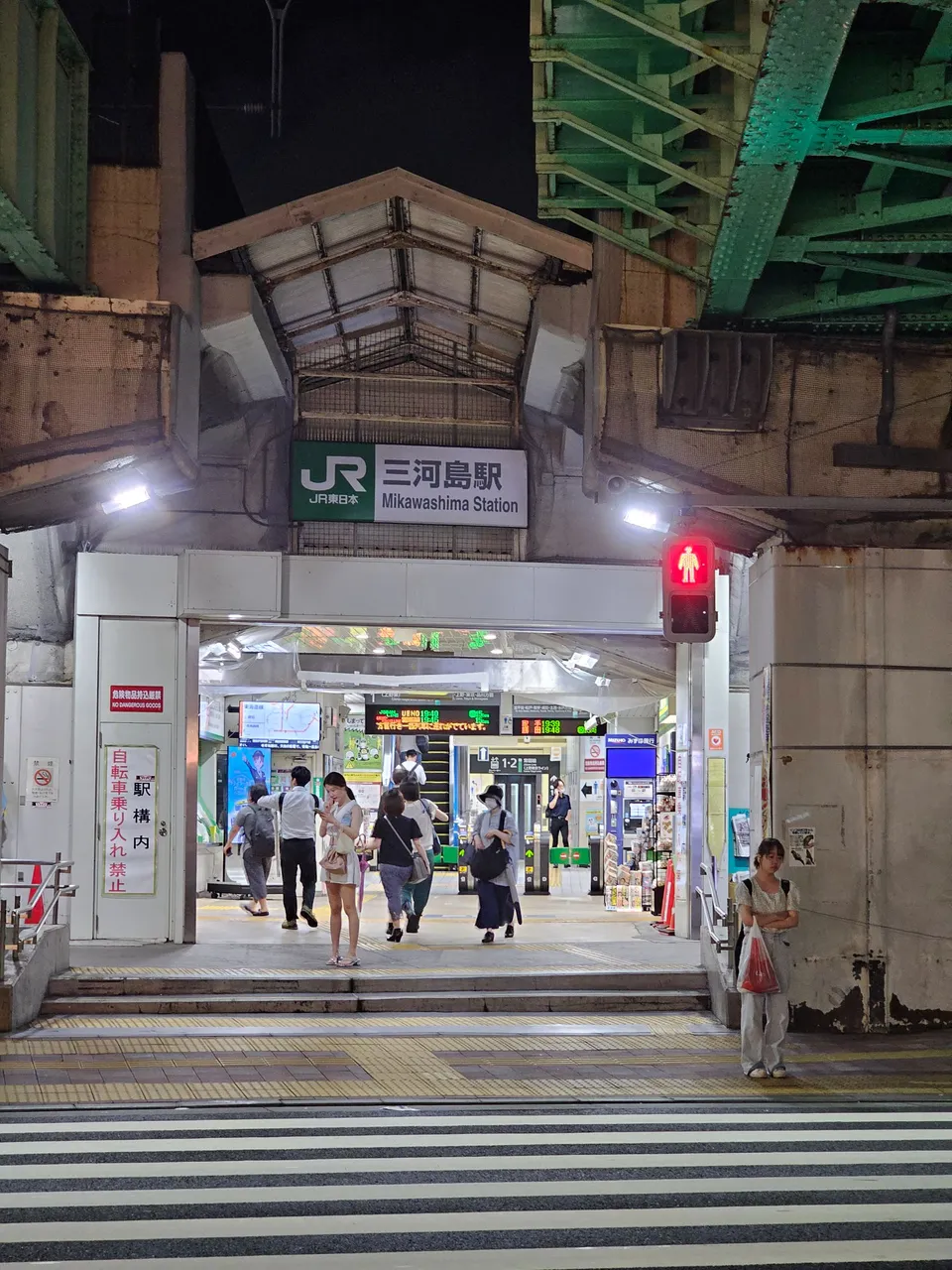
mikawashima (三河島)
i started at the station nearest to home.
as this area was mostly residential, that reflected much to the very simple one entrance-exit gated station.
this is how a low-key station looks like, nothing extra (very mindful, very demure).
i passed by residential houses; thus, the lack of pictures for privacy's sake.
then i finally reached a park, it was but a small one but the small children playing there were satisfied fully.
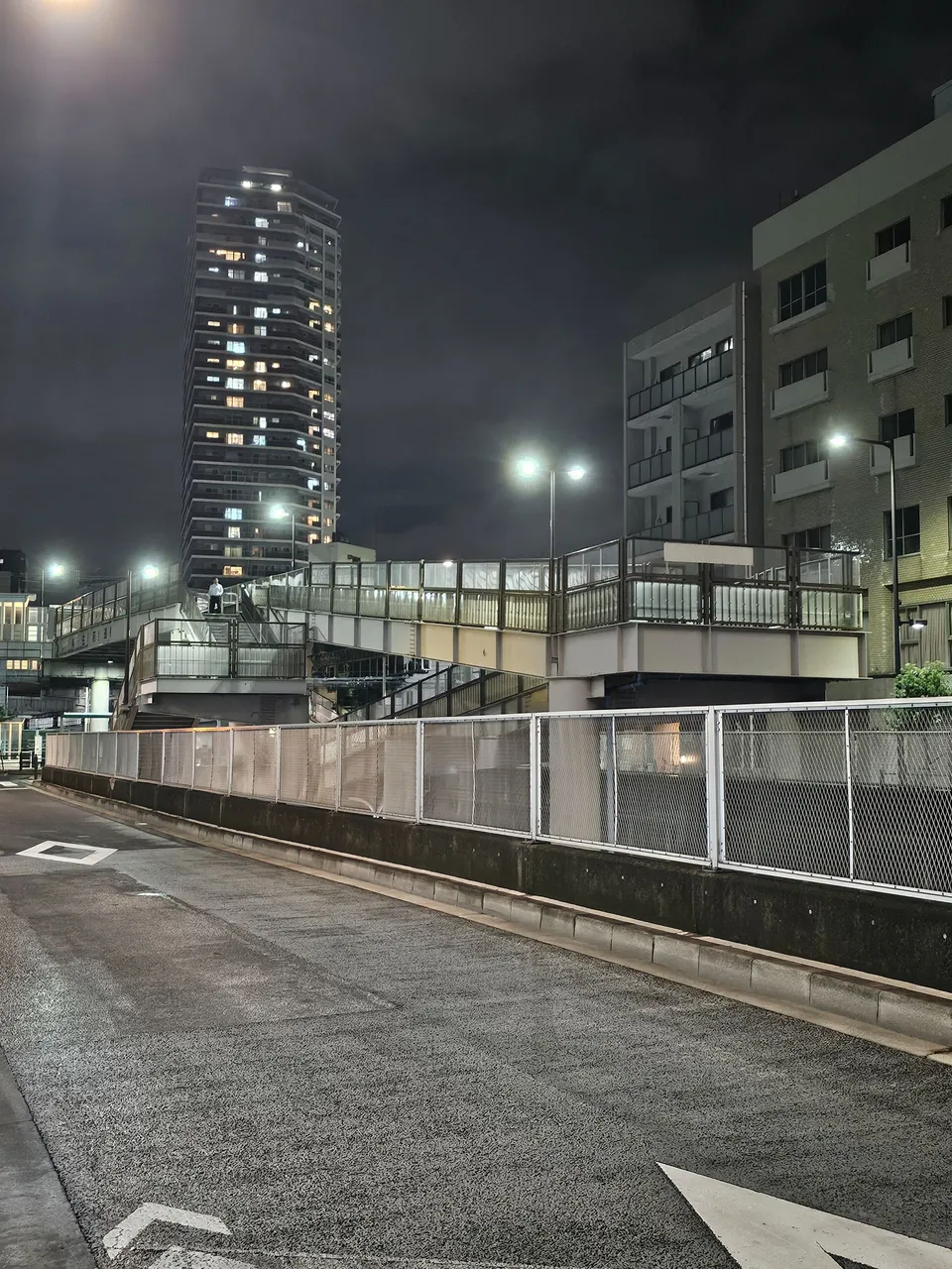
as i was nearing the next station, i reached a bus parking lot and this elevated walkway which crossed the river of train tracks which originated from this area.
i only peered through the cracks, i didn't dare take pictures.

minami senju (南千住)
now this station was big leaps in size compared to the previous one, it was even in a "solid" building (compared to the open platform of my home station).
businesses and activities were starting to get lively in this area.
one of the probable reasons would be the fact that this station is home to three train lines giving it more importance.
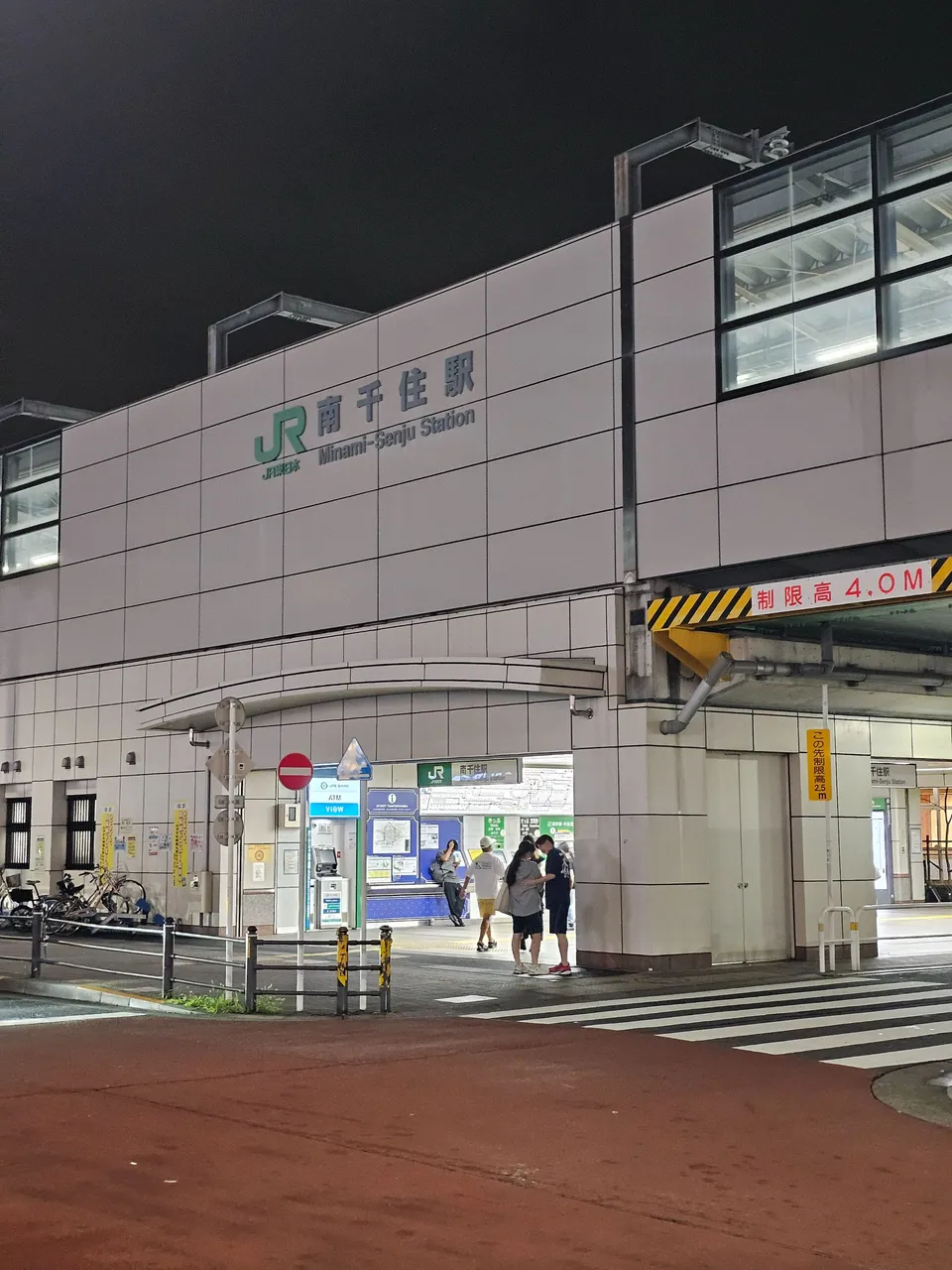
there were lots of restaurants around the station, there was even a mall.
but i didn't came there for that, i only passed by.
from there, i had to cross the sumida river through the senju ohashi bridge.
there were actually two bridges directly beside each other, i used the simpler with no arches this time which gave me an unobstructed view of the river and the joban railway bridge; yes, railways have their own dedicated bridges most of the time.


kita senju (北千住)
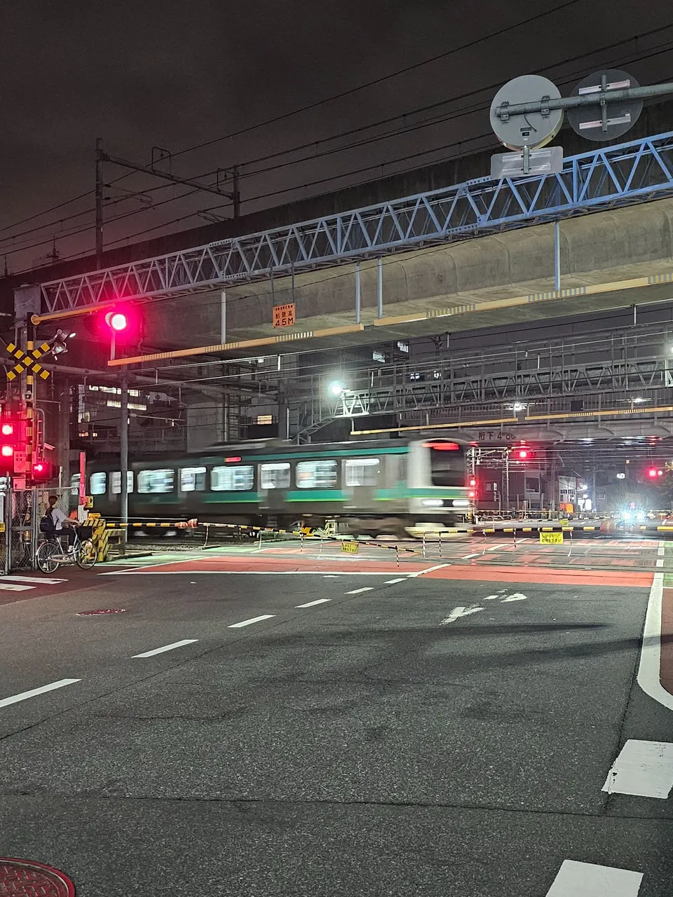
some portions of the train lines in this station crosses pedestrian roads, a rare sight as most train tracks are usually elevated from the ground.
i guess the area has a higher elevation compared to the other places which resulted to this.
that is one fast train, better let it pass and follow the signs for safety.
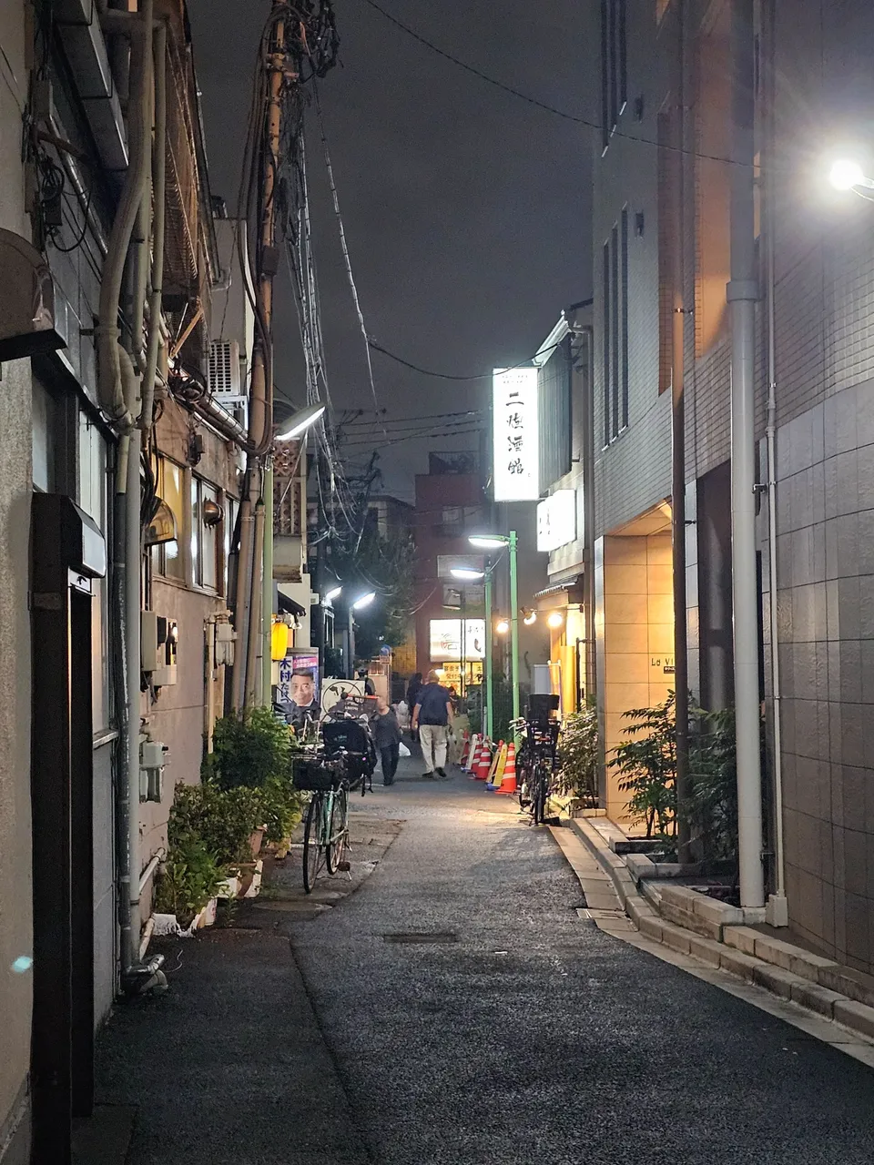
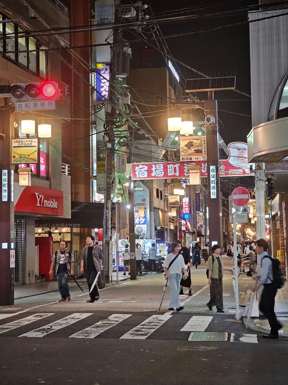
i headed to kita-senju station through this narrow alley filled with small restaurants, pubs, "entertainment", and izakayas (alcohol drinking places).
very very lively, very not like the two other stations where i came from.
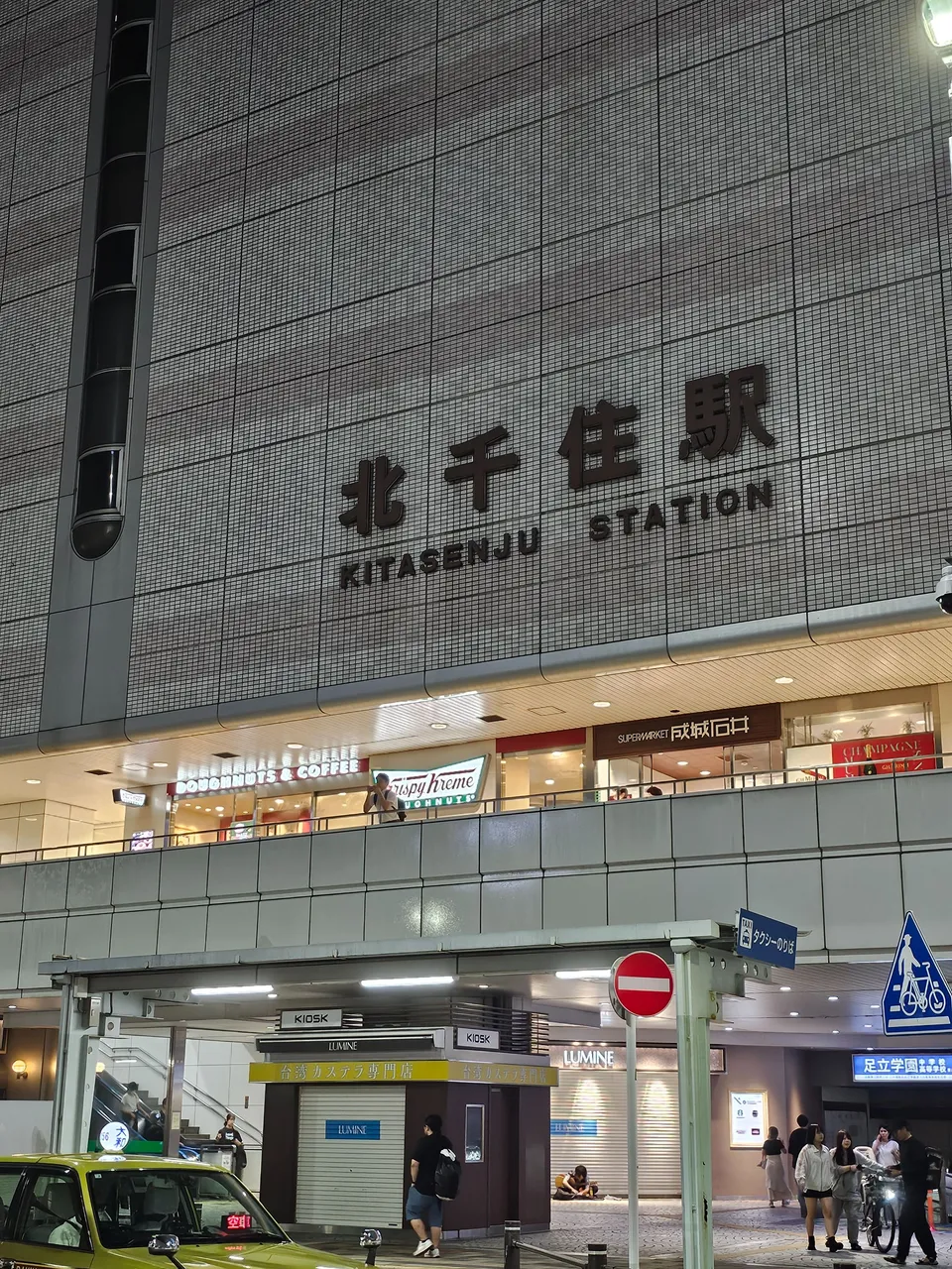
mikawashima station was ranked in the 250s, minami-senju in the 200s of the busiest stations according to the japan railway company site, the train company which runs joban line; but oh boy, kita-senju station is ranked 10th busiest of the year 2023.

this station is a major interchange railway with 5 lines from four train companies serving the station.
that shows how busy it is, and a busy station deserves a grand looking station building.
life surrounding the station also flourished, the road i passed through earlier was just one of the many roads filled with shops.
as such, we often come here on weekends to enjoy the great food.
two major malls are also in here, that is how important this station is.
i would have wanted to proceed to one more station, but it was very hard to reach.
the next one was across the arakawa river and the nearest bridge from kita senju was nowhere near the next station.
it was like the stations were the endpoints of the hypotenuse of a right triangle, and the bridge was the third point; i had to walk on the two perpendicular sides.
and that makes it extra far!
and it was drizzling again, so i decided to go home walking on a different route.
looking at the map below, the sharp turn southward at the top was where i decided to go home.
i had to hurry as the drizzling continued; thus, no pictures.
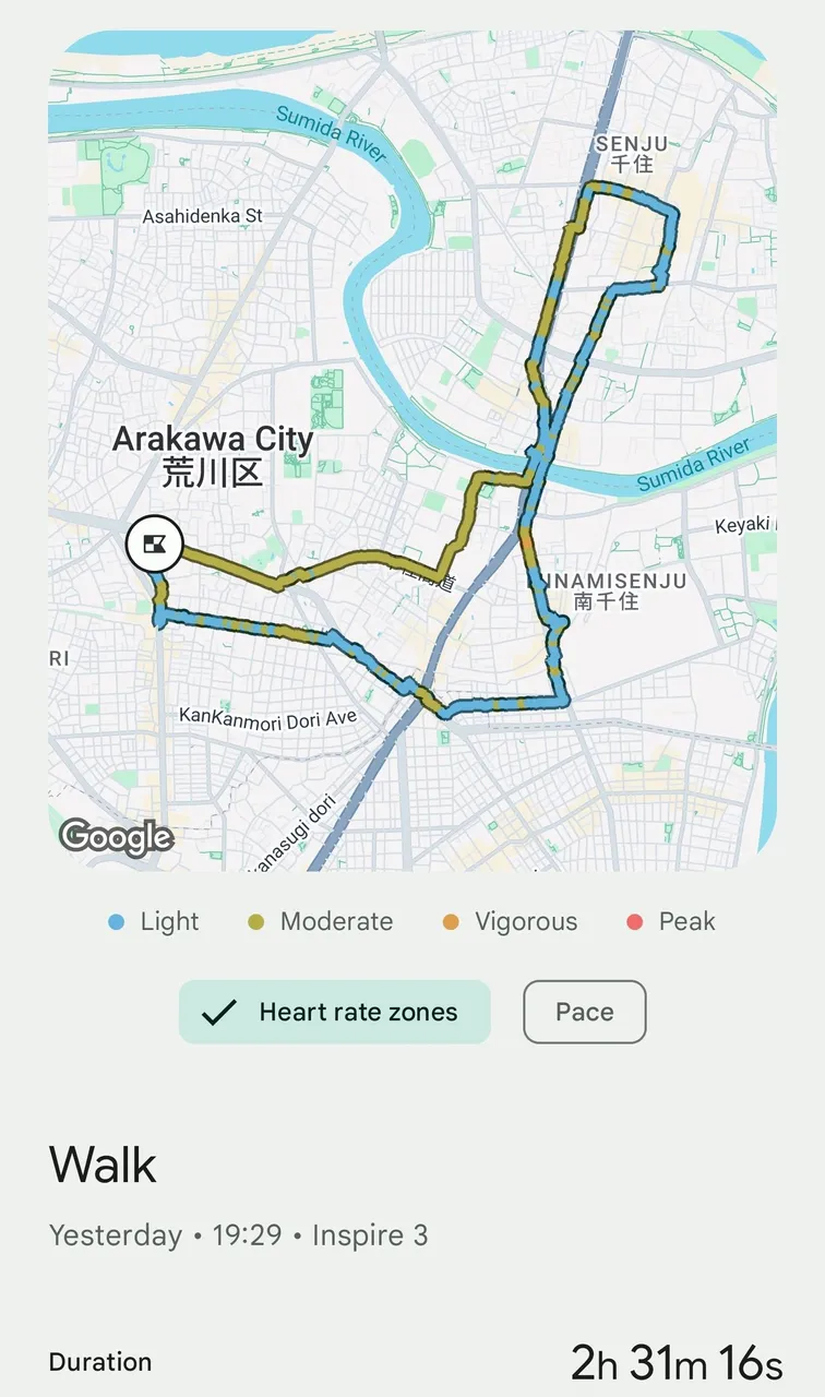
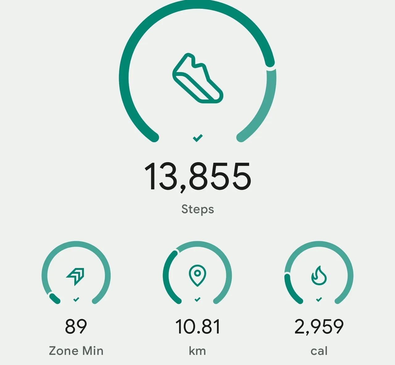
in total, i walked for around 10 km this time.
but i safely returned home to complete the nightwalk.
hope you had fun!
as always, AMPING KANUNAY!

all content is by yours truly unless otherwise specified
all photos are taken with a galaxy s23 ultra
This report was published via Actifit app (Android | iOS). Check out the original version here on actifit.io


Height168.0 cm |  | Weight71.4 kg |  | Body Fat20.9 % |  |
Waistcm |  | Thighscm |  | Chestcm |  |