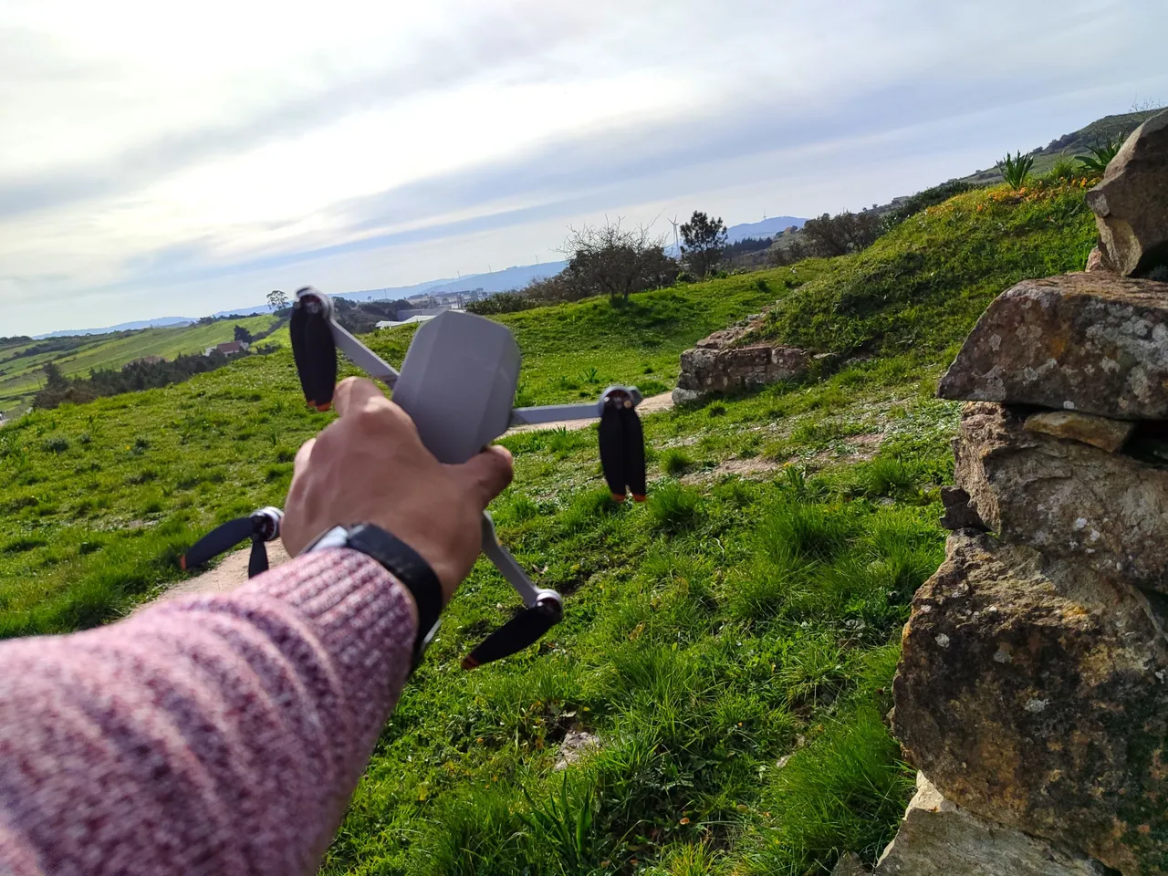
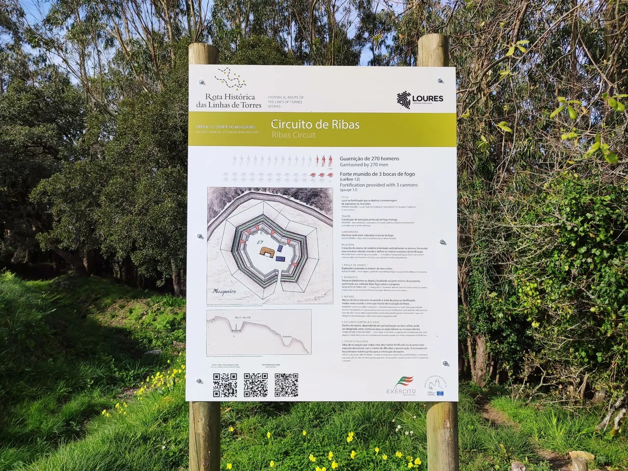
Hello fellow travelers and drone lovers! Today I pass through this super community to share my new experience with you, it is a small path of approximately 4km that ends in one of the most important war structures in Portuguese history, it is the Mosqueiro Fort, which along with more than 150 military structures had an important contribution to stopping Napoleon's troops during the early 18th century. With my drone we are going to see what the fort looks like from various angles and learn about history!🚩🚙🌄
Hola amigos viajeros y amante de los drones! hoy paso por esta super comunidad para compartir mi nueva experiencia con ustedes, se trata de un pequeño sendero de aproximadamente 4km que finaliza en una de las estructuras belicas mas importantes de la historia Portuguesa se trata del Fuerte de Mosqueiro, el cual junto a mas de 150 estructuras militares tuvieron un aporte importante para frenar las tropas de Napoleon durante principios del siglo XVIII, con mi drone vamos a ver como luce el fuerte desde varios angulos y aprender de historia!🤯🍍🌏🏯🏰
How to get to the Fort?🧭🌍/Como llegar al Fuerte?🍍🚩
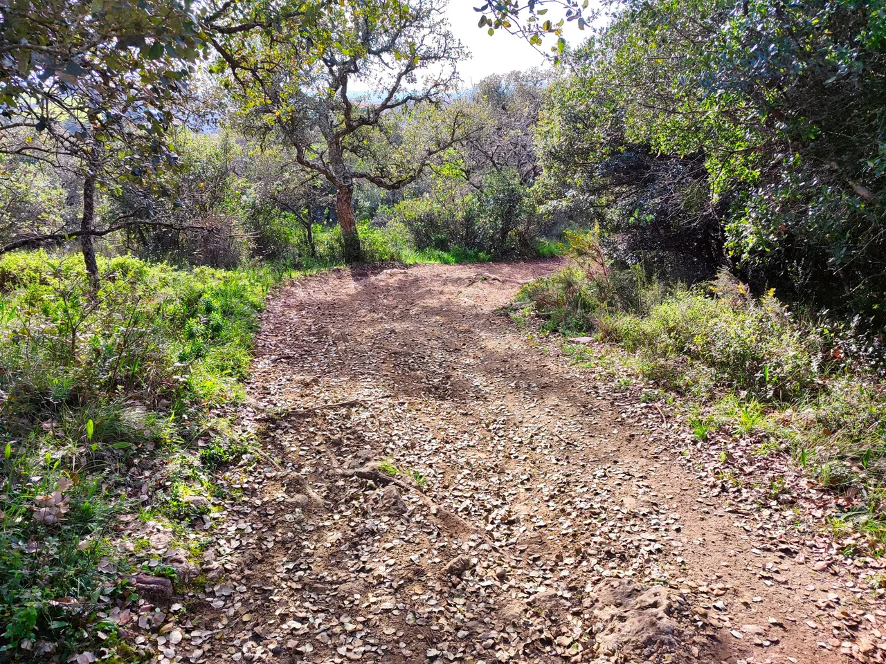
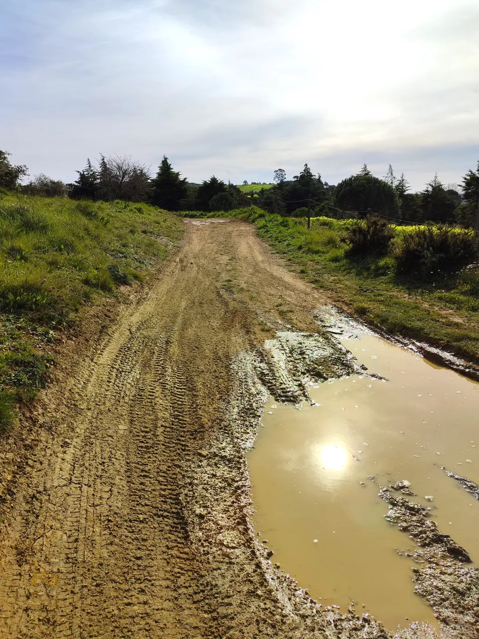
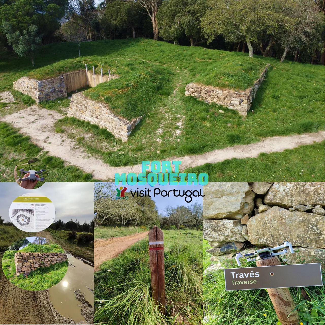
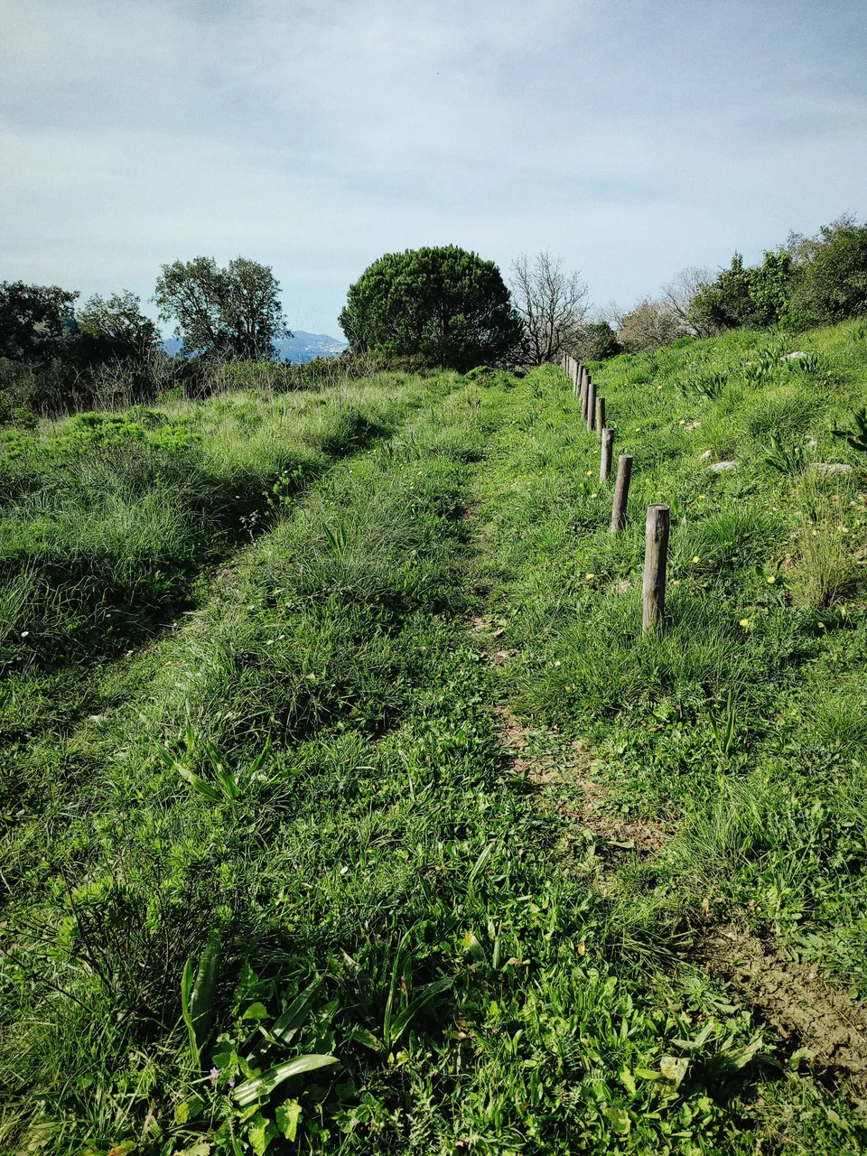
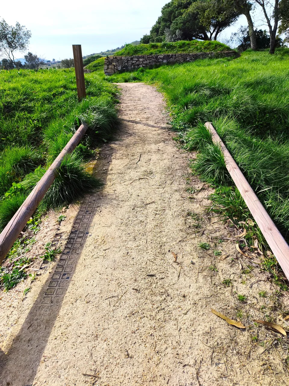
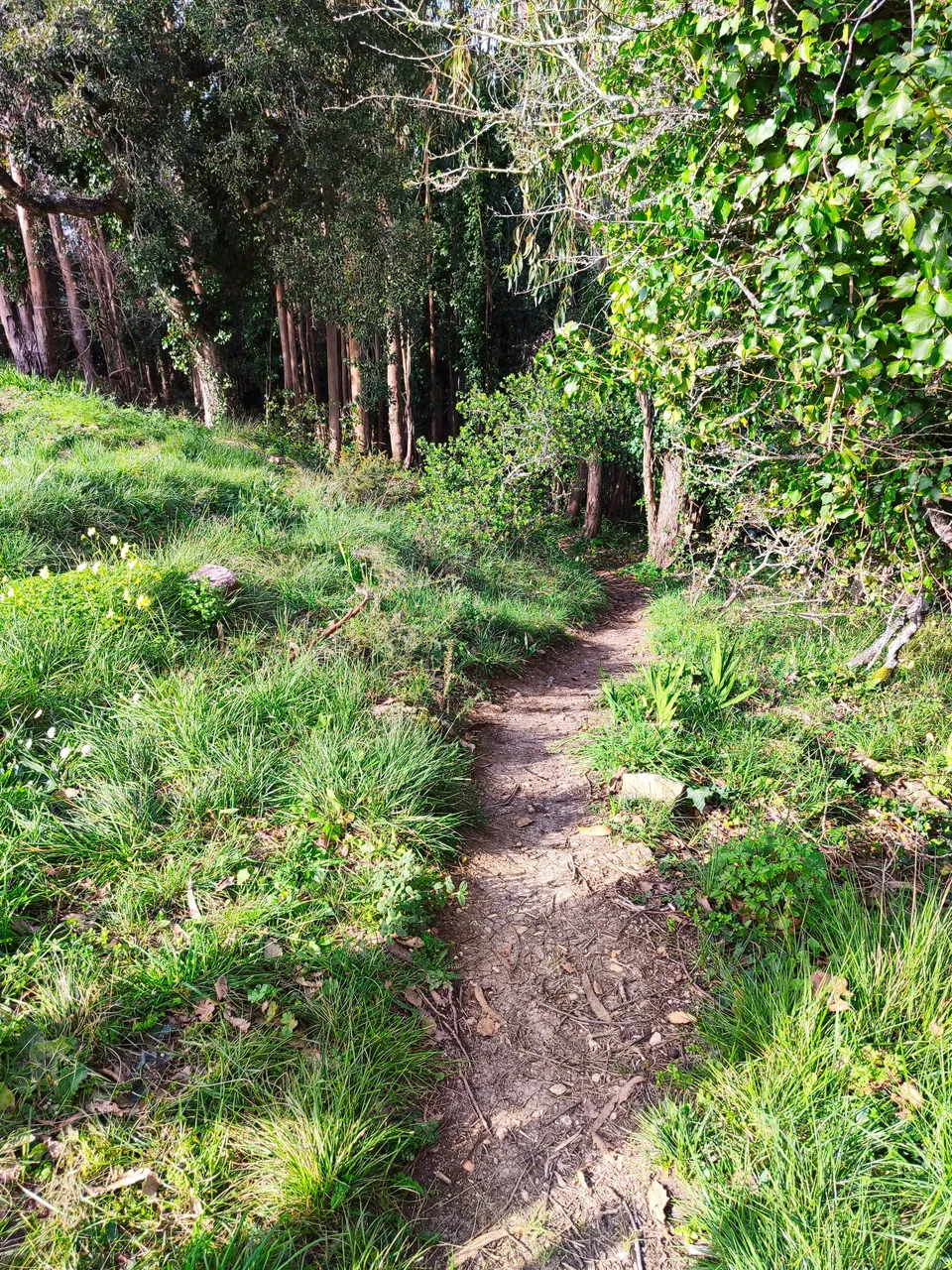
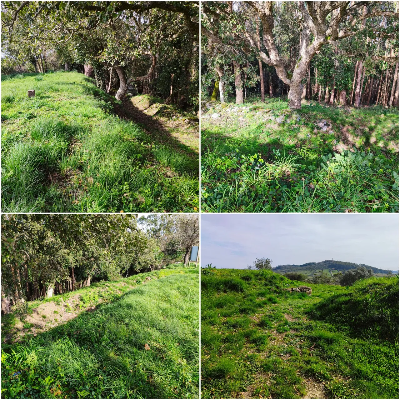
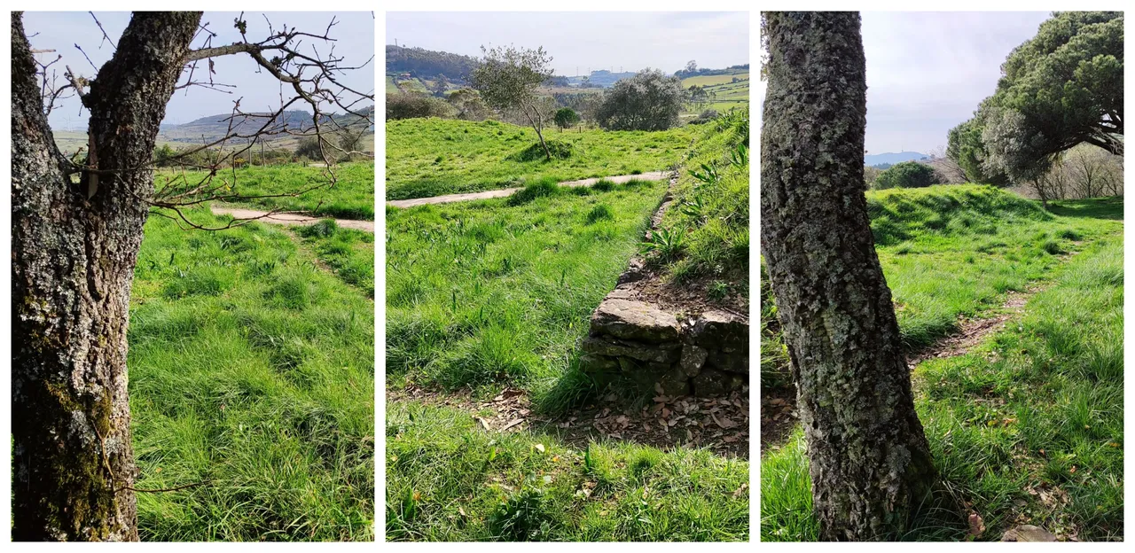
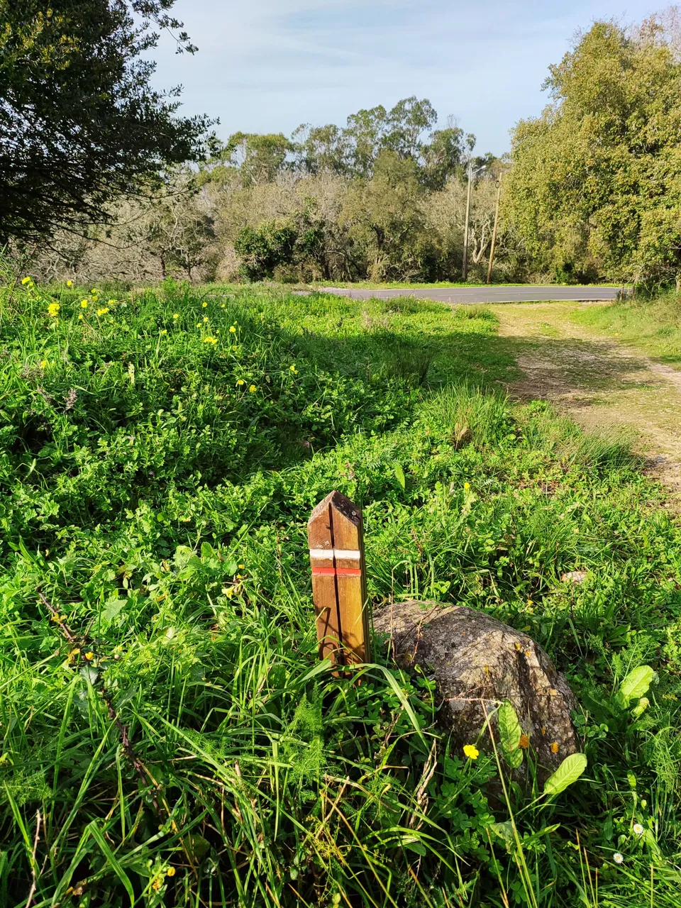
If you like to walk and you don't mind getting dirty then the Mosqueiro military fort is an alternative for hiking and being able to pilot your drone without a permit in Portugal, you can find the fort at the following coordinates: (38.898847, -9.182898), get to it It can be quite an odyssey depending on the level of difficulty and demand you want to take! For example, from the center of Loures to here you could walk more than 12km, you can also visit it along several trails like I did and walk a total of 4km but between forest and muddy road! If you don't want to walk then you can come by vehicle! you have all the alternatives!🌏🍍🌍
Si te gusta caminar y no te importa ensuciarte entonces el fuerte militar de Mosqueiro es una alternativa para hacer senderismo y poder pilotear tu drone sin permiso en Portugal, podras encontrar el fuerte en las siguientes coordenadas: (38.898847, -9.182898), llegar a el puede resultar toda una odisea dependiendo del nivel de dificultad y exigencia que quieras tomar! por ejemplo desde el centro de Loures hasta aqui podrias caminar mas de 12km, tambien puedes visitarlo por varios senderos como hice yo y caminar un total de 4km pero entre bosque y carretera fangosa! si no quieres caminar entonces puedes acercarte en vehiculo! tienes todas las alternativas!🌄🚙🚩💂♂️

History of the Fort🧭🌍/Historia del Fuerte🍍🚩
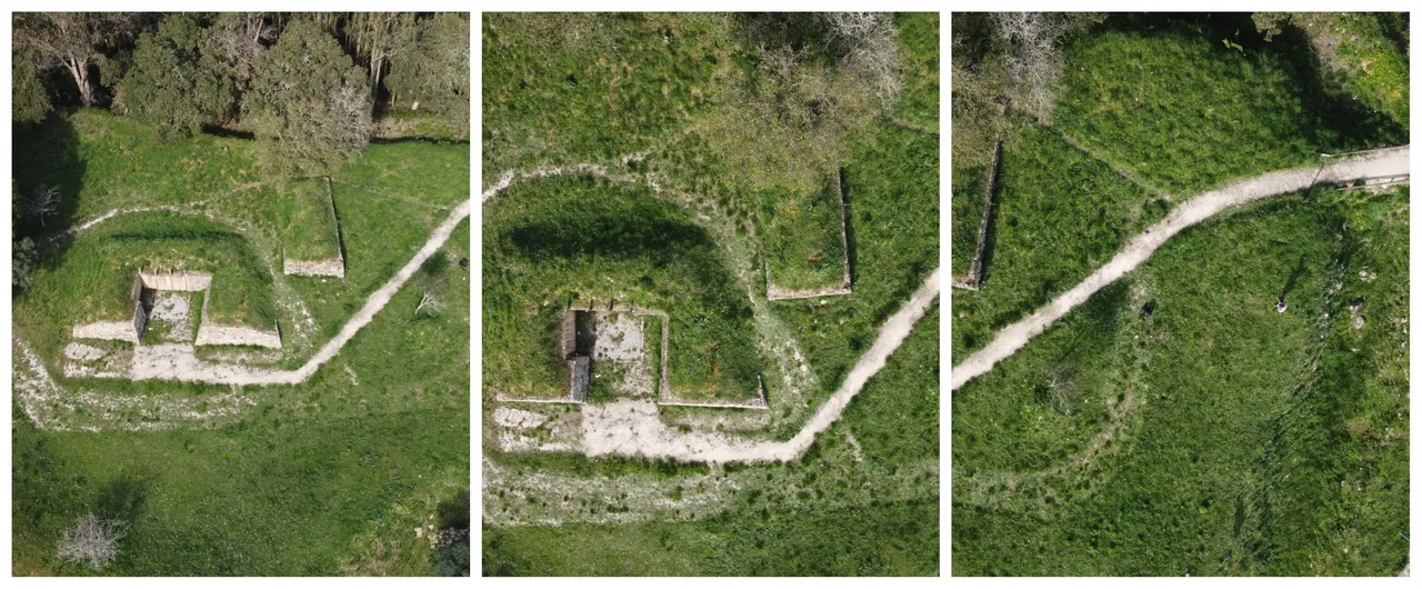
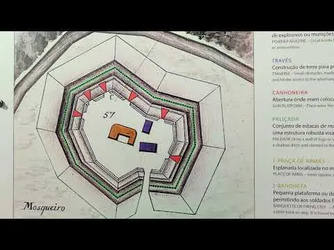
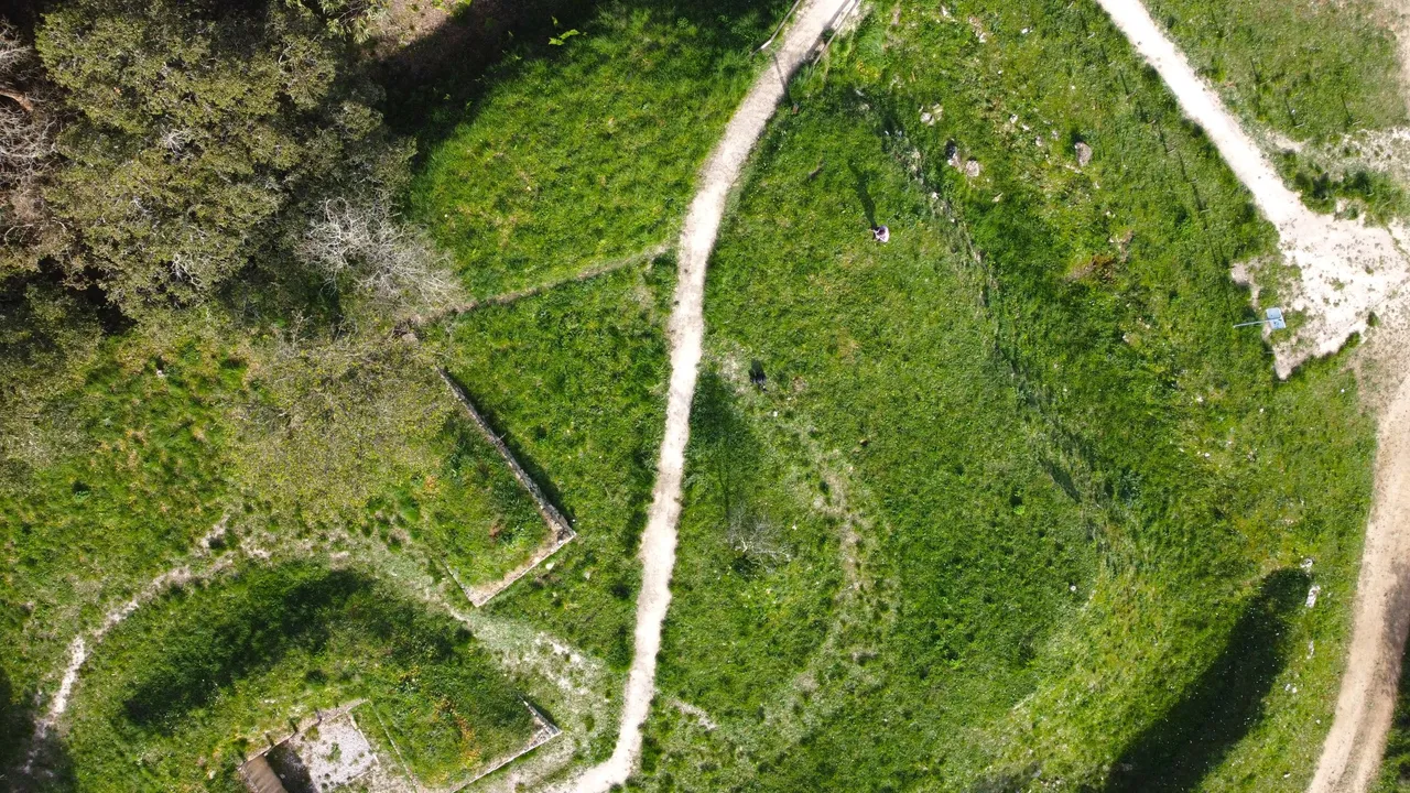
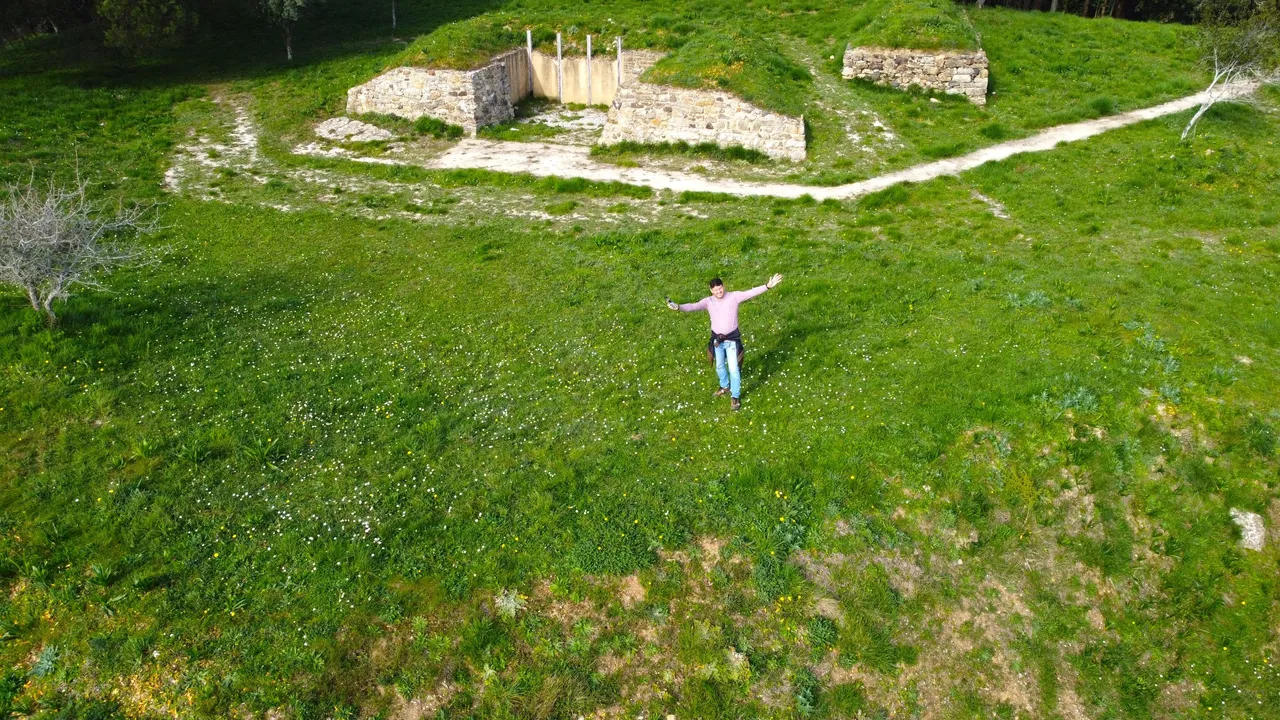
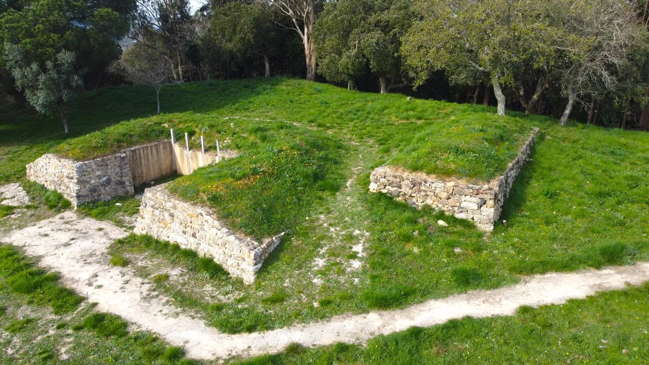
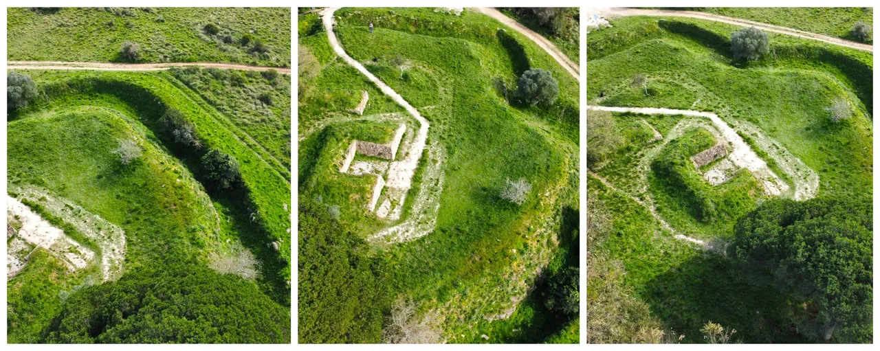
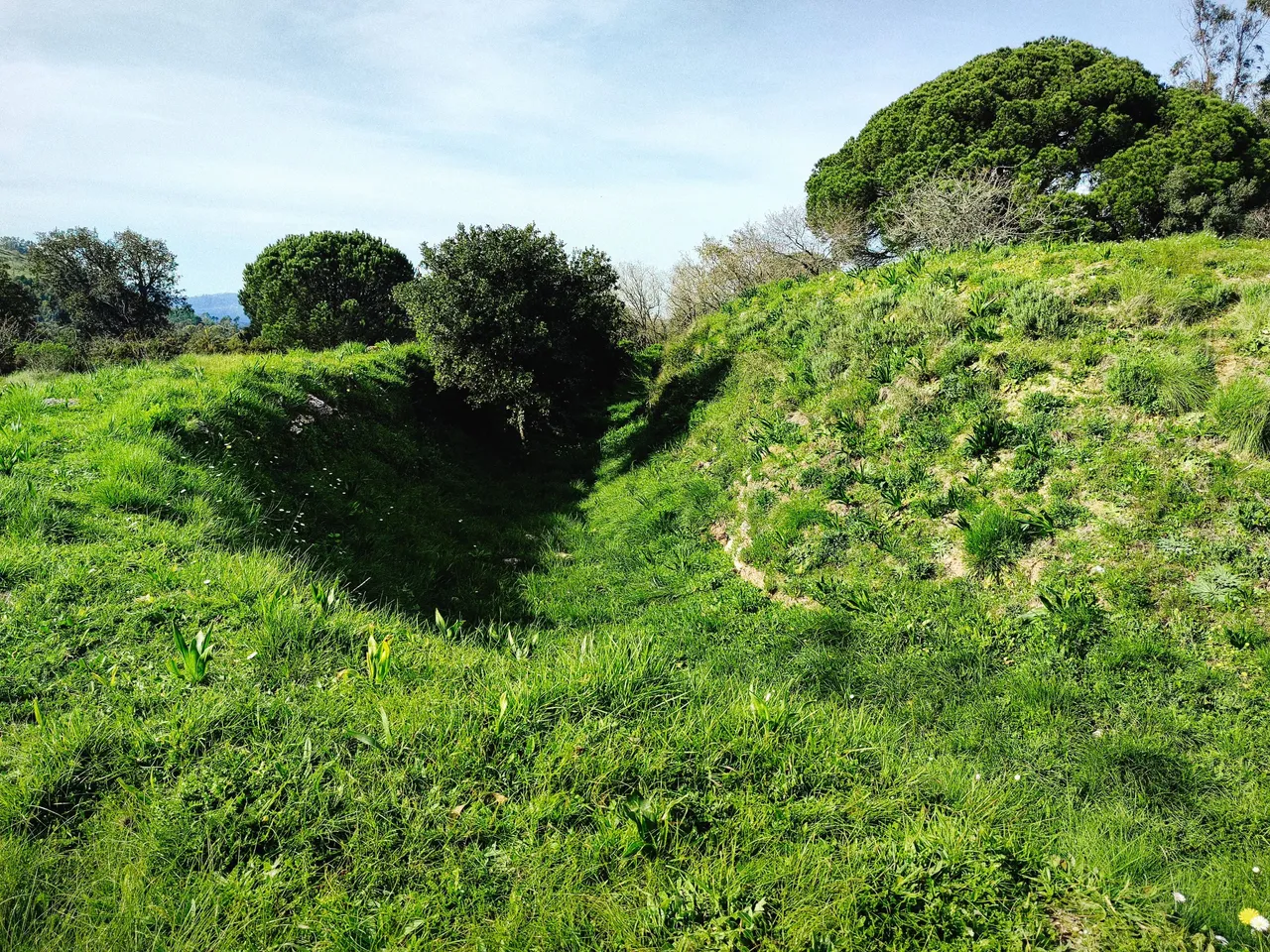
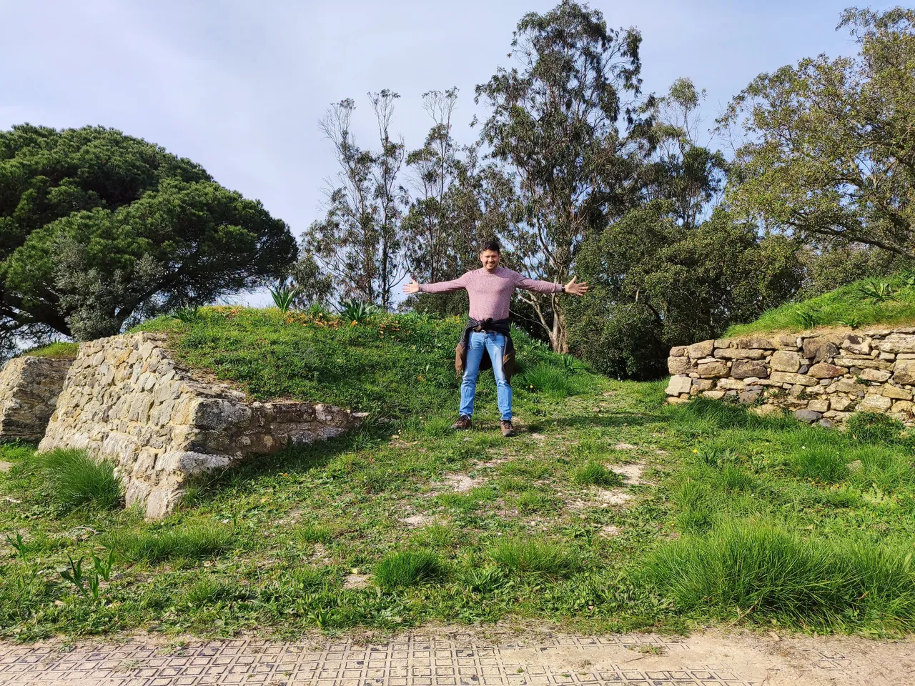
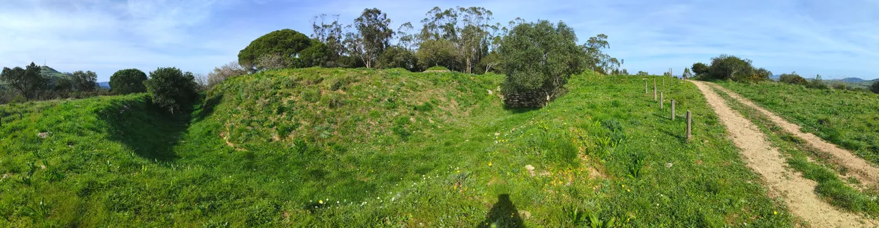
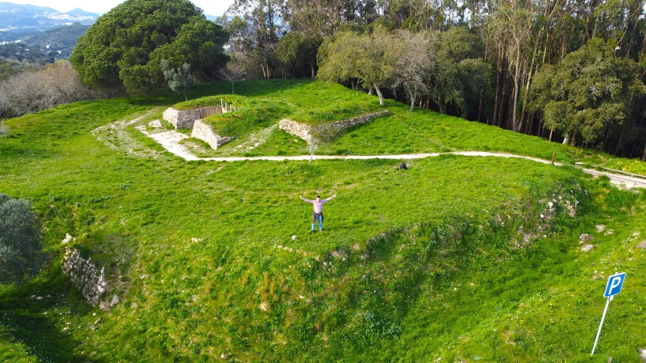
The most incredible thing about Fort Mosqueiro is when you see it from the angle that can only be filmed with the drone from the sky because that is when we understand that it is a true work of war art, normally these forts had a drawbridge which was the only way Crossing it is therefore impossible for the troops because the stone together with the water that surrounds it makes it impossible to swim up it and even more so if we remember that gunpowder cannot get wet so the only way to break the line of Torres Vedras is with cannons. and let's remember that there was a line of 150 strong so Napoleon had no chance!🤯🏯🧭
Lo mas increible del fuerte Mosqueiro es cuando lo ves desde el angulo que unicamente puede ser filmado con el drone desde el cielo porque alli es cuando entendemos que es una verdadera obra de arte belica, normalmente estos fuertes tenian un puente elevadizo que era la unica forma de cruzarlo por tanto para las tropas es imposible porque la piedra junto con el agua que lo rodea hace que sea imposible subirlo nadando y mas si recordamos que la polvora no puede mojarse asi que la unica forma de romper la linea de Torres Vedras es con cañones y recordemos que habia una linea de 150 fuertes por tanto Napoleon no tuvo oportunidad ninguna!🚩🚙🌄
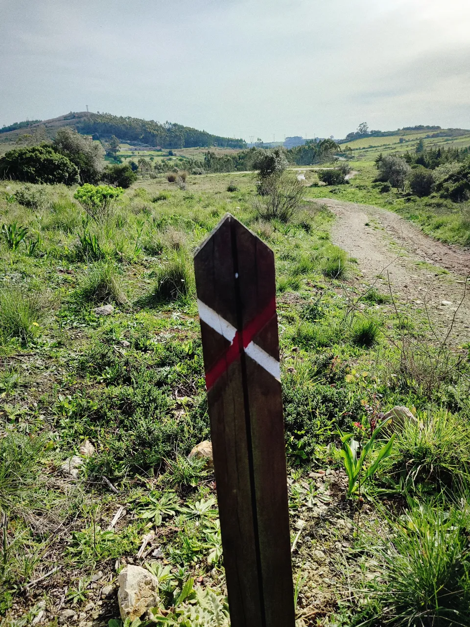
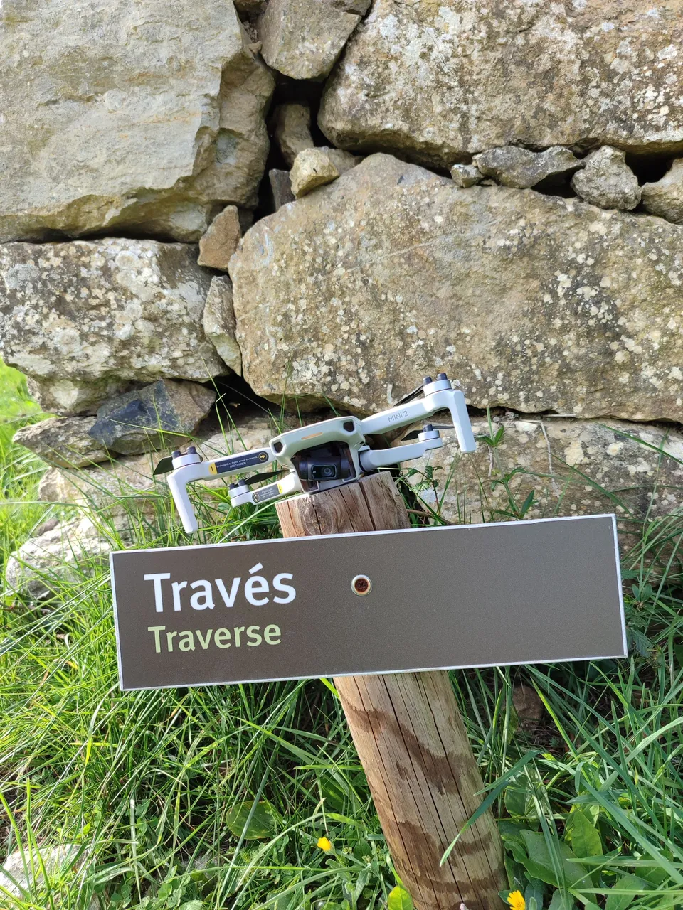
following the signs🌊🚙🍍
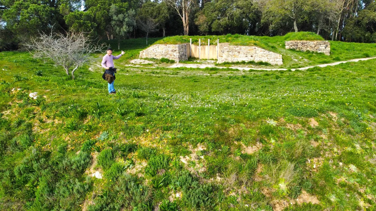
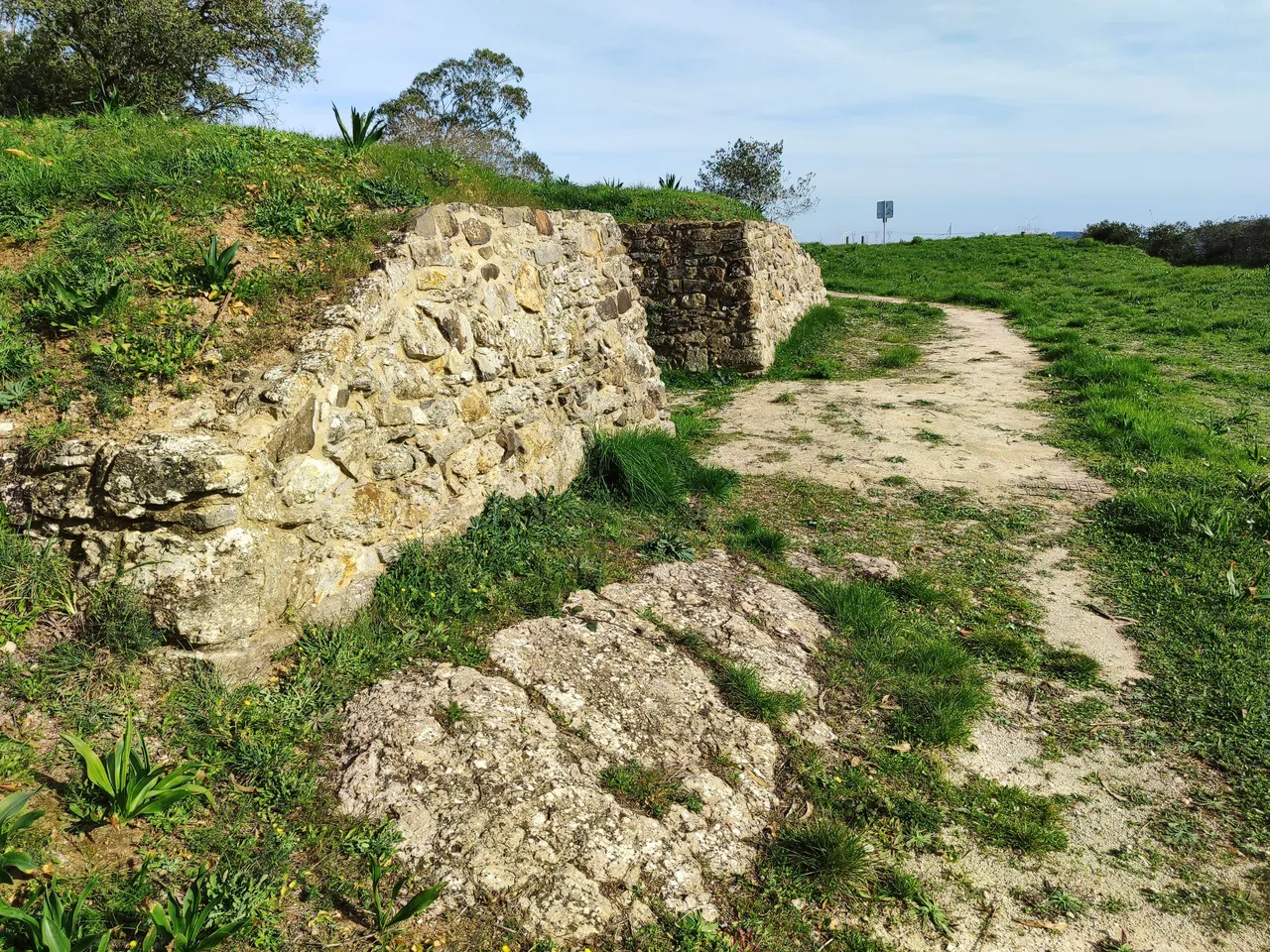
The characteristics of the Fort make it an obstacle that was a challenge for Napoleon in the 18th century, according to historical records, they came from the north and the defensive line was located between about 15-20km from Lisbon, it could have a garrison of up to 300 men, all of them armed with ammunition that could be distributed among all the other military forts! A total of 3 cannons were waiting to be fired at the enemy from a hill no more than 100 meters high! To get to the fort just follow the marked path👀🧭🌏
Las caracteristicas del Fuerte lo convierten en un obstaculo que supuso todo un reto para Napoleon en el siglo 18 segun registros historicos ellos vinieron del norte y la linea defensiva se situaba entre unos 15-20km de Lisboa, podia tener una guarnicion de hasta 300 hombres todos armados con municiones que podia ser distribuida entre todos los otros fuertes militares! un total de 3 cañones aguardaban a ser disparado sobre el enemigo desde una colina con no mas de 100 metros de altura! para llegar al fuerte basta con seguir el sendero señalizado😲🚙
What is the ribas circuit?🧭🌍/Que es el circuito de ribas¿🍍🚩
With this fort I already completed the famous Ribas circuit, which is a 13km path that has a circular route and allows you to see most of the defensive line of Torres Vedras, I already completed this objective and it took me more than 3 posts and A walk of more than 45km I clearly made many detours but I recorded all the main military forts that defended Portugal! If you ask me what is the best time to see them? I would say summer!🧭🚩🏰
Con este fuerte ya complete el famoso circuito de Ribas que se trata de un sendero de 13km que tiene un recorrido circular y que permite ver la mayor parte de la linea defensiva de torres vedras, ya complete este objetivo y me tomo mas de 3 post y una caminata de mas de 45km claramente hice muchos desvios pero registre todos los principales fuertes militares que defendieron Portugal! si me preguntas cual es la mejor epoca para verlos? diria verano!🌊👨💻🤯
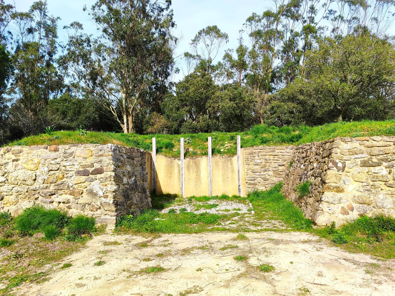
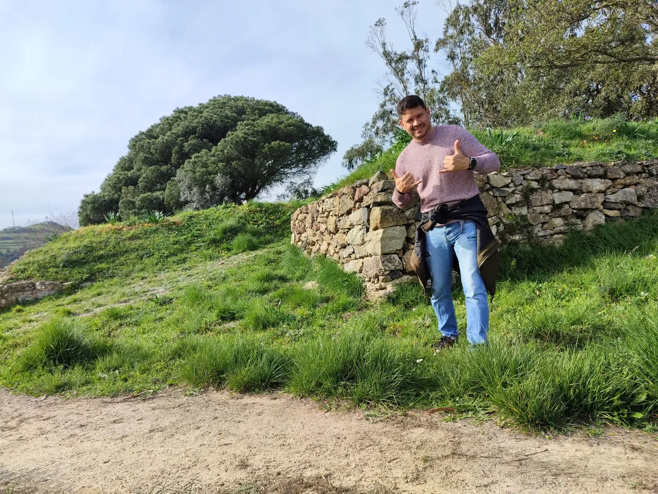
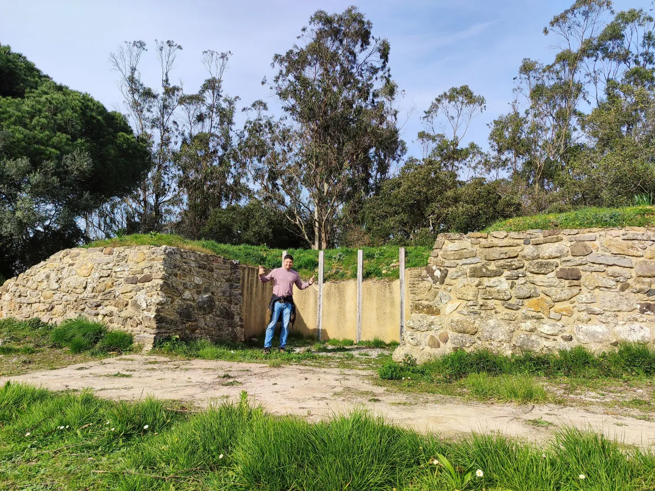
WRefreshing inside the wall🧭🌍/Refrescando dentro de la muralla🍍🚩
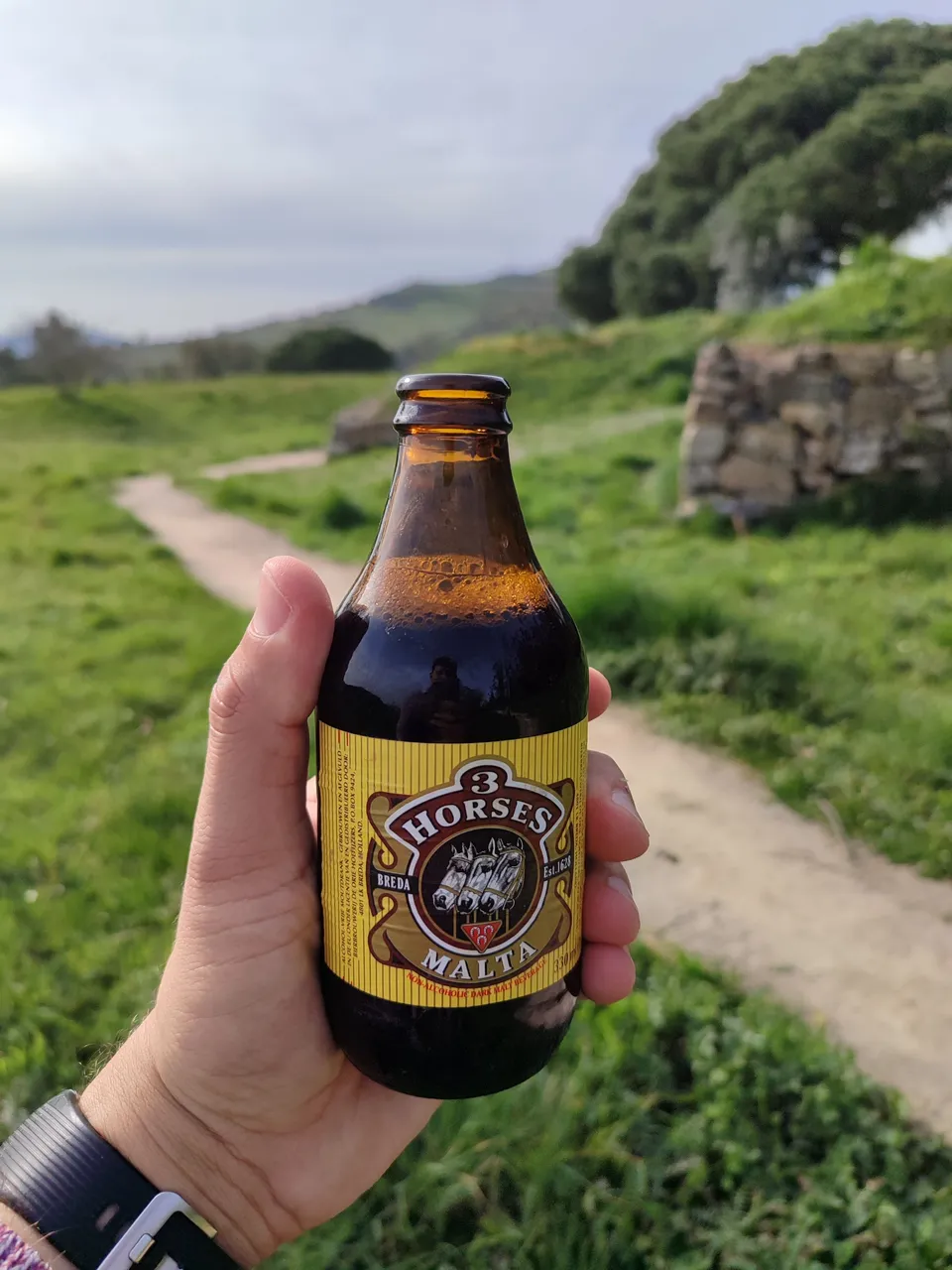
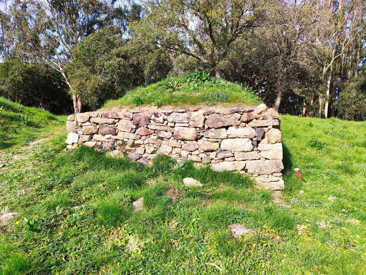
Who would have thought that here we are in the middle of the military fort with just under 10 meters wide, it was quite hot so I decided to drink a malt while enjoying the landscape that the Portuguese military had more than 100 years ago! Many objects found here are in various museums and universities in the country!🧭🚩
Quien diria que aqui estamos en medio del fuerte militar con poco menos de 10 metros de anchura, estaba bastante calor asi que decidi beberme una malta mientras disfrutaba del paisaje que tenian los militares portugueses hace mas de 100 años! muchos objetos encontrados aqui estan en varios museos y universidades del pais!🏰🚙

DNA is an organization to foster and DENSIFY NATURE-APPRECIATION which aims to establish REPORTS OF BIODIVERSITY DATA that is contributed by all of us Hiveans and subsequently cataloged.
Therefore DNA searches for HIGH-QUALITY posts that aim to DESCRIBE and determine the BIODIVERSITY AROUND YOU with added EXPLANATIONS and INFORMATION. For these informative posts they offer a CURATION SERVICE using the @dna.org account. It is also a CURATION TRAIL. Just add the #dna TAG if you think that any of your posts is what they are looking for.
THANKS FOR READING ME (PHOTOS OF MY PROPERTY) / GRACIAS POR LEERME FOTOS DE MI PROPIEDAD🙂🧠🦾👍