Dolomites Day 3: Adolf Munkel Weg

On the third day of our stay in the Italian Dolomites, I decided to get a little involved in choosing a hiking trail. It's about the fact that on the second day we climbed Saceda, which was quite an effort for me too, not to mention my inexperienced companion Maja. For these reasons, I thought we should slow down a bit and choose a slightly easier trek and enjoy the walk above all.

The choice fell on the Adolf Munkel Weg, a trek that was officially supposed to be about 9 kilometers with about 400 meters of ascent. It will turn out that the variant I chose is a bit longer with 11 kilometers and about 500 meters of ascent, but even with that inaccuracy, this trek is one of the easiest in the Dolomites. However, don't be fooled by the lightness, this is definitely one of the most beautiful hikes that offers an extraordinary experience of walking through a rich forest with a view of the southern side of the Saceda cliffs. All recommendations!


The Adolf Munkel Weg is actually a much longer trek, which is one-way, so it didn't suit us. Instead, I made a combination of several tracks and switched from track to track multiple times to create a circuit that worked for us.

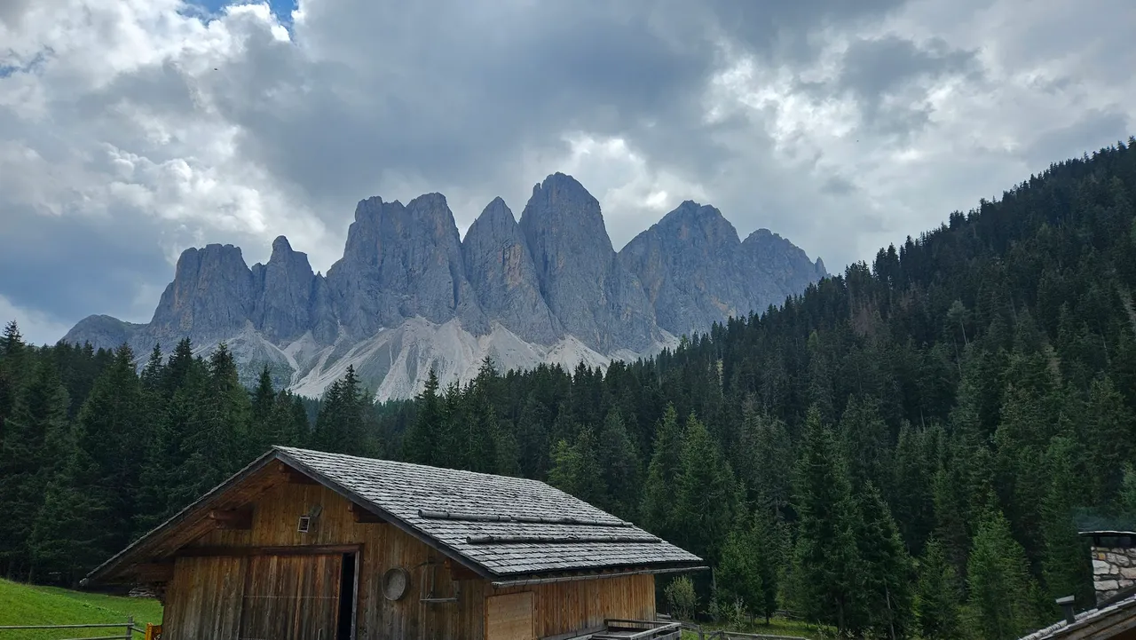
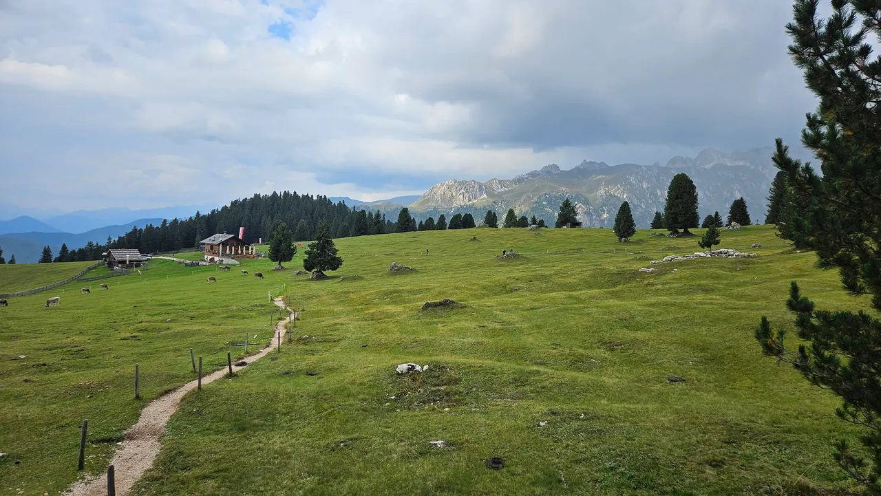
The start of the trek is in the Zans National Park at the large parking lot from which trails no. 36 which are the most frequent targets of hikers who visit this area. However, instead of going up and down the same trail, I had a slightly different plan.
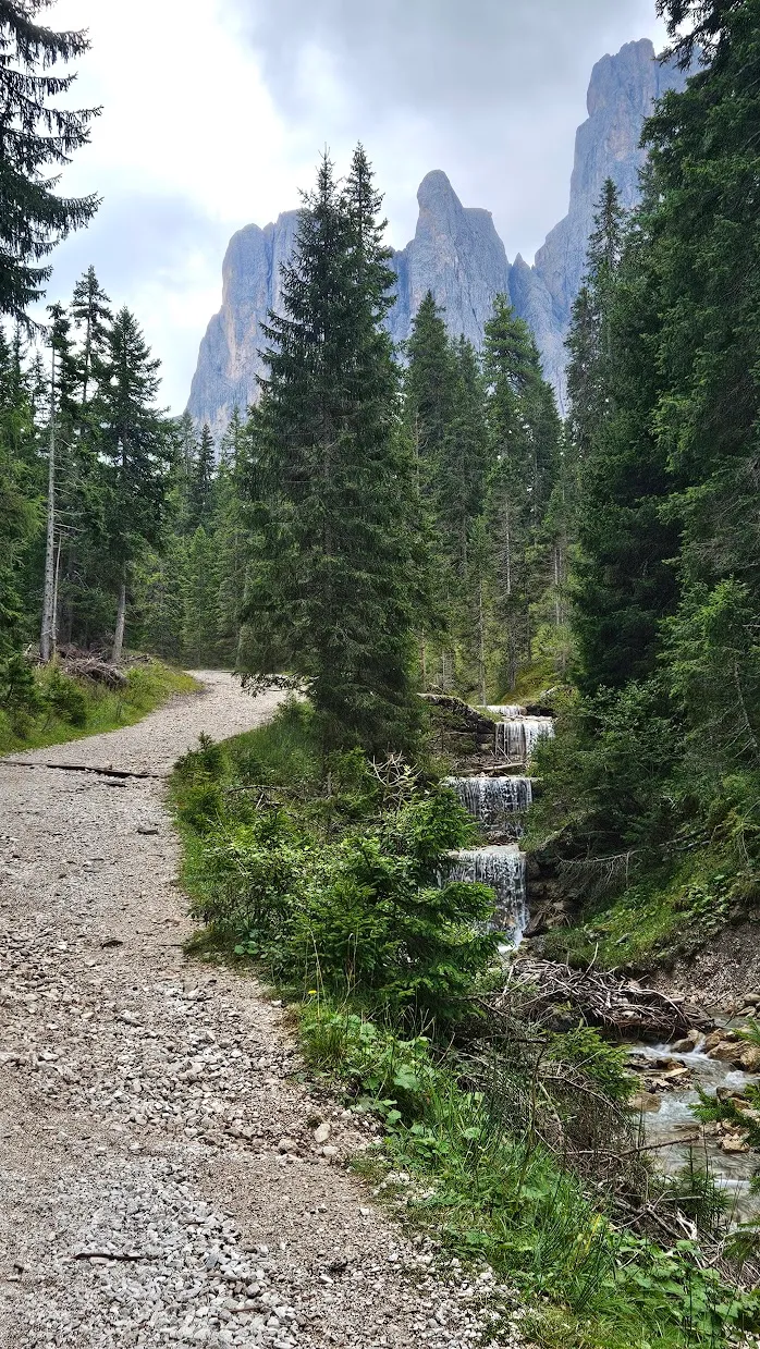

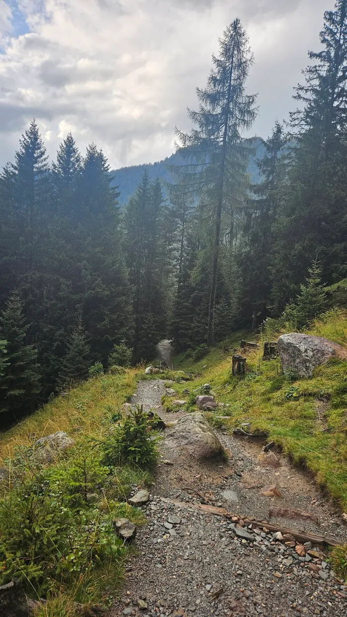
We started along the little-visited trail no. 6. This trail gently climbs through rich forest following the course of the Rio de Funes and then the Rio San Zenon. Although I expected this to be a very easy part of the trek, it turned out to be the most difficult due to the very high humidity around the rivers and the above average temperature for the Dolomites at this time of the year.
Two kilometers along the course of the river, we came across an intersection with trails no. 35A and no. 35. Here we turned to the south-west following the path no. 35 for the next 4 kilometers to its intersection with trails no. 36 and trail no. 34. This is the beginning the most beautiful part of the trek.

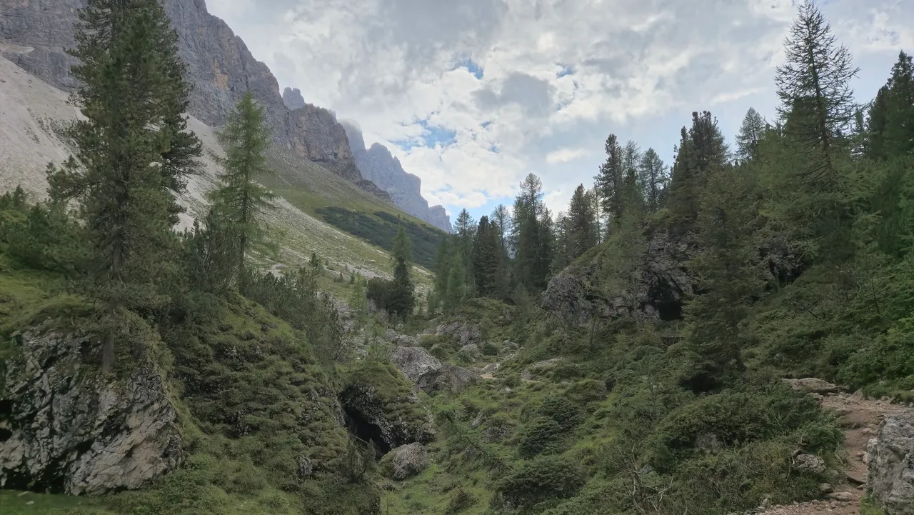
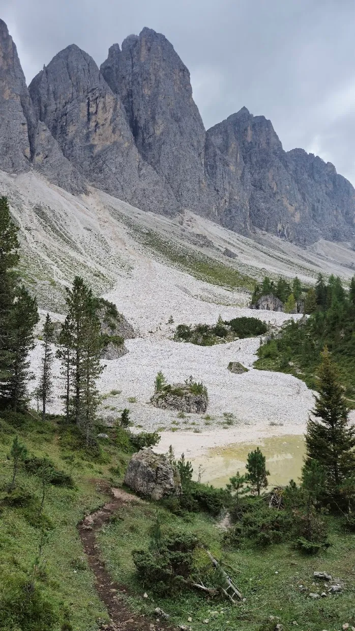
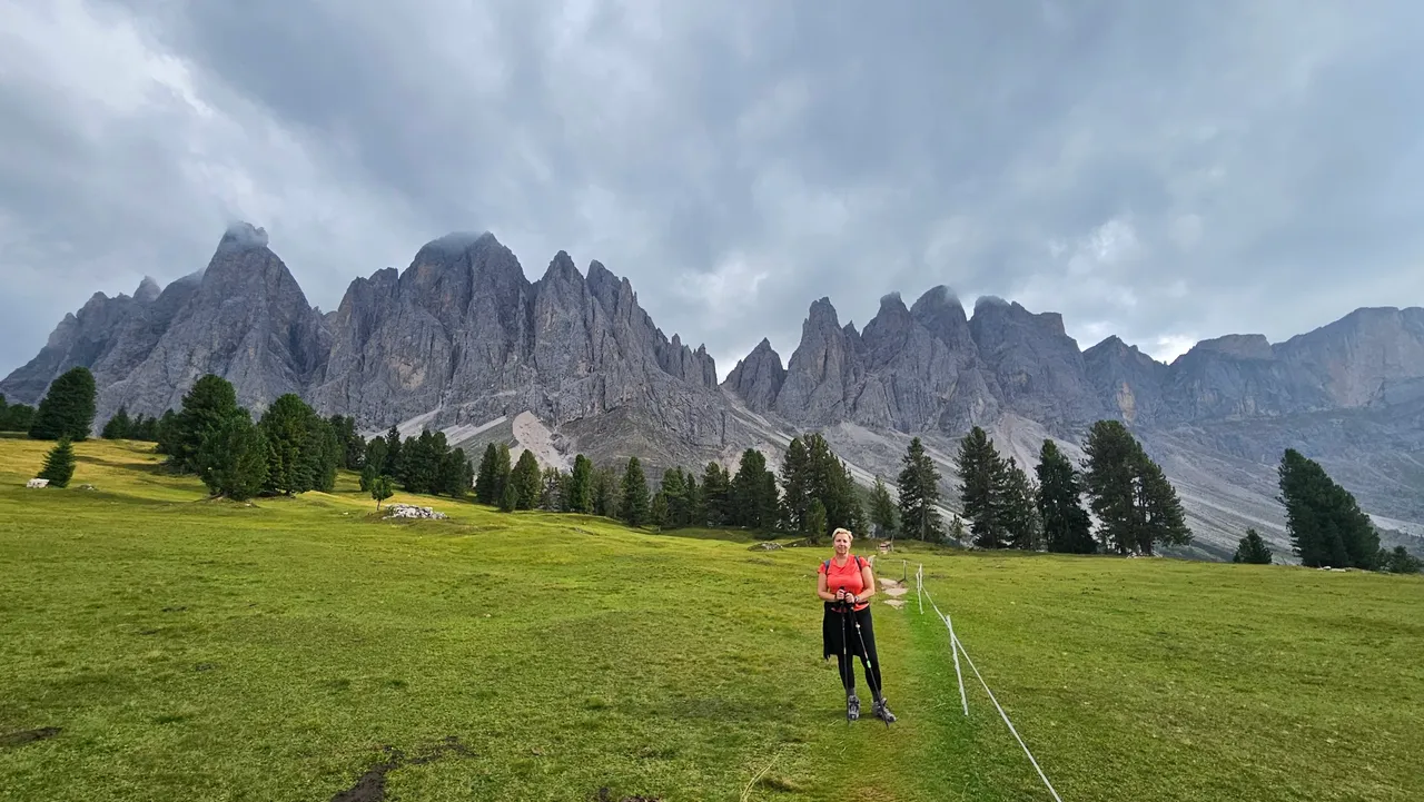
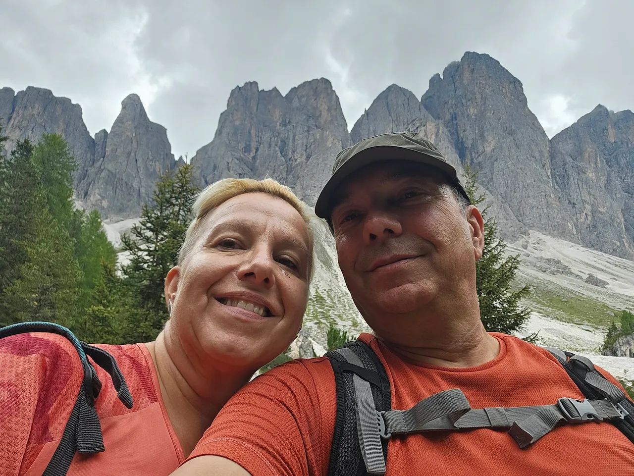
The road takes you along the edge of a lush forest, over numerous roots and earthen hills below the sharp cliffs of Saceda. In a few places, it is possible to enter the couloirs (halls) of Saceda and feel the absolute silence that reigns in the couloirs, except when they are working. Fortunately, this time we did not witness the noise of the avalanche of peeling stones that rumbled down the mountain and filled the couloir. We had an absolutely peaceful walk, but in the spring when the mountain wakes up, you should definitely be very careful and not go too close to the cliffs.


At the intersection with trails no. 34, 35 and 36, we chose to go up the path no. 34 to a small hill on which there are a couple of mountain lodges with a divine view. It doesn't really matter if you choose track no. 36, both lead to the same place, but maybe path no. 36 offers a slightly more open view of the surroundings. As I said, there are mountain lodges on the spacious meadow to which both paths lead. The field itself is full of cows grazing idly and watching the hikers on their way. A real paradise.
We chose the first rifugio, the Gschnagenhardt Alm, simply because we came across it first. This mountain lodge at 2,006 meters above sea level has several specialties to try, but I definitely recommend the homemade apple juice, which brought me back to my childhood with lightning speed. In addition, the juice is really nutritious, so it will also rehydrate you after the hike.

While we were sitting in the mountain lodge, usually for this time of year and the Dolomites, there was a sudden change in the weather. In just a few minutes, the weather turned from a sunny day into a rainy storm that threatened to get us completely wet for the second day in a row. Since we already knew that Maja's rain jacket was not working, we quickly organized ourselves as we did on the first day - Marko and Ivan hurried to the car, and Maja and I followed trek slowly at her pace.
This time, apart from rain, we also had the problem of cold. In the forest, the temperature suddenly dropped to only ten-ish degrees above zero, and Maya was already quite wet. So I made her put on literally everything I had in my pack and picked up the pace to where it was safe for her. We continued our journey through beautiful Dolomite forests to the parking lot and the warmth of the car.
I have to mention the excellent function of the newer Garmin watches and satnavs, which have offroad maps loaded into memory. On the previous day on Saceda, and on the Adolf Munkel Weg hike, I used the navigation option to determine the optimal, the fastest and easiest way back to the starting point. The route more or less agreed with my plan, which involves returning along path no. 36 to the Zans parking lot. This closes the circle, if the description is not enough, the gpx track can be found on my Strava profile.

This hike is my absolute recommendation. With 11 kilometers and 470 meters of ascent, it represents easier hikes in the Dolomites, and the views and landscapes are truly divine. Enjoy the extraordinary view of the vertical cliffs of Saceda from the rich forests, and be sure to treat yourself to some Alpine delicacy and apple juice in a rifugio.
Until the story of the fourth day, big greetings!