
There are only two prescious days on a weekend and how you spend it will decide your mood for the coming week. Some people travel out of town, others stay at home with fam. Some look for a place to chill in the city, others go outdoors to unwind.
As for me, if I’m not on a major climb with friends, I’m usually hiking in the mountains of Cebu.
And speaking of hiking, probably the go-to weekend playground in the city would be the Pamutan Trail — most commonly known as Spartan Trail. The good ol’ route starts from Sitio Banawa, traversing Brgy. Buhisan, and ends in Brgy. Pamutan. It’s a very interesting trail that offers diverse tracks as hikers pass through open hills, shallow river, bedrock, and forested mountains.
As I have shared in my previous post, more routes have been added after the pandemic and new generation of hikers now prefer the shorter ones. My friends and I have tried the these trails as well but Pamutan Trail will always be special to us.
And that is what this post is all about. Remembering our good ol’ favorite trail.
First Leg: Through the stairway to heaven
Our hike to Pamutan Trail started with an easy walk along the paved road of Paseo Arcenas subdivision ascending to the city’s pilgrimage center, Good Shepherd. From here, one can already enjoy the view watching the sun rise over the cityscape below.
After passing the residential area, we prepared ourselves for the dreaded “stairway to heaven” which meant an uphill climb through a series soil steps. Personally, this part was the most exhausting for me since the stair treads were uneven — sometimes the steps get too close to each other, other times they’re to far. Top it off with the sun’s heat and you can’t help but say “can we go back now?”
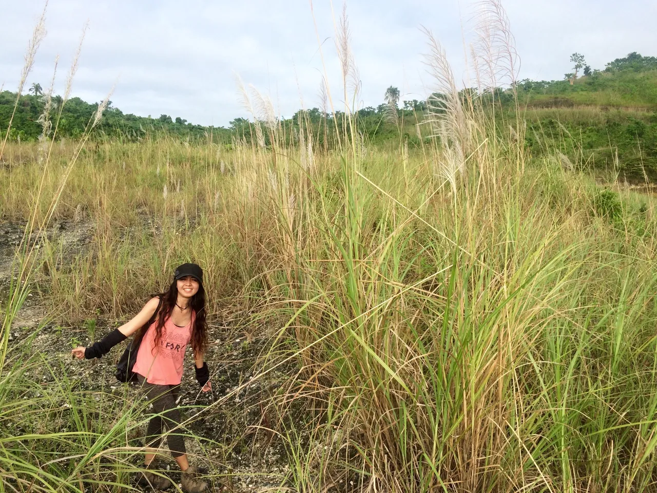
The end of the stairway led to a flat-topped hill called Monterazzas. This area has now been closed to the public and developed to a subdivision which offers a unique blend of city living and nature. But seven years ago, there was nothing here but grass and the breathtaking view of the city.
Second Leg: Down the riverbed
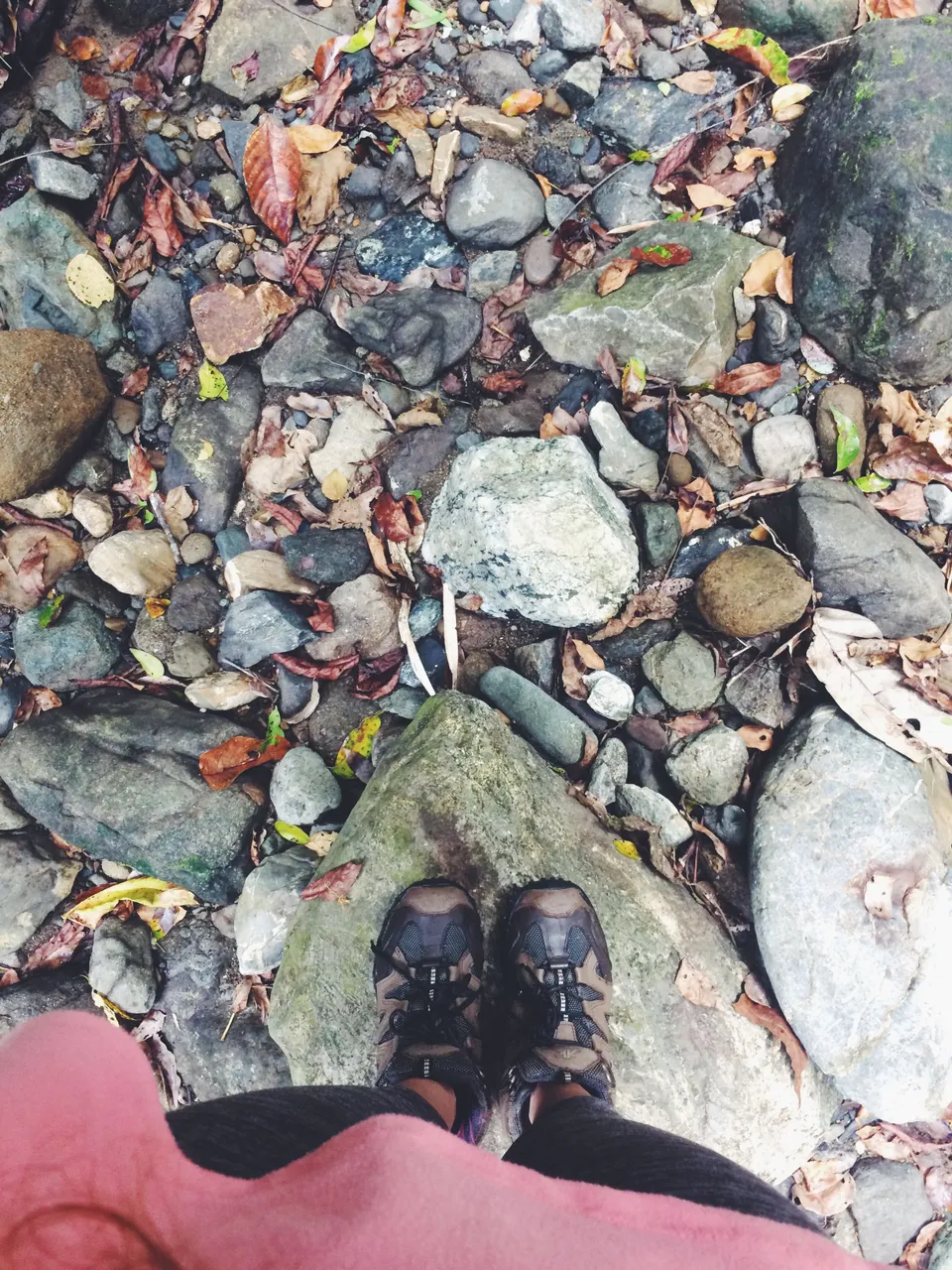
After taking our time in Monterazzas, we then descended to the river of Buhisan. This part, definitely, was my favorite of our day hike. We walked through the bushes and narrow trail until we reached the riverbed. During wet season, water in the river rises up to knee deep. Meanwhile, during dry season, there’s a little or no water at all and you get a long bed of rocks instead.
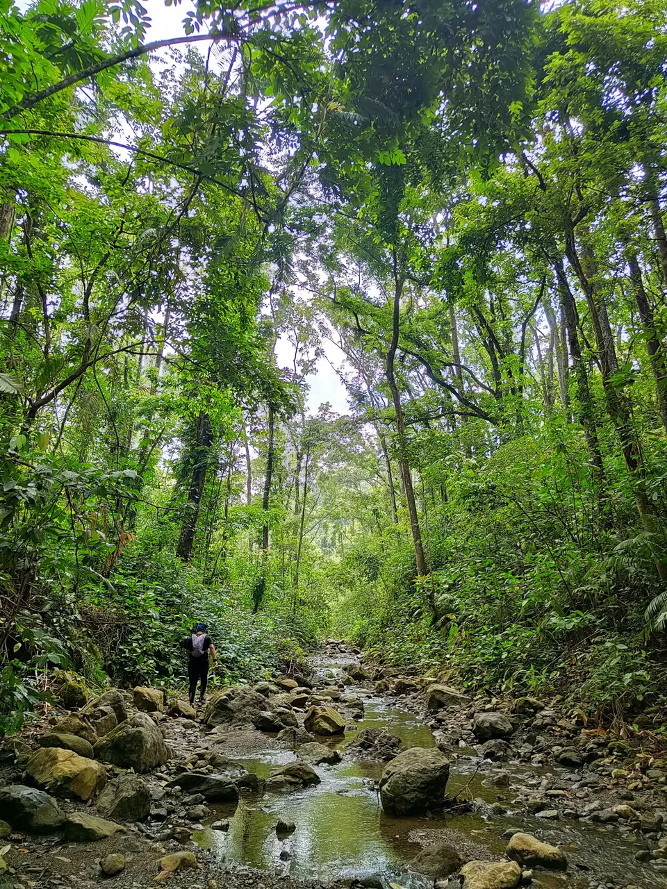
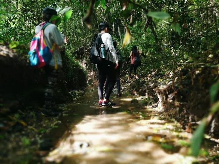
Hiking in this part of Pamutan Trail feels like going to the depths of the Amazon. The sunlight piercing through green trees paired with the sound of water streams make the forest come alive.

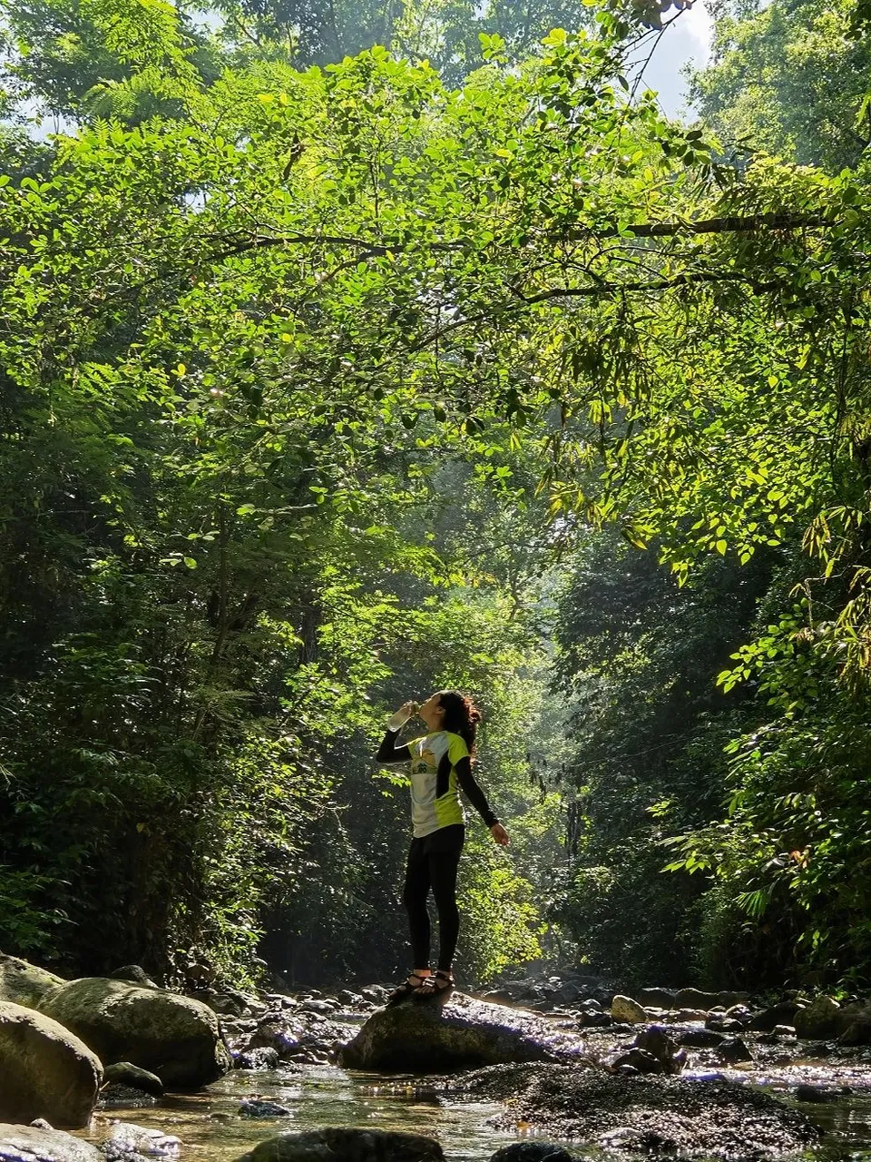
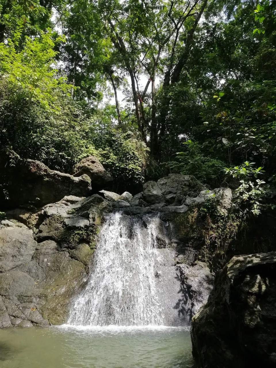
Along the way are some mini pools where one can take a dip, relax, and immerse in the silence of nature.
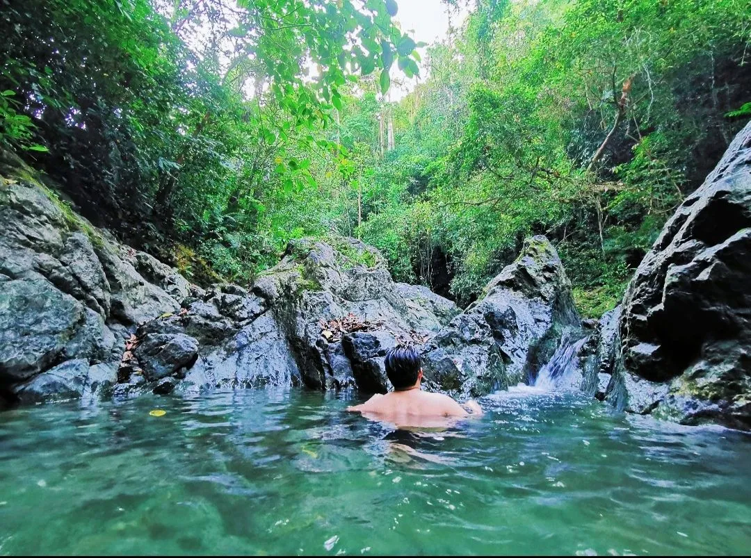
The trek then led us to a waterfall where we rested and prepared for the last leg of the Pamutan Trail.
Last Leg: Into the thick of it
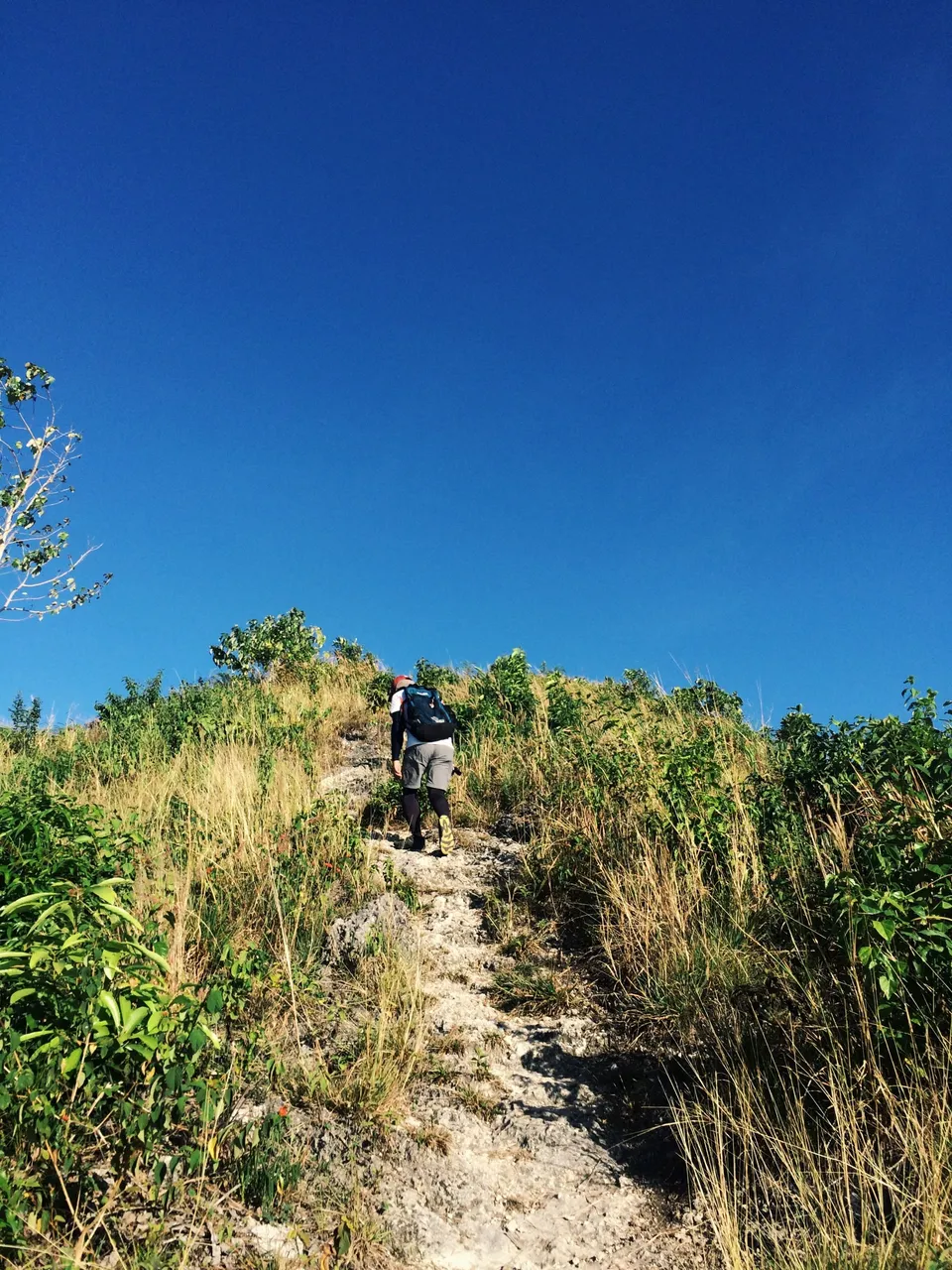
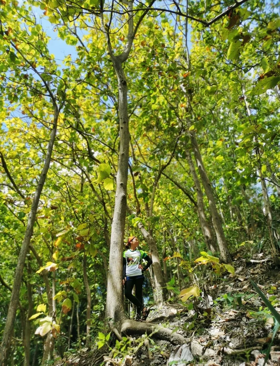
The last leg of Pamutan Trail is a direct assault on the ridges of Buhisan Watershed and Forest Reserve. In this section are thick growth of teak trees which are still a matter debate among local hiking groups. Although it may not be the perfect species to plant — being not an endemic tree — these trees have provided the much-needed shade during our hikes. Its large deciduous leaves give a wide canopy along the trail — and a colorful one depending on the season.
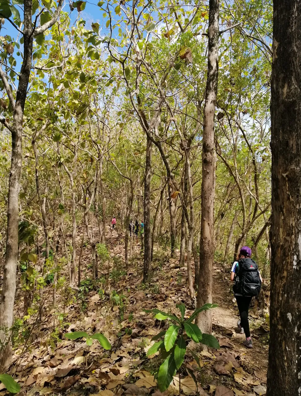
After several rest stops, we continued with the seemingly endless assault. We never thought we’d want to see the end this bad. For hours, we hiked on uphill slopes, panting and probably asking ourselves in silence if we made the right decision to hike when we could have been sleeping at home.
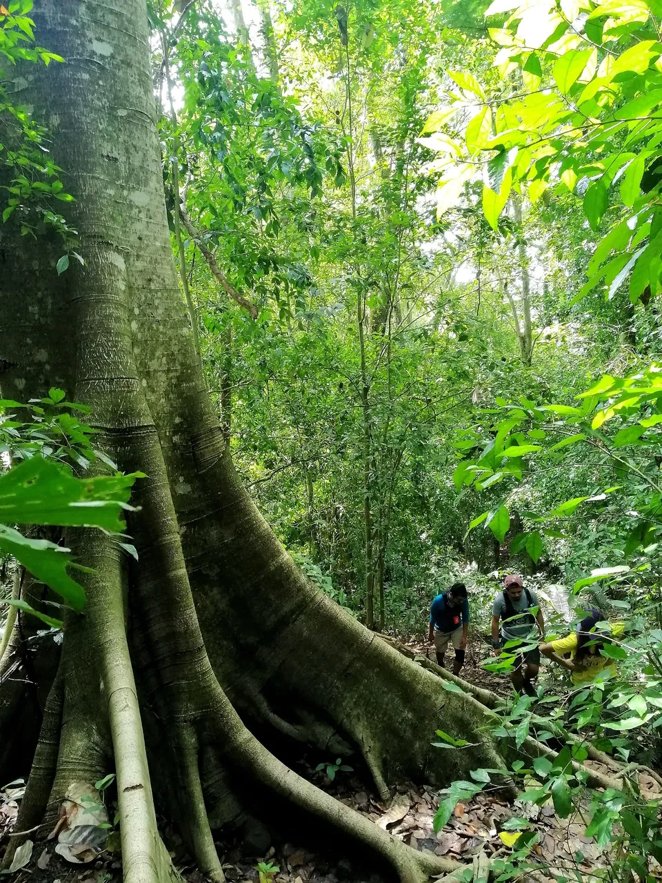
It wasn’t long until we reached the towering old Dao tree. Generally, this has been a go-to resting spot among hikers from hours of walking on steep trail. Personally, I see this tree as an assurance that we're almost at the end of the hike.
After three hours of hiking, covering seven kilometers of diverse paths, the lengthy climb finally ended in Brgy. Pamutan. All the sweat is worth it because of the different experiences this good ol' trail had to offer.
Hopefully, despite the many changes made by Typhoon Odette and the establishment of newer routes, people will still continue to add this trail to their weekend escapades. It's one of a kind and a great training ground for newbies and seasoned hikers alike.

Hello! I'm Maria, a hopeless romantic who travels in pages and places. I hope to share my love for words and the world with you here in HIVE.
If you like this content, don't forget to follow, upvote, and leave a comment to show some love. You can also reblog if you want to. Let's connect! 🤍