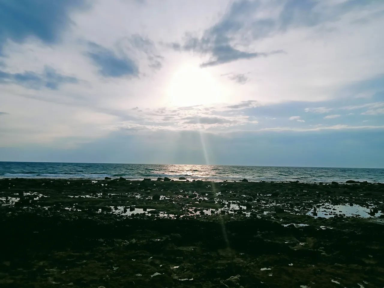
I did a travel this afternoon at the beach located in Barangay Calangahan and to see the beauty of the place hidden here. Are you ready to explore the place? So lets begin.
Location:
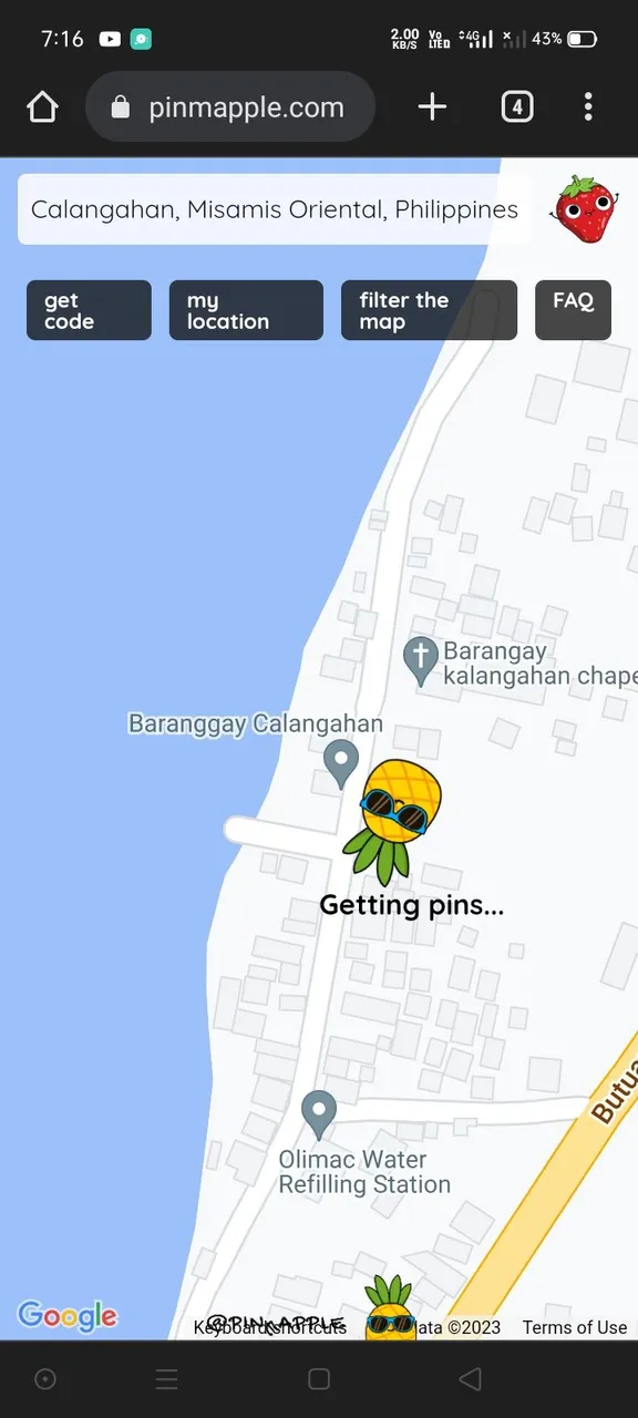
Pinmapple
Using pinmapple site, lets trace the area first. Barangay Calangahan is located next to Barangay Punta Silum. This Barangay is served as the boundary point between the two Municipalities, The Manticao and Lugait. There are lots of people living in this place and it is divided into 4 Puroks;
- Masidlakon 1
- Masidlakon 2
- Bougonvilla
- Sampaguita
Most of the people living in this place are fishermen and they already owned small boats used for fishing activities. From Iligan City, it takes a few hours of travel depends on how traffic the road is. And it needs to ride on a bus or Jeepneys.
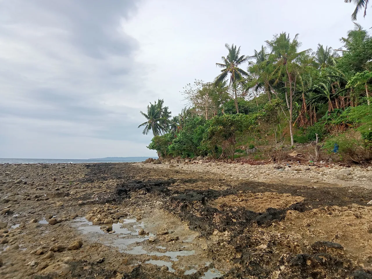
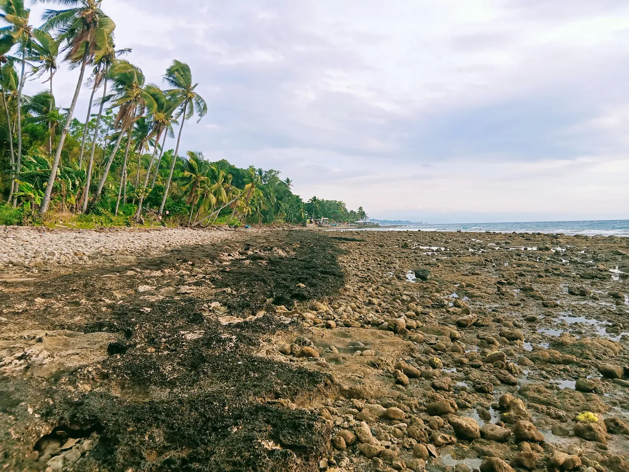
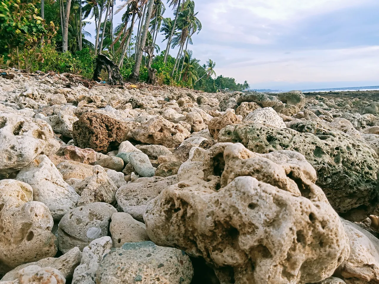
During my travel, I noticed that there is a low tide happens and all of the stones are already shown up because the water out. There are lots of stones we can see and found here in the place and in local term we called it, "Pagang". The coral reefs usually grows in this kind of stones and some marine animals just like fish, crabs and shrimps also hide in here. There are black portion of the stones I've seen during my beach travel and I am a little bit curious about what I seen. I tried to asked some of the residents here and they told me that it was an old road during the Second World war. I was very amazed.
According to them, this was an old road during Second World War. This black color in the stones was an asphalt used for cover the concrete to make it really hard and can't easily breakable. As the many years has pass and the water keeps higher, the old road was completely gone and submerge in the sea water.
There are lots of stones can be found here and of course, there are also dangerous sea animal creatures hidden underneath of this stones. It is really important to wear slippers or sandals when we decided to walk here at the beach.
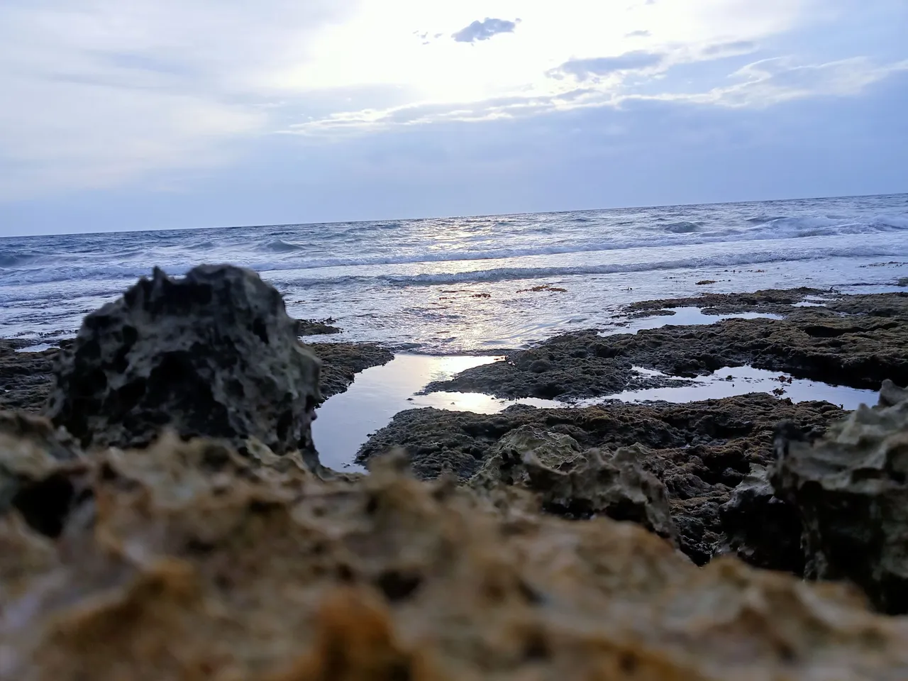
Some of the stones are very pointed and sharps that is why we should be very careful by steeping it. It was a kind of windy situations during my beach exploration and the waves are higher again. Soon this stones will also submerge in the water again due to high tide. The sky was very cloudy but I think it wont rain. There are also lots of seashells hidden in the stone holes and most of it are edible.
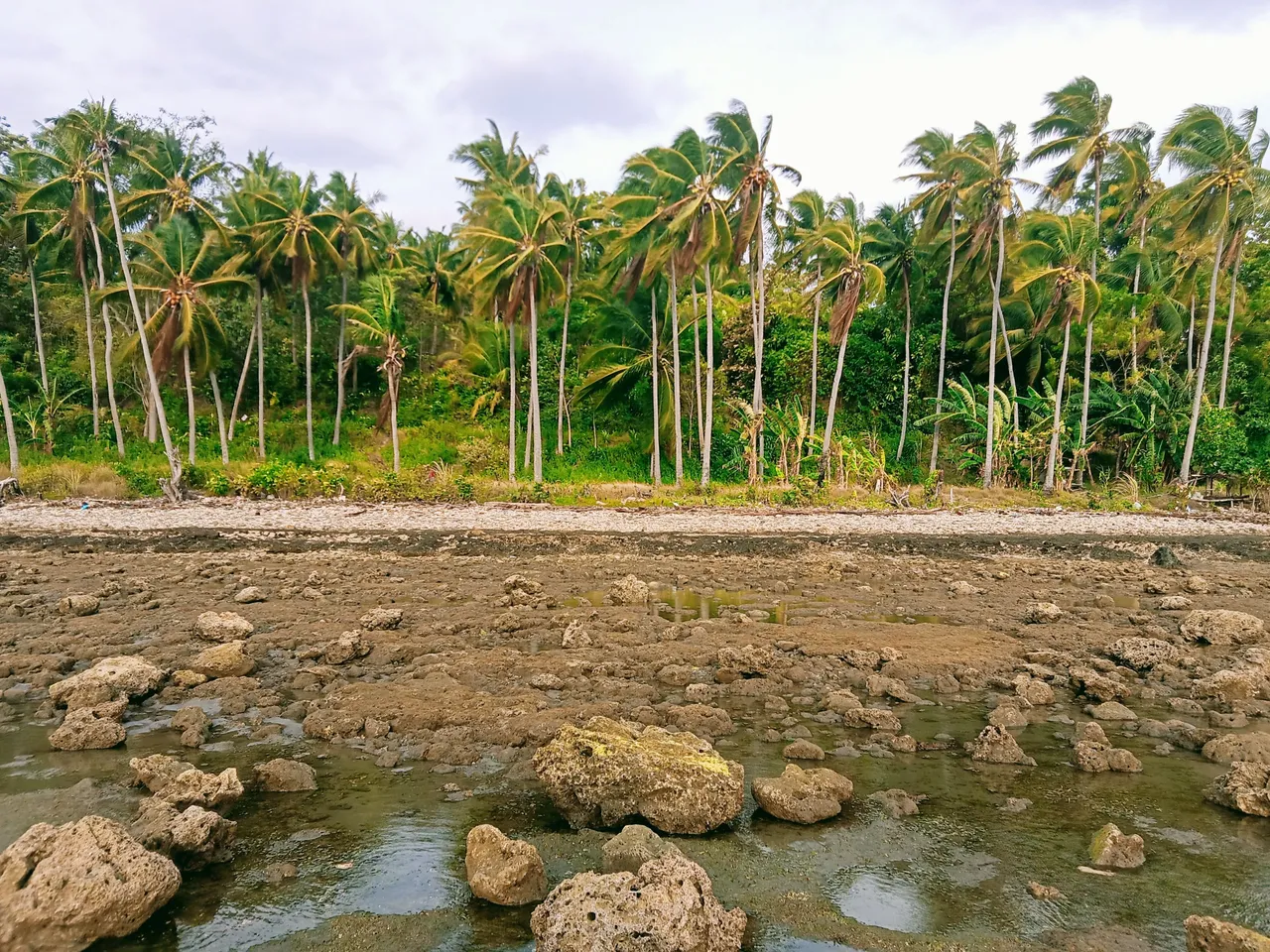
There are lots of coconut trees can also seen here and I am very amazed of it. This coconut trees is not planted instead this was comes from the waves splashing and washed away and landed it here. Many years has pass, the sea water rises up and the coconuts float in here and grows into a taller one. There are lots of fruits bares in this trees and most of the visitors and beach goers get some fruits in here.
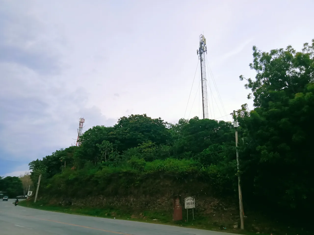
This two Cellsite towers helps us a lot here in the Country. Through this, we can be able to communicate, text, or surfing the net and it gives a great contributions to all of us here. This towers is located at the border point of Lugait and Manticao. Even if the beach contains many stones but still it is perfect for swimming and beach exploring.