Taoyuan Valley
Taoyuan Valley is located at the boundary of New Taipei City and Yilan County in the Northeastern part of Taiwan. It is considered the tail of the Snow Mountain, also known as Xueshan.
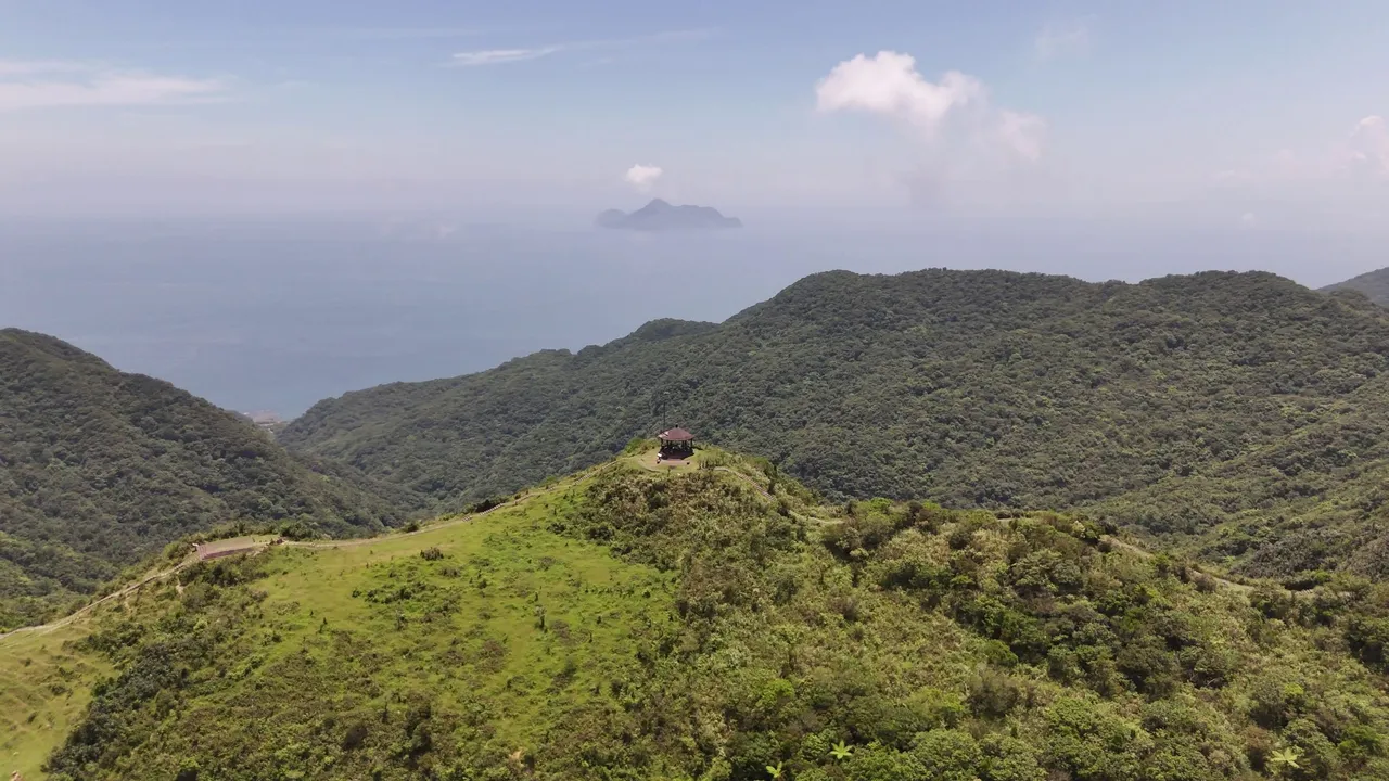
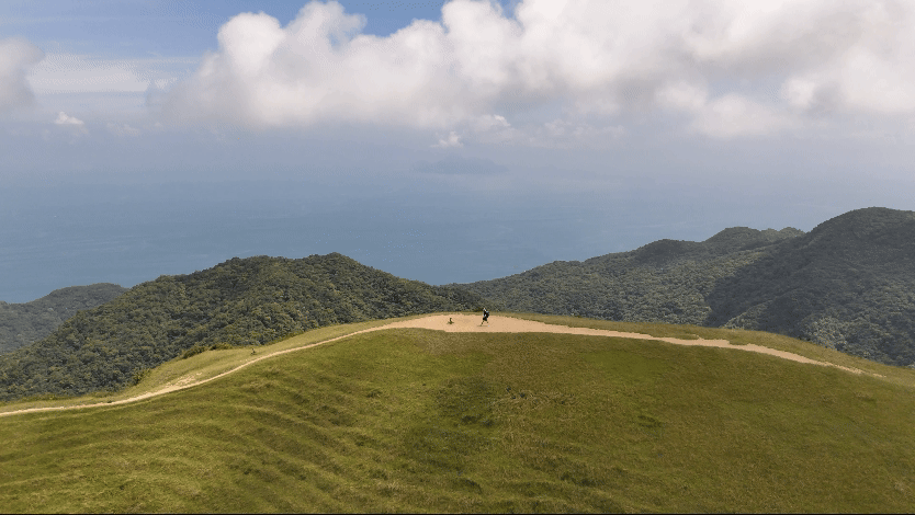
On top, when looking in the direction of New Taipei City the visitors will see a beautiful green land and neighbouring mountain ranges; on the direction of Yilan, visitors will immerse in the scenic view of mountain seascape and the Turtle Island.
Trails
Taoyuan Valley has three main trails namely Neiliao, Daxi, and Caoling trails. Neiliao is the shortest trail that visitors can just finished in a matter of 20 mins, it is very accessible by car and bus. While Daxi is a steep trail that starts from the coast of Yilan. And Caoling which connects to the Caoling Historic Trail that is also starts from the coast of Yilan.
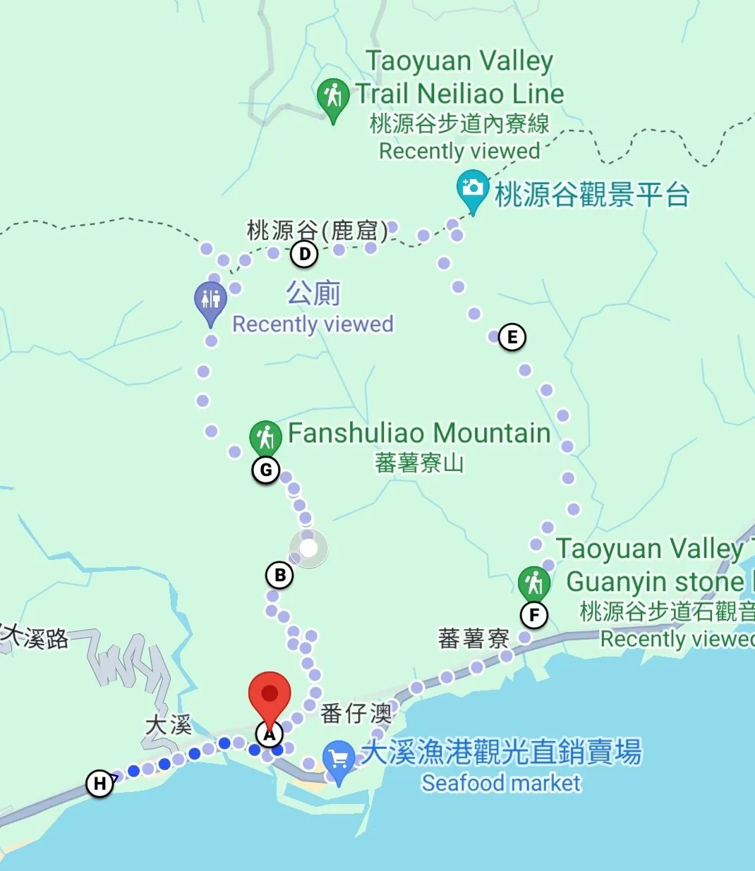
For my hike, I planned to make a loop ascending from the Daxi trail and descending to Guanyin Stone trail, another trail in between Daxi and Caoling. The loop is spanning approximately 14 km.
Getting There

It was a good Saturday morning with clear skies, which made me even more excited for the hike. It had been raining recently in Taipei, and I was hesitant to go because of that. I even brought a raincoat just in case it rained.
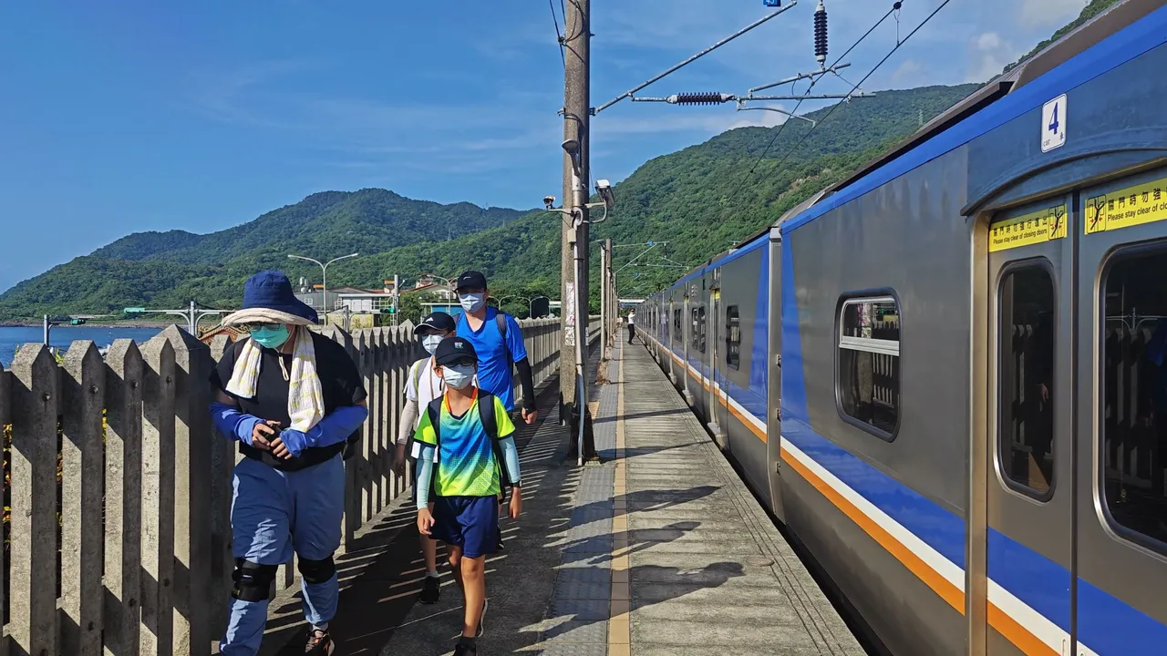
From Taipei, I took the local train (TRA) that brought me directly to Daxi Station, which is a kilometer away from the trailhead. In just an hour, I arrived there along with other hikers. In Taiwan, people of all ages love to go to the mountains.
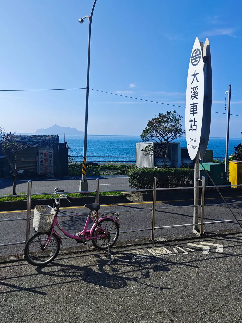
Upon exiting Daxi Station, I was greeted by the charming ocean view of Yilan. From there, I could see Turtle Island, with a perfectly calm ocean, a gentle breeze, and the subtle warmth of the morning sunlight.
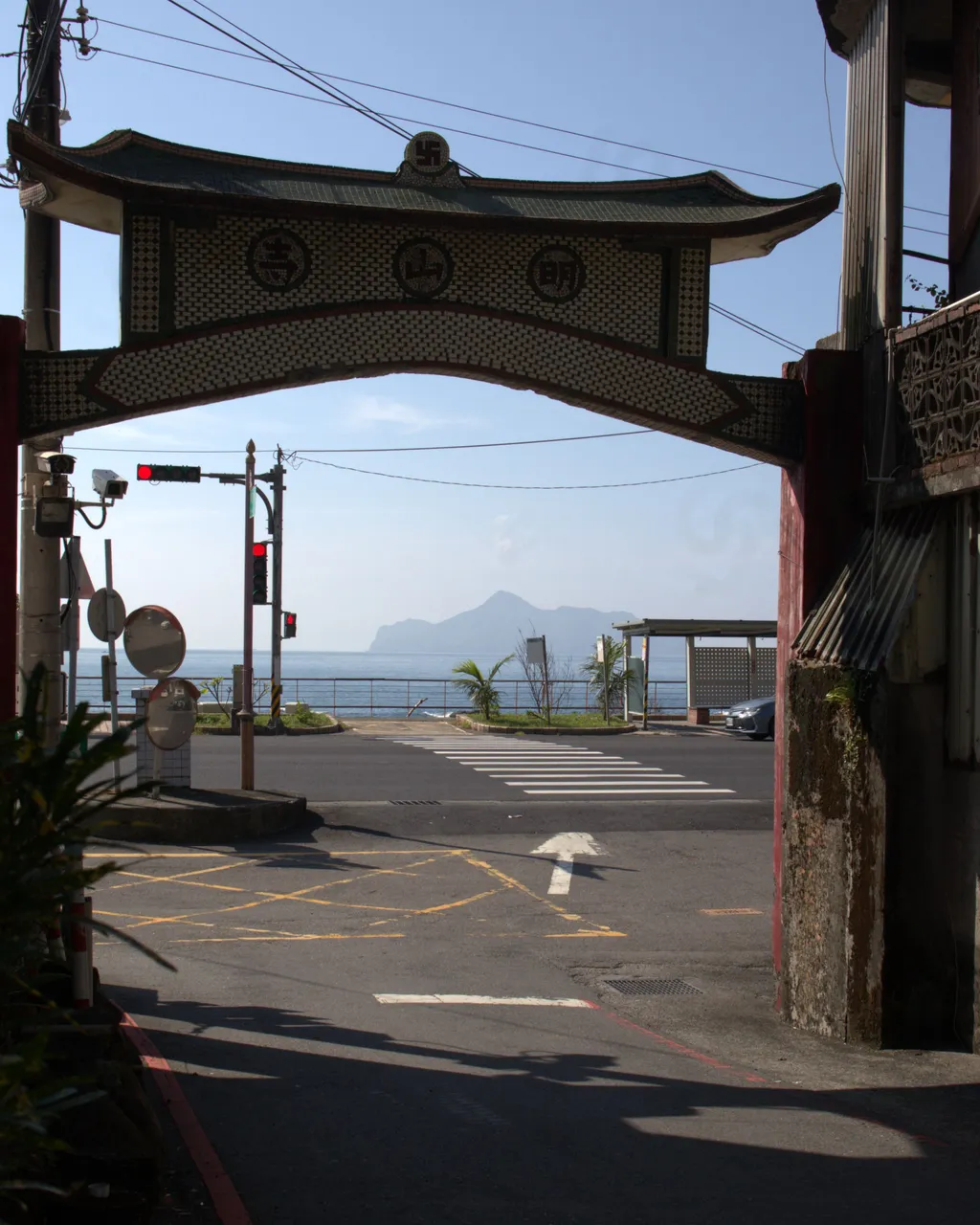
On my way to the trailhead, I passed by a small village, and as I exited, I saw an arch that revealed another view of Turtle Island. The morning coastal view was truly perfect and never failed to mesmerize me.
Ascending Trail
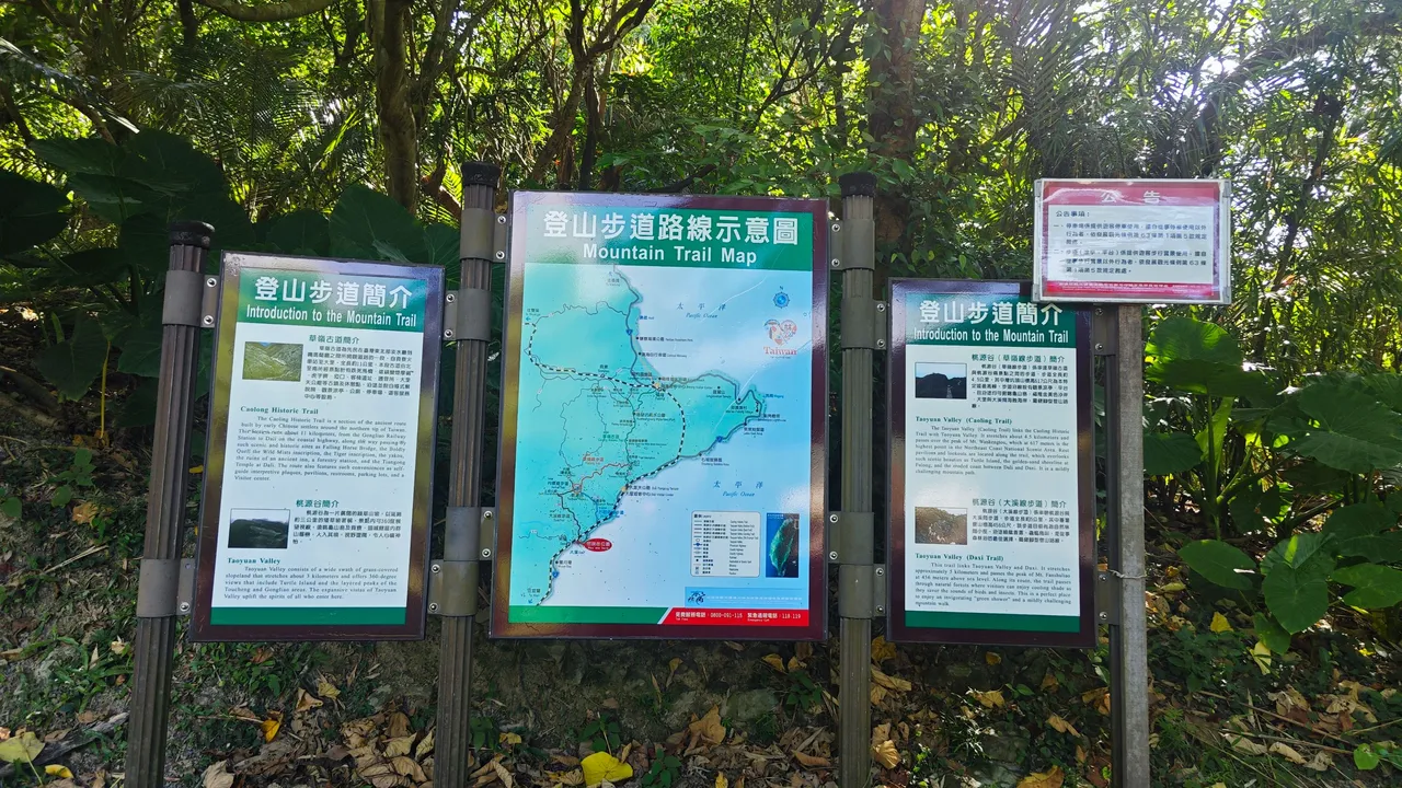
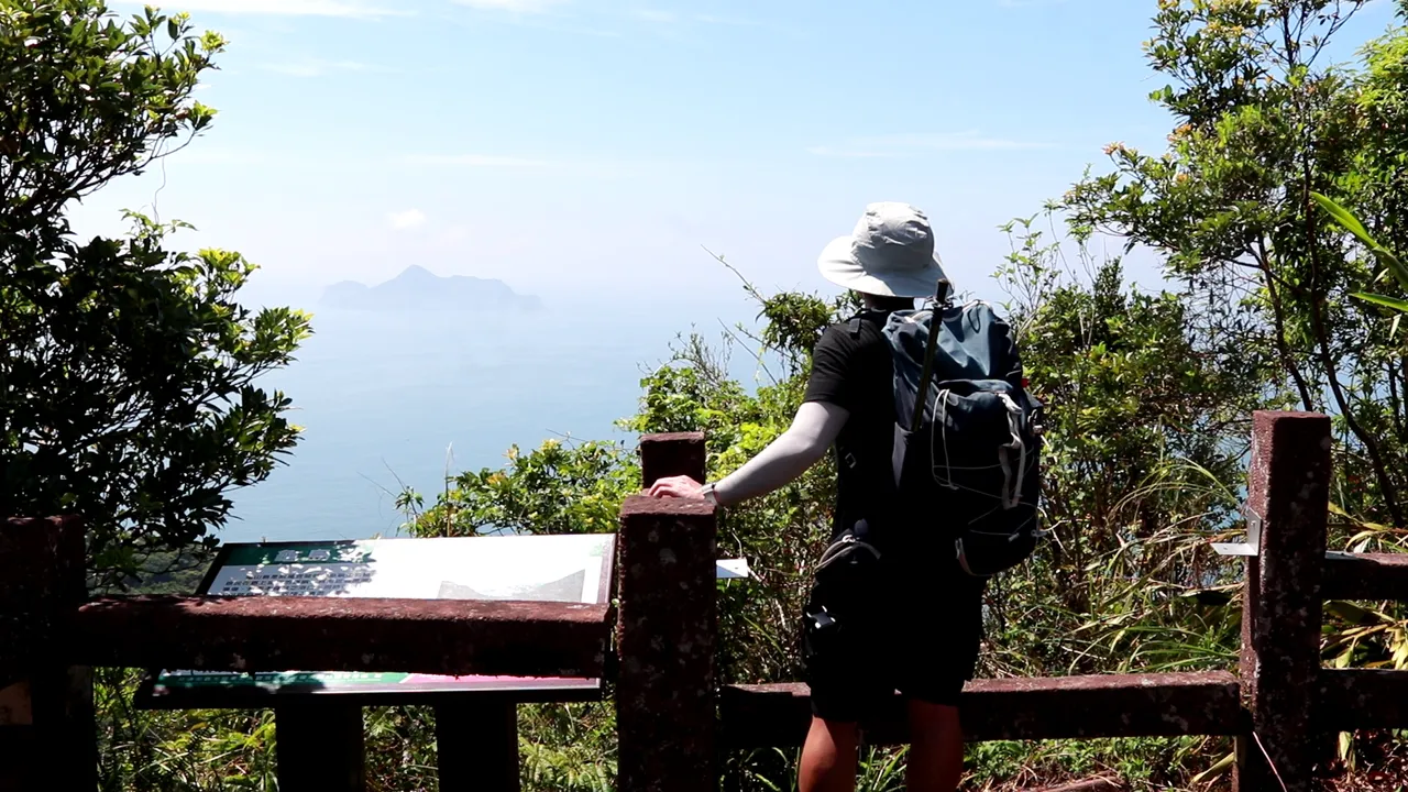
Arriving at the trailhead, I saw these boards introducing the trail, with a trail map in the middle showing the network of trails on this mountain. It's quite helpful to start with this information, so I know what to expect and where to go if I need to change my route due to unforeseen circumstances, which can always happen in the mountains.
Shortly after reading the information, around 9 AM, I started my hike, aiming to reach the summit before noon. I was about to ascend a 5.3-kilometer-long trail with an elevation of approximately 590 meters above sea level.
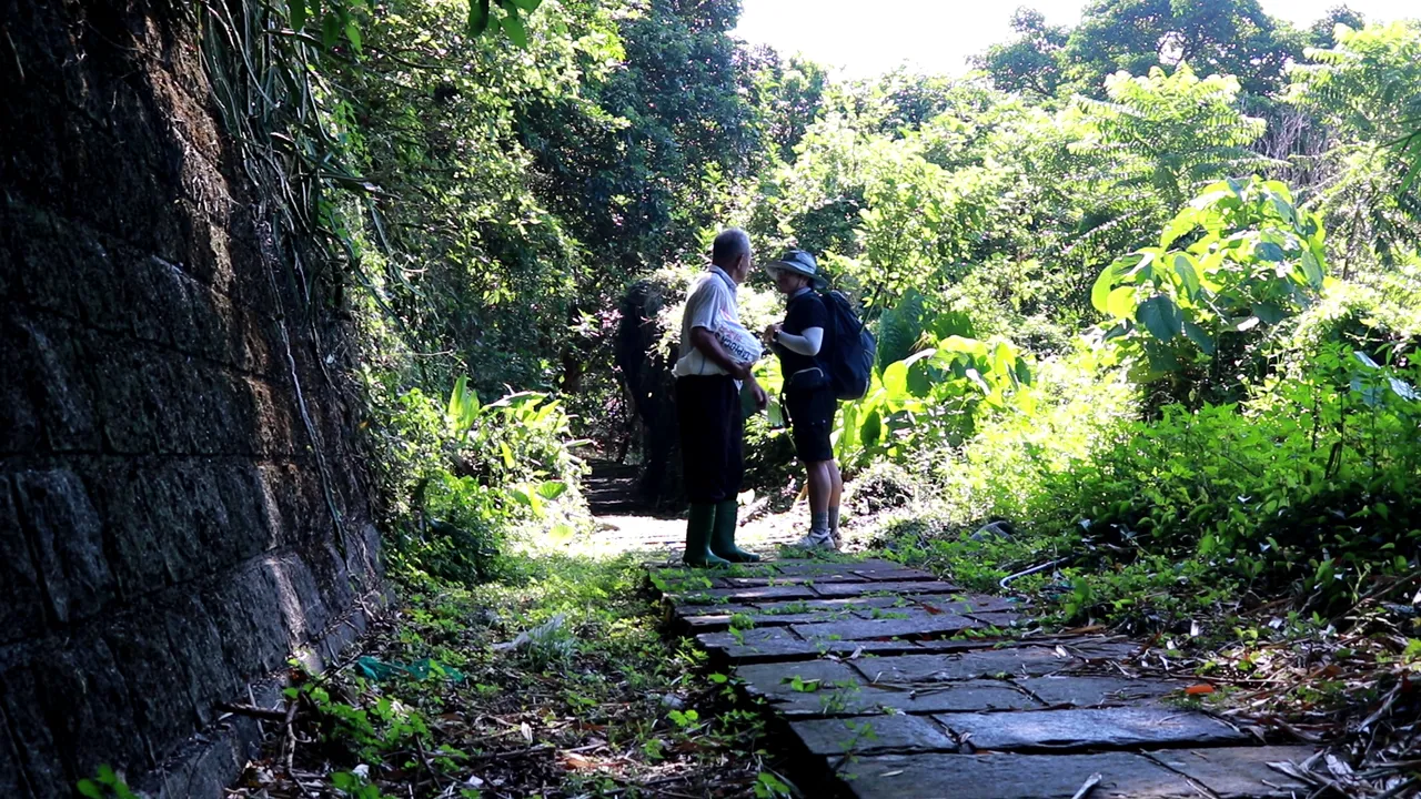
I came across an elderly local and had a small talk with him. He noticed me setting up my tripod and camera and struck up a conversation. To his surprise, I was a foreigner with limited knowledge of their language. I wasn’t entirely sure if I understood him correctly, but from the few words I could catch, I believe he was describing how great this trail and the mountain at the top are. Such a nice encounter to get started.
Going back to the topic, it’s a considerable distance, but not too high. However, since I'm hiking alone, I try not to underestimate the trail, as anything could go wrong in the mountains. I always have to be extra careful while enjoying my adventure.
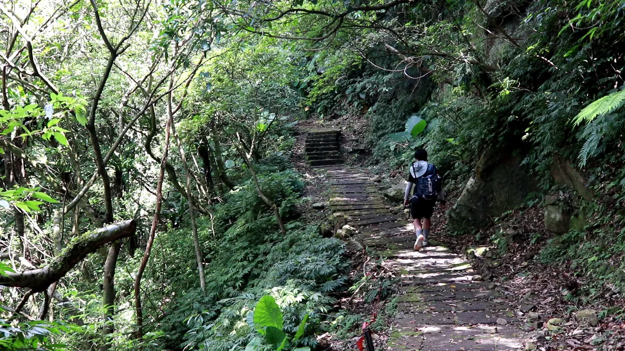
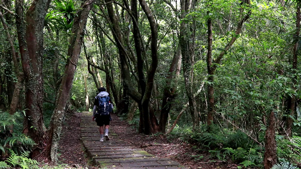
Ninety percent of the trail is paved with stairs and concrete steps, and it winds through a lush forest. Some sections are covered in moss, which makes them slippery. I also noticed a few rocks along the trail that I believe may have fallen due to recent earthquakes in Taiwan.
The trail was so peaceful that day; it felt like I almost had it to myself. There was nobody else around, just me, nature, and the insects and animals that might have been watching me. Would you believe that I saw a baby deer along the way? Well, it was my first time and I also can't believe it myself.
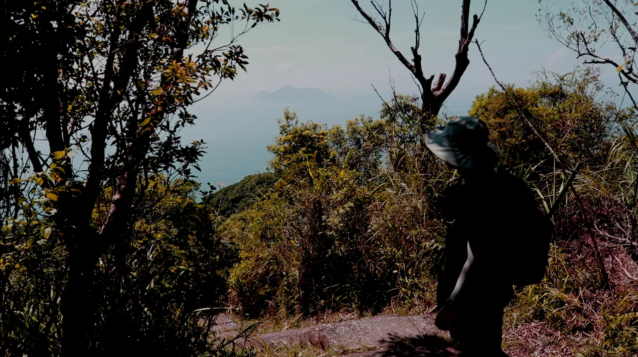
Halfway through, I reached a point where I could see Turtle Island again. I encountered a couple of hikers descending who warned me about a slippery segment ahead.

They also mentioned a spot where I could find a toilet and access spring water. I really appreciate how Taiwan supports outdoor activities and develops safe trails with accessible basic amenities.
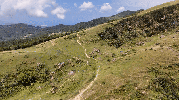
Xueshan Ridge Tail

It was around 11 AM when I finally emerged from the forest trail and arrived at the Xueshan Ridge Trail. This is the final leg of the hike, where the trail runs through grassland, fully exposed to the heat of the sun.
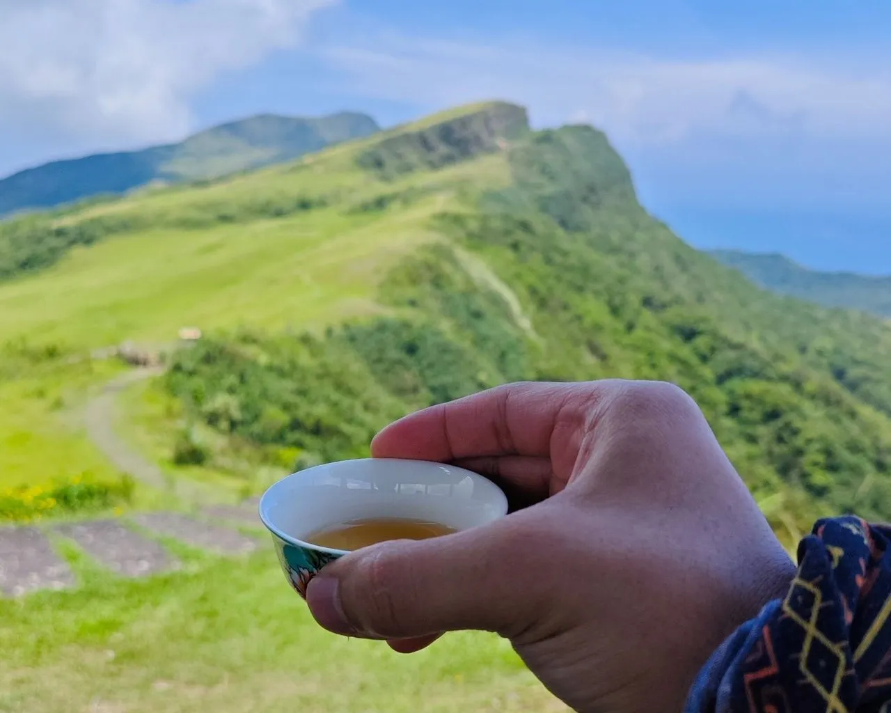
About 1 km from the peak, I found an observatory along the trail. It was half past eleven, so I decided to rest here, have my lunch, and enjoy the 360-degree view while cooling down.
Here, I met other hikers and visitors who had taken the shorter trail. They were very kind and offered me freshly made tea, which I enjoyed while taking in the breathtaking view of the summit in front of me.
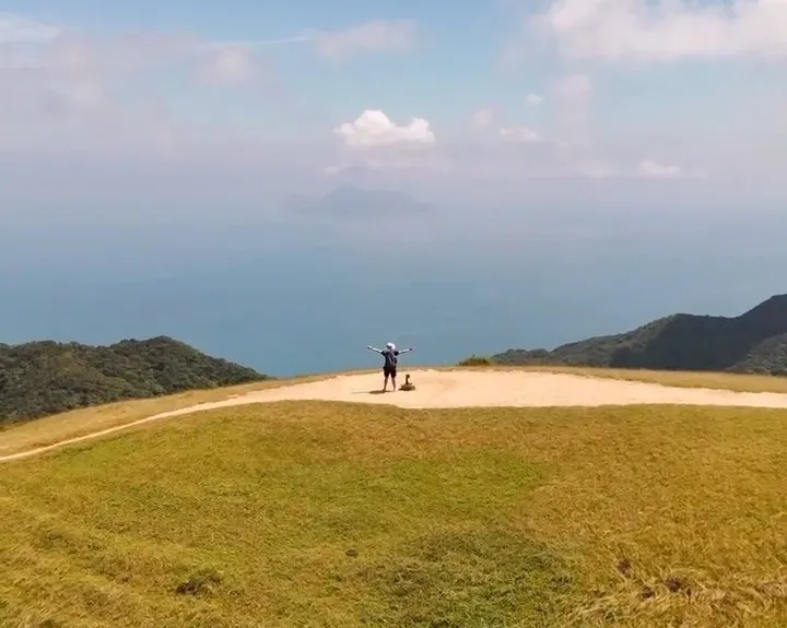
Summit
Afraid of getting caught by the approaching rain, I continued my hike to the summit shortly after having lunch and a great conversation with the locals.
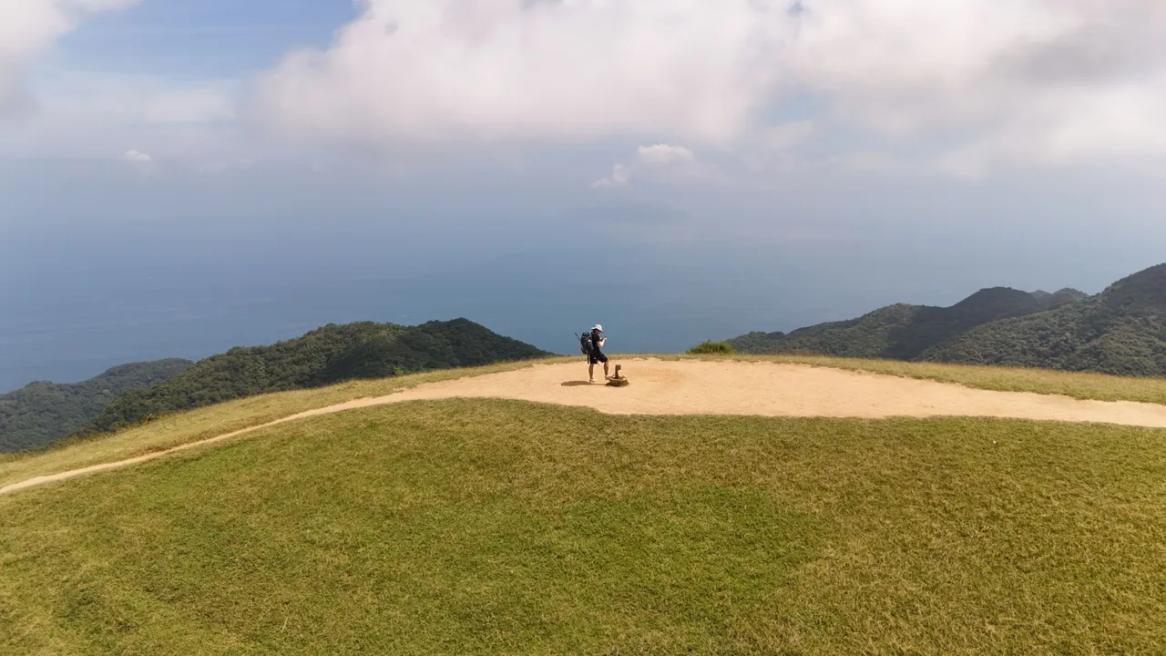
I arrived at the summit in no time and stayed there for quite a while, capturing cinematic drone shots and enjoying a mindful moment, surrounded by nothing but nature.
Thoughts
It wasn’t my first time going on a solo hiking trip, but this one was quite special. It was my longest solo hike, and I found myself almost entirely alone on the trails, with only a few other hikers along the way. Having a busy career in the fast-paced tech industry, these kinds of journeys help me retreat and restore my mindfulness. It’s also nice to have random encounters with strangers along the journey; it makes the trip more meaningful and reminds me that there is always more to life.