Just a short distance out of Washington D.C., there is a section of the Potomac River where the river shows its wild side. After meandering slowly through the hills separating Virginia, Maryland,and West Virginia countryside, about 14 miles west of Washington D.C., the river goes through a few miles of elevation drop, creating waterfalls and rapids that look like something you’d see in Colorado, not the D.C. suburbs.
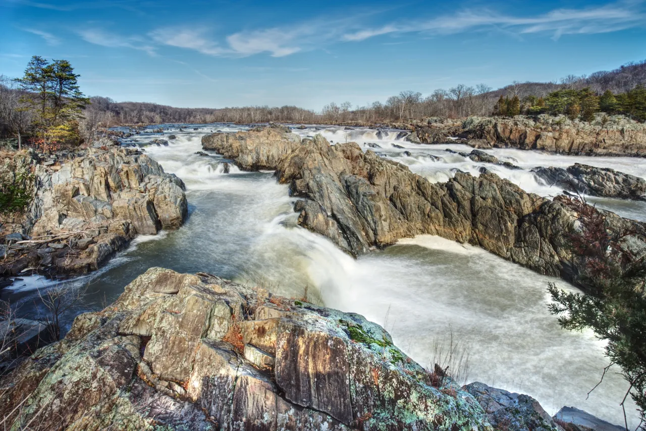
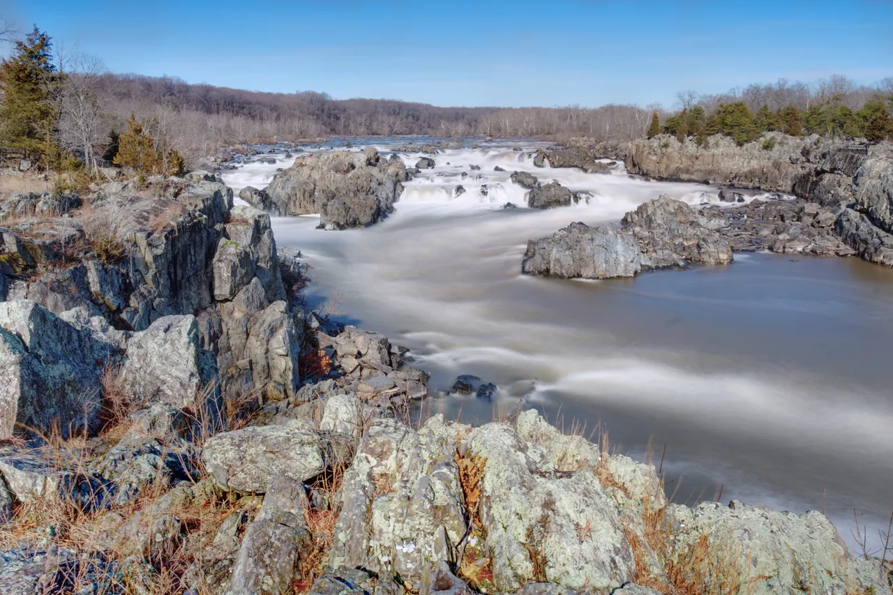
Great Falls from Virginia
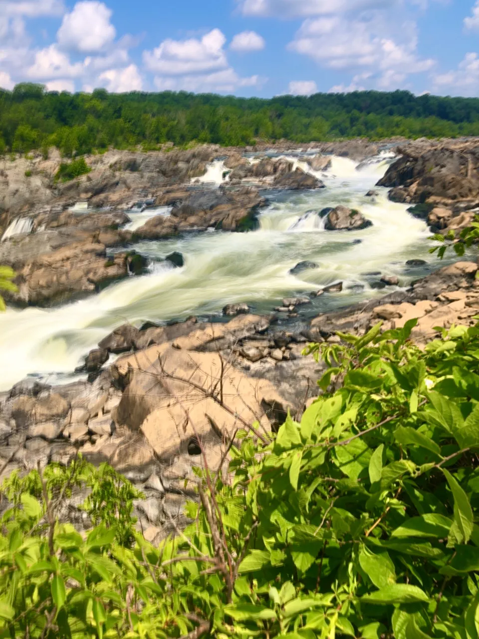
Great Falls National Park on the Virginia side of the Potomac gives visitors great views of the falls looking upstream from three different viewing platforms in the park. The platforms can be rather crowded on weekends so you might want to visit during the week if you can. Overlook 1, 2 (photo above), and 3 (photo below) are all accessible with just a very short walk from the parking lots in the park. The view from Overlook platform 1 gives you a good view of rapids and the occasional kayakers brave enough to tackle this section of the river, but the view of the falls is better from Overlooks 1 and 2.
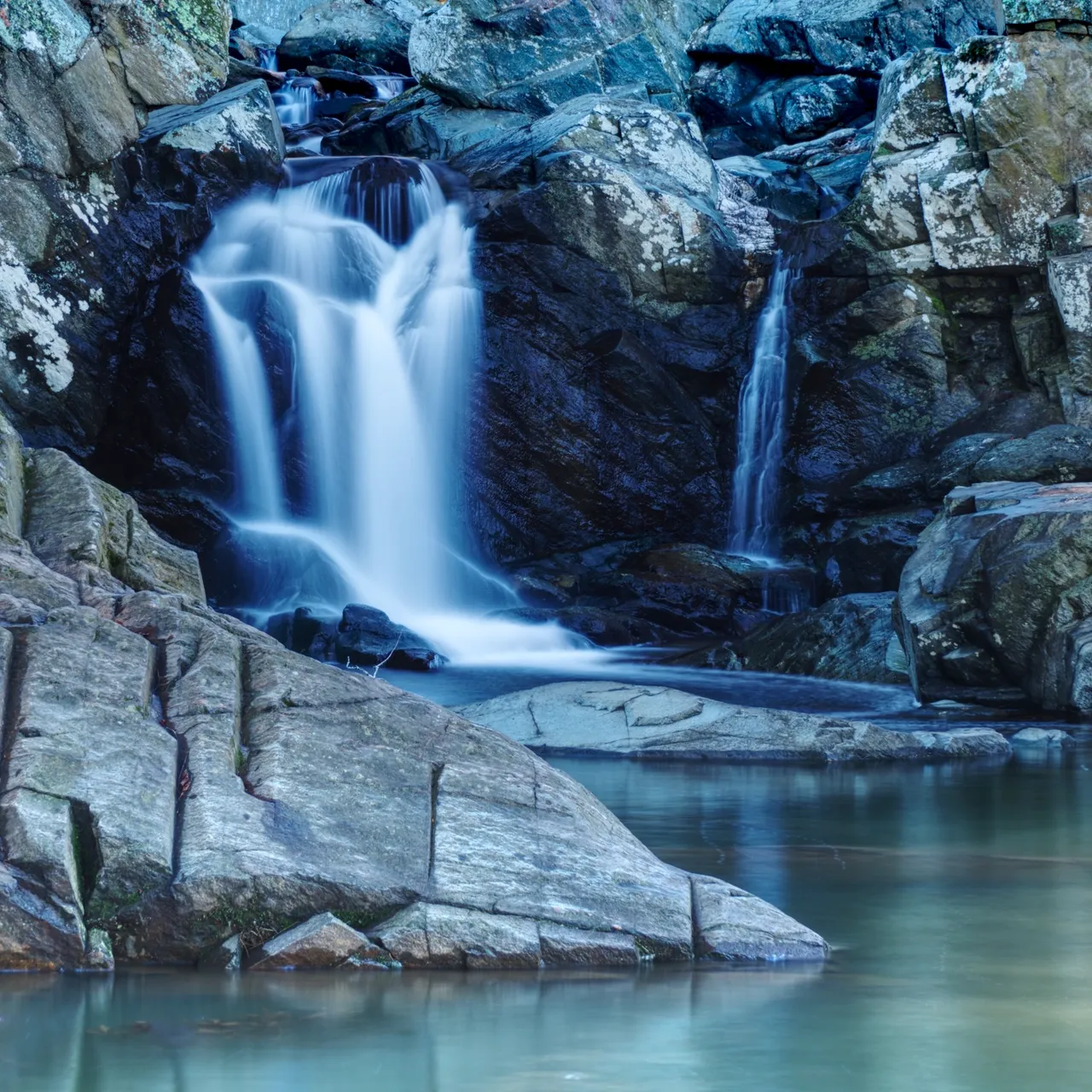
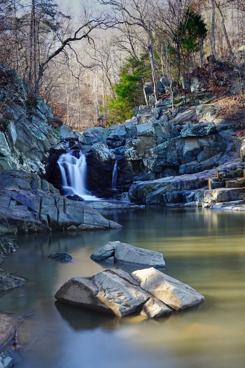
Scott’s Run
Just downriver on the Virginia side is another smaller waterfall where Scott’s Run meets the Potomac. The stream creates a nice waterfall as it flows over a hill into the Potomac. It is only a little more than a mile to walk down to, so worth the effort. It is outside of the Great Falls National Park, but if you love waterfalls like I do, you’ll visit Scott’s Run while you are in the area.
Great Falls from Maryland
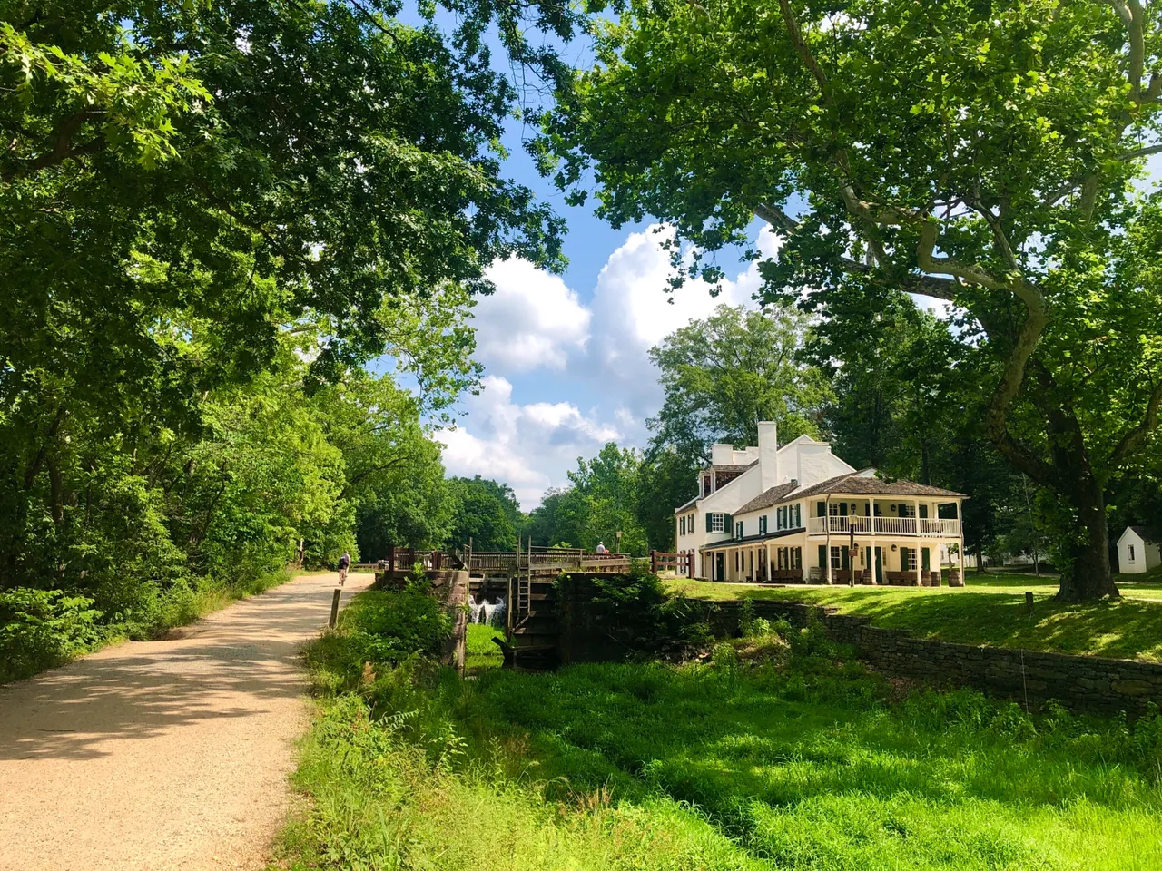
On the Maryland side of Great Falls, you get to a viewing platform by taking a walk through the C&O Canal National Park. You want to park at the Great Falls Tavern Visitors Center in the park and then take a walk down river on the canal path to get to the Olmstead Island Trail that take you out in the river to see the falls. The canal path is quite scenic in and of itself as you see the the photo below and in my post from a few weeks back. The photo below was taken from just down the C&O Canal Path with a view of the historic Tavern.
@dabeckster/biking-the-c-and-o-canal-in-washington-d-c
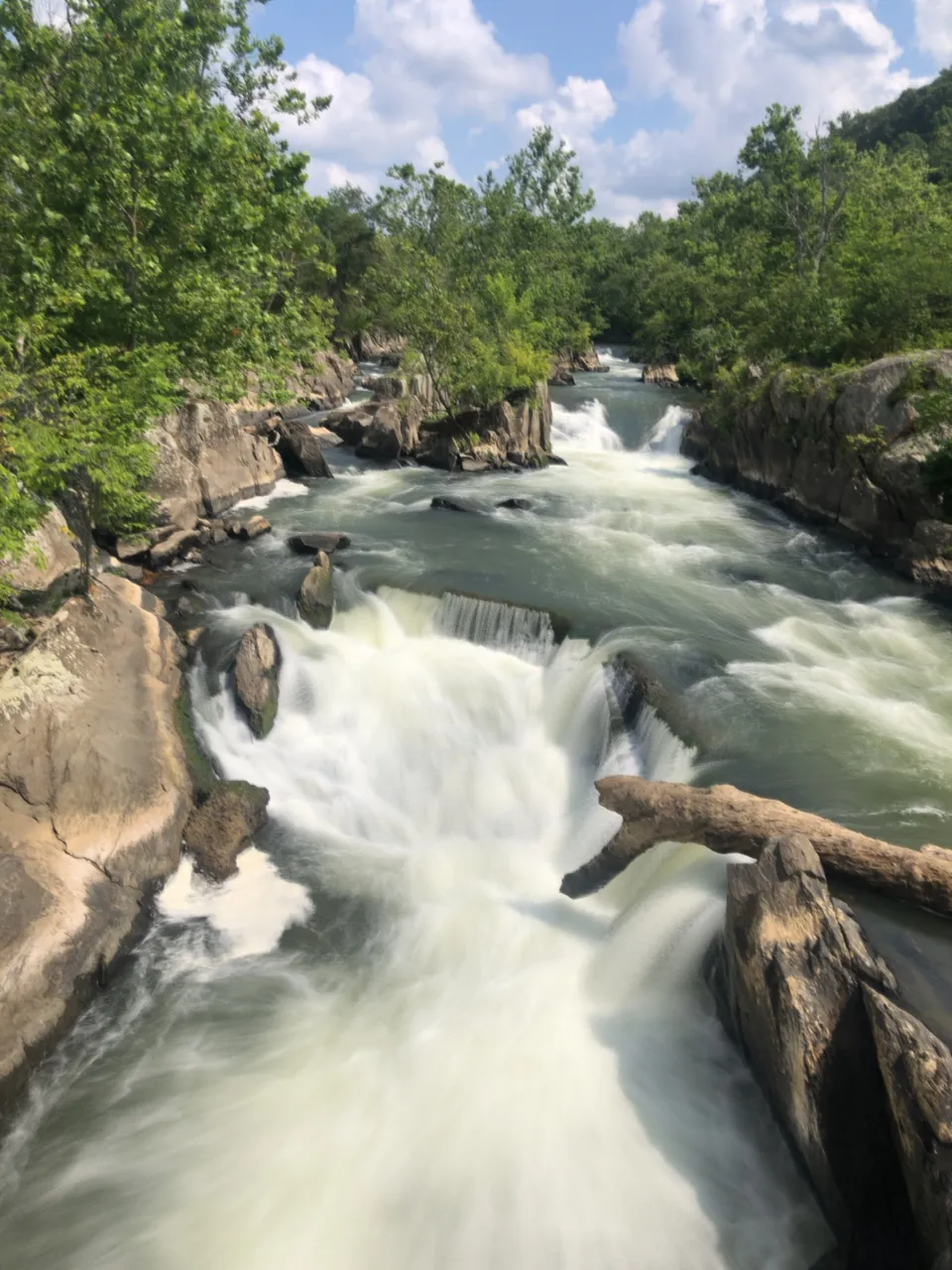
As you cross the bridges on the Olmstead Island Trail that take you to the viewing platform, there are views to smaller channels of the Potomac that cut through the rocks before you get to the wide part of the river. The photo below is looking up one of the channels. I actually think this channel is as beautiful as the wider section of the river that you see from the Maryland side.
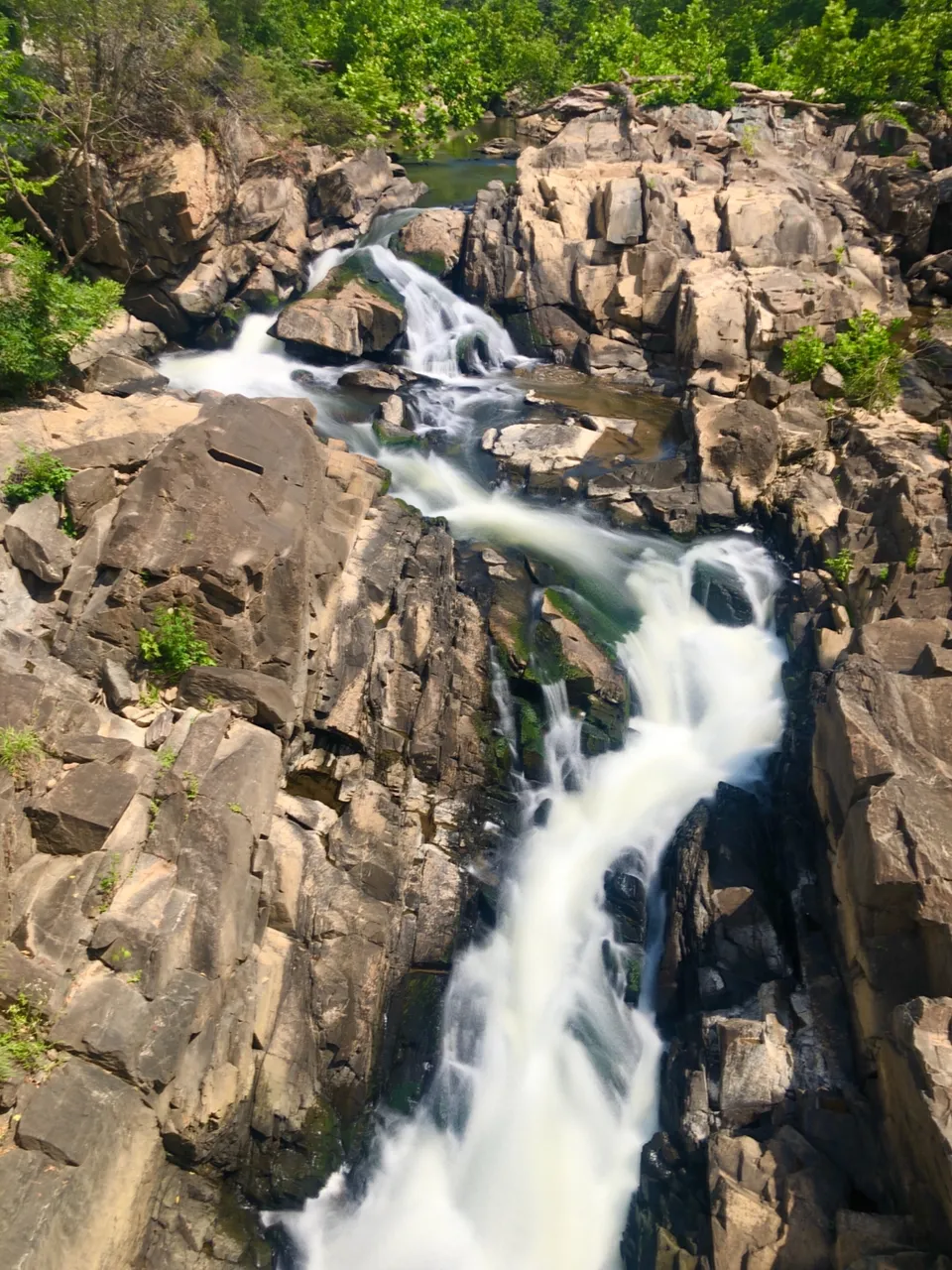
Below is a view looking down one of the channels from the same bridge leading out to the viewing platform.
There is another smaller channel that you see on your way out to the viewing platform on the Maryland side.
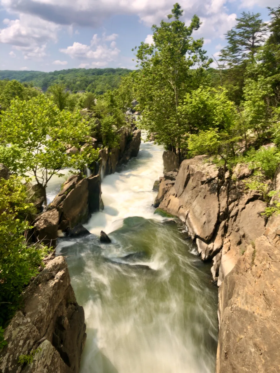
Below is the view looking up river from the viewing platform. It is not as nice a view as is available on the Virginia side, but certainly worth the short hike if you are along the C&O Canal path. Sorry for the blurry photo, doing a long exposure on a platform with people walking around created vibration that caused the less than sharp photo.
There is plenty of nature’s wild beauty to see just a short drive from the nation’s capital. If you happen to be in the area, go take a look. You won’t regret it.
All images in this post were created by me. Let me know if you would like to use any of them. Thanks.