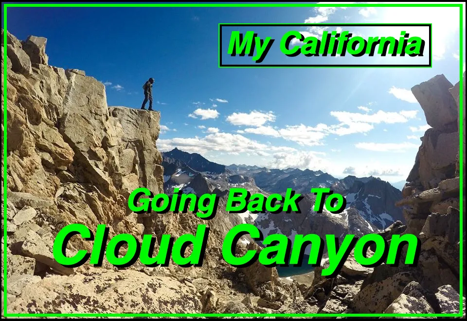
For this weeks Show Us Your California contest by @thesocalhive I head out into the Sequoia backcountry for my second trip to...
Cloud Canyon!!

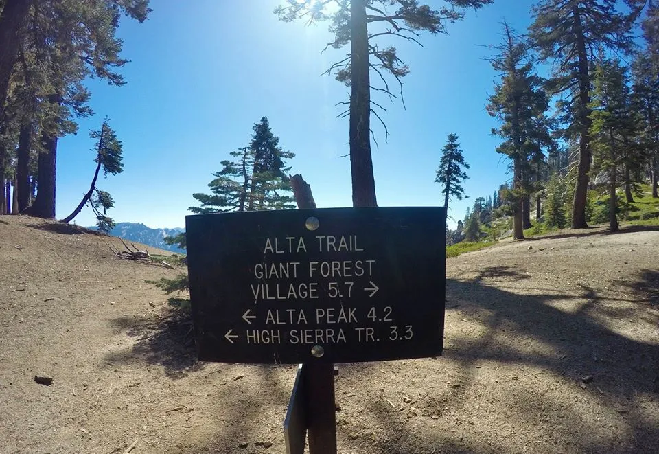
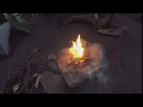
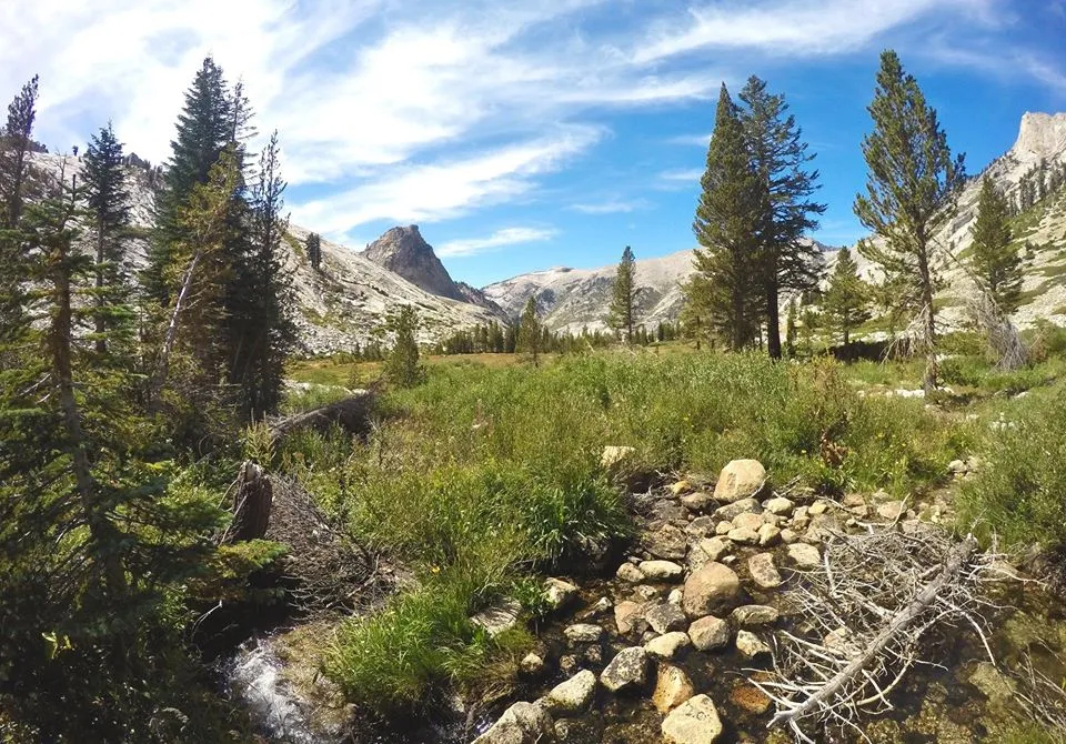
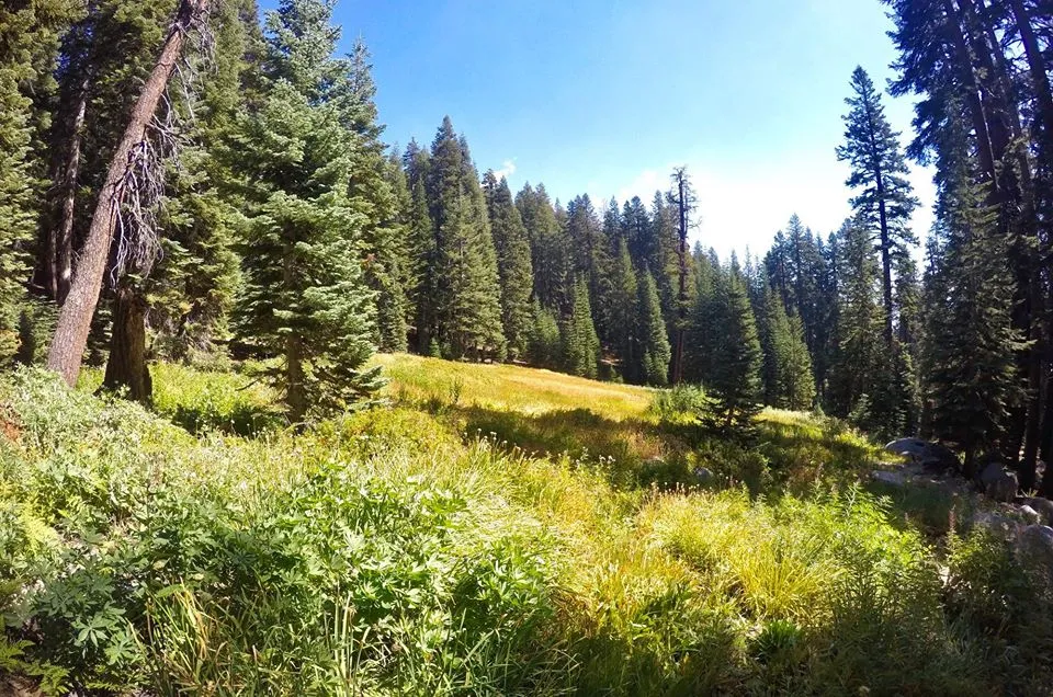
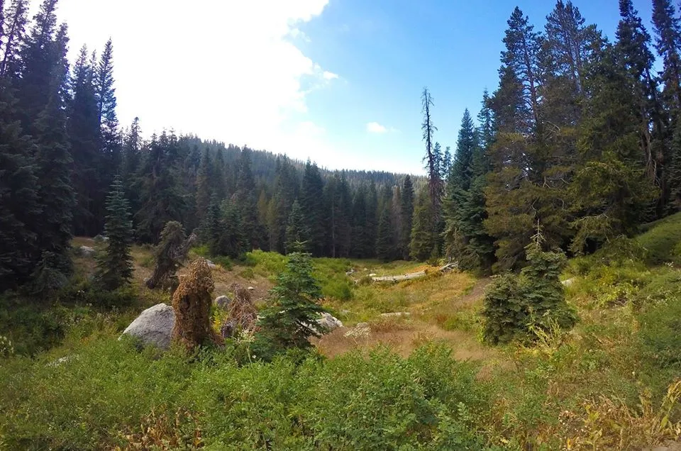
I left the Dorst creek campground and drove down to the Woolverton trailhead. I threw on my pack and headed out on my longest hike of the trip. A seven day trek out to Cloud Canyon and back. Earlier in the year I had gone out to Cloud Canyon via a different route, but due to heavy rainstorms I wasn't able to climb any peaks out there. So I was determined to get back out there and climb 'em! From Woolverton I climbed up to the trail junction at Panther gap. I dropped my gear there and made the quick side trip up to Panther peak... which was totally worth it! I sat on the peak for a bit and enjoyed the views. Then I dropped back down to the gap, picked up my gear, and continued up the trail. I ran into a backcountry ranger and talked to him about my plans for this trip. He warned me about icy snow patches on the north side of Lion Lake pass. Luckily I had packed my ice axe just in case, so I wasn't to worried. Then I dropped down the Seven Mile trail to the HST(High Sierra Trail) and followed it to Nine Mile(aka Dead Coyote) creek where I made my first camp. This was the only spot along my trip where a campfire would be legal so I collected some wood and enjoyed a nice fire while I made dinner.
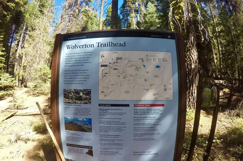
Woolverton Trailhead
Trail junction at Panther Gap
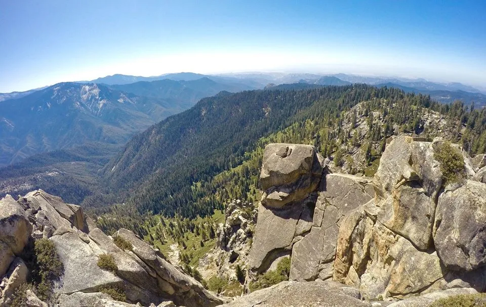
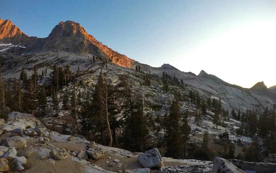
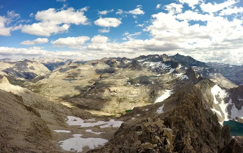
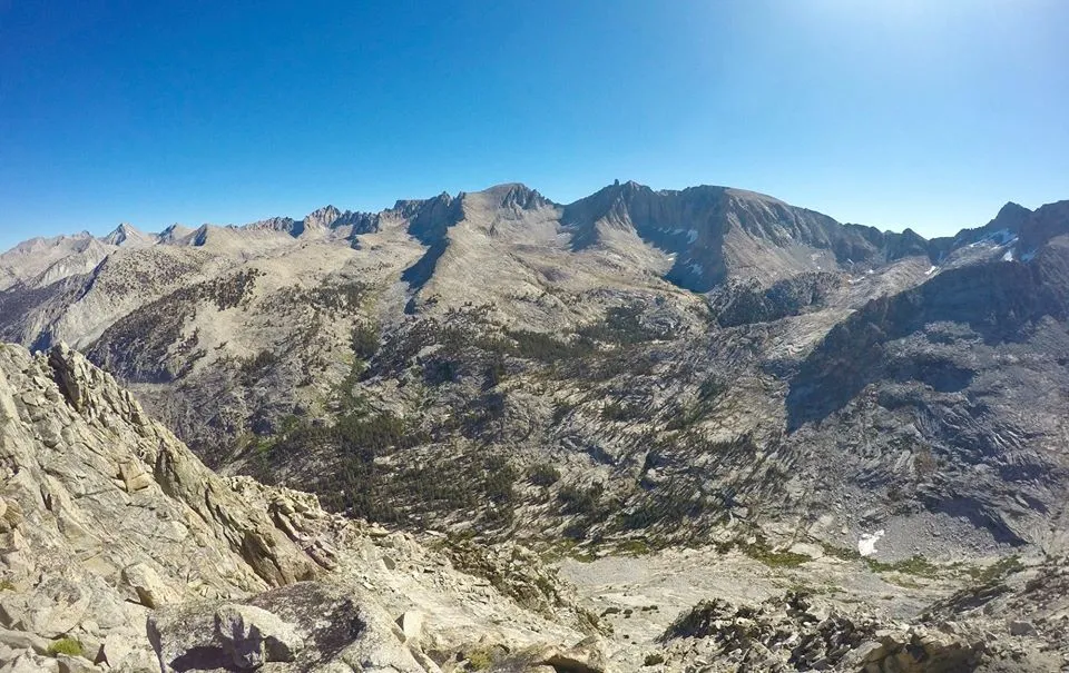
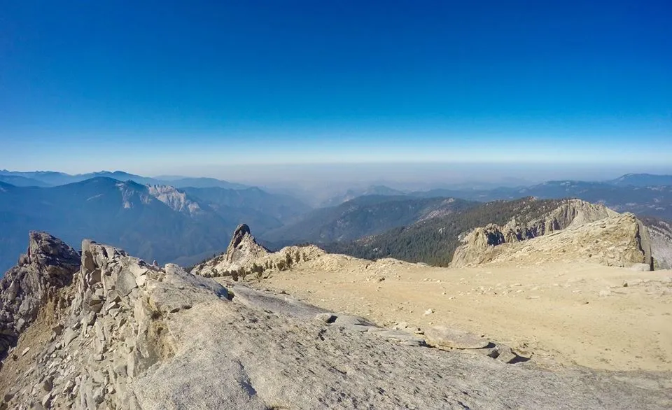
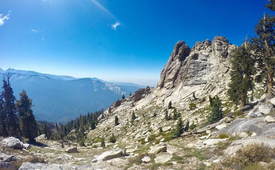
Views from Panther Peak
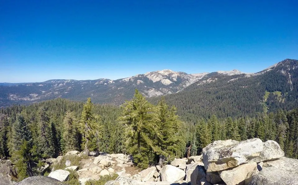
Views from Panther Peak
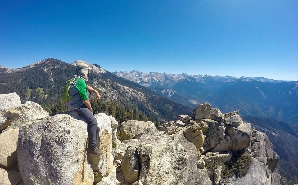
Relaxing on Panther peak

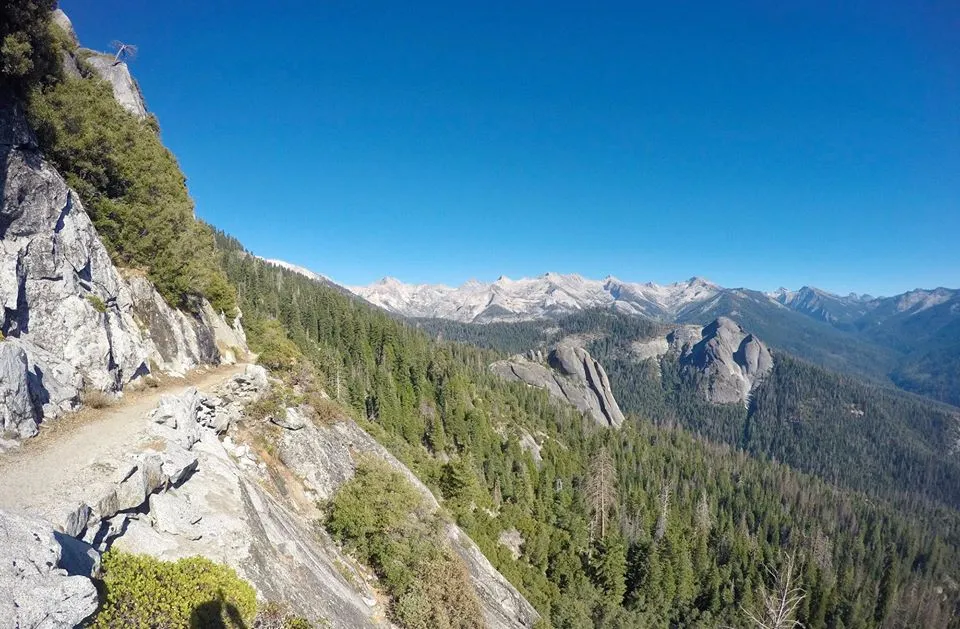
Hiking on the High Sierra Trail
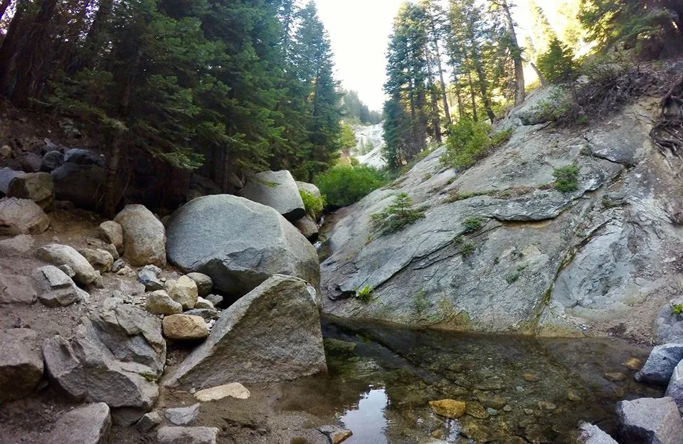
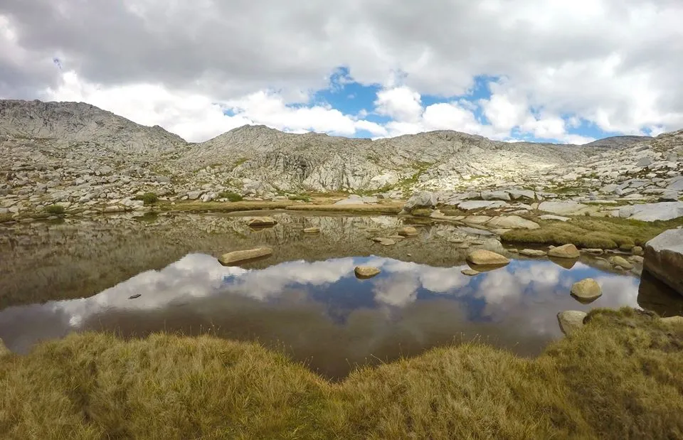
Nine Mile creek
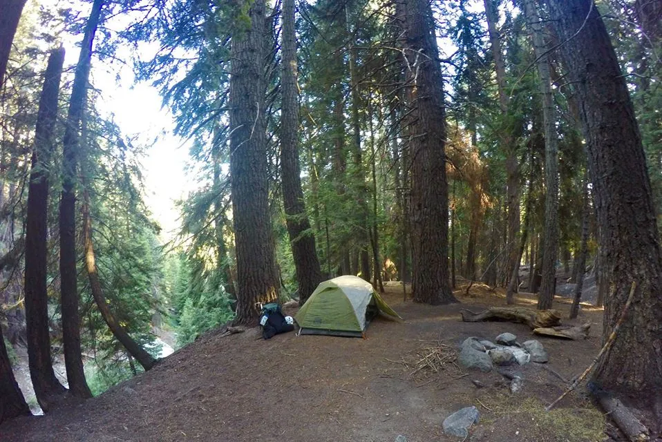
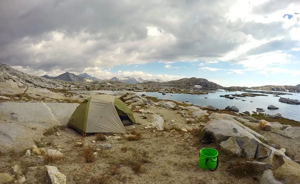
My first camp
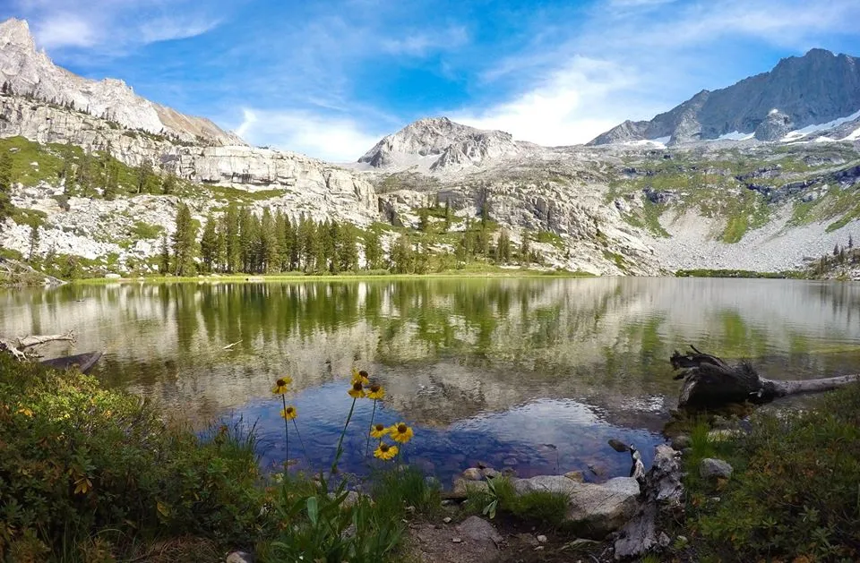
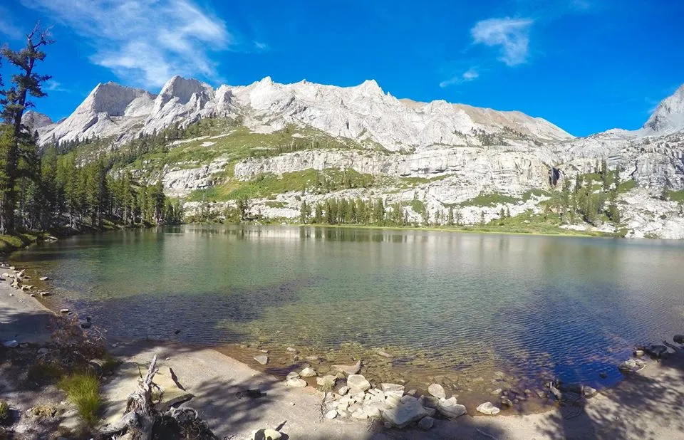
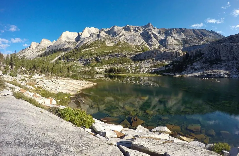
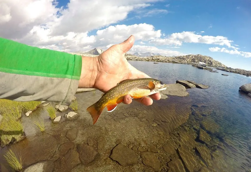
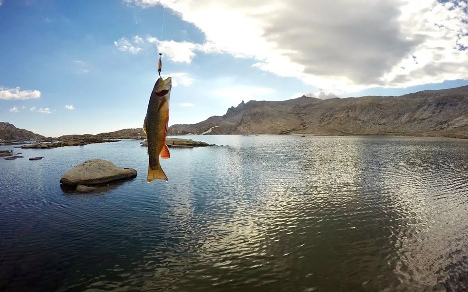
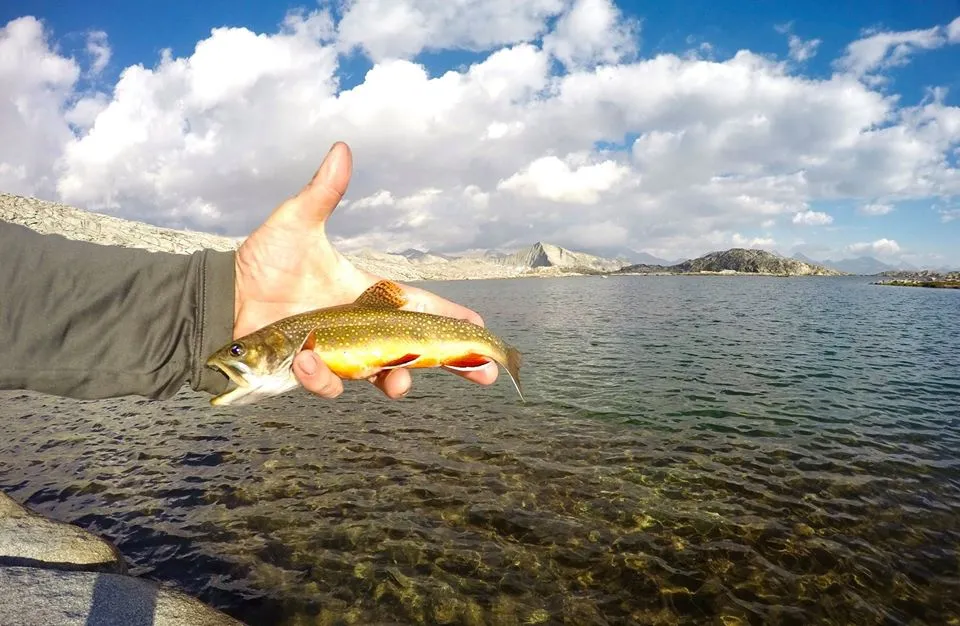
The next morning I packed up camp and headed back out on the HST. Down through Buck canyon and up to the Bearpaw meadow High Sierra camp. At the trail junction at Bearpaw meadow I took the high trail into Lone Pine canyon and then headed up the canyon all the way to Tamarack lake. I was blown away when I got there. Tamarack is probably one of the most beautiful lakes I've ever seen. The big waterfall on the far side of the lake and the huge glacially carved crags that surround the area add to it's epicness. I found a good spot by the lake and setup my camp. I had originally planned to climb Lion Rock, but I was already pretty tired and it was already getting kinda late in the day so I decided to just hangout and enjoy some trout fishing at the lake.
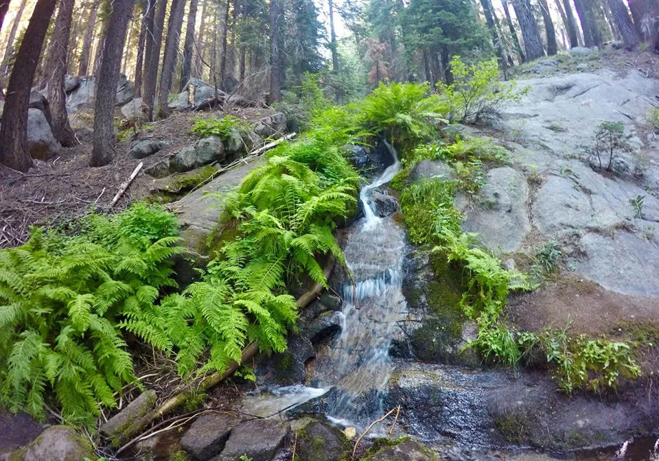
Small creek along the High Sierra Trail
Trail junction at Bearpaw meadow
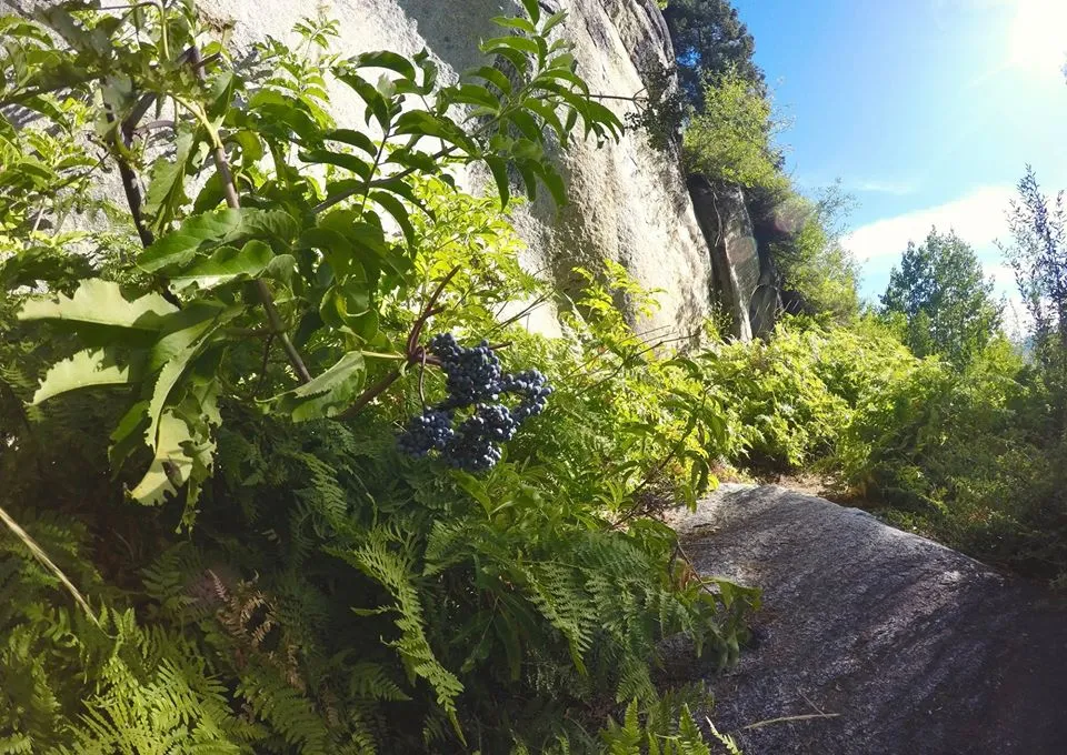
Elderberries along the High trail
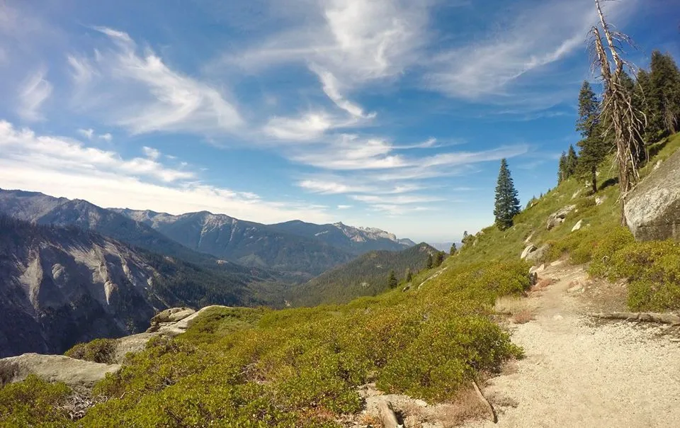
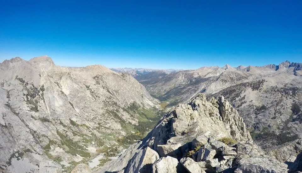
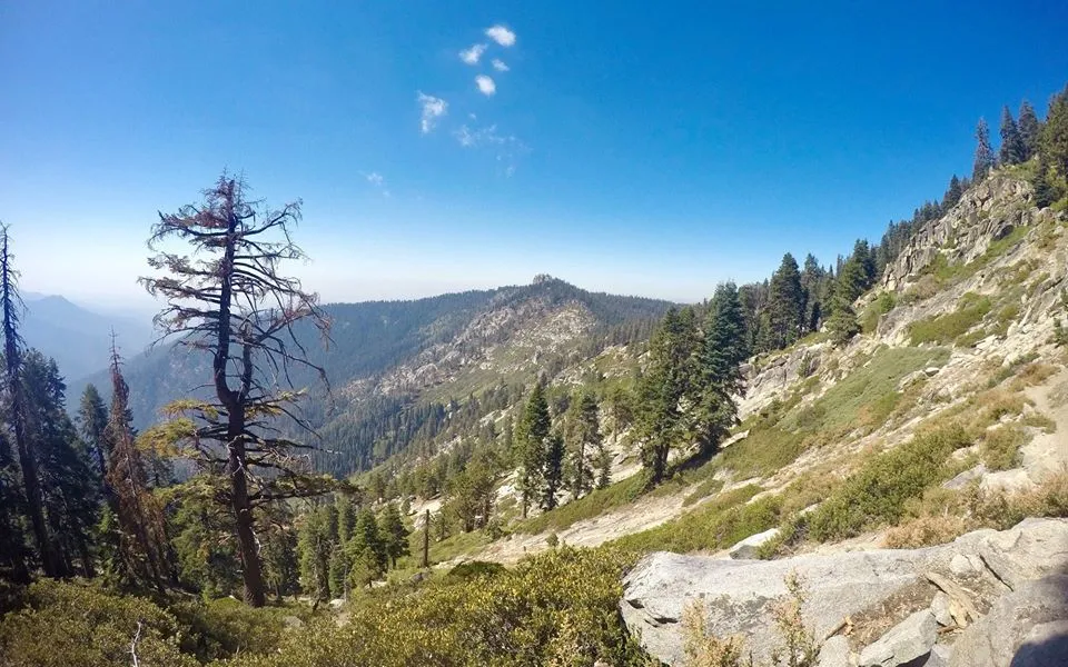
Views from the High trail
Dropping into Lone Pine canyon
Dropping into Lone Pine canyon
Lone Pine creek
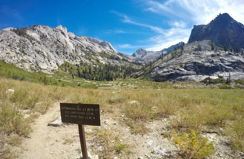
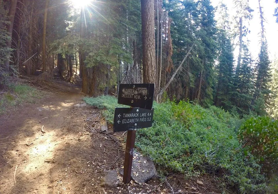
Trail junction for Elizabeth pass
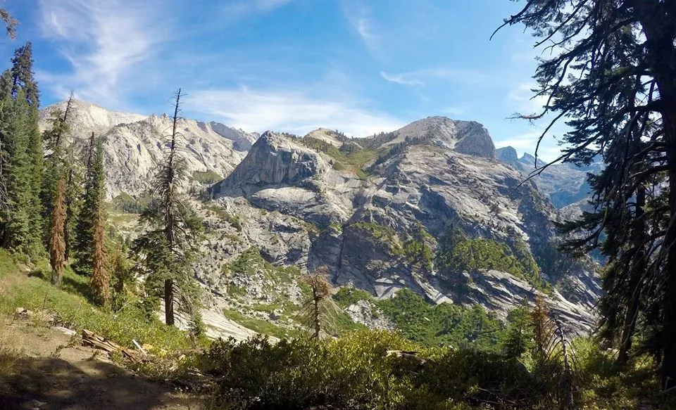
Lone Pine Canyon
Lone Pine creek
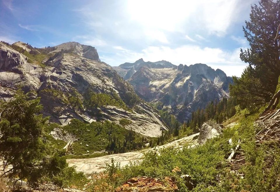
Upper Lone Pine canyon
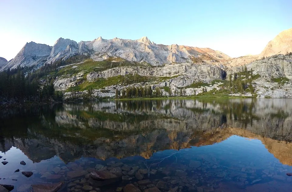
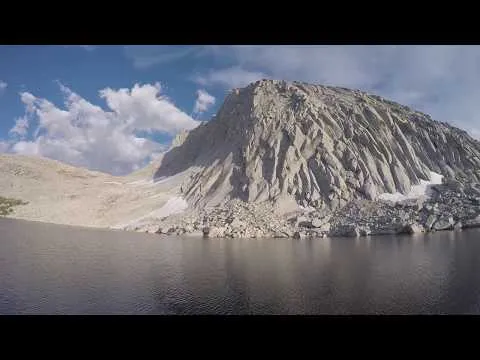
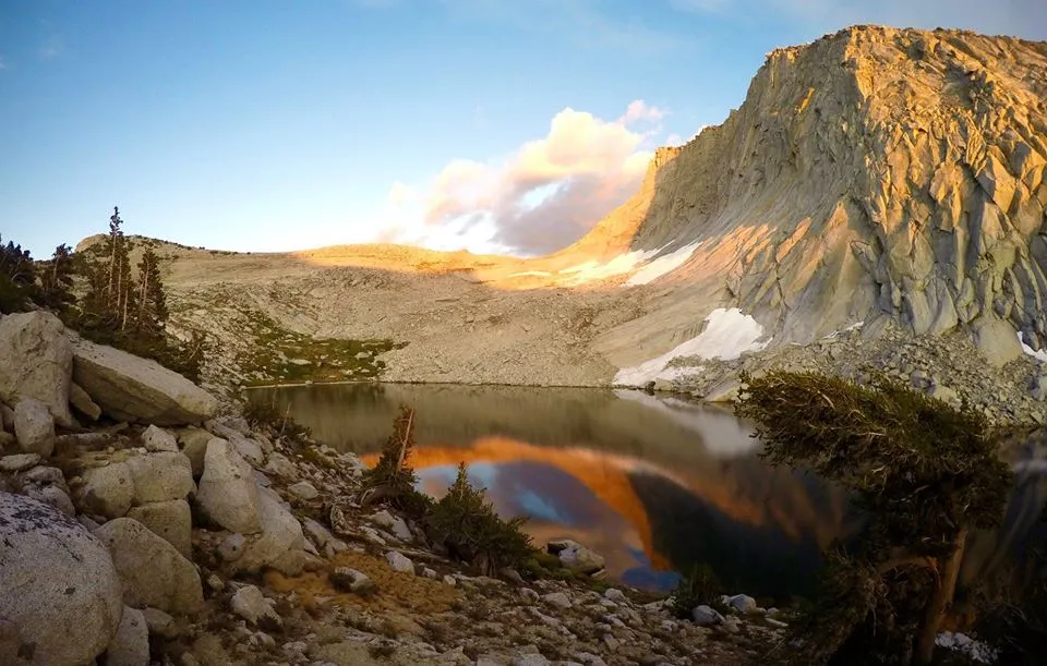
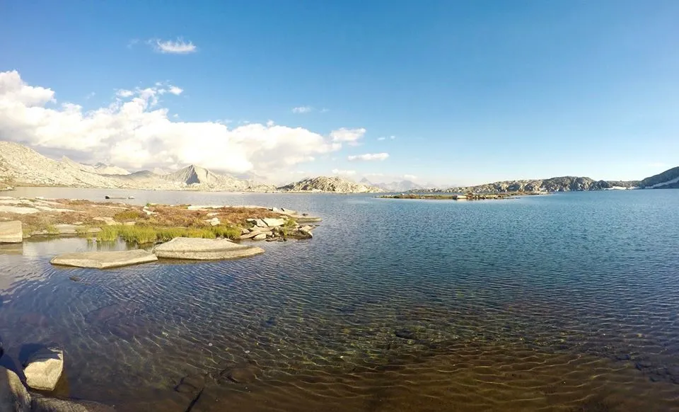
Tamarack lake
Tamarack lake

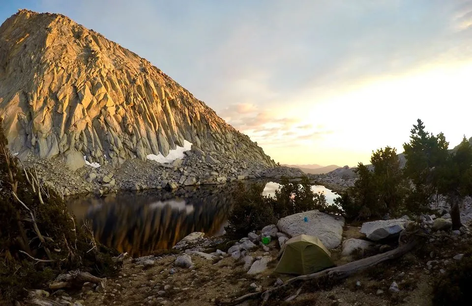
Camp #2
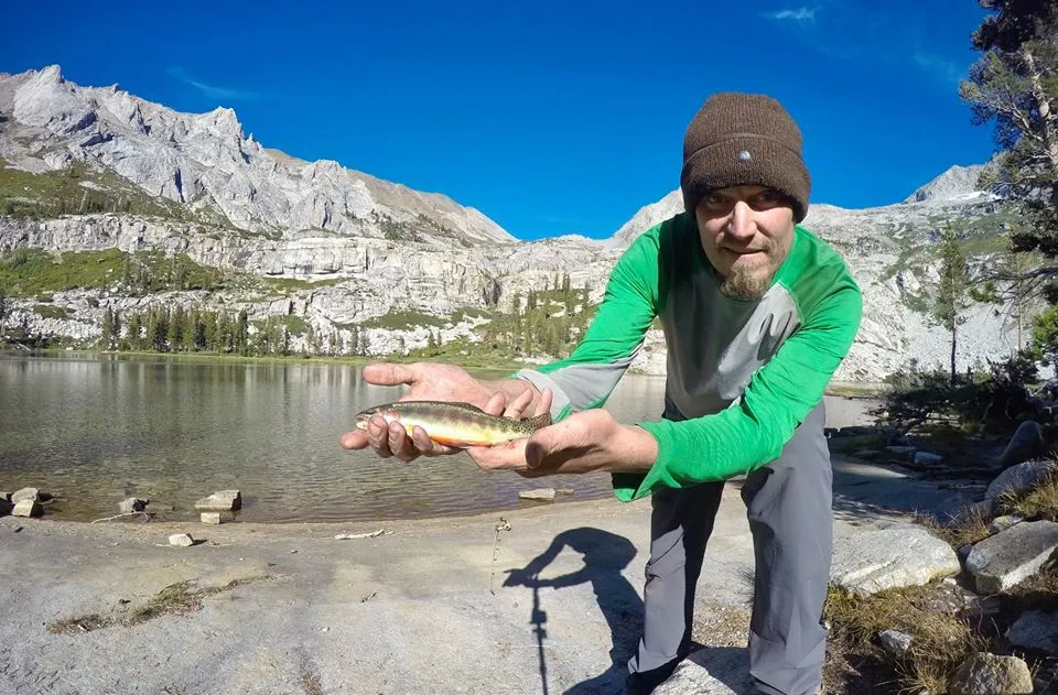
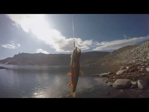
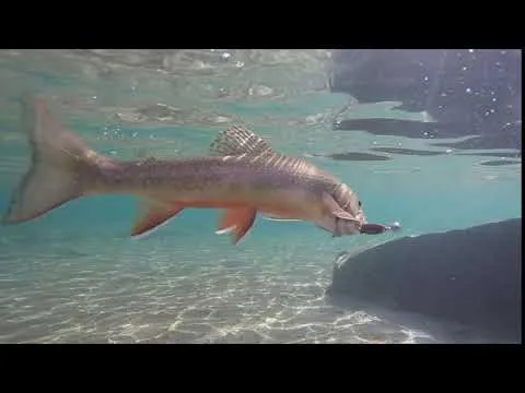
Trout fishing
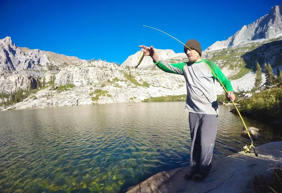
Trout fishing
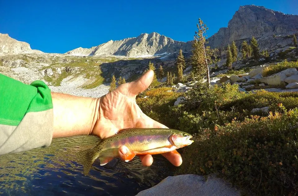
Trout fishing
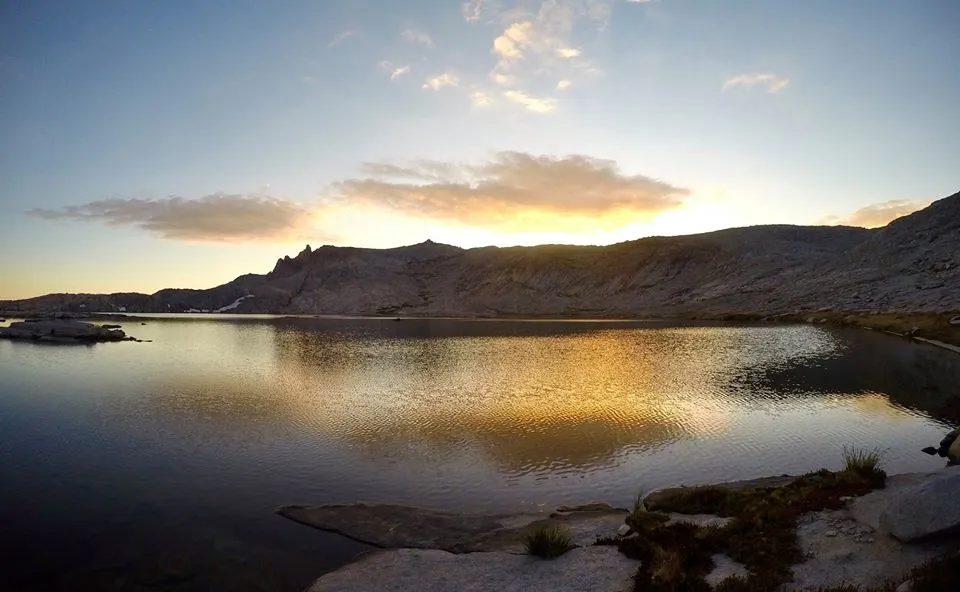
Evening at Tamarack lake
Sunset from camp
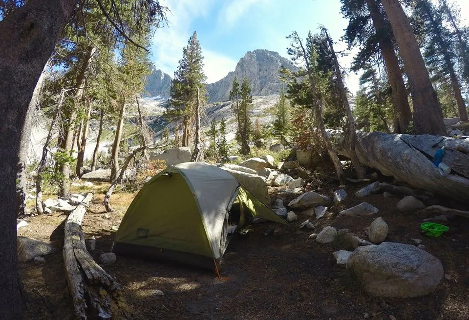
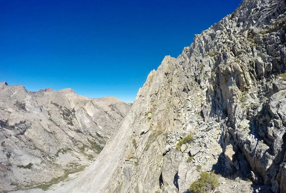
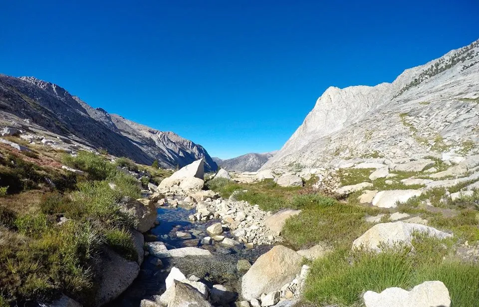
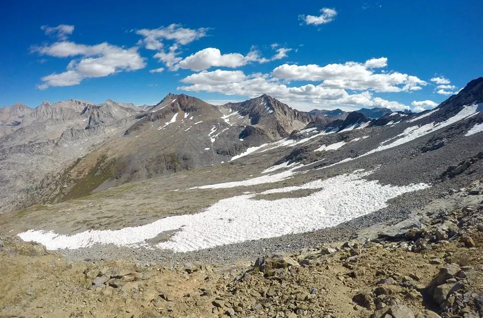
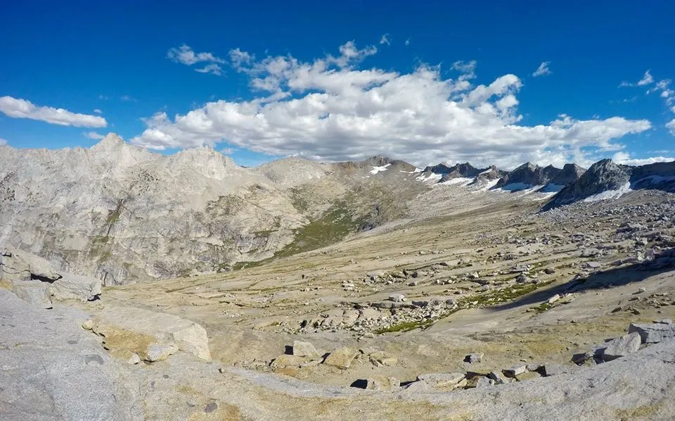
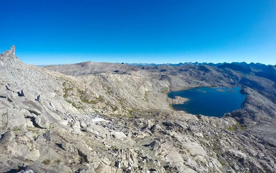
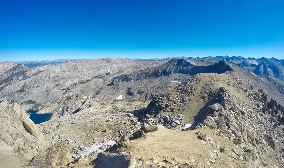
The next morning I packed up camp, hiked around the lake, and started the climb up to Lion Lake pass. The climb took a bit of route finding to avoid brush and cliffs, but I found a decent route and got up to Lion lake. I took a quick break and filled some water at the lake and then made the final climb up to Lion Lake pass. Looking off the north side eased my worries about the ice patches(although I couldn't actually see the worst of it). I dropped my gear at the pass and then climbed up the west ridge of Triple Divide peak(12,634')! I took an unnecessarily difficult route up (I discovered the better route on the way down), but I got to the summit without any issues. The views were amazing in all directions. As the name says it's a triple divide, with it dividing the Kings, Kern, and Kaweah river drainages! After hanging out on the summit for a bit I descended back down to the pass and then dropped off the north side into Cloud canyon. There was a lot of snow still, but since it was later in the day it wasn't to icy. I would have been fine without the ice axe, but there were a few spots where I was happy I had it. I got down into the canyon and made my camp in the same area where I had camped in the rainstorm earlier in the year. Luckily the weather was looking good for this trip.
Morning time at Tamarack lake
Overlooking upper Lone Pine canyon on my way up to Lion Lake
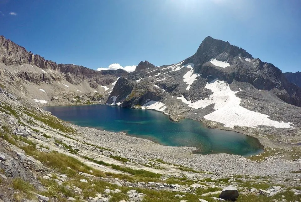
Lion lake
Looking north from Lion Lake pass
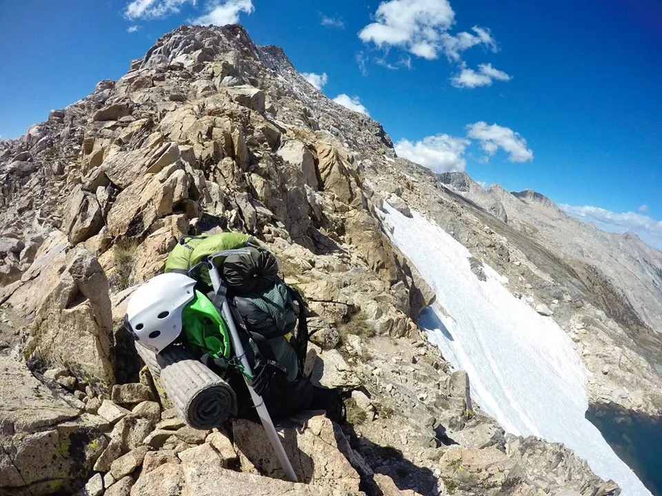
Leaving my pack at Lion Lake pass
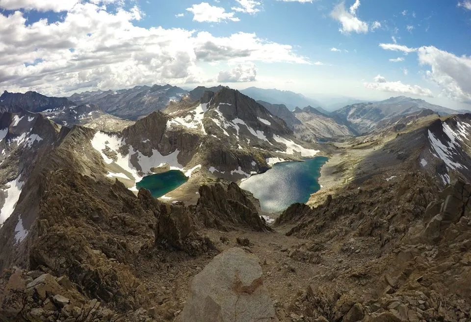
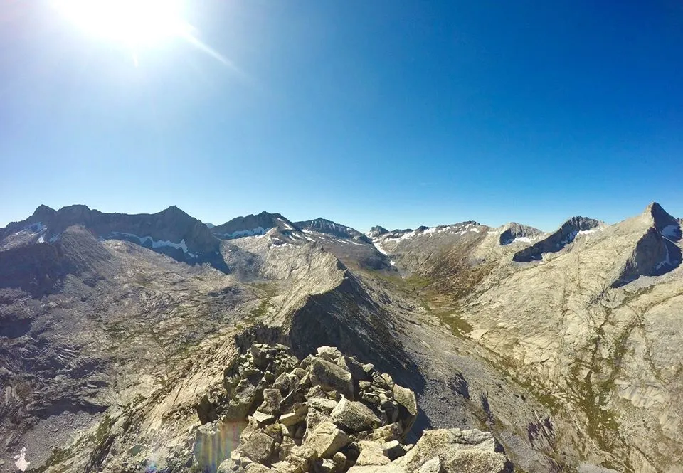
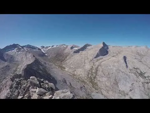
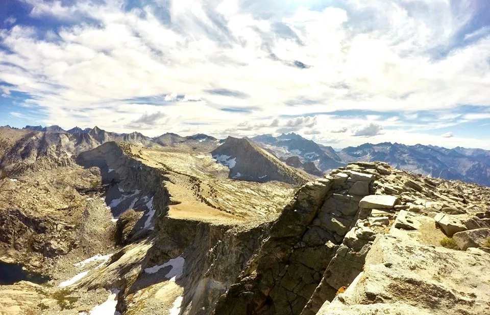
Views from Triple Divide peak
Views from Triple Divide peak
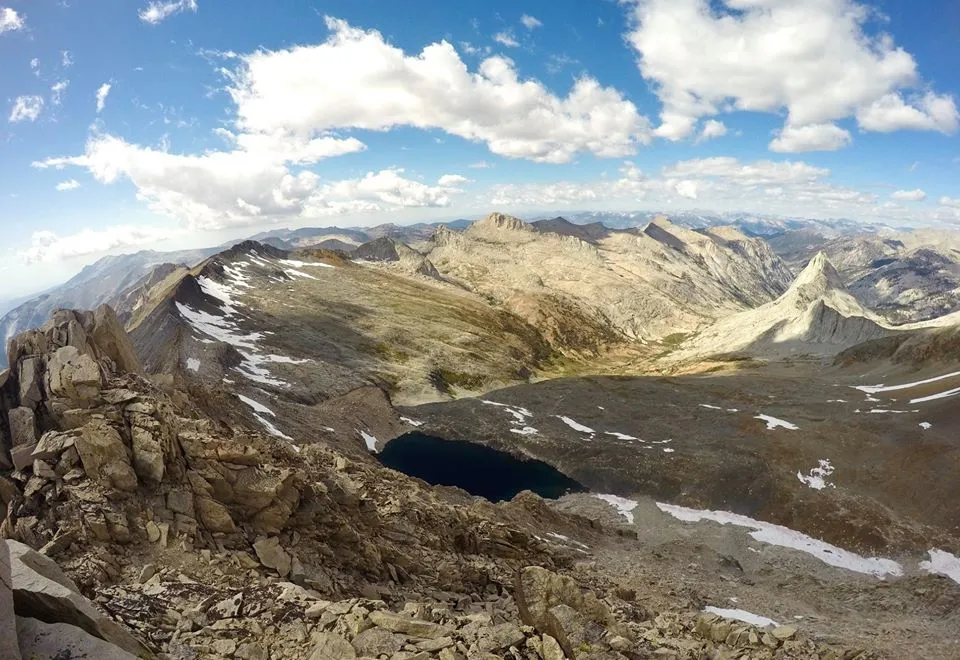
Views from Triple Divide peak

Descending the west ridge
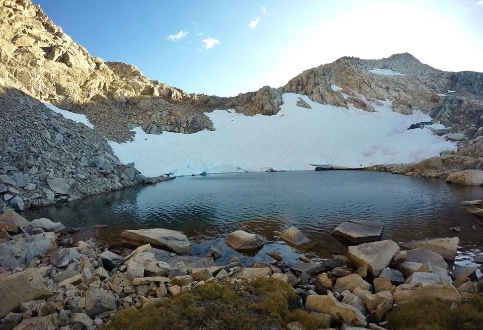
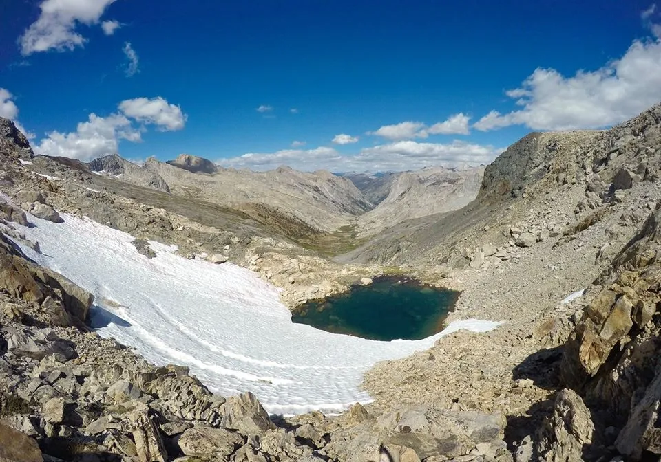
The small lake just below Lion Lake pass
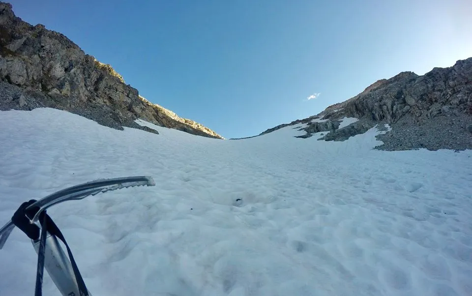
Using my ice axe on the snow patches
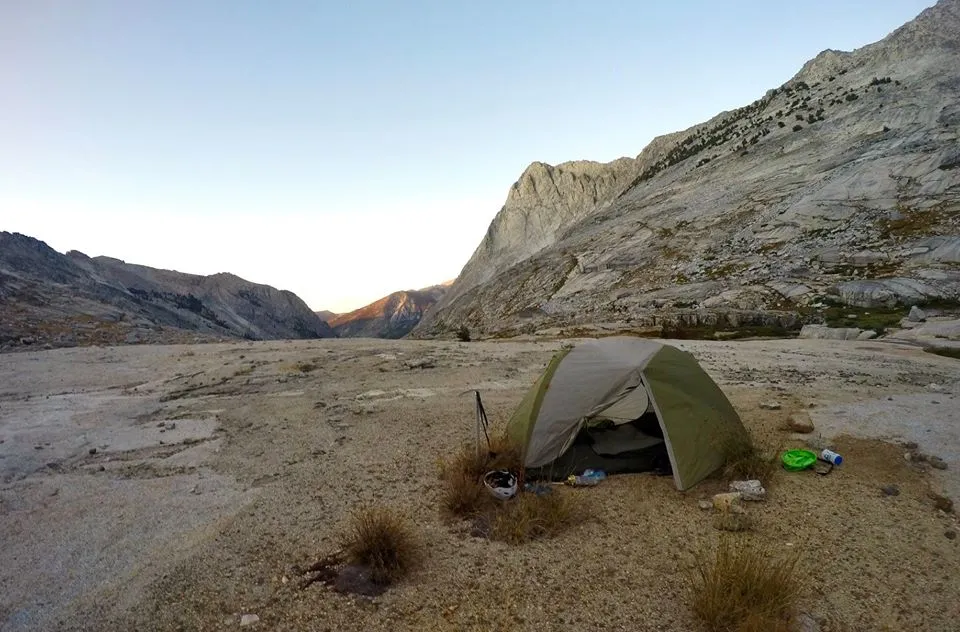
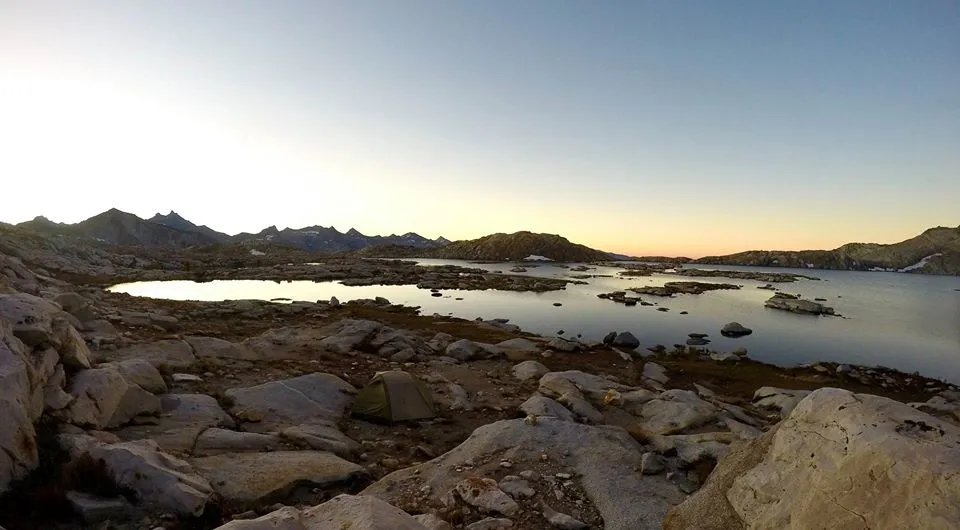
My camp in Cloud Canyon
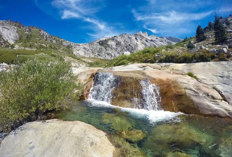
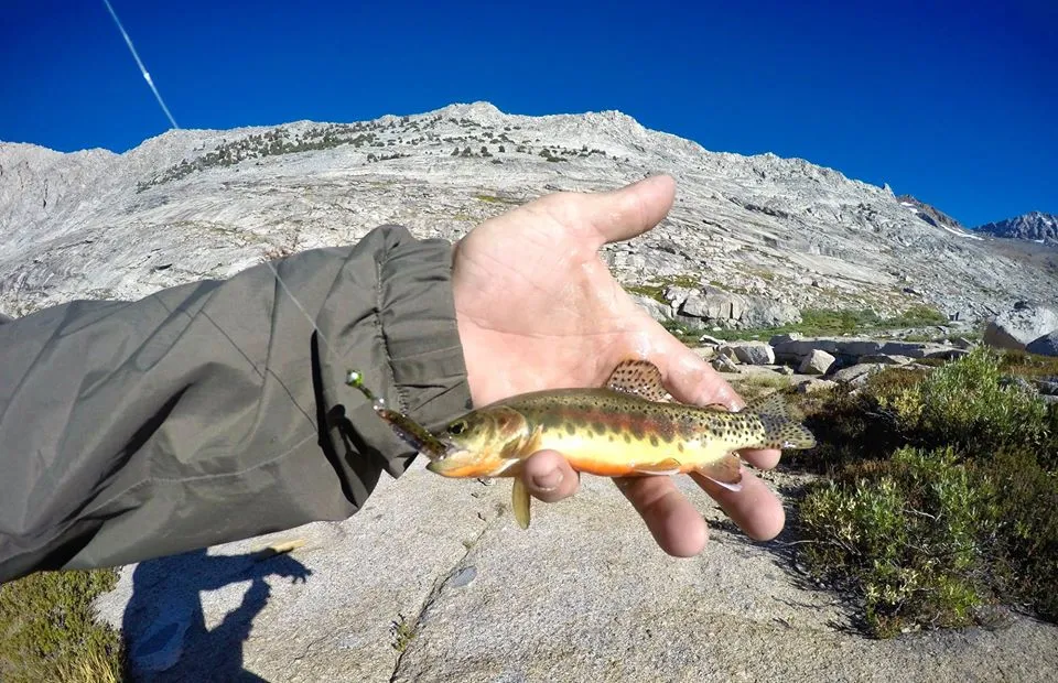
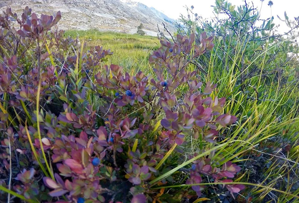
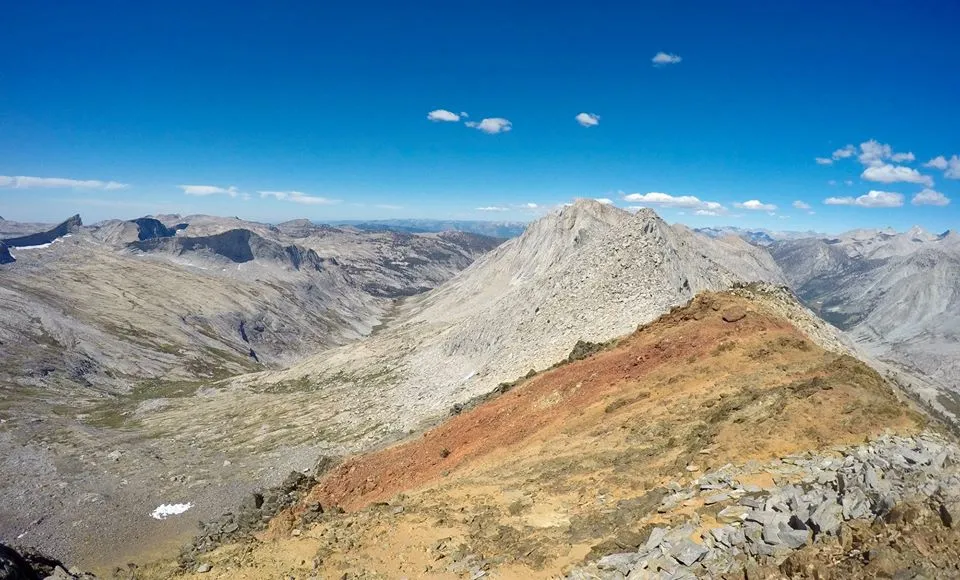
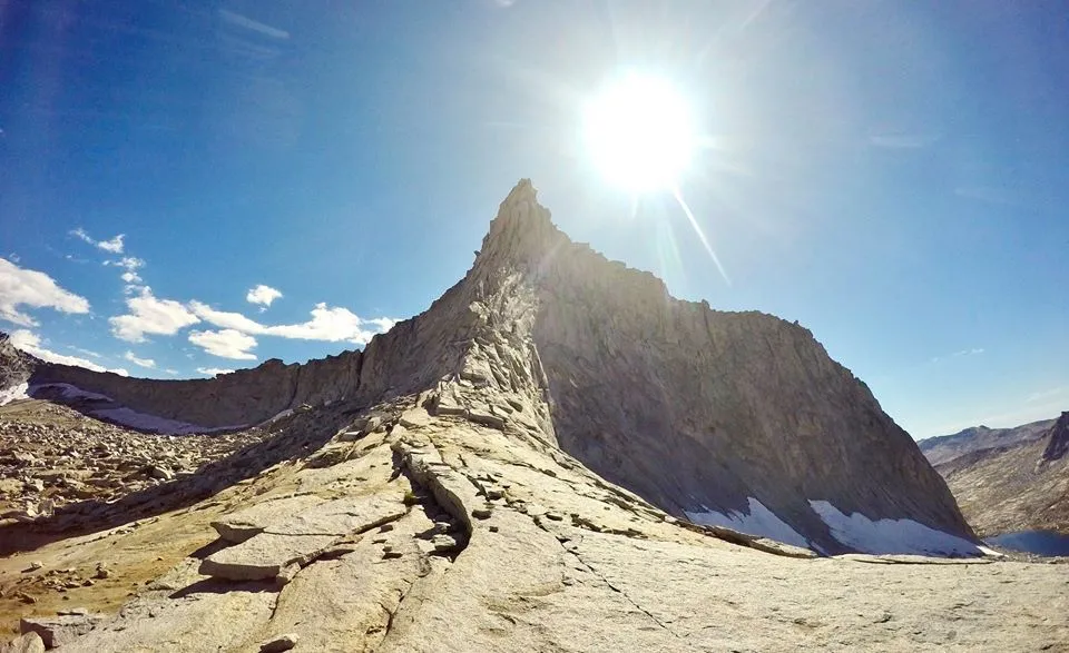
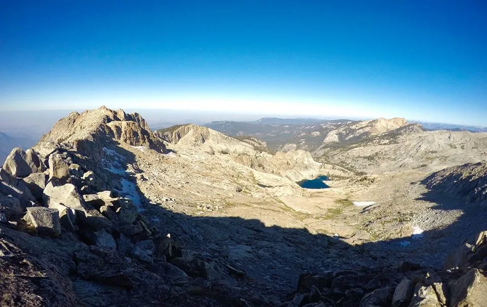
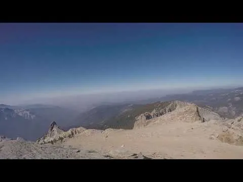
The next day was all dedicated to climbing Whaleback(11,726')!! It wasn't a long climb, but it was a detailed route and a semi-technical climb so I wanted plenty of time. I climbed up to the bottom of the cirque where the route was supposed to start, but had a bit of trouble finding it. And I got myself into a few sketchy spots searching around before finally finding the bypass route that took me to a ledge that successfully dropped me into the cirque. From there it was an easy climb up to "Eckert's Blowhole" which is a small tunnel in the rocks. Once through the Blowhole I followed the narrow ridge up behind big crags and down through steep loose chutes. Then I got to the final climb. I passed the first two chockstones which both took exposed class 4 climbing to get around and then I hit the crux. It was still class 4, but was a bit more tricky. This got me on top of the south ridge and from there it was a class 2-3 scramble to the summit! The view was awesome, but I have to admit it wasn't quite as good as Triple Divide. But the climb up was so much fun that it made it extra rewarding to be up there. I spent over an hour on the peak, just soaking in the beauty all around me. Then I started my descent. Which was just as exciting as the ascent! Maybe even more so. I got back down to my camp and it was still pretty early so I hiked all around Cloud canyon. It was an awesome end to a great day. I had accomplished my goal of coming back to Cloud canyon and climbing both Triple Divide and Whaleback and then topped it off with a leisurely afternoon checking out some of the waterfalls on the creek, fishing the little pools for trout, and collecting wild blueberries in the meadows!
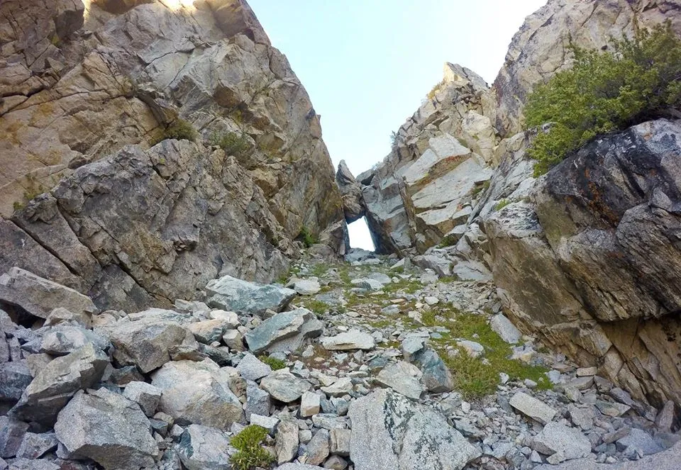
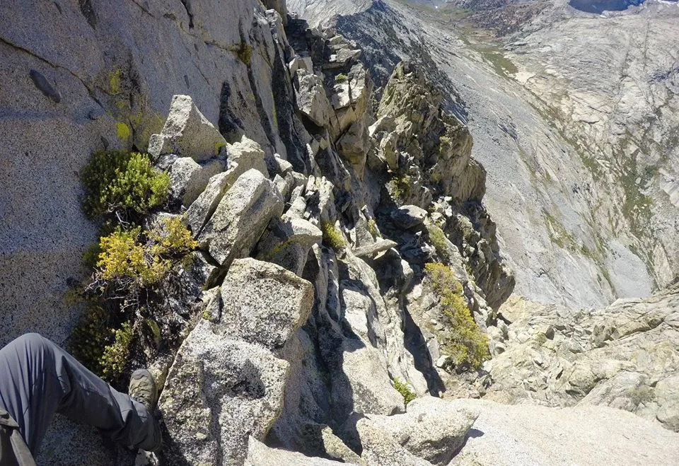
Eckert's Blowhole
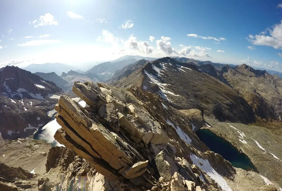
Views from Whaleback
Views from Whaleback
Views from Whaleback
Descending Whaleback
Descending Whaleback
Back down in Cloud Canyon
Trout fishing
Wild Blueberries
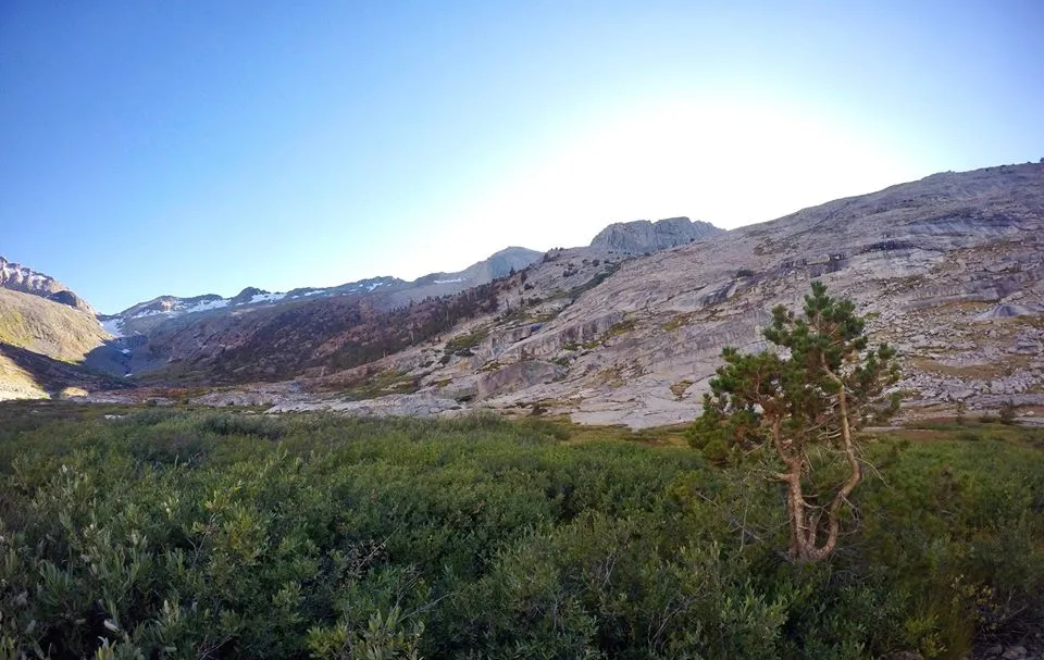
Upper Cloud Canyon
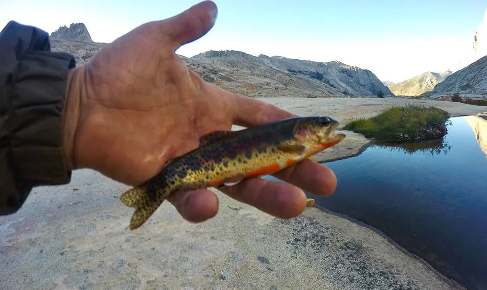
Trout fishing
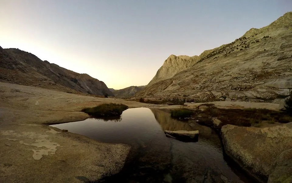
My second evening in Cloud Canyon
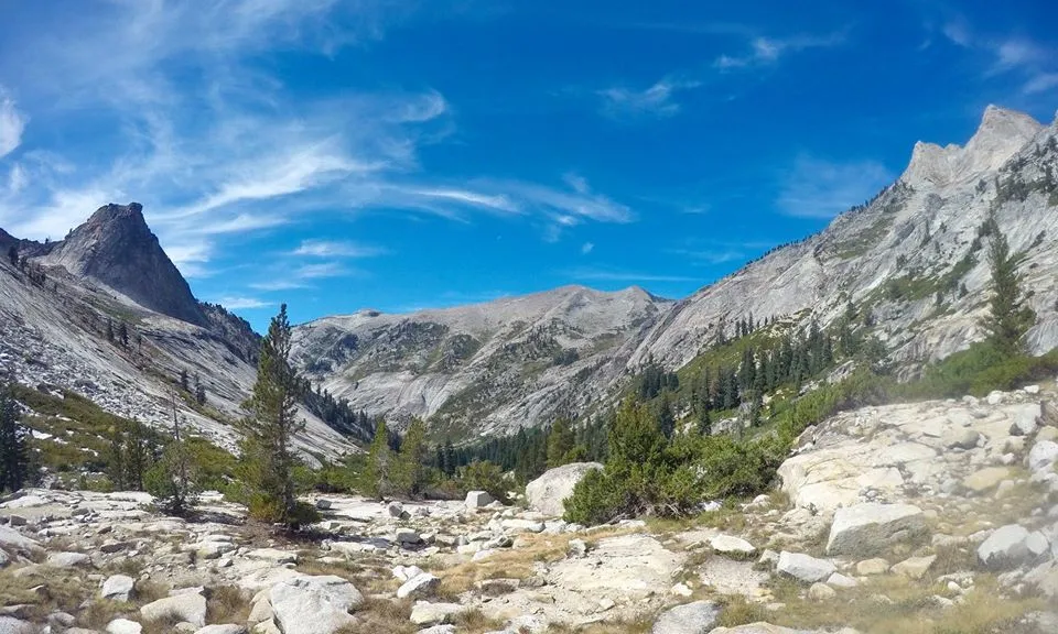
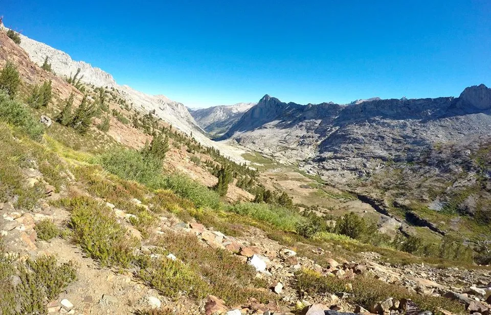
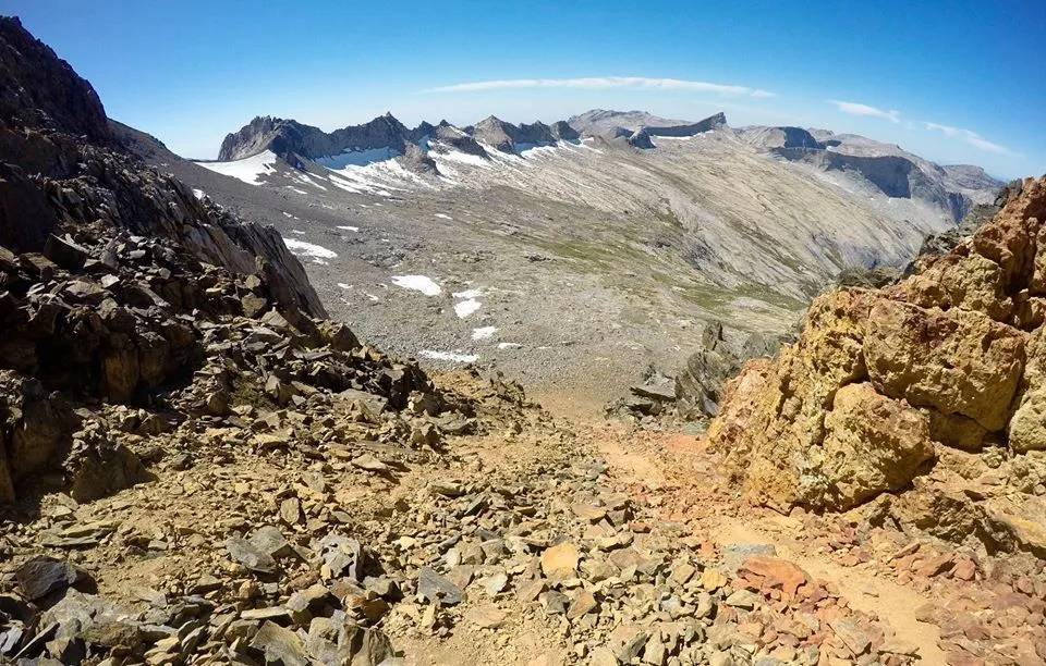
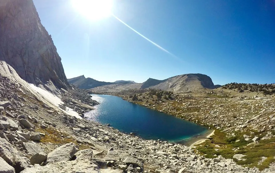
The next morning I packed up and started the big climb up and over Coppermine pass. The pass had epic views rivaling those of Whaleback and Triple Divide. The west side of the pass was an almost vertical chute full of completely loose rock. So making my way down was a tedious "slip 'n slide" on the talus and scree, but once down the first couple hundred feet or so the pitch decreased and the rock stability increased. From there it was a long but relatively easy trek across the head of Deadman canyon. Passing the trail to Elizabeth pass and continuing cross country up and over Horn Col and then dropping down to Lonely lake where I found an excellent spot to make my next camp.
Overlooking Cloud Canyon on my way up Coppermine pass
Views looking east from Coppermine pass
Coppermine pass
The chute on the west side of the pass
Looking down Deadman canyon
Looking back across the head of Deadman canyon
The Horn
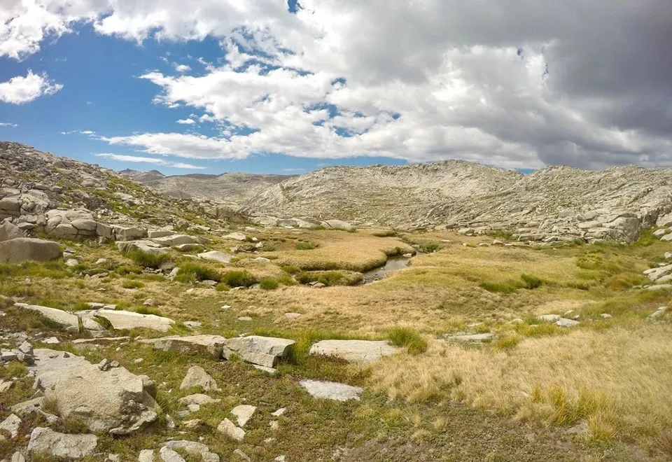
Overlooking Lonely lake
Lonely lake
Evening at Lonely lake
Evening at Lonely lake
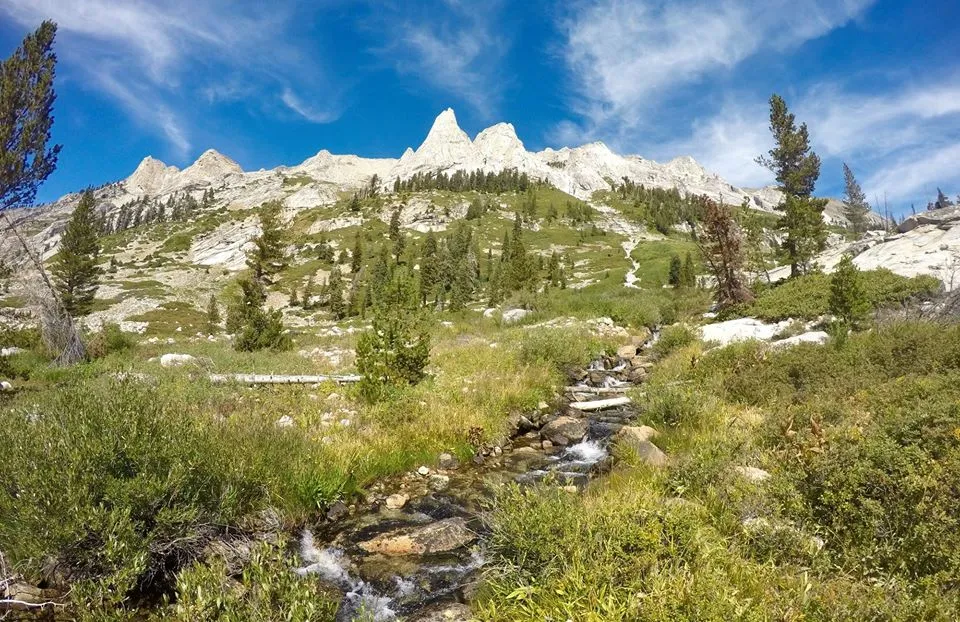
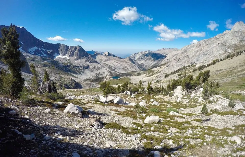
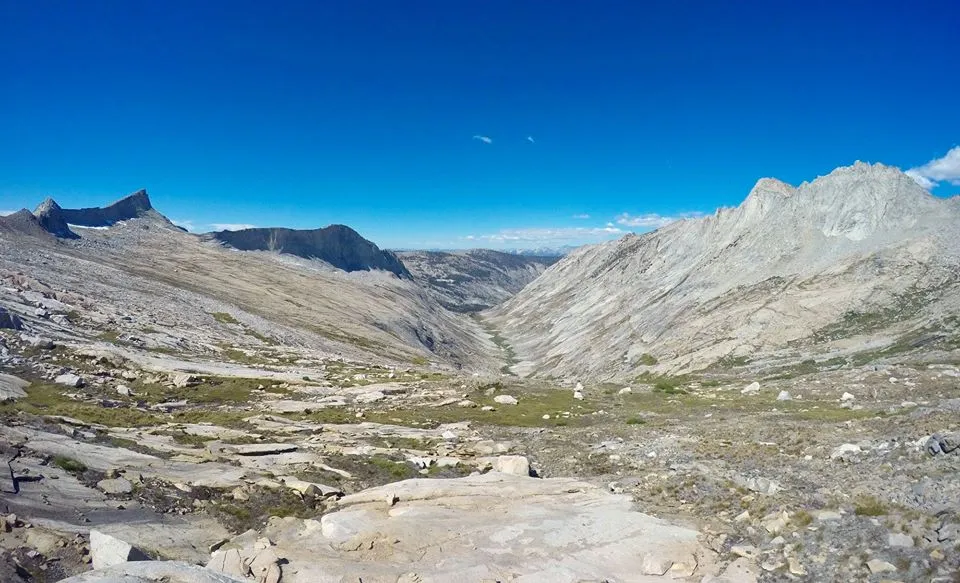
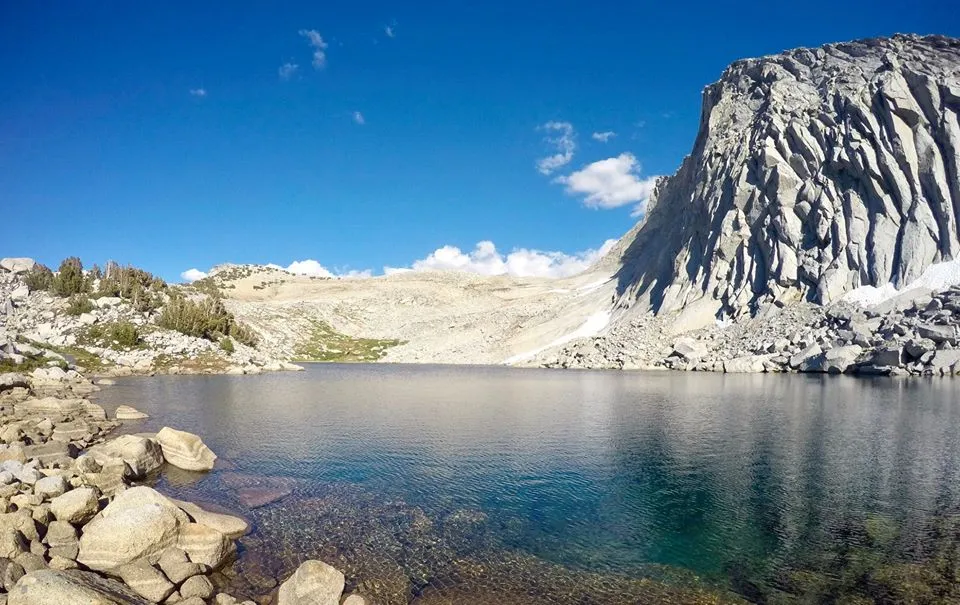
The next day I headed towards Pterodactyl pass. I had tossed around the idea of climbing The Horn before moving on, but I already had Big Bird Peak(11,600') on the list for the day, so unfortunately I decided to skip it. I traversed the head of Buck canyon, climbed up and over Pterodactyl pass, and on to the Tablelands. I made my way to one of the small lakes on the eastern side, dropped my gear there. Then I made the steep but fairly easy class 2 climb up to the summit of Big Bird Peak. The peak was fairly wide and flat, but the eastern edge was a huge vertical cliff face dropping straight down to the Big Bird lakes. The climb wasn't all that exciting, but the views were possibly the best of the whole trip! Overlooking the Tablelands, the Big Bird lakes, and Deadman canyon. It was truly spectacular. After enjoying the summit I descended back down, picked up my pack, and headed across the Tablelands to Moose lake. Traversing the Tablelands was all fairly easy terrain, but a few sections were a bit of a maze to get through. When I arrived at Moose lake I was floored. It was so big and beautiful! I found a great spot by the lake to setup my last camp of the trip. Then I spent the rest of the day hiking around the lake catching lots of trout!
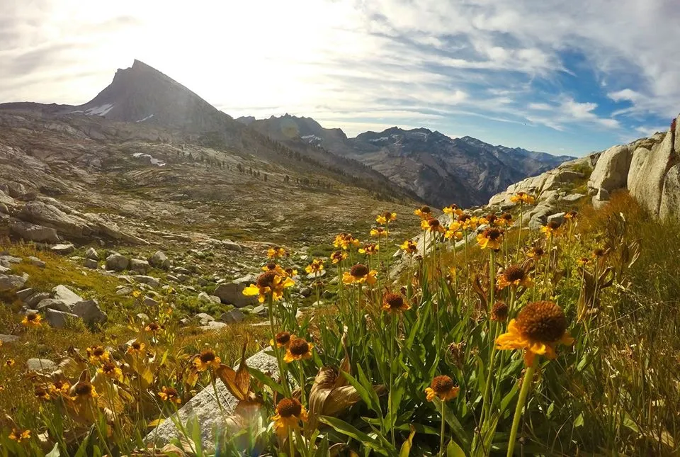
Blooming Bigelow's Sneezeweed near Pterodactyl pass
Overlooking the Tablelands from Pterodactyl pass
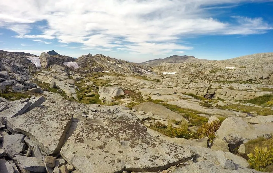
Tablelands
Looking south from Big Bird peak
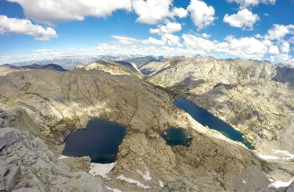
Looking north from Big Bird peak

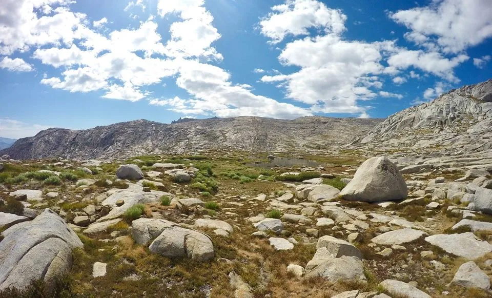
Meadows on the Tablelands
Small lakes on the Tablelands
Making my way across the Tablelands
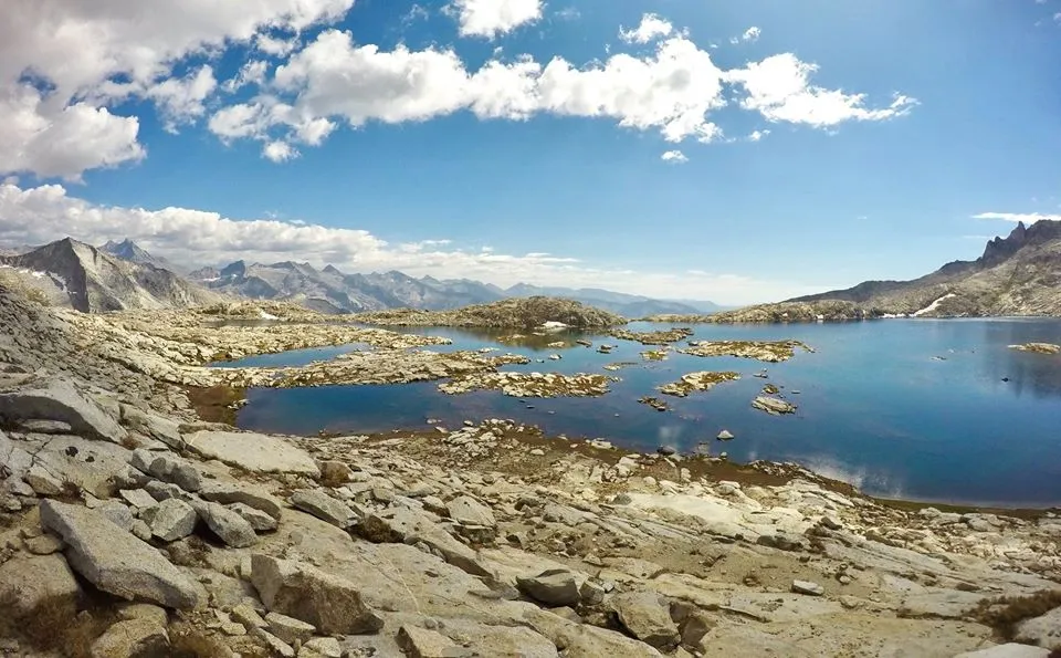
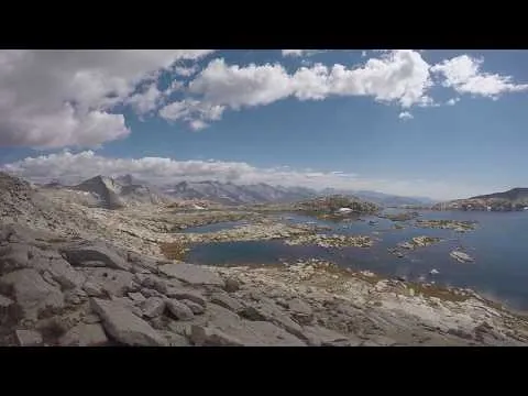
Arriving at Moose lake
My last camp of the trip
Trout fishing
Trout fishing
Trout fishing
Moose lake
Evening at Moose lake
The next morning I packed up camp, hiked around the lake and then climbed up onto Alta peak's east ridge. I traversed the long rugged ridge line and eventually got to the summit of Alta peak(11,204')! My fifth and final summit of the trip. I signed in the summit register and took a little break to enjoy the views. I was glad to be up there nice and early. I probably would have stayed on the top longer, but at this point I was dreaming about a cold beer and the delicious grilled cheese and tomato sandwich at the Lodgepole visitor center! So I headed down the Alta peak trail with haste. Down passed Tharps rock, Mehrten meadow, and eventually back to Panther gap. From the gap I dropped down the trail and then when I was just a couple miles from the trailhead I came upon a couple other hikers... it turned out to be my buddy @alaqrab! Him and another friend had stayed at Pear lake the night before and were on their way Mehrten meadow for another night. It was so wild to run into them out there! I chatted with them for a bit and told them all about the adventures I'd been on. Then we both went our own ways and I hiked the last couple miles back down to the Woolverton trailhead where I began. From there I drove over to the Lodgepole campground and got a campsite. Then I headed to the visitor center for a shower, some calls on the payphone, a case of beer, and that delicious grilled cheese!!
Morning at Moose lake
Overlooking Moose lake and the Tablelands
Traversing the east ridge to Alta peak
Views from Alta peak
Views from Alta peak
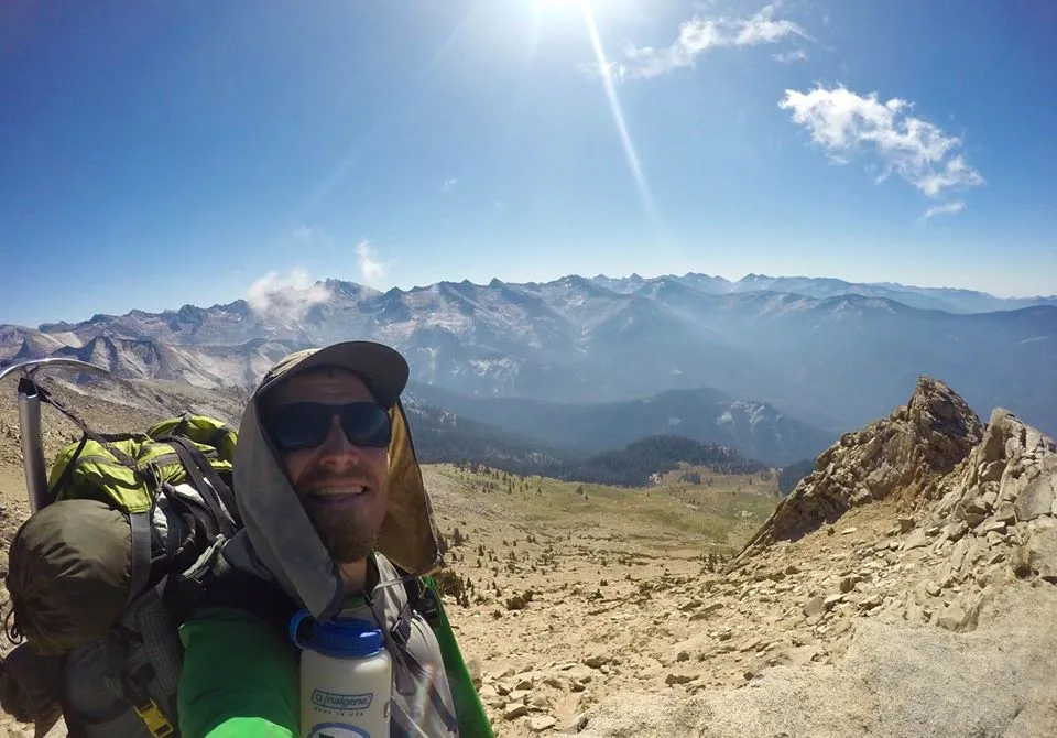
Selfie on Alta peak
Tharps rock
Mehrten meadow
Hiking back to Panther Gap
@alaqrab and I
Hiking back to Woolverton
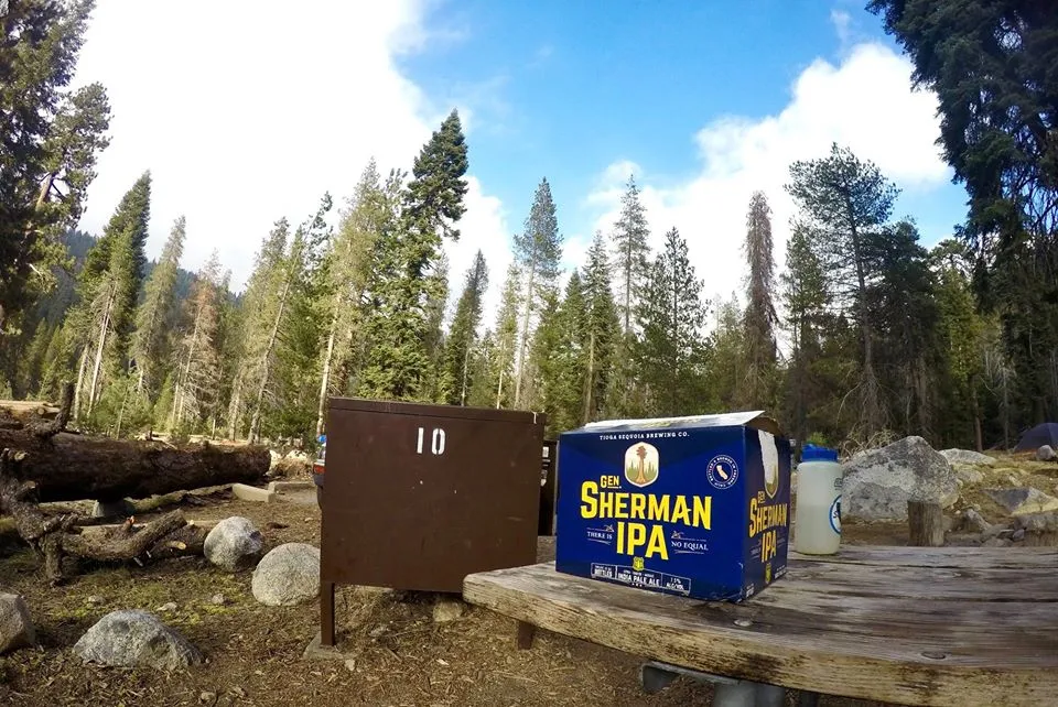
Enjoying some beers at the Lodgepole campground
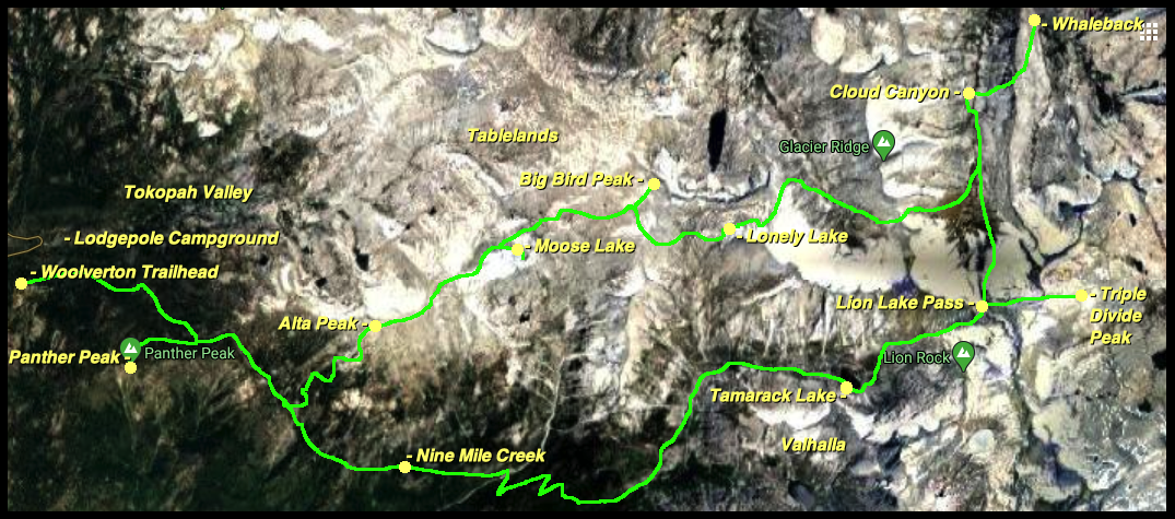
Map (click to enlarge)
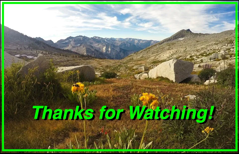
Until next time...
I hope you have enjoyed this glimpse into
My California!!
Contact me on Discord

#SoCalHive is building and supporting the Hive Blockchain community in Southern California. If you are from SoCal and are into creating quality content here on Hive, we'd love for you to follow us @theSoCalHive and join our group on Discord


Animation By @zord189


Pinmapple