Montain Semeru, Indonesia
Shot from Drone dji Mavic pro
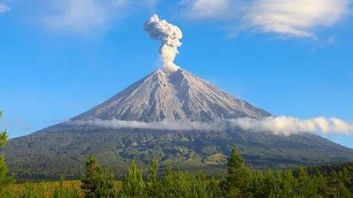
Sumeru is the highest volcano on Java Island, with its peak Mahameru, 3,676 meters above sea level (mdpl). The crater at the top of Mount Semeru is known as Jonggring Saloko. Semeru has a Dipterocarp Hill forest area, Upper Dipterocarp Forest, Montane forest, and Ericaceous Forest or mountain forest. The position of this mountain lies between the administrative area of Malang Regency and Lumajang, with geographical position between 8 ° 06 'LS and 120 ° 55' east longitude. In 1913 and 1946 Jonggring Saloka crater has a dome with an altitude of 3744.8 M until the end of November 1973. To the south, the dome is breaking down the crater rim causing lava flows leading to the southern side covering Pronojiwo and Candipuro areas in Lumajang. At noon the wind caved north toward the summit carrying poison gas from Jonggring Saloka Crater.
The climb should be done in the dry season is June, July, August, and September. Should not climb in the rainy season because of frequent storms and landslides.
Please follow me
https://steemit.com/@ryanananda