When Ren and I travel, often we do not have a definite plan in mind. In many cases, we didn’t even plan that we were taking a trip, let alone plan out the trip. At some point during breakfast, one of us will ask what we want to do this weekend, and an hour later we will be hitting the road. Some of our best trips have started out this way much like our trip to Houston. Other times we plan things out in detail. We know when we are leaving, how far we will drive, where we are staying, what gas will cost, and what our budget will be for the trip. Both of us exhaustively research the area, to see what is available. Sometimes we even have a list of specific things that I want to photograph while we are there. Our Davis Mountain Trip is a great example of this. Then there are trips that start out with a very detailed plan, but we end up scrapping it all and winging it. Our latest trip was one of those.
I have been crazy about astronomy since I was a kid. I got into photography three years ago because I wanted to do astrophotography. Specifically, I wanted to take photos of the Milky Way. When I told Ren I wanted to get a camera and learn photography, she supported me. One of the things I love best about our marriage is how we support and encourage each other. I never imagined how much I would love photography, or how much it would change my outlook on life.
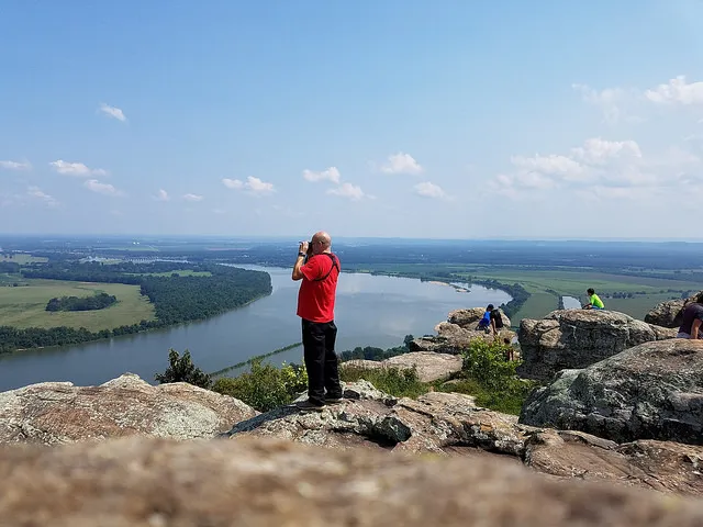
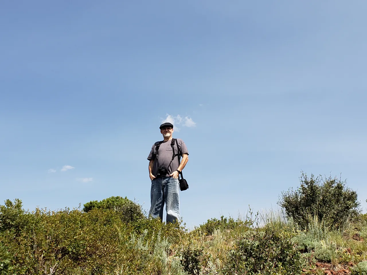
Scott taking photos at Petite Jean Mountain, Arkansas.
If you want to do astrophotography, one of the things you have to deal with is light pollution. You have to get where it is dark, far away from the city lights. Living in Fort Worth, that was not terribly difficult. I was about an hour and a half from reasonably dark skies, and three hours from very dark skies. The other thing you have to deal with is that you need to shoot when the moon is not in the sky, so the New Moon is ideal. Once we moved back to Tulsa, really dark skies were further away. Looking at the Light Pollution map on http://darksitefinder.com I saw that the darkest skies in Oklahoma were found at the far western end of the panhandle. In fact, these were as dark as anyplace in the continental U.S., and right there in the middle of these wonderfully dark skies was Black Mesa State Park. I wanted to go. The problem was that it was over seven and a half hours away; this would be a major trip. I had suggested it a few times, but Ren had not been enthusiastic because she was worried about the heat and the distance.
When I saw the August New Moon was going to fall on a weekend, and that it was going to fall during the middle of the Perseid Meteor Shower, I told Ren that I was going to want to be somewhere DARK that weekend. I was surprised when she suggested that we go to Black Mesa. It took me about half a second to agree. We started our planning. More accurately, Ren started planning. She presented me with three plans with a break down of costs, driving times, and the number of new counties we could get.
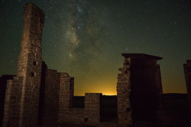
Night sky at Fort Griffin State Historic Site in Texas.
We figured out what we wanted to see while we were there, which counties we would visit, how much gas it was going to take, and even where we would buy our gas, as we were headed into areas where you could not count on gas stations being nearby when you ran low. We knew we were headed to the park. There were three tri-state markers we wanted to visit, (A tri-state marker is where three states meet. If it’s not in the middle of a river, there will usually be a marker of some kind.), and, since Ren loves geology as much as I love astronomy, we were going to visit the Capulin Volcano National Monument in New Mexico.
Taking a half-day Thursday off from work we hit the road as soon as I got off work. We drove straight to the park along Highway 412, with only a minor detour to visit Gloss Mountain State Park, which was right on the way. We arrived at camp just after dark and got our first surprise. For a park that brags about their dark skies, they had the place lit up like downtown. Street lights everywhere. We would have to get away from the park to get our stars. We set up our hammock stand camp for the first time in the dark, but they are very straightforward and it went quickly. It was cloudy that evening, with a small chance of rain Thursday and Friday, but we got lucky, while there were storms around us, they passed us by.
We spent Friday, as planned, exploring the park, visiting two of the three tri-state markers, and a couple of canyons in Colorado. Friday evening I found a location and set up to take pictures, but it was pretty cloudy and I didn’t get the dark skies I had anticipated.
Saturday the plan was to get the third tri-state marker and visit the Capulin Volcano National Monument in New Mexico. We left camp and headed toward the Oklahoma-Texas-New Mexico border. When we got close enough to civilization to get a cell phone signal, I checked the weather forecast. The clear skies that had been predicted, were looking more and more unlikely. I wasn’t going to get my stars, again. I wasn’t too upset about it because we were having a great trip, and if you do astronomy long, you know that this is just part of the hobby. Sometimes it works out and sometimes it doesn’t.
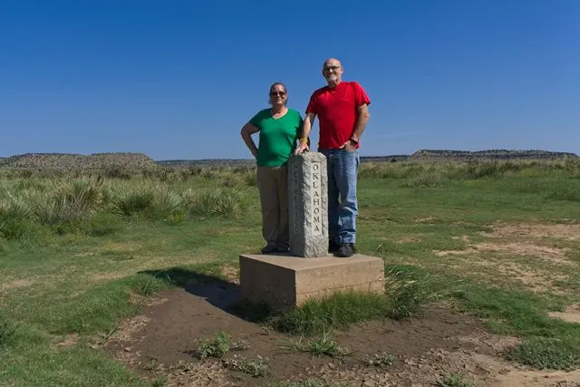
Us at the Oklahoma-New Mexico-Colorado tri-state marker.
As we headed into Clayton New Mexico, on the way to the Volcano, I looked at the map and told Ren, “If I can’t have stars, I want mountains. Let's go to Taos.” She asked how far it was, and I told her it was just over two hours. I expected a little resistance to scrapping the plan she had worked so hard on, however, to my surprise, she agreed right away. At this point, we knew nothing about Taos except that there were mountains. While Ren drove, I tried to figure out what we wanted to do when we got there. We aimed to stop at a place called Eagles Nest Lake State Park, and figure out where to go from there. While I looked over Google Maps, I saw a marker for Cimarron Canyon State Park, but it wasn’t clear what it was. We drove on toward the mountains, which were becoming more and more impressive the closer we got to them.
Reaching the town of Cimarron, we stopped at a tourist information booth to pick up some brochures and spoke with the attendant. I noticed a National Park Passport stamp and asked her what it was for. It turns out that Cimarron Canyon was a National Scenic, and Historic drive and we were driving right through it to get to Eagles Nest. We always try to take any Scenic Byway we pass. This was as beautiful as any with its huge cliffs and thick forest while the Cimarron River flowed the length of the canyon. I love Rivers, and the Cimarron is not just any river, it flows into Keystone lake just a few miles from where we live in Oklahoma where I have camped many times. It had an entirely different character here near it’s beginning. The middle section of the canyon was the state park, with lots of campsites along the road. We were in love with the place.
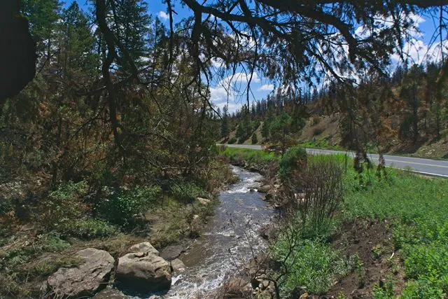
The Cimarron River near the headwaters.
Reaching the town of Eagles Nest we had decided that we could see lots of interesting places by taking the Enchanted Circle Scenic Loop, which includes Taos and goes through large areas of the Carson National Forest. The only issue was that it was nearly 3:00 pm and we were about three hours from camp if we skipped the volcano. I wasn’t willing to skip the volcano because I knew how much it meant to Ren.
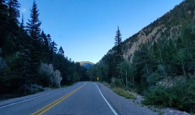
I called my boss, asking if I could take an extra day of vacation, while Ren tried to find a reasonably priced hotel; turns out that reasonably priced and Taos, don’t really go together. After a bit of searching, we found a room right in Eagles Nest so we booked the room. While we chatted with the manager, he told us that if we were driving the Loop, we should be sure and drive over to the Gorge Bridge, and told us how to get there. We were set with a basic plan for the afternoon so we headed out on the Enchanted Circle Scenic Loop and it was well worth taking the extra day. There is something about the mountains that call to me, something that feels like home. Whether it’s the Davis Mountains in Texas, the Ozarks in Arkansas, or the Sierra Nevadas in California. I love the mountains. These were no exception. It was a gorgeous drive through mountains, forests, and quaint little towns. The highest pass we drove through was just over 9,800 feet.
There were several roadside parks that were part of the Carson National Forest when we stopped at one to stretch our legs a bit, we crossed a small stream flowing gently over the rocks. To my surprise, it was the Red River. We had lived on the Red River for five months when we were park hosting on Lake Texoma for Eisenhower State Park. We had even made a point of crossing every Red River bridge from Texas to Oklahoma, and here we were crossing it again in New Mexico; it was so small.
The Red River between Oklahoma and Texas
As we made our way around the loop we reached the intersection where we turned left to go to Taos, or right to go to the gorge bridge. We turned right. Wow! Just Wow!. On this trip, we had seen mesas, huge mountains, beautiful lakes, canyons, cliffs, forests, and scenic rivers, but this was by far the most majestic, and impressive thing that we saw. It was the Río Grande del Norte National Monument. The Rio Grande. We have traveled extensively in Texas, spent the better part of three years trying to see as much of Texas as possible, yet this was our first time to see the Rio Grande. It was amazing. This is the seventh highest bridge in the US, 565 feet above the river. There is a parking area on either side, with a scenic overlook, and you can walk out on the bridge. It was truly awesome, in the best sense of the overused word.
Reluctantly, we left the gorge and headed into Taos. I won’t spend much time on Taos, as this is getting rather long enough already. We drove around for a few hours, loved the place. Ren wants to move there; of course, she says that about every place we visit. I guess it’s a good thing we plan to buy an RV someday so we can live wherever we visit.
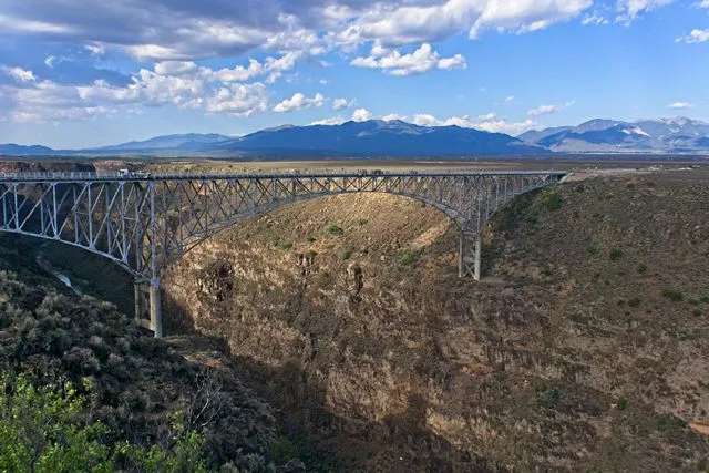
Río Grande del Norte National Monument
I suggested that we visit the Taos Ski Valley before heading back to the hotel. This was the first place I got any real pushback from her. Not that she didn’t want to go, but she is frightened about driving down twisty, turny roads, especially since it was getting late in the day; however, me driving scares her even more because, in her words, she is a bad passenger. One of the things I admire most about Ren is that she does not let her fears get the better of her. It took her a few moments to work up her nerve, but she agreed.
The Hondo Canyon Road is the road that leads up the valley to the ski lodge. I know I’ve said this several times already, but it was a beautiful drive through the valley with huge cliffs and tall trees and is a valley, there was, naturally, a stream named the Hondo, Rio. As is usual in this area, we were in the Carson National Forest and there were lots of scenic roadside campgrounds. We drove up to the lodge, but it was getting late, so we didn’t get out of the car, then headed through the valley again, stopping at a few of the parks.
It was time to be heading back to the hotel. The last leg of the drive was the twistiest and turniest road of the entire trip, and it was full dark, so we didn’t see most of it. When we got back to the hotel, Ren went to bed; she was exhausted from the last leg of the drive. The hotel manager told me earlier I could get a good view of the milky way from the deck on top of the hotel overlooking the lake. I went to take some pictures, but between the hotel and city lights, they were not the skies I had come seeking, but they weren't bad.
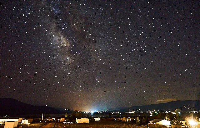
Milky Way above Eagles Nest, New Mexico.
The next morning we found the entire town socked in with fog. We were not eager to drive through the canyon again until the fog lifted, so we walked through town to find breakfast. What we found instead was there wasn’t anywhere in Eagles Nest to get breakfast at 8:00 on a Sunday Morning. Did I mention that Eagles Nest is tiny? Did I mention that Eagles Nest is at an altitude of more than 8,200 feet? We hadn’t really paid much attention to that before taking our walk, but as we were walking back the thinness of the air became apparent. We were huffing and puffing by the time we got back.
When the fog burned off we headed back through the valley to Cimarron then north to Raton, where we found breakfast. Then we took the Raton pass into Colorado where we visited Trinidad State Park, before heading to the Capulin Volcano National Monument. This is an extinct, cinder cone volcano, with the cone remarkably preserved. There are a visitors center and a road that wraps around the cone to a parking lot near the top. From there you can hike down into the vent, or around the rim. We intended to hike around the rim, but between the altitude, our exhaustion, and general lack of fitness we turned back well before we reached the top. It was still worth the trip, and even from the parking area near the top, it is an impressive view.
Scenic view from on top of Capulin Volcano National Monument.
It was time to head back to our camp in Black Mesa and Google wanted to take us back to Clayton, but we hate taking the same road back as the road we came on, so we took the road less traveled; literally. What a difference. We went north through Folsom then took a small road east. It alternated between paved and gravel, and, usually, the gravel was smoother, but it was so worth it. The road led through a canyon we didn’t find on the maps, and where there is a canyon, there is a stream. The canyon, river, and road were all named the Dry Cimarron. Yes, another branch of the Cimarron River. The canyon went on for hours, almost entirely empty. Huge, rugged and beautiful in a very different way than the other Cimarron Canyon, but no less impressive. It was one of my favorite parts of the trip.
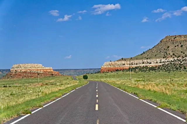
Dry Cimarron River Canyon in Northeastern New Mexico.
We got back to camp at a reasonable time, and as we were settling in, it became apparent we were going to have clouds again that night. Realizing I was not going to get the perfect night sky photo, I suggested we pack up camp and head south into Texas. In visiting the Texas Panhandle a few weeks earlier, we now had visited all but two counties in Oklahoma. The last two were down south and we decided to go get them.
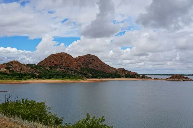
We got back to camp at a reasonable time, and as we were settling in, it became apparent we were going to have clouds again that night. Realizing I was not going to get the perfect night sky photo, I suggested we pack up camp and head south into Texas. In visiting the Texas Panhandle a few weeks earlier, we now had visited all but two counties in Oklahoma. The last two were down south and we decided to go get them. In no time we were on the road. An hour and a half drive, and a minor crisis involving so many bugs hitting the windshield we could barely see out took us to Lake Meredith National Recreation Area. Being Sunday night the place was empty and we found a nice site overlooking the lake, and slept under the stars, with a cool breeze to keep the bugs away.
The next morning we visited the Alibates Flint Quarries National Monument. Walked through the visitors center, watched the informative movie and took a short hike, then got back on the road. We headed into Oklahoma to get those last two counties. On the way to Kiowa County, we were passing right by Quartz Mountain State Park. We couldn’t be this close without stopping. It is a very pretty park, though the lake was very low at the time. We spent about an hour here before heading to our next destination.
Quartz Mountain Nature Park near Altus, OK.
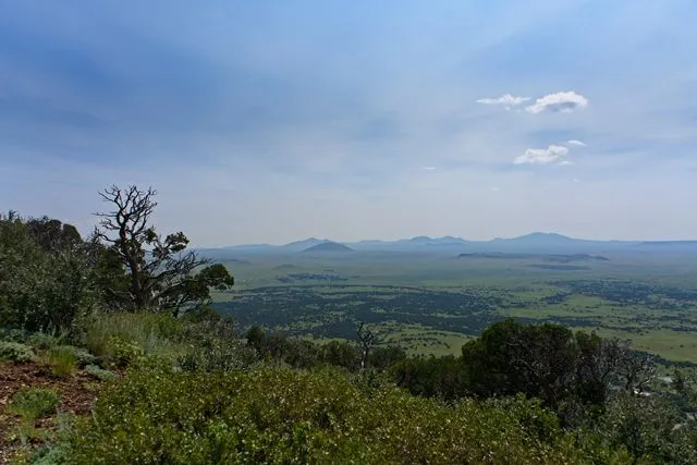
The Wichita Mountains National Wildlife Refuge is a place I had to hear about for a while but had not yet managed to visit. It was getting late and I was thinking we should just head home, but Ren knew how much I have wanted to go here and insisted that we take the time. I’m so glad I listen to her. I had been afraid that after seeing New Mexico, that Oklahoma would seem dull and unimpressive by comparison. I needn't have worried. The mountains of Oklahoma may not be as tall as those of New Mexico, but they are no less beautiful. We ended up staying much longer than we intended and it was getting dark by the time we headed home.
Arriving home late, we were tired and sore, however, the trip had been more than we ever expected because we abandoned our plans and took a chance. Sometimes having a plan is important because it tells you the when, the where, and the how; but it often causes you to miss the unexpected treasures of traveling along the backroads. Our motto is “Get out, live life outside your box,” sometimes that means getting outside of your plans. Take a chance, do something unexpected, live your life to the fullest. I still want to go back to Black Mesa. I still want those dark skies. But I wouldn’t trade this trip for the one we planned.
Safe Travels,
Scott