
Welcome everyone! With snow and near zero degree F temperatures forecast for next week, we decided to get out and enjoy one of the last sunny and warmer days. We took a trip into Bend to visit Shevlin Park. Our walk will encompass just a small portion of the 981 acre, mostly undeveloped, park. I had never been here before but I figured it was time to start exploring some of the many miles of trails located in the town of Bend. :)
On this walk we decided to do a little loop trail that explores two sides of Tumalo Creek as it flows through the park. It ended up being about a 2 mile round trip.
Click images for larger view
Here is a shot as we cross the bridge to the other side of the creek. While most of the brilliant fall colors are gone there is still much winter type beauty to be seen.

A last shot of the creek before we begin a mild ascent to the rim on the east side.

A view looking west back into the park.

An exposed root system from a long ago fallen tree. This shot also kind of shows how as you go up the hill away from the creek you begin to see the more arid desert type landscape.

A shot of the creek down below as we continue to parallel the creek heading south.

Although it was 40 some degrees F out , when you are in the sun in the high desert it can feel quite a bit warmer.

A shot of the bridge as we head back across the creek to complete the loop. The blanket of yellow needles you see on the ground are from the numerous larch trees in the area. I'm looking forward to trying to catch these trees earlier in the fall before they lose all their needles.


I may have have gone a little overboard taking shots of these dead trees, but they really intrigued me and I was doing a little experimentation with my camera. :)

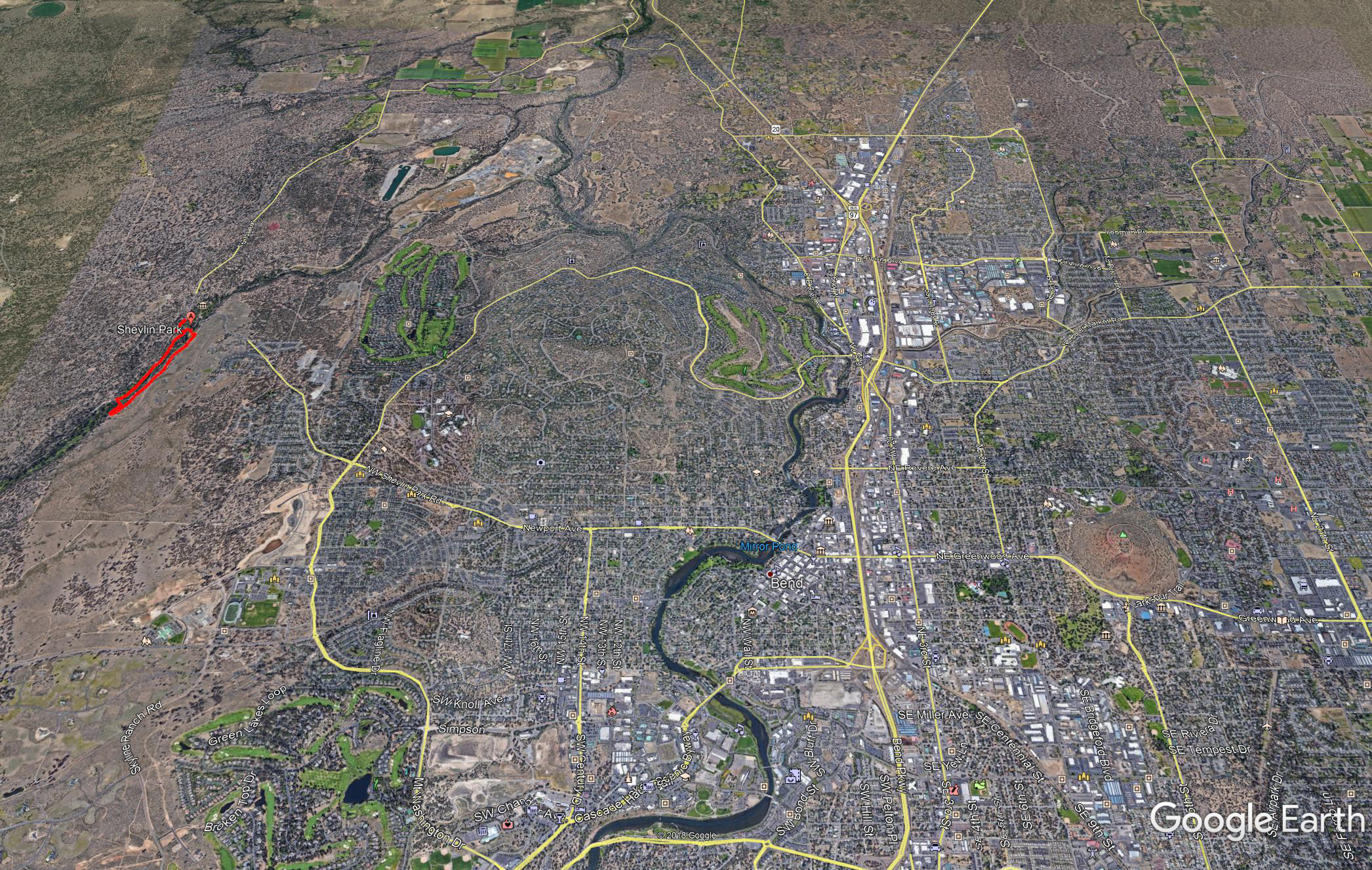
Here are a couple Google Earth shots I made showing the apprx. trail route and the location of the park relative to Bend OR.

Click images for larger view
Photos taken by me, 
Thanks for looking and enjoy your day!