Huricane Irma
If you live anywhere from Florida to North Carolina, keep your eyes on this one just in case and have a plan to "board up" and take a mini-vacation out of town if you live in the direct path. Tomorrow they could forecast a curve out to sea, then Wednesday forecast it back into Florida - we all know how that goes.
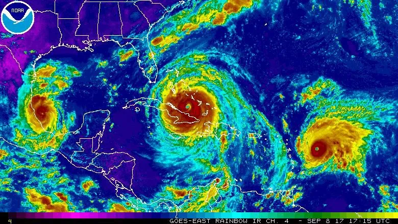
GOES-EAST / NOAA
Forecast models are coming into agreement about a more Westerly path, with the exception of the GFS, it is still holding a North turn over the Bahamas just before Florida with an impact in North Carolina. ALL models are forecasting at least a CAT 4 hurricane with at least 135mph winds. Currently the system is expanding in size and has a growing wind field, meaning it's impacts will be over a larger area.
while the post edit period is open.
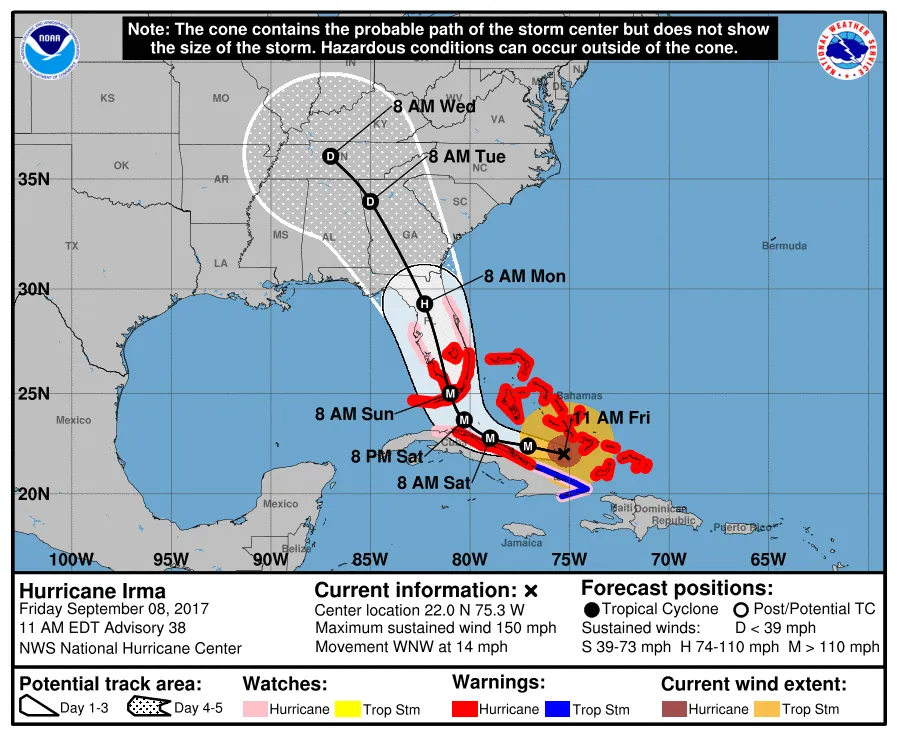
Firday 11AM Advisory - Track adjusted slightly West in this Advisory
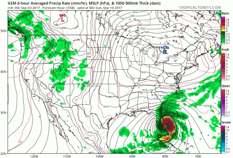
CMC/GEM forecast model for Sunday September 10, 2017

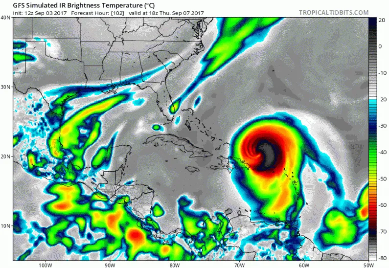
HWRF Wind Field Forecast through Friday September 8, 2017
Frontal Boundary for the Block
The frontal boundary dropping down across the US ( shown below) will be the key player in setting up the Florida deflector shield. It was expected to be strong enough to curve Irma North, but the latest runs are showing a stronger high pressure ridge in the Atlantic and a weaker boundary. We will see how this plays out in the next few days.
It's been almost 12 years since Hurricane Wilma hit South Florida in October of 2005, only 6 months after our wedding.
Wilma was forecast to hold it's CAT 1 strength (75mph) as it made landfall on the Southwest coast and lose strength as it made its way to the Northwest across the state. Well, we all know how that went down... just hours before landfall it began a rapid intensification cycle as it crossed over the extremely warm Gulf Stream current water. It made landfall and continued to grow in size and strength even as it made it's way across land. It exited Palm Beach county as a CAT 3 hurricane with winds of 115 mph and gusts to 145mph. We had the pleasure of having the eye pass directly over the apartment we lived in at the time in Boca Raton. Needless to say it did not go well. Concrete power poles snapped like twigs. Our area had no running water for 2 weeks, and no power for 3.5 weeks. Thankfully I had an SUV and was able to drive over fallen palm trees and berms to get out of the community and drive North to Melbourne the next day where we stayed with friends.
We have not had any significant tropical impacts since Wilma. Even us hurricane-hardened Floridians know our limits and have our criteria for getting out of the way of land-falling storms.
Fingers crossed - Keep your eyes on this storm (and the invest system behind it) to be on the safe side.
Have a plan in place, just in case!
Let me know what you think, please leave your comments below.
As always, please upvote this post and follow me if you like my work and want to see more.
If you think others will enjoy this Please ReSteem it!
Thanks for reading!