Pix4dcapture
turns your consumer drone into a professional mapping tool
Screenshots
Hunter's comment

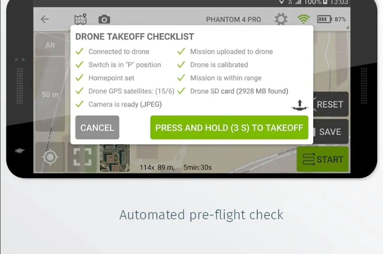
Do you want to use your drones more productively? Pix4Dcapture can be the answer. This app converts your drones into a professional unmanned aerial mapping tool.
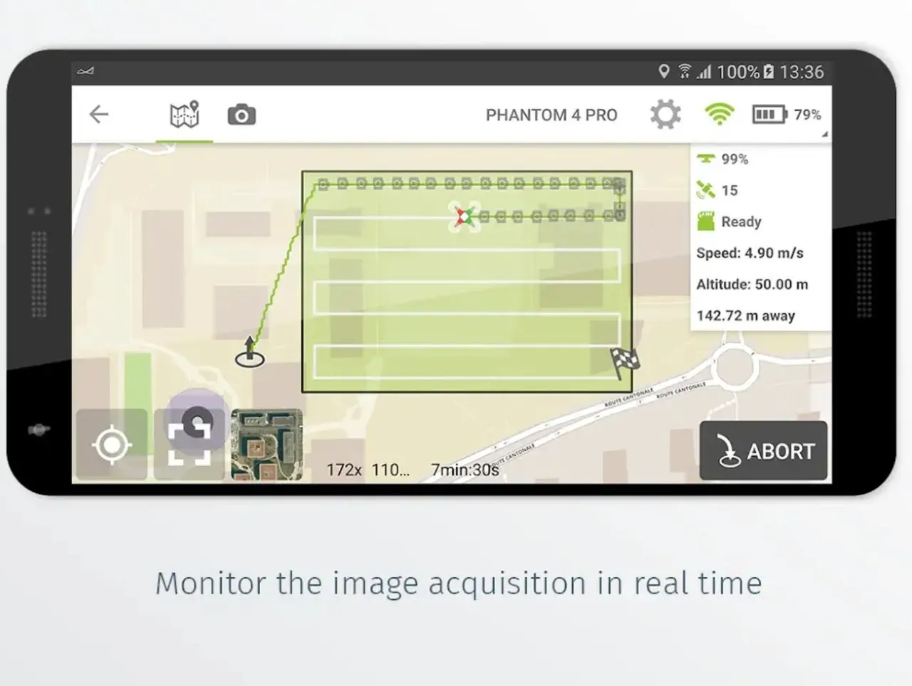
The drone's camera automatically captures the thermal image data of RGB to capture the best 3D model and map.
This RGB thermal image data can also be used for agriculture. Professional agricultural dragon parrot Bluegrass that I introduced before also supports Pix4Dcapture.
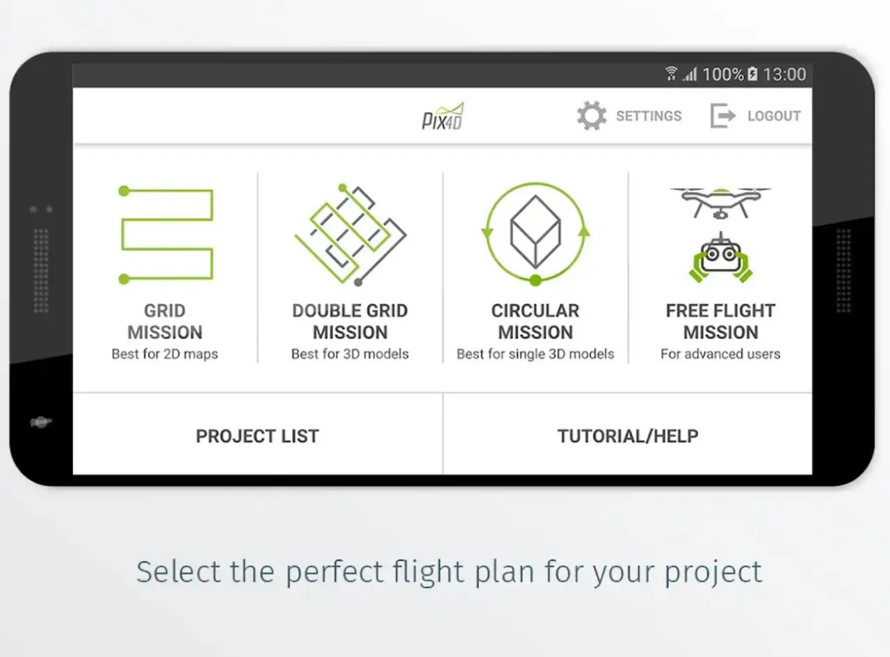
Here are the drones that support this app
Phantom 4 Pro
Phantom 4
Mavic Pro
Matrice 200
Matrice 210
Matrice 210 RTK
Inspire 2
Inspire 1 (Pro)
Phantom 3 Professional
Phantom 3 Advanced
Phantom 3 Standard
Matrice 100
Spark
Bebop 2 with Skycontroller 2
Bluegrass
H520 with E90 camera
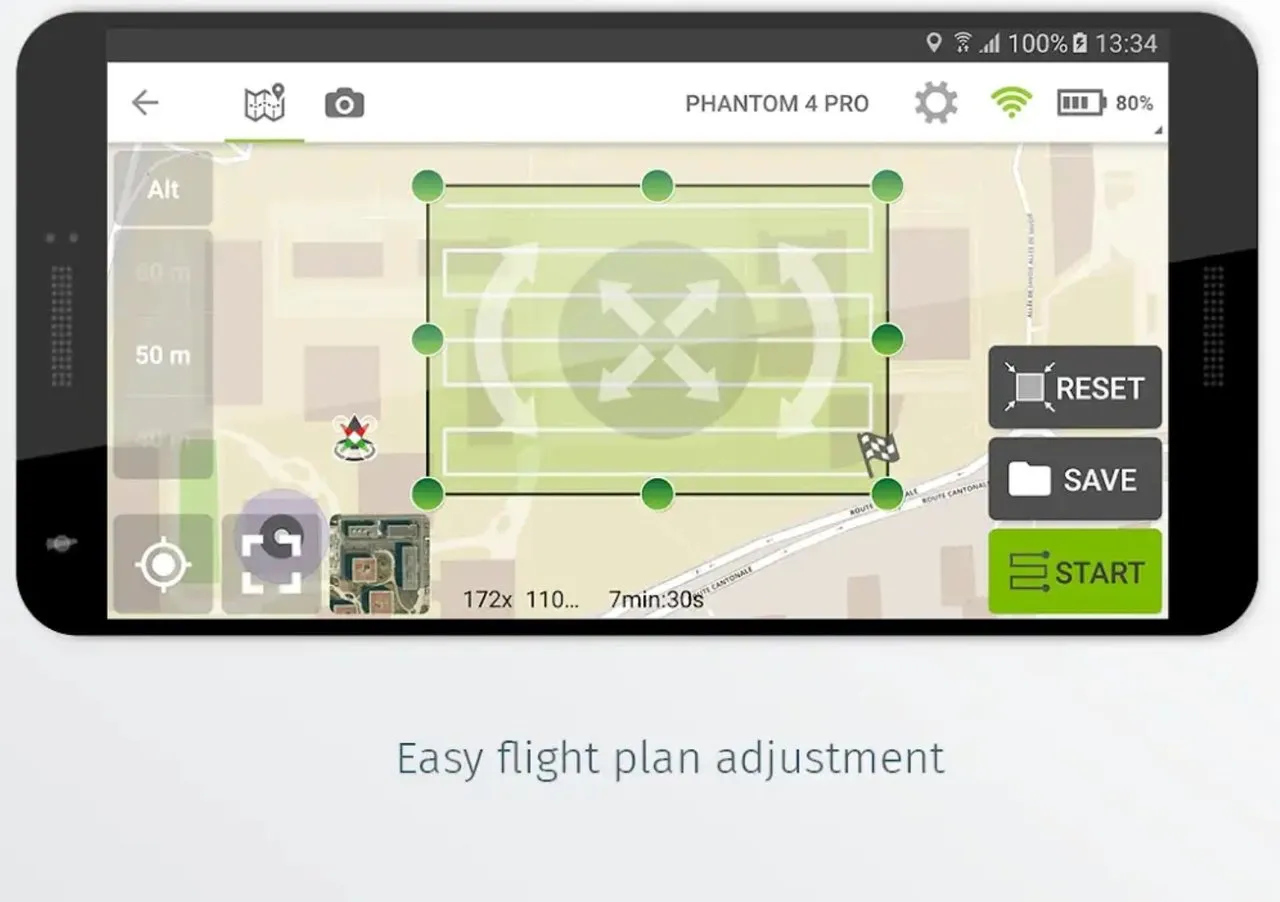
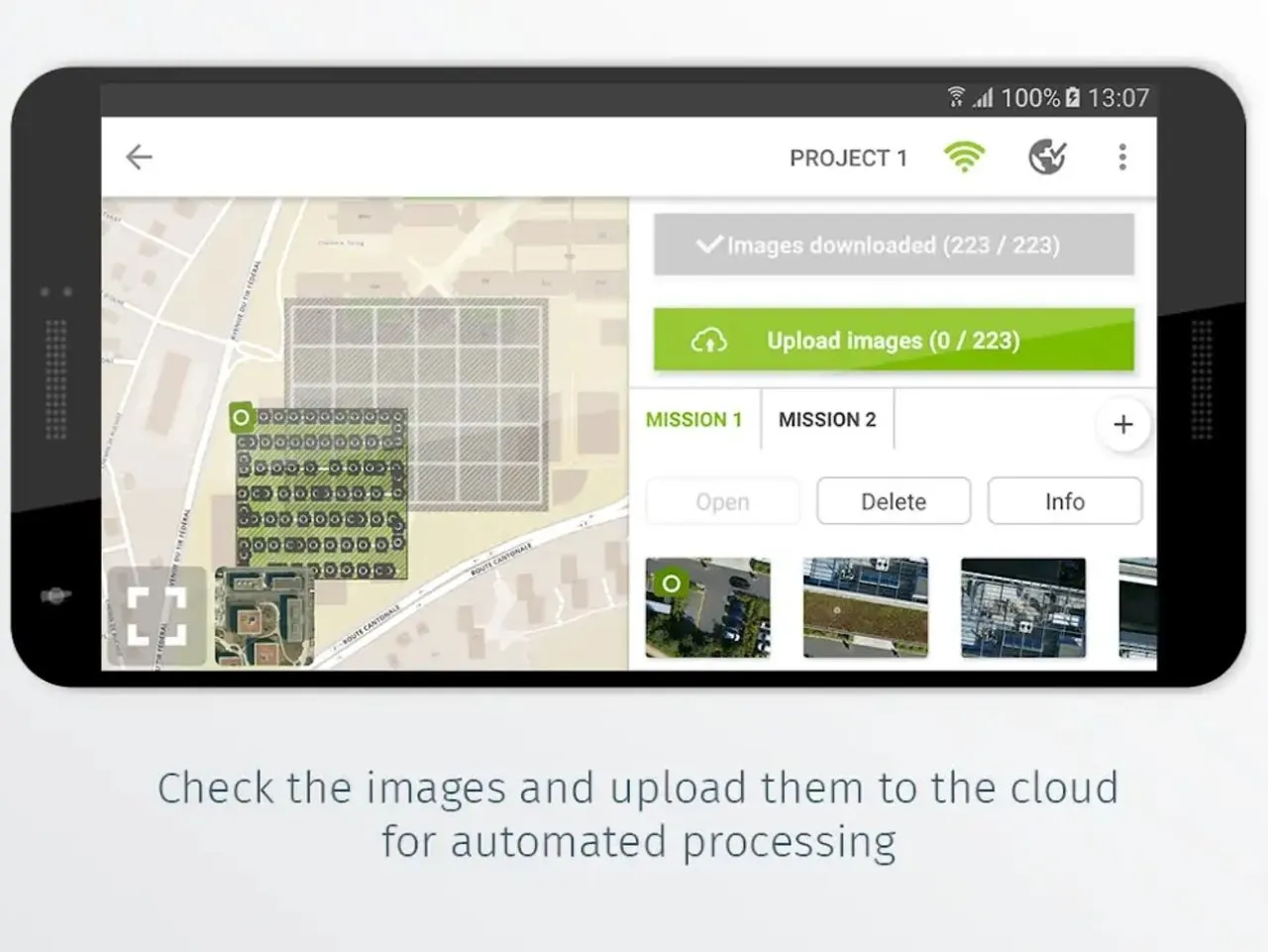
In addition to getting infrared data, this app also allows remote control by setting zones and setting travel routes. This means that there are many ways to use it besides agriculture and 3D mapping ..!
Link
https://pix4d.com/product/pix4dcapture
Contributors
Hunter: @sunsu

This is posted on Steemhunt - A place where you can dig products and earn STEEM.
View on Steemhunt.com