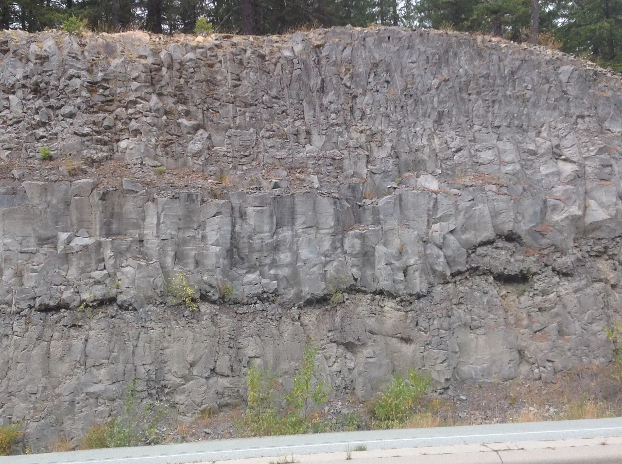
Knowing something about the geology of the land you live on creates a greater perspective of your own time and place, geologically speaking! I have learned that where I live there were more than four lava flows (from the Late Pleistocene period) comprise the vertical layers underfoot. The photo is of the Cheakamus Valley basalt layers, taken from the highway to Whistler, and are part of the Garibaldi Volcanic Belt. This is a chain northwest-southeast of volcanoes and their respective lava flows that to this day are part of what is known as the northern end of the Cascade Volcanic Arc. The southern end stretches into Wahington and Oregon states. In the photo, you can easily make out 3 distinctive layers. Note the basalt is vertical. The lava flowed over glacial till and gravel before cooling and creating a hard weather resistant cap over what would have been more easily eroded materials. 10,000 years later (17,000+/- years ago) ice from the iceage (Fraser Glaciation) receded from Valley releasing voluminous and epic flows of flood / melt water and creating the creek channels and lake beds. It formed much if the silts and now dry lands of the Fraser and Columbia River deltas. It even created a fiord where the sea moves into a valley (Howe Sound), between Vancouver and Squamish.
Curiosity and learning, becoming aware of what we do not know - are an elixir for a long and involved life! What lies below your feet?