An exploration geoscientist, in order to reduce exploration uncertainties and to increase the probability of exploration success, has to acquire and analyse various types of geoscientific data.
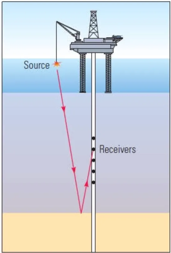
VSP is one of the most important exploration tool for exploration geoscientist. In this the source is kept on the surface and sensor is kept in the borehole.
The sound source is exploded and the resulting waves travel through subsurface experiencing reflections, refractions, and diffraction which are sensed and recorded by the sensor in the hole for up to 3-7 seconds.
Then the sensor is moved up to next level and the process is repeated. Normally the inter level distance is 15m. And recording is done from bottom of the borehole upto 200m.
The recorded data is processed to extract time-depth relationships which can also be converted into interval velocity, average velocity etc.