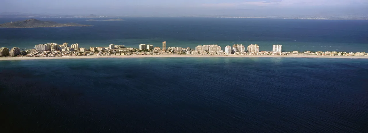
Aerial photo of the strip of land that closes off the Mar Menor, a saltwater lagoon on the coast of the province of Murcia, in the eastern Mediterranean of the Iberian Peninsula. While the narrow strip of land is completely built up as a result of tourist speculation, the lagoon's waters are highly polluted by agricultural overexploitation of the surrounding area. The photo may be attractive because of the distance, but the reality nearby is utterly tragic.
Photograph taken from a Cessna 172 light aircraft using analogue film with the Hasselblad X-Pan panoramic format camera.
ESP
Foto aérea de la franja de tierra que cierra el Mar Menor, laguna salada en la costa de la provincia de Murcia, en el levante mediterráneo de la Península Ibérica. Mientras la estrecha franja está completamente construida fruto de especulación turística, las aguas de la laguna están altamente contaminadas por sobreexplotación agrícola que sufre su entorno. La foto puede resultar atractiva debido a la distancia, pero la realidad cercana es completamente trágica.
Fotografía tomada desde una avioneta Cessna 172 con película analógica con la cámara de formato panorámico Hasselblad X-Pan.
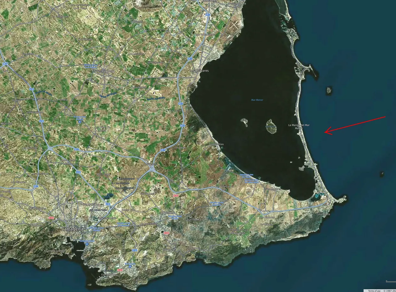
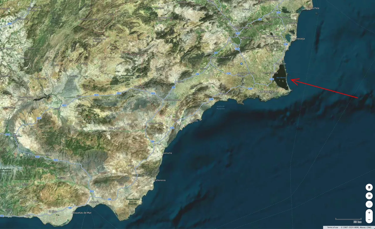
Map of situation of the coast where 'La Manga' es sit.
Mapa de situación de la costa en la está enclavada La Manga.
Unless stated otherwise, all the pictures and the words are mine.
Do not use this image without my written permission.
Proudly free of AI.
Thanks for stopping by and taking a look.
Camera: Hasselblad X-Pan
Lens: Hasselblad 45mm f:4
Film: Fujifilm Provia 100
Scanned: Minolta Dimage Scan Dual II
Processed with Capture One
Translated with DeepL.com plus little adjustments made by me.