Friday was a pretty full day for us on the camping trip we recently took to Tawas Point State Park. We got up and played a round of disc golf and then we decided to go out and do a bit more exploring from there. I picked a couple of places that were less than an hour from the campground and the one site is just down the road from the other site.
You might remember from my post about the disc golf course I was talking about how gross the water was. I mentioned that later that day we would be visiting a place with much cleaner water. Well, this is it.
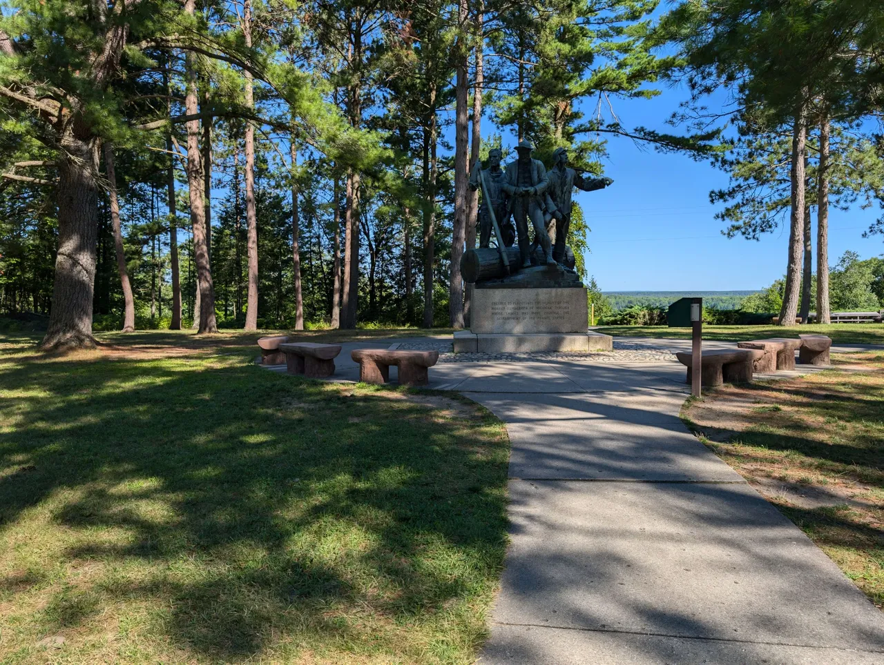
We stopped at Lumberman's Monument first. I honestly can't remember the last time I visited this spot. I know I had to have been a very small child at the time. I've seen photos of it from many other people, but I can't remember h having ever seen it before. Like I said, though, I know that isn't he case because my family used to travel all over the state visiting stuff like this when I was younger.
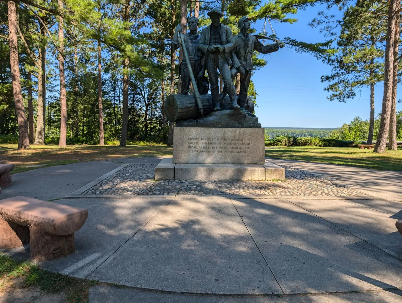
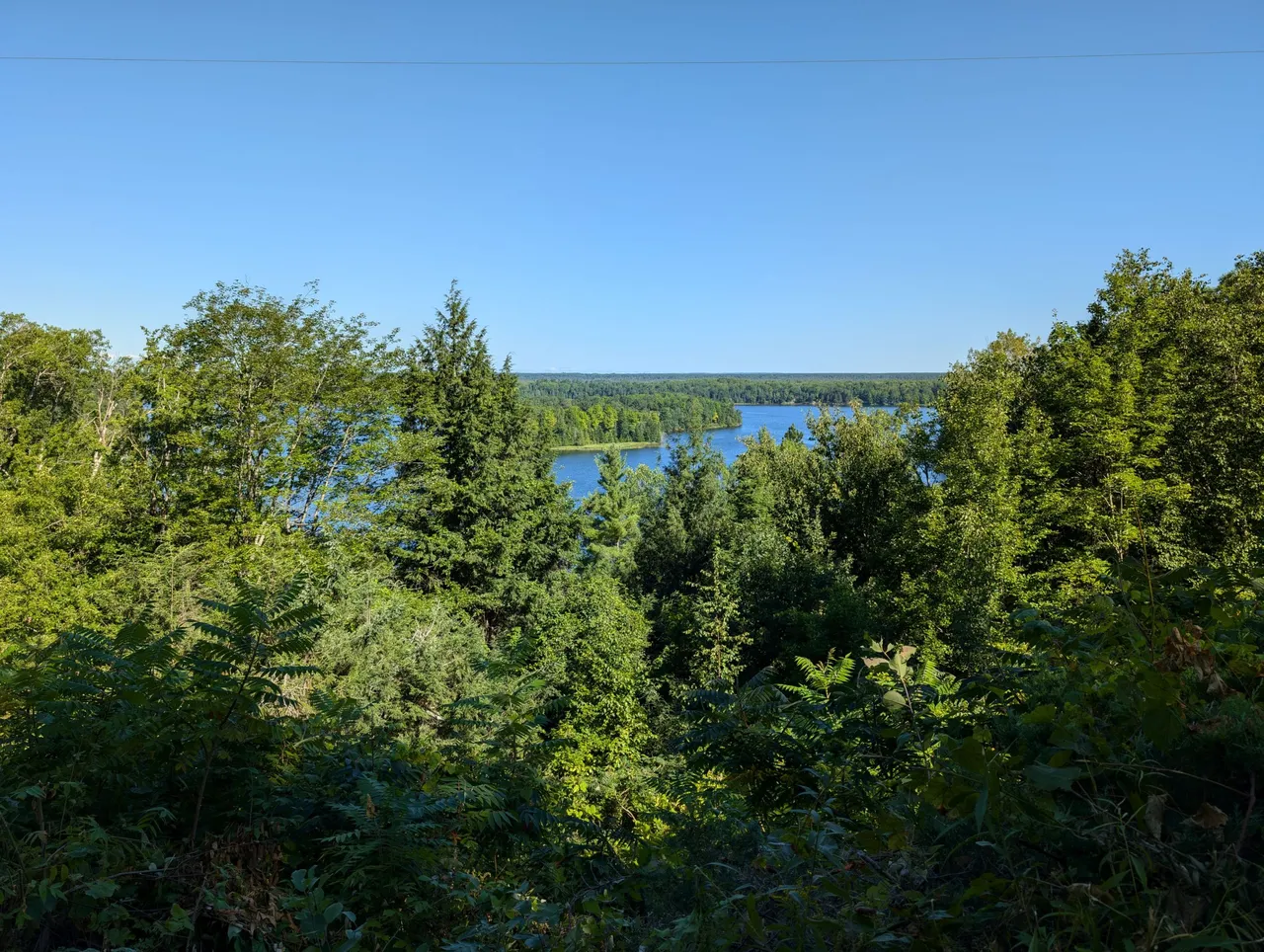
This 14 foot statue sits near a bluff that overlooks the Au Sable river area. The river is actually dammed, so it looks more like a lake, but technically it's a river. Both the locations I am going to share today sit in the middle of the Huron-Manistee national forest. Michigan has quite a few national and state forest sites where large stretches of forest are protected from harm.

While I had seen plenty of photos of the statue and another feature I will share in a second, what I failed to realize was just how amazing the view was. The East side of Michigan isn't really known for huge elevation changes, but this view from the bluff overlooking the Au Sable river was just breath taking.
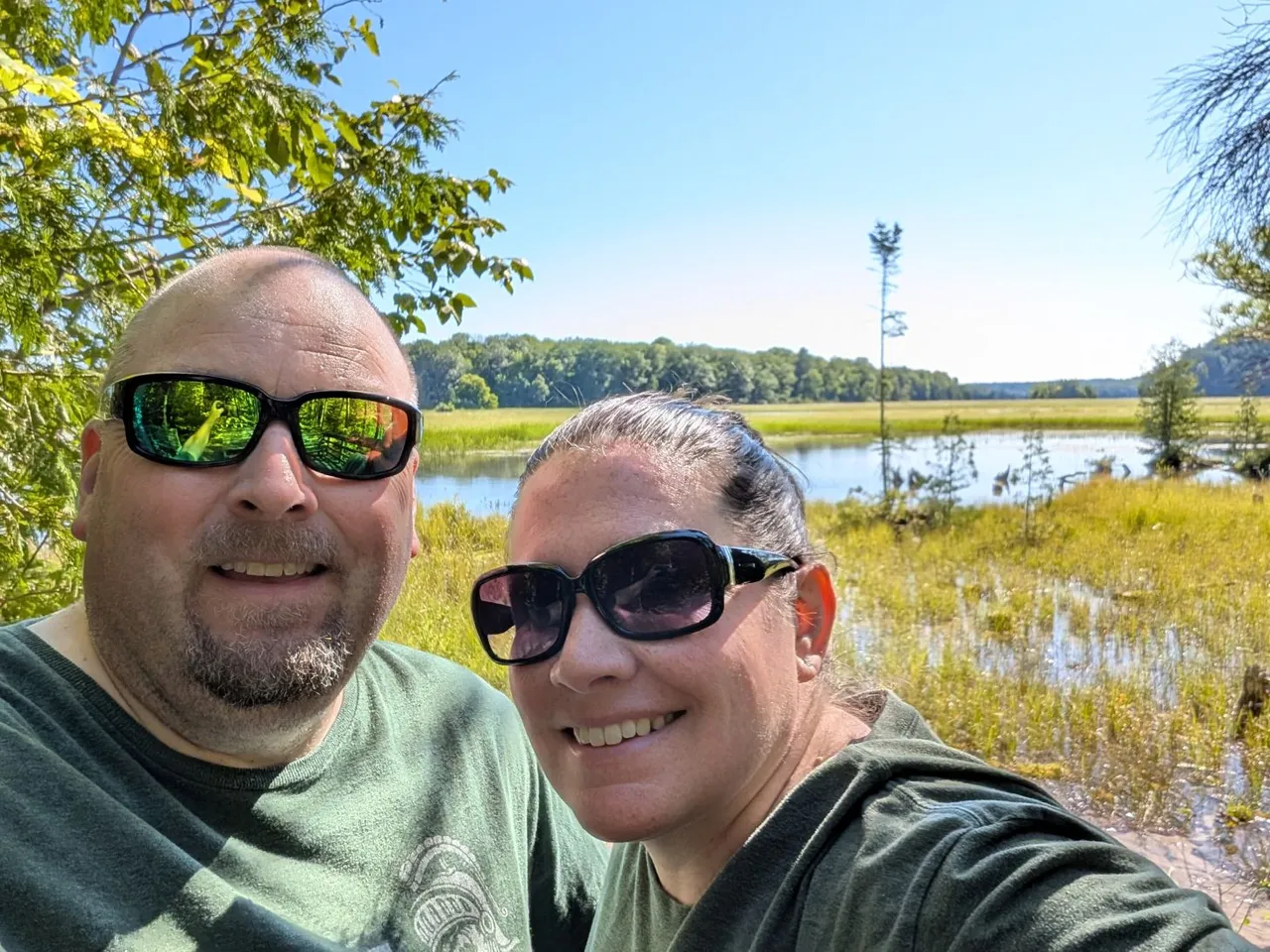
@mrsbozz had decided to stay in the truck since she knew I just wanted to grab a few quick shots. I kind of wish she had ended up coming with me, but I settled for the opening photo and this lone selfie instead.
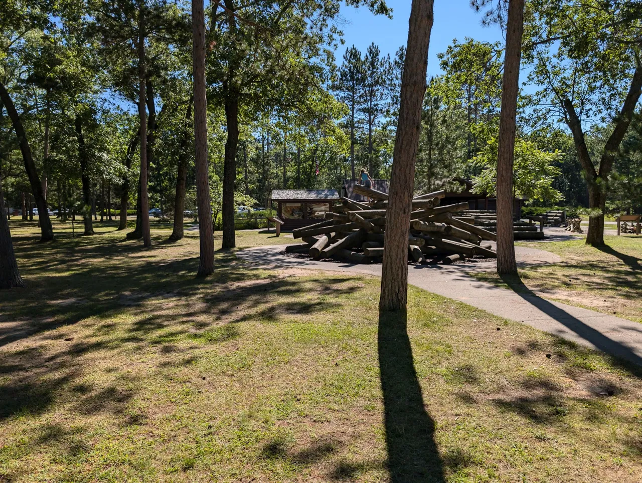
This is probably of the spots I have seen photos from the most. People and kids love to climb all over this "log jam". I didn't want to get a shot too close because there was a random kid crawling around on it and the last thing I need is to be accused of taking pictures of little kids.
That being said, it's probably hard to take a photo of the log jam without at least one person climbing around on it. This park has a small rustic camping area as well as a visitors center that has a lot of displays and activities centering around the lumbering legacy in Michigan.
I'm sure there was a lot more here we could have explored, but I knew the next stop was going to be a bit of a struggle, so I wanted to get on our way.
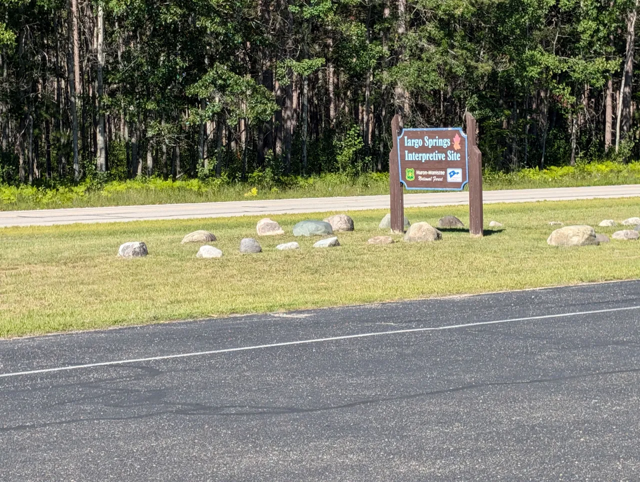
Iargo Springs is just up the road and after a bit of a workout, it provides you with an up close and personal view of the Au Sable river. If you want to get a bit more of the history of the springs, I encourage you to follow the link above. This area was used as a water source for travelers before it was even fully settled.
I'm not sure why they specify this, but Europeans have been visiting the springs recreationally since the 1920's.
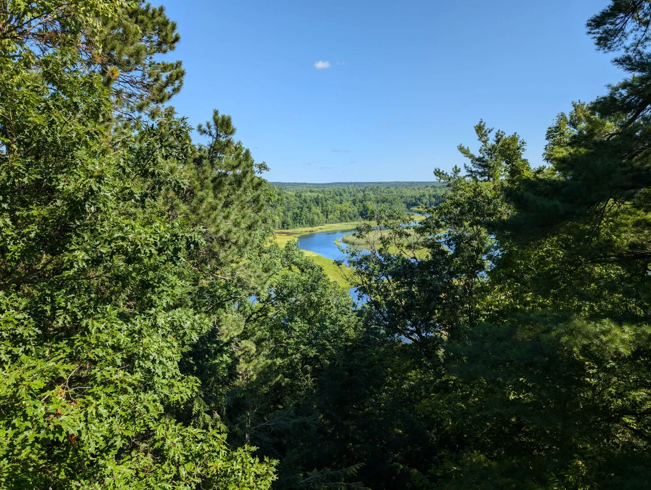
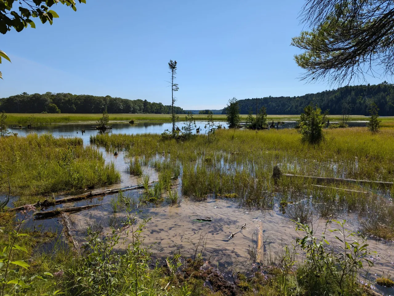
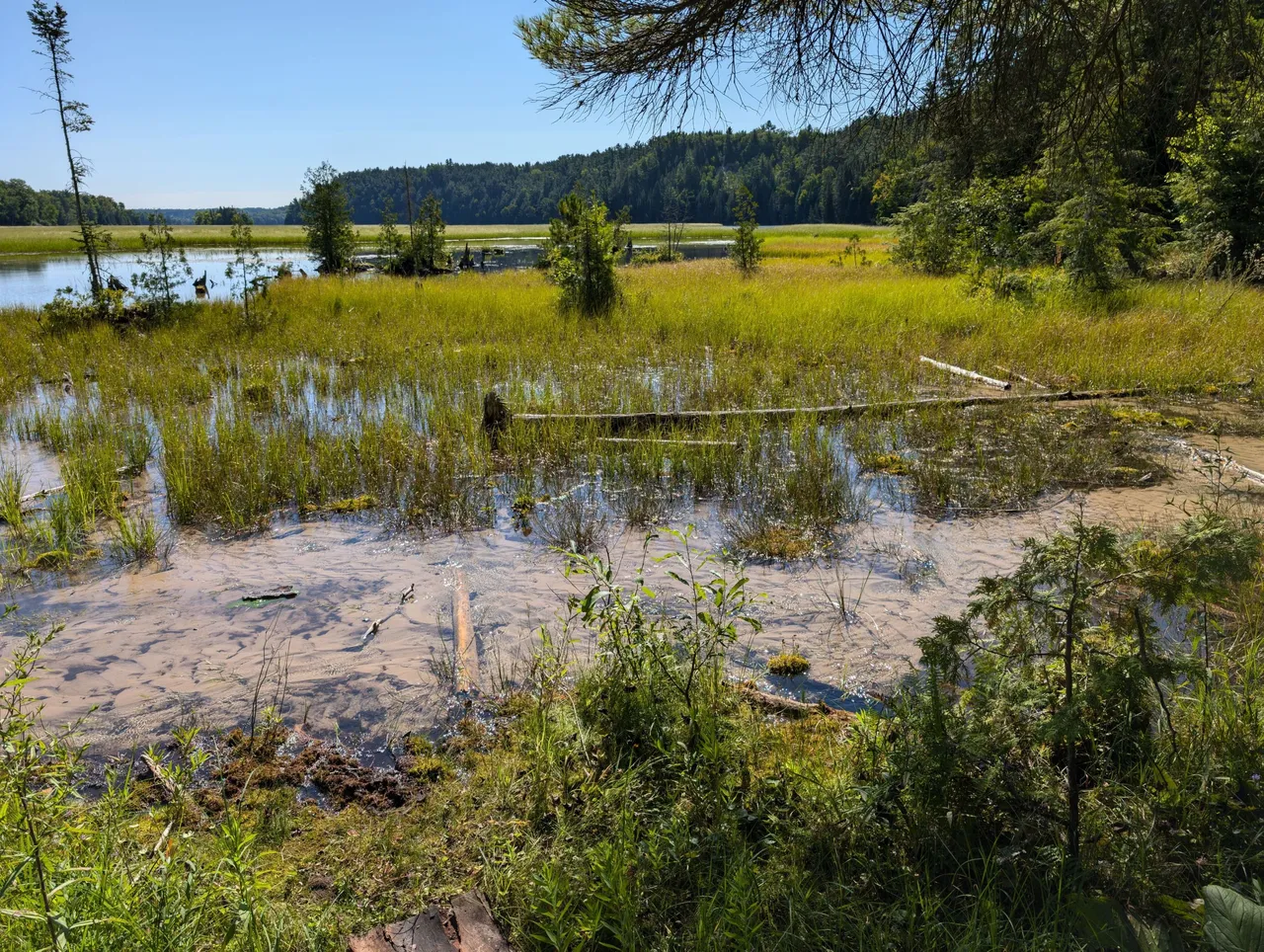
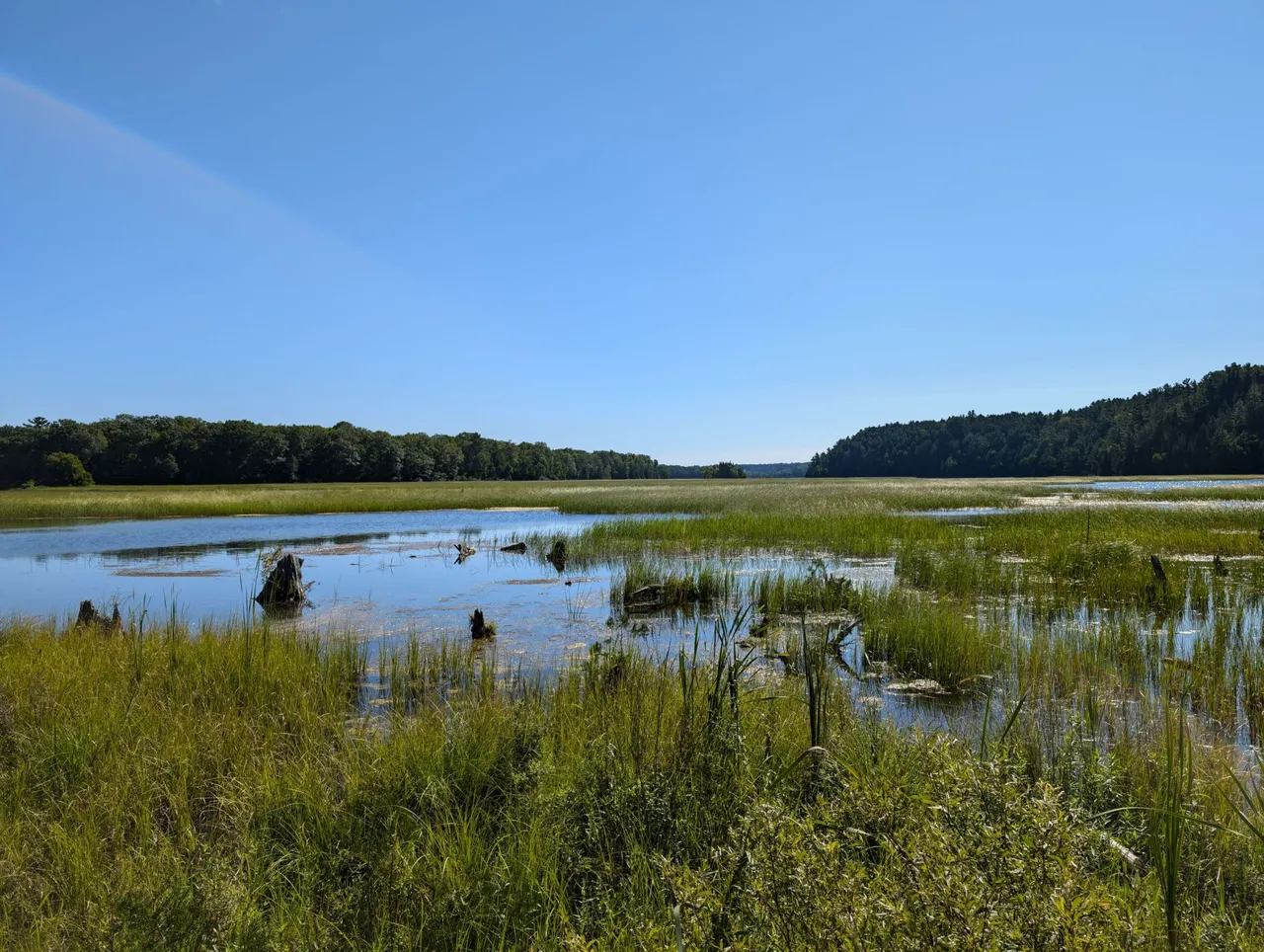
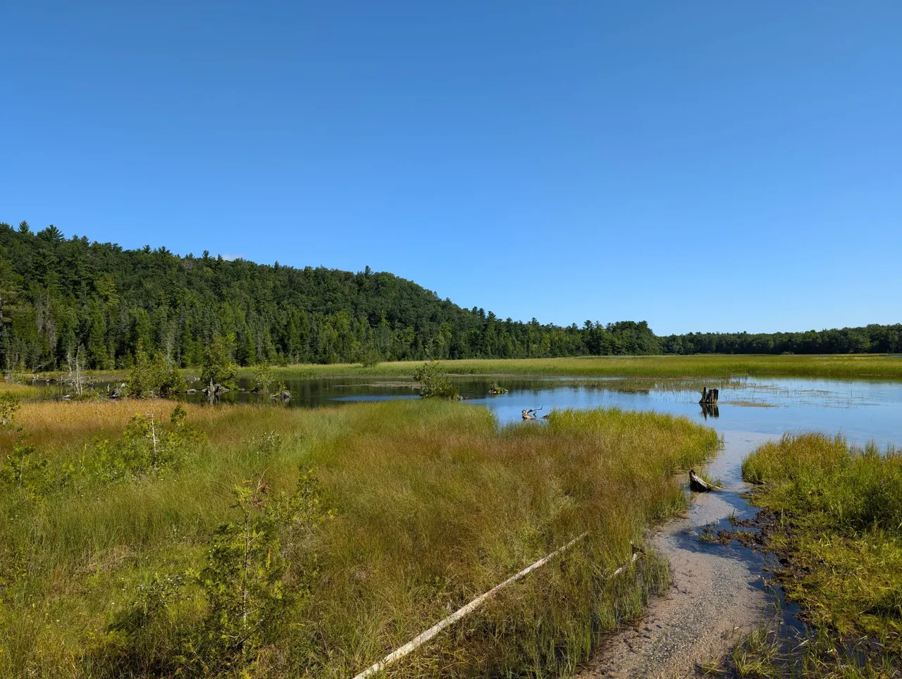
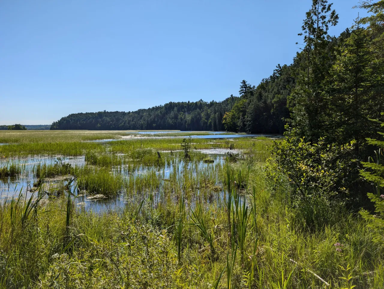
Since this park is just down the road from the other one, you have to remember that you are still up on the bluff. They have built a nice viewing platform that gives you a panoramic view like the one you see above. Actually, I didn't realize just how awesome that photo was until I looked at it again this morning.
It might have been a little cooler if that middle tree branch wasn't in the way and you could see more of the winding river, but I still think it turned out pretty cool. The contrast of the blues and greens is pretty stunning.
Besides the viewing platform, there is a path with 300 stairs that leads you down to the springs. Now, 300 stairs might not seem like a lot, but trust me it is. Maybe not when you are going down, but for sure when you are coming back up!
I think @mrsbozz was wondering what I was getting her into when we started the long and winding path down the bluff.
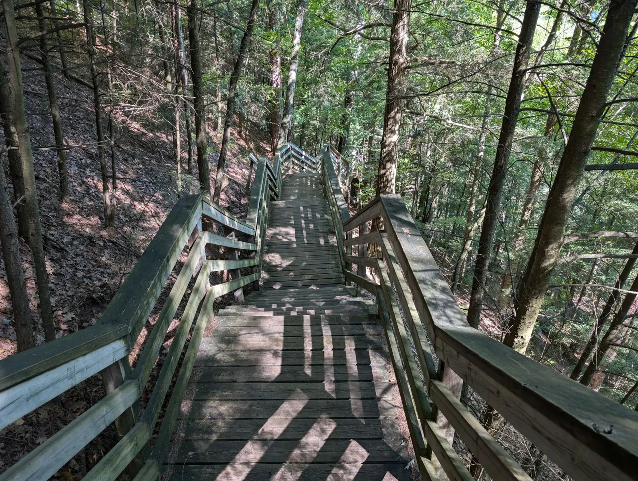
The stairs almost feel like they go on and on forever. They have rest areas at different spots along the way which is nice. Again, maybe not as necessary on the way down, but on the way up, they definitely help!
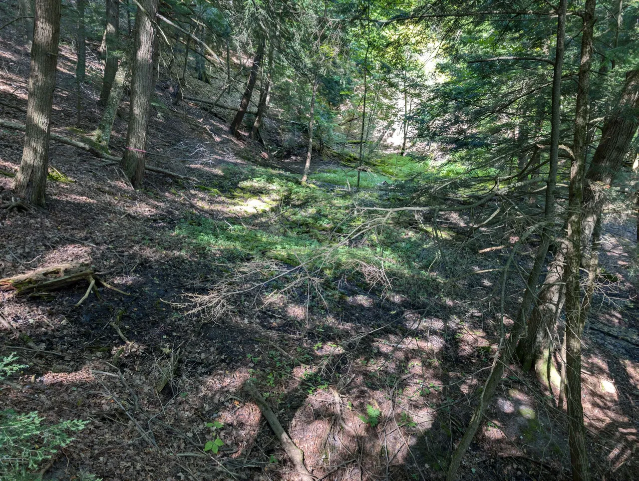
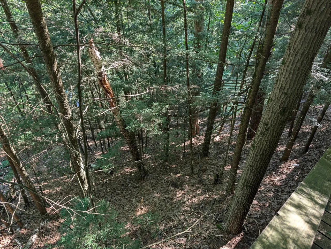
This is just a random spot I took down the side of the slope as we were going down the stairs.
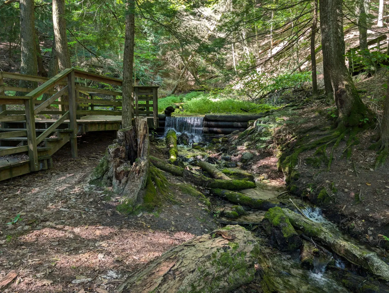
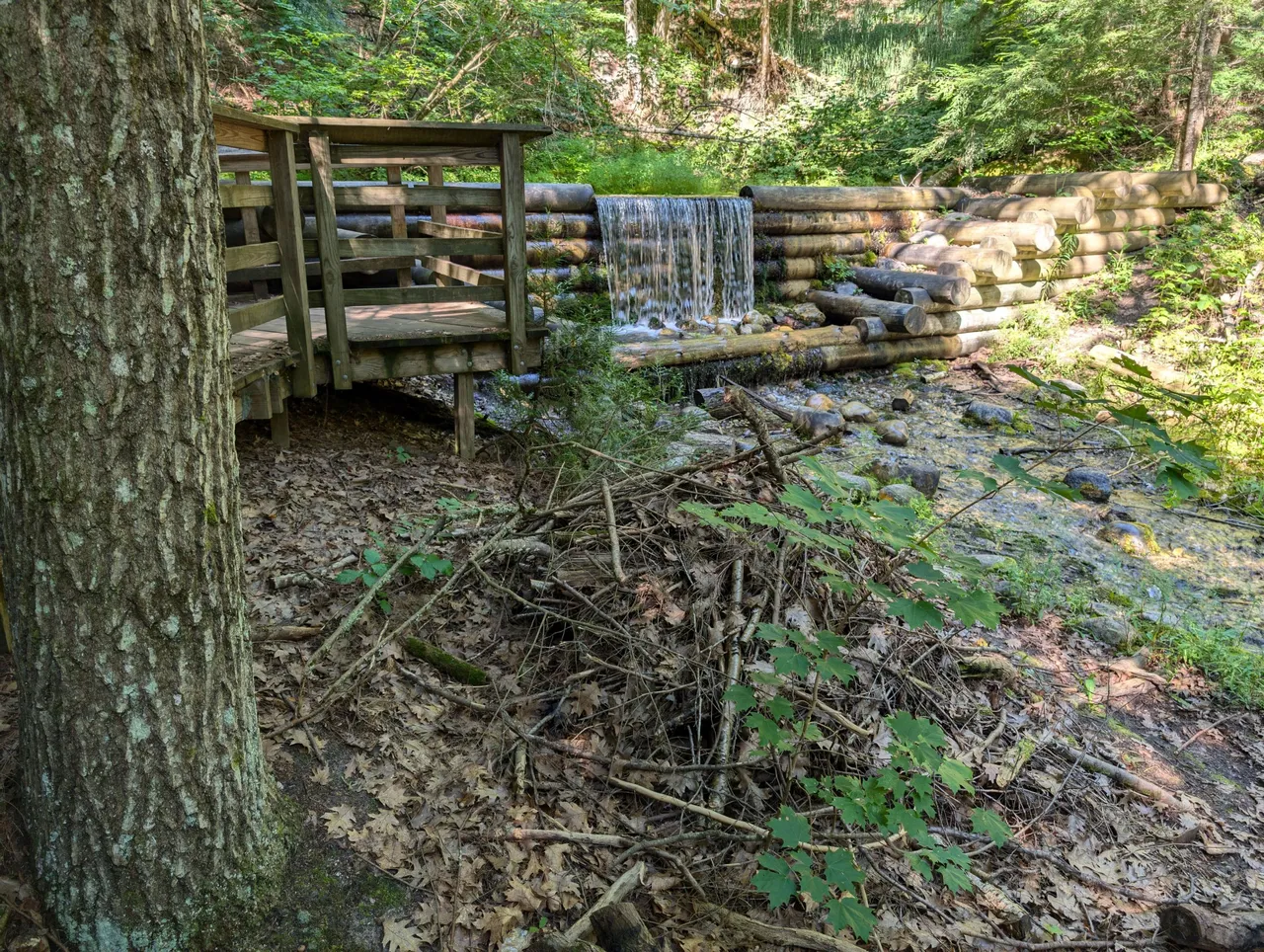
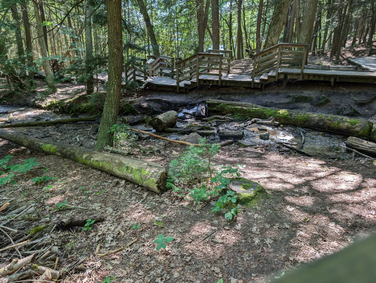
Once you get to the bottom, things open up a bit and you can see they have built some nice features to make viewing the springs a bit more enjoyable. While I don't remember visiting Lumberman's Monument as a kid, I do remember visiting Iargo Springs.
When I was younger I believe the stairs were there, but none of the raised walkways were. I also don't believe the dammed areas were there to create the waterfalls. The water just flowed freely down from the bluff and out of the ground and you had to step over or through the streams to get around.
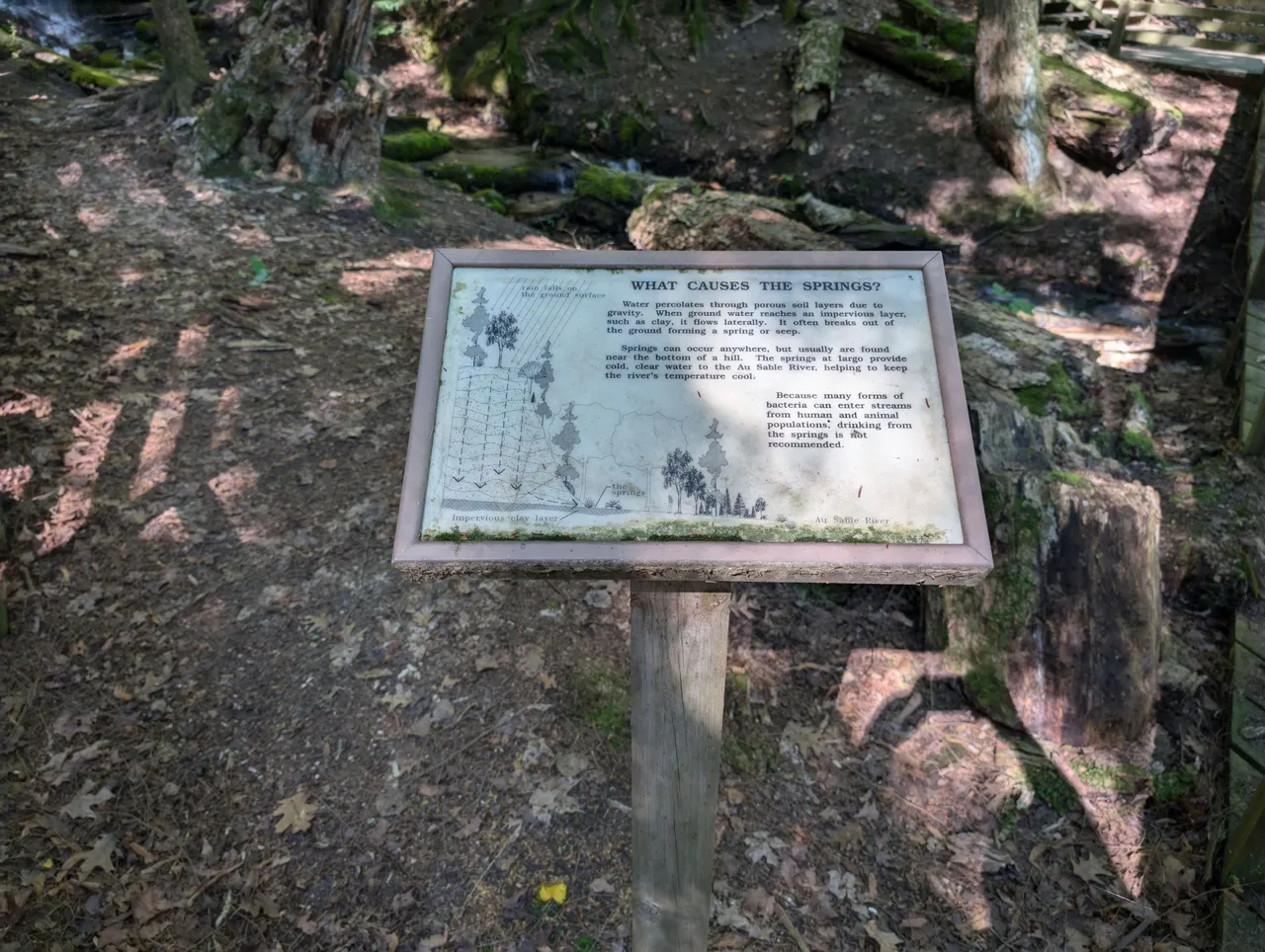
Here is the text of the sign above since I know it is probably hard to read:
What Causes the Springs?
Water percolates through porous soil layers due to gravity. When ground water reaches an impervious layer, such as clay, it flows laterally. It often breaks out of the ground forming a spring or seep.
Springs can occur anywhere, but usually are found near the bottom of a hill. The springs at Iargo provide cold, clear water to the Au Sable River, helping to keep the rivers temperature cool.
Because many forms of bacteria can enter streams from human and animal populations, drinking from the springs is not recommended.
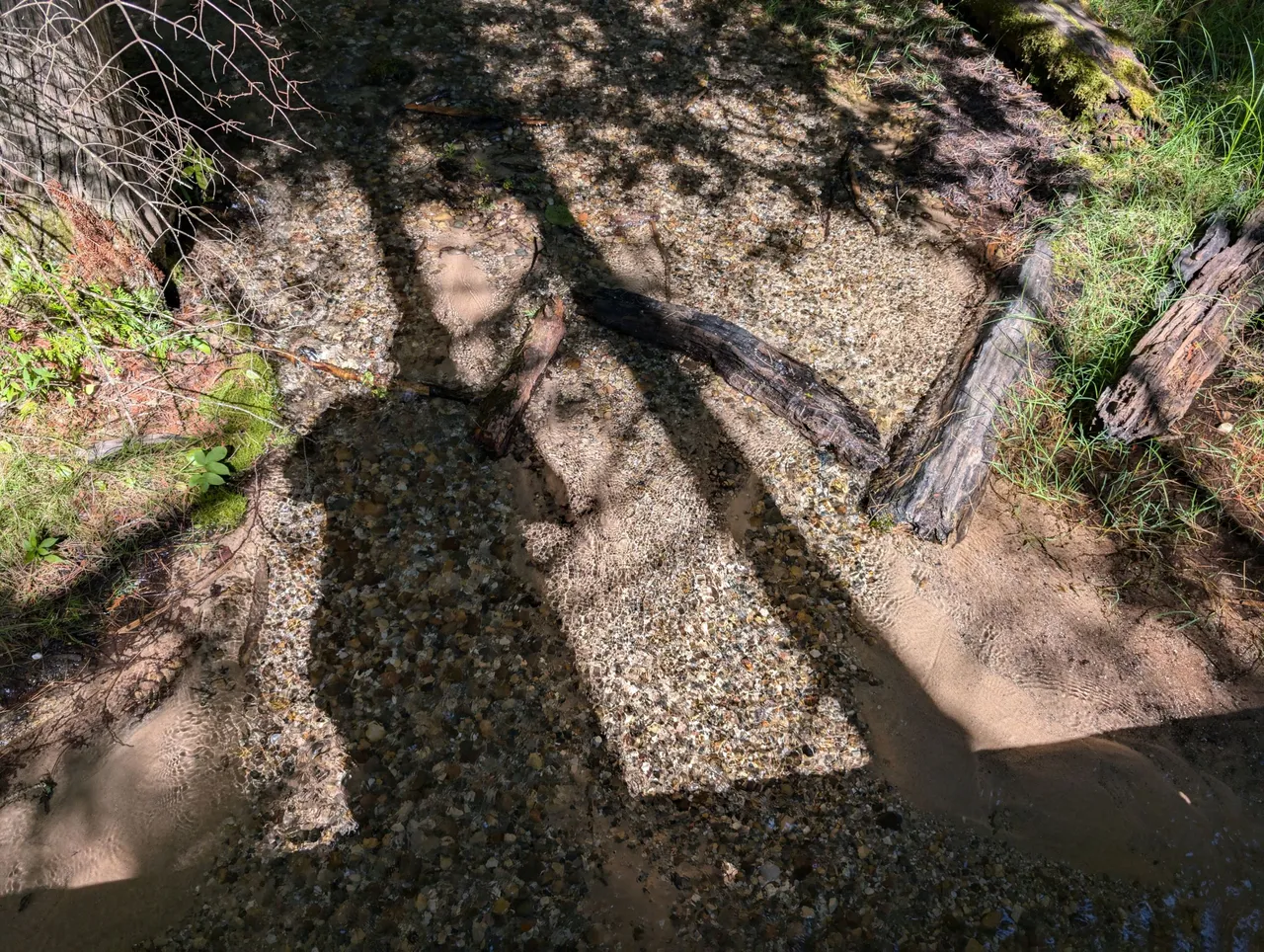
The water is so pristine and clear that you can't help but wonder what it must have been like for some of the first people who discovered this area. I have little doubt the Native Americans were probably all over this site before the Europeans came around and started mucking about.
This whole area is actually considered a "Transition Forest". When the glaciers went away, Northern plants and animals showed up as they were used to the colder climates. Meanwhile, as things heated up, the Southern plants and animals started moving North. This process of the glaciers retreating and the area warming up created an in between area called the "transition forest". This was the only area you could find both southern and northern species of animals and plants cohabitating.
All I know is that it is quite beautiful and if you ever get the chance to stop by and see it, you definitely should. You might hate me after you are about halfway coming back up the 300 stairs, but I stand by my recommendation. We had to stop a couple times on the way back up just to catch our breath, but we eventually made it and headed back to the campground for lunch.
As @mrsbozz had never been to Iargo springs before, I am really glad I got to share this experience with her. As I said before, I was lucky enough to visit many places in Michigan when I was a kid. I love sharing some of them with my wife who is just now seeing them for the first time.
Also as we did a bit of walking for this post, I am going to include it as a #wednesdaywalk submission sponsored by @tattoodjay.
Sports Talk Social - @bozz.sports