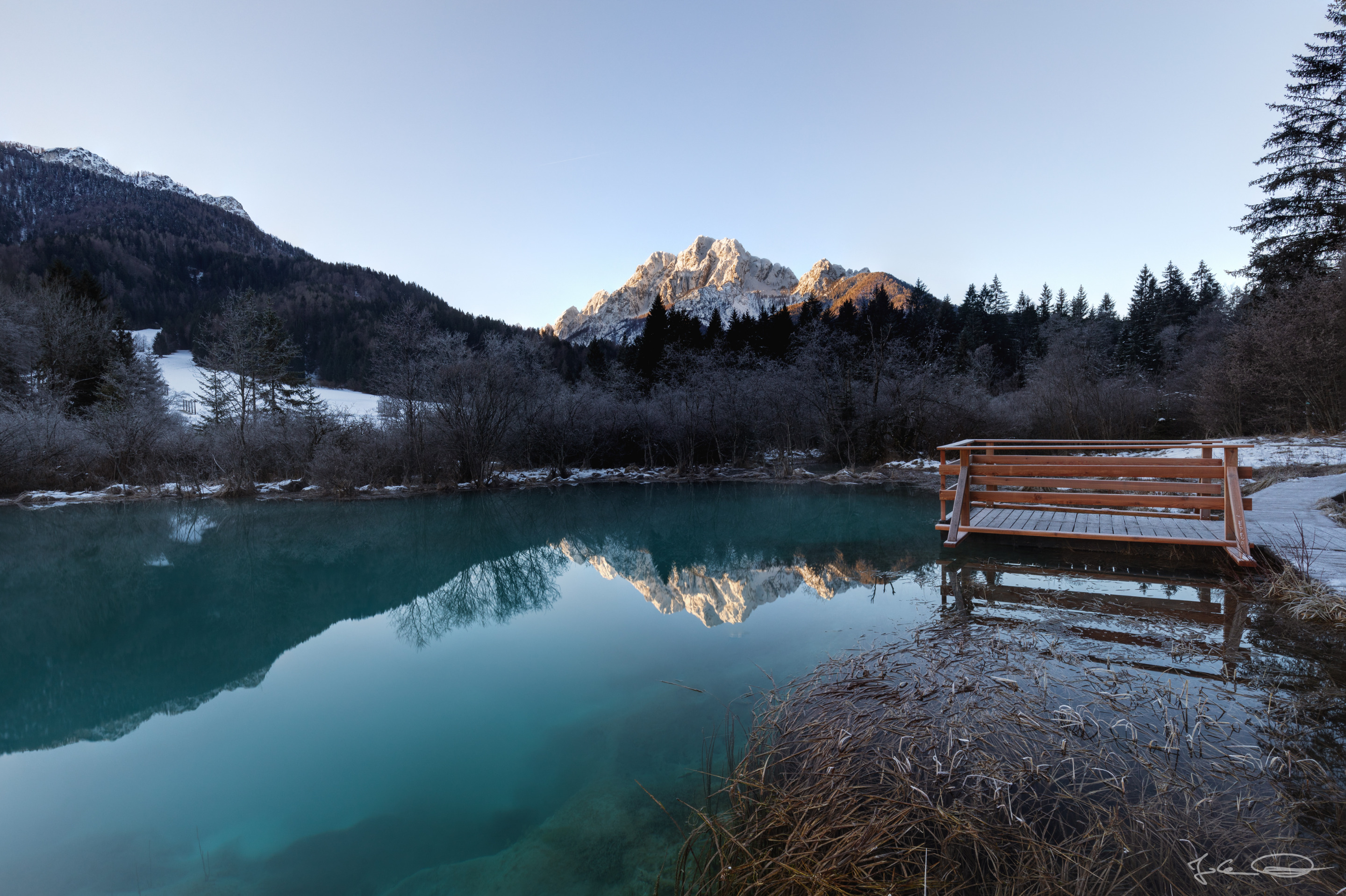
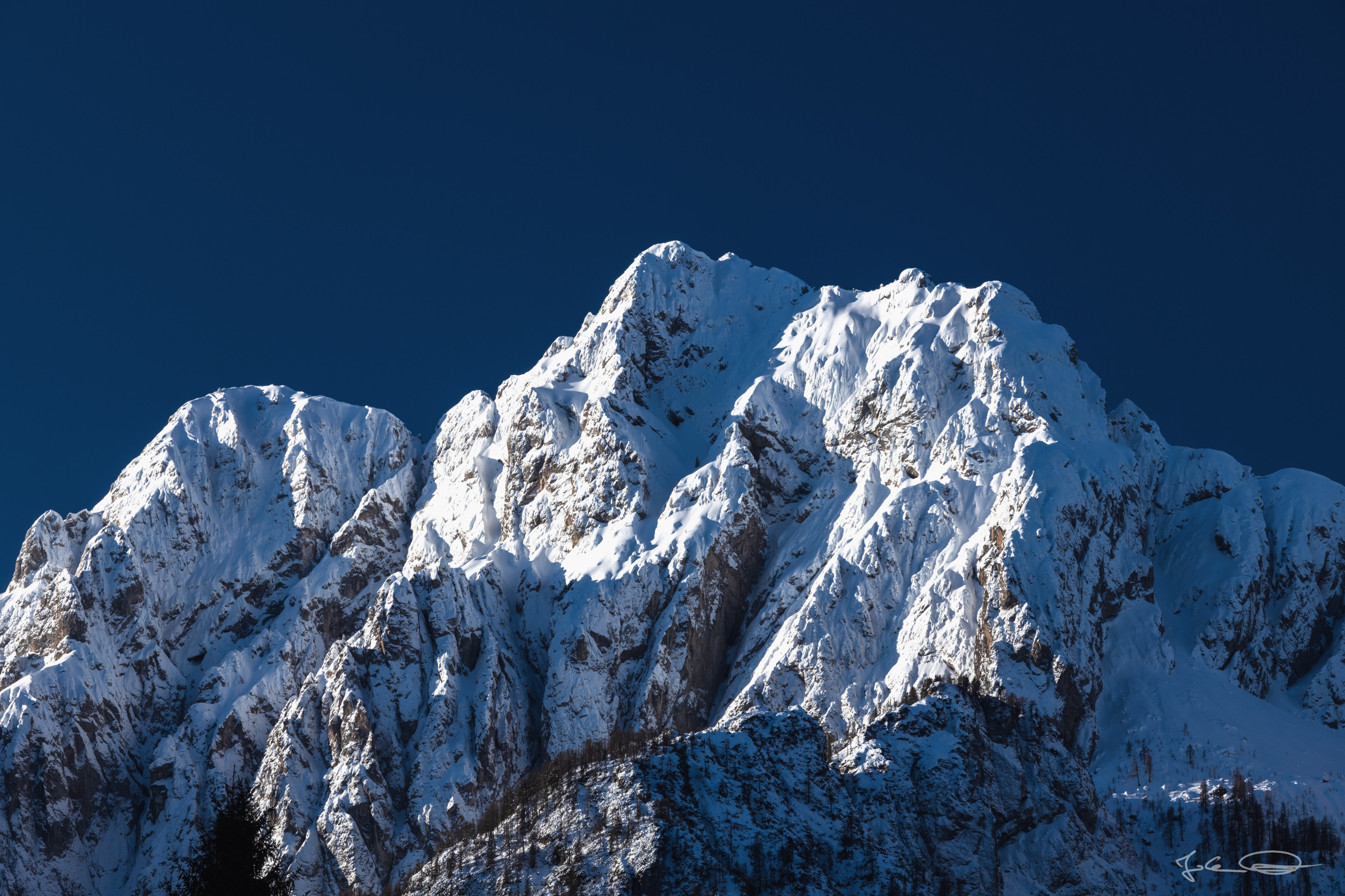
Blue skies in the morning and a rocky, snow-covered mountain in winter - what could be more beautiful? |
Blauer Himmel am Morgen und ein felsiger, schneebedeckter Berg im Winter - was gibt es Schöneres? |
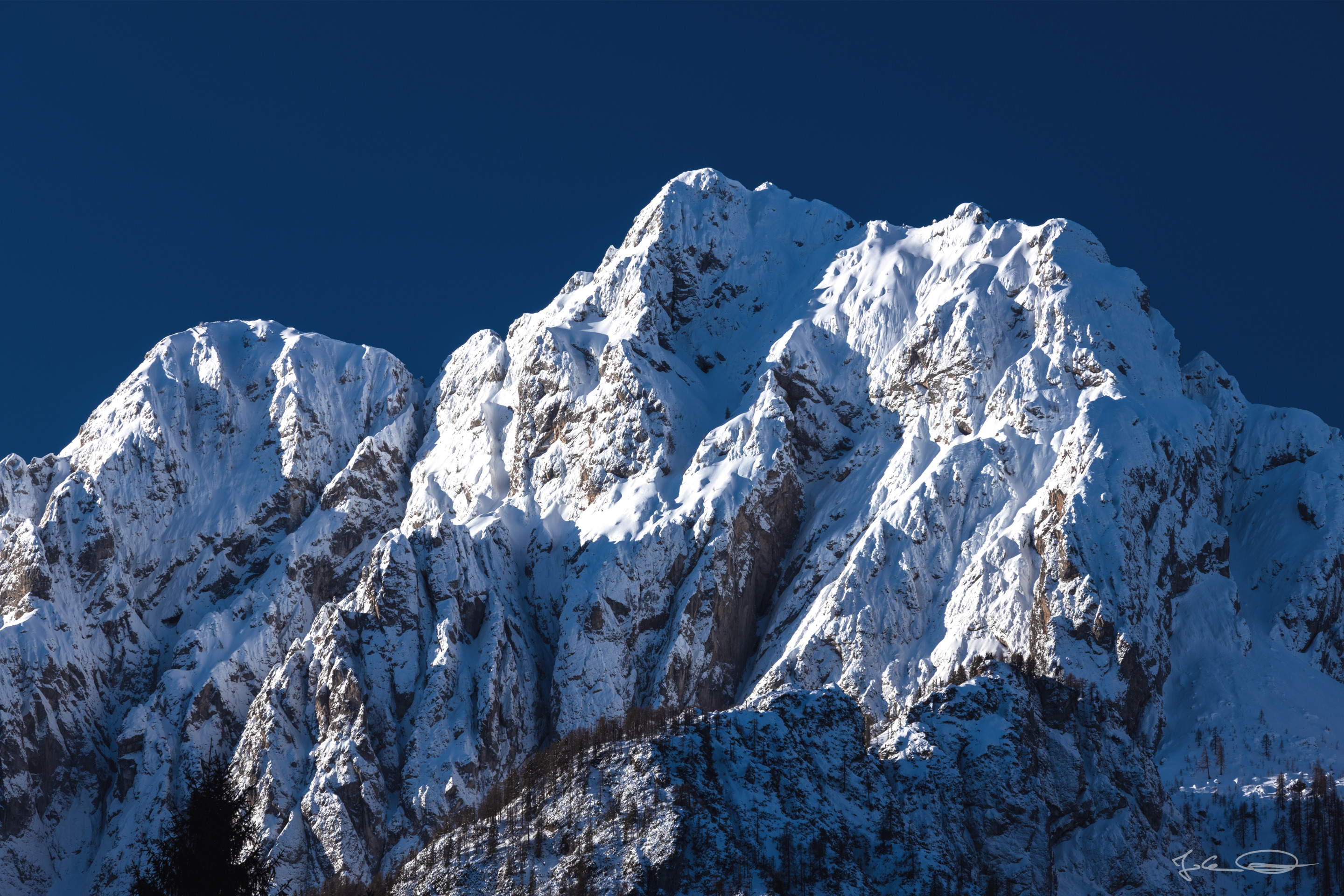
Visoka Ponca - Ponza Grande - Hohe Ponza
Julian Alps . Italy / Slovenia

It can be even nicer when this mountain is illuminated by the morning sun and reflected in an emerald green lake. | Noch schöner kann es sein, wenn dieser Berg von der Morgensonne bestrahlt wird und sich in einem smaragdgrünen See spiegelt. |
❖ click the image for fullsize view ❖
A few weeks ago I was in Slovenia in the Zelenci Nature Reserve and was able to photograph this beautiful snow-capped mountain early in the morning against a deep blue sky. | Vor ein paar Wochen war ich in Slowenien im Naturreservat Zelenci und konnte diesen schönen schneebedeckten Berg früh am Morgen vor einem tiefblauen Himmel fotografieren. |
❖ click the image for fullsize view ❖
❖ click the image for fullsize view ❖
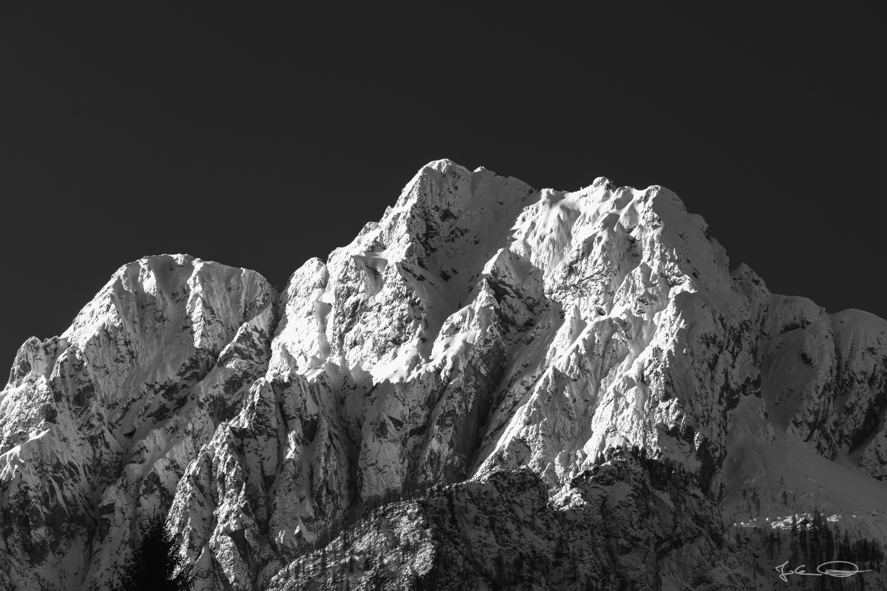
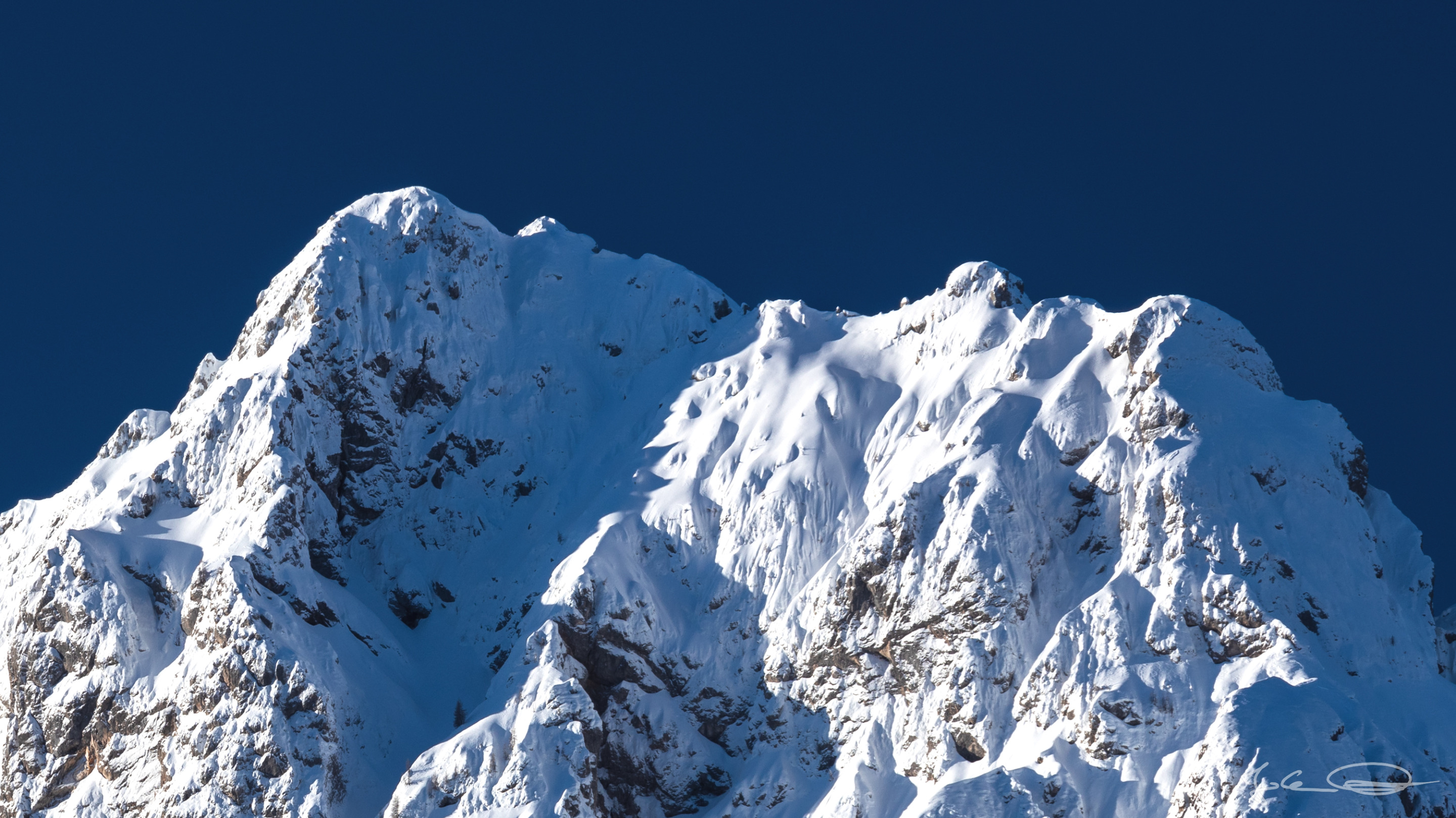
The mountain Hohe Ponza, Italian Ponza Grande, Slovenian Visoka Ponca is 2,274 m / 7,460 ft high and is located in the border area between Italy and Slovenia. | Der Berg Hohe Ponza, Italienisch Ponza Grande, Slowenisch Visoka Ponca ist 2.274 m / 7.460 ft hoch und befindet sich im Grenzgebiet zwischen Italien und Slowenien. |
❖ click the image for fullsize view ❖
On the other side of the mountain is Italy and there are the Fusine Lakes (Laghi di Fusine / Weißenfelser Seen). At the upper Fusine lake Lago di Fusine Superiore is the starting point for a via ferrata on this mountain. The tour is said to be beautiful in terms of landscape, but long and exhausting, as it is a hike and climb of about 6 1/2 hours over 9 kilometers (5.59 miles) and 1,350 meters (4,429 feet) elevation. | Auf der anderen Seite des Berges ist Italien und dort befinden sich die Fusine Seen (Laghi di Fusine / Weißenfelser Seen). Am oberen Fusine See Lago di Fusine Superiore ist Startpunkt zu einem Klettersteig auf diesen Berg. Die Tour soll landschaftlich wunderschön, aber lang und anstrengend sein, soll sie doch über 9 Kilometer (5.59 miles) Distanz und 1.350 Höhenmeter (4,429 feet elevation) gehen und etwa 6 1/2 Stunden dauern. |
❖ click the image for fullsize view ❖
Information
| Location / Standort: Zelenci - Google Maps |
All photos were shot with the Canon EOS R and one of these lenses: Canon RF 24-105mm f/4 L IS USM, Canon EF 70-200mm f/4 L IS II USM, Canon EF 16-35mm 1:4L IS USM, SIGMA 105mm 1:2,8 DG MACRO HSM, SIGMA 150-600mm F5-6.3 DG OS HSM C |
If you like my photos I would appreciate an upvote, nice comment or a resteem 😊 ... and maybe you would like to follow me, so you do not miss a post from me anymore.
Thank you for visiting my blog,
have a nice evening, 
Photos and Text: Johann Piber | All rights reserved - do not use without my permission
#originalcontent #originalworks
    |