A 43 year old map shows 36 nodes, connecting 42 computer hosts, making up the totality of the internet in May 1973.
An original Map of ARPANET (Advanced Research Projects Agency Network), forefather of the internet we have today, has been uncovered from the Carnegie Mellon School of Computer Science in Pittsburgh, PA.
Shortly after this map was created, the internet went global with a satellite link beaming ARPANET access to Norway and London.
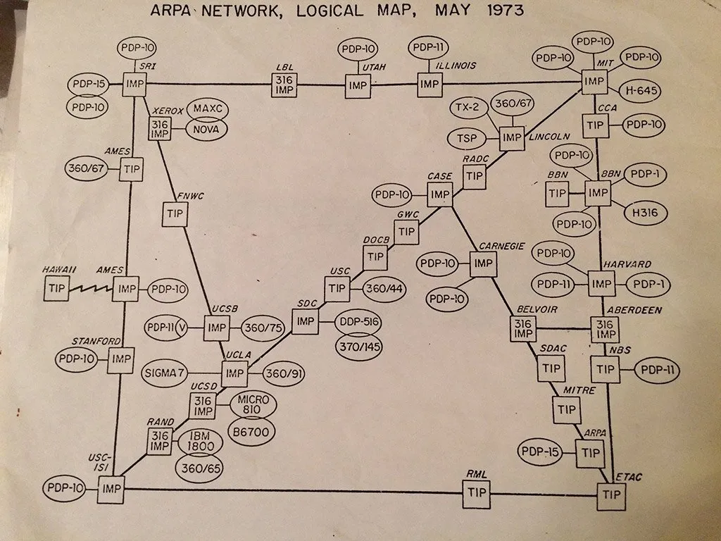
David Newbury is the Carnegie Museum of Art employee who found this map in a bunch of old papers from his dad who had been working there since the 70's. He posted it December 10th on Twitter.
You can see on the map Hawaii is on the far left, West. Close by you have Stanford and UCLA. Going to the East, there is Carnegie, Harvard and MIT. Ovals are host computers, while squares routing devices connecting them.
There was a previous map released, dated to September 1973, but this one is from May.
From the September map, you can see some slight changes, that's because only one new router was being added per month to the ARPANET.
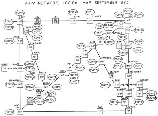
Which looks like:
It wasn't until 1990 that the first website was "turn on" by Tim Berners-Lee, a scientist at the CERN research facility in Switzerland.
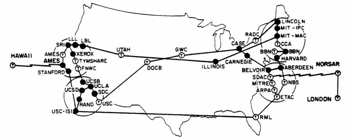
This is a previous map of unknown time:
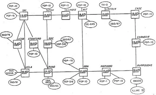
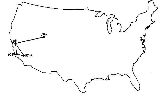
While back in 1969 this is all there was:
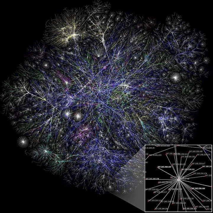
We have come a long way since then.
This is what the internet looks like now:
References:
- What the entire internet looked like in September 1973
- What the internet looked like in 1973
- A map of the entire internet in 1973 has been found in some old university papers
@krnel
2016-12-17, 11:05am