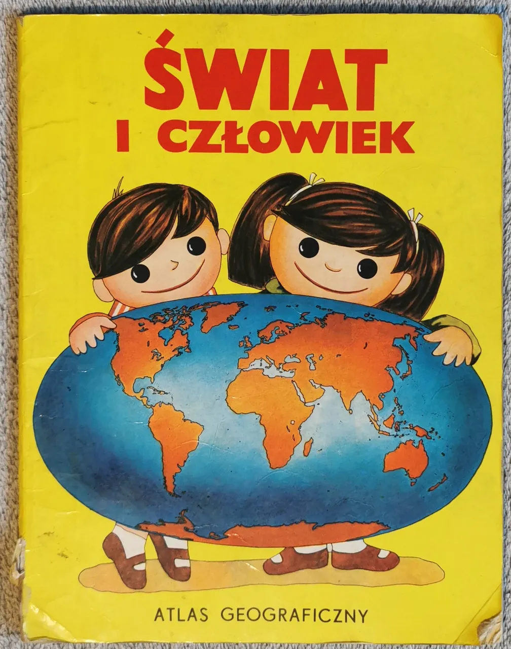
| W dzisiejszym odcinku czeka nas powrót do lat (mojego) dzieciństwa. Książka wydana w 1988, prawdopodobnie również wtedy kupiona – i kilkuletni Marcinek poznający świat z jej pomocą. Nosi tytuł „Świat i człowiek : atlas geograficzny” i została przygotowana wspólnie przez Państwowe Wydawnictwo „Wiedza Powszechna” z Warszawy oraz Główny Zarząd Geodezji i Kartografii z Moskwy. Wydana w ZSRR, ale oczywiście, z minimalnymi wyjątkami, treściowo dopasowana do czytelnika polskiego. Co przygotowano dla młodych czytelników? Czy książka sprzed blisko 40 lat może być jeszcze przydatna w dzisiejszych czasach? | Today's episode takes us back to the years of (my) childhood. A book published in 1988, probably bought at that time - and a few years old little Marcin exploring the world with its help. It is called ‘The World and Man: a Geographical Atlas' and was produced jointly by the State Publishing House 'Common Knowledge' in Warsaw and the Central Committee for Geodesy and Cartography in Moscow. It was published in the USSR, but of course, with minimal exceptions, the content was adapted for the Polish reader. What was prepared for young readers? Can a book from almost 40 years ago still be useful today? |
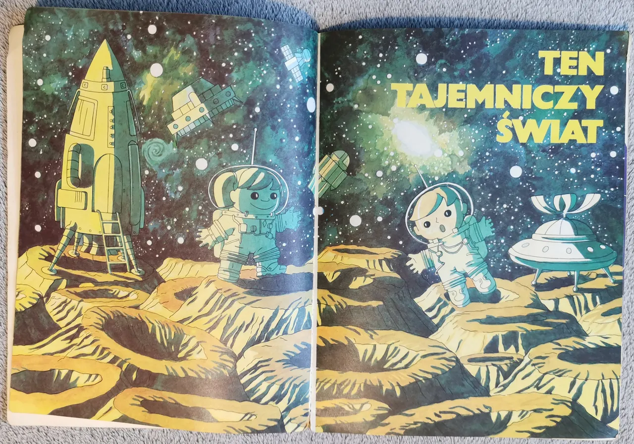
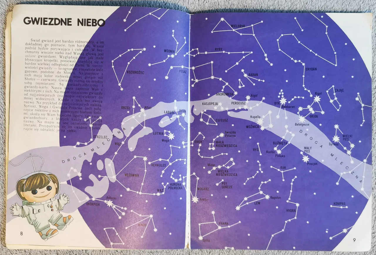
| Układ wydaje się niezbyt typowy (pewnie oczekiwalibyśmy przejścia od jednostek najmniejszych (najbliższe otoczenie), przez coraz większe (kraj), aż do największych (Wszechświat). Zaczynamy właśnie od spraw kosmicznych | The structure does not seem very typical (we would probably expect a progression from the smallest units (the neighbourhood), through increasingly larger ones (the country) to the largest (the Universe). We start with the Cosmos |
| od mapy nieba i gwiazdozbiorów | from a map of the sky and the constellations |
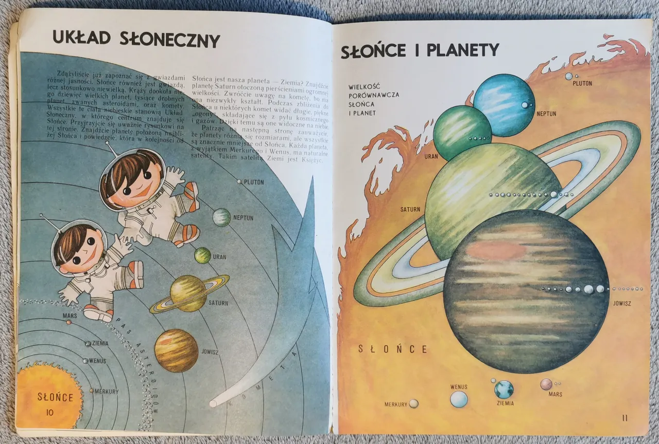
| przez Układ Słoneczny | through the Solar System |
| po historię podboju Kosmosu, ze szczególnym uwzględnieniem takich postaci, jak Gagarin, Hermaszewski czy lądujący na Księżycu Armstrong z Aldrinem (widać delikatne odchylenie ku perspektywie radzieckiej). | to the history of the conquest of the Cosmos, with a special focus on figures such as Gagarin, Hermaszewski or the moon landing of Armstrong and Aldrin (a slight bias towards the Soviet perspective is noticeable). |

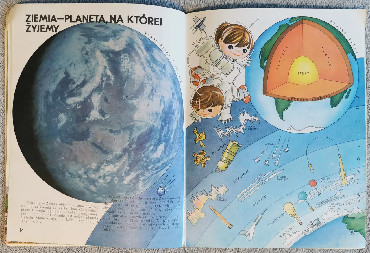
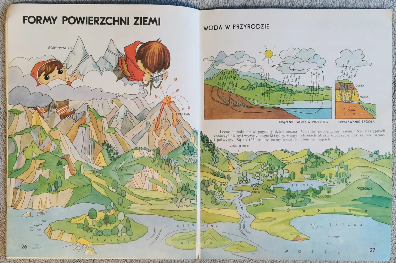
| Następnie młody czytelnik poznaje budowę wewnętrzną Ziemi i poszczególne warstwy atmosfery | The young reader is then introduced to the internal structure of the Earth, the different layers of the atmosphere |
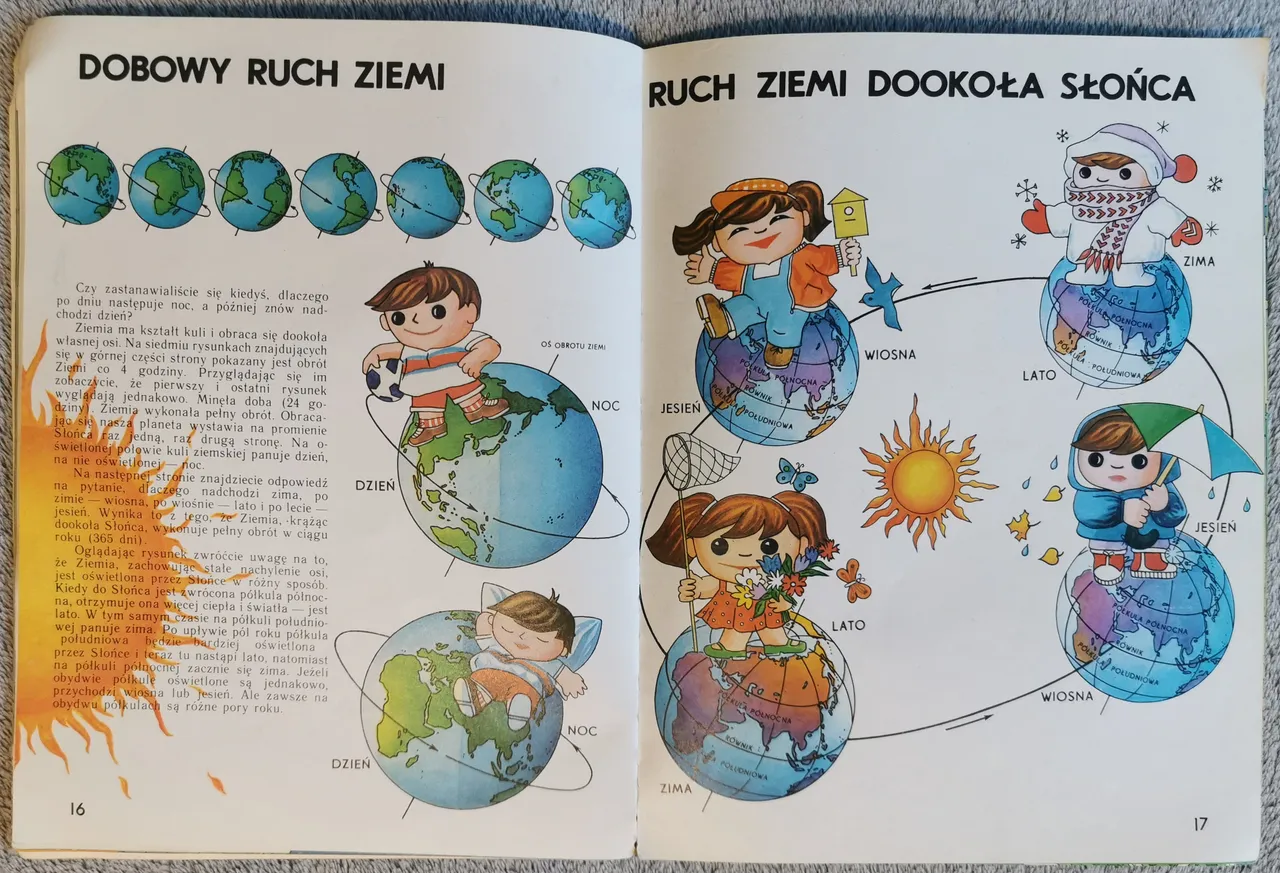
| dowiaduje się też o ziemskim ruchu obrotowym (w wyniku którego powstają dzień i noc) oraz obiegowym dookoła Słońca (który daje nam pory roku). | and learns about the Earth's rotation (which gives us day and night) and its orbit around the Sun (which gives us the seasons). |
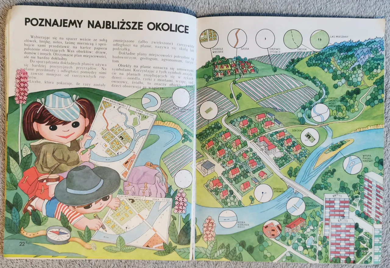
| Dopiero w kolejnym kroku – w teorii – będziemy poznawać Polskę – a i to w sposób niestandardowy. Pierwsze bowiem strony to poradnik orientowania się w terenie za pomocą kompasu i innych znaków terenowych | The next step - in theory - is to learn about Poland, but even this is done in a non-standard way. The first pages are a guide to orienteering with a compass and other landmarks |
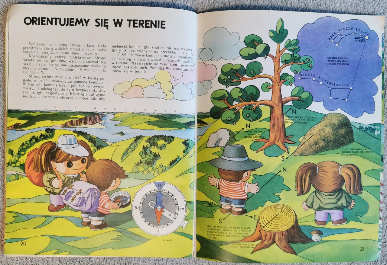
| a następnie ogólny i zwięzły kurs czytania planów i map (swoją drogą, z perspektywy lat dostrzegam tu możliwość pewnego uwarunkowania na uprawianie biegów na orientację w wieku dorosłym…). | followed by a general and concise course in reading maps and charts (by the way, in retrospect I can see the possibility of some conditioning for practising sport orienteering as an adult...). |
| Zanim zaś dotrzemy do Polski, dowiemy się jeszcze, czym jest globus (i jak wyglądają kontynenty), a także – jakie formy geologiczne może przyjmować powierzchnia Ziemi i jaki jest obieg wody w przyrodzie… | And before we finally reach Poland, we learn what the globe is (and what the continents look like), what geological forms the Earth's surface can take, and what the water cycle is in nature... |
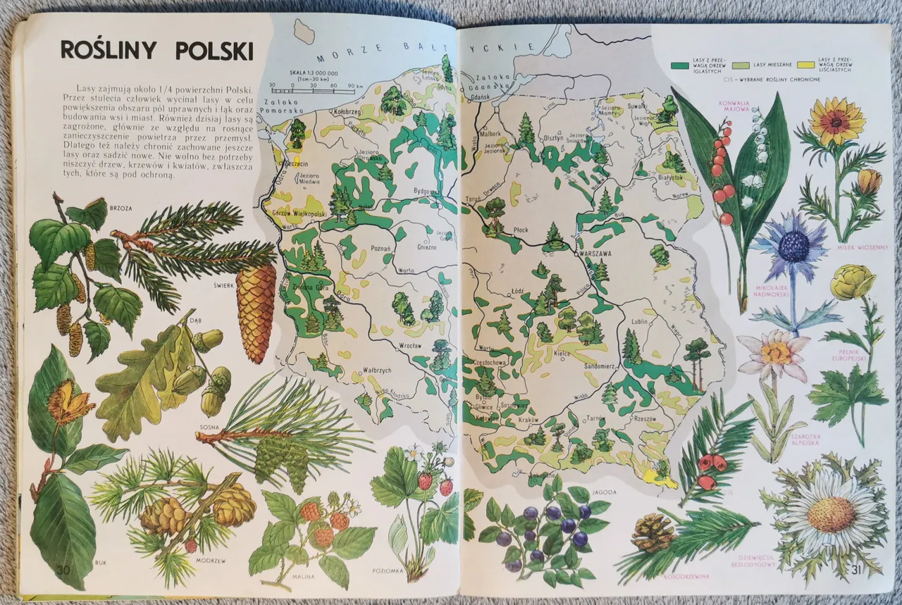
| Aż w końcu nadchodzi czas Polski, zaprezentowanej na pięciu mapach. Są to, po kolei, uproszczona mapa fizyczna z zaznaczonymi bogactwami mineralnymi (przedstawionymi również na rysunkach) | Then, finally, comes the time for Poland, being presented on five maps. These are a simplified physical map showing mineral resources (also illustrated) |

| mapa świata roślinnego (z dość dobrze oddanymi ilustracjami, pozwalającymi nauczyć się rozpoznawać niektóre gatunki) | a map of the flora (with fairly well-drawn illustrations enabling the learner to recognise some species) |
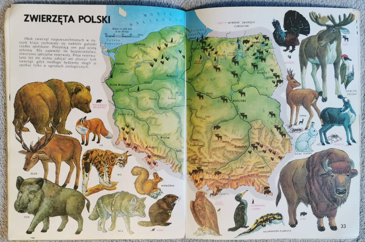
| mapa polskiej fauny (również z ilustracjami) | a map of Polish fauna (also illustrated) |
| mapa ochrony przyrody – z zaznaczonymi parkami krajobrazowymi i narodowymi, wreszcie na koniec mapa administracyjna – ze starym jeszcze podziałem na 49 województw – której towarzyszą herby miast wojewódzkich oraz przykłady tradycyjnych strojów ludowych z różnych regionów kraju. | a map of nature conservation - with landscape and national parks marked, as well as areas of nature endangered by pollution, and finally an administrative map - with the old division into 49 voivodships - accompanied by the coats of arms of the voivodship capitals and examples of traditional folk costumes from various regions of the country. |

| Gdy mamy już przyswojoną wiedzę o Polsce, możemy przystąpić do poznawania innych części świata. | Once we have acquired the knowledge of Poland, we can begin to explore other parts of the world. |
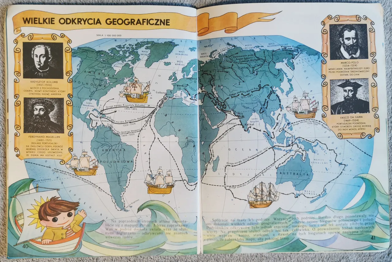
| Najpierw o czasach wielkich odkryć geograficznych, z przedstawieniem postaci Kolumba, Magellana, Marca Pola oraz Vaska da Gamy. | This begins with a rather selective history. First, the period of great geographical discoveries, with introductions to Columbus, Magellan, Marco Polo and Vasco da Gama. |
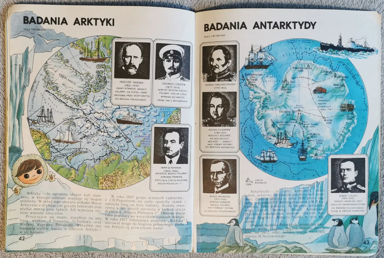
| Następnie badania Arktyki i Antarktydy – i tu pojawiają się drobne wątpliwości. W przypadku Antarktydy dobór przedstawionych postaci zbytnio nie razi (jest Amundsen, jest Scott, są badacze rosyjscy – Bellingshausen i Łazariew – którzy jako pierwsi dotarli do brzegów Antarktydy). Jednak przy Arktyce bardzo dziwi brak Peary’ego (uważanego w czasach wydania książki za pierwszego zdobywcę Bieguna Północnego!) i zastąpienie go radzieckim badaczem Iwanem Papaninem, który – choć też miał swoje zasługi dla badań Arktyki (kierował pierwszą dryfującą stacją naukową) – chyba jednak jest postacią mniej rozpoznawalną i niekoniecznie niezbędną aż tak młodym czytelnikom. | Then comes the exploration of the Arctic and Antarctic - and here a few doubts arise. In the case of Antarctica the choice of characters presented is not too surprising (there is Amundsen, there is Scott, there are Bellingshausen and Lazarev, Russian explorers who were the first to reach the shores of Antarctica). However in the case of the Arctic the absence of Peary (considered at the time of the book's publication to be the first to conquer the North Pole!) and his replacement by the Soviet explorer Ivan Papanin (who, despite his contribution to Arctic exploration – he was in charge of the first floating scientific station – is probably a less well-known figure and not necessarily necessary for such young readers) I find rather shocking. |
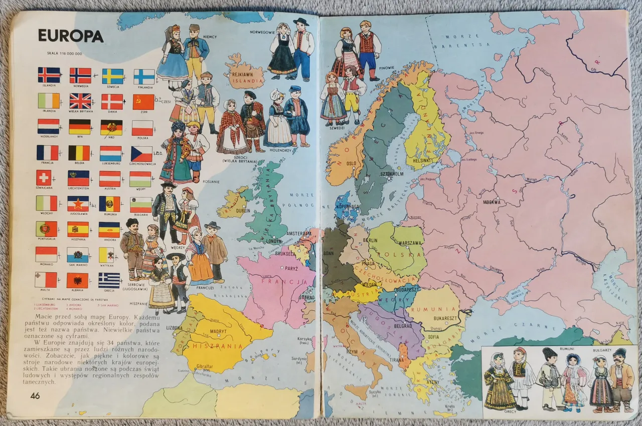
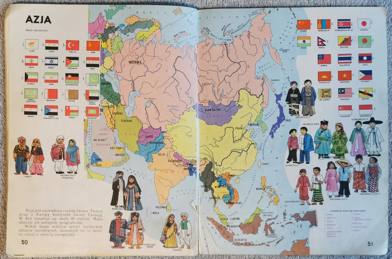
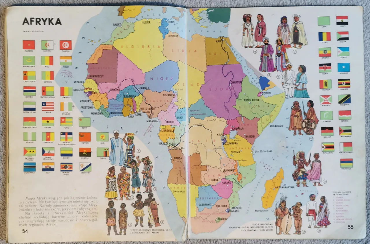
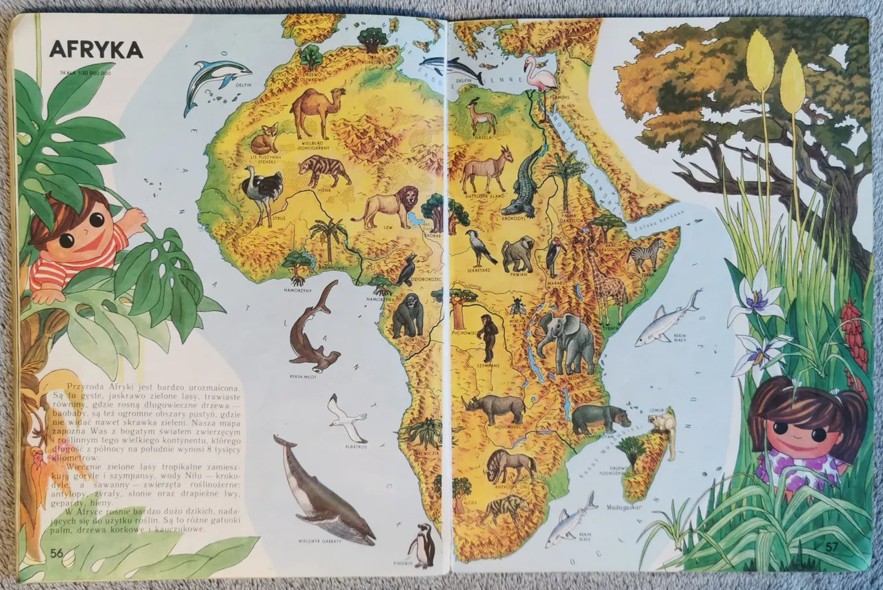
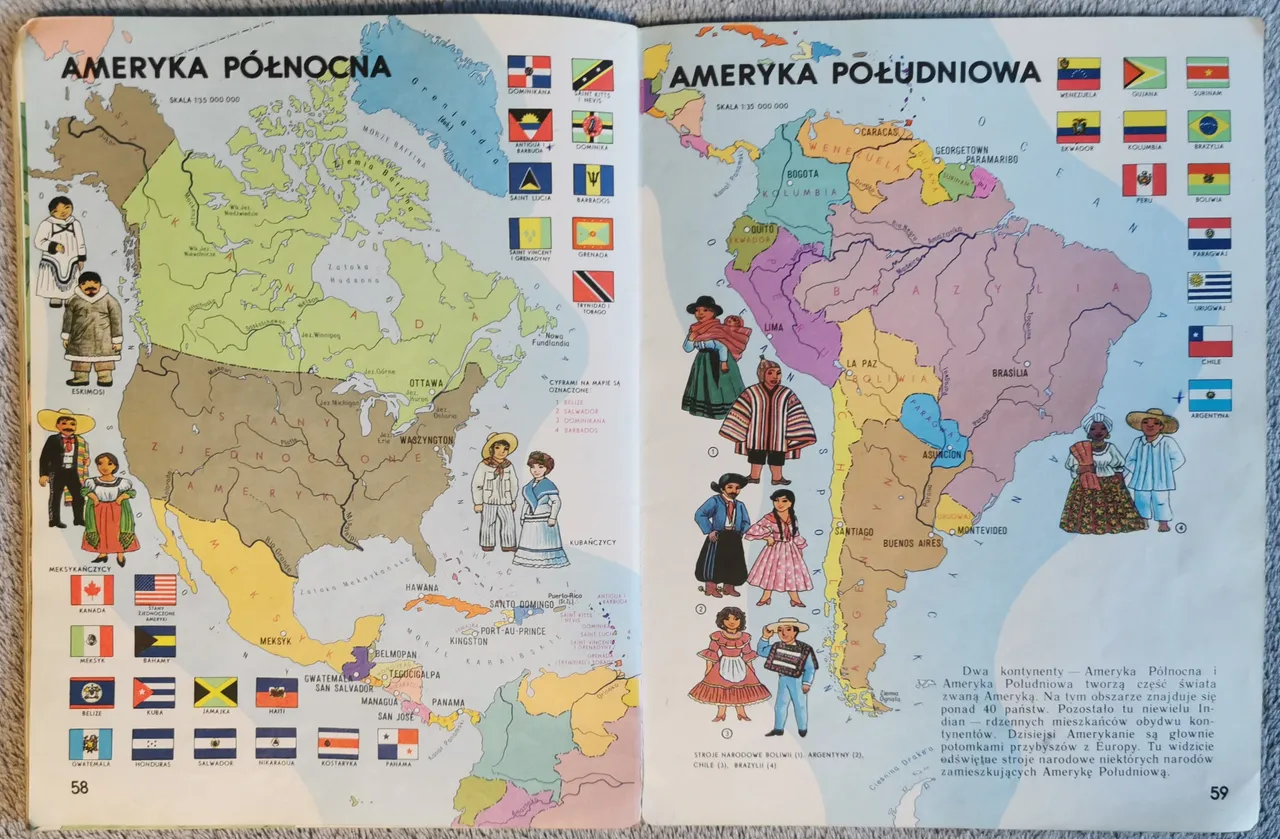
| Następnie mamy mapę polityczną świata i bardziej już szczegółowe przedstawienie poszczególnych kontynentów. Każdemu z nich przysługują po dwie mapy – polityczna, z dodatkiem flag poszczególnych państw oraz przedstawieniami strojów ludowych części z nich, a także fizyczną – z zaznaczeniem także flory i fauny. Nie jest to może obraz bardzo szczegółowy, ale pozwala zdobyć choćby bardzo ogólne wyobrażenie na temat Europy | Next we have a political map of the world and a more detailed representation of each continent. There are two maps for each of these - a political one, with the addition of flags of individual countries and depictions of the folk costumes of some of them, and a physical one, with flora and fauna also marked. This may not be a very detailed picture, but at least it gives a very general idea of Europe |

| Azji | Asia |

| Afryki | Africa |
| obu Ameryk | Americas |

| oraz Australii z Oceanią. | and Australia with Oceania. |

| Pora więc wrócić do postawionego na początku pytania i zastanowić się, czy treści zgromadzone na tych 64 stronach w dzisiejszych czasach mają jeszcze jakieś zastosowanie? Moim zdaniem to nie ma tak, że mają, albo że nie mają. Na pewno gdyby po prostu dać ją dziecku bez żadnego komentarza, w takiej postaci, w jakiej wydano ją przed blisko czterema dekadami, byłoby z tego więcej szkody, niż pożytku – zdezaktualizowało się zbyt wiele rzeczy: zmienił się podział administracyjny Polski (a nawet oficjalna nazwa!), pozmieniały się liczba i nazwy państw świata, zmieniły się niektóre flagi… Również w kwestii Układu Słonecznego mamy już dużo większą wiedzę i nie zgadza się chociażby liczba księżyców większości planet. Ba… nawet samych planet, od czasu zdegradowania Plutona. Więc niezbędny jest albo dość zaawansowany komentarz, albo gruntowna aktualizacja sporej części książeczki. Z drugiej strony nie można stwierdzić, że absolutnie wszystko jest do niczego. Dużym plusem jest niewątpliwie szata graficzna – przyjazna dla oka, a jednocześnie tam, gdzie jest to konieczne – wystarczająco szczegółowa. Również pomysł na wprowadzenie takich elementów, jak orientowanie się w terenie należałoby uznać za ciekawy i wyróżniający na tle innych, podobnych publikacji. Reasumując – zaktualizowana książeczka w takim kształcie prawdopodobnie mogłaby dziś całkiem dobrze sprawdzić się w roli pierwszego, bardzo elementarnego przewodnika po świecie i Polsce dla kilkuletnich dzieci, zbyt jeszcze młodych na smartfony, komputery czy internet. U dzieci starszych, które w zasięgu paru kliknięć będą mieć dostęp do tych samych treści, tylko bardziej szczegółowych i ozdobionych prawdziwymi zdjęciami – raczej wielkiego zainteresowania nie wywoła. Cóż dopiero stare, oryginalne wydanie – ono może stanowić jedynie nostalgiczny powrót do lat dzieciństwa dla pokolenia moich rówieśników. Z tego względu oceniam tę książkę na 7 na 10 (dobry) w roku wydania, jednak po upływie 35 lat – co najwyżej na 4 na 10 (ujdzie), a i w tym swój udział ma stara dobra nostalgia. | So it is time to return to the question I posed at the beginning and to consider whether the content of these 64 pages is still useful today? In my opinion, it's not the case that it is, or that it isn't. If you were to give the book to a child without any commentary, as it was published almost four decades ago, it would do more harm than good - too many things have become outdated: the administrative division of Poland has changed (and even the official name!), the number and names of countries in the world have changed, some flags have changed... Even in terms of the solar system, we have much more knowledge now, and the number of moons of most of the planets is not correct. Even the number of planets themselves, as Pluto has been demoted. So either a fairly advanced commentary or a thorough update of a fairly large part of the book is needed. On the other hand, it cannot be said that everything sucks. A big plus is undoubtedly the graphic layout - easy on the eye and at the same time sufficiently detailed where necessary. The idea of introducing elements such as orienteering is also interesting and different from other similar publications. To sum up, an updated booklet in this form could probably work quite well today as a first, very elementary guide to the world and Poland for children of a few years old, too young for smartphones, computers or the Internet. For older children, who would have access to the same content in just a few clicks, but more detailed and illustrated with real photographs, it is unlikely to attract much interest. Not to mention the old original edition, which for my generation can only be a nostalgic throwback to childhood. For this reason, I would rate this book 7 out of 10 (good) in the year of publication, but after 35 years - at most 4 out of 10 (acceptable), and even that includes good old nostalgia. |