Unfortunately, architectural masterpieces and heritage faced devastating natural and artificial calamities over time like earthquakes and bombing. In 2013, heritage churches in Bohol suffered a collapse after an earthquake. In 2011, the famous world trade center bowed down after a hijacked plane bombarded it. It is undeniable that the masterpieces that stood the test of time will eventually crumble either partial or complete. Restoration and reconstruction of heritage buildings give it a renewed structure that enables it to stand time longer. Restoring these buildings poses a problem of not having a concrete model of the heritage buildings.
Drones provide us a rapid and cost-effective mapping of cultural heritage buildings. It easily captures data with high resolution and eliminates the need for actual climbing up or low-resolution photographs on the ground. Drones can perform 3D modeling and record the condition and contextual imagery of a heritage building. It allows us to inspect inaccessible spaces such as bell towers. Using video and image processing, we can create 3D models of the buildings, which will help during restoration or retrofitting.
We can use drones to record historic buildings, monuments, archaeological sites, and landscapes. Besides, it is vital to take aerial shots that have a thorough look at their condition without going through the tedious climbing walls and getting into limited spaces. Drones employ a wide range of sensors with hyperspectral and multispectral imaging capability. We can capture dramatic illustrative photographs and creates a metrically accurate survey for conservation work.
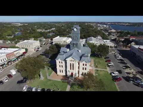
Hood County Courthouse by UM Inspection
In Texas, UM Inspections surveyed and created 3D models for County Courthouses and other cultural heritage sites in the city using drones. They disclosed that a reality-based survey is for cataloging, restoration, and conservation. The photographs taken were feed to CAD, GIS, and alike to create 3D models of the courthouses. It is a step to plan out better protection of existing Cultural Heritage from degradation or loss. A detailed 3D point-clouds and textured models give a better look at what we need in conservation and management. To date, new recording and visualization techniques produce reality-based 3D models with high geometric accuracy and realistic appearance.
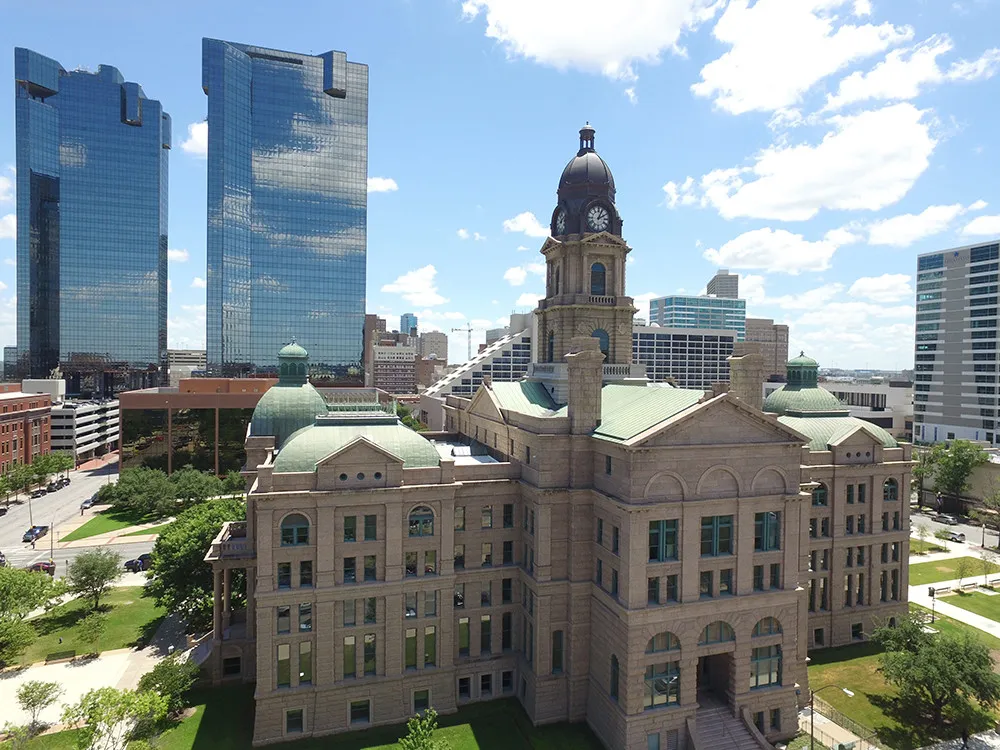
The 3D Model of Hood County Courthouse generated from drone photos and video. (source)
We can use drones to help us better plan cities and landscapes. Brett Milligan used drones to help him restore the ecology of the dunes in Antioch along the San Joaquin River in California. He used drones to monitor the growth of vegetation, which plants are preventing soil erosion in the area. He created a point-cloud model of the space. They used the model with physical CNC in planning for wind tunnels. Cresolus and his crew surveyed Park Gabon at the Atlantic coast. They used drones to get a firmer grasp of the park. They studied the SAT imagery and existing park photos for better planning. They tapped into the drones to have a quicker survey and gain deep insights.
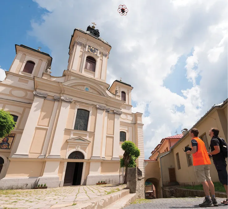
Mapping a architectural site in Slovakia. (source)
In 2012, the film and advertising experts of Studio 727 and German drone manufacturer Aibotix commenced a monumental task of digitizing about 2,000 cultural sites in Slovakia, which the Slovakian government funded. They used terrestrial laser scanning and digital photogrammetry that acquires millions of data points along with thousands of accurate and high-resolution photos. The raw images provided high-quality and detailed 3-D models of the cultural sites. They captured each architectural buildings down to centimeter accuracy. Studio 727 completely digitized more than 1,450 heritage objects at 81 large architectural buildings between 2012 to 2015. The images, videos, and 3D models from the project will be available the future architects, historians, conservationists, and restorers for educational and many other purposes.
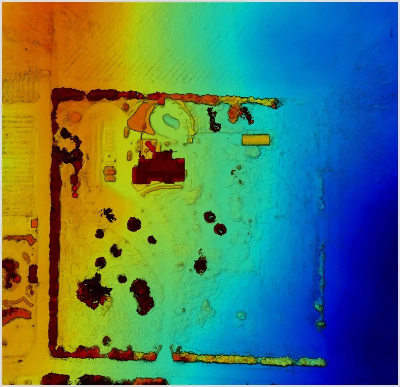
The elevation map generated from the drone survey. (source)
Landscape designer Eric Arneson used drones to better look at the land that he will design a landscape. He stated that the birds-eye view from the drones allowed him to see a new perspective of the land. It enables him to plan a better landscape using drone mapping. For him, drone mapping saves time and money by optimizing the surveying process. Arneson added that it aids designers in designing ortho-realistic plans. It would give clients a holistic perspective of the projects.
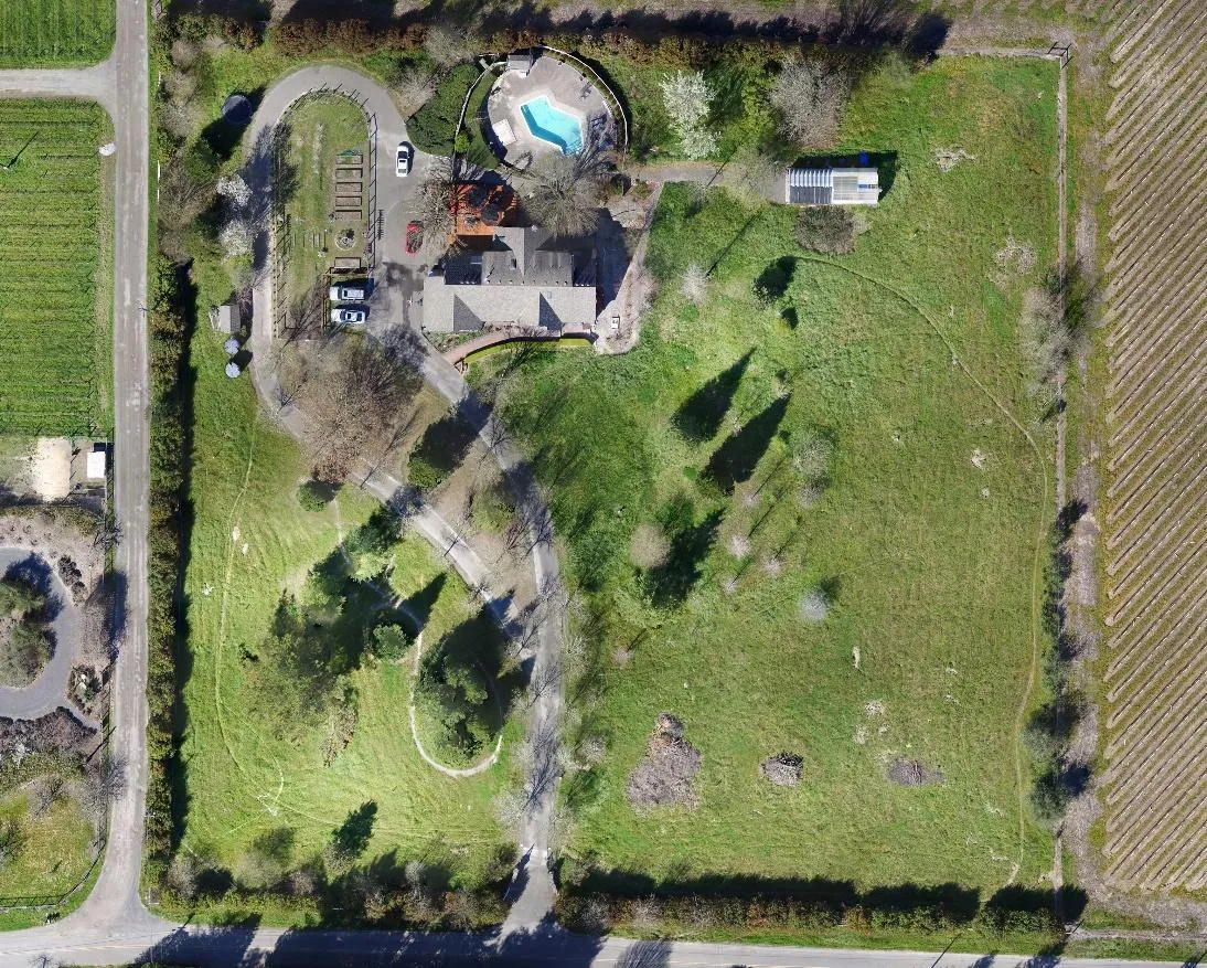
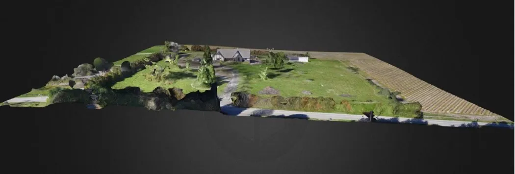
The 4-acre landscape design project of Eric Arnerson in Sonoma County .(source)
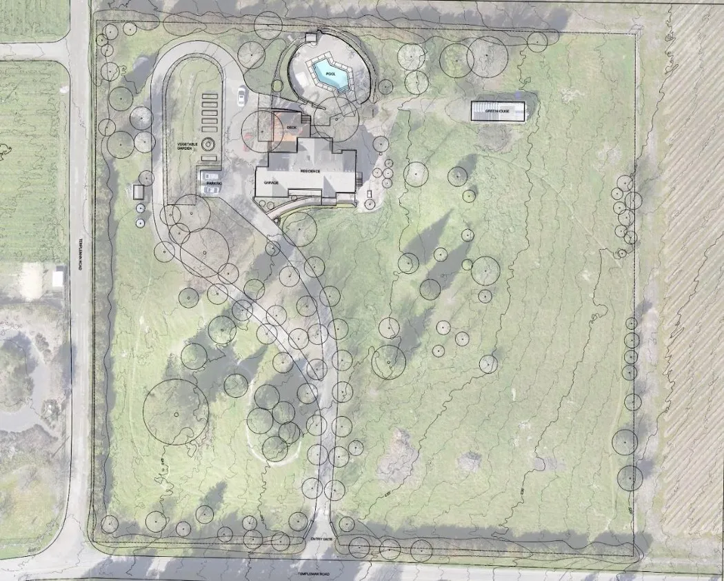
Image trace overlaid onto ortho-realistic map, created in AutoCAD. (source)
Surveying takes a lot of labor and long hours to gather details about the land's topography, elevation, and grade. It involves hands-on measurement to identify the reference points on the property to help the designer understand the property. With drones, we can measure these property points at a lesser time and labor. When Eric Arneson worked on a landscape project in Sonoma County, he estimated that surveying would take about six hours with two-person doing it, but it only takes one hour flying with a drone.
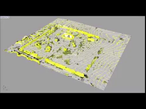
Drone-Generated Contour Map Render by Eric Arneson
The 3D model of the site. (source)
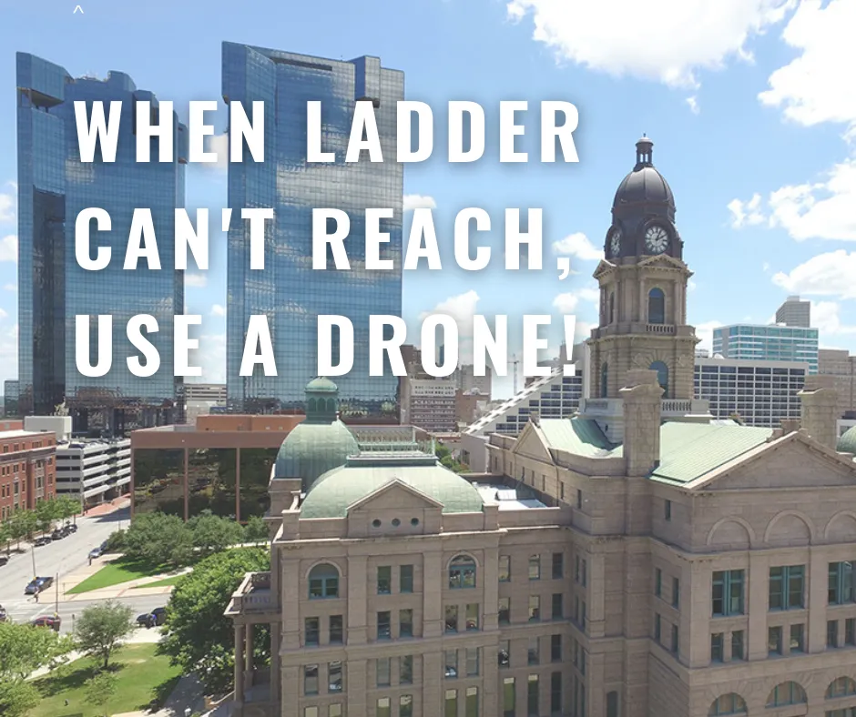
The drone allows us to capture the fine details in the structure and showcase it at every possible angle. We can see the architectural building from a perspective that is not possible at ground level. With drones, we can see the structure at once without taking much effort into climbing a ladder to see details. Drones can capture still and moving scenes through their sensors. We can use the images and video to create a 3D model of the structure. It is a great tool to document architectural heritage sites that will help with their restorations.
Large projects benefit a lot from drones. Surveying will take a shorter time and fewer people to perform it. We can create high-quality 360° videos for our 3D modeling that will make our clients in awe. Drones are a cost-effective approach in creating architectural 3D models. Architects can point out potential issues by reviewing the aerial footage rather than going through the site itself. It can speed up reviews during technical consultations and the construction of structures. It saves us time and costs.
Note: The cover image is created by the author in Canva.
References
- Picturesque: Using Drones to Preserve Historical Sites
- Maximizing the Potential of Drones
- Sustainable Design and Construction with Drones
- Drone Preservation of Cultural Heritage Architecture in Texas
- Drones for Architects: New Capabilities for the Construction Sector, How to Get Started and How to Navigate the Law