I needed the window seat on our flight back home from San Jose, Ca. I was constantly leaning over in front of my Son to snap photos of the aerial views we were experiencing. We didn’t get to see any the of snow covered mountain peaks of the Cascade Mountain range on our way down there. It was pretty late at night, which did make flying over San Francisco pretty amazing. An ocean of city lights. Too bad the only good view of the city lights was out the other side of the airplane. We missed out. Our return flight home made up for it though.
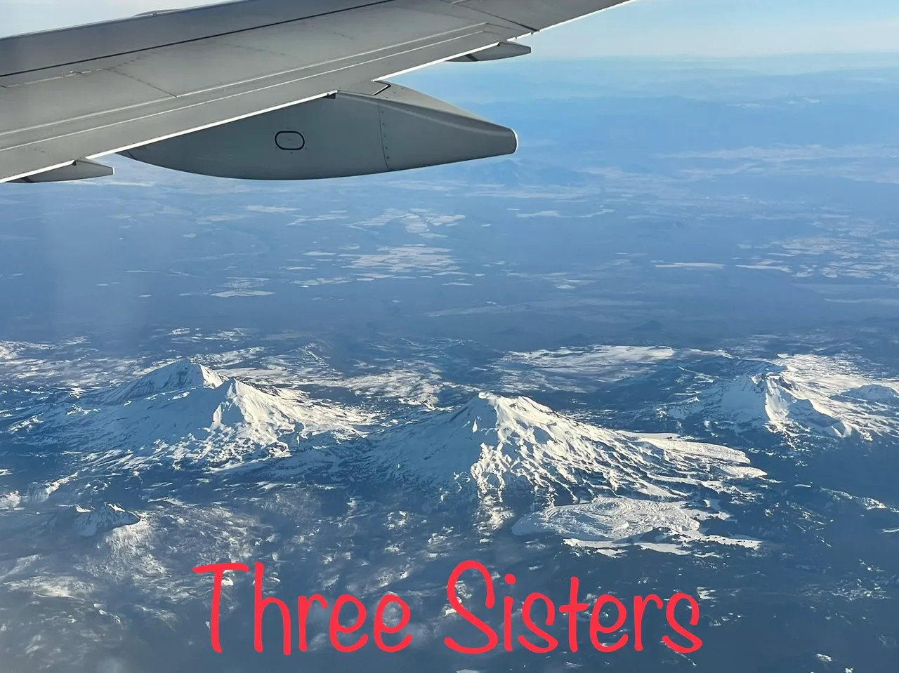
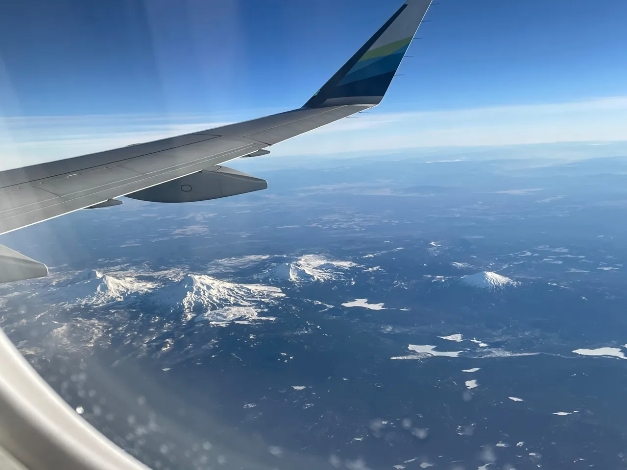
I’ve always just known them as the Three Sisters Mountains. Did they have individual names? So I looked it up real quick. Gee, that’s real creative… North Sister, Middle Sister, and South Sister… that’s the best they could come up with?
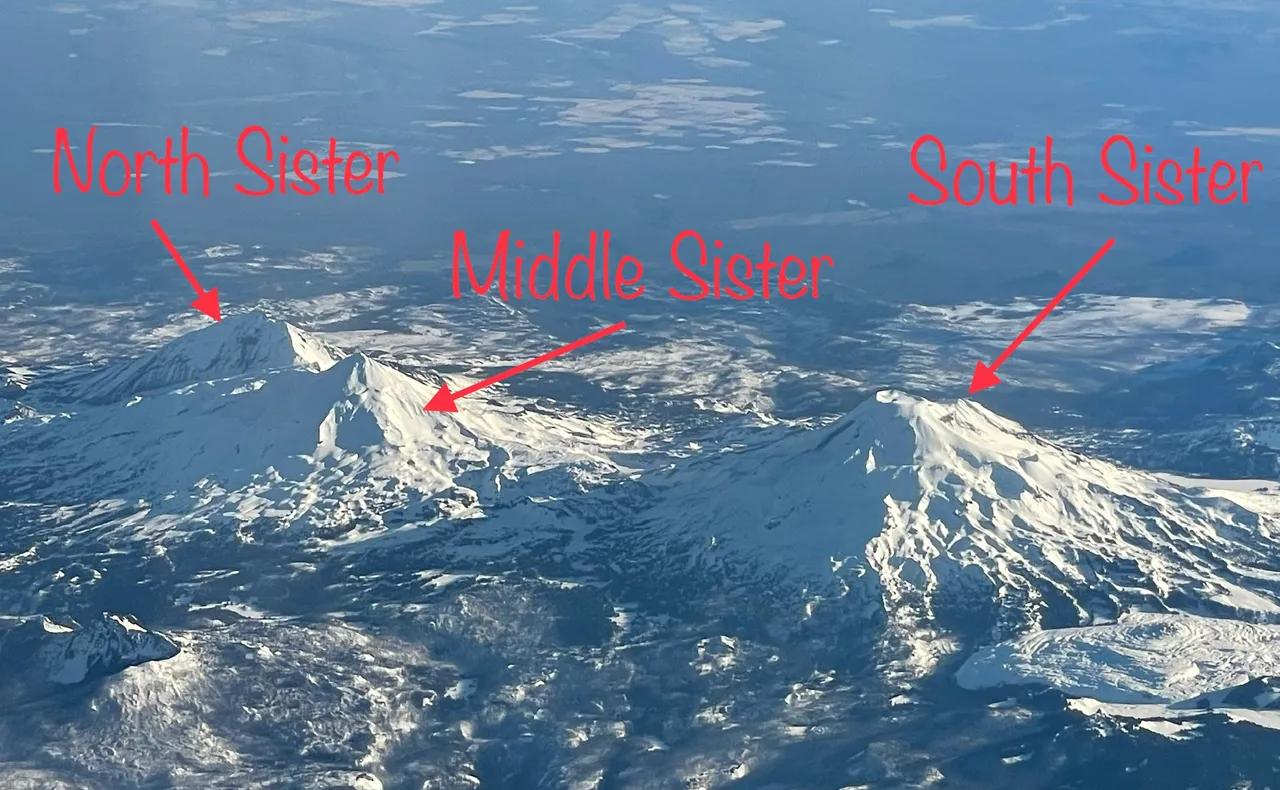
North Sister-10,090ft
Middle Sister-10,052ft
South Sister-10,363ft
At least the pioneers of old had given them decent names. Faith (North Sister), Hope (Middle Sister), and Charity (South Sister). I’m gonna stick with what Pioneers named named those Sisters
As we made our way north along the Cascade Mountains and past the Three Sisters, we came to the next Mountain Peak.
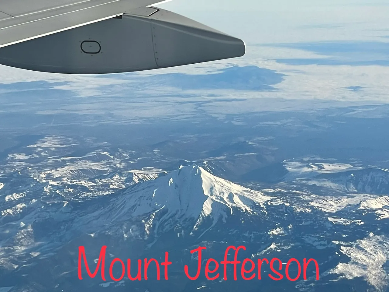
Mount Jefferson-10,502ft
Mount Jefferson is the 2nd tallest Mountain in Oregon. Within minutes we we would be passing the tallest mountain in Oregon.
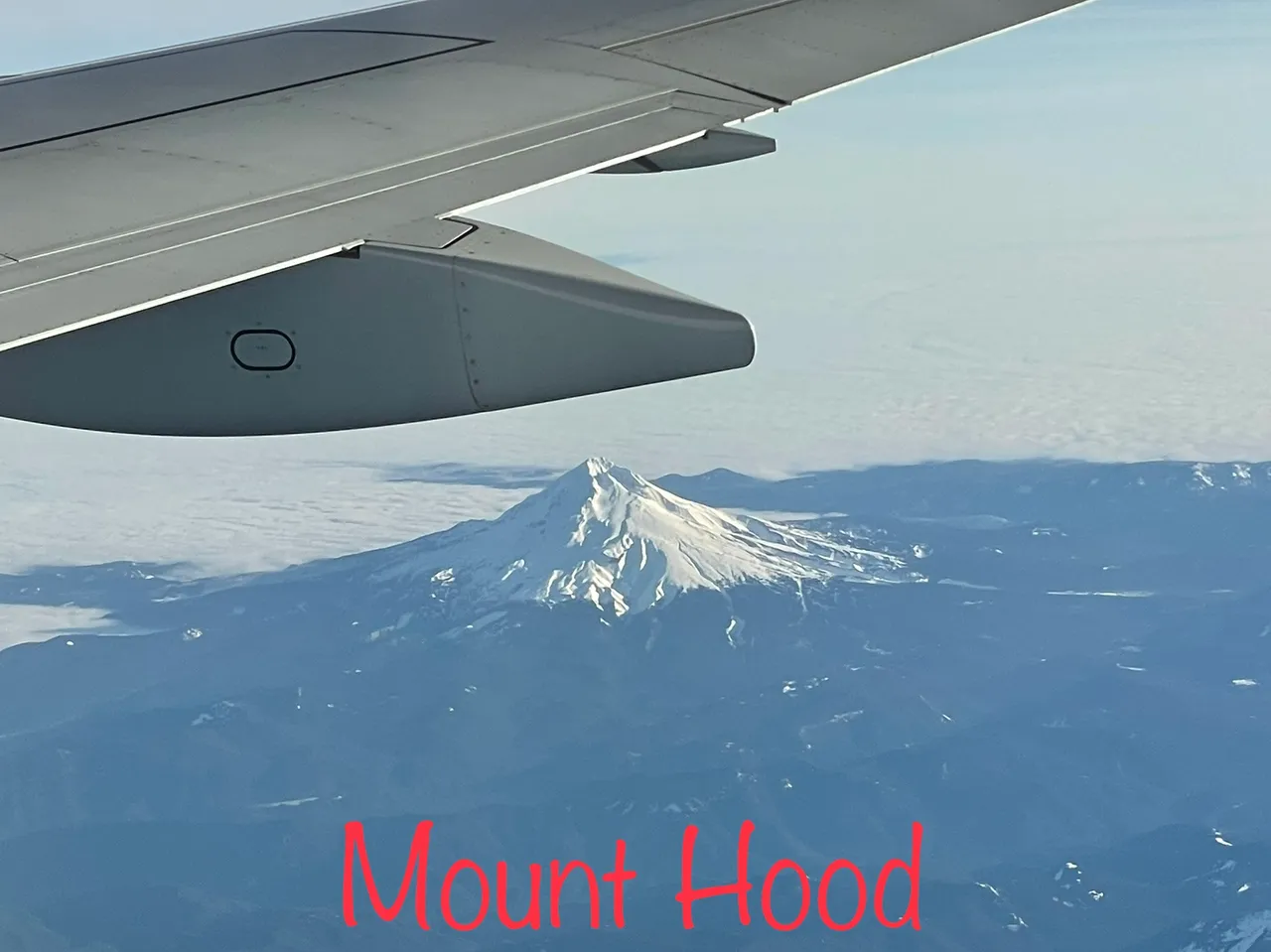
Mount Hood-11,239ft
I know of lots of family and friends that love to go snow skiing there. I have never actually been there. Always seeing it off in a distance during our travels. My Dad on the other hand, he has climbed this bad boy once.
Shorty after passing Mount Hood, we crossed into Washington State. This Mountain is pretty easy to identify… being that half of it is missing.
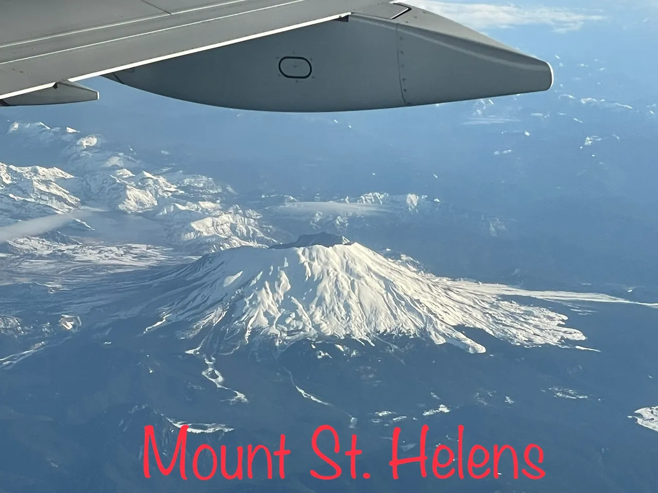
Mount St. Helens-8,363ft
Just 6 days after my brother was born, Mount St. Helens blew its top. What once stood 9,677ft was reduced to 8,363ft. My parents still have a huge jar of volcanic ash. Why… I don’t know but they have it. Mind you we lived 183 driving miles away at the time of its eruption. The cars and streets were covered with ash.
My Dad and I have hiked to the top of Mount St. Helens together. Hiking through the snow to be able to stand on the upper edge and look down into the crater. What a crazy sight!
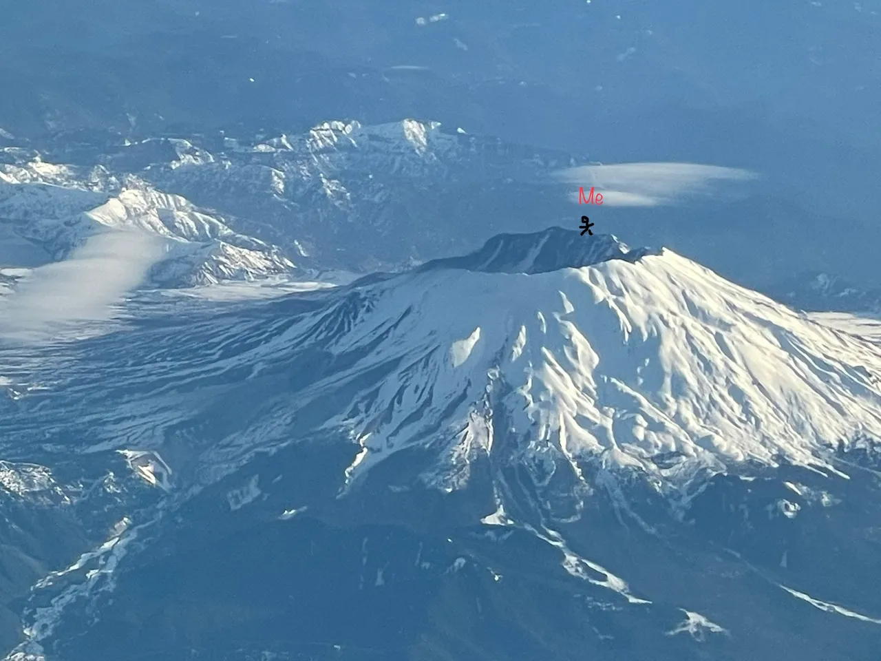
I remember standing on the edge looking down into the crater and seeing the lava dome formed in the middle. Since it’s eruption it has had continuous volcanic activity until 2008. That’s how the dome was formed.
Looking to my left and right at the dozen or so people standing on the snowy overhanging ledge, I decided to back up a bit. There was one guy that brought some golf balls and his clubs. He teed off a few golf balls into the crater. Another guy brought up a chair, cigar, and a beer. He sat there with one leg crossed over the other enjoying a cold beer, big ol’ stogie and a great view. Me, well I wondered around the side away from everyone and got prepped up for the fun slide down the mountain. The cold weather helped to disguise the smoke clouds I was puffin’:wink:wink. Put your pack on your chest, lay back, and enjoy the fast ride down the mountain. Damn that was fun, especially after enjoying some greenery.
Continuing north to Seattle, off to the east is the tallest mountain in Washington state…
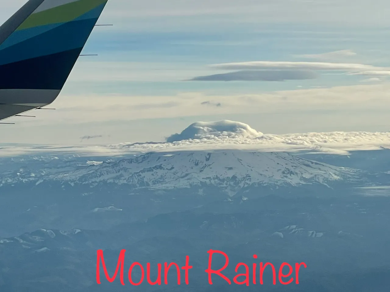
Mount Rainer-14,417ft
Look at how the clouds formed around the peak making it look even taller. Half way up the clouds are flat then the build up a big cotton ball of clouds over the top.
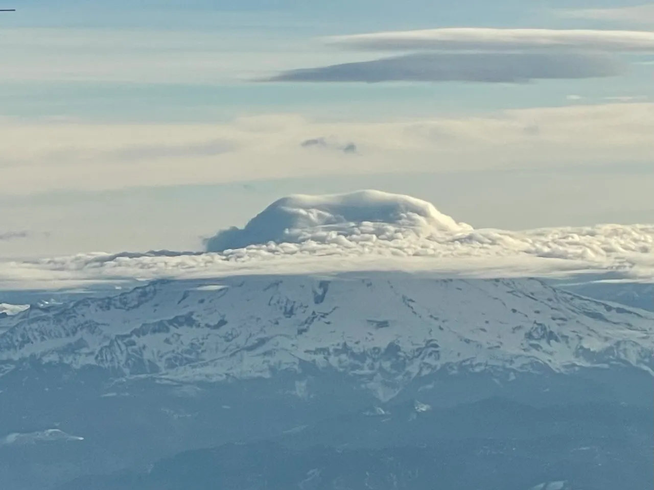
According to Wikipedia, Mount Rainer is the most dangerous active volcano in the world. I knew most, if not all the major mountains in the Cascade Mountains were considered active volcanos. But… “The World’s Most Dangerous” is only 177 driving miles away… ummm If/when this thing blows we may end up getting a little more than just some ash covering the streets and cars.
The second tallest mountain in the Cascade mountain range sits off to the east behind Mount St. Helens. I couldn’t get a good shot of it because the dang wing of the plane was in the way. So I had to borrow one…
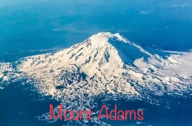 Mount Adams-12,281
source
My Dad has hiked Mount Adams twice and I have done it once. I still brag about how I got higher on Mount Adams than he did. You see when he got to the top there wasn’t as much snow as when I got there. On the peak there is a little fire lookout building. Both times he went the little cabin was almost completely exposed. When I reached the top, only tip of the roof was visible. WINNER! Though it would have been cool to see the old log building, getting higher than my Dad on Mount Adams feels way better. Bragging rights…
On a clear day driving from Eastern Washington to either Portland, Oregon or Seattle, Washington one can see multiple mountains at one time. When traveling to Portland you can see Mount Adams, Mount St. Helens, and Mount Hood. When traveling to Seattle you can see Mount Adams, Mount St. Helens, and Mount Rainer. I wish the fog/cloud weren’t so thick on the flight from Seattle to Walla Walla so I could have seen these from the air. Maybe next time…

Your Random
Dose of...