
Day 7 was filled with so many new amazing things, our brains were burned out. When you take in that much it seems like you need time to process it.
That desert used to be a thriving forest and river valley. 🤯🤯🤯
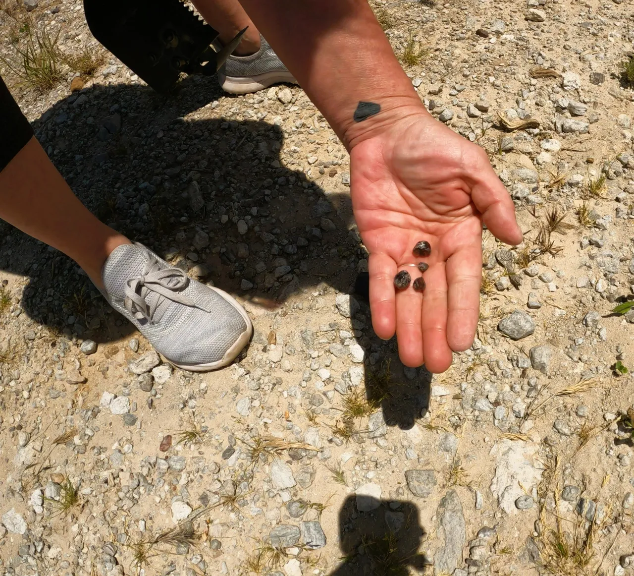
Day 8 was a day of rest and rock hunting. Just South of Payson is the town of Superior Arizona. This area is known for it's Black Obsidian, also known as Apache Tears.
Black Obsidian aka Apache Tears
Legend has it, in the 1870's, 75 Apache warriors ran into the US Cavalry up in the mountains. A battle ensued and the Apache were out numbered. Instead of dying at the hands of the soldiers, they rode their horses off a cliff to their deaths. Their wives and families cried tears down to the earth and they turned into these black stones.
Apache Tears are said to have emotional healing properties and absorb negative energy. People also use them for grounding and even jewelry.
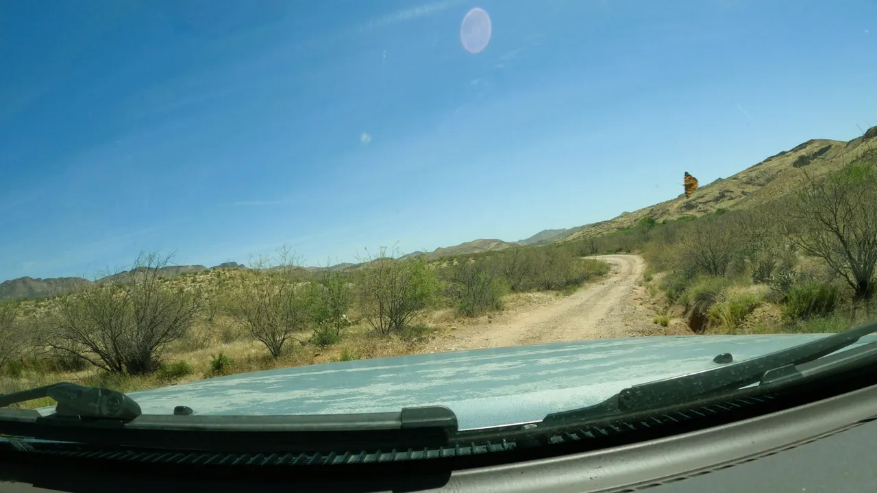
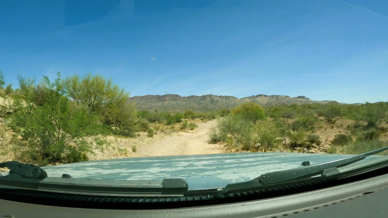
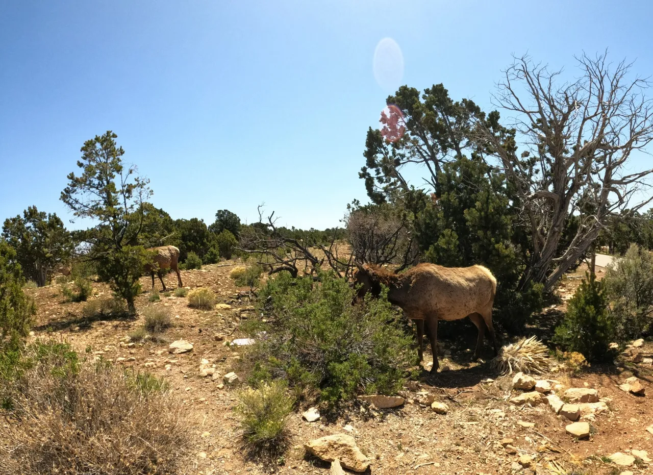
After another drive into the middle of nowhere we found the site. This road was very rough and mostly in a washed out creek bed. It's hard to tell from the pictures but it was pretty wild. We also had a butterfly guiding us!
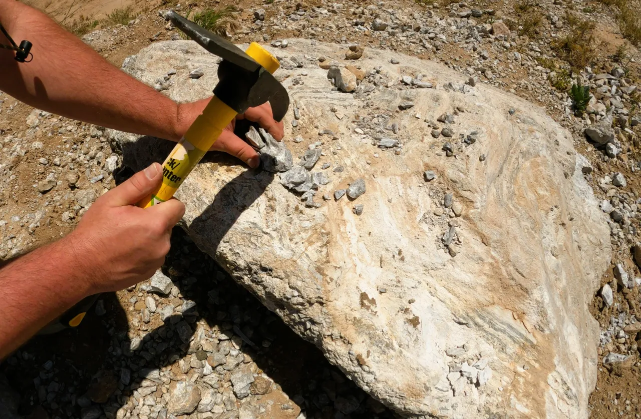
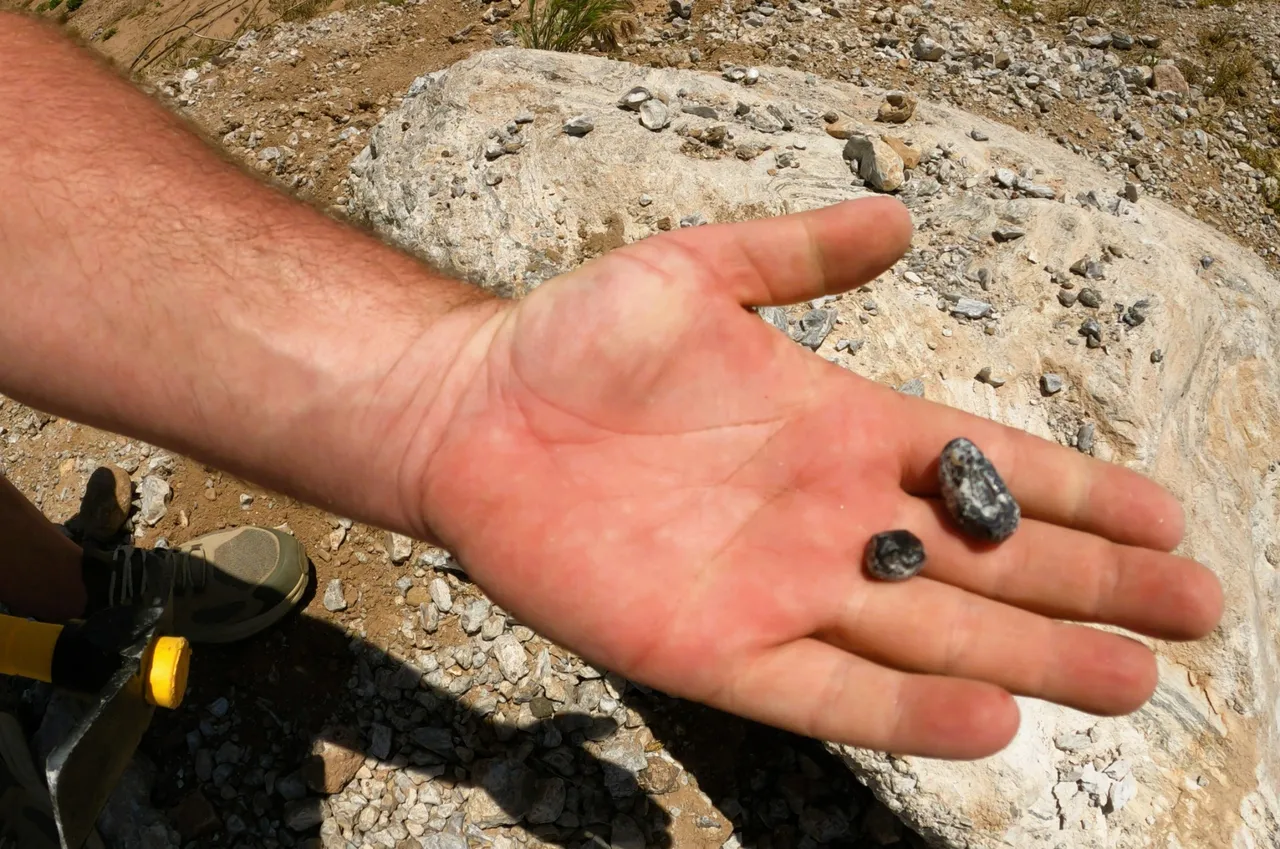
Black Obsidian is Volcanic Glass formed millions of years ago. The host rock, or Matrix, in this area is Perlite. You can find the Obsidian laying all over the ground. The ground is very hard and you'll need a rock pick or similar to get them out.
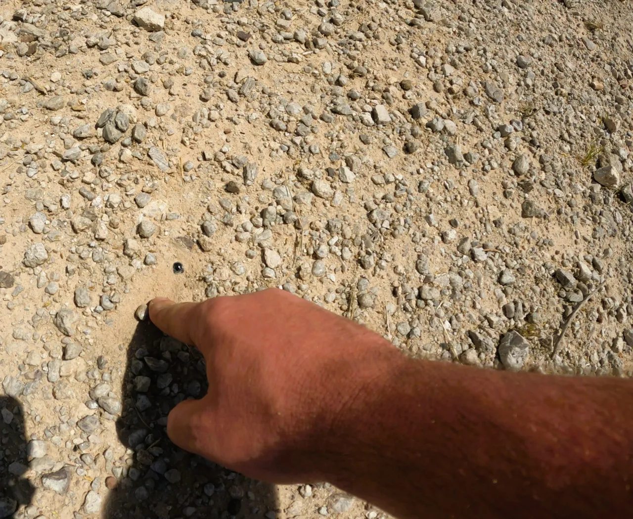

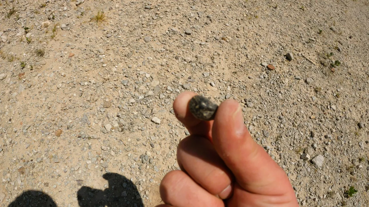
Some of them need to be broke out from the Matrix. It's very brittle and doesn't take much to get out.

Day 9 - Grand Canyon
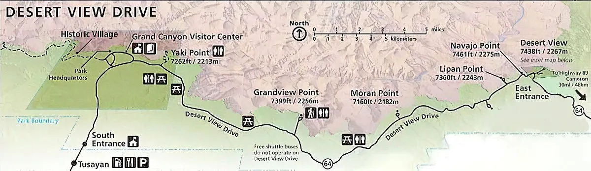
Feeling well rested, we jumped in the Chariot and hit the road. 20min down the road and we found the South Entrance. The line was short and we made it in the park.
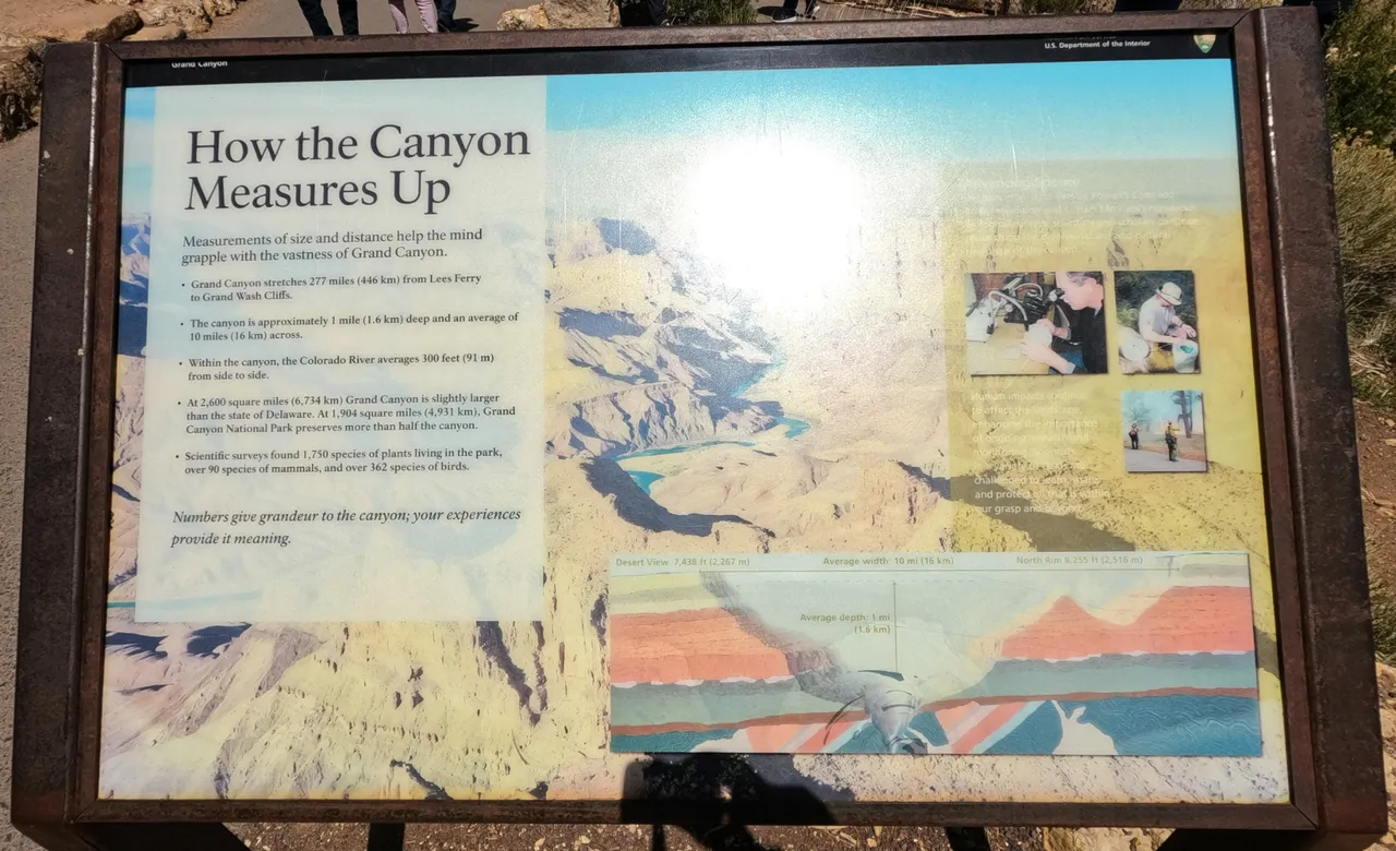
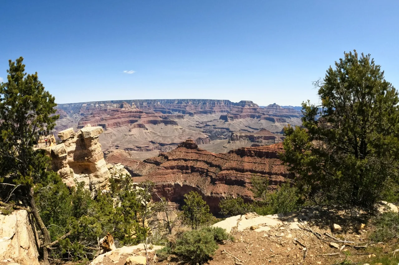
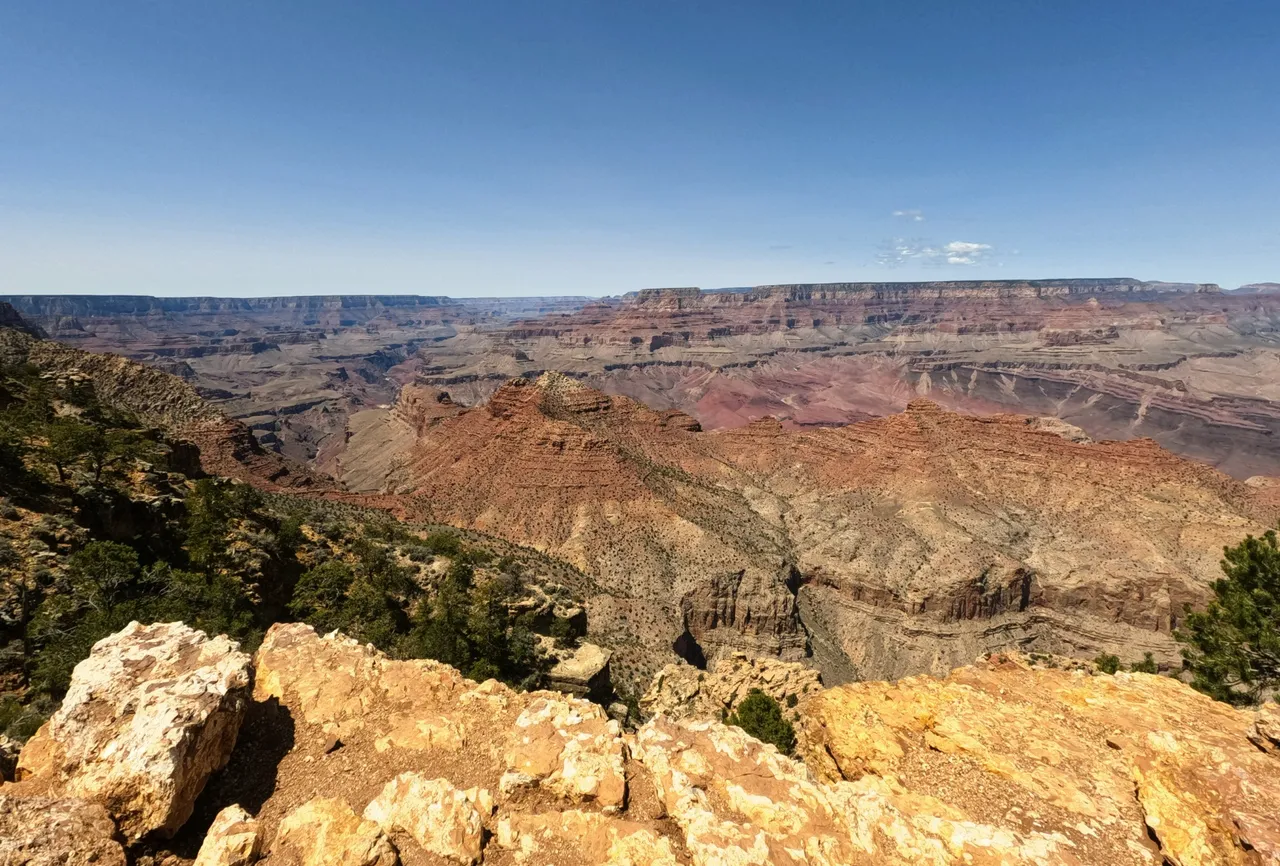
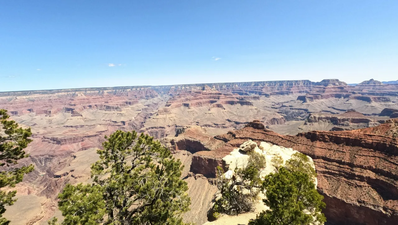
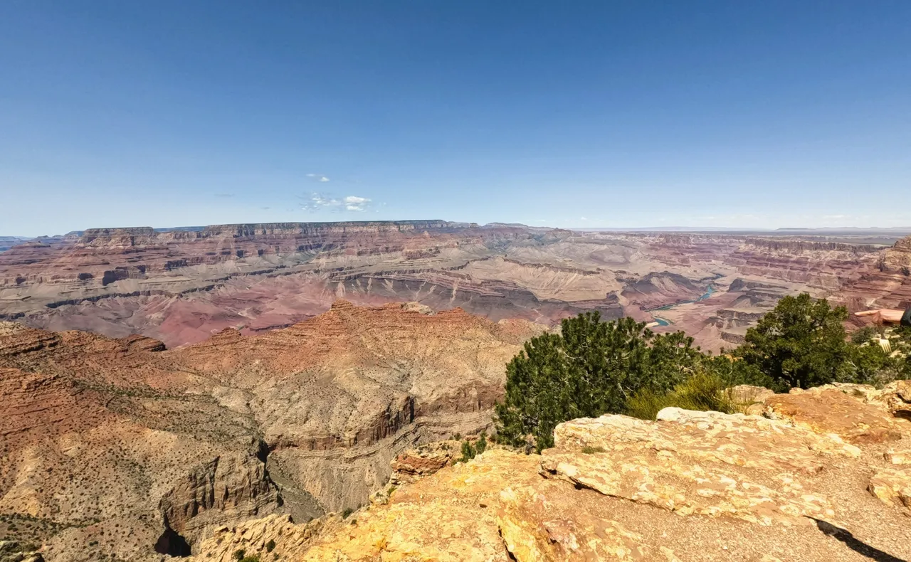
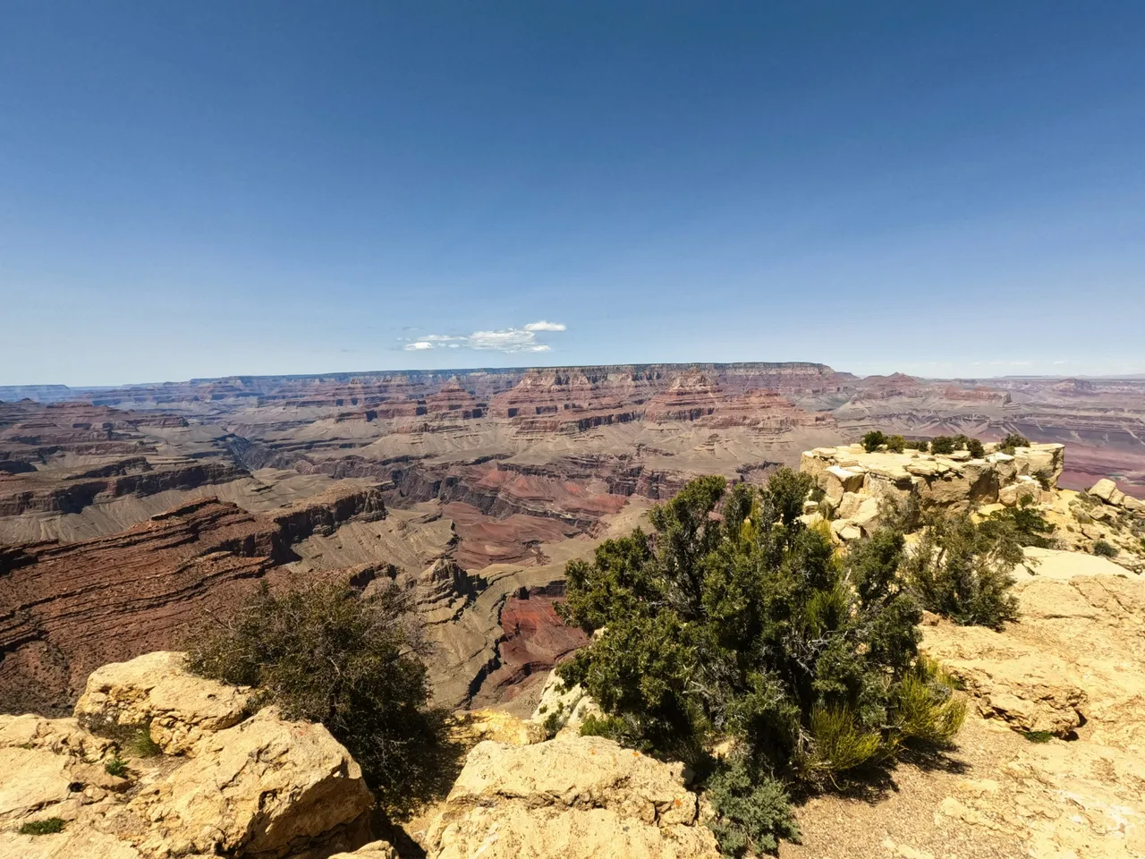
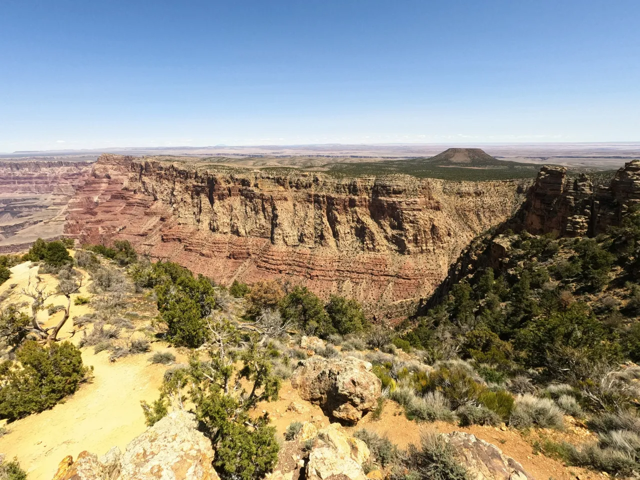
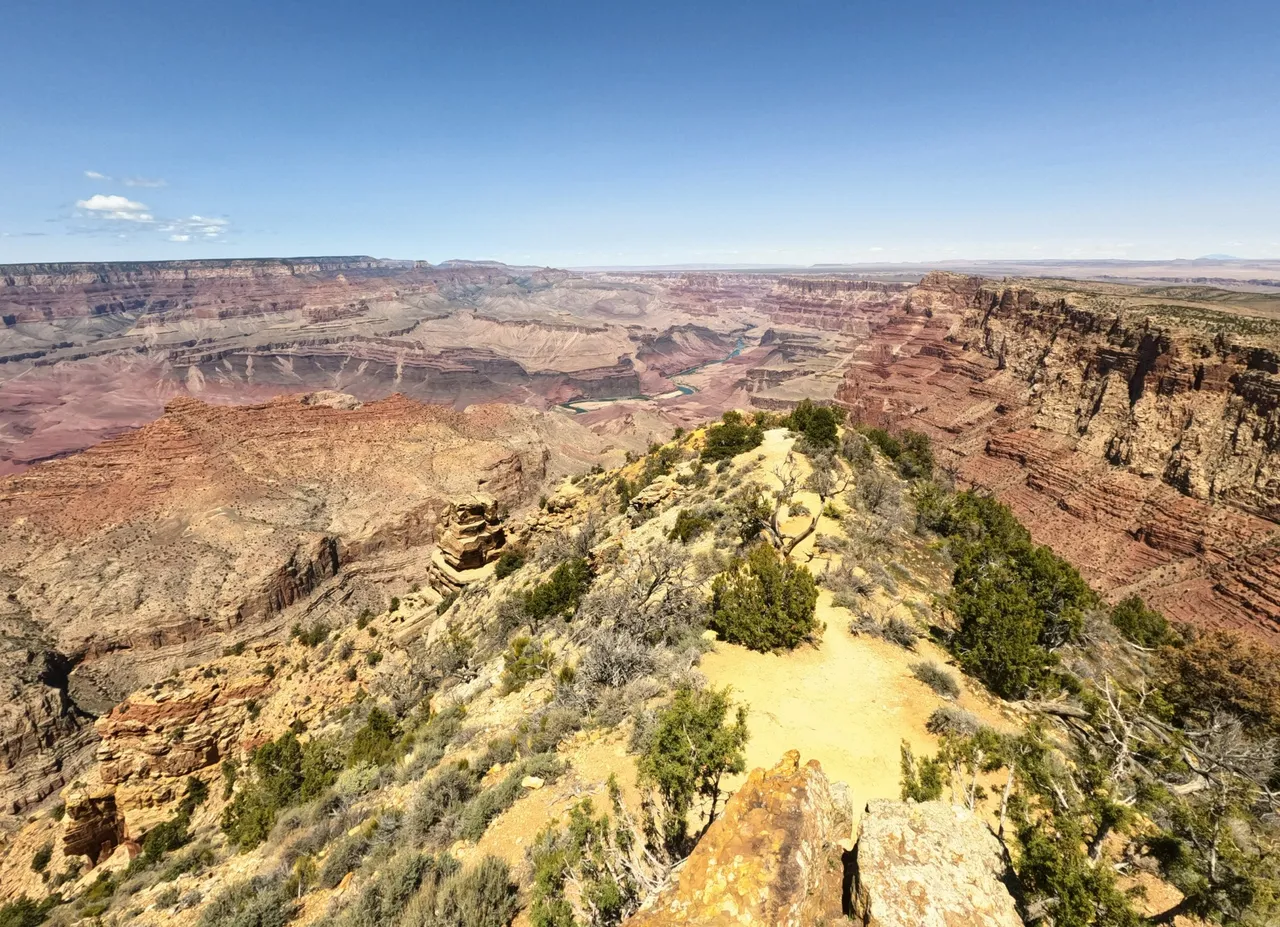
Stretching 277 miles and averaging 10 miles wide, the Grand Canyon is a HUGE! It averages 1 mile in depth with some areas far exceeding that. The Canyon covers 2600sq miles and is larger than some US states.
We followed the typical South Entrance Trail out to Desert View. Here is a map you get when you enter. National Parks Grand Canyon Map
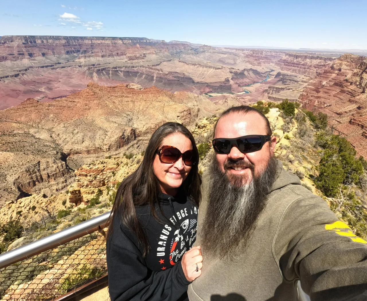
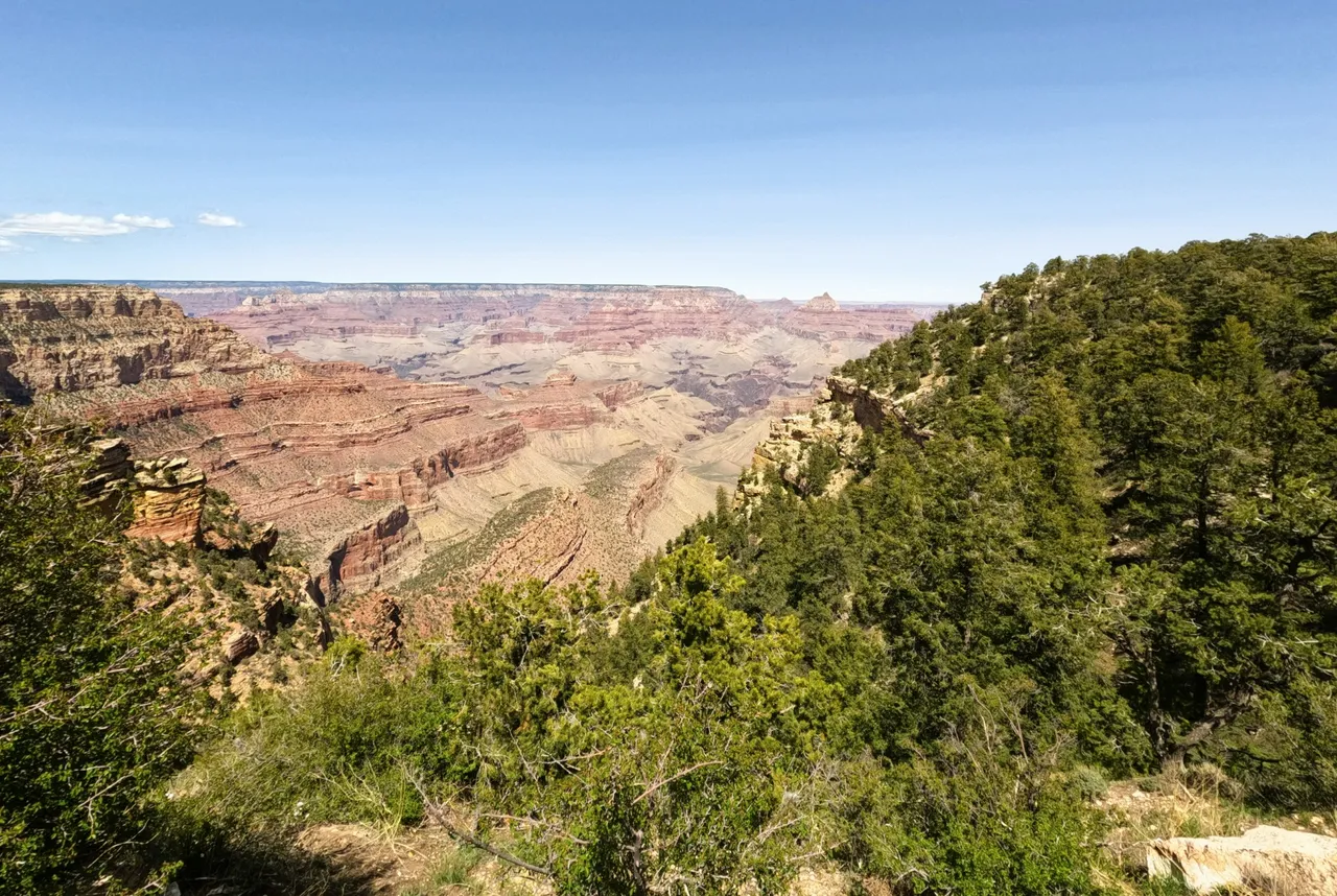
Their will never be enough words or pictures to describe looking out into the canyon. Until you are there you won't understand. It doesn't even feel real. It's like you are in a simulation or dream.
I could sit and stare for hours out across it. Imagine being the first person to walk across the desert and then come to this. How would you get around it? Sheer cliffs in every direction and it goes further than you can see.
These don't do the canyon justice. It's so hard to capture it's enormity.


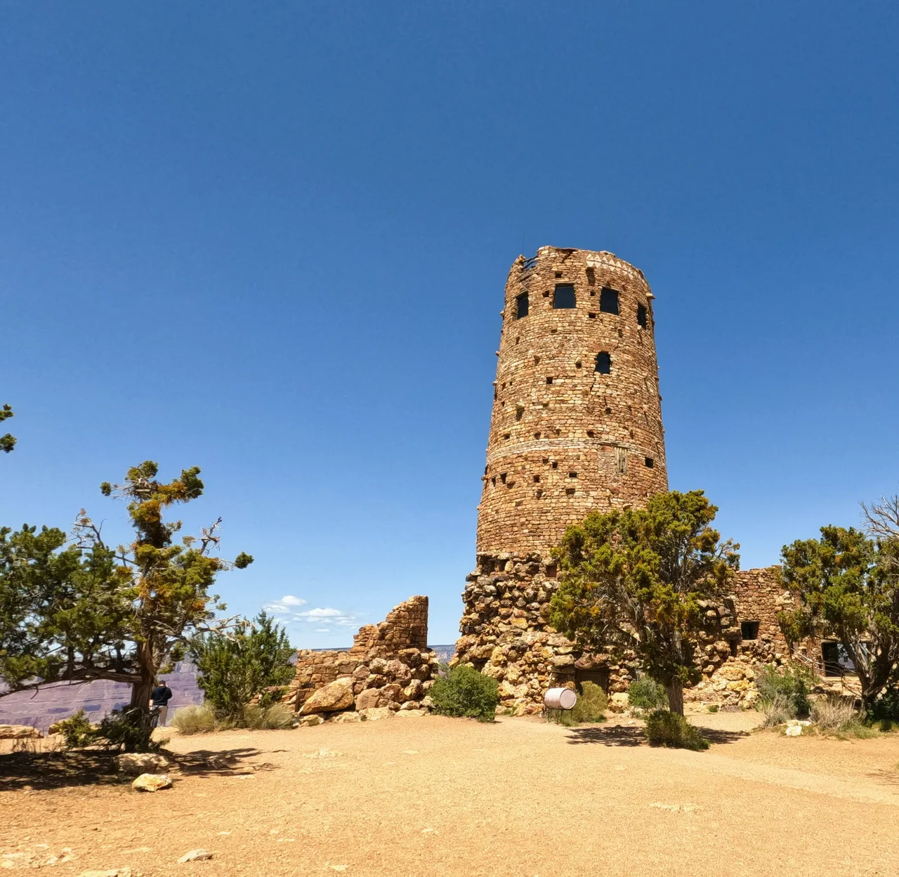
This is the Desert View Watchtower. You'll find it on the East side of the trail. It was designed by Mary Colter and completed in 1932. She studied how the ancient Pueblo and Hopi built and was inspired to build this.
It's now home to restrooms, giftshop and museum of Hopi culture and symbolism. The views from here are amazing and included in the above photos.
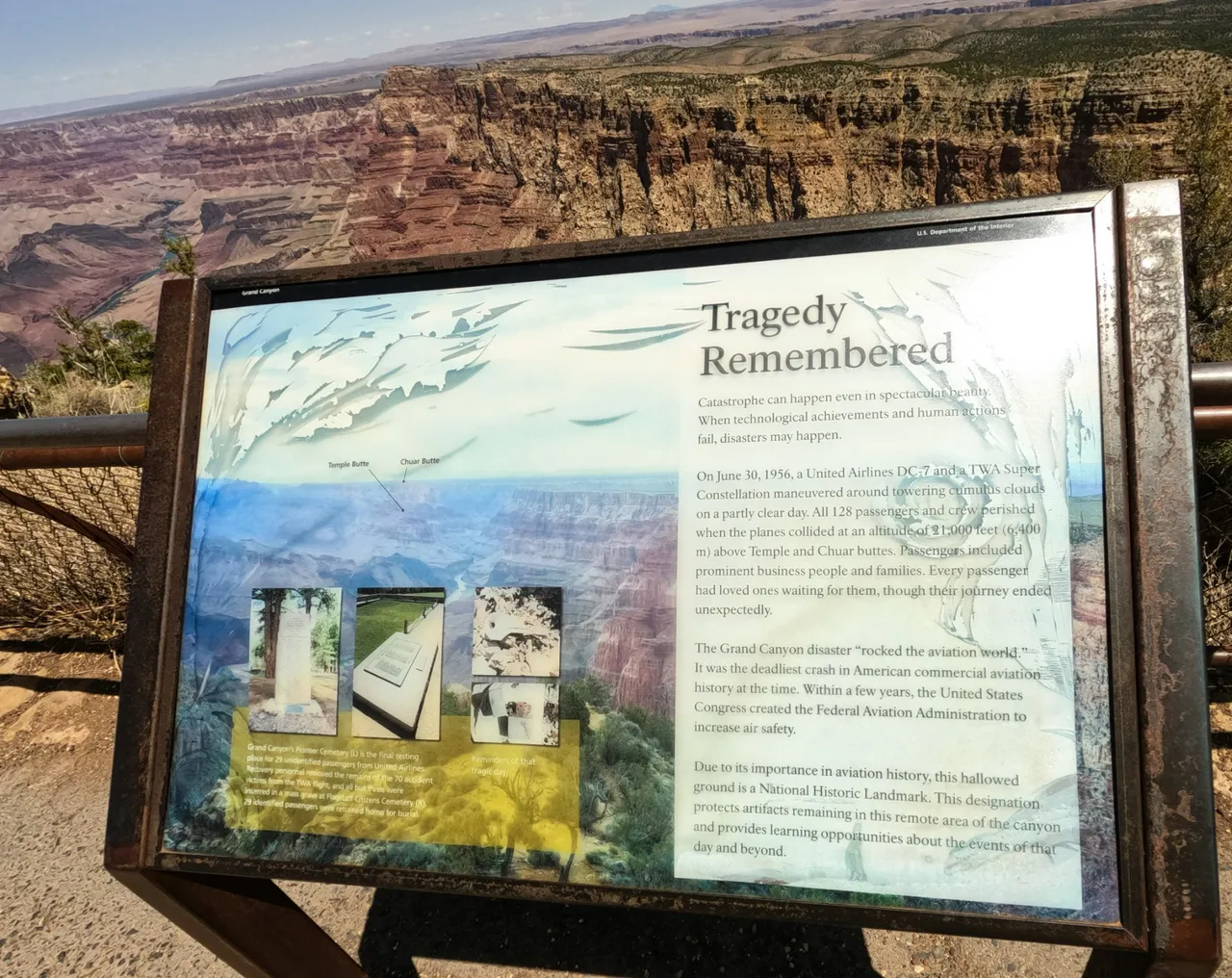
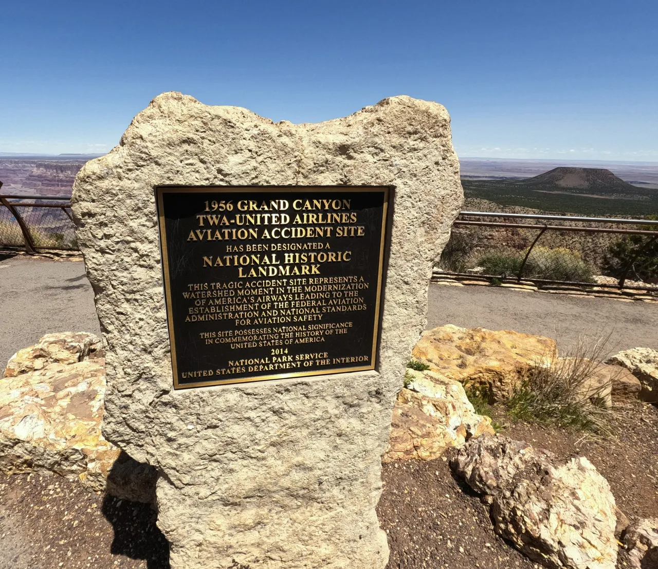
Also in this location is a memorial. In June of 1956, 2 airplanes collided at 21,000ft killing all 128 passengers and crew members. In the picture you can see off in the distance where the wreckage was found.
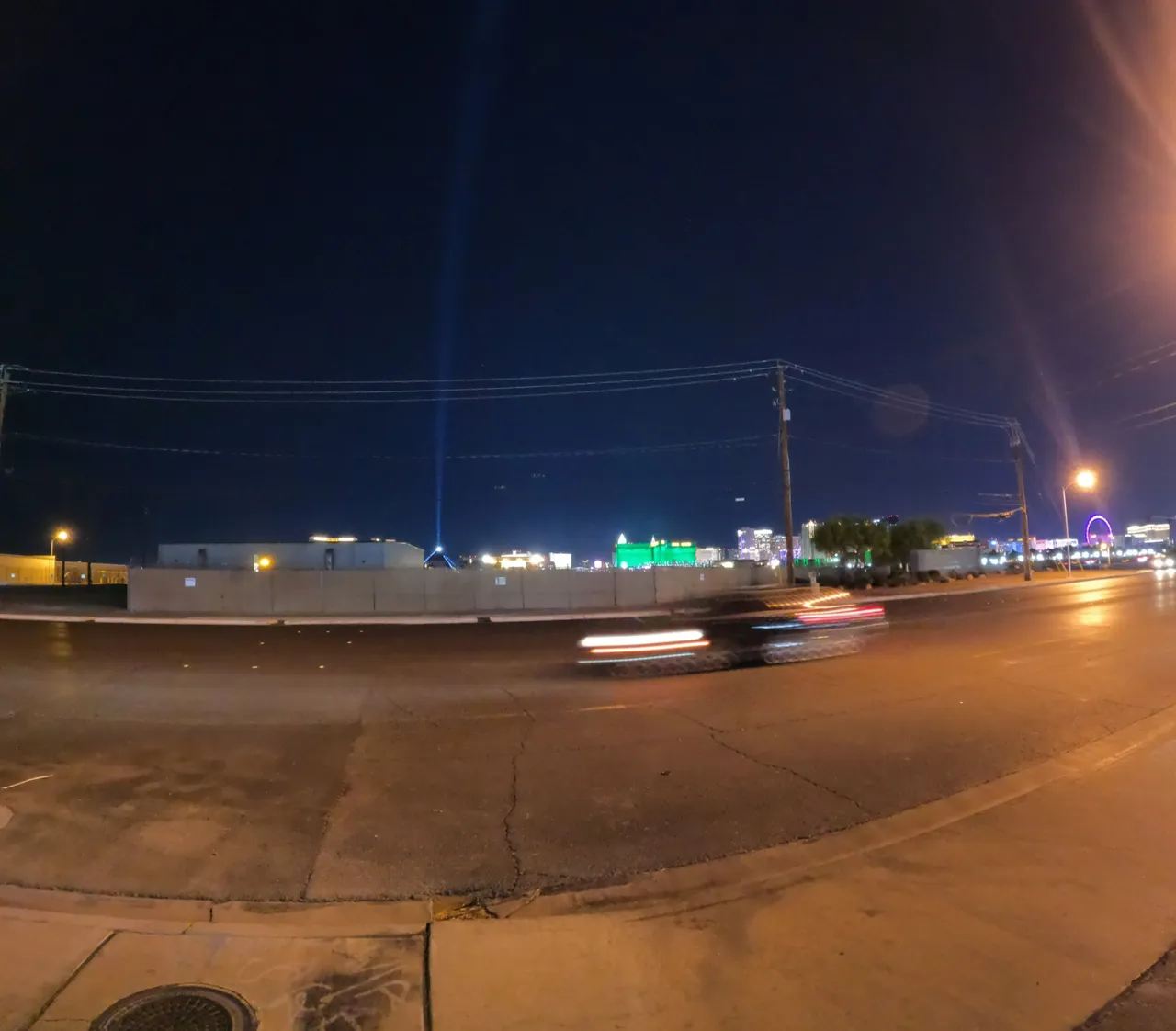
To end the day we headed to Las Vegas. We were supposed to stay on the strip...but our truck didn't fit in the parking garage. We figured that out after hitting the first plastic hanging pipe with the height on it.
Then people pulled in behind us. We went forward and hit a second hanging pipe, but this one was metal. It scrapped all the paint off the roof rack. At this point there was no turning back. We made a U-Turn and got out as fast as possible.
The day had already been a long one and we were now frustrated. Out of the city we go. What a day!!!
That was a wrap for Day 8 and 9. Keep an eye out because we are close to the end of Route 66. Where will we go next?!?
Thanks for following along and we look forward to questions or comments!
