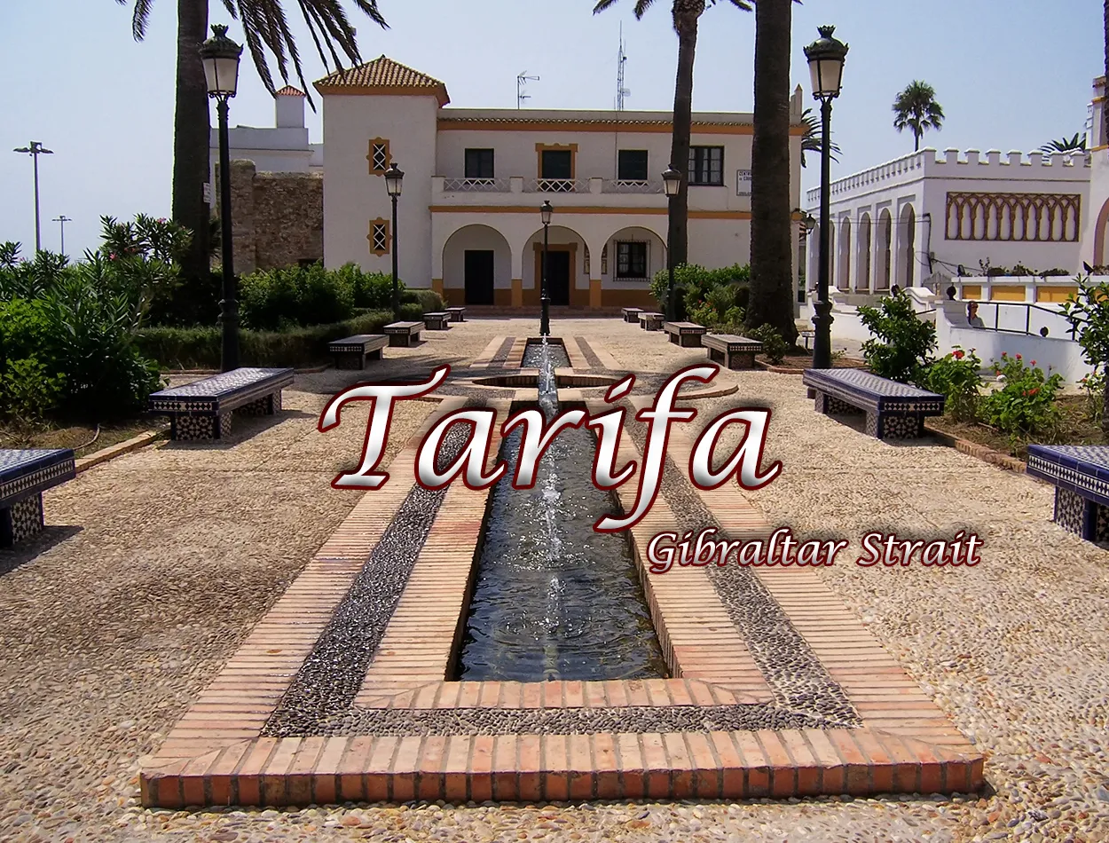
One of the goals I set for myself on my travels was to reach one of the southernmost cities on the European continent, the city of Tarifa in the province of Cadiz located in the autonomous community of Andalusia. One of the closest points to the African continent in the Strait of Gibraltar, the area is presented as a gateway and link between the Mediterranean Sea and the Atlantic Ocean. This visit was not only planned to see this city but also to tour the surrounding areas, areas of beautiful white beaches and small coastal towns with the special charm of this southern part of the country. The geography of the place seemed very different to what I had seen in areas close to this region, presenting formations modified by the movement of the tectonic plates and the separation of both continents by them. From nearby Cadiz and driving first along the E-5 and then taking the N-340, I arrived at an area of large beaches where the intense blue color of the sea gave me an idea of what awaited me. Upon arrival, Tarifa presented itself as an intense white colour characteristic of the towns of the south and a very defined urban structure up to the port and also to its southernmost point, the island of Tarifa.
Una de las metas que me propuse en mis viajes era alcanzar una de las ciudades más al sur del continente europeo, la ciudad de Tarifa en la provincia de Cádiz situada en la comunidad autónoma de Andalucía. Uno de los puntos más cercanos al continente africano en el estrecho de Gibraltar la zona se presenta como puerta de entrada y unión del mar Mediterráneo con el Océano Atlántico. Esta visita no solamente la tenía prevista para ver esa ciudad sino también para recorrer los alrededores, zonas de hermosas playas blancas y pequeños pueblos costeros con el encanto especial de esta parte sur del país. La geografía del lugar me pareció muy distinta a lo que había visto por zonas cercanas a esta región presentando formaciones modificadas por el movimiento de las placas tectónicas y la separación por ellas de ambos continentes. Desde la cercana Cádiz y conduciendo primero por la E-5 para luego tomar la N-340 llegue hasta una zona de grandes playas donde el color azul intenso del mar me iba dando una idea de lo que me esperaba. A la llegada Tarifa se presento como un intenso color blanco característicos de los pueblos del sur y una estructura urbana muy definida hasta el puerto y también hasta su punta más al sur, la isla de Tarifa.

|
|

|
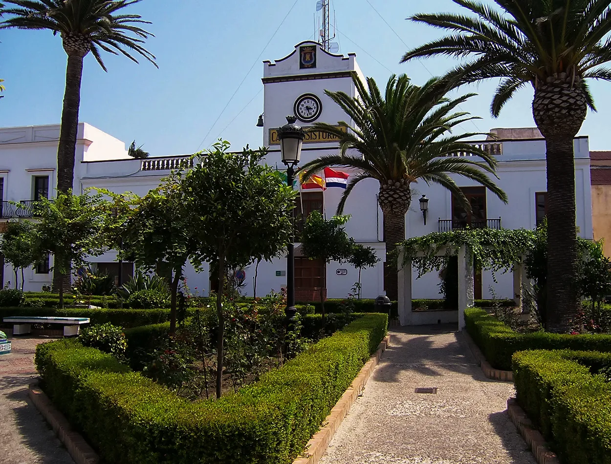
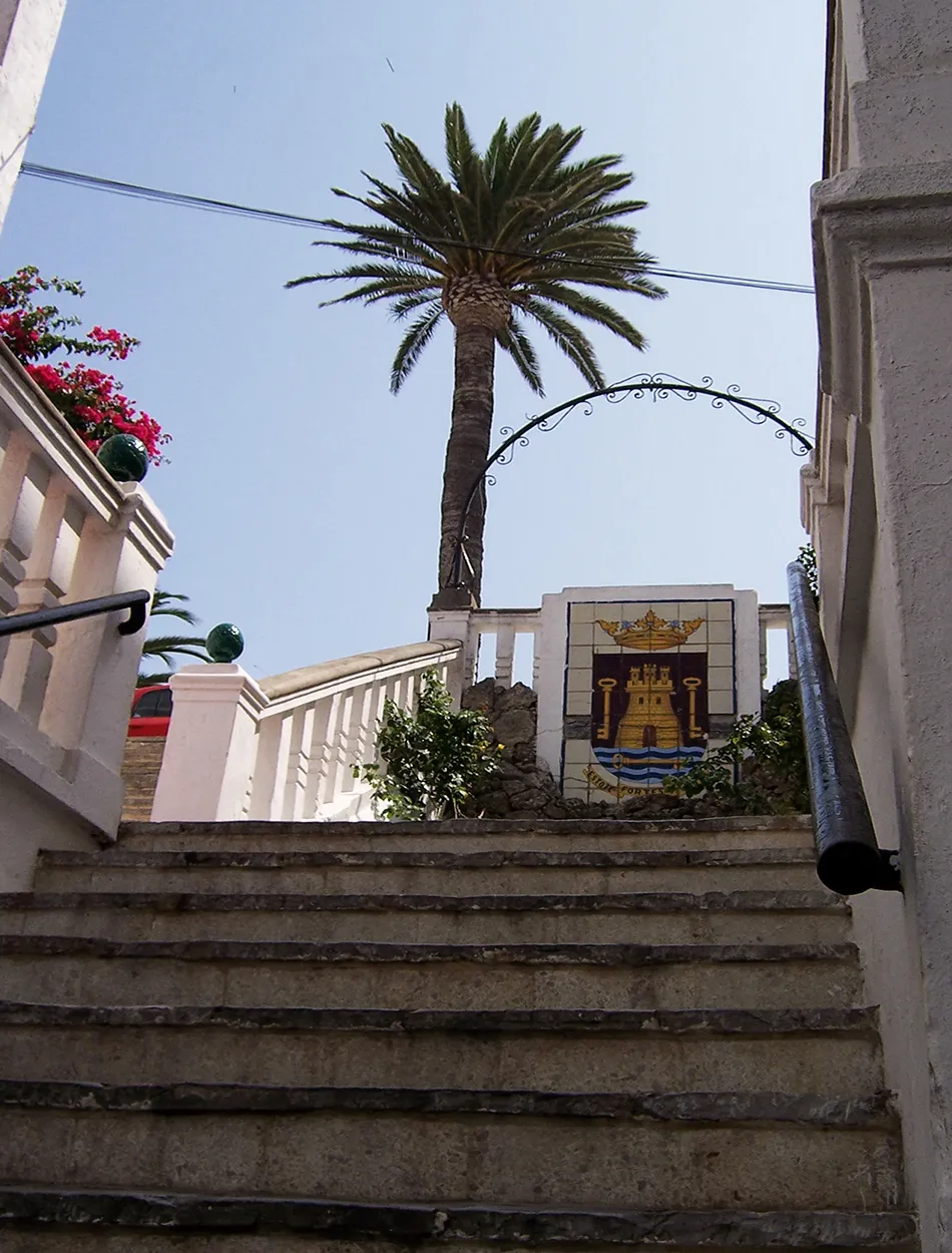
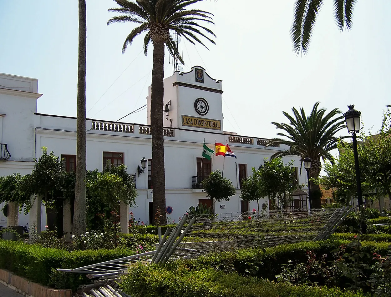
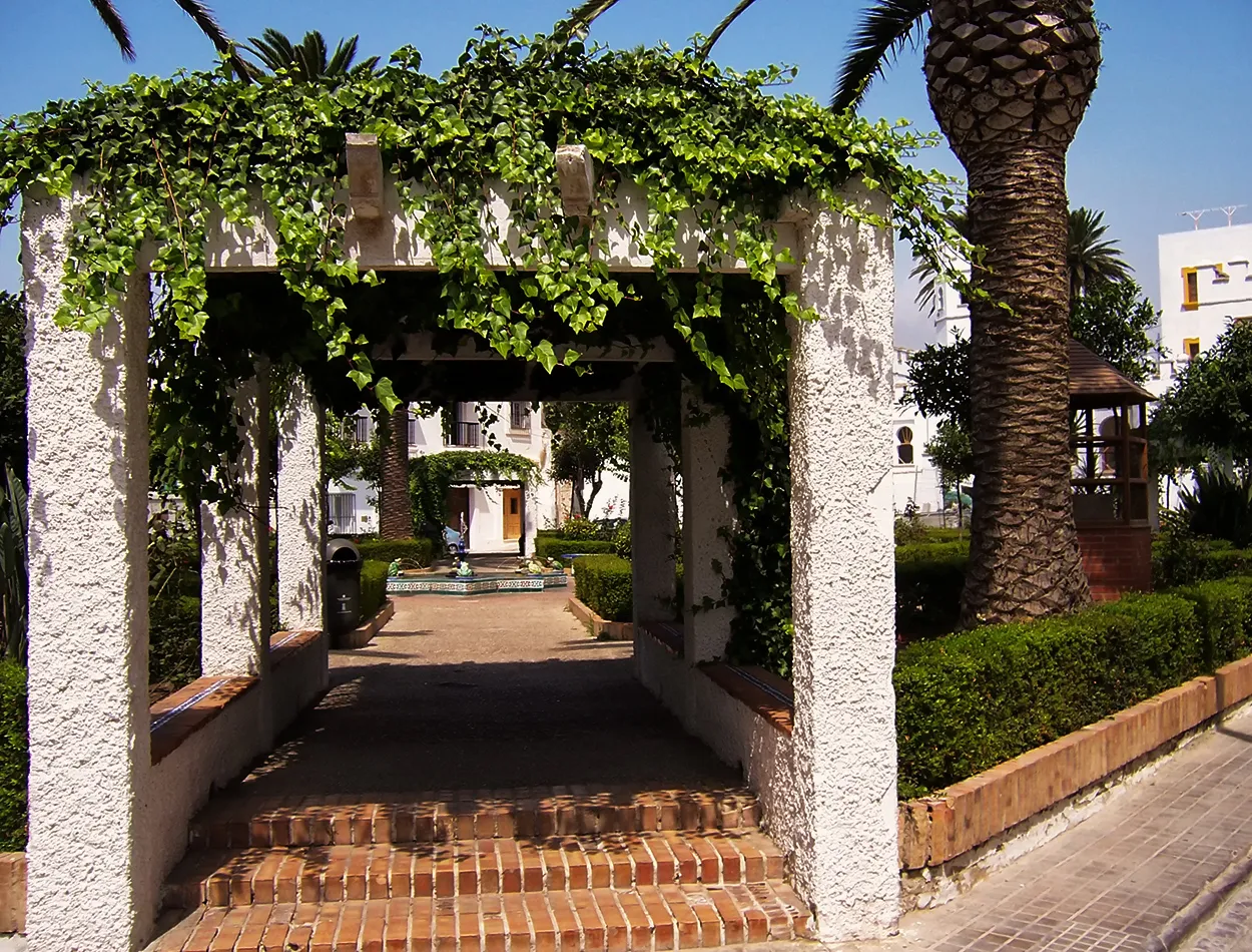
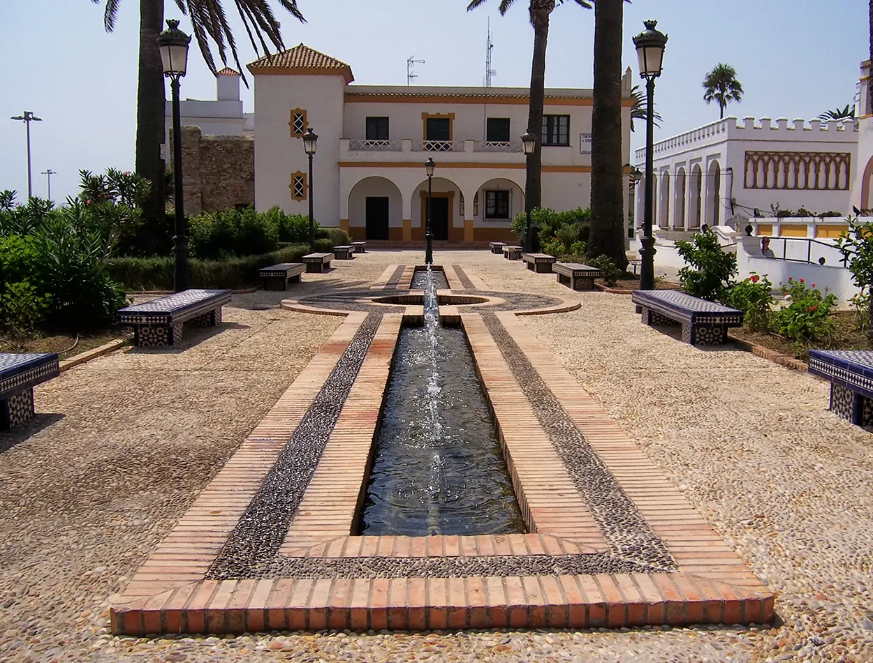
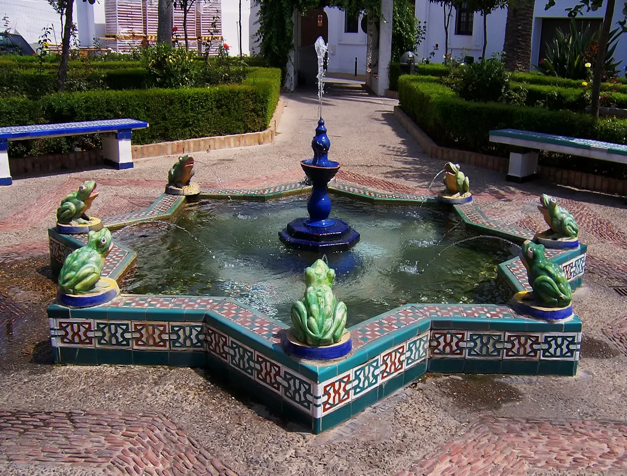
Upon reaching the town centre I headed to the port area to leave my car there and begin the tour of this historic city. With the first human settlements and remains of cave paintings and later a large colony and cities of the Roman Empire, it is one of the oldest inhabited areas in this part of the planet. From the port I went into its most emblematic streets until I reached the square where the town hall building and its beautiful square are located. The type of architecture was a mixture and I found colonial style buildings mixed with others with more African characteristics with a citadel and fort. At times I had the impression of being in the sister continent, Africa, since the whole environment reminded me of the northern area of Morocco and Tunisia. The square and the joy of the fountain in the style of Arabic architecture presided over the square giving it a touch of sound and freshness with the flow of water through that channel.
Al llegar al núcleo urbano me dirigí a la zona portuaria para dejar allí mi coche y empezar el recorrido por esta histórica ciudad. Con los primeros asentamientos humanos restos de pinturas rupestres y posteriormente una gran colonia y ciudades del imperio romano es una de las zonas más antiguas habitadas en esta parte del planeta. Desde el puerto fui adentrándome por sus calles más emblemáticas hasta llegar a la plaza donde está ubicado el edifico del ayuntamiento y su hermosa plaza. El tipo de arquitectura era una mezcla y encontré edificios de estilo colonial que se mezclaban con otros de características más africana con alcazaba y fortín. Por momentos me daba la impresión de estar en el continente hermano, África, ya que todo el entorno me recordaba a la zona norte de marruecos y Túnez. La plaza y la alegría de la fuente del estilo de arquitectura árabe presidian la plaza dándole un toque de sonido y frescura con el correr del agua por aquel canal.

|
|
|

|

|

|
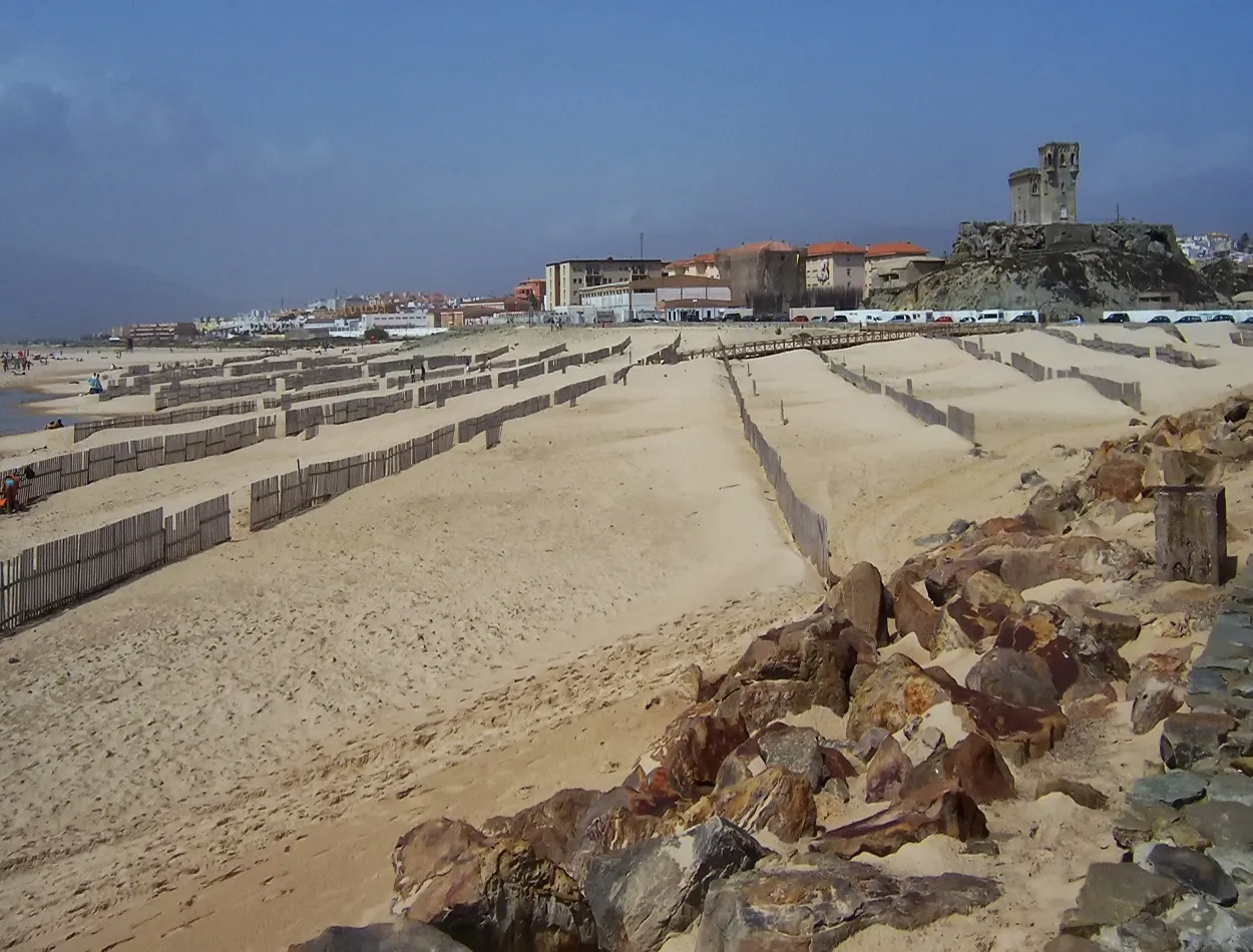
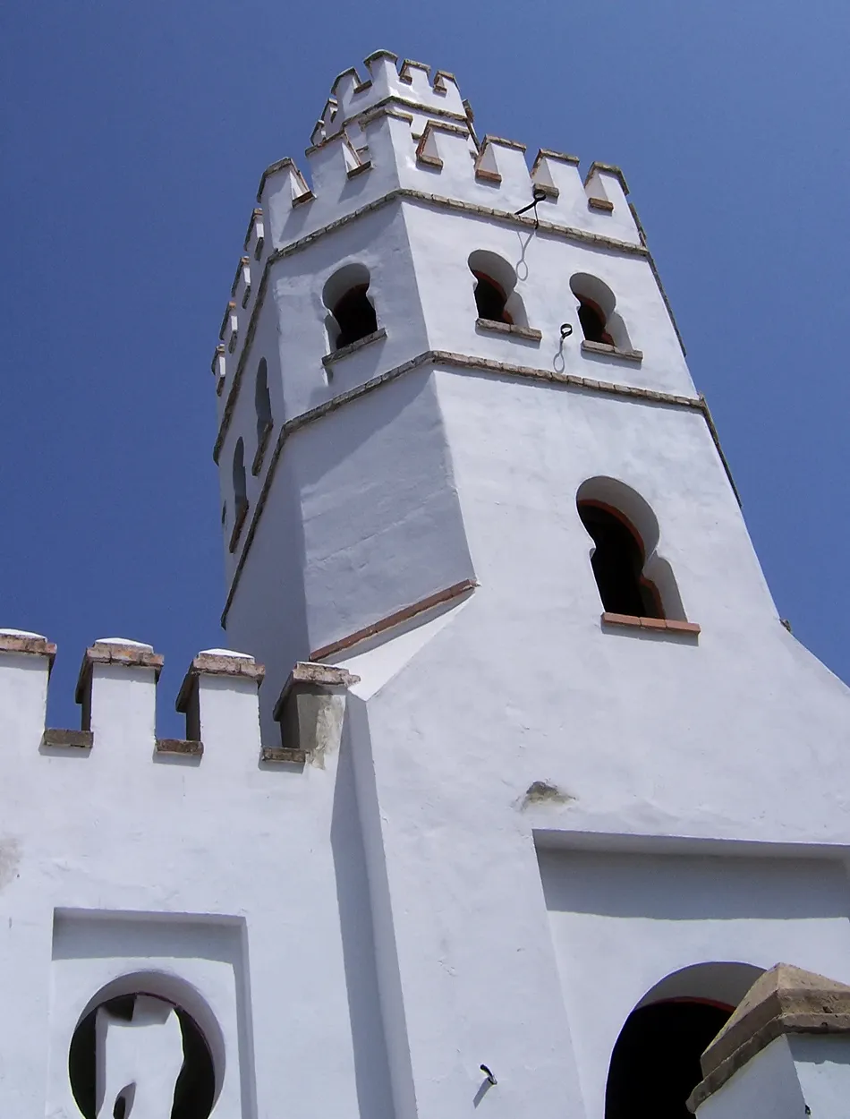
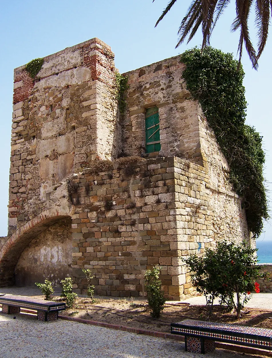
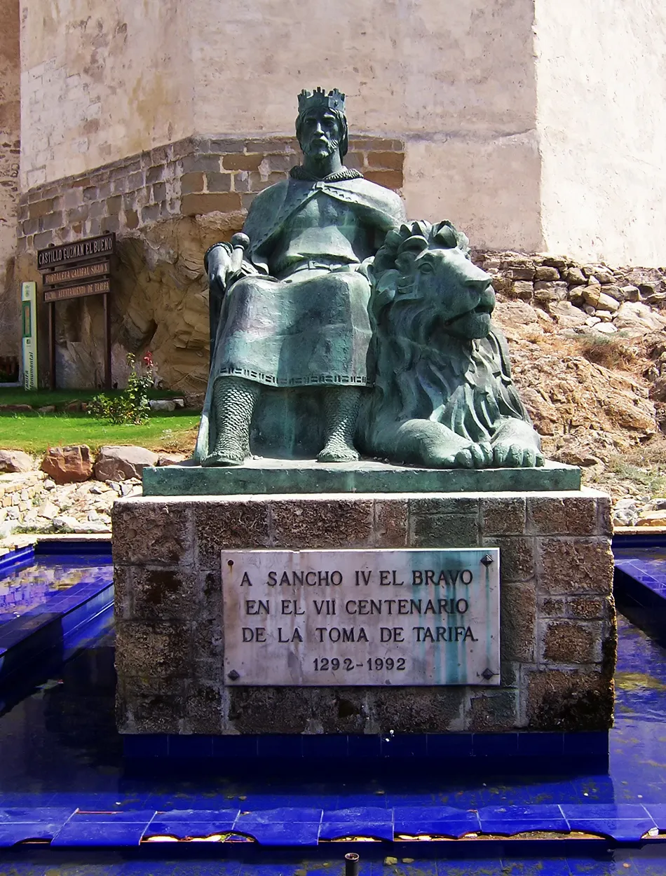
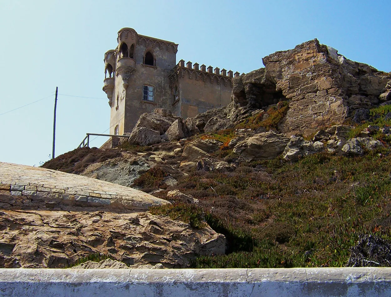
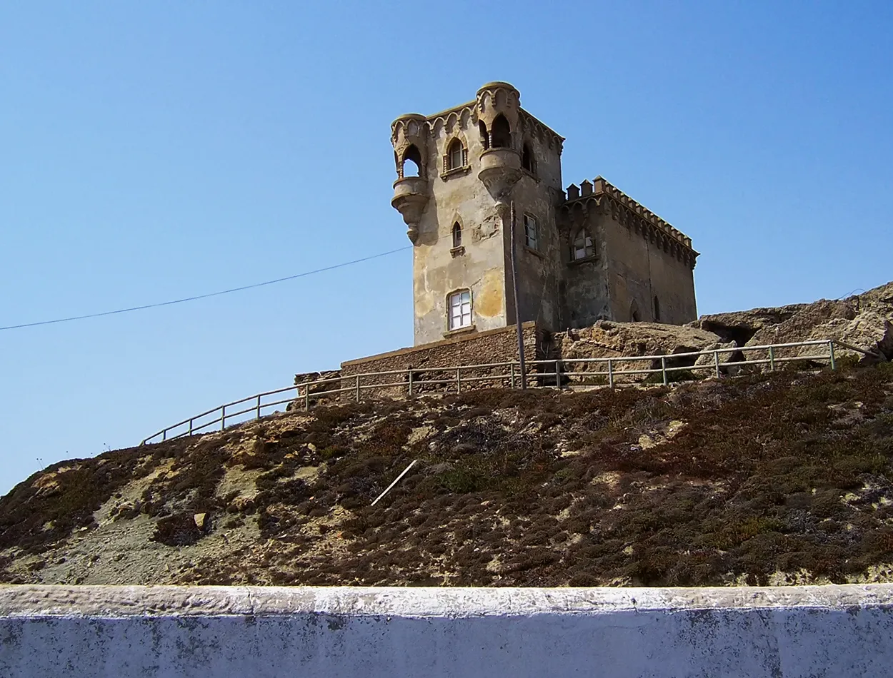
The streets led me to another of the main points of the city and its two walled forts, the Albarrana tower and the Taifa castle. History leaves a clear mark on this place, having been a Muslim military stronghold for a long period. It was the point where a large contingent of soldiers landed to begin what would be the conquest of the Taifa kingdom and the inclusion of the Iberian Peninsula in the Arab world.
Las calles me llevaban a otro de los puntos principales de la ciudad y a sus dos fortines amurallados, la torre Albarrana y el castillo de Taifa. La historia deja una clara huella en este lugar habiendo sido reducto militar musulmán durante un largo periodo. Fue el punto donde un contingente importe de soldados desembarcaron para iniciar lo que sería la conquista del reino de Taifas y la inclusión en el mundo árabe de la península Ibérica.
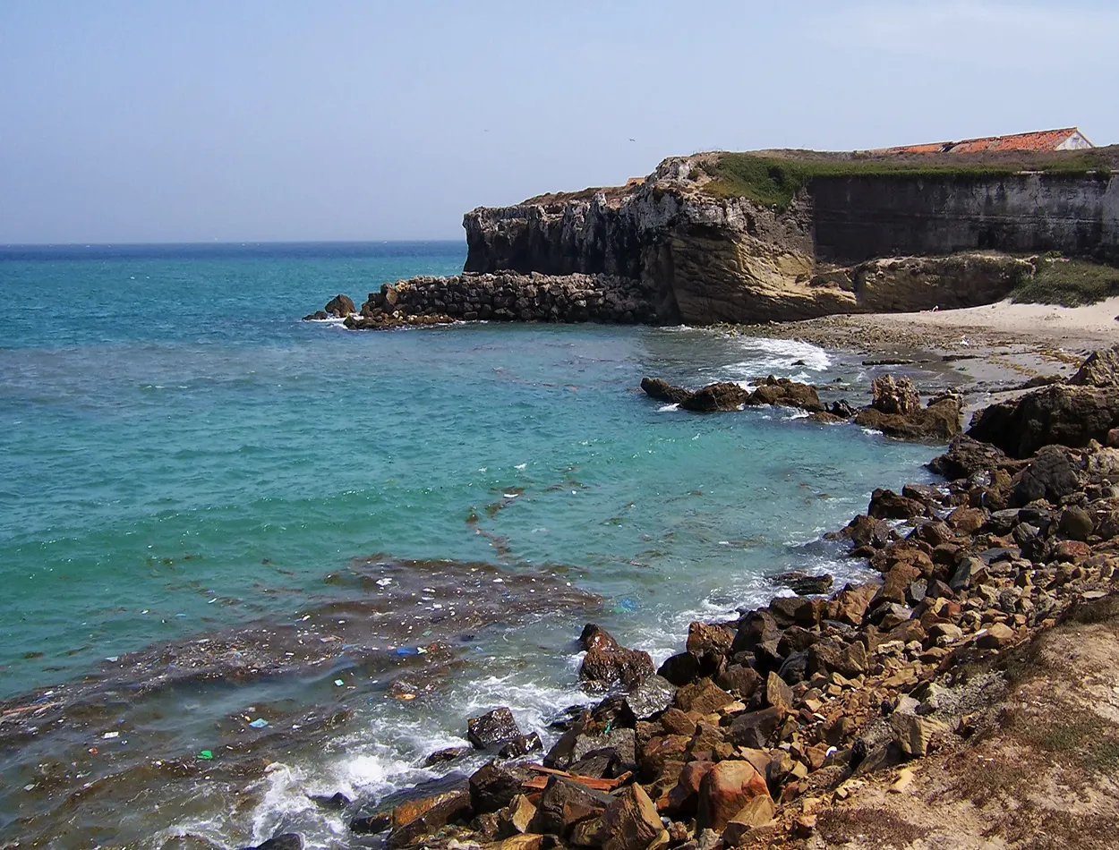
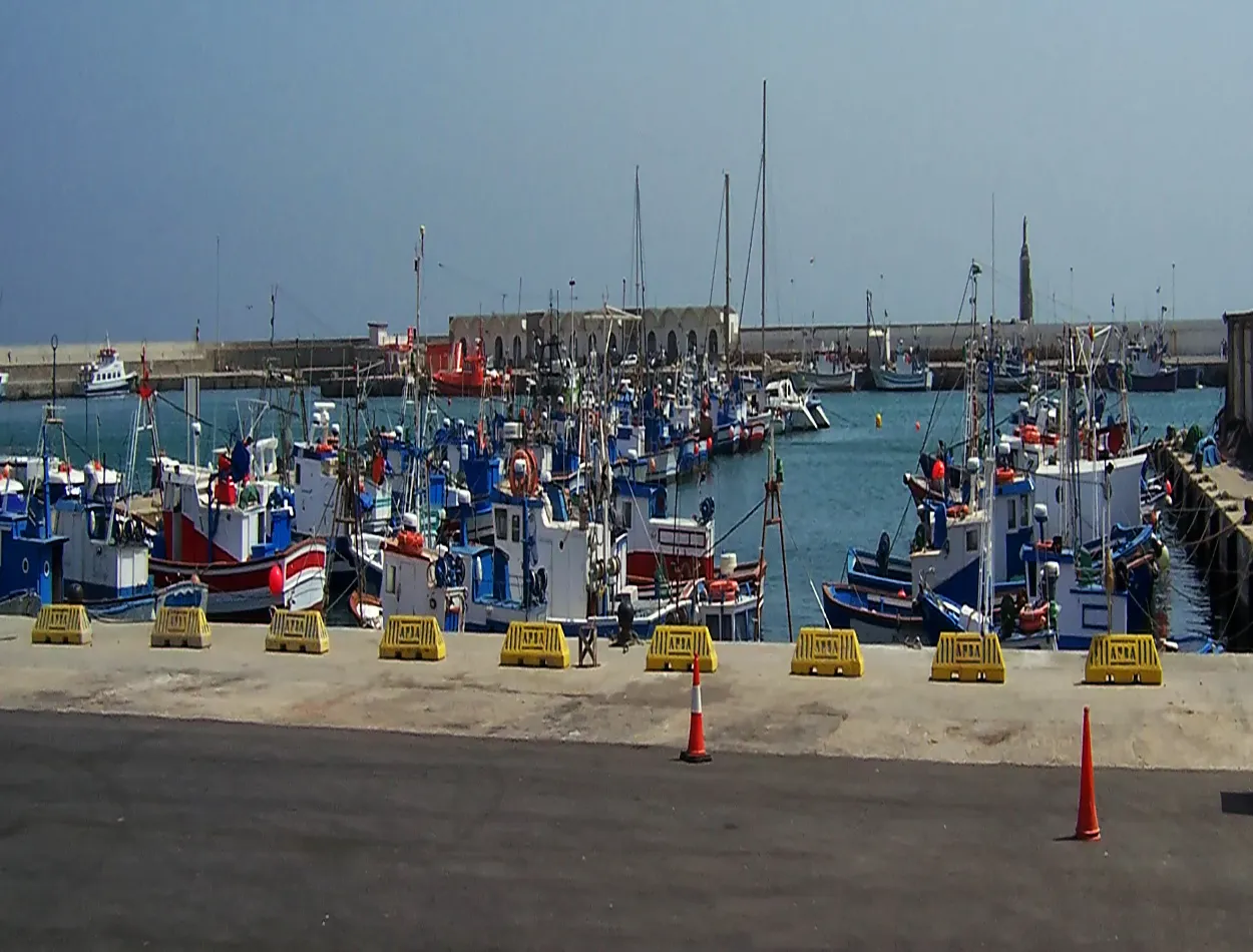
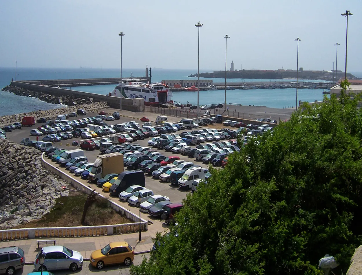
I headed towards the port and could see a great movement of ships transporting and making the route of the strait, crossing with those big ferries loaded with vehicles to the other continent. I was informing myself about how to make and the cost of that crossing since my intention was to cross the strait on future occasions to visit Ceuta, Melilla and the north of Morocco.
Me dirigí hacia el puerto y pude observar un gran movimiento de barcos que trasportaban y hacían la ruta del estrecho, cruzar con esos grandes Ferris cargados de vehículos al otro continente. Me estuve informando de cómo poder hacer y el coste de aquella travesía ya que mi intención era cruzar el estrecho en próximas ocasiones para visitar Ceuta, Melilla y el norte de Marruecos.
|

|

|
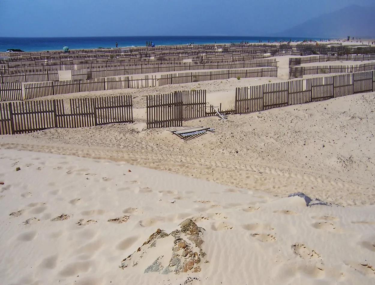
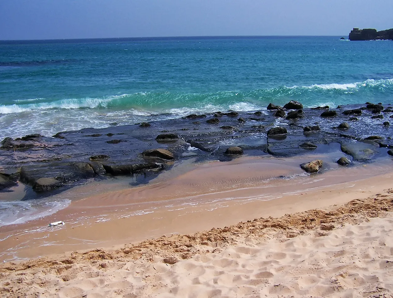
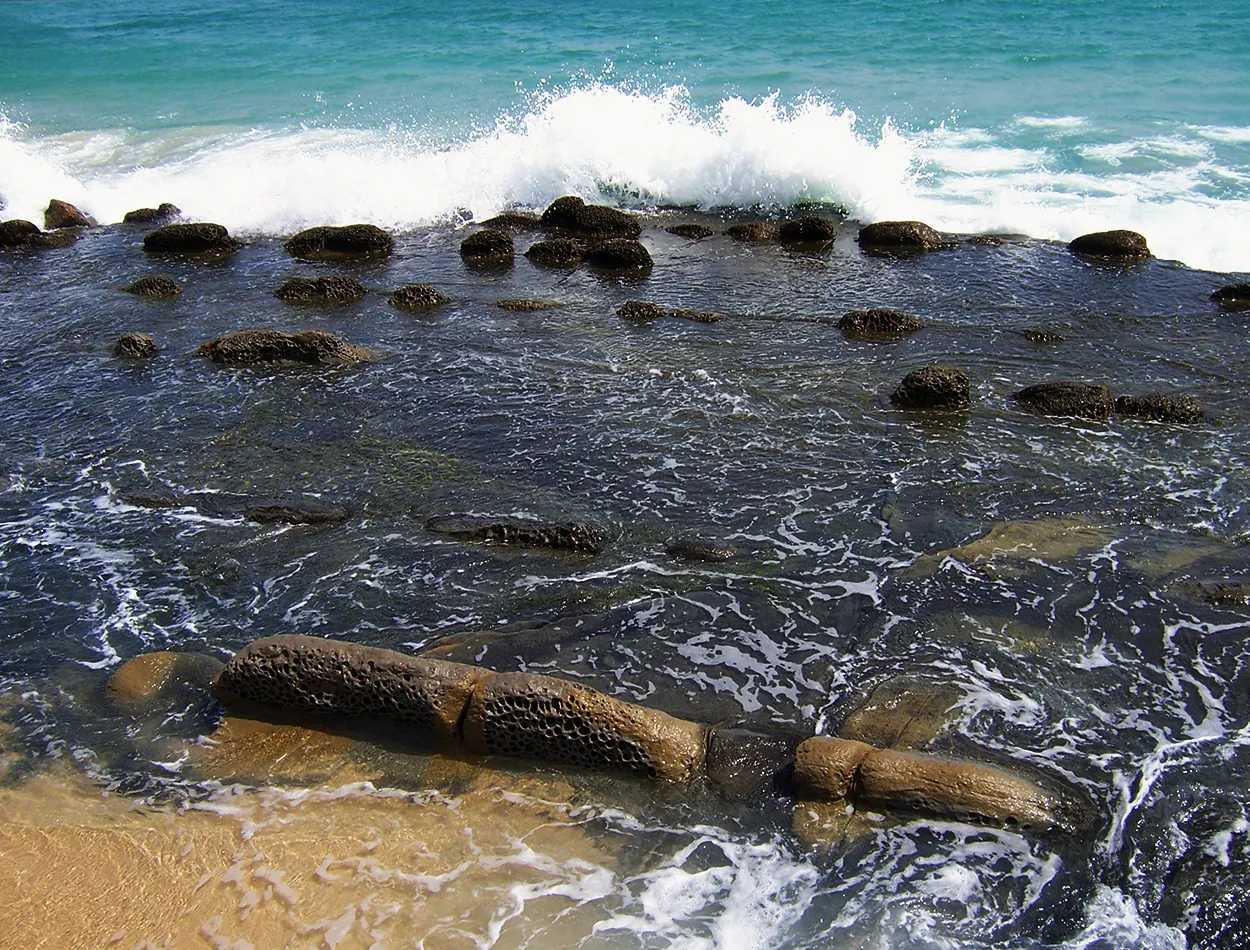
After walking along a stretch of land I wanted to reach the island of Tarifa, the southernmost point of the continent. At this point I realized that I was between two waters, between the Mediterranean Sea that began on my left and the Atlantic Ocean located on my right, the situation seemed very special to me. Blue waters and a beach and recreational area where surfers, divers and beach lovers could enjoy one of the best places to practice and enjoy an ideal place for it.
Después caminando por un brazo de tierra quería llegar a la isla de Tarifa, punto más al sur del continente. En este paso me percaté que estaba entre dos aguas, entre el mar Mediterráneo que comenzaba a mi izquierda y el océano Atlántico situado a mi derecha, la situación se me hizo muy especial. Aguas azules y una zona de playas y recreo donde los surfistas, submarinistas y amantes de las playas podían disfrutar de uno de los mejores lugares para la practicar y disfrutar de un lugar ideal para ello.


|
|

|

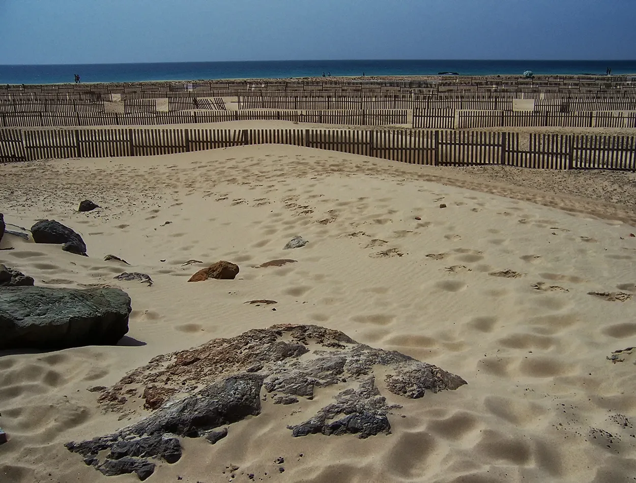
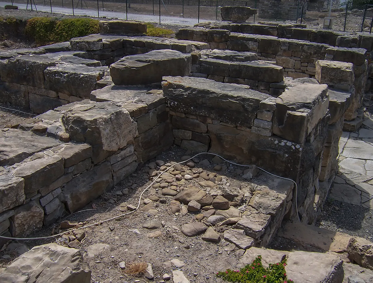
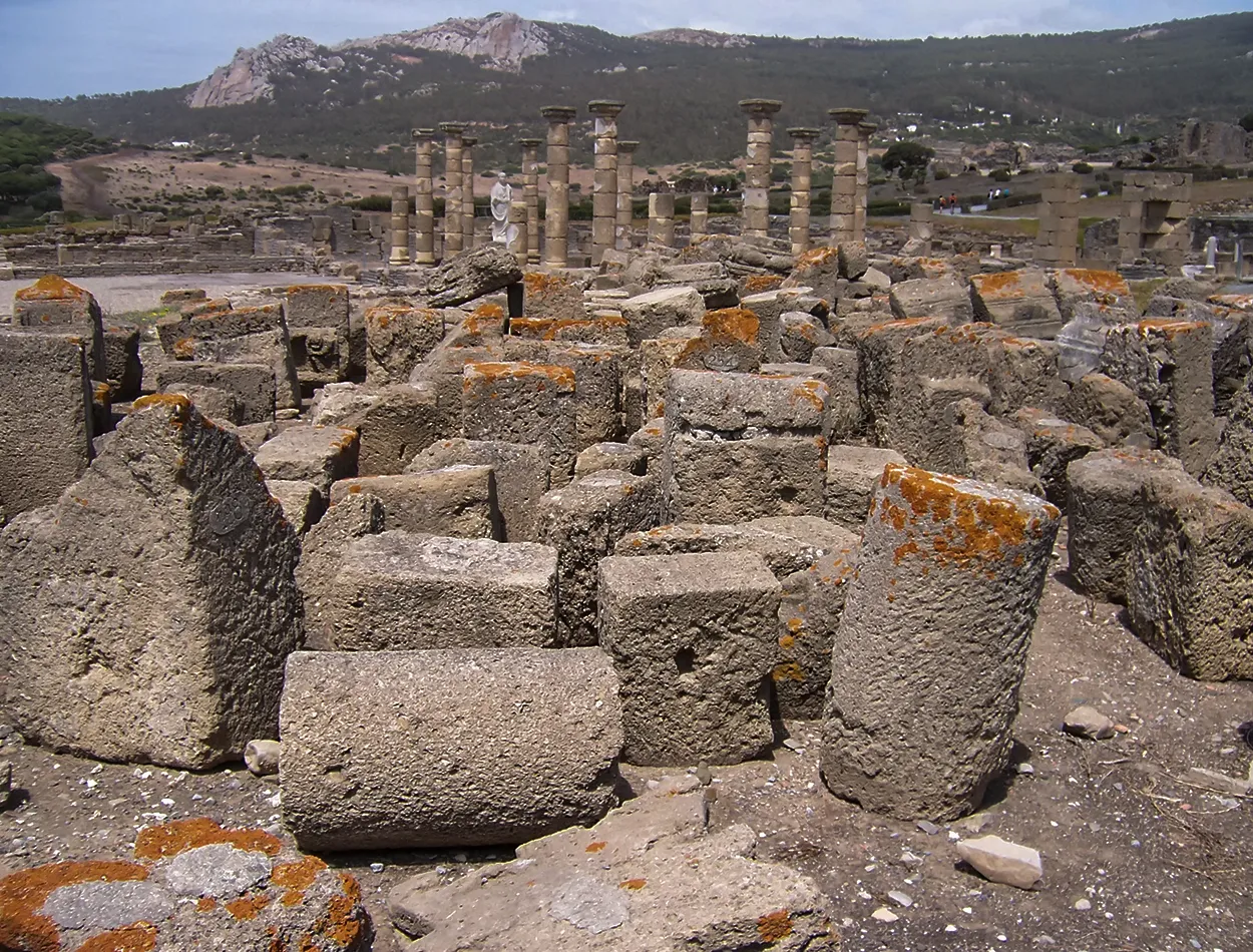
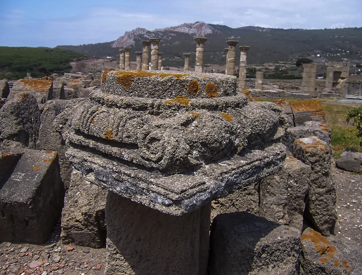
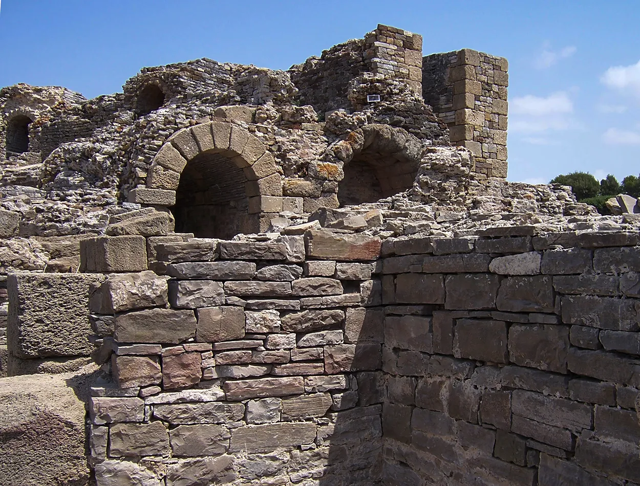
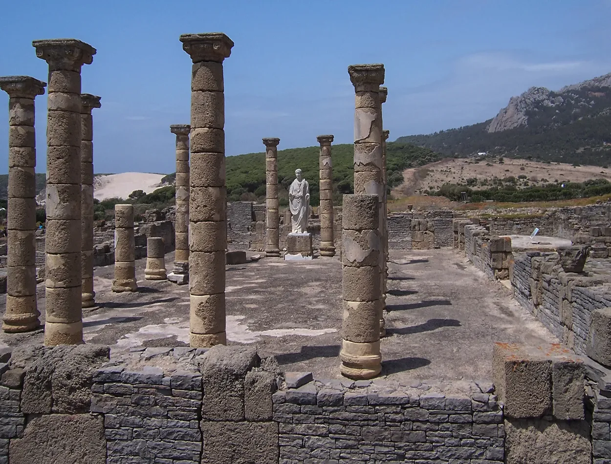
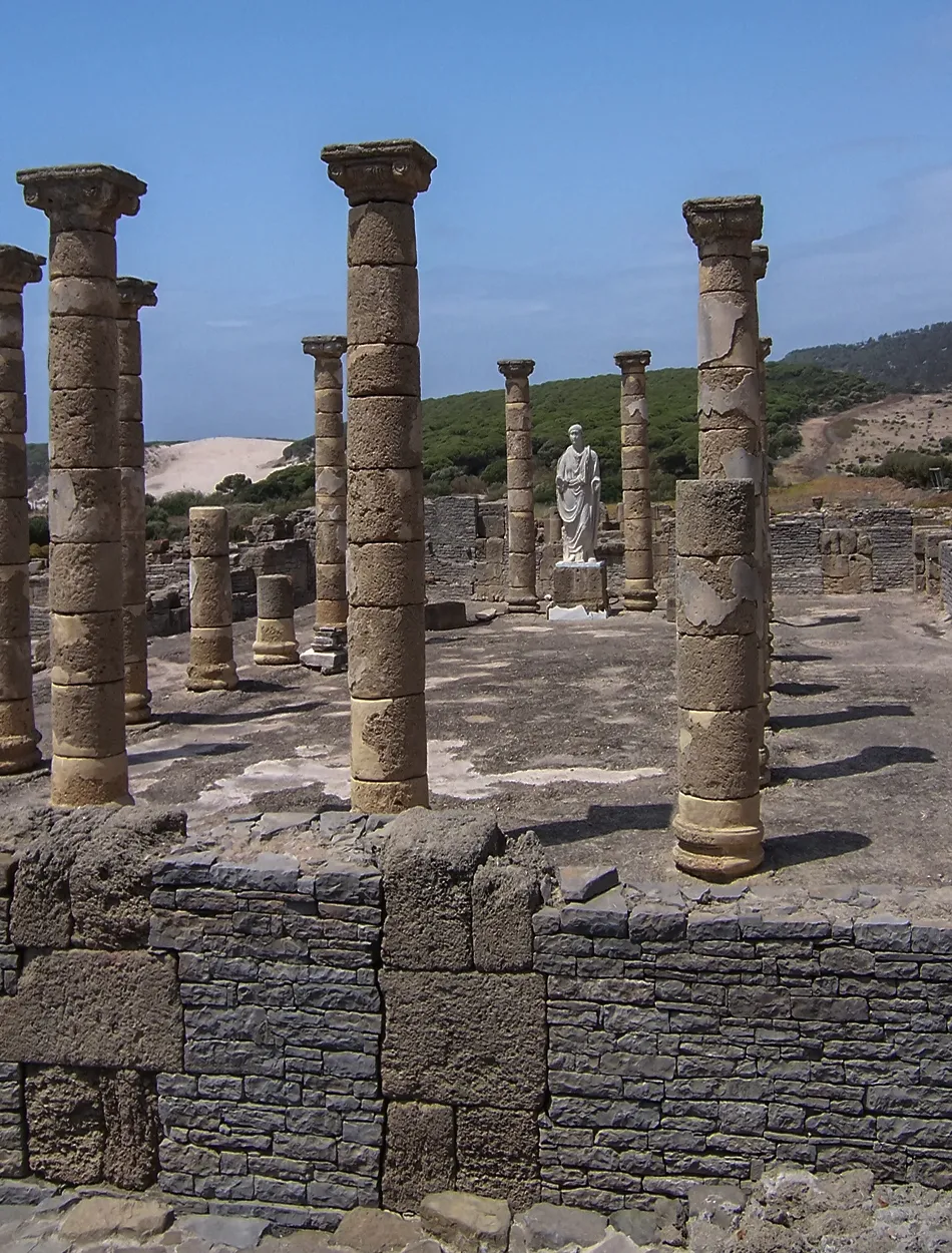
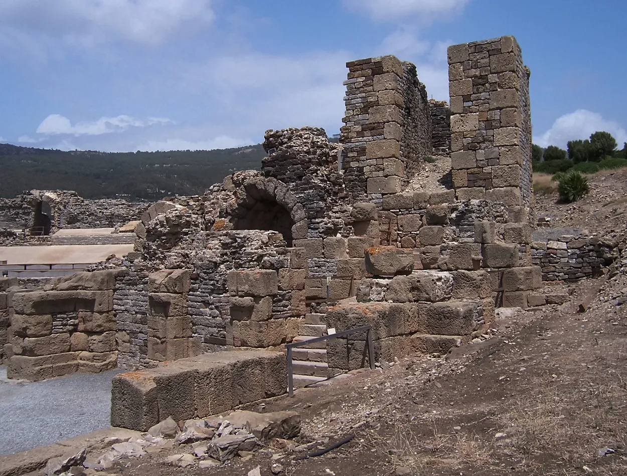
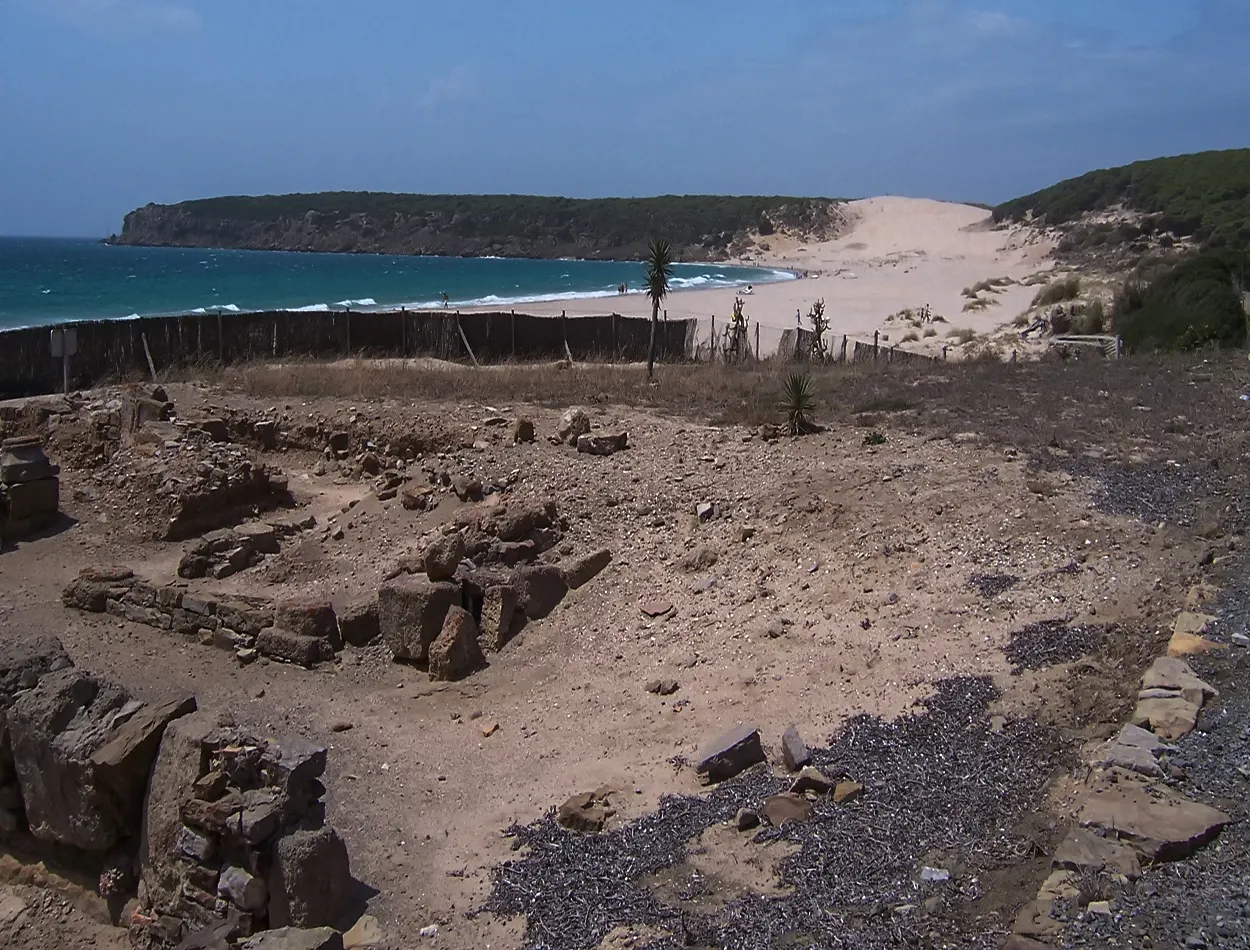
I couldn't leave the area without visiting the natural park of the Strait and the Bolonia Inlet, where there are some beautiful beaches and the remains of an important Roman city, "Baelo Claudia", located on the beach. An important military and economic enclave of the Roman Empire, which was destroyed by a tidal wave and only the remains that can now be visited remain. Its size is impressive and although a significant part of it has been lost, it still preserves the essence of what this important port hub once was.
No podía marcharme de la zona sin visitar el parque natural del estrecho y la ensenada de Bolonia donde hay unas hermosas playas y los restos de una importante ciudad romana “Baelo Claudia” situada a pie de playa. Un importante enclave militar y económico del imperio romano que por un maremoto que se produjo fue arrasada y solo quedaron los restos que ahora se pueden visitar. Impresiona su tamaño y aunque se ha perdido una parte importante de ella aun conserva la esencia de lo que un día fue este importe núcleo portuario.

|
|
|
Tarifa and Bolonia, their coast and history did not leave me indifferent in this adventure that I hope to continue towards lands further west, in the waters of the Atlantic Ocean. Today I share this experience with all of you in the #worldmappin project in which I participate, leaving a record of my experience on the world map. I extend an invitation to you to visit the beautiful places that I present to you. Greetings friends.
Tarifa y Bolonia, su costa e historia no me dejaron indiferente en esta aventura que espero continuar hacia tierras más al oeste, en aguas del océano atlántico. Comparto hoy esta experiencia con todos ustedes dejando constancia de mi experiencia en el mapa mundial. Les extiendo una invitación para visitar los bonitos lugares que les presento. Saludos amigos.

| Categoría | Phototalent |
| Ajustes | ISO-100 f/8 1/100s |
| Cámara | Nikon D7100 - Olympus E410 y Kodak Z |
| Lente | Nikkor or Olympus |
| Localización | Spain |
Image ©oscarps. All Rights Reserved.
Original content by @oscarps