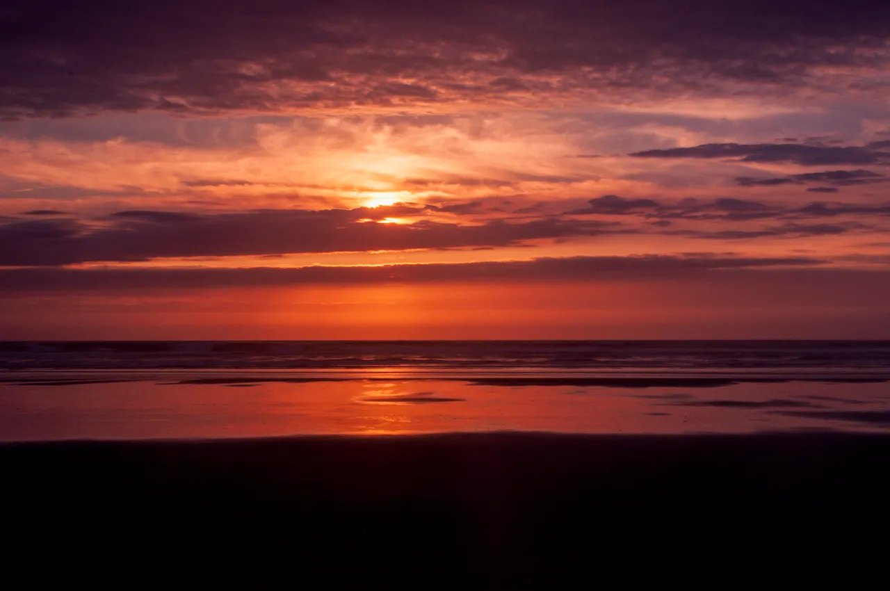
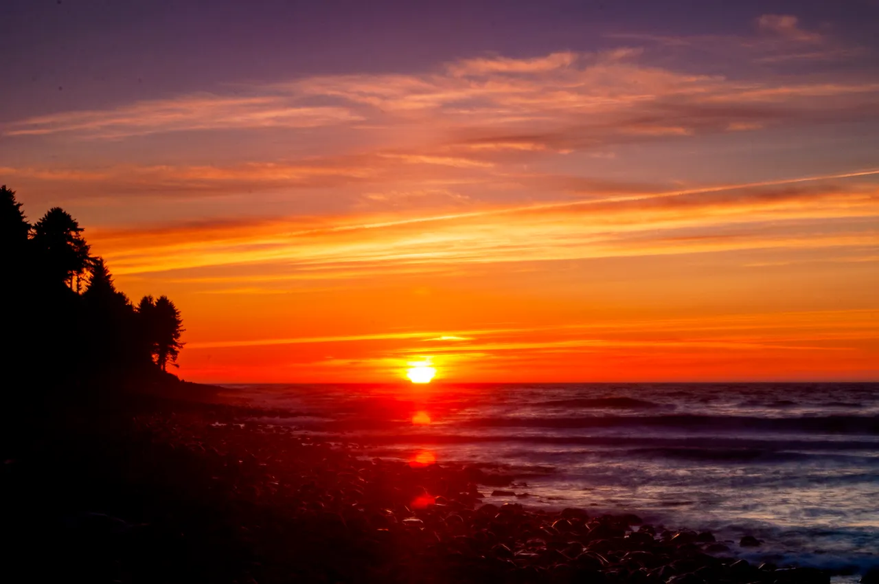
One of my favorite places from my travels is the little town of Seaside, Oregon. Located along Highway 101 and just south of the Columbia River and the Washington/Oregon border, I stopped there intending to stay a couple nights at the Seaside International Hostel. I ended up enjoying my time there so much that those two nights stretched into seven, Seaside proved to be and interesting little place and also made for a nice base of operations for exploring the surrounding countryside. Immediately upon checking in, I grabbed my camera and tripod and headed to the beach to try and catch the sunset.
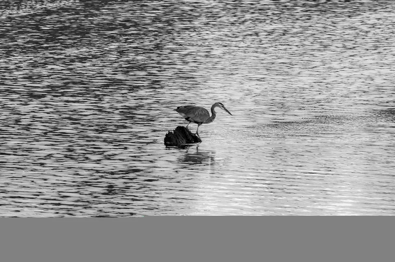
My biggest issue with Seaside was deciding what to do first. The hostel provided coffee, a cast iron skillet and the makings for you to fix pancakes so you always got your day started off right. There's a river that runs along the back of the hostel property and one morning I happened to be back there to catch this critter snagging some breakfast as well.
One of my adventures during my stay in Seaside involved a return to Astoria and a bit of exploration there. Astoria is actually the first town you come to when you cross into Oregon from Washington on the 101. The town used to mostly be built on stilts and pilings over the river but it kept burning down so they eventually dredged the river to make some flat land along the river's edge. A decent bit of the town is built on the steep hills rising up from there and at the top of one is the Astoria Column, which is where I started my adventure.
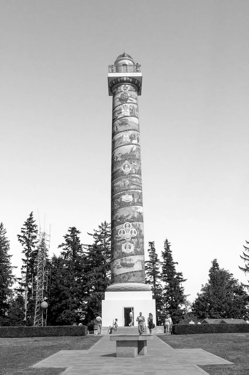
The column is 125 feet tall and you can climb the stairs inside to the observation deck at the top. It is also on the National Register of Historic Places but I was there primarily for the views afforded by the observation deck. From the observation deck you can see for miles in any direction, it definitely makes all the stair climbing worthwhile.
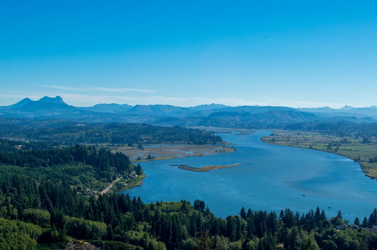 View looking south from the observation deck
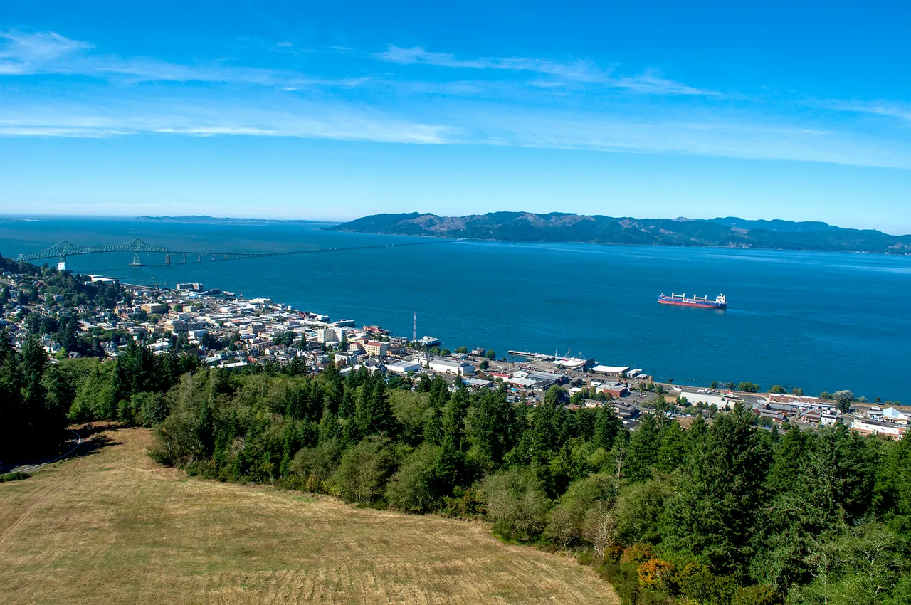
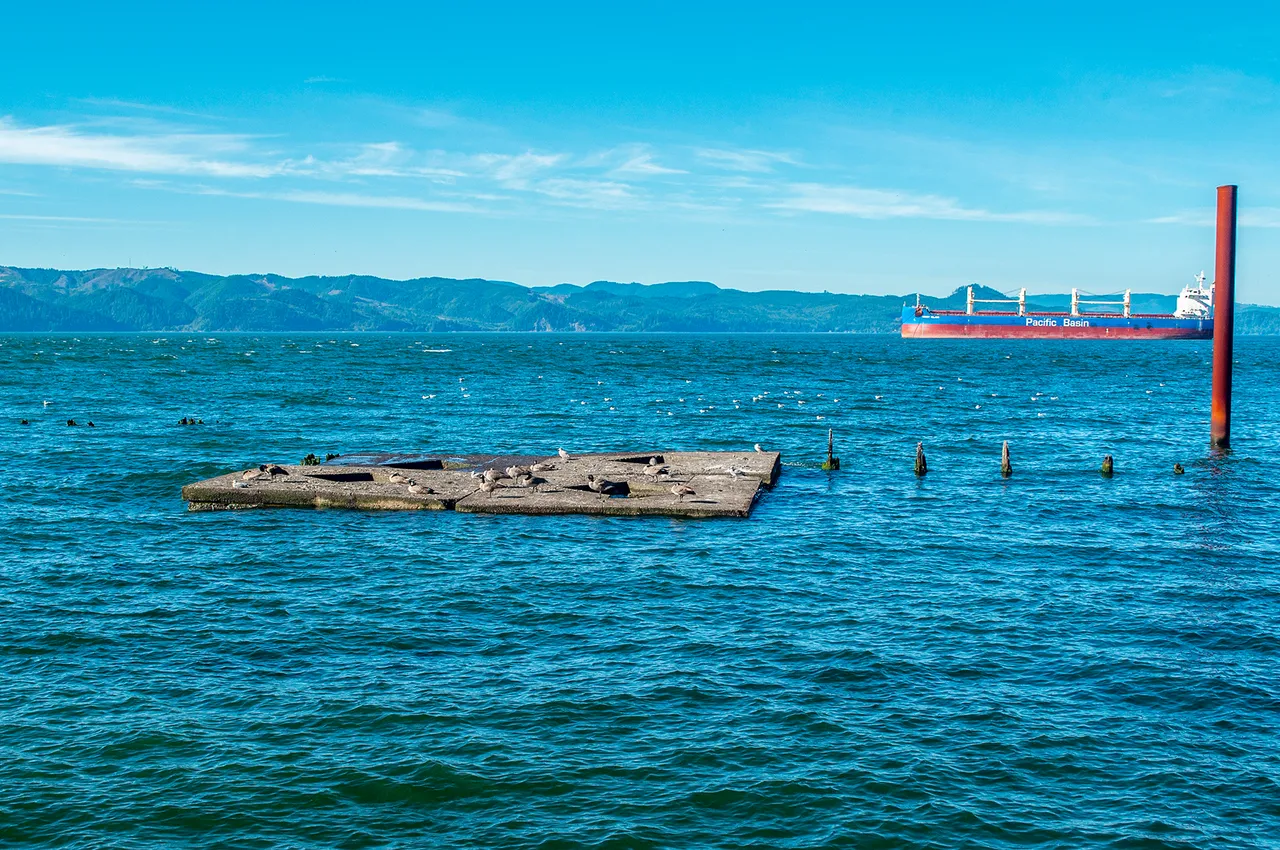
View looking west from the observation deck. Astoria lies below, with a cargo ship waiting either tides or a pilot to cross the Columbia River Bar and head out into the ocean. The bridge in the distance is the one that carries Highway 101 across the Columbia from Washington.
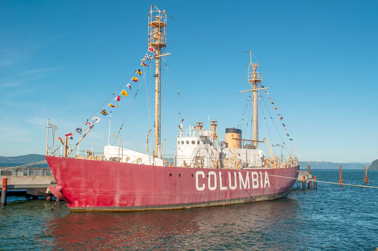
The Columbia River Bar is the treacherous stretch where the Columbia River crashes into the Pacific Ocean. Thousands of ships have sank in the area over the years, earning it the nickname Graveyard of the Pacific. Until it's retirement in 1979 the lightship Columbia (pictured above) helped to guide ships across the bar, serving in place of a lighthouse.
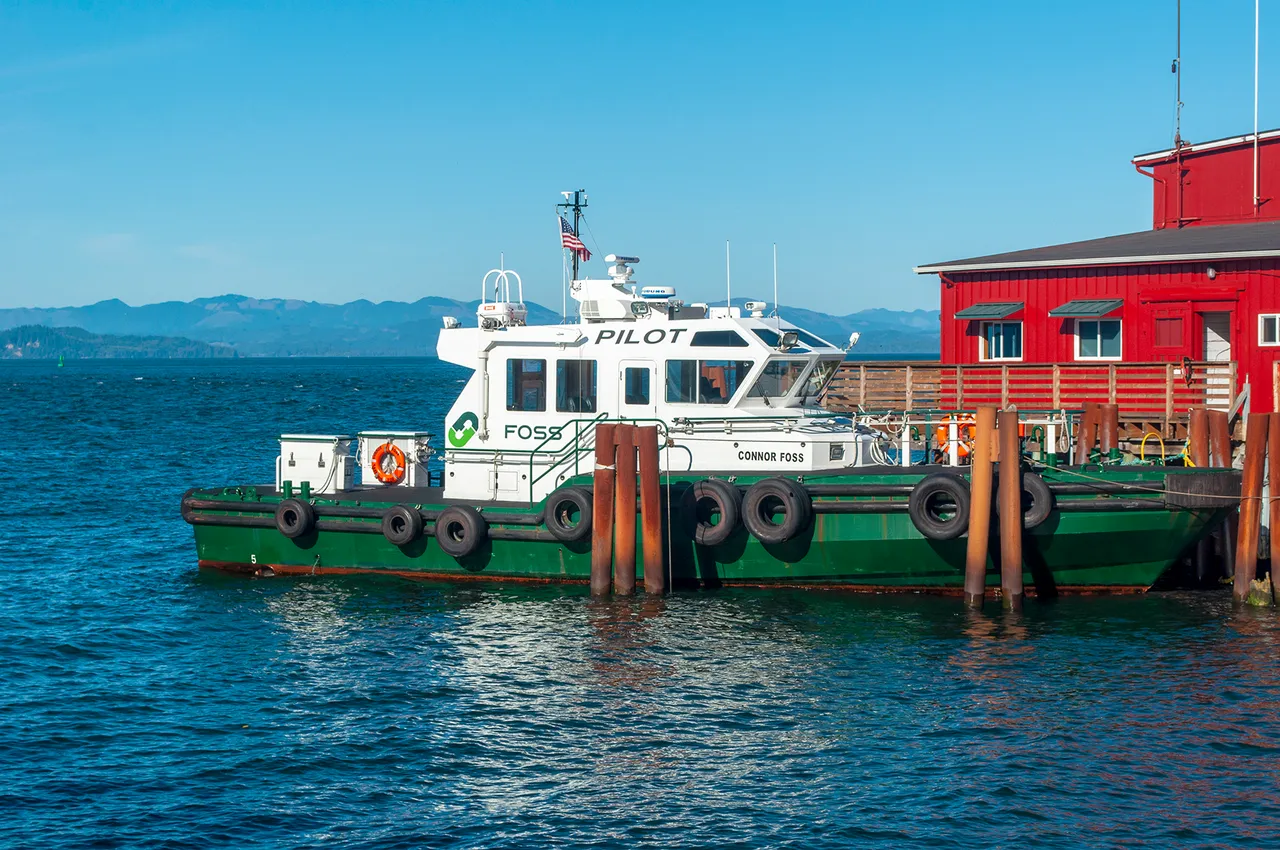
To sets of pilots are required for a cargo ship like the one pictured earlier to get to or from its destination, one to get across the bar and another to guide the ship up or down river. After leaving the column I went down to the riverfront and wandered Astoria for a bit. There's a maritime museum (I didn't go in there but it looked interesting) and the Columbia is docked outside. Wandering along from there I got to see one of the boats for the river pilots as well as some interesting remnants of old structures.
I could have spent so much more time in Astoria wandering around and taking in the sights and snapping photos but everything else I wanted to do was calling to me so I eventually called it quits and headed back to Seaside. I got back with enough time to grab some vittles and scoot on down to the beach for another sunset.
Fort Clatsop was the fort built by the Lewis and Clark Expedition for the winter of 1805-06, after they had finally made it to the Pacific Ocean. Lewis and Clark met up here in Louisville, Kentucky for the expedition, today there's parks, statues, and memorials dedicated to them all over the area. When I found out that Fort Clatsop National Historic Park is located just a little off the 101 between Astoria and Seaside, just a few minutes drive up the road from my hostel I couldn't pass up the opportunity to visit.
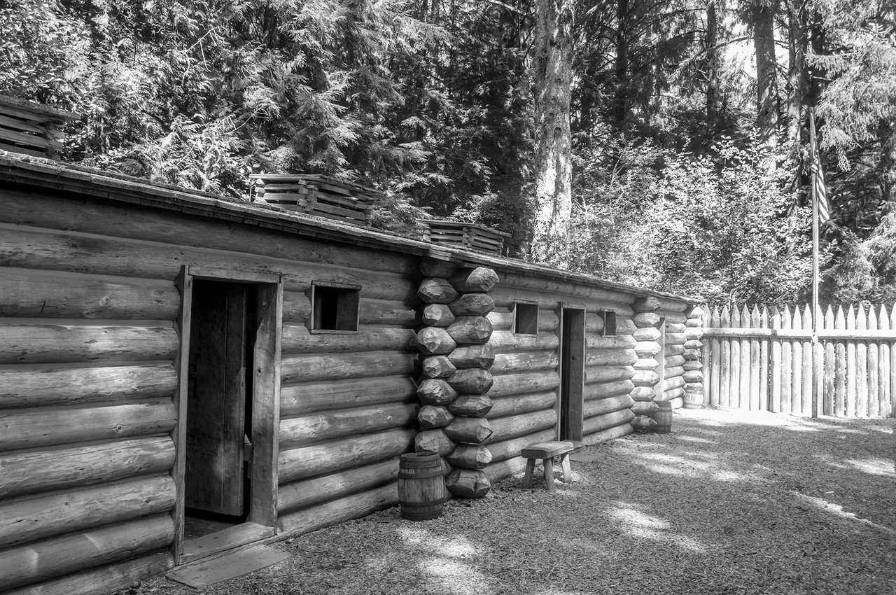
The original fort did not survive the wet weather of that neck of the woods and the first reproduction of it was mostly destroyed in a fire, what you're looking at is the second reproduction of it, built in 2006. The expedition stayed at the site for a little more than a hundred days and it apparently rained for the overwhelming majority of those.
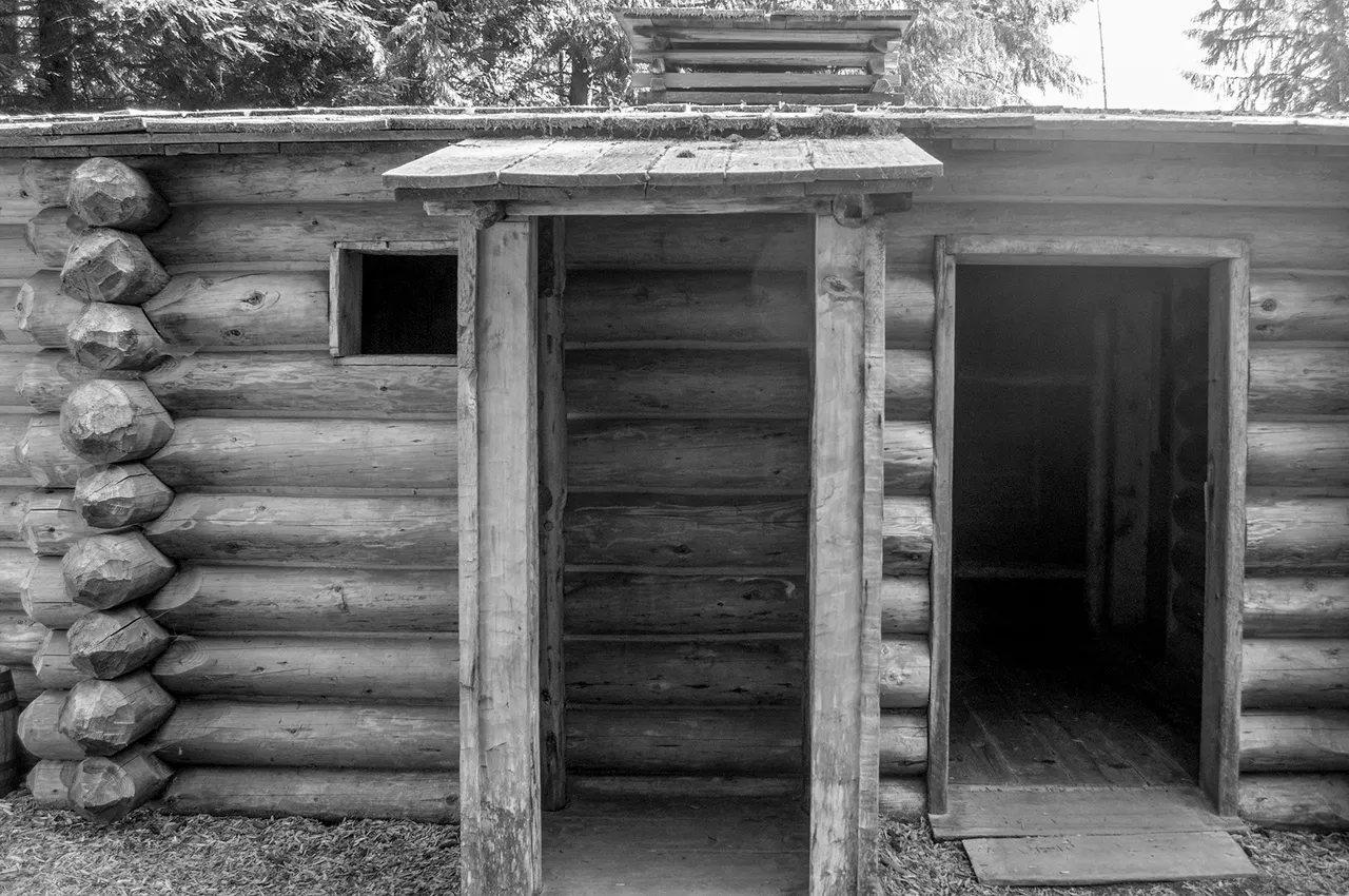
The fort was on the rough and ready side, in the photo above you can see one of the sentry posts (is it just me or does it bear a more than passing resemblance to the old school bus stops?). Apparently the expedition were quite eager to leave the fort, I know I wouldn't be especially thrilled about experiencing a Pacific Northwest winter there.
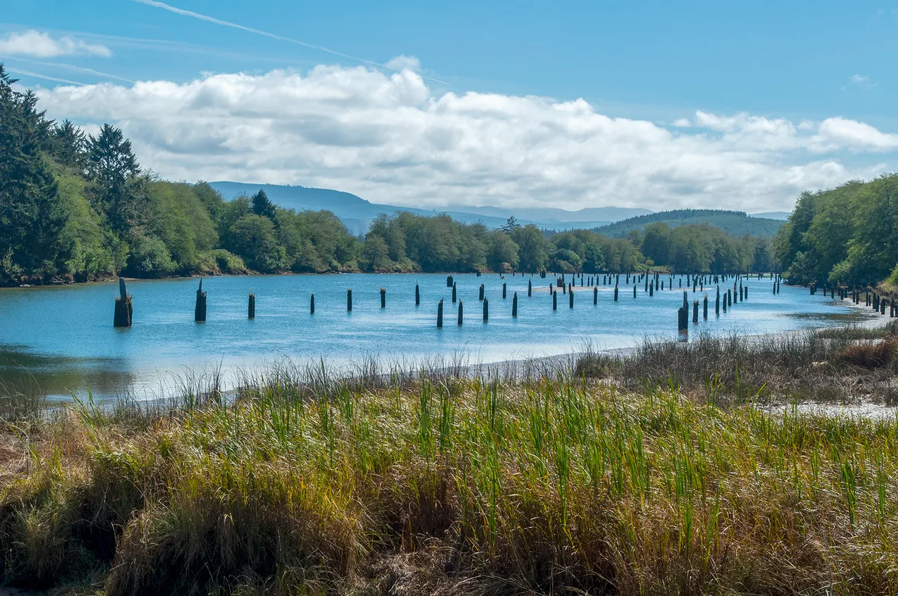
I did a bit of wandering in the area surrounding Fort Clatsop, the photo above is from that. Logging used to be a major industry in this area, those pilings you see sticking up out of the water are remnants of those operations. They're old Douglas-fir trees that are up to 60 feet long and embedded up to 20 feet into the river bottom. These here were used during the log sorting and raft building process.
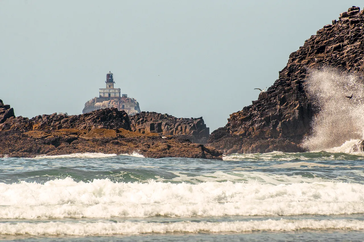
Tillamook Head is located between Seaside and Cannon Beach, the next town down the 101. The landmass in the first photo of this post is Tillamook Head, which rises to about 1,200 feet above sea level. I spent a couple days of my time in Seaside exploring Tillamook Head and its environs. There's a trail across it (part of the Pacific Coast Trail) that will take you through Ecola State Park and into Cannon Beach to the south. The lighthouse in the photo above is Terrible Tilly, which you can read more about here.
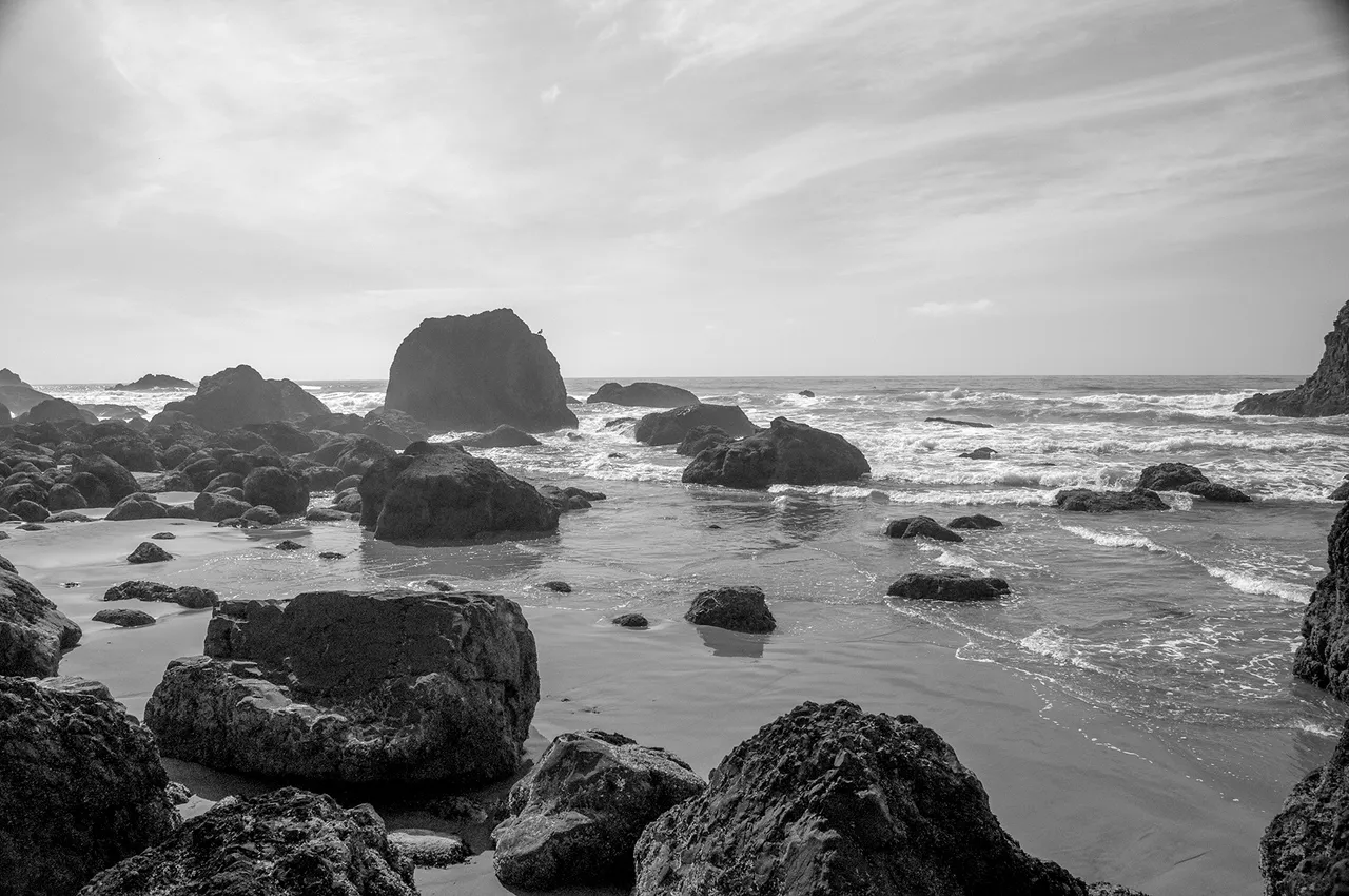
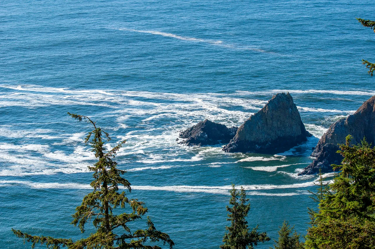
Rather than hike the trail all the way through (and wind up 8 miles away from my car in another town) I split it up and hiked halfway in from both directions. I took my time and spent two days exploring, playing amid the rocks on the beach in Ecola State Park (photo above) and on the heights of the head.
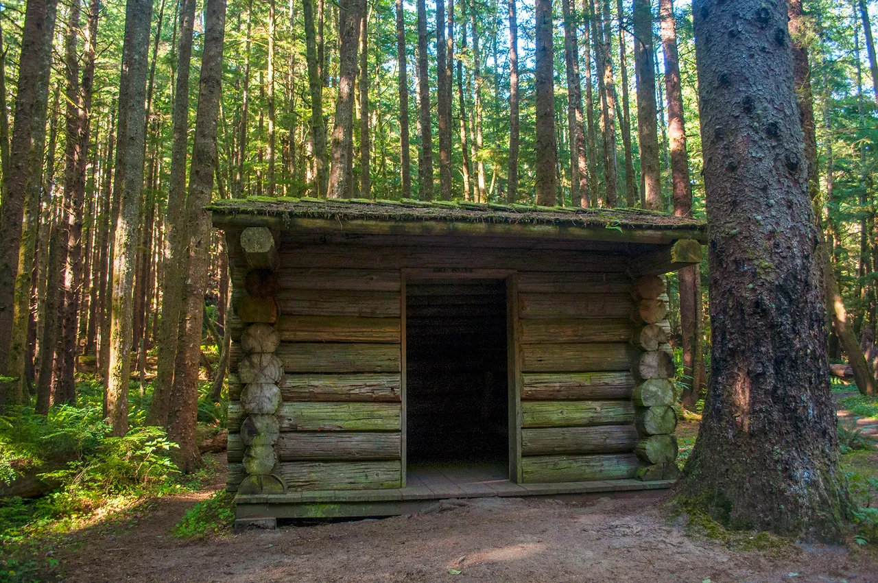
The cabin in the photo above was for thru hikers on the PCT but also made for a nice place to stop and eat a bite. There's an old WWII bunker nearby but all you can do is look at it from the outside, it's not open to the public. Near the cabins (there were 3 or 4) was the best lookout point on the head that I found, these next two photos are looking down from there.
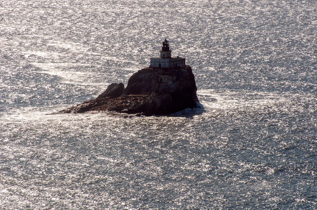
It's Terrible Tilly!
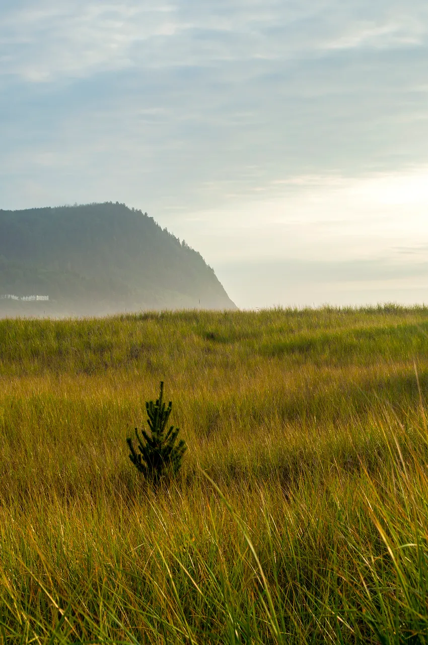
A couple miles up the road from Seaside is the little town of Gearhart, it was recommended to me that I stop at the Pacific Way Cafe and Bakery there and get a bowl of clam chowder, which I did on my way to Astoria. That turned out to be some of the best clam chowder that I've had. Before leaving Gearhart I went and wandered along the shore for a bit, the photo below if from Gearhart, looking out over the dunes and the Pacific. Although I couldn't get my camera out in time to snap a shot I did see several elk wandering about the dunes which surprised me. It hadn't occurred to me that they might be fond of that environment too but they seemed to be right at home. Apparently the Lewis and Clark Expedition ate so much elk during their time at Fort Clatsop that they became sick of it but I didn't see that many walking around.
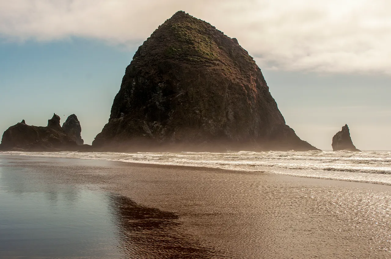
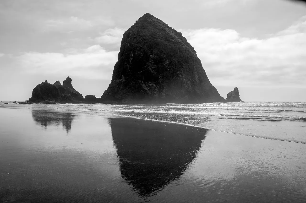
No trip to the area would be complete without photos and the visiting of Cannon Beach to see Haystack Rock and the other sea stacks just off the coast. I found myself returning to Cannon Beach repeatedly, it's a lovely and beautiful town and beach. I was quite amused wandering around the town, I kept noticing 'historic markers' noting when this building or that was built. I found it amusing mainly because none of the buildings dated back to no ealier than the 1920s.
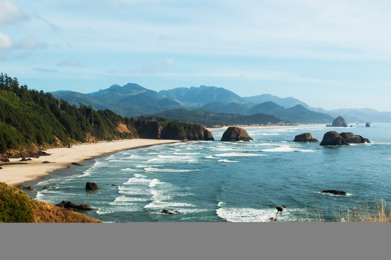
The photo above is looking south towards Cannon Beach from Ecola State Park. The large rock just offshore the furthest back and to the right is Haystack Rock. Haystack Rock appears in a couple movies, including the Goonies.
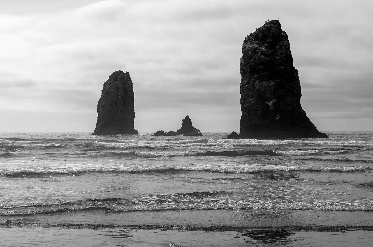
The other sea stacks around Haystack Rock are collectively referred to as the Needles, below is a couple of those.
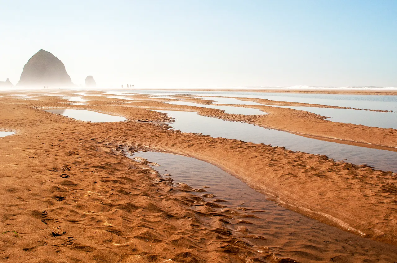
There's so much to see and do around Seaside, I feel like I'm leaving plenty out but this post has gone on quite long enough. I will leave you with one last photo of Haystack Rock and one last suggestion. If you happen to find yourself in the area and what some good seafood, check out the Bell Buoy of Seaside. It's a bit of a hole-in-the-wall but it has some of the best seafood I've had on the west coast, I stumbled upon it by asking the locals where they went to get seafood. They pointed me towards it and it did not disappoint! It's also strategically located across from a dispensary so you can fill up on all kinds of good things with just one stop.
Until next time, safe travels y'all!