This post is about my visit to the well known Dinorwig Quarry in North Wales. The quarry dates back to 1787, and it was operational until 1969. It's a remarkable place - a huge scar in the landscape from centuries of slate mining. In 2021 it was awarded UNESCO World Heritage Status. It is a great location for moody photography, so I was really excited to be back in North Wales with my camera. The weather was absolutely glorious during our stay, which was not what I had in mind for this location. So instead, my husband and I had a enjoyable hike in the mid-afternoon sunshine.
The distance (according to Strava) was 3.8 miles, with 862 feet of climbing. It's not a particularly challenging hike. We were lucky to be given a lift to the base of the 'zig zags' path, at the bottom of Llyn Peris lake. If one is starting the walk from Llanberis, it's about a 40 minute flat walk along the road on the south easterly side of the lake (there is a good pavement), to get to the beginning of the path.
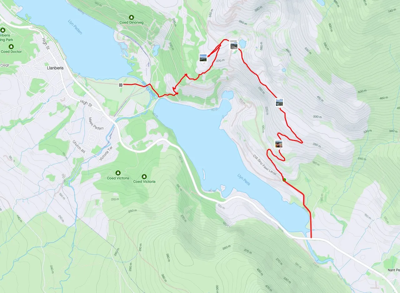
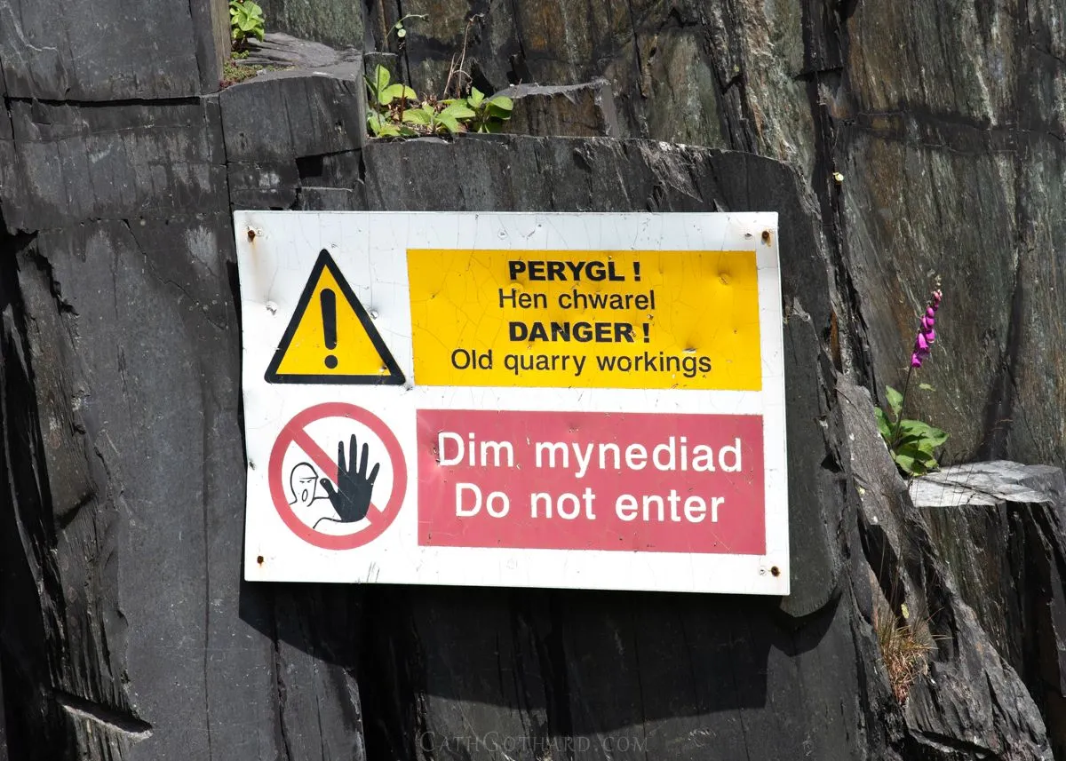
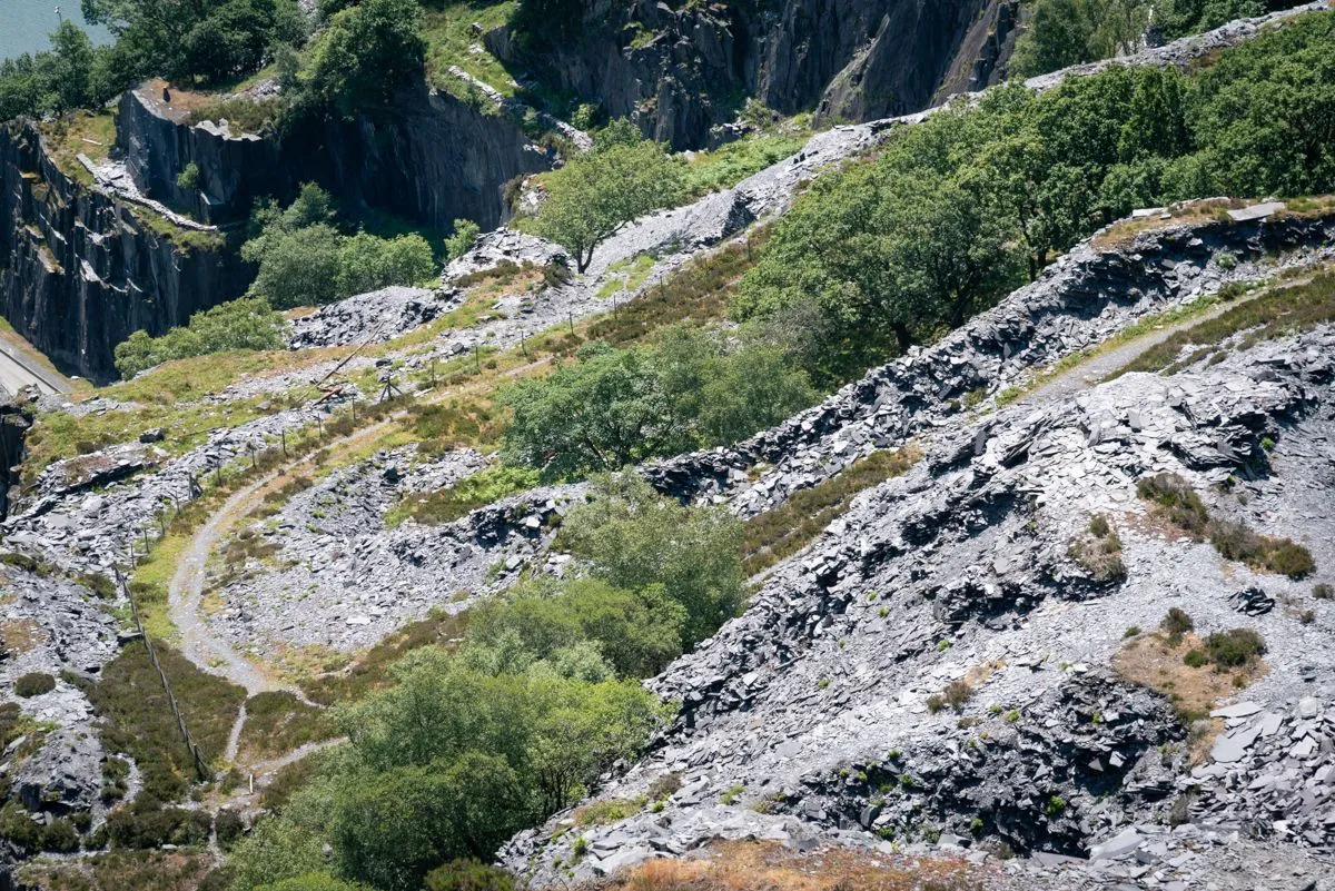
One thing that is really obvious is that the quarry is no where near as open as it used to be. The first time I came here it was easy to wander around, and everything seemed quite accessible. There is a designated path now, and there are signs requesting that people do not stray from the pathways.
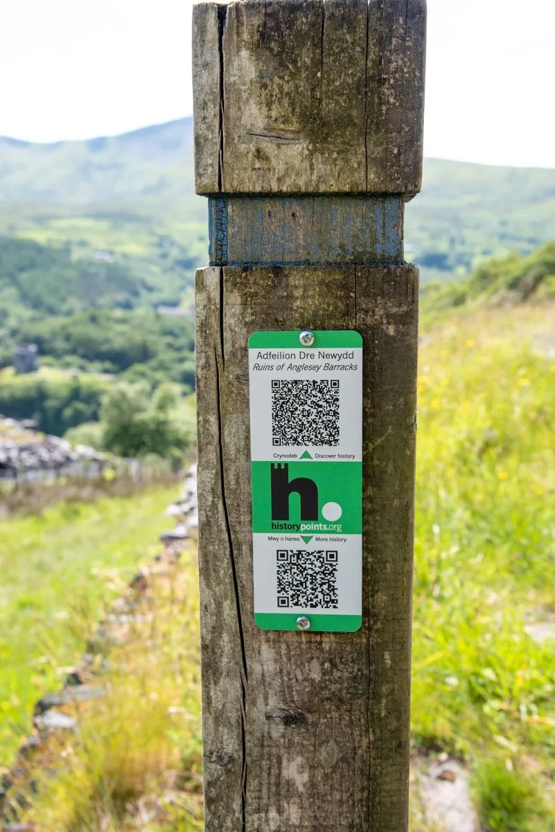
There are lots of information points on the fence posts that have QR codes, dotted around the hike. Here's an example of one of them. It's very cool that there are 2 versions. The top one can be read on a smart phone without internet access, and below, a more detailed web version is available.
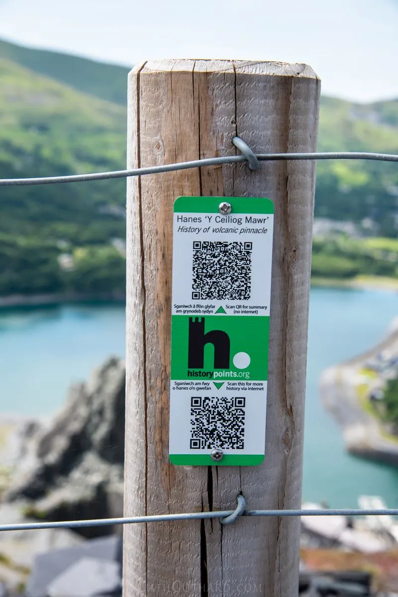
Here's the link to the lower web version from this particular information point.
https://historypoints.org/index.php?page=ceiliog-mawr-pinnacle-llanberis
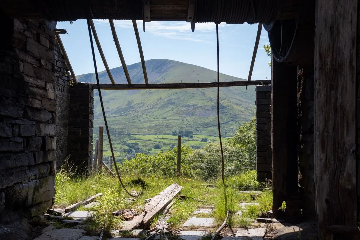
And below, is a photo of the view that it is referring to.
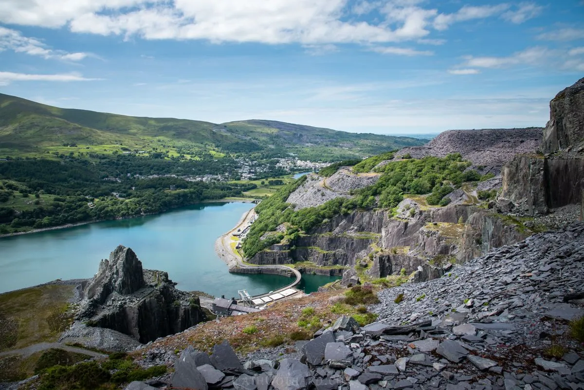
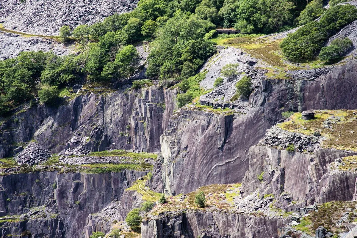
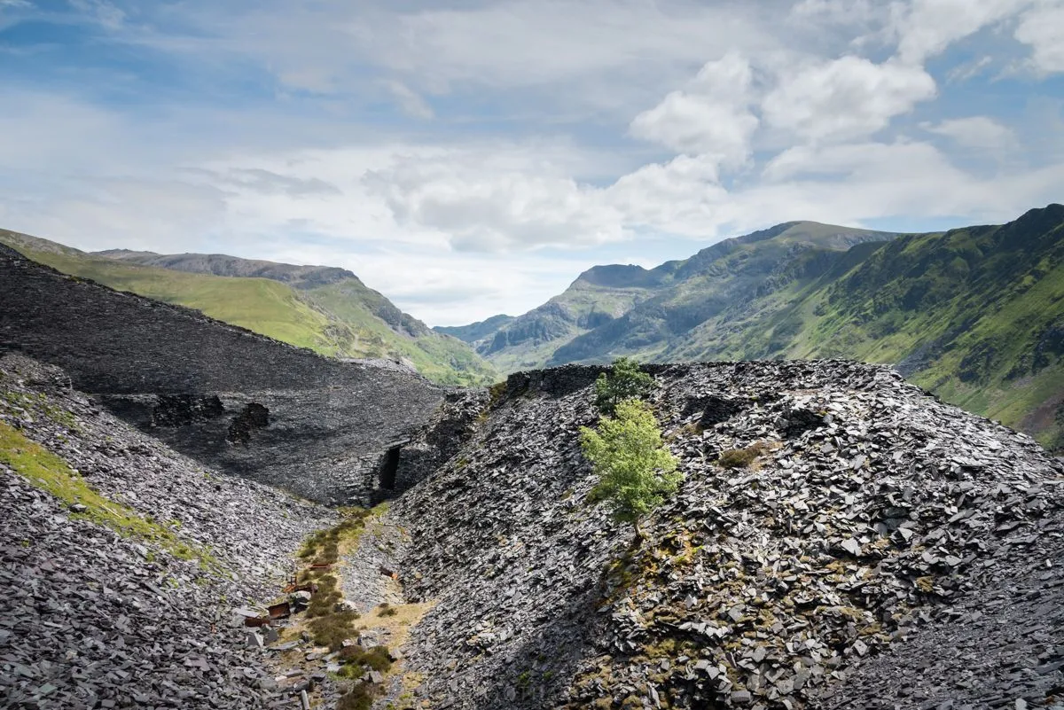
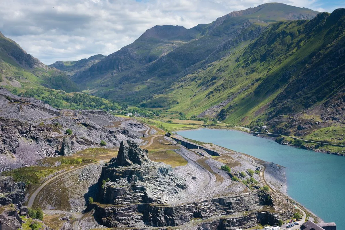
The scenery is very striking, and it's hard to comprehend just how much stone has been removed from this mountainside. It's a huge gouge in the landscape. Nature is fighting back, and there are trees and greenery growing in every corner of the quarry that isn't bare rock.
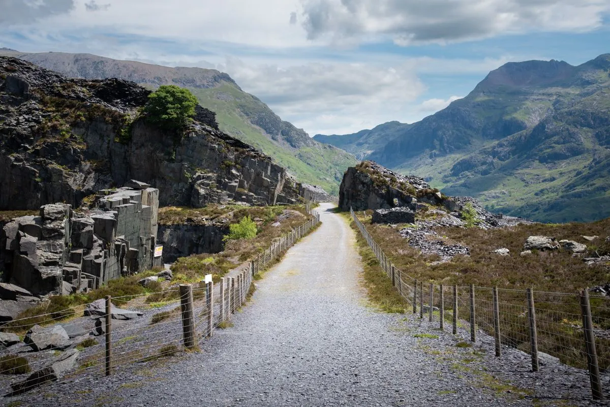
As one ascends further up the pathway, bigger views are available up the mountain pass.
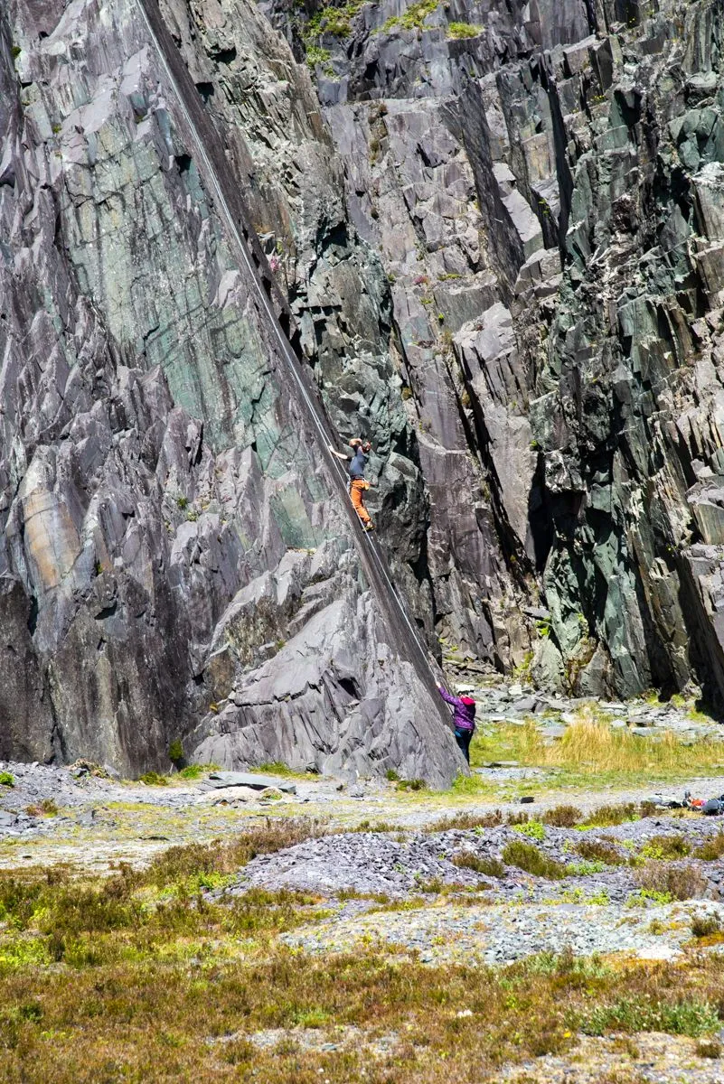
One of the many signs requesting that people do not enter beyond the fences.
That being said, these climbers were beyond one of the 'Do Not Enter' signs.
The view looking down.
Looking across the lake in the direction of Snowdon.
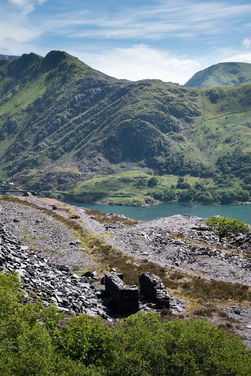
There is a viewing platform at the highest point of the walk. This photo below was taken looking back in the direction from where the walk started. The bottom of the 'zig zag' path can be seen at the end of the lake. The summit of Mount Snowdown (the highest mountain in Wales), is top right in the frame.
From the viewing platform we took the pathway down one of the old disused railway tracks.
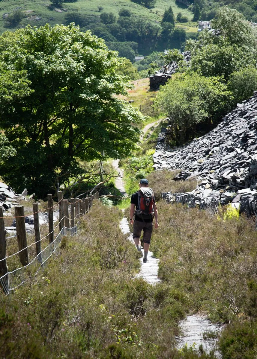
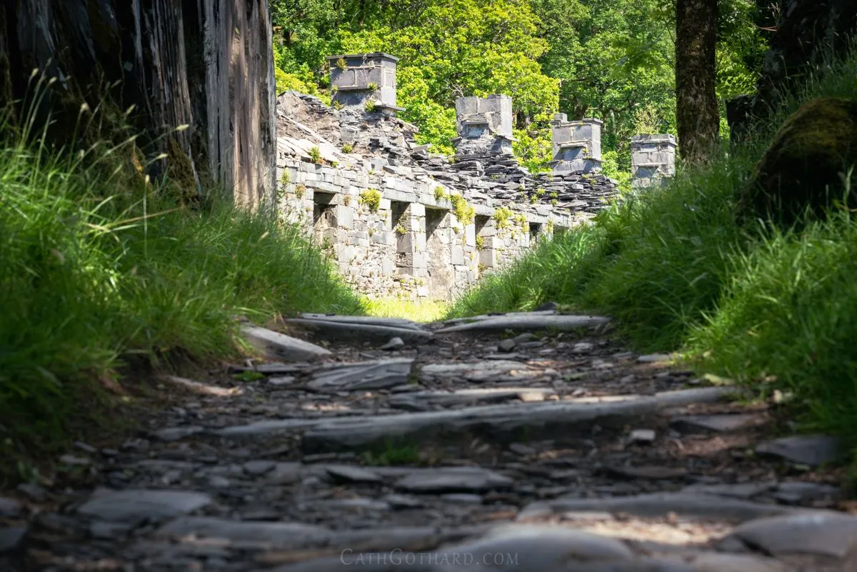
Half way down the decent are the Anglesey Barracks.
https://historypoints.org/index.php?page=ruins-of-the-anglesey-barracks-dinorwig
These barracks used to house the miners who lived too far away to travel to the mine every day. This spot is popular with photographers, but the blue sky weather didn't really lend itself to the usual composition that I see on Instagram. Instead, I went for my own take on this well photographed scene.
Continuing the decent along the path, through some beautiful old oak woodland, we arrived back at lake level. From here it is a short walk back into the town of Llanberis, along the shore of Llyn Padam.
I can be found on...
Instagram: https://www.instagram.com/cathgothard/
Website: www.cathgothard.com