Трошки зимно ще на дворі, не дивлячись на те, що сьогодні восьме березня погода зовсім не весняна, йде сніг і досить холодно. Тому покажу фото літнього Києва, які були зроблені в минулому році.
It is still a bit cold in the yard, despite the fact that today, March 8, the weather is not spring at all, it is snowing and quite cold. Therefore, I will show photos of summer Kyiv, which were taken last year.
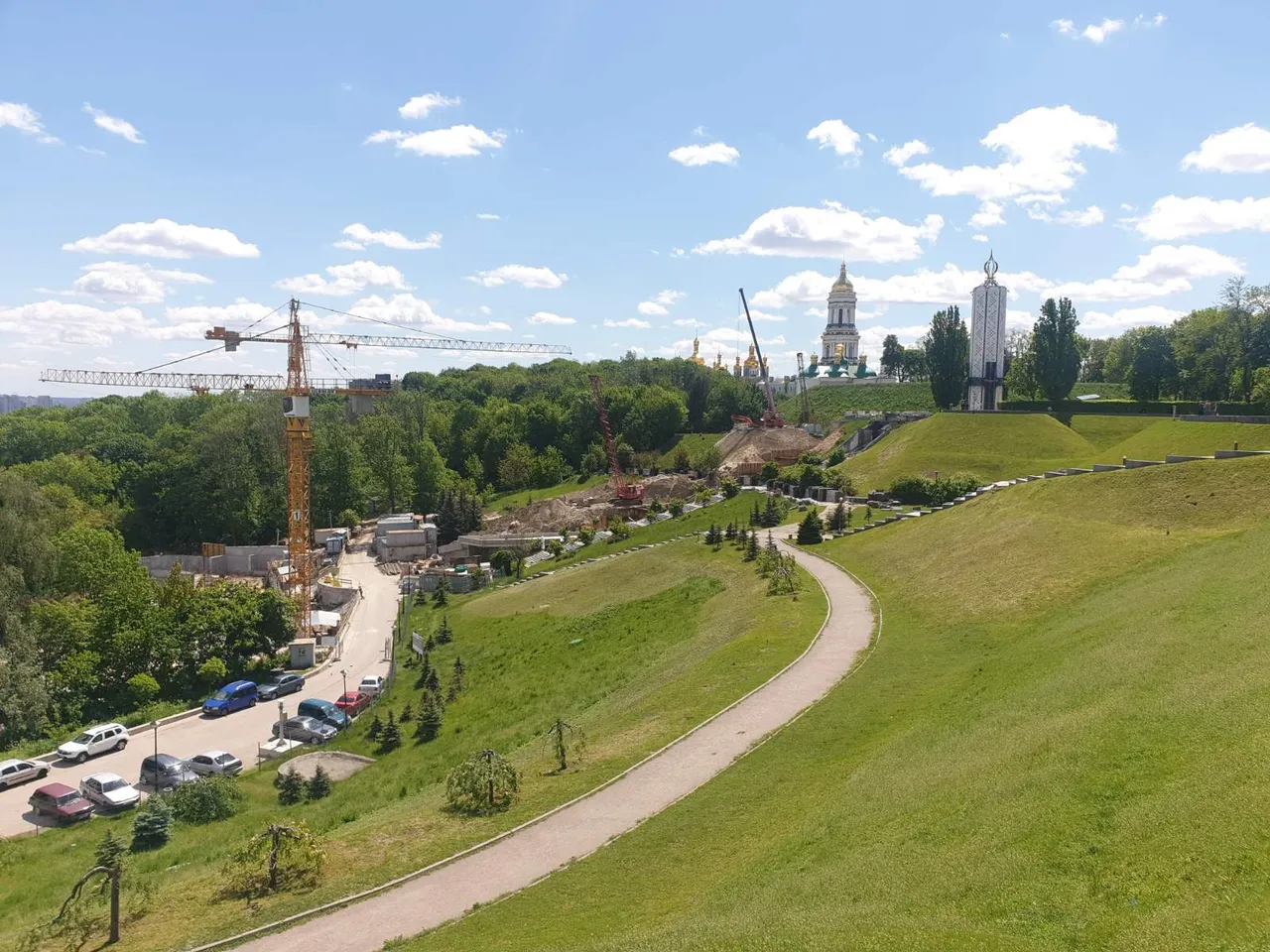
На фото зображені Печерські пагорби, зняті з Дніпровського узвозу, неподалік від парку Слави. На фото видно Києво-Печерську Лавру, вірніше її велику дзвіницю та монумент Свіча пам’яті на території музею Голодомору. Також видно будівельні роботи – це відбувається створення другої черги музею, яке має завершитися у 2023 році.
The photo shows the Pechersk hills, taken from the Dnieper descent, near the Park of Glory. The photo shows the Kiev-Pechersk Lavra, or rather its large bell tower and the monument of the Candle of Remembrance on the territory of the Holodomor Museum. Construction work is also visible - this is the creation of the second phase of the museum, which should be completed in 2023.
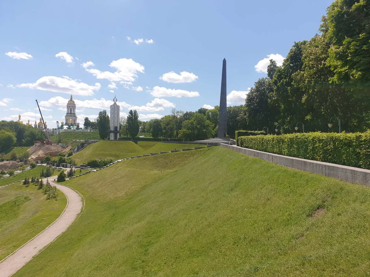
Якщо подивитися трохи правіше, то можна побачити 27-ми метровий гранітний обеліск меморіалу Вічної Слави, який створений на честь загиблих у Другій світовій війні. Цікаво, що музей Голодомору було відкрито при Президенті Ющенко у 2009 році, а меморіал Вічної Слави в далекому 1957 році.
If you look a little to the right, you can see the 27-meter granite obelisk of the Eternal Glory Memorial, which was created in honor of those killed in World War II. Interestingly, the Holodomor Museum was opened under President Yushchenko in 2009, and the Eternal Glory Memorial in 1957.
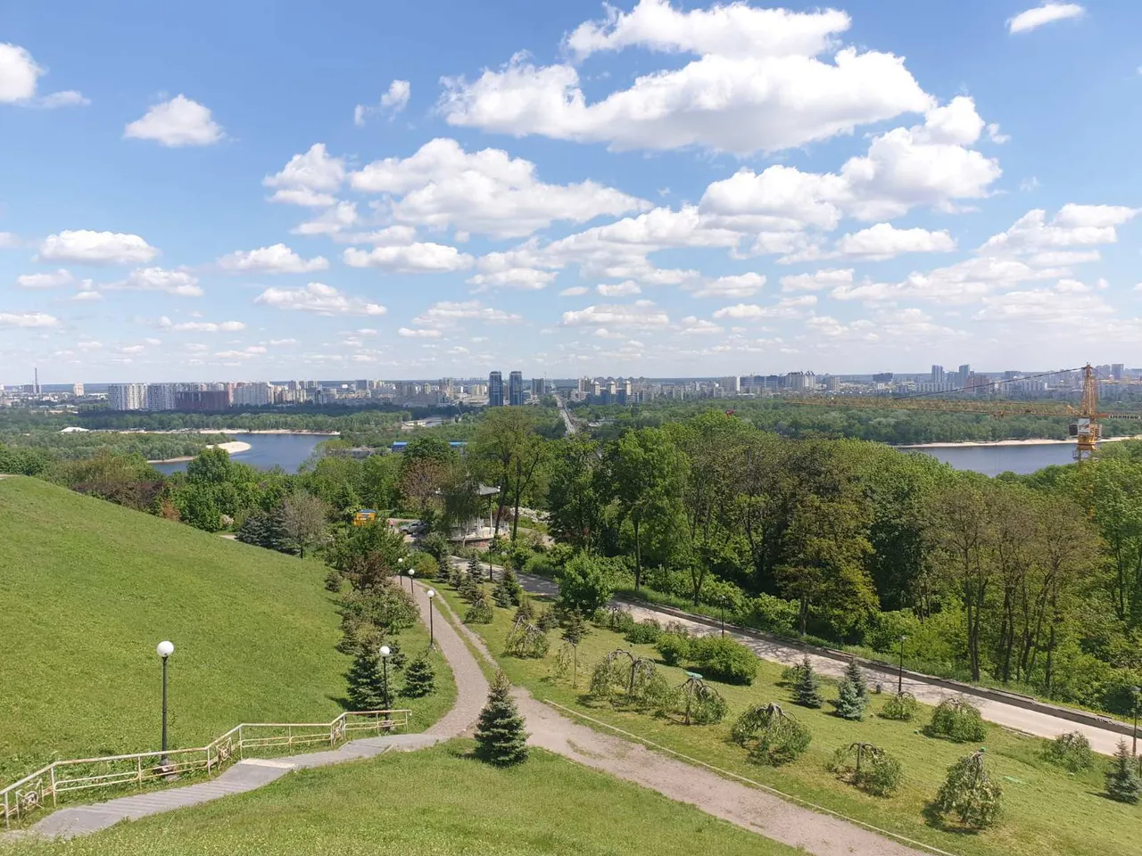
Якщо подивитися вниз з дніпровських круч, то відкривається вид на лівий берег Києва. В тому числі видно пряму дорогу, яка уходить вдалечінь. Це Броварський проспект, який є частиною автошляху з Києва на Чернігів чи Суми і далі закордон. Також цікавий факт: з 1912 по1914 роки Броварським проспектом пролягала трамвайна лінія до самих Броварів.
If you look down from the Dnieper cliffs, you can see the left bank of Kiev. Including you can see a straight road that goes into the distance. This is Brovarsky Avenue, which is part of the highway from Kyiv to Chernihiv or Sumy and beyond. Another interesting fact: from 1912 to 1914, a tram line to Brovary itself ran along Brovarsky Avenue.