No Chance for Light Painting
Hello friends of abandoned places. In the last two weeks I was on the Darß, a peninsula on the German Baltic coast. I wanted to switch off from the hustle and bustle of the big city Berlin, come to rest, recover and relax. So completely without camera and light painting it goes but then not. I made my way to a bunker between Wustrow and Ahrenshoop. The bunkers served to monitor the state border of the GDR. Installed there are radar systems, different radio measuring systems (LOT M, BWR-X12A, MR-10) to detect targets over the water like ships or low flying airplanes as well as heat direction finding systems (Astra 2). There is almost no information about the latter. It is not quite clear to me how a precise heat direction finding can be made at long distances of several kilometers. That would be interesting. The BWR-X12A is actually a ground weather radar which has been misused. The main purpose was to detect "border violators", i.e. people who wanted to leave the GDR. The system was quite effective - more than a dozen people failed to escape across the Baltic Sea to the promised land of the West.
Hallo Freunde der verlassenen Orte. In den letzten zwei Wochen war ich auf dem Darß, einer Halbinsel an der deutschen Ostseeküste, unterwegs. Ich wollte mal abschalten von der Hektik der Großstadt Berlin, zur Ruhe kommen, mich erholen und entspannen. So ganz ohne Kamera und Light Painting geht es dann aber doch nicht. Ich machte mich auf den Weg zu einer Bunkeranlage zwischen Wustrow und Ahrenshoop. Die Bunker dienten der Überwachung der Staatsgrenze der DDR. Installiert warten dort Radaranlagen, verschiedene Funkmessanlagen (LOT M, BWR-X12A, MR-10) zum Erfassen von Zielen über dem Wasser wie Schiffen oder tieffliegenden Flugzeugen sowie Wärmepeilanlagen (Astra 2). Zu letzteren findet man so gut wie keine Informationen. Mir ist nicht ganz klar, wie man auf große Entfernungen von mehreren Kilometern eine präzise Wärmepeilung machen kann. Das wäre schon interessant. Bei der BWR-X12A handelt es sich eigentlich um ein Boden-Wetterradar, welches zweckentfremdet wurde. Hauptsächlich ging es wohl darum "Grenzverletzer" aufzuspüren, also Menschen, welche die DDR verlassen wollten. Das System war recht effektiv mehr als einem dutzend Menschen gelang die Flucht über die Ostsee in das gelobte Land des Westens nicht.


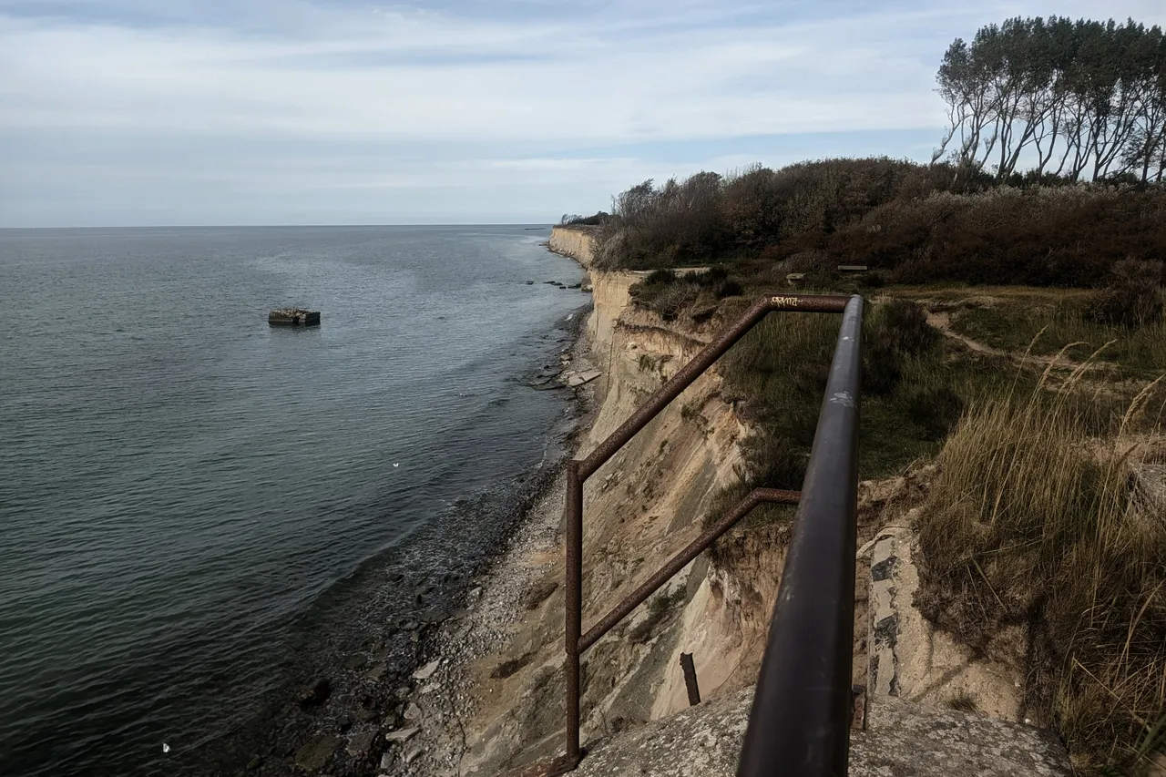
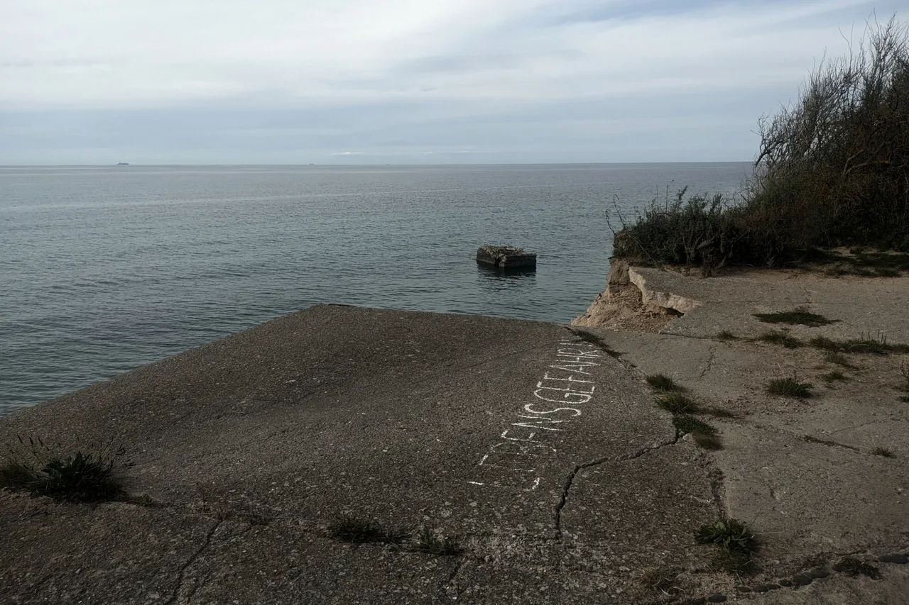
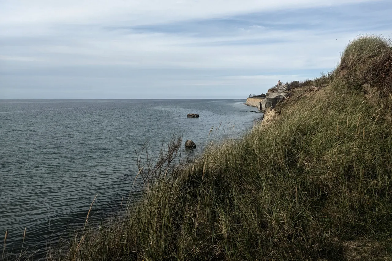
When I got there, it was immediately clear that the idea of waving flashlights around there at night was life-threatening. Even the visit during daylight was very dangerous. The bunkers were built into the cliff. Every year, 1 to 3 meters of the cliff collapse into the depths. Every step has to be chosen very well if you don't want to fall into the depth.
Als ich dort ankam, war sofort klar, dass die Idee dort nachts mit den Taschenlampen rumzufuchteln lebensgefährlich ist. Schon der Besuch bei Tageslicht war sehr gefährlich. Die Bunker wurden in die Steilküste gebaut. Jedes Jahr stürzen 1 bis 3 Meter der Steilküste in die Tiefe. Jeder Schritt will sehr gut gewählt sein wenn man nicht in die Tiefe stürzen will.

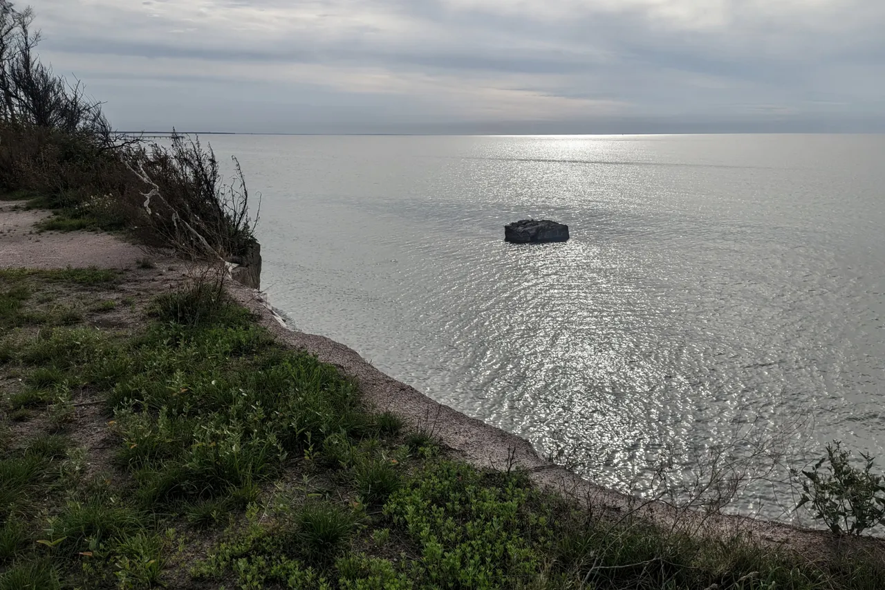
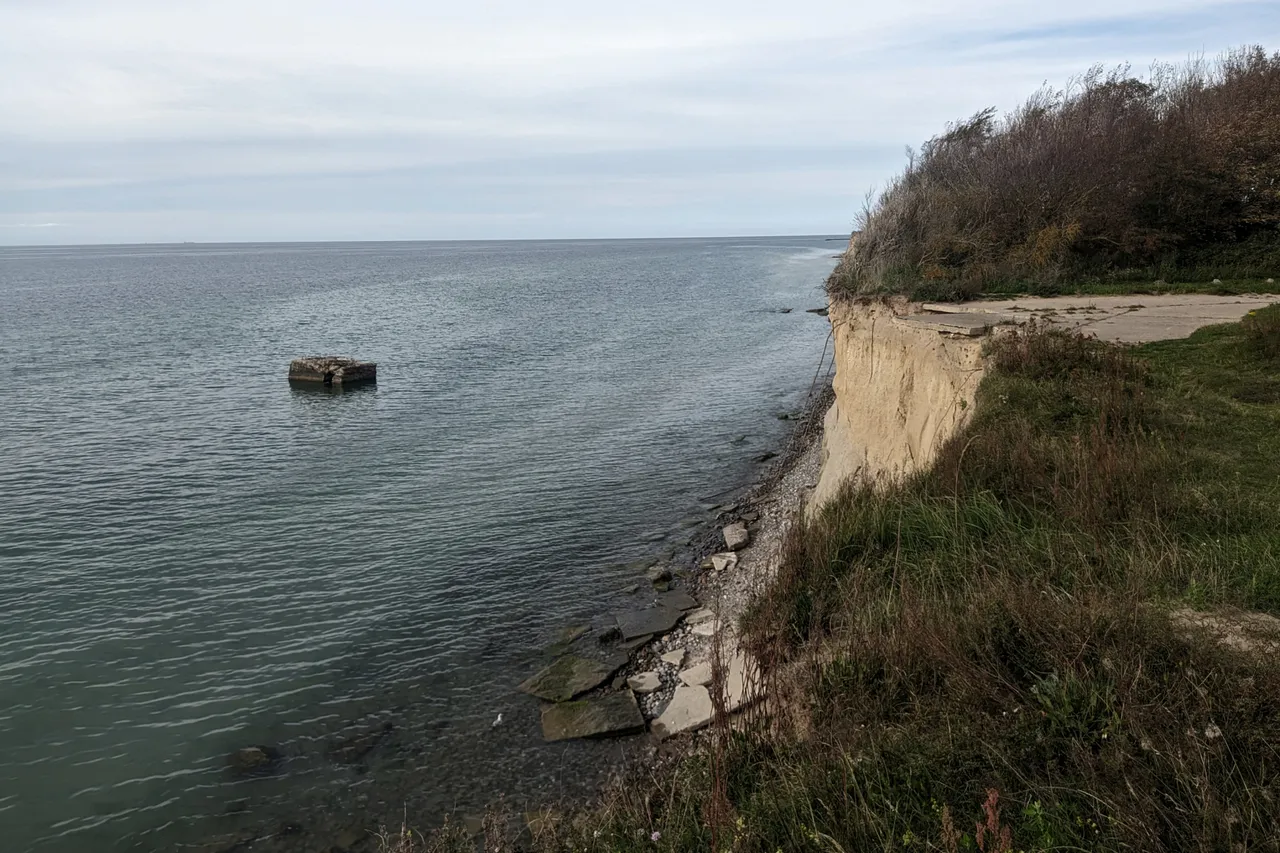
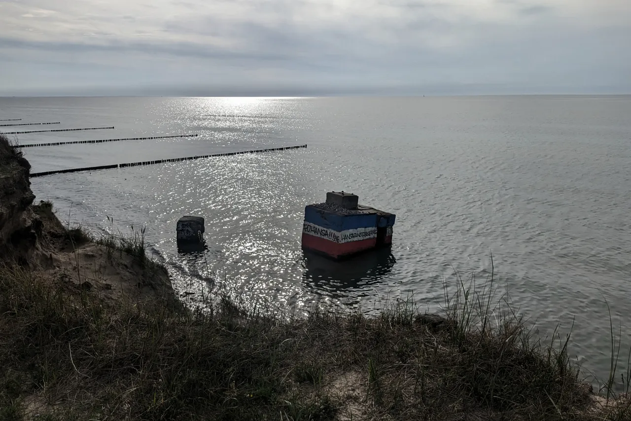
As you can see from the pictures, many concrete parts of the bunkers are lying in the Baltic Sea. The parts are not moved by the current. At the time of the construction of the plant, the coast went up to the place where the respective concrete part lies. The construction of the facility was started in 1959. Each time a bunker or a concrete anchor for the antennas fell into the water, the facility was rebuilt a few meters further inland. To me, that sounds like a completely stupid idea. The accommodation buildings were also moved further inland.
Wie man auf den Bildern erkennen kann, liegen viele Betonteile der Bunker in der Ostsee. Die Teile werden nicht von der Strömung bewegt. Die Küste ging zum Zeitpunkt des Baus der Anlage bis an die Stelle, an der das jeweilige Betonteil liegt. Mit dem Bau der Anlage wurde im Jahr 1959 begonnen. Jedes Mal wenn ein Bunker oder eine Betonanker für die Antennen ins Wasser gestürzt ist, wurde die Anlage einige Meter weiter landeinwärts wieder aufgebaut. Für mich klingt das nach einer völlig bescheuerten Idee. Auch die Unterkunftsgebäude wurden weiter landeinwärts versetzt.


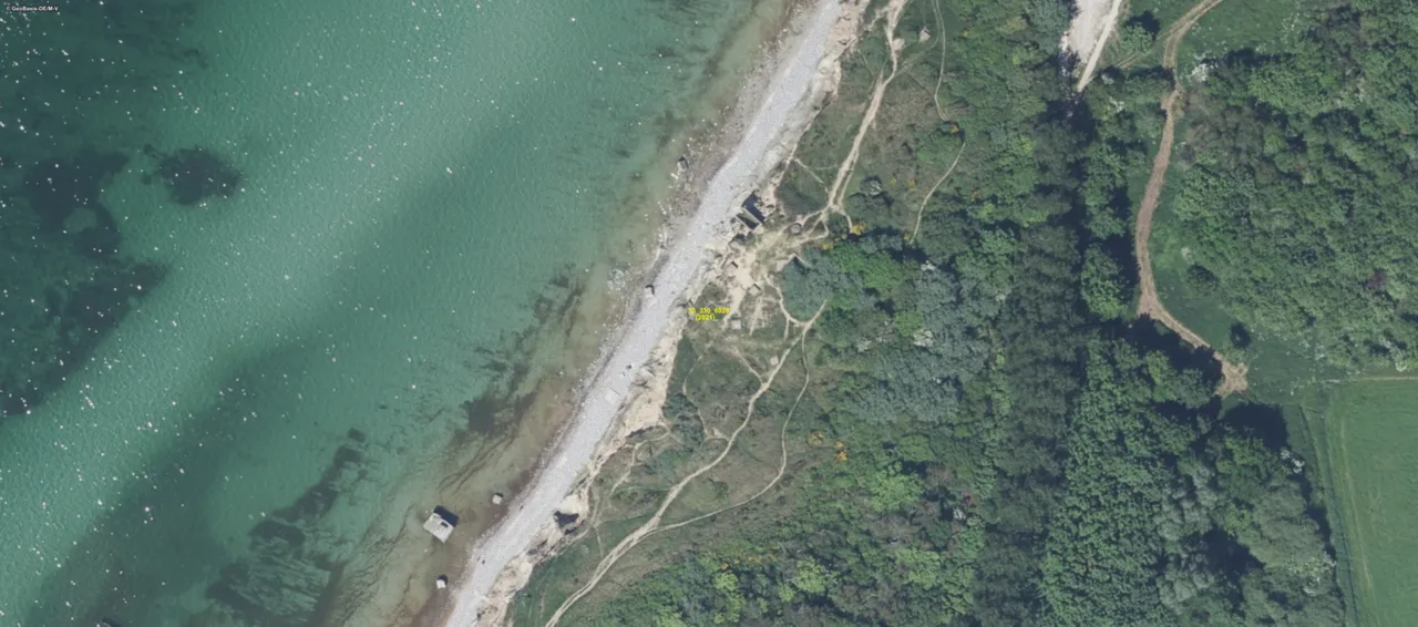
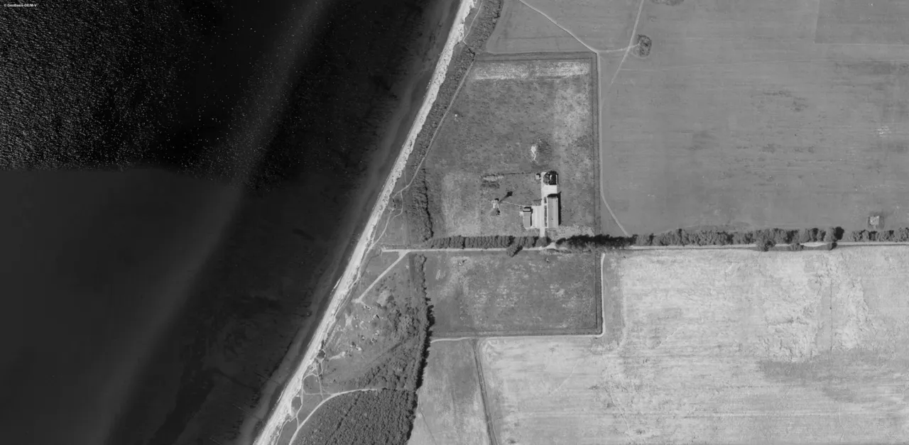
For a better overview, here is an aerial photo from the year 2021. Source: GeoPortal.MV (https://www.geoportal-mv.de/)
Zur besseren Übersicht mal ein Luftbild aus dem Jahr 2021. Quelle: GeoPortal.MV (https://www.geoportal-mv.de/)
And for comparison, an aerial view from 1991. The accommodation buildings were demolished a short time later. Source: GeoPortal.MV (https://www.geoportal-mv.de/)
Und zum Vergleich ein Luftbild aus dem Jahr 1991. Die Unterkunftsgebäude wurden kurze Zeit später abgerissen. Quelle: GeoPortal.MV (https://www.geoportal-mv.de/)
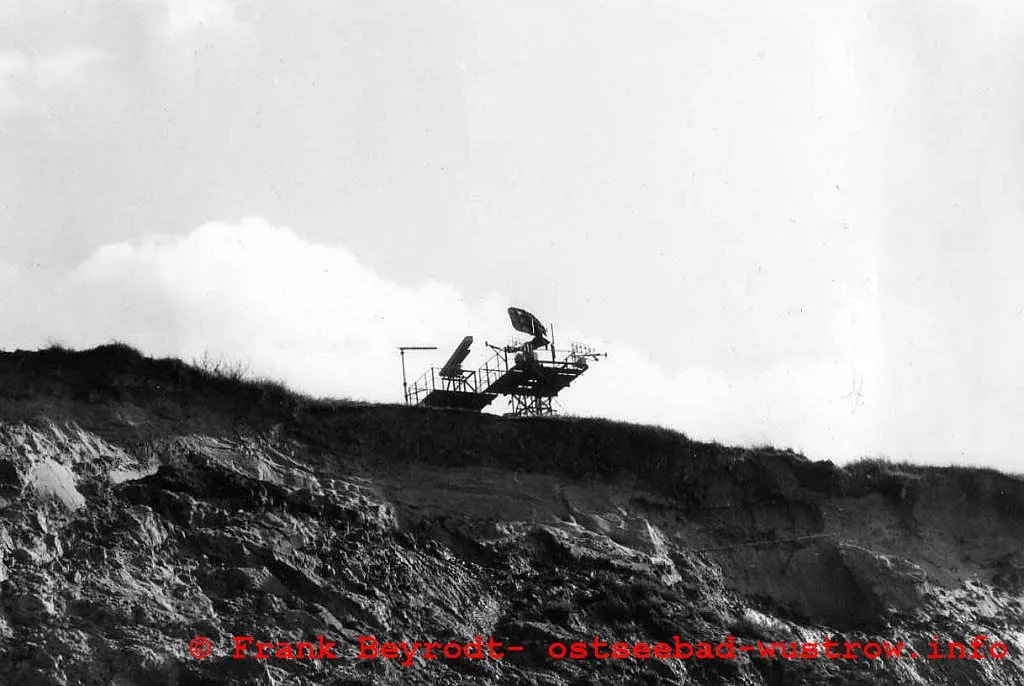
It was strictly forbidden to photograph the facilities in the GDR. I could find a picture from the year 1988 on the Internet. Source: Frank Beyrodt - https://www.ostseebad-wustrow.info/
Es war in der DDR streng verboten die Anlagen zu fotografieren. Ein Bild aus dem Jahr 1988 konnte ich im Internet finden. Quelle: Frank Beyrodt - https://www.ostseebad-wustrow.info/
In total, there were probably 24 such surveillance installations on the Baltic coast. Except for the remains of the bunkers in Wustrow, you can hardly find any remains of the facilities, after the end of the GDR, almost all facilities were completely removed. There is also hardly any information about the exact locations and functions of the surveillance facilities. In the western direction, the next facility was in Warnemünde, in the eastern direction at Darßer Ort.
Insgesamt gab es wohl 24 solcher Überwachungsanlagen an der Ostseeküste. Bis auf die Reste der Bunker in Wustrow findet man kaum noch Überreste der Anlagen, nach dem Ende der DDR wurden so gut wie alle Anlagen komplett beseitigt. Man findet auch kaum Informationen über die genauen Standorte und die Funktionen der Überwachungsanlage. In westlicher Richtung war die nächste Anlage in Warnemünde, in östlicher Richtung am Darßer Ort.


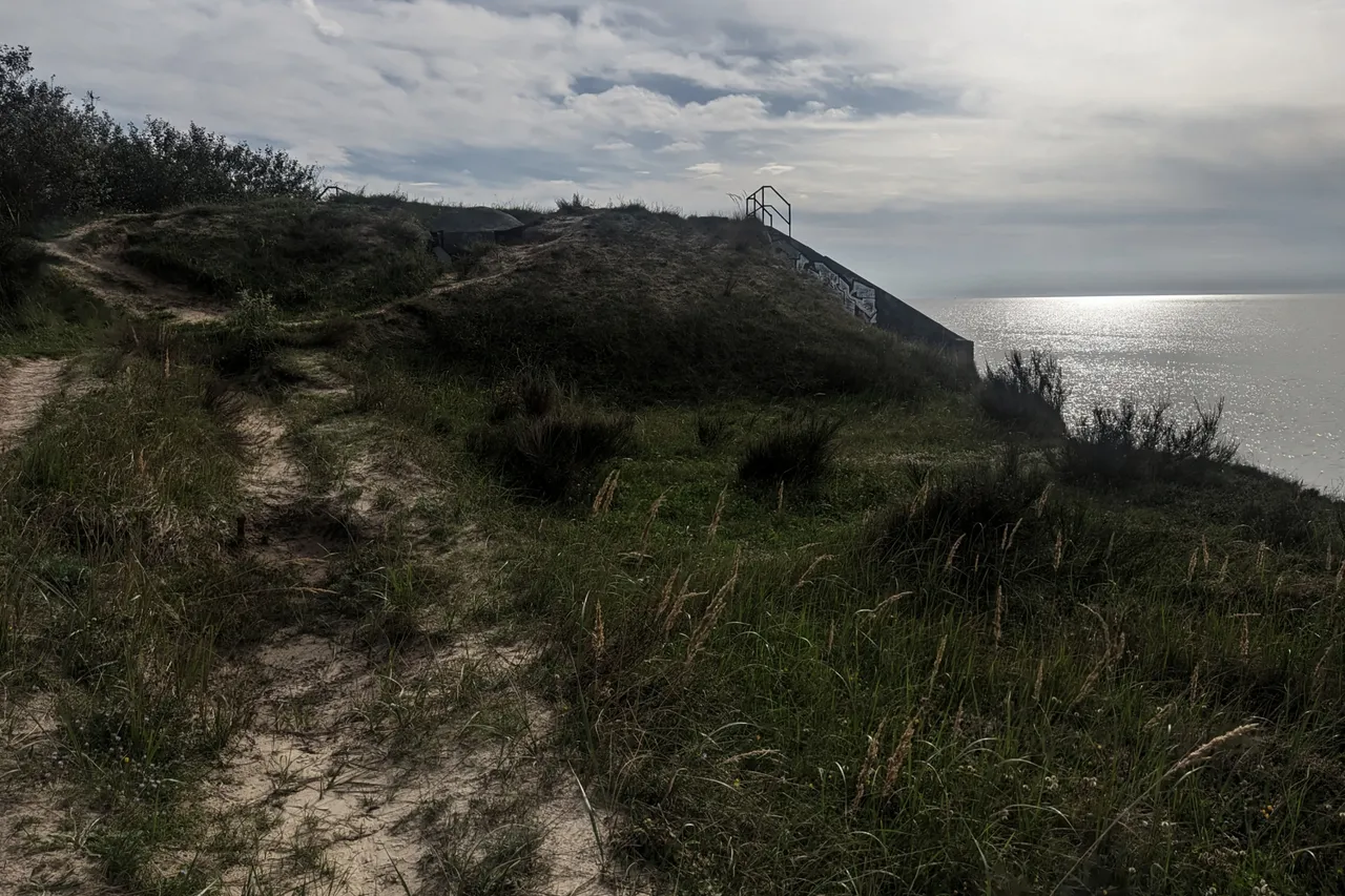
I tried to find an entrance to the main bunker. The entrance on the lake side (upper picture) is not accessible and locked. The entrance on the land side was welded shut with a steel plate.
Ich versuchte einen Zugang zum Hauptbunker zu finden. Der Eingang auf der Seeseite (oberes Bild) ist nicht erreichbar und verschlossen. Der Eingang auf der Landseite wurde mit einer Stahlplatte zugeschweißt.

The entrance on the land side is not so easy to discover. As you can see in the photo, nature has reclaimed the cliff.
Der Eingang auf der Landseite ist nicht so einfach zu entdecken. Wie man auf dem Foto gut erkennen kann hat sich die Natur die Steilküste wieder zurück erobert.

This is probably the emergency exit of the main bunker. This was sealed with concrete.
Hierbei dürfte es sich um den Notausgang des Hauptbunkers handeln. Dieser wurde mit Beton versiegelt.

The purpose of this concrete tube is not clear to me. It goes about 2 meters into the depth. Below lies garbage and sand. Maybe this was an access to another bunker.
Der Zweck dieser Betonröhre ist mir nicht klar. Es geht ca. 2 Meter in die Tiefe. Unten liegt Müll und Sand. Vielleicht war das ein Zugang zu einem weiteren Bunker.
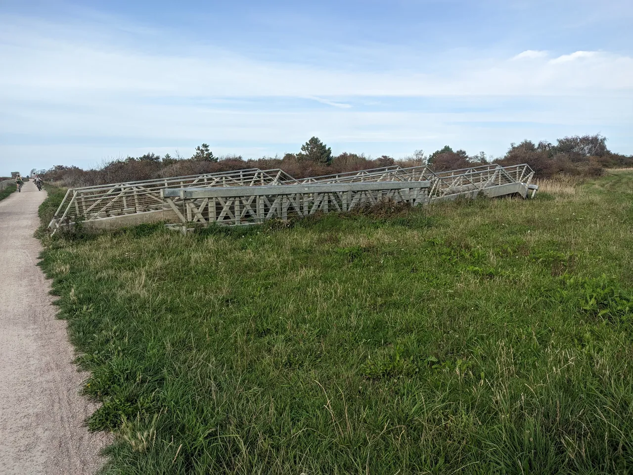
I would have liked to take more photos from the beach. But unfortunately the stairs to the beach, which stood about a hundred metres from the bunker, have been removed. It now lies on top of the meadow. Presumably it was in danger of falling down. The site can also be reached by a longer walk along the beach from either Wustrow or Ahrenshoop. From the spot on the cliff where the bunkers are, however, it is a 2 to 3 km walk and then the same distance back. The pictures from below were not that important. Maybe I will go to the Darß again. Then I plan a walk along the beach from Wustrow to the bunkers. And I'm sure I can take relatively safe pictures from the beach at night, even though more concrete parts could fall off at any time.
Ich hätte gerne noch Fotos vom Strand aus gemacht. Aber leider wurde die Treppe zum Strand, die etwa hundert Meter vom Bunker entfernt stand, entfernt. Sie liegt jetzt oben auf der Wiese. Vermutlich drohte sie abzustürzen. Man kann die Stelle auch über einen längeren Spaziergang am Strand entweder von Wustrow oder Ahrenshoop erreichen. Von der Stelle auf der Steilküste an der die Bunker stehen sind das allerdings 2 bis 3 km Fußweg und dann nochmal die gleiche Strecke zurück. So wichtig waren dann die Bilder von unten auch nicht. Vielleicht verschlägt es mich ja nochmal auf den Darß. Dann plane ich einen Strandspaziergang von Wustrow aus zu den Bunkern. Und vom Strand aus kann ich sicher auch nachts relativ sicher fotografieren, auch wenn jederzeit weitere Betonteile abstürzen können.


About me
