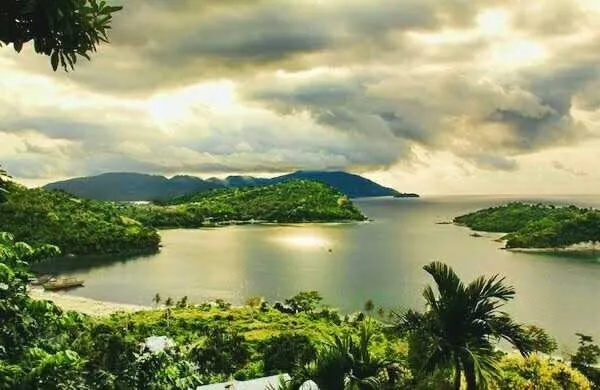
Weh Island or Pulau Weh or Pulo Weh (by the local population commonly referred to only as "Sabang", the name of the largest city) is a small active volcanic island to the northwest of Sumatra, 45 minutes by fast regular ship or 2 hours by ferry from mainland, Banda Aceh. It was originally connected to the Sumatran mainland and became separated by sea after the volcano's last eruption in the Pleistocene era. The island is situated in the Andaman Sea. The largest city on the island, Sabang, is the northernmost outpost of Indonesia.
The island is known for its ecosystem; the Indonesian government has declared 60 square kilometres (23 sq mi) of inland and sea around the island as a wildlife protection area. A rare megamouth shark species was found on shore and the island is the only habitat for the threatened toad, Duttaphrynus valhallae (formerly Bufo valhallae). Coral reef areas around the island are known for their large variety of fish species.
Geography
Weh Island is located in the Andaman Sea, where two groups of islands, the Nicobar Islands and Andaman Islands, are scattered in one line from Sumatra to the north up to the Burma plate. The Andaman Sea lies on an active moving small tectonic plate (microplate). A complex geological fault system and volcanic arc islands have been created along the length of the sea by the movement of the microplate.
The island lies about 15 kilometres (9 mi) off the northernmost tip of Sumatra. The island is small at only 156.3 km2 (60.3 sq mi), but mountainous. The highest peak is a fumarolic volcano, 617 metres (2,024 ft) high. The last known eruption is estimated to have occurred in the Pleistocene age, as a result which the mountain partially collapsed and was filled by the sea, forming a separate island.
At a depth of 9 metres (30 ft), close to Sabang city, underwater fumaroles emerge from the seabed. At Gapang Beach (Gapang is name of a kind of a tree), one hour from Balohan Port to the west there is also underwater fumaroles which is suitable for diving and is called as Hydrothermal Point. A volcanic cone is found in the jungle. There are three solfatara (mudpot) fields on the island: one is 750 metres (0.5 mi) southeast of the summit and the others are 5 kilometres (3 mi) and 11.5 kilometres (7 mi) northwest of the summit, on the western shore of Lhok Perialakot bay.
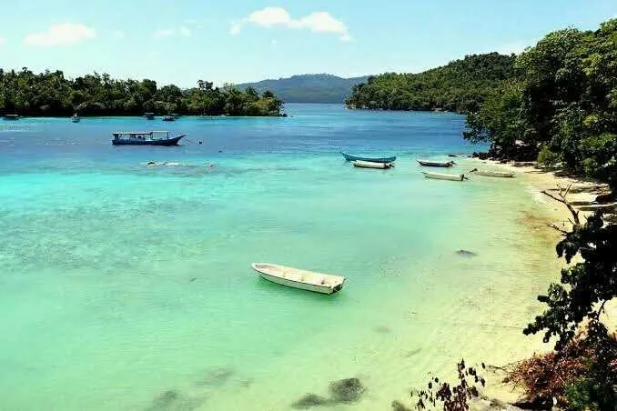
There are four islets surrounding Weh Island: Klah, Rubiah, Seulako, and Rondo. Among those, Rubiah is well known for diving tourism, because of its coral reefs. When traveling to Saudi Arabia was only possible by sea, Rubiah was used as a place of quarantine for Indonesian Muslims during the Hajj pilgrimage season.