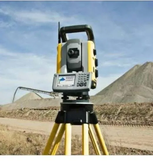
Steemit friends are amazing. Total station is a survey tool used for land mapping and construction. Total stations are theodolites that have been integrated with electronic distance meters (EDMs) that function to read the distance and slope of a measurement point.
The total station measurement results can be in the form of distance and angle as where theodolite, or in the form of 3 dimensional coordinates x, y and z.
The total station in operation from the start of the appliance to the measurement is the same as the theodolite setting, only in measurement with the total station there is an additional menu to convert the distance and angle into x, y and z coordinates.
Total stations are widely used for land measurement or more precisely the topographical mapping of an area to be measured. Total stations are also often used in construction buildings to look for points of a job such as the determination of the foundation and corner of the building. For archeology, sometimes the total station is used to measure the depth of excavation.

That's all my knowledge, hopefully useful.
Regard @abumuhammad