Adsactly Education: Colorado River
The United States has six truly great rivers. The Colorado, Snake, Columbia, Missouri, Mississippi, and the Rio Grande. This series will chronicle each one.
The Colorado River is one of the most well known of all the rivers. In 1869 John Wesley Powell made the first trip through the Grand Canyon by boat and the romance with the Colorado has grown steadily since then. By the time it reaches the Pacific Ocean at the Gulf of California it has passed through seven American and two Mexican states. A river that rises up high in the Rocky Mountains, it’s canyons and desert vistas excite us all. It is also a river in great jeopardy. It is a complex and fragile system.
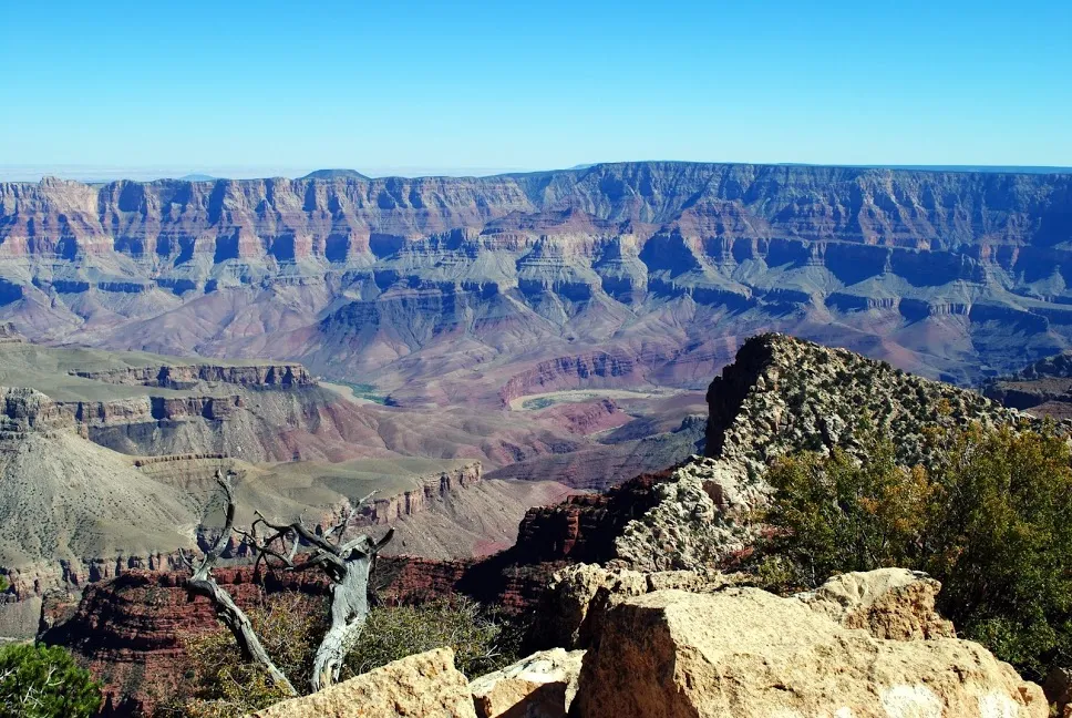
The Colorado River from the North Rim Photo Courtesy of the author
The River Runs It’s Course
The Colorado River starts as a tiny trickle in La Poudre Pass, Colorado, at an elevation of 10,184 ft (3104m) and ends in the dry and dusty delta 1450 miles (2,344 km) away. In between it runs in a torrent on the west slope of the Rockies, gathering in tributaries of streams and minor rivers. It tears through the first of it’s many canyons just before meeting up with the Gunnison River at Grand Junction, Colorado. There are at least five more canyons before it flows into Glen Canyon, the site of the first major dam on it’s run.
Glen Canyon Dam was built in the 1960s under tremendous pressure from the newly burgeoning environmental movement. Glen Canyon is now completely flooded with an enormous reservoir known as Lake Powell. The river then runs through Lee’s Ferry which was a natural crossing point of the river. It is here that the ‘official flow’ of the Colorado is measured for apportionment to the seven remaining states in it’s travels.
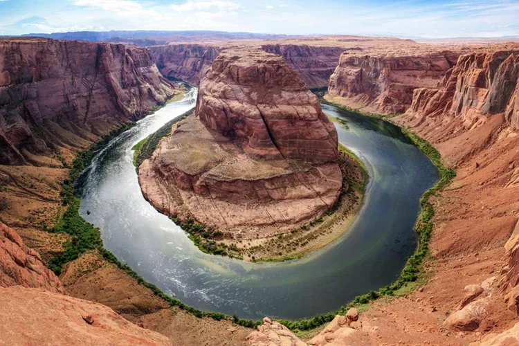
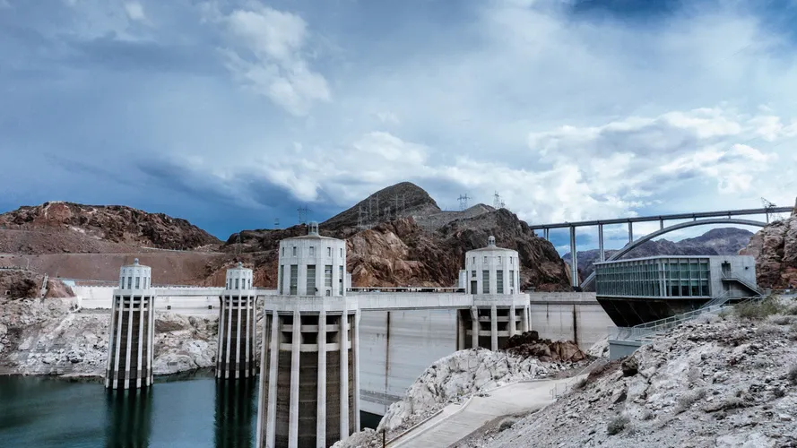
Next is the Grand Canyon, one of the 8 wonders of the world. 277 miles of free running river in one of the most spectacular settings known to man. Past the Grand Canyon is Lake Mead, the impoundment behind Hoover Dam. It is the former Black Canyon and is the largest reservoir in the nation.

From there the river turns almost straight to the south and heads for the Pacific Ocean and the Gulf of California. The first dam on the shared border between Arizona and California is Parker Dam, was originally built primarily as an impoundment basin to pump water to the LA basin and the Central Arizona Canal.
Laguna Dam and Imperial Dam on the lower river are mainly used to control floods and provide irrigation water to the valleys of California and Arizona where a huge fraction of the nations winter vegetables and other crops are raised.
After the river leaves Yuma, Arizona, the remaining flow is less than 7000 cubic feet per second, and every single drop of that is used for irrigation and drinking water in Mexico. Not one drop of Colorado River water makes it to the sea. An extensive delta that was built up over centuries is entirely dry.
Why Does It Matter?
The Colorado River is a legendary stream in the US. It was the last major river that was fully explored and John Wesley Powell made it absolutely famous with his 1869 journey through the Grand Canyon by boat. Since then it has grown in stature as it winds it’s way through the desert Southwest. It is mostly remote and often found in a spectacular canyon.
The average flow of the Colorado River (as measured at Lee’s Ferry) is something over 22,000 Cubic Feet per Second (CFS). It provides drinking water for over forty million people in the US and Mexico, as well as irrigation water for millions of acres of productive farmland. The Colorado River is an important source of hydroelectric power for a vast region as well as being a huge part of the tourism in the area. The river flows through or around 7 National Parks.

The San Juan River, tributary of the Colorado. Photo Courtesy of the author.
It’s The Water
More than 35 million people get their drinking water at least partially from the Colorado River. Los Angeles, San Diego, Phoenix, Tucson and many more rely on the river for household water. Golf courses, parks and recreational facilities across the vast region rely on the river.
Agriculture needs are enormous. Millions of acres of high production farm ground is watered by the Colorado in the states of Colorado, Utah, Arizona, California, Sonora and Baja California, using the river to grow crops. This is principally fruit and vegetable growing, the area provides the whole country with winter crops of tomatoes, lettuce, carrots, and all table vegetables. Citrus takes a large bite from the pie as does soft fruit, nuts and sweet corn.
Tourism is a massive piece of the puzzle that is the Colorado River. From the obvious lure of the Grand Canyon to rafting on the upper parts of the river, many people spend a lot of money to experience the river directly. Boating on the lower river is extremely popular with all forms of recreational boating. Lake Mead and Lake Powell both have a rental houseboat industry that is extensive.

Vermillion Cliffs. Photo courtesy of the author.
Geology of the River
The river starts just west of the Continental Divide in the West Slope of Colorado. The Rockies are a relatively young set of upthrust mountains that are old and very stable mostly igneous rock. The west slope is an inhospitable and rugged territory so the early part of the river is largely un traveled. At one point in history, the river ran almost straight west, possibly emptying in Monterey Bay, California.
At some point in the last few million years the Kaibab Plateau rose and Baja California split off from the rest of Mexico, giving the river a new course to follow to the sea and allowing it to cut through multiple sedimentary structures forming the canyons that are so beloved today.
Volcanic events in the more recent past have also given the Colorado some of it’s character. Basalt, Limestone, Sandstone, Granite. The Colorado knows them all.

Glen Canyon Photo courtesy of the author
Where Does the River Go From Here?
The ecology of the river is, generally speaking, a mess. Not that the water isn’t pretty clean, it really is a priority with 40,000,000 million people depending on the ability to drink the water.
The impoundments, particularly behind Glen Canyon Dam and Hoover Dam are filling with silt at an alarming rate. Lake Powell (behind Glen Canyon) is expected to silt completely full within 500 years. The Grand Canyon is a maze of sand bars that have changed the very character of the river. Lake Mead (behind Hoover Dam) is the repository for the silt that grinds out of the Grand Canyon every year and will soon be feeling the effects of it.
Lack of available water makes it so the silt can’t be washed out of anyplace. None of the dams on the river can stand the pressure and lack of water flow means it can’t be washed into the Gulf of California and the Delta under any circumstances. It is a large problem that will get nothing but larger as time goes on.
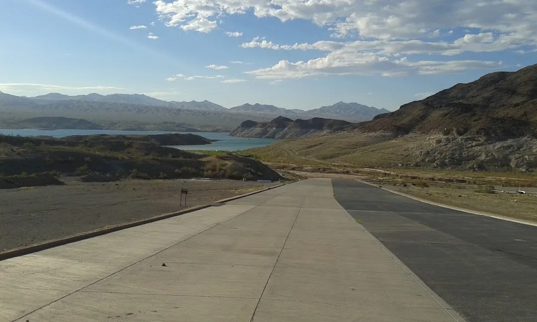
Lake Mead is low. Photo courtesy of the author.
The Colorado is just plain oversubscribed. The water allocated by treaty is not near enough to fulfill the needs. Agricultural land, good useable land, is going unused. Cities buy the water allocation from farmers to provide for their ever growing needs. No water? No farming. This is very arid land. How much food production can this country and this world afford to do without?
Tourism is already suffering. The canyons remain ever popular, as do the national parks. The incredibly low levels of Lake Powell and Lake Mead have really cut into the boating industry and with it ‘tourist services’ like lodging and food. Gas stations and stores suffer all along those two lakes.
The Delta is dry. Not one single drop of Colorado River water makes it to the ocean. As the Delta dies, the local weather changes. Dust from the many acres of silt in the Delta is easily wind borne and makes problems on a regular basis. It is a cycle that can’t be broken under the current set up.
What Can Be Done?
Right now, today, the single best hope is conservation. But that will take some cooperation between very disparate factions. Frankly, most people don’t care a bit so long as their water runs out of the tap.
Extreme conservation measures could buy the watershed perhaps as much as 50 years at the current usage rates. The numbers stated when Glen Canyon Dam was built are now known to be too optimistic. There is said to be a major drought in the entire basin, but the truth is, I suspect that the situation is way closer to normal or the new normal than not. I think that not only were the numbers used for the last treaty optimistic, but that the situation is even more grave today.
For the record, I live in Yuma, Arizona. The last stop in the US for the Colorado. The answers to these questions are incredibly important to me and to the future of the region. The entire river system is in peril. Our very lives and the lives of 40,000,000 million others depend on it.
While the words and ideas in this post are strictly those of the author two sources were referred to by me to insure numerical and historical accuracy.
Wikipedia: Colorado River
American Rivers: Colorado River
Unsourced Photos are used courtesy of the author.
Authored by: @bigtom13
Adsactly is a society for freethinking people. Interested? Click Here to join our Discord channel.

In the bottom of the page type in: adsactly-witness and select vote.

All small letters and without the @ sign
Or give us a direct vote here
Thank you!
Click on the coin to join our Discord Chat

Witness proposal is here:
Go To Steem Witness Page
In the bottom of the page type: adsactly-witness and press vote.

Use small letters and no "@" sign. Or, click here to vote directly!
Thank you!