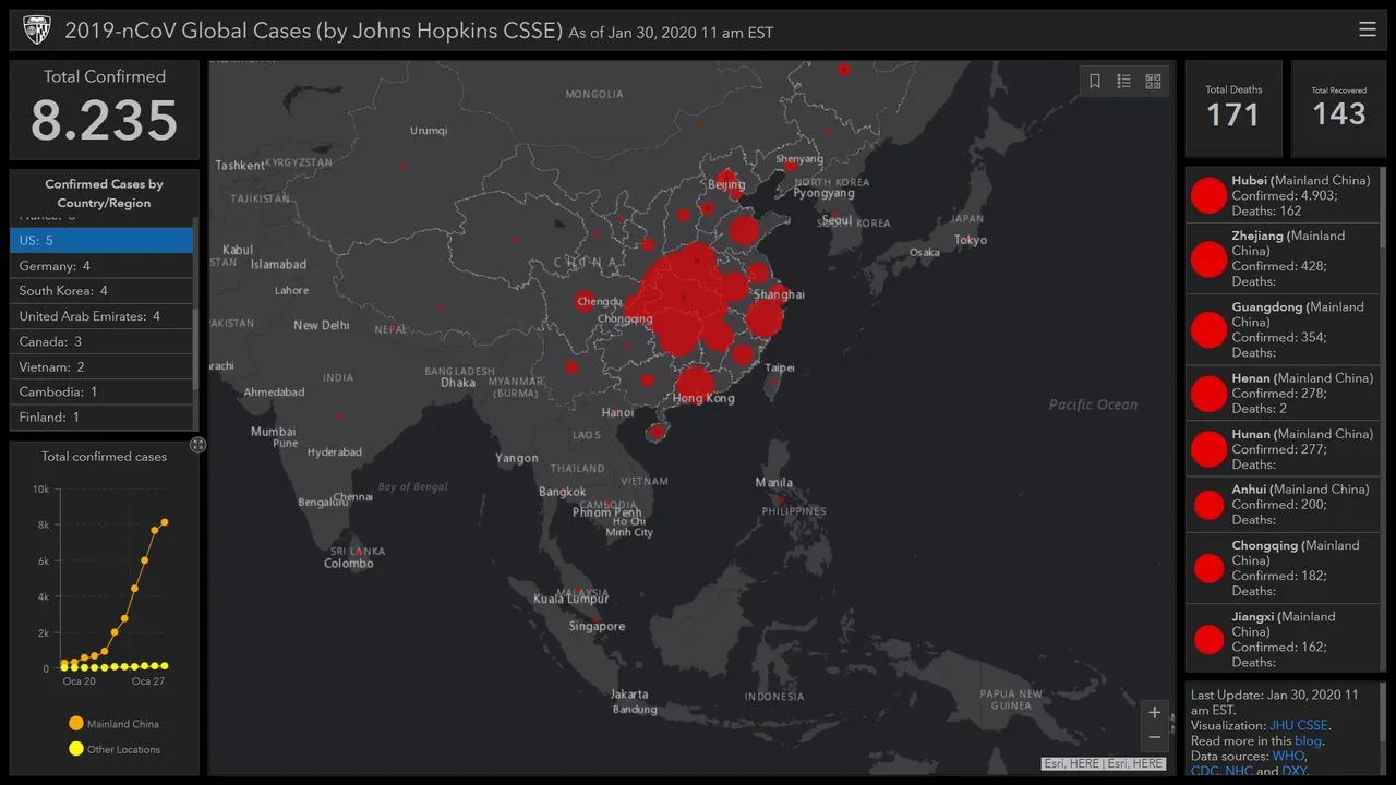
Thanks to this map, we can see which countries the virus is infected to.
Here is this map:
https://gisanddata.maps.arcgis.com/apps/opsdashboard/index.html#/bda7594740fd40299423467b48e9ecf6
Thanks to this map, we can see which countries the virus is infected to.
Here is this map:
https://gisanddata.maps.arcgis.com/apps/opsdashboard/index.html#/bda7594740fd40299423467b48e9ecf6