This is my piece of the puzzle. This information was received by me in an intuitive, co-creative process with the Universe because I really wanted to know the truth of who built the megaliths, and it led to all the information I shared in my video and much more. It is clear to me that this information was given to me to bring it to light. Please watch the foundational video on this blog of "Physical Evidence for the Layout of a Planetary Grid System...and a Suppressed Global Civilization."
There is no place on the planet that this civilization is not. Like I said in the video, the evidence is all around us, and below us, and hidden in plain sight. Literally just outside our front doors, in our back yards, in our neighborhoods, in our parks, and road system.
The purpose of this blog is to show you exactly why I believe this, and provide much, much more evidence to support my belief, and information on other related topics. Not knowing this information allows all the many crimes against Humanity, the Planet, and the Creator/Creation to continue unabated because no one knows about it. It has been well-hidden for a reason by those who wish to harm us all for power, control, and energy. Everything is changing, and this information needs to come back out into collective awareness as soon as possible.
I also believe, that up until 500 or so years ago, Humanity was on a positive evolutionary path and in Unity Consciousness, and that around 1492 was the beginning of the hijack of this timeline by dark forces, and the replacement of it with one called Rome. Can't tell you how this was done, just that it looks like that is what happened because the Ancient Global Civilization built everything on the planet. The same styles/designs cross oceans and continents, from ancient to modern!!!
I am going to start at the beginning of my life, because this is a lifelong pathway that ultimately connected me to the Truth. I wasn’t consciously aware of my spiritual path, and its direct connections to this information, for most of my life. But I was connected to it from the very beginning of my life. I am almost 55-years-old. It has taken me most of that time to put all these puzzle pieces together. Starting this process by telling you about specific moments of awareness in my life journey is ultimately the best way to organize an overwhelming amount of information.
I am from a White, Anglo-Saxon, Protestant (AKA WASP), solidly middle-class family, primarily with roots in the Deep South.
All my known ancestry goes back to the very beginning of what has come to be known as the United States, starting with the Mayflower’s arrival to the so-called Plymouth Bay Colony (I am a direct descendant of William Brewster, a moving force behind the Pilgrims, and the lay religious leader of the Plymouth Colony until the arrival of its ordained minister several years later) to the 1750’s with the influx of the Scots-Irish, my lineage through my maternal grandmother. This is in accordance with the history we have been taught.
It is important to note, that on my Dad’s side of the family, the family history was repeated to my generation as that of the Huguenots. That was all they knew. No elaboration. Just that they were French Huguenots.
Up until recently, the Huguenots were recorded in available historical references as Reformed Calvinists. So the available information not long ago was that for some reason a Protestant Christian sect in France, the Huguenots, were persecuted, and even massacred, for almost 100 years. Come to find out in the Internet Age, the Huguenots were Cathars and Moors.
I grew up in Montgomery County Maryland, outside of Washington, D.C. My first home as a small child was in Rockville. When I was two, my parents moved to Gaithersburg, which is where my earliest conscious memories are. Not any big hits there until much, much later.
The family church I grew up in was Twinbrook Baptist in Rockville. When I started researching a couple of years ago, I found out that the Twinbrook area is adjacent to Rock Creek.
The softball team, of which my dad, an elementary school teacher and administrator, was a member, practiced at the Meadow Hall Elementary School field, which was right beside the church, just slightly downhill, and was the next street address over on Twinbrook Parkway.
When dad was practicing, and I was young, I, instead of watching the games, I was always down off into the woods, right off the ball field, exploring. It was a really cool place, in more ways than one. What I remember is going down, down into the woods, and eventually finding really big stones to play in. They were really fun for a 6-, 7-, 8-, or whatever-year-old, to play in and around.
This location was close to Lake Needwood and Lake Frank, and both are man-made lakes. I will dedicate a future blog exclusively on the role man-made lakes play related to this subject and the cover-up of it.
In 1974, right after the birth of my youngest brother, we moved to a larger home in Rockville. I always tell people we moved as close to Potomac, Maryland, as my parents could afford. I lived here until 1982, when, after 1 year of junior college, I joined the Army for the Veterans' Educational Assistance Program. So this is where I grew up.
The house was brand new when we moved in - no trees, and the funny, almost comet-green color of sprayed grass seed.
The reason I bring this up is because the street we lived on - Lindley Terrace - on one end, some of the houses had a steep gradient on the backside - I mean really steep!!! However, the houses were built on a predominantly flat surface. The house my parents bought was on one of the flattest lots on the street. This relates to what I now believe was actually underneath us. Like, a flat-topped pyramid, perhaps? I mean, when I was a kid, for some reason, I really made a mental note of the unusual features of my neighborhood street.
We were literally right next to the boundary fence of the Lakewood Country Club, with a golf tee area right next the fence. I will be dedicating a specific blog on how golf courses relate to the subject of the cover-up of mounds.
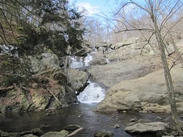
As a family we would go occasionally to Thurmont, Maryland, in Western Maryland, to Cunningham Falls State Park. There was a picnic/swimming area at a lake, and then there were the falls themselves. So I have memories of climbing up the big rocks of the falls. I, like everyone else, had no concept in my awareness, that waterfalls could be anything other than natural. But massive and block-shaped stonework is a recurring feature of waterfalls like what is pictured here. Take a close look at the shape of the rocks in this photo.
Before moving on from Cunningham Falls, it is important to note that Camp David is located in the vicinity. As I learned more about earth grids, I found out that Camp David is situated on a nodal point. It is the norm for centers of power to be on the earth's power points. There is a reason for this.
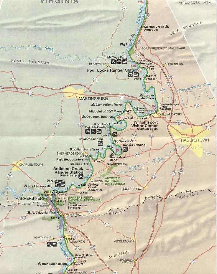
My house was relatively close to Great Falls, Maryland. Access to the falls themselves, at least when I was young, was cut off after Hurricane Agnes went through in 1972. There was access to an area with big stones that was fun to hike and climb, as well as the C & O Canal. So, it was a place I went to many times with family or friends.
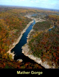
When I started to piece together that waterfalls, and canals as well, were part of the Ancient Civilization, I looked up Great Falls. This is an aerial image of Mather Gorge there. Now, I think the spin is how this could be natural, but look at how straight it is.
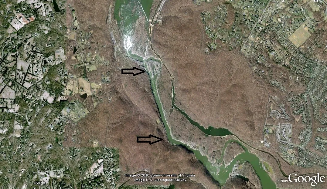
And here is how it looks closer to earth....
And then when you realize that part of the ancient civilization involved canal-building (another blog unto itself), then it becomes logical to see this as a canal rather than natural.
This is a picture of the C & O Canal at Harper's Ferry. They want us to believe that this was built in the early 1800's. So, what is wrong with that date of construction? This is a sophisticated engineering project.
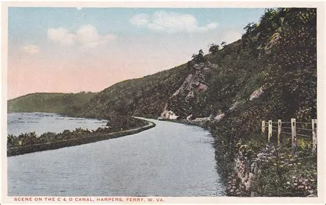
As a matter of fact, the C & O Canal parallels the Potomac River through this area for a long distance. What technology existed in America in the late 1700s/early 1800s could have built a sophisticated project like this? I am not aware of any technology that existed at that time that could have built something like this. According to our history books, the second Industrial Revolution didn't begin in the U.S. until the mid-1800s.
My conclusion is that the C & O Canal, as well as the Erie Canal, and the St. Lawrence Seaway, and a canal system that covered the continent, was built by the advanced ancient civilization that was long-established here when the Europeans first arrived. Again, when I say ancient, I mean a very old civilization that was living and flourishing in North America (and South America) when the Europeans first arrived. And I have much more to say about the use of the word European to describe white people in a later blog based on my findings. This ancient civilization was global!