Good morning! T.G.I.F.
The rain is steadily coming down this morning. We will have some heavier pockets that come through during the afternoon, all adding up to an inch or more. A brisk south wind has brought temperatures to around 50° already, topping off in the mid 50s later on. Winds could gust up to 40 mph this afternoon, especially along the south shore.
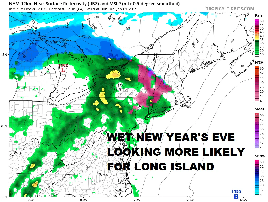
Rain will taper off this evening and skies will clear overnight. The sun returns for both Saturday and Sunday, but chillier air also moves in. Temperatures will start around 50 tomorrow morning before falling into the 40s by the afternoon. Sunday will be the coldest day of the next several, with highs in the upper 30s. Skies will stay mostly sunny, with perhaps some high clouds filtering up from the south. Warmer weather returns as we head into New Year's Eve, but clouds will also be increasing. Rain will arrive by the evening - terrible timing for those brave souls headed to watch the ball drop! Rain will last into New Year's Day, which will otherwise be mainly cloudy.

As the temperature roller coaster continues, it will turn colder again for the rest of the week. A few models have hinted at a storm developing south of the area, which could mean some snow. I will be posting tomorrow about the long term forecast, so be on the lookout for that! --Geoff
Posted from my blog with SteemPress : https://www.weatherlongisland.com/soggy-friday-new-years-eve-looking-wet-as-well/