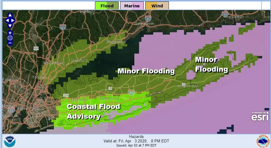

We all know that spring on Long Island is a very difficult time of year with lots of issues thanks to the cold ocean and the occasional ocean storm. One such storm today brought clouds and waves of rain along with gusty winds at times. Fortunately the storm stayed well offshore but improvement over the weekend will be slow. Coastal flood advisories are up for Southwest Suffolk and Southern Nassau County for minor coastal flooding at high tides into Saturday while the north shore and East End will see isolated pockets of minor flooding that is below advisory criteria. Tidal conditions will improve Saturday as the storm moves away to the east.
SATELLITE


The satellite shows the well defined circulation of the storm offshore and we are still seeing a few bands of rain on the regional and local radars moving southwestward and weakening. The bulk of the rain is done though there could be another drop or two of rain overnight from a stray patchy of rain coming in from the northeast. Temperatures will be in the 40s overnight.


Only slow improvement is forecast over the weekend. Leftover clouds will be around on Saturday from the ocean storm offshore though it may be far enough east to allow for some slivers of sunshine to develop in the afternoon. Highs should reach into the 50s though on the East End and shore locations it may not get out of the 40s.

Sunday brings clouds in from the west with a weakening weather system moving across the Great Lakes and falling apart as it moves into the Northeast US. There should be some sun in the mix and temperatures should reach the 50s. A wind off the ocean and cloud cover will likely hold temperatures down a bit especially on the East End where 40s will be the highs. Monday should be a decent day with some sunshine and highs could reach the 60s away from the ocean. Shower chances appear for Tuesday and Wednesday though still on the mild side. Then we wait for a stronger storm to impact the Northeast late next week or next weekend.
Please note that with regards to any tropical storms or hurricanes, should a storm be threatening, please consult your local National Weather Service office or your local government officials about what action you should be taking to protect life and property.
Posted from my blog with SteemPress : https://www.weatherlongisland.com/coastal-flood-advisory-long-island-overnight-into-saturday-morning/