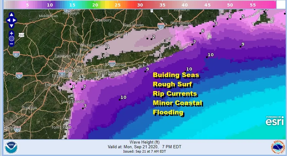
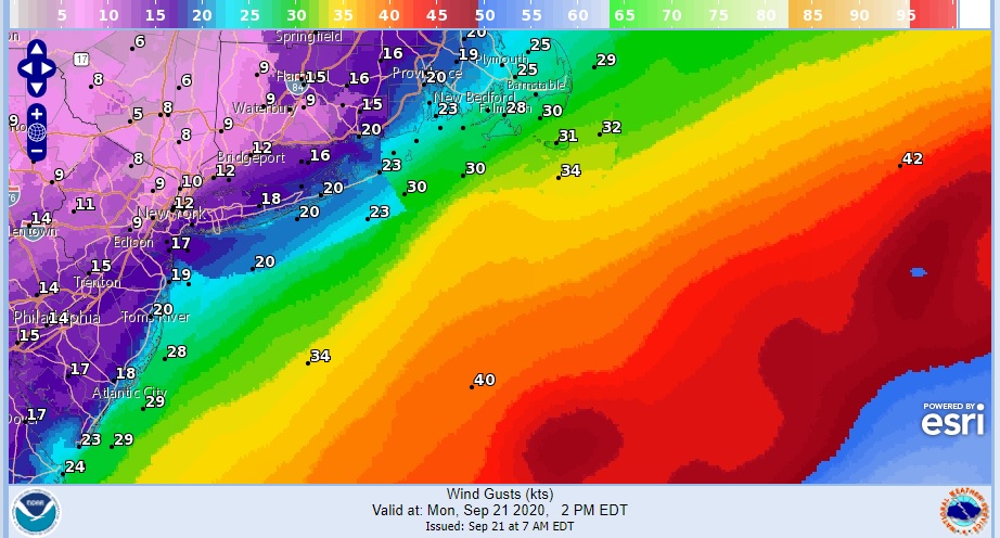
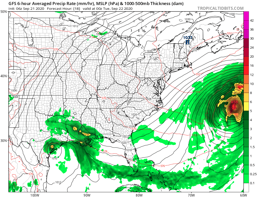
Going offshore today is probably not a good idea. It is deceptive this time of year to have such a beautiful air mass covering the Northeast US and Long Island with tons of sunshine and at the same time have a hurricane that will pass about 600 miles to the east. This is our condition today and tonight as Hurricane Teddy heads northward. It is passing east of Bermuda by over 100 miles this morning and then it will be on to Nova Scotia on Tuesday. The closest pass here will come tonight and that means developing rough ocean seas.
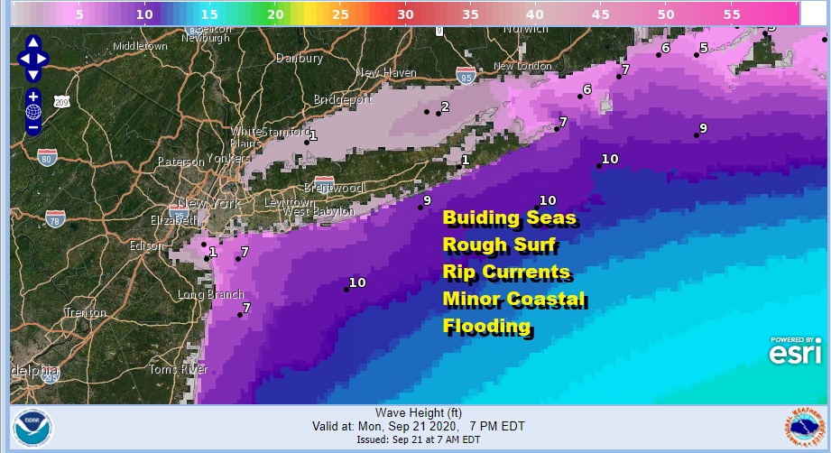
Rip currents will be a big deal today at the beaches along with rough surf and crashing waves. Coastal flooding is likely at high tide though it is expected to be minor coastal flooding and only impact the most vulnerable areas of the south and north shore. Other wise it is sunshine today and highs in the low to mid 60s. There will be a northeast breeze that will be noticeable at the beaches.
SATELLITE


The wind has kept things warmer here at night. At least there has been enough of a breeze to keep temperatures from going much below the mid and upper 40s. We expect the same thing to happen tonight. Tuesday sees the high to the north reform to our south. Hurricane Teddy heads to Nova Scotia and our winds gradually turn from northeast to northwest.
That change starts a slow warm up with highs reaching the upper 60s to lower 70s Tuesday with plenty of sunshine. Then the winds go west southwest with the high moving to the Carolinas Wednesday. We will have another day with plenty of sunshine and highs Wednesday will be in the mid 70s to around 80!

We will roll along on Thursday with the high still in control though it will weaken enough to allow a cold front to slowly approach. Sun and clouds seems to be the way to go for Thursday because there is very little in the way of moisture to produce showers. Highs again will be in the 70s to near 80 degrees.
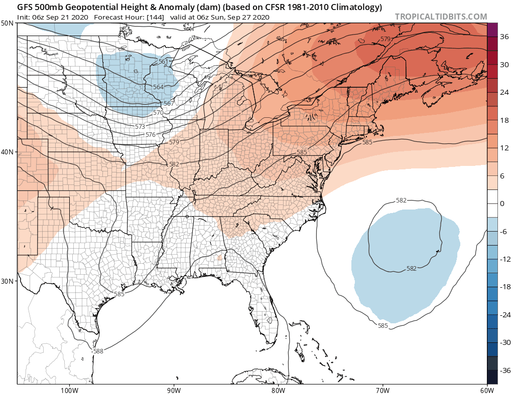
Over the weekend and into next week we will see significant changes in the upper pattern and this includes a deep trough moving into the Eastern US. Ahead of this however we would not expect much to happen Friday through Sunday with clouds and some sun in the forecast each day, though I would tend to think more clouds as we move through the weekend. Highs by day should be mainly in the 70s. No rain is indicated until the next cold front which arrives next Monday with some showers. The depth of this trough is significant and it will eventually be followed by cooler air for a few days later next week. It should also be noted that a trough like this creates a southerly flow along the Eastern Seaboard so this would not be the time to see a tropical system spinning up off the Southeast US coast. So far it seems that this is not an issue and probably won't be.
Please note that with regards to any tropical storms or hurricanes, should a storm be threatening, please consult your local National Weather Service office or your local government officials about what action you should be taking to protect life and property.
Posted from my blog with SteemPress : https://www.weatherlongisland.com/rough-surf-high-tides-today-as-hurricane-teddy-to-pass-600-miles-to-the-east/