
For this weeks Show Us Your California contest by  @socalsteemit I head up into the San Gorgonio wilderness for a fun hike to...
 South Fork Meadows!!
My buddy Larry (
South Fork trailhead at Barton Flats
Frog creek
Old cabins at Horse Meadows
Old cabins at Horse Meadows
Views while climbing Poopout hill
Mt. San Gorgonio from Poopout hill
South Fork Meadows
South Fork Meadows
Kiddos playing in the meadows
Larry and his kiddos
Views of Sugarloaf Mountain from the South Fork trail
Hiking down the trail
Getting foggy back at Barton Flats
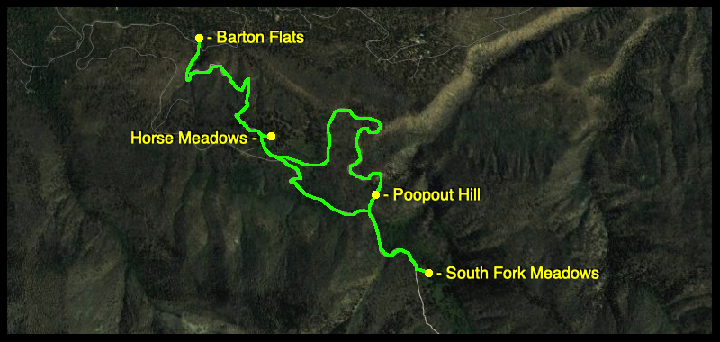
Trail Map
(click to enlarge)
Until next time...
I hope you have enjoyed this glimpse into
My California!!
all photos by 
[//]:# (!steemitworldmap 34.142019 lat -116.849189 long South Fork Meadows d3scr)
Steemit World Map
Contact me on Discord
#SoCalSteemit is building and supporting the Steemit community of Southern California. If you are from SoCal and are into creating quality content here on Steemit, we'd love for you to follow us @SoCalSteemit and join our group on Discord
Animation By 