There's a new long-distance hiking trail around my hometown Krems, the Kremstal-Donau long-distance hiking trail, a circular trail divided into 15 stages, that connects a total of 12 municipalities.
I have decided to walk all stages until the end of 2020 and since I don't like New Year's resolutions I started on the last day of the last year with the first two of the 15 stages.
In this post I am going to present the second stage to you which leads from Mautern an der Donau to Furth bei Göttweig.
The post about the first stage can be found here (Travelfeed) respectively here (Steemit)!

The second stage starts where the first one ended: At the Rathaus (town hall) of Mautern.
From there you continue walking the St. Pöltner Strasse.

At the roundabout walk straight ahead (third exit). A little bit later you will see the barracks of the Austrian Armed Forces on the left side.

Some meters later, you have to turn right and walk a street called "Neubergweg" to the south.

When you come to the "Hauerkreuz", a wayside cross, you have to choose the left path.

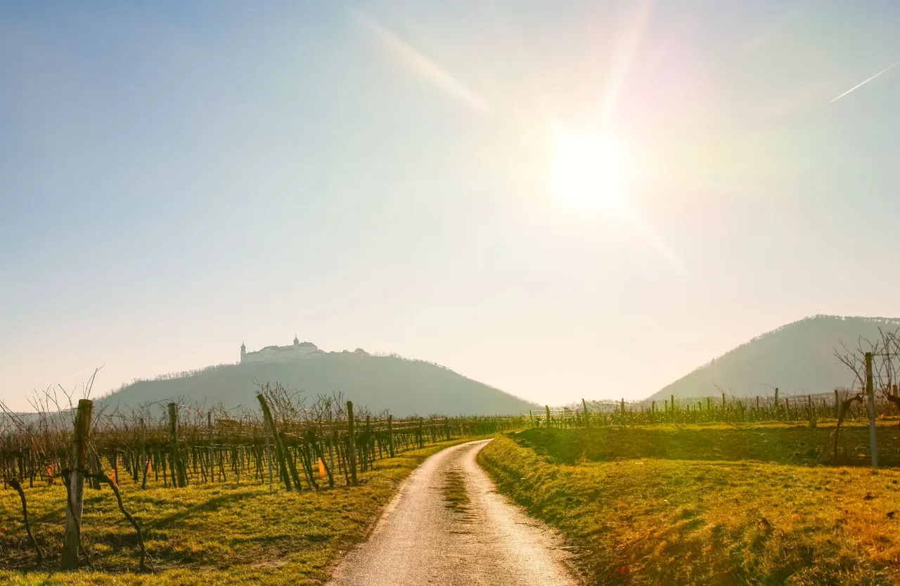
A little bit later the way splits. Here you have to turn right and continue your walk in the "Kellerweg", a small cellar alley with some wine cellars.

After approximately 1 kilometer you will come to this crossroads. Here you have to turn left into the "Zellergraben".

First you walk through the vineyards for about 150 meters, then the "Zellergraben" becomes a hollow way.

The "Zellergraben" is also part of the "Themenweg Löss und Wein", an educational path about loess and wine. Therefore you will find some information boards.

Then you will come to the village Furth and see some wine cellars…

and see this great artwork sculpted into the loess.

Then you will come to a broader street, the "Weinbergstraße". Here you have to turn right.

But only for some meters. After the kindergarten (the big building on the left side) a small and steep streets called "St. Wolfgang-Weg" leads up the hill.

Then you have to walk down this small path to the church.

The church's architecture is quite unusual: There are two passageways below the chancel. The right one is for pedestrians and you'll have to walk through there.
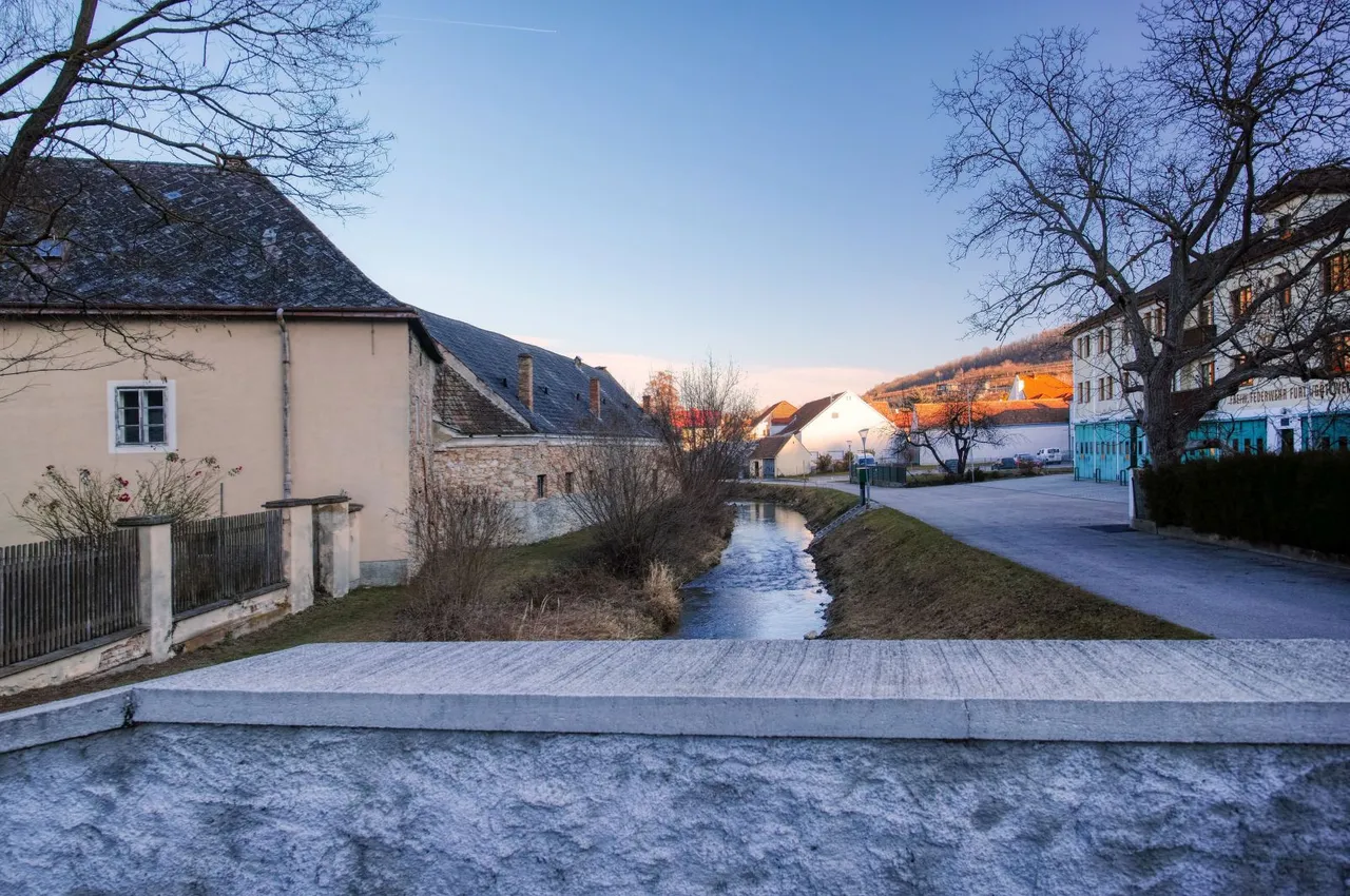
Then you have to walk over a small bridge to cross the creek called "Fladnitz" and then turn left again.
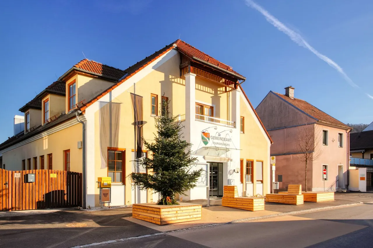
You will then finally come to the "Obere Landstraße", as the main street is called here and turn left. Now you only have to walk some meters to reach the destination of this stage of the hiking trail, the "Gemeindeamt" (municipal hall) of Furth.
The walking distance of this stage is about 4 kilometers and you'll need about 1 hour. So you can easily walk this stage right after the first stage.
A German description including more photos and a map can be found on my weblog schmatz.blog.
The official description can be found on donau.com. GPS data can also be obtained from bergfex.at.
View this post on TravelFeed for the best experience.