
hello friend in this blog we will talk about the new technology and how they are adapting perfectly the spatial reference system, such as drones and satellites both platforms with important advances at the technological level since they have development of altimetry (height) many higher , in this present advance I will be coaching on each aerial platform as a drone system, who subscribes this is @diegoferrer student of Geodesic Engineering.
first of all we must know that it is a drone :
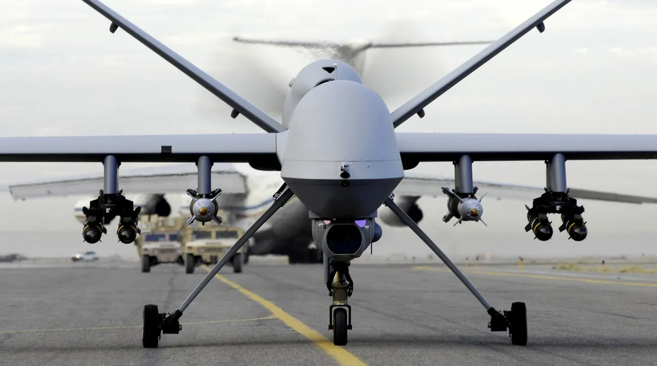
Drone is a small type of unmanned flying device that can be controlled remotely; A drone can be used in many tasks that the human can not or do not want to perform, or are simply too dangerous, for example, the exploration or cleaning of toxic waste, and how could it be otherwise, for military purposes
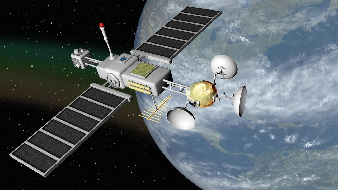
What is an artificial satellite?
They are space platforms manufactured on Earth and shipped in a launch vehicle, a type of rocket that sends a payload into outer space. Artificial satellites can orbit around moons, comets, asteroids, planets, stars or even galaxies. After its useful life, artificial satellites can remain orbiting as space junk.
Now, a corresponding analysis is presented below, between dron and satellite: high altitude aerial platfors:
ESA is considering extending its activities to a new region of the sky thanks to a novel type of aerial vehicle, a kind of 'missing link' between drones and satellites.
High-altitude pseudo-satellites (HAPS) are platforms that float or fly at high altitudes, like conventional ships, but function as satellites, except that instead of operating from space they can maintain their position in the atmosphere for weeks or months , offering continuous coverage of the territory they cover.
The best operational altitude is around 20 km, above clouds and currents and about 10 km above commercial aircraft, where the wind speeds are low enough for its position to be maintained for long periods.
From this height, the pseudosatélites have an observation range of up to 500 km away, so they can perform precision monitoring and surveillance tasks, carry out high bandwidth communications or offer support for satellite navigation services. existing.

Several ESA directorates have come together to investigate their potential, as the future systems specialist Antonio Ciccolella explains: "In observation of the Earth, they could offer prolonged high-resolution coverage in priority regions, while in relation to navigation and telecommunications , they could reduce the blind spots in the coverage and combine a large bandwidth with a negligible signal delay. "
"ESA is studying what is the best way to combine the different fields."
For his part, Earth observation specialist Thorsten Fehr explains that they have been thinking about the concept for the last 20 years, but now it is finally going to come true.
"This is due to the maturity of the key technologies for this: miniaturized avionics, high performance of solar cells, minimum weight of batteries and wiring, smaller Earth observation sensors and broadband communication links that can offer services at competitive prices. "
Navigation engineer Roberto Prieto Cerdeira adds: "There is a clear potential for emergency response. Pseudo-satellites could also be used semi-permanently, perhaps by expanding the coverage of navigation satellites in high and narrow cities and valleys. "
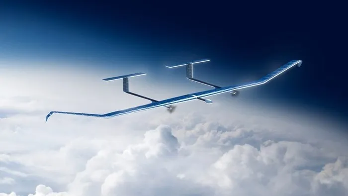
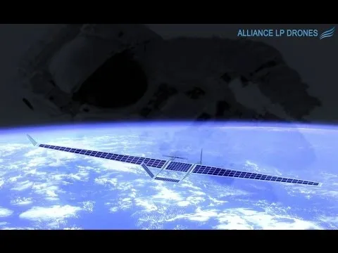
European companies have already unveiled several product lines. For example, Airbus has developed Zephyr, a platform with wings and powered by solar energy that, in 2010, broke the world record by staying flying 14 days without refueling.
Zephyr-S is designed to carry payloads of several tens of kilos for a maximum of three months in a row, with secondary batteries to stay operational at night. The Zephyr-T version, in preparation, will allow higher payloads and offer more power.
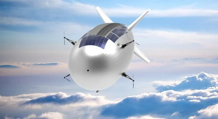
Meanwhile, Thales Alenia Space is developing Stratobus, a platform lighter than air, with a first flight planned for 2021.
The Stratobus dirigible can accommodate payloads of up to 250 kg, while its electric motors will cope with the breeze to keep it in position and, during the night, its fuel cells will take care of the power.
Many other companies are developing vehicles, payloads and services. Last month they met at ESA's inaugural workshop with representatives of potential clients, including the European Defense Agency, Frontex (the EU agency in charge of border management) and the Copernicus environmental monitoring services of the EU.
"This is the first meeting of this kind in Europe, with more than 200 experts in HAPS", explains Juan Lizarraga Cubillos, from the telecommunications area of ESA.
"We have listened to the needs, opportunities and critical issues on the ground, especially as a complement to existing satellite services, in order to start preparing a future ESA program."
ESA considers these vehicles a valuable way of establishing complementary applications to those of its satellites, while accelerating space technologies through early high-altitude flight tests.
It was also indicated that the acceptance of HAPS in the market would depend on its efficiency and its cost-benefit ratio, and the best way to prove this would be through demonstration projects.
"We have to make them fly," said Álvaro Rodríguez, of the EU Satellite Center. The technology is there, all the ingredients are there, now it's time to mix them to get a quality recipe. "
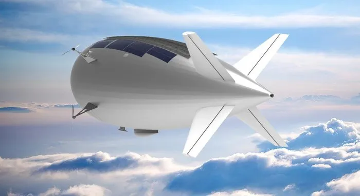
Stratobus with its solar panels
Below you can see videos about each drone in its functions and what utilities they present:
France to build EXTREME HIGH ALTITUDE uav aircraft

Hermes High Altitude Platform System
Zephyr - High Altitude Pseudo Satellite (HAPS)
