A couple of years ago, I stayed at an Airbnb that would have excellent sea views if it wasn't for rock in the way. The remains of an ancient volcano rim, the Maunganui Bluff, is a prominent landmark in the area, and many historical events have happened here. One famous story involves a crossing by my sixteen-great-grandfather Tōhe. He named the bluff because it resembled a mountain from his far-northern homeland. Tōhe's name is part of the Maori name for Ninety Mile Beach - Te-Oneroa-a-Tōhe - which means Tōhe's Long Beach. So, I had to walk the track across the bluff.
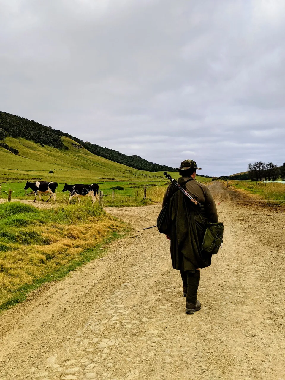
On my way with kilt, haversack, leg wraps and walking poles. The kilt and wraps are a 70/30 cheap wool blend. I want to see how the kilt performs in this type of environment. I carry three litres of water and sufficient gear for basic first aid and an emergency overnight. A full post on my loadout is here: Day walk gear including great kilt and leg wraps
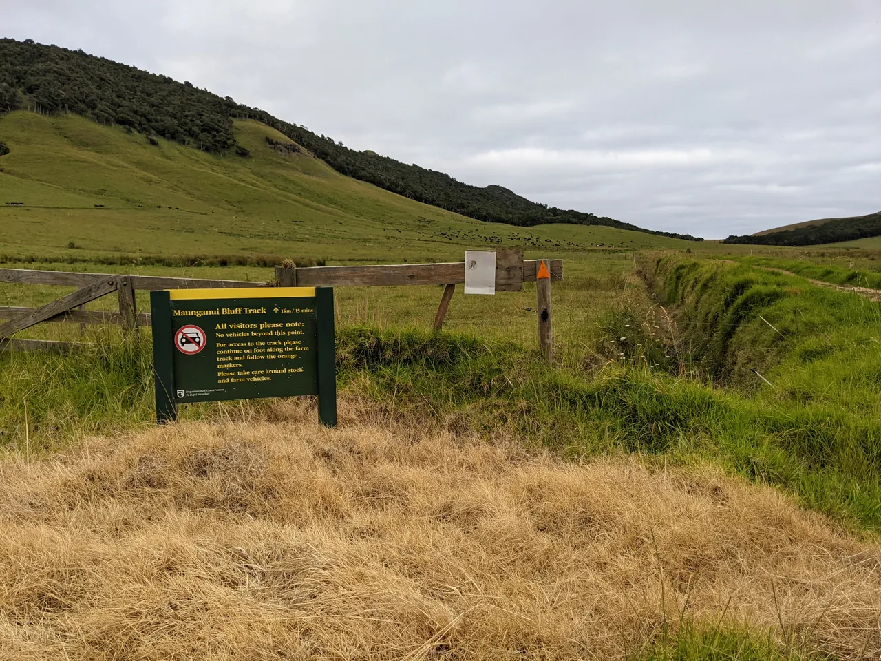
I start walking at the end of a road, and the first part is along farmland. Note the electric fence wire across the farm race (service track).
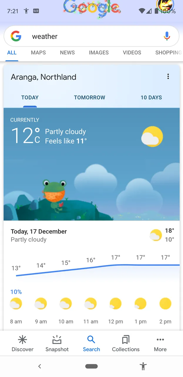
Weather forecast for the day - it is pretty cool for summer. Perfect kilt weather. Always check the weather.
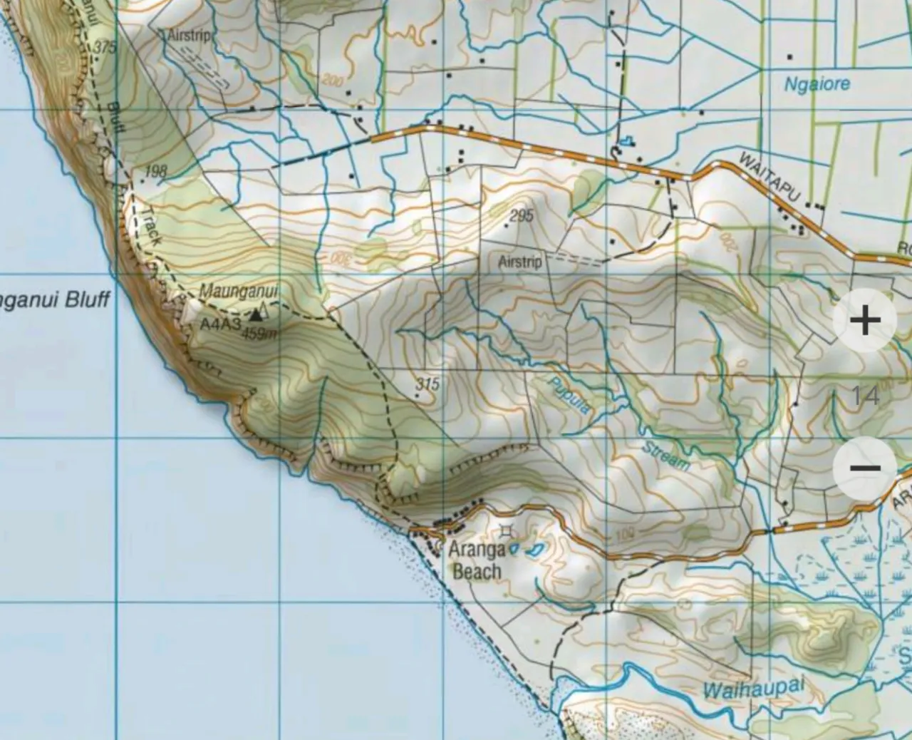
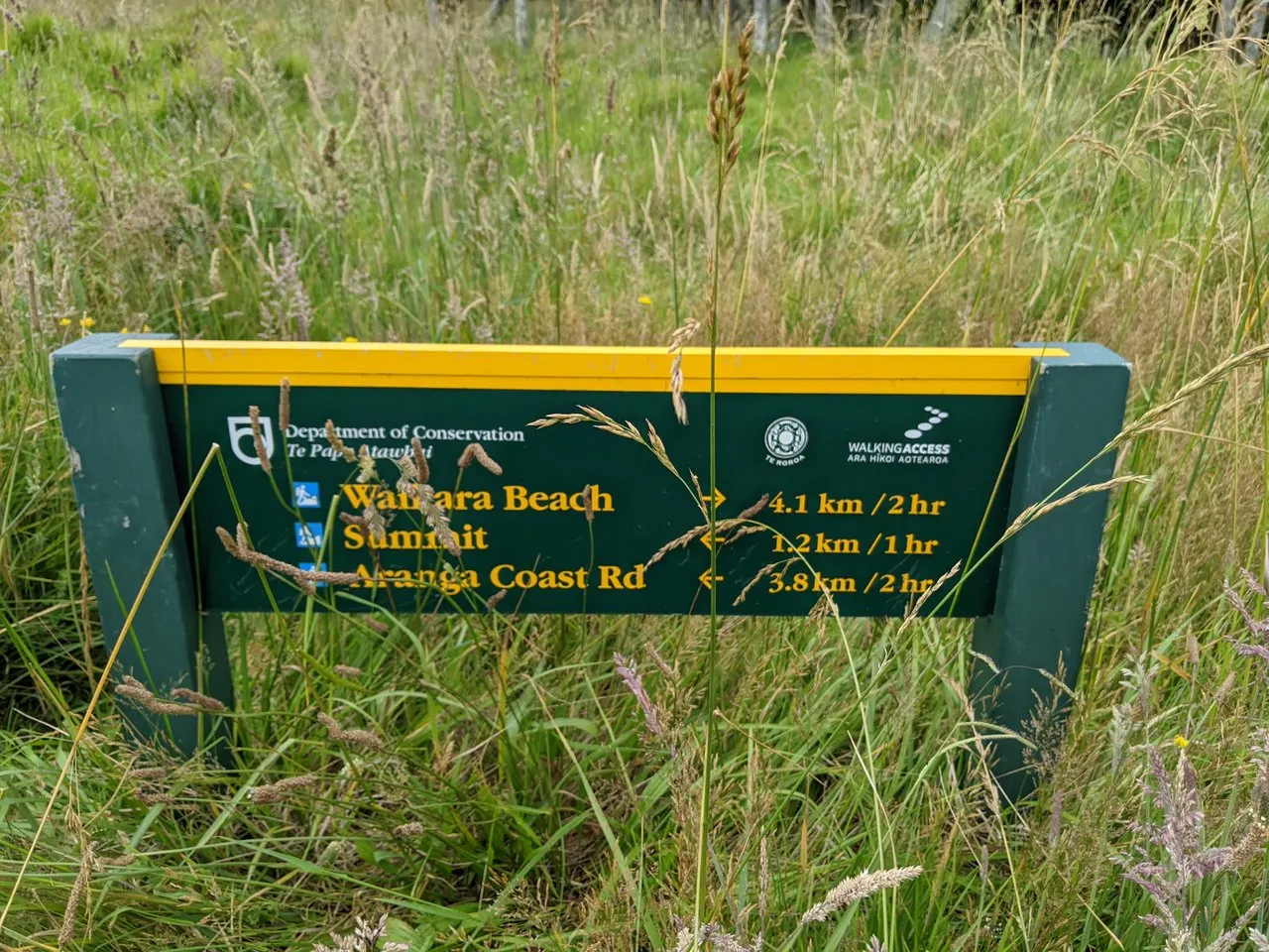
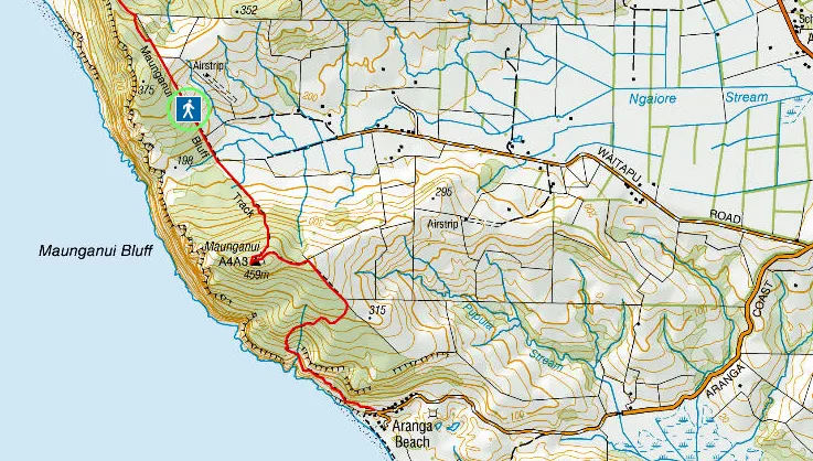
Here is the map I used. At the end of Waitapu road, walk along a farm race, across farmland, over a fence and then navigate off trail for a few hundred metres before joining the path in the Waitapu saddle near the cliff face. Excellent.
A note on Maori names: although names can be broken down, be careful. We Maori can be protective of our history, and you might get the answer you want to hear rather than the real story. Maunga = mountain, nui = big. Big mountain. Wai = water, tapu = taboo/sacred. Though, there are people also named Waitapu, at least one who died not far from here.
End of the road, time to walk.
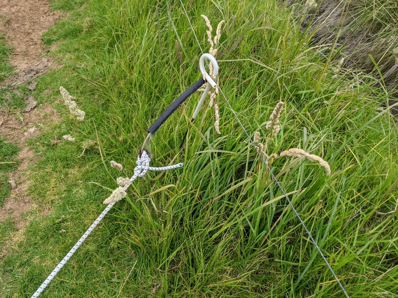
Electric wire gate. Either go under or grip the insulated black pipe, open the gate and then close it after yourself. I was once caught out when the insulated handle had perished, exposing the zappy wire where I couldn't see it.
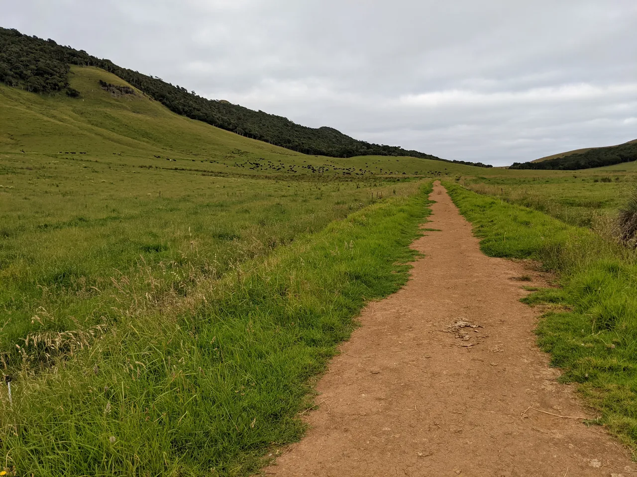
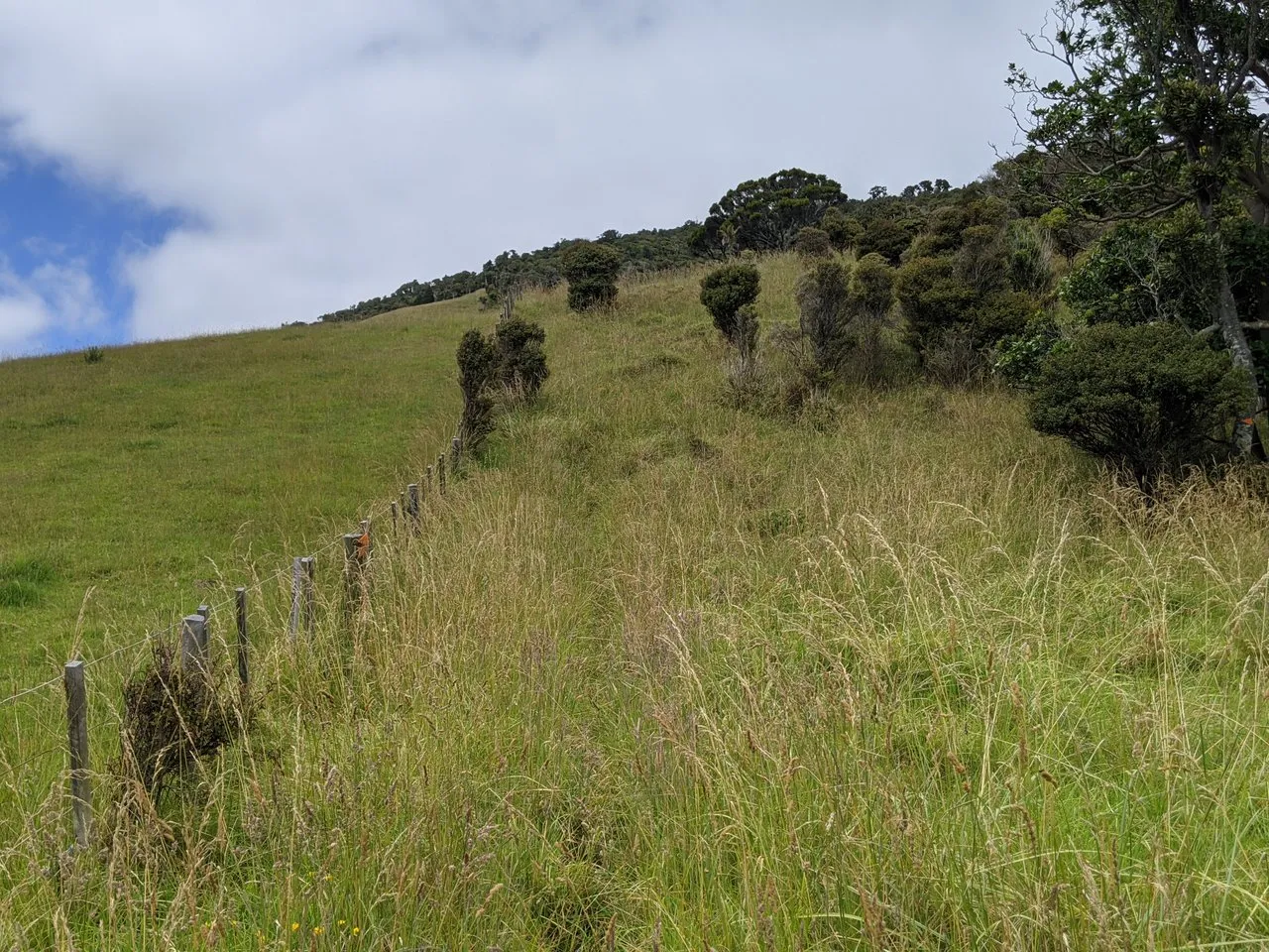
The start of the walk is across a farm. Maunganui bluff is on my right. The Waitapu saddle in the distance is where I'm going.
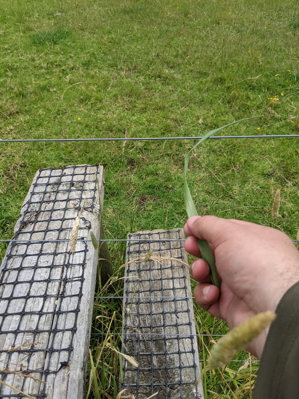
At the end of the farmland is a stile. These are steps that allow you to go over the fence. But, the fence is electric - which you can tell because it either makes a "tick" noise, you can use a green piece of grass to test, or you can see insulators on the posts. On my way over, the electric fence was not on. Also, the stile had a loose top step.
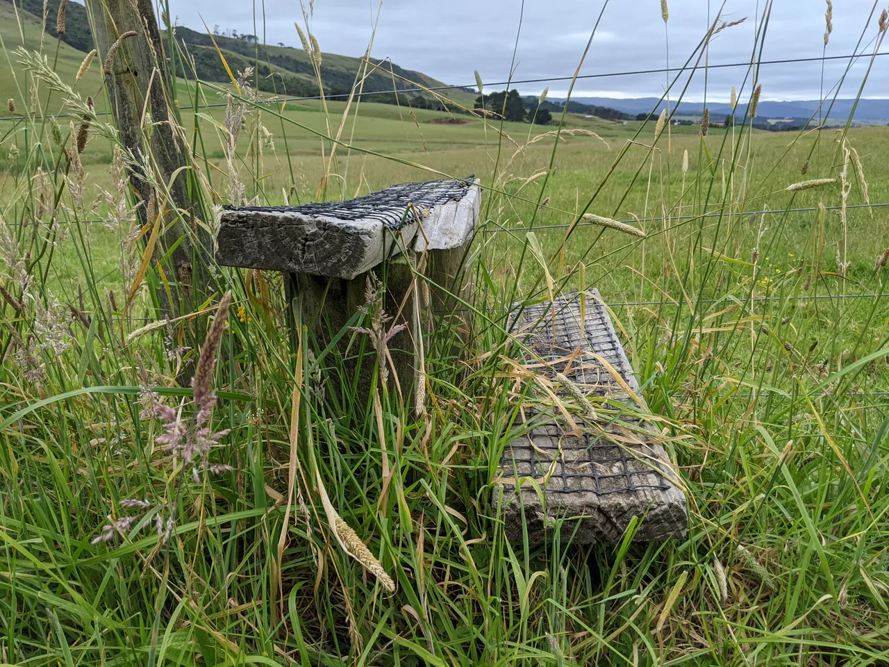
Over the stile and looking back. My AirBnB is up on those hills to the left, and the bluff is to my right.
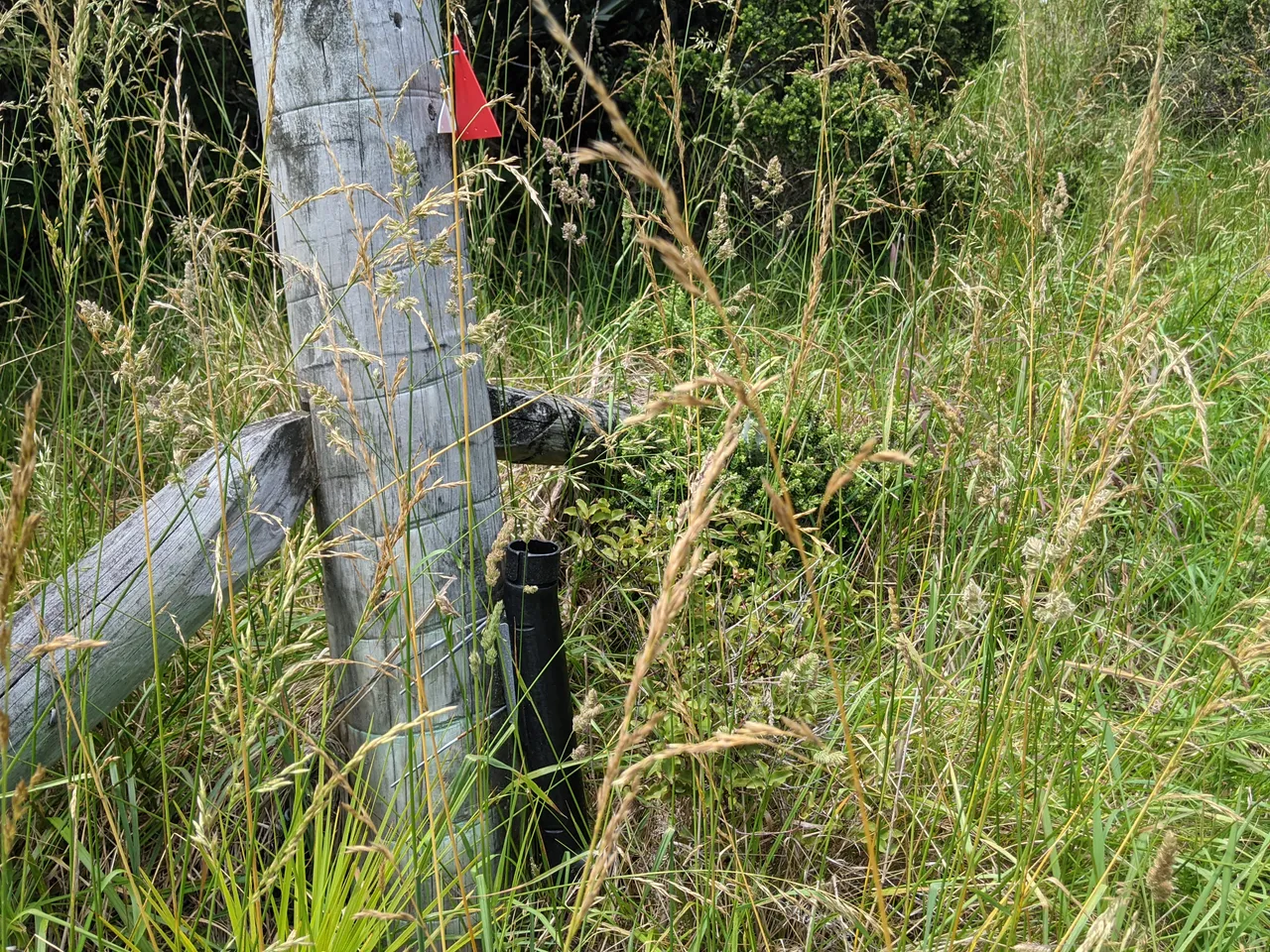
Just over the stile and buried in the grass is this sign. I had to walk past this towards the saddle where I thought I'd join the Maunganui bluff track. For whatever reason, I misinterpreted the arrow. I walked to the left of the sign rather than turning 90 degrees to my left. There were no other visible track markers from this point.
The new track goes up to the left of the stile, not where I went! But duh, if I'd turned left just over the stile, I would've been on this lovely new track. I wasn't expecting a trail here, especially not one that looks like this. COVID has meant many tracks were less used and not maintained.
I go across grassland towards the Waitapu saddle. I have no photographs of this because I mainly was swearing. When I say grassland, I mean horrible tangles of Kukuia grass, some taller than I. You had to walk with high/short steps, wait to sink and hope you didn't get stuck. Crossing that 400 metres or so took nearly an hour or constant struggle—all the joy of slogging through mud, none of the beauty benefits. The leg wraps, while a little warm, did a great job of protecting my legs from the myriad micro-abrasions that wading through vegetation brings.
At the saddle, I couldn't see any trail markers. So I took a short rest and headed towards the bluff in the correct direction according to my map. At least the grass at the saddle was more meadowlike. And the view ... well, 198m drop to the ocean, and I'm not too fond of heights. So yeah, great.
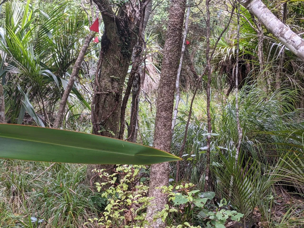
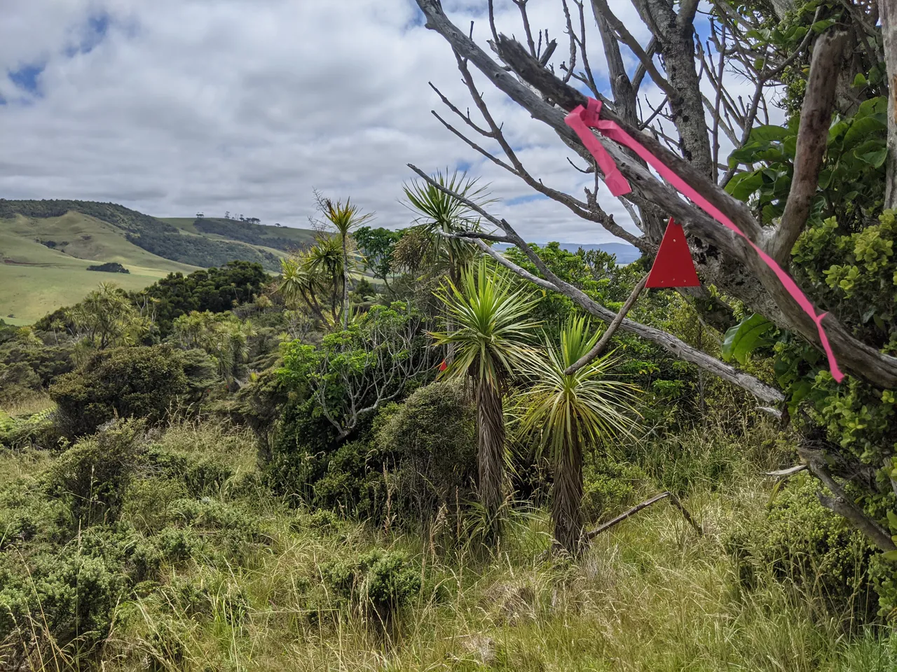
Not far inside the treeline, I see pink markers. Well, they are markers, but DOC track markers are orange! Maybe they weathered funny - but they are going in the right direction, and they're the only markers I can see.
Something feeding. Probably possums. They'll nibble at me if I don't make it back. I made it a few hundred metres into the treeline before the track markers stopped at the bottom of a cliff face. I look around, and the terrain is rough and overgrown, and there are no more markers.
I have to make a decision, so I take a rest break. I'm now high enough that I get a cellphone signal. So, I checked the maps on the Department of Conservation website and...
... the track has been moved inland! You can still join the track off Waitapu road, but you don't walk to the saddle along the cliffs. I should've checked this map sooner!
Great. So, my options are:
- Continue on towards the bluff summit and meet the track there. Off-trail navigating in steep/rough terrain, the estimated speed is about 1-400m per hour. Unfortunately, I'd need more water and time.
- Navigate through the bush and try to meet the new trail at the nearest/most convenient point. Again, I'd need to be faster to make it with the supplies and time I have. Damn. Also, risk of injury and I'm by myself. Let's not do that.
- Head back down the way I came, rejoin the track at the most accessible point - likely the stile - and then reevaluate for time and supplies. Who am I kidding? I'm going to need more time and supplies. So, abort the mission.
Well, the bluff was there when my sixteen-great-grandfather Tōhe crossed it in a legendary journey from the north, and it'll be there if I come again sometime. Also, my ancestor died after completing the bluff crossing. So yeah, an ancestral warning not to push it. So, I do the sensible thing and head back the way I came out of the tree line and down the saddle.
As I break the treeline and head down the saddle, I see more of these markers. Finally, they lead back into the bush over a promontory on the south side of the saddle. This track may get me where I need to be sooner. Well, I only want to wade through the kukuia grass if I have to, and I have enough supplies to backtrack if the trail is incorrect, so let's go. This off-map trail may join up with the proper track soon enough that I can carry on! Here's hoping.
I meander downhill and across dried streams but generally in the right direction—the trail alternates between bush and gorse. Surprisingly, the kilt doesn't get noticeably caught on anything. Perfect!
And finally, this off-map trail rejoins the mapped route earlier than the stile. Just about 2-300m metres earlier. I don't have time to make the Bluff this year - so I'll have to come again. Oh well.
Even though the fence at the stile wasn't electrified when I crossed, a sixth sense told me to test again, and this time it was live. So I covered the top wire in all my spare clothes and a doubled-up poncho, then crossed. Despite all those layers, I could still feel a slight zap near the family jewels.
Then a power walk/wobble across the farm back to the road head. This is just one of those things in the outdoors. It's enjoyable even when things don't go according to plan. I haven't been back yet—one day.
Until next time.